
John Scott Lansill papers
Abstract
Descriptive Summary
- Title
- John Scott Lansill papers
- Date
- 1926-1940, undated (inclusive)
- Extent
- 15 Cubic Feet
- Subjects
- black-and-white photographs
- Depressions -- 1929
- Great Depression
- Greenbelt (Md.)
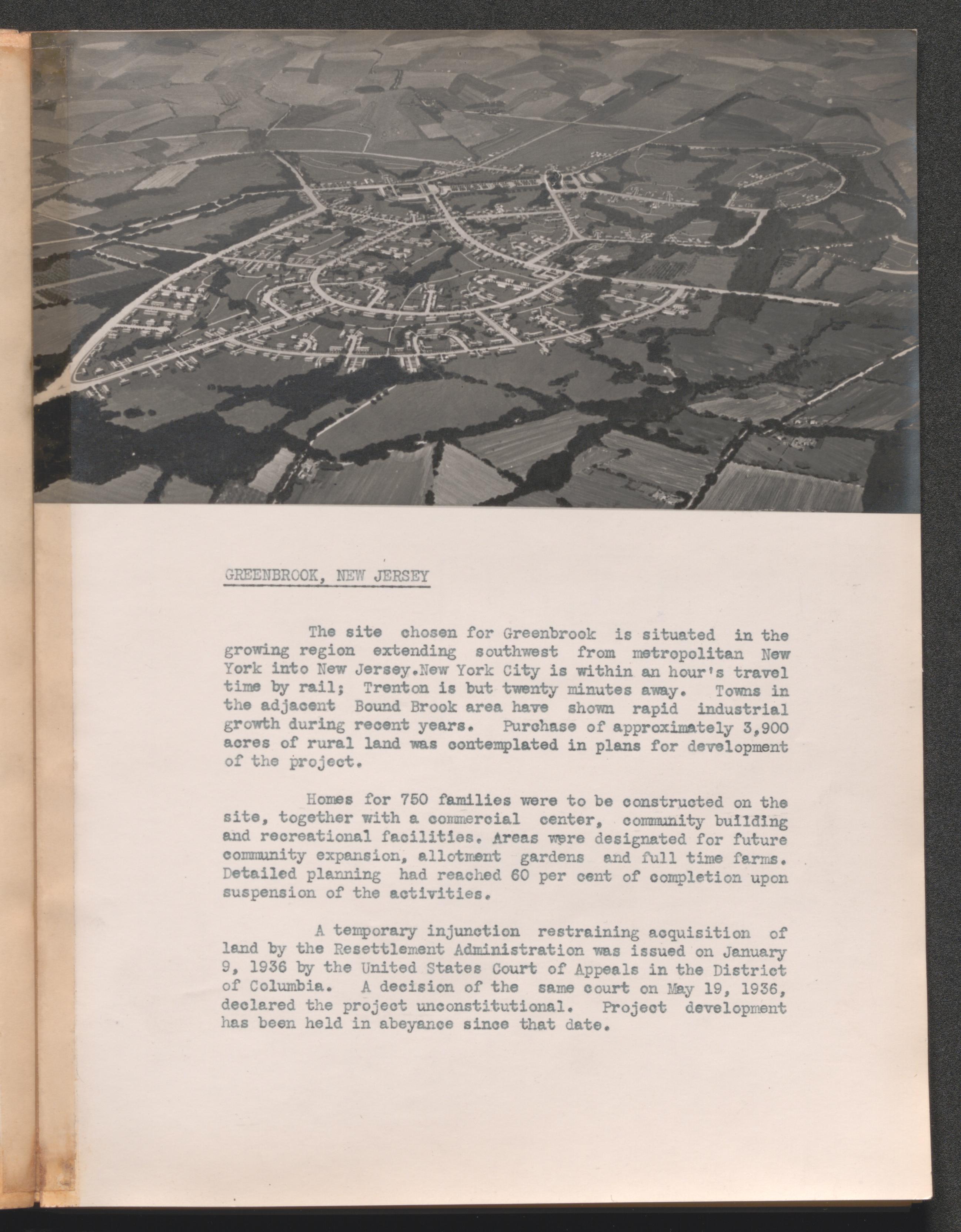
- Greenbrook (N.J.)
- Greendale (Wis.)
- Greenhills (Oh.)
- New Deal, 1933-1939.
- Public housing -- United States -- 1933-1945
- Reports.
- Resettlement.
- United States -- Social conditions -- 1933-1945
- United States. Resettlement Administration
- United States. Resettlement Administration. Division of Suburban Resettlement
- Arrangement
- Collection is arranged by subject and format.
- Preferred Citation
- 65m19: [Identification of item], John Scott Lansill papers, 1926-1940, undated, University of Kentucky Special Collections Research Center.
- Repository
- University of Kentucky
Collection Overview
- Biography / History
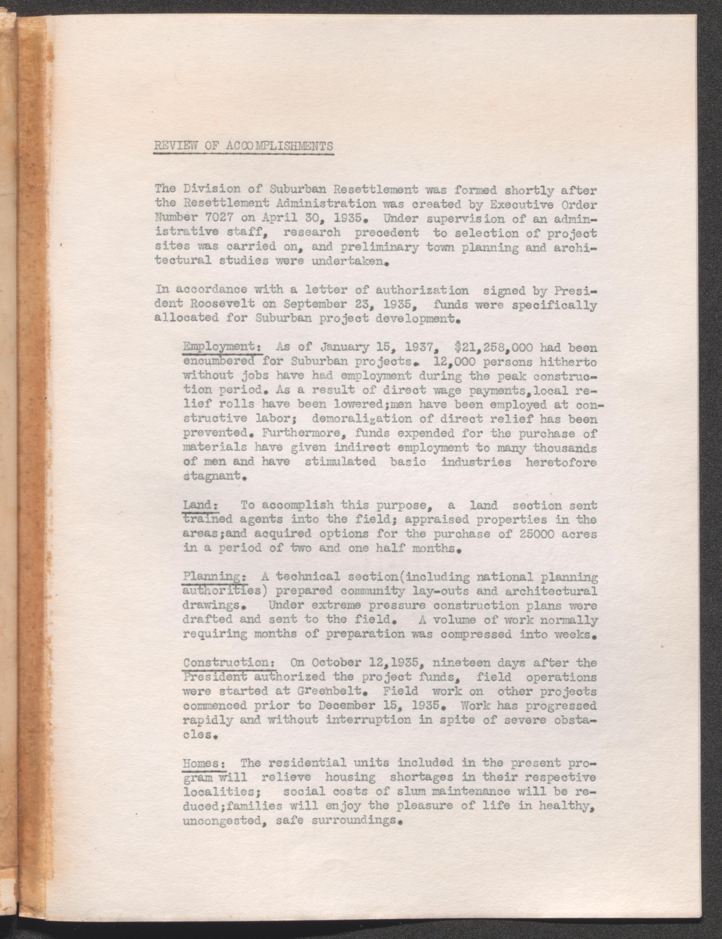
- John Scott Lansill, a native of New York, was a federal government official and a civic leader in Lexington, Kentucky. He graduated from the University of Pennsylvania in 1916 and was a veteran of both World Wars. Lansill held several government positions, including Director of the United States Resettlement Administration's Division of Suburban Resettlement, a New Deal agency. The Resettlement Administration was established by executive order in 1935 and was absorbed into the Department of Agriculture as the Farm Security Administration in 1937. In Lexington, Kentucky, Lansill was one of the founders of the Idle Hour Country Club, the curator of Transylvania University, and a member of the Kentucky Historical Society.
- Scope and Content
- The John Scott Lansill papers (dated 1926-1940, undated; 15 cubic feet; 24 boxes, 3 items) consist of records, correspondence, reports, maps, and photographs relating to the United States Resettlement Administration Division of Suburban Resettlement, a New Deal agency directed by John Scott Lansill. The majority of the collection relates to the Greenbelt Town Program. This project relocated destitute or low income families into newly constructed, planned communities. It also provided construction work for some of the jobless. The papers include official correspondence, reports, photographs, drawings, and publicity papers relating to the Greenbelt program, particularly to four model Greenbelt towns: Greenbelt, Maryland; Greenbrook, New Jersey; Greendale, Wisconsin; and Greenhills, Ohio. These materials, especially the photographs, reveal the state of housing before governmental intervention in these areas.
- Some of the materials cover projects of the Resettlement Administration after its functions were absorbed by other departments. Similarly, the collection has a bound map of the land program under the Federal Emergency Relief Administration which had been incorporated into the Resettlement Administration. There are other miscellaneous materials about general town planning.
- The photographs series has been digitized. Duplicate photographs were digitized only when the content (front or back) varies from the original).
Restrictions on Access and Use
- Conditions Governing Access
- Collection is open to researchers by appointment.
- Use Restrictions
- The physical rights to the materials in this collection are held by the University of Kentucky Special Collections Research Center.
Contents of the Collection
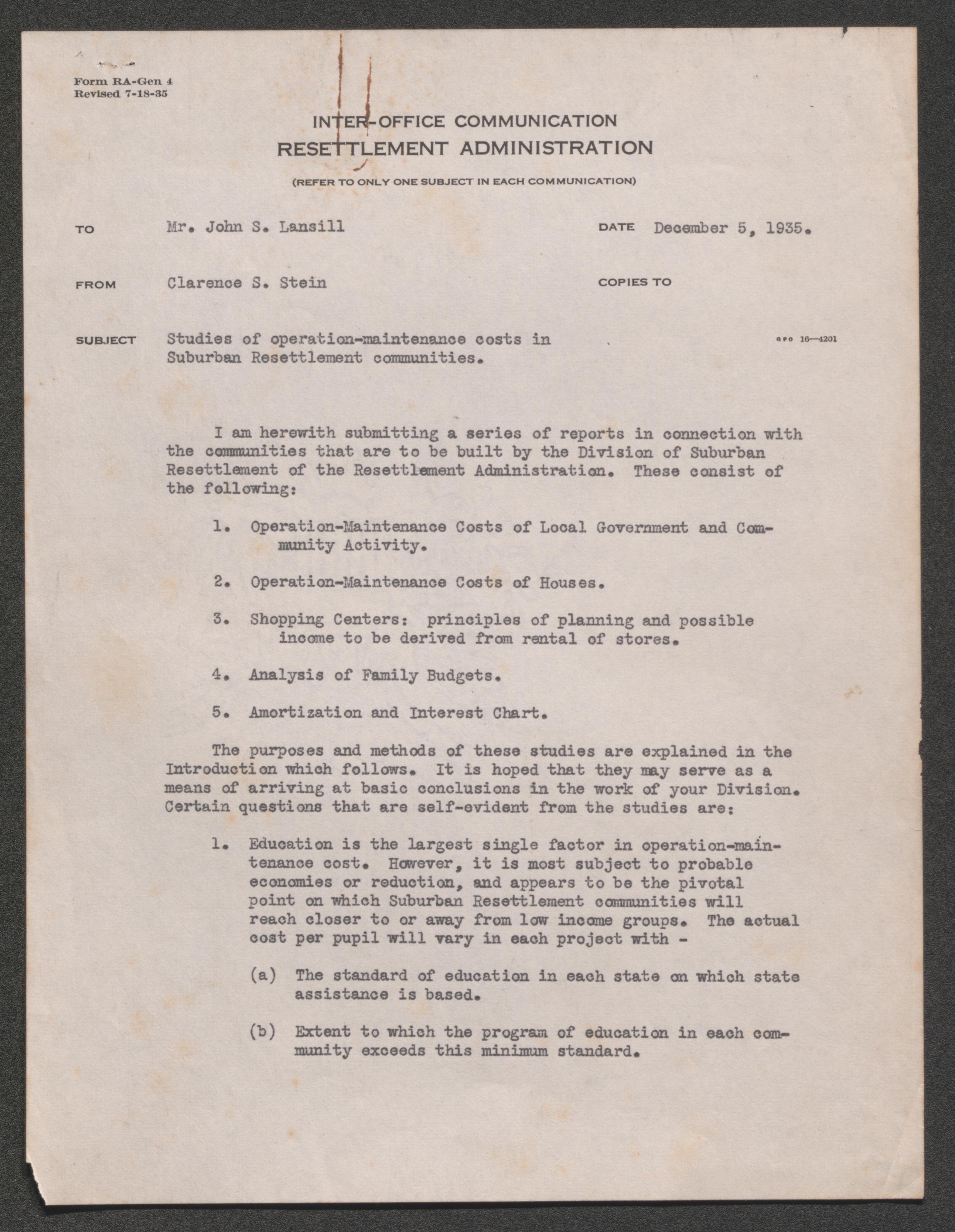
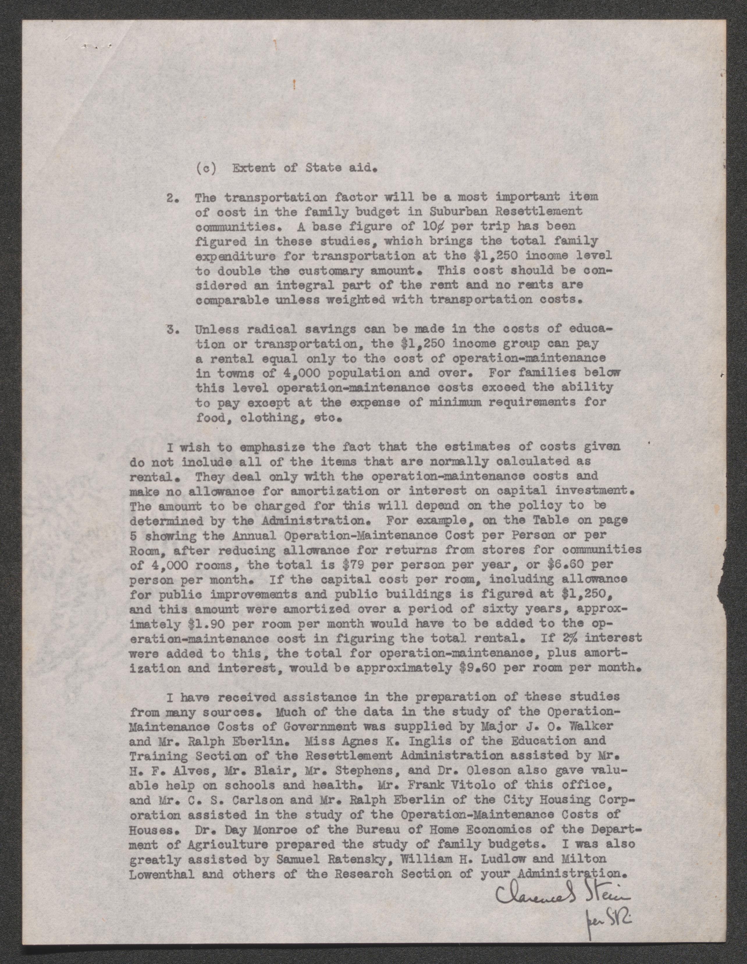
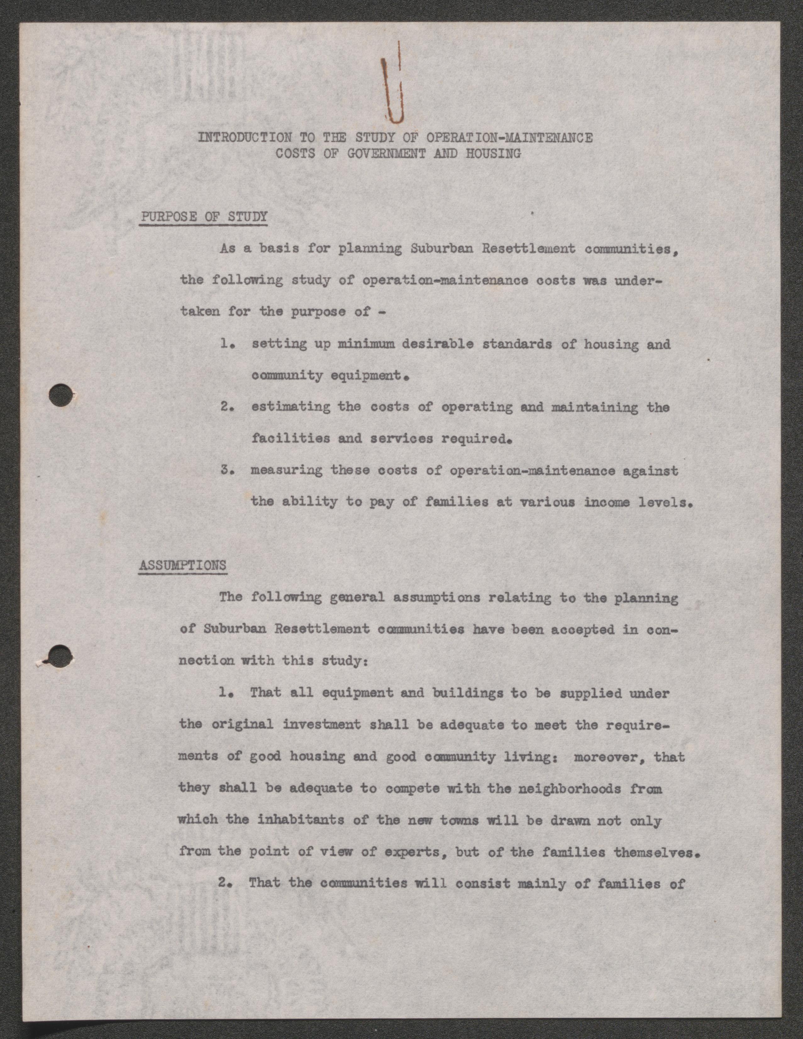
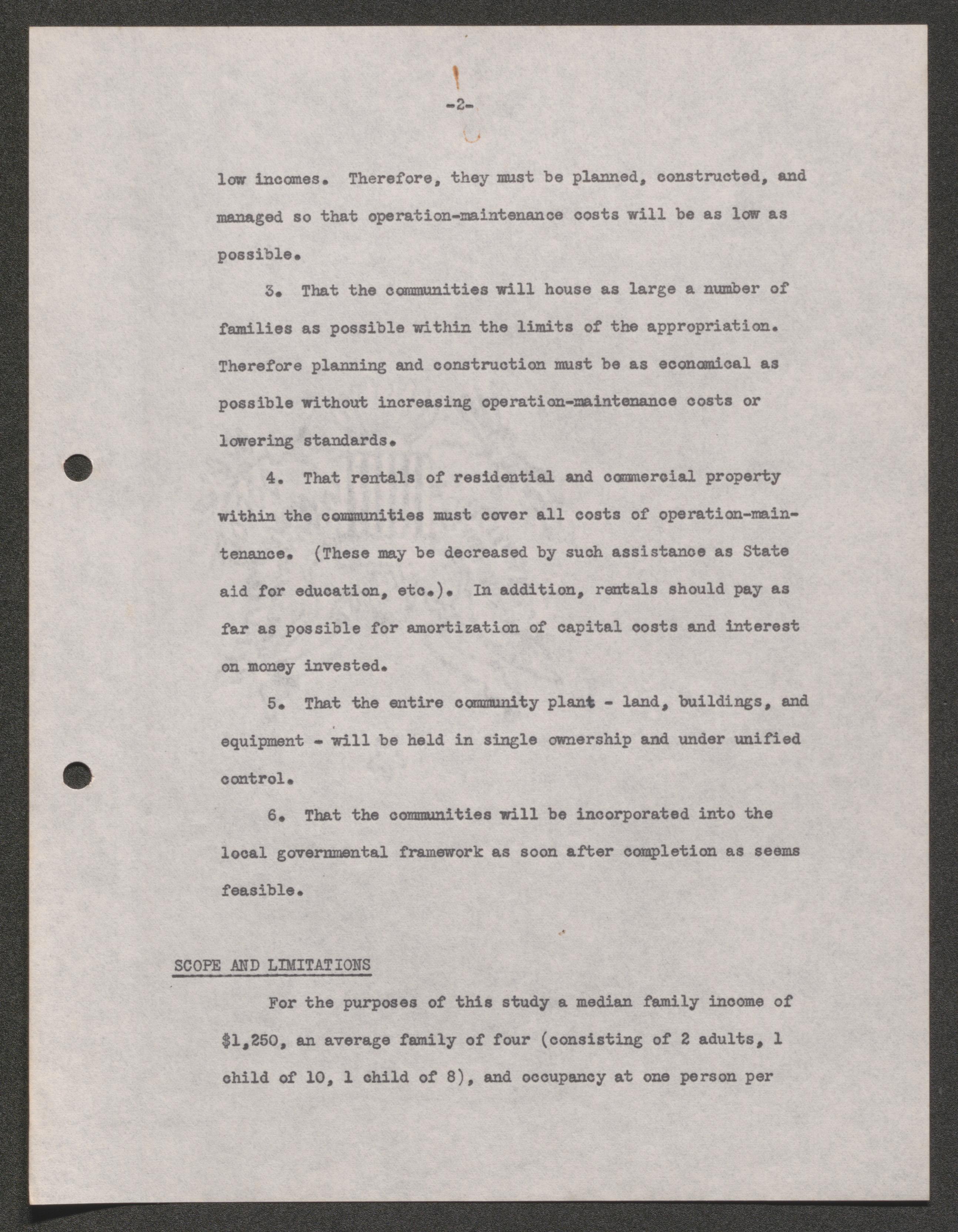
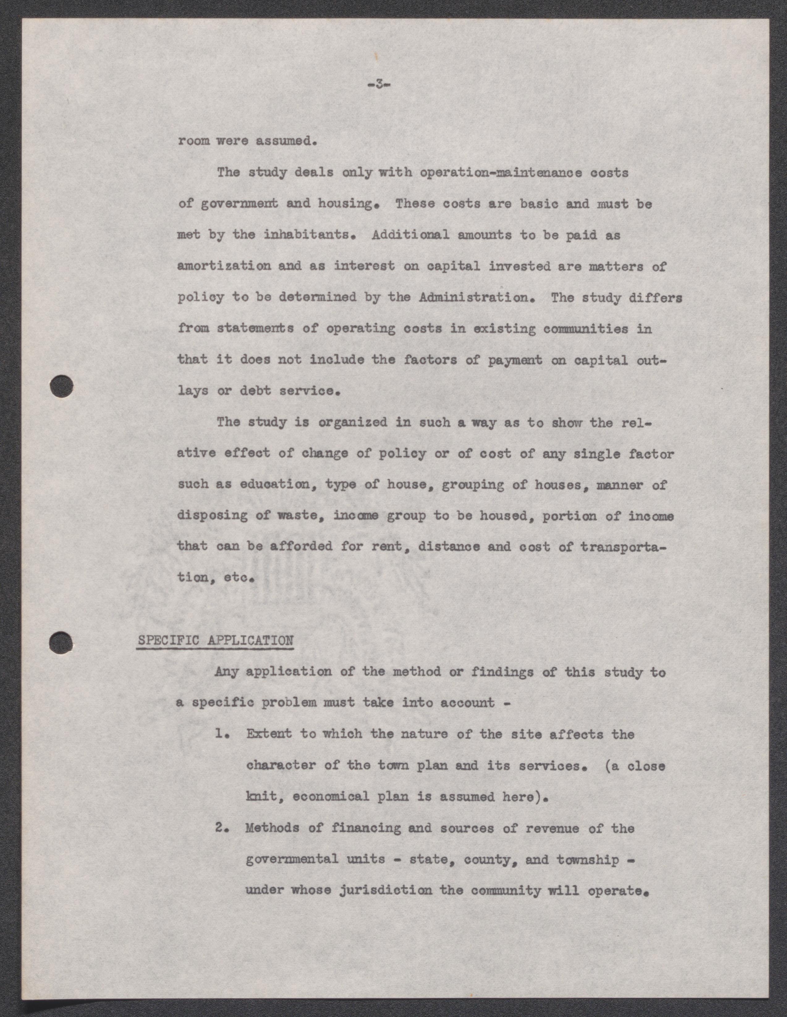
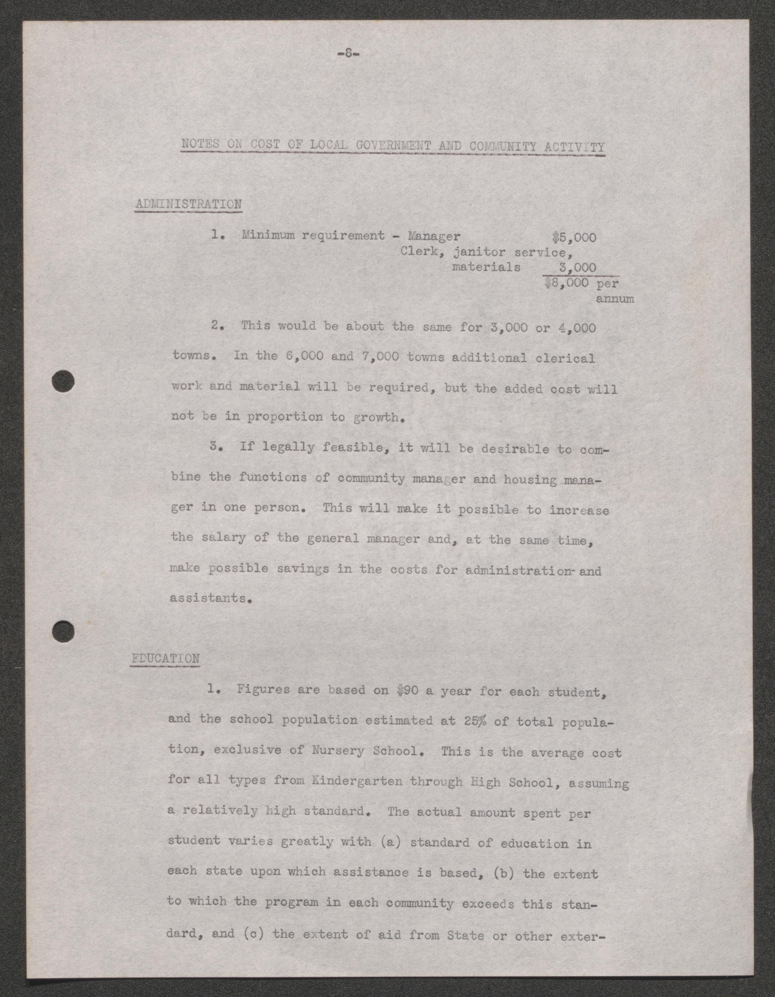
Project plans and research, 1926-1939, undated
Scope and Contents
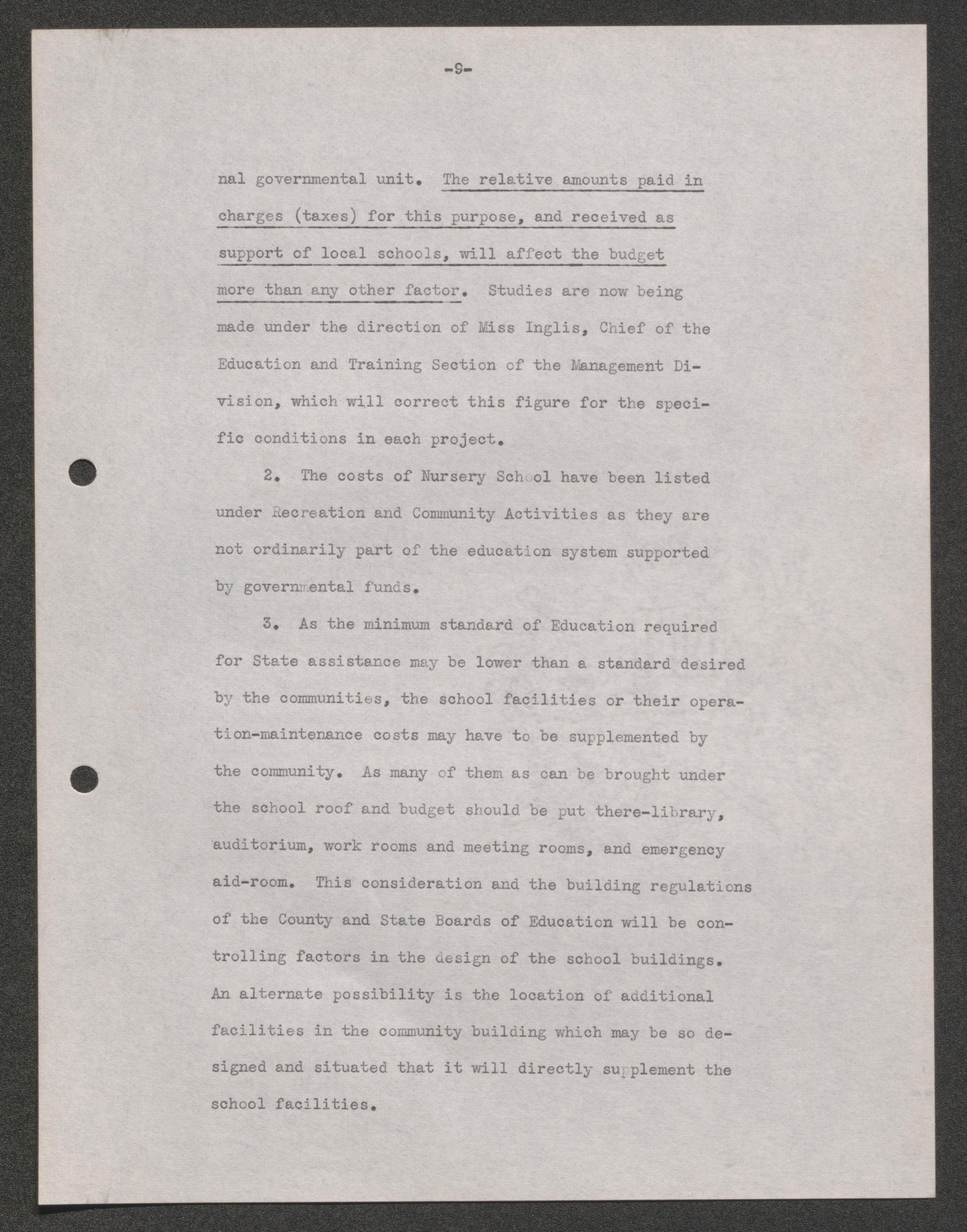
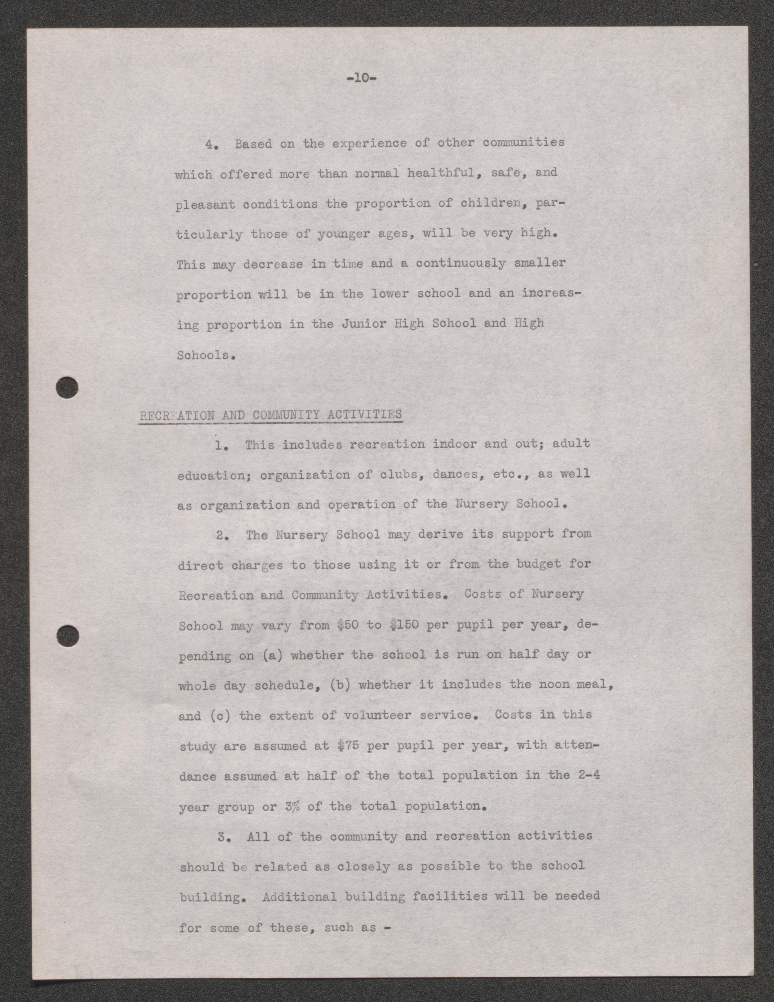
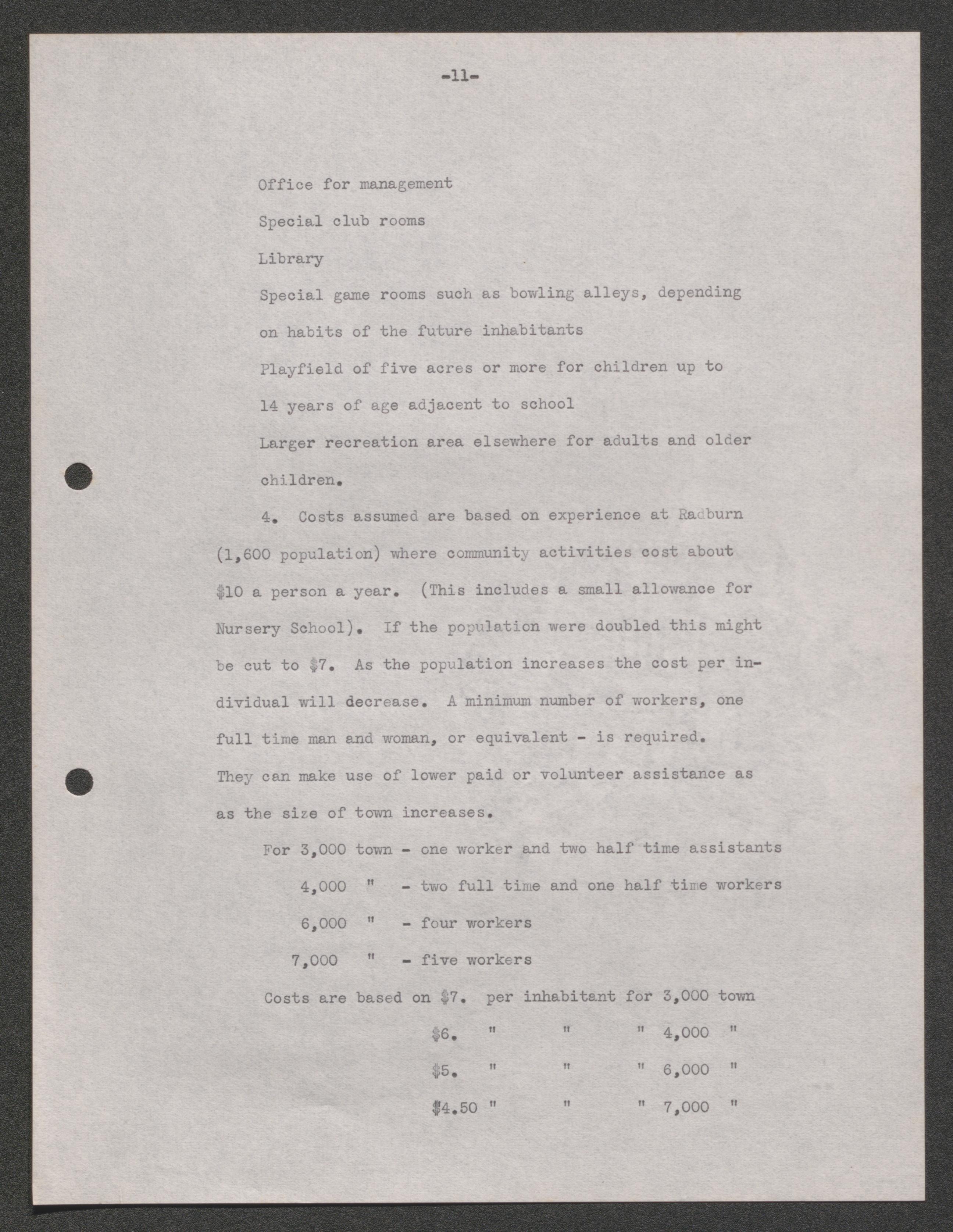
The Project Plans and Research series includes materials related to the entire United States Resettlement Administration's Division of Suburban Resettlement projects during the New Deal. Reports on potential projects are included as well as the summary reports from completed works. Ephemera from the project are included like advertisements for housing and work, illustrations of potential housing projects and aerial photographs of potential site. The series also contains pamphlets and books on urban planning from England and the United States.
Project plans, 1936
Project specifications, 1937
Final reports, 1936
Final Report I, 1937-1938
Final reports by government agencies, 1937-1938
Final projects exhibits report III, 1937
Historical report, 1937


Confidential project description book, 1935
Confidential report, 1935 April 20
Sir Unwin's lectures, 1936-1937
Town planning of Charlottesville, Virginia, undated
Proposed housing development at Stansbury Creek, Maryland, 1938
Typical house and farm structure plans on rural settlement projects, 1935 October 30
Mount Vernon maps and pamphlets, 1937
Norris, Tennessee map, pamphlets, and review, 1937
Report and proposal to the Rockefeller Research Foundation, 1936
Philadelphia blueprints and correspondence, 1937
Confidential Central Housing Committee Report for Pennsylvania, 1937
Housing literature booklets, 1926-1939
Housing literature for the United States, 1935-1939
Housing literature for England, 1934-1937
National Park Service Manual of Instruction for the Establishment, Planning and Development of Land Program Projects, undated

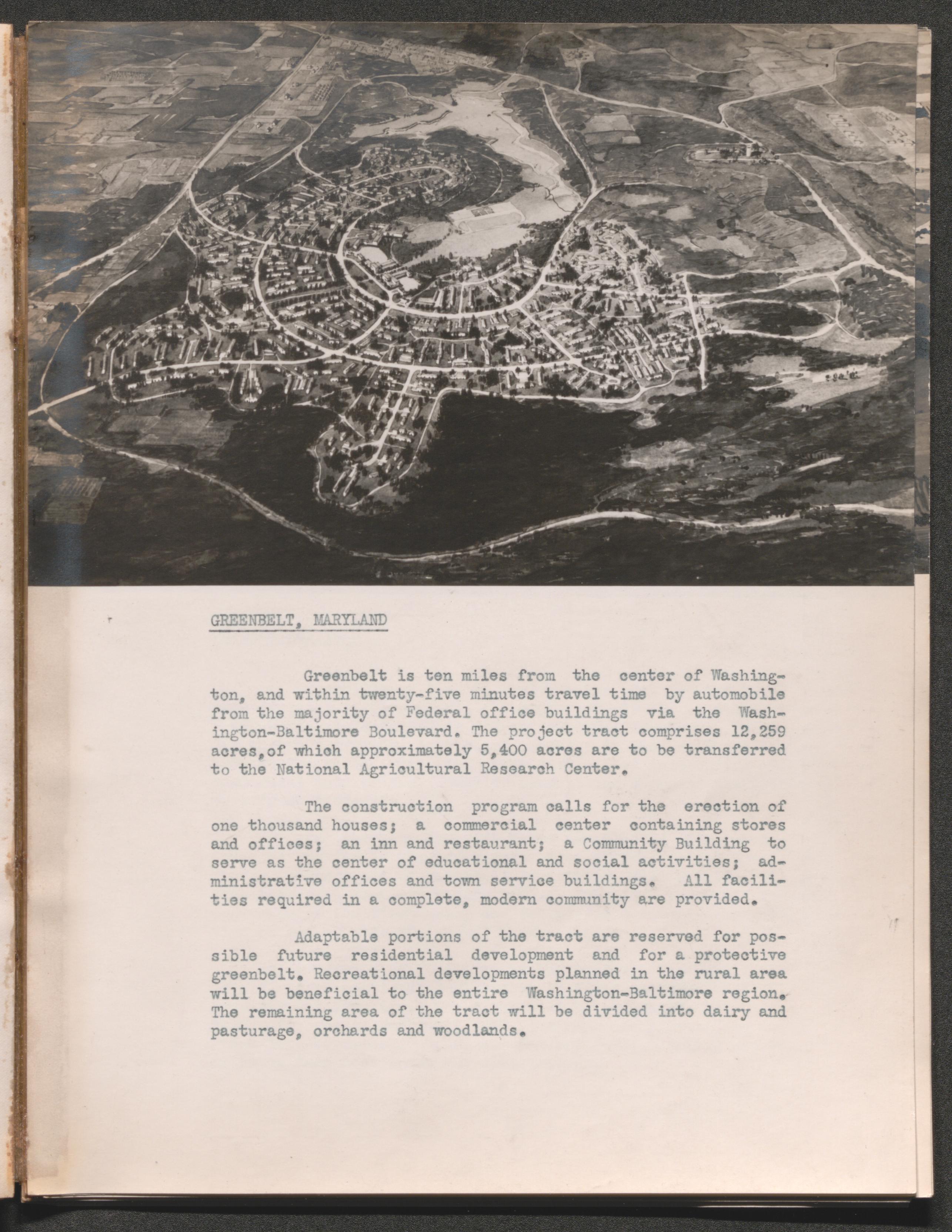
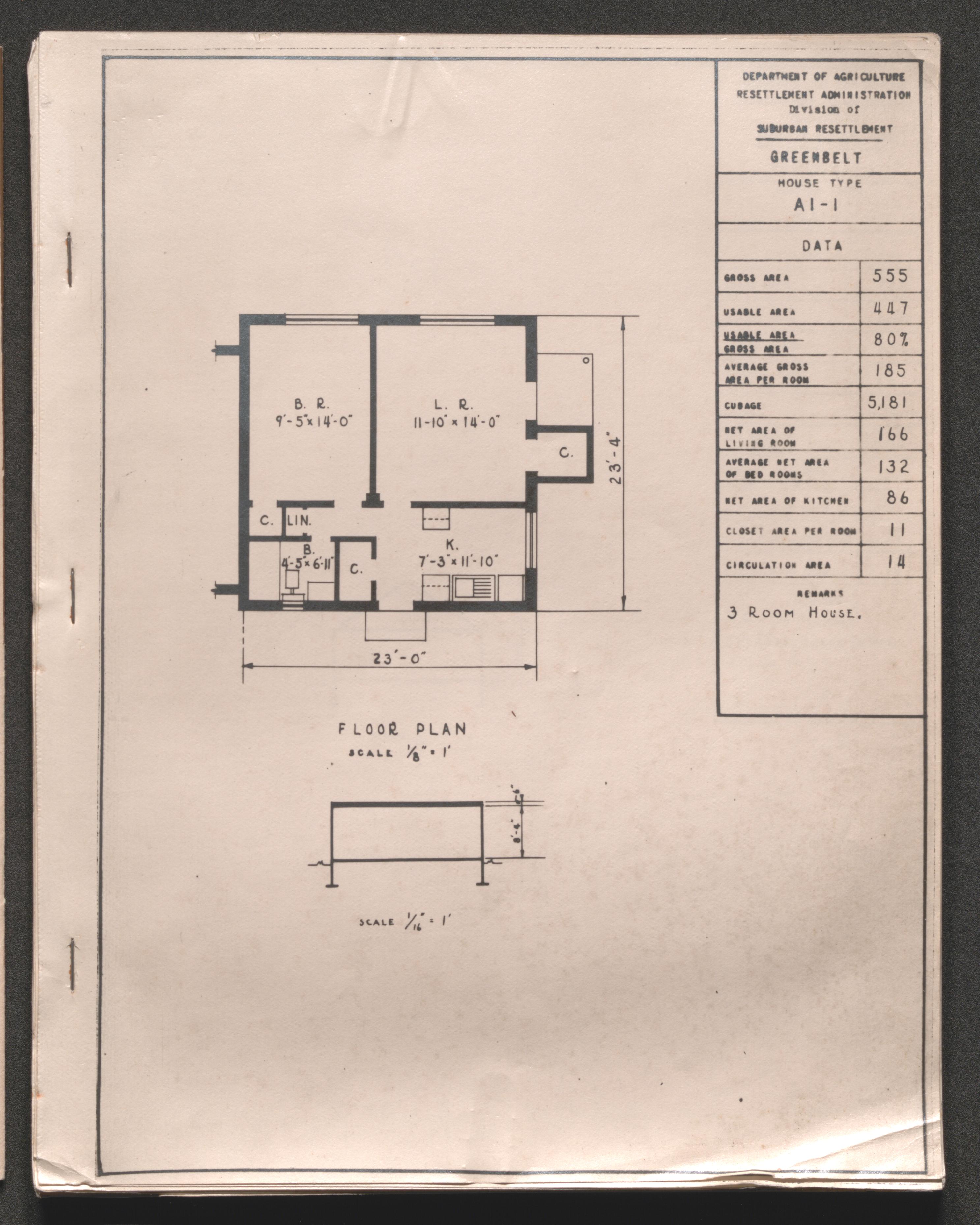
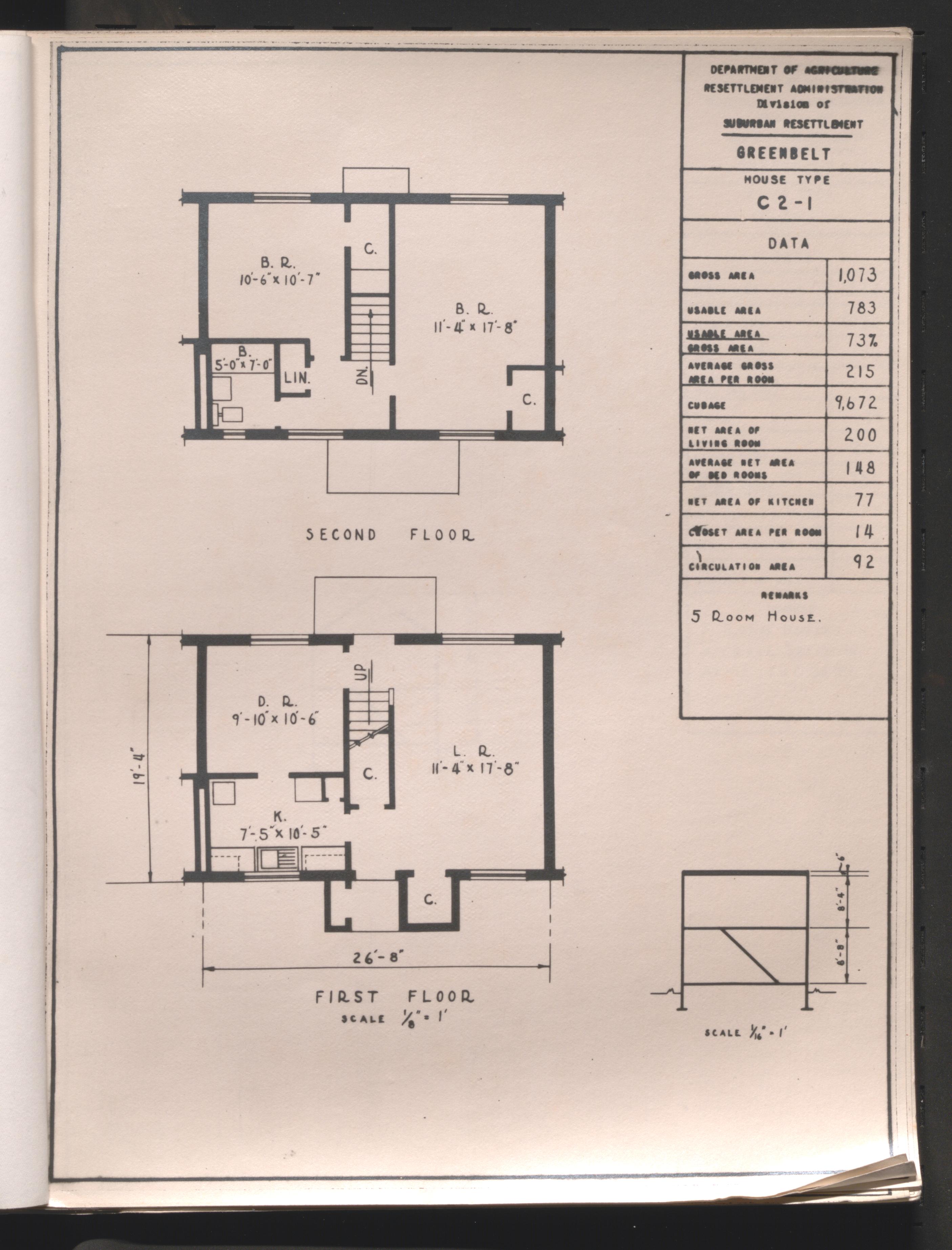
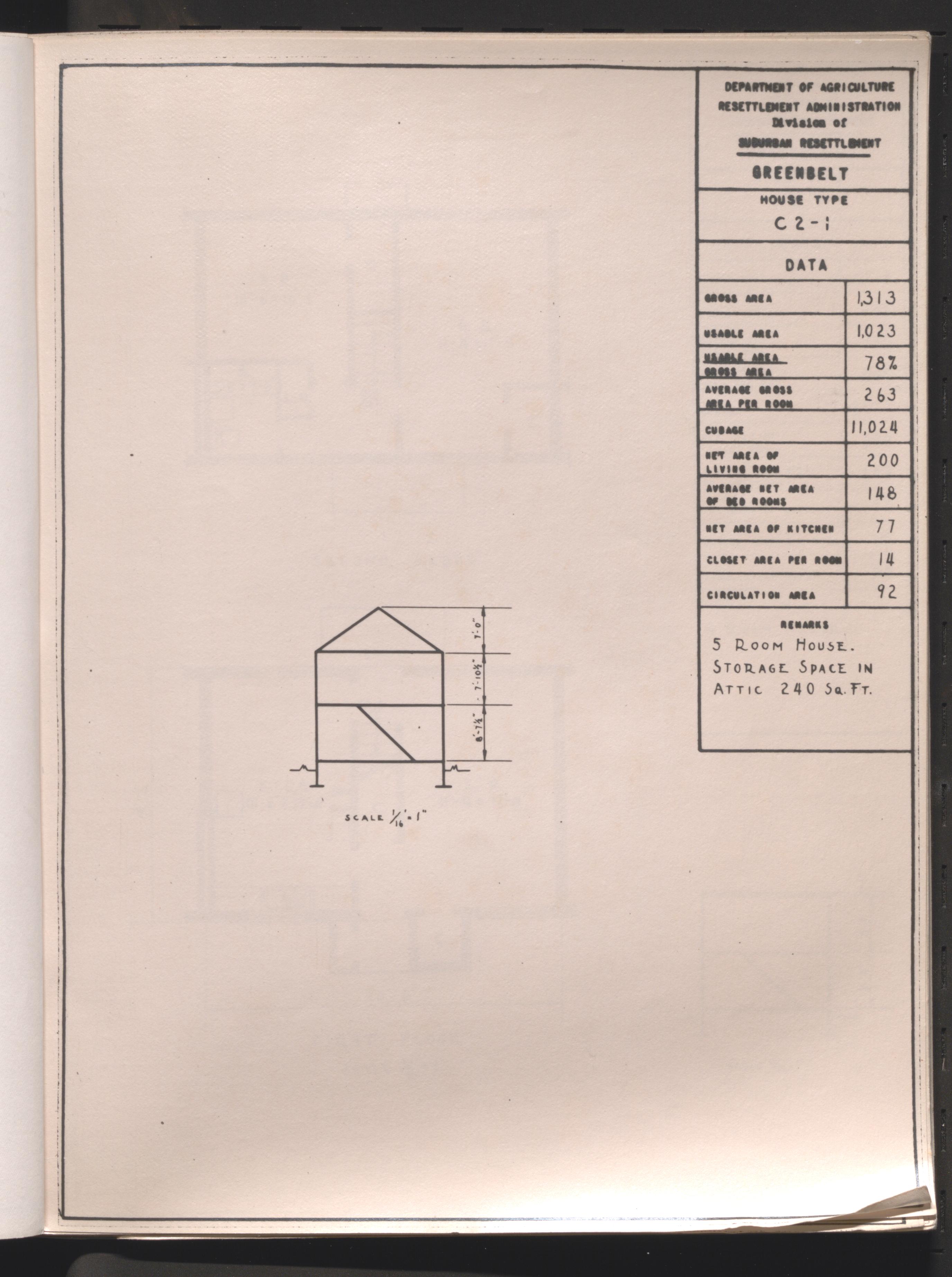
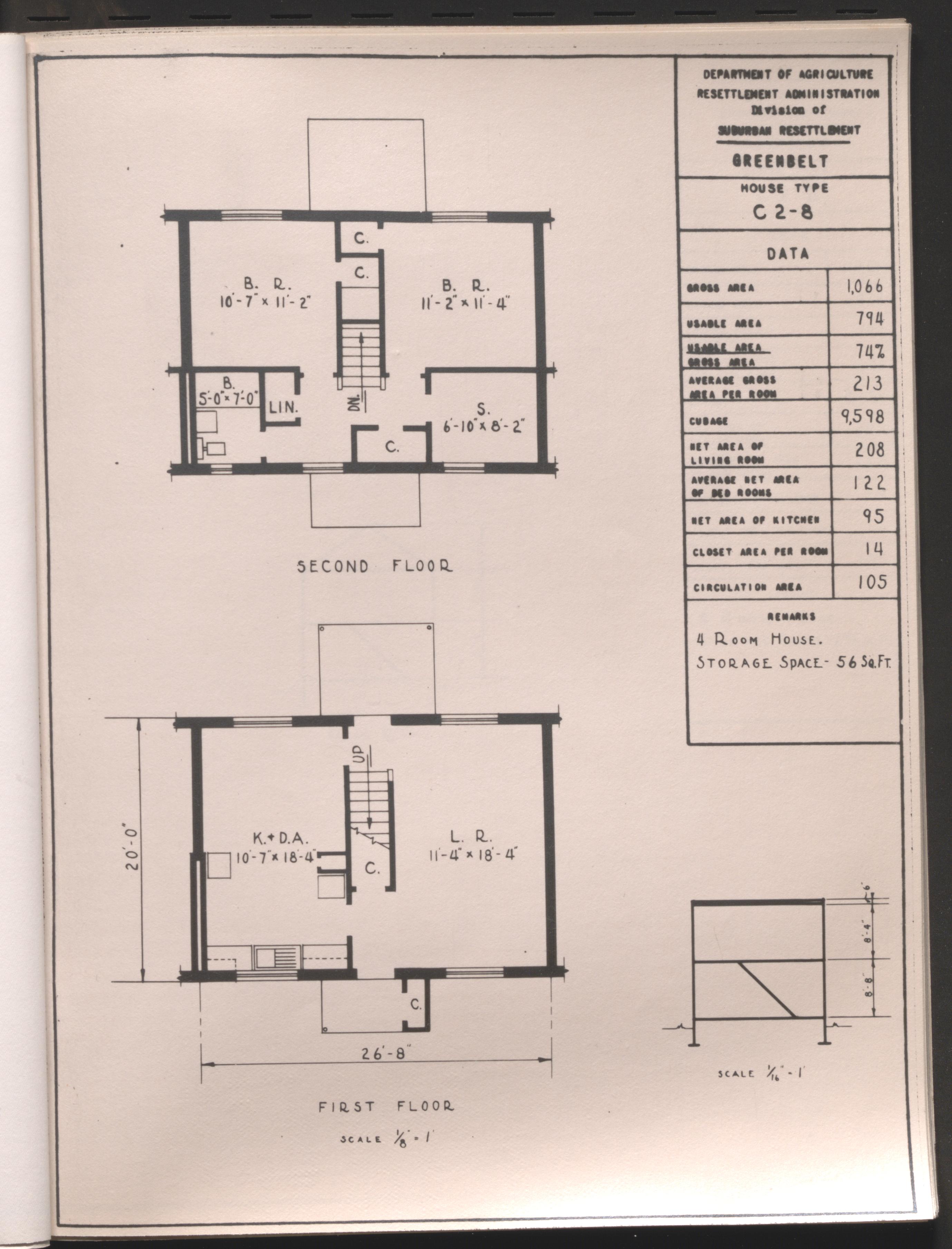
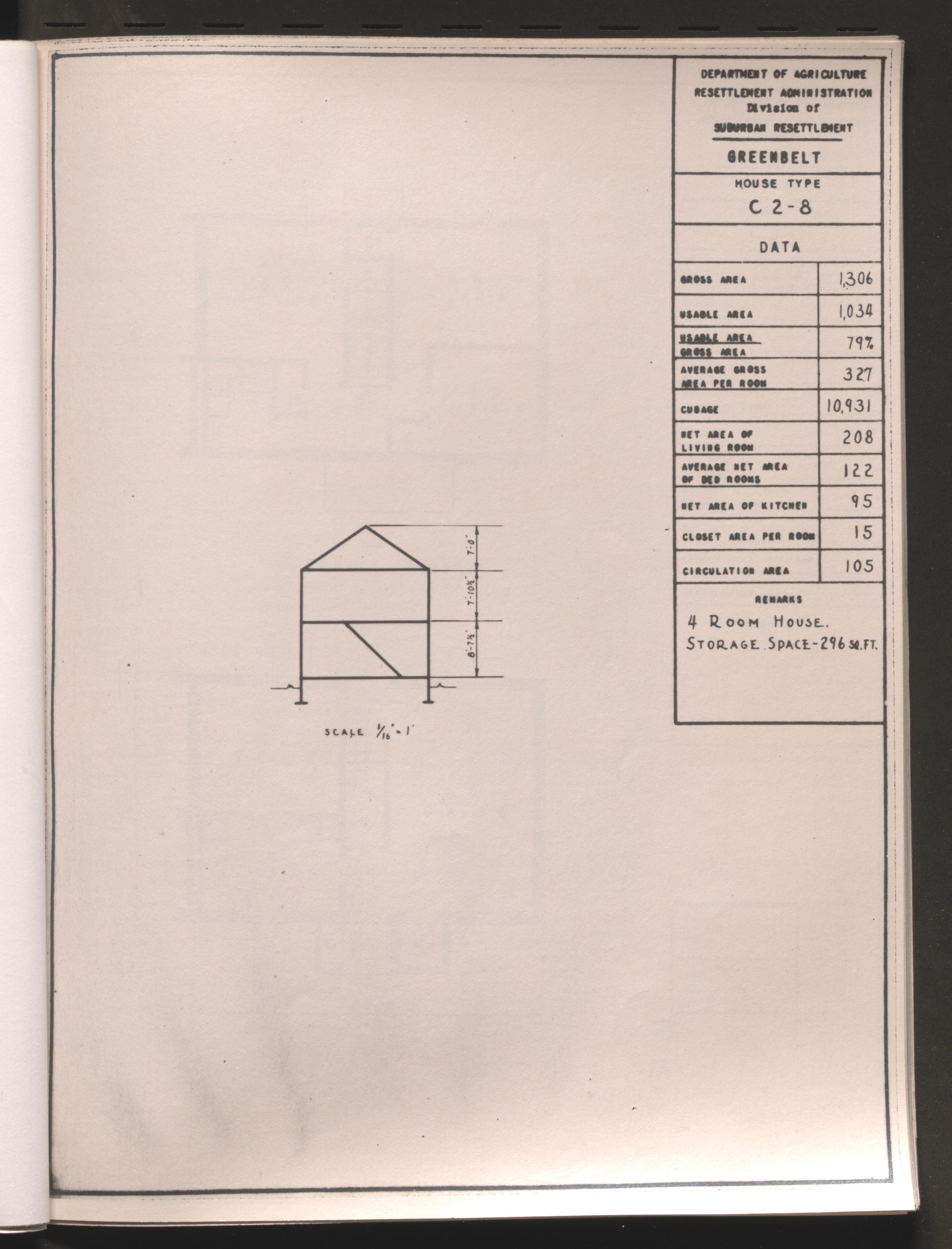
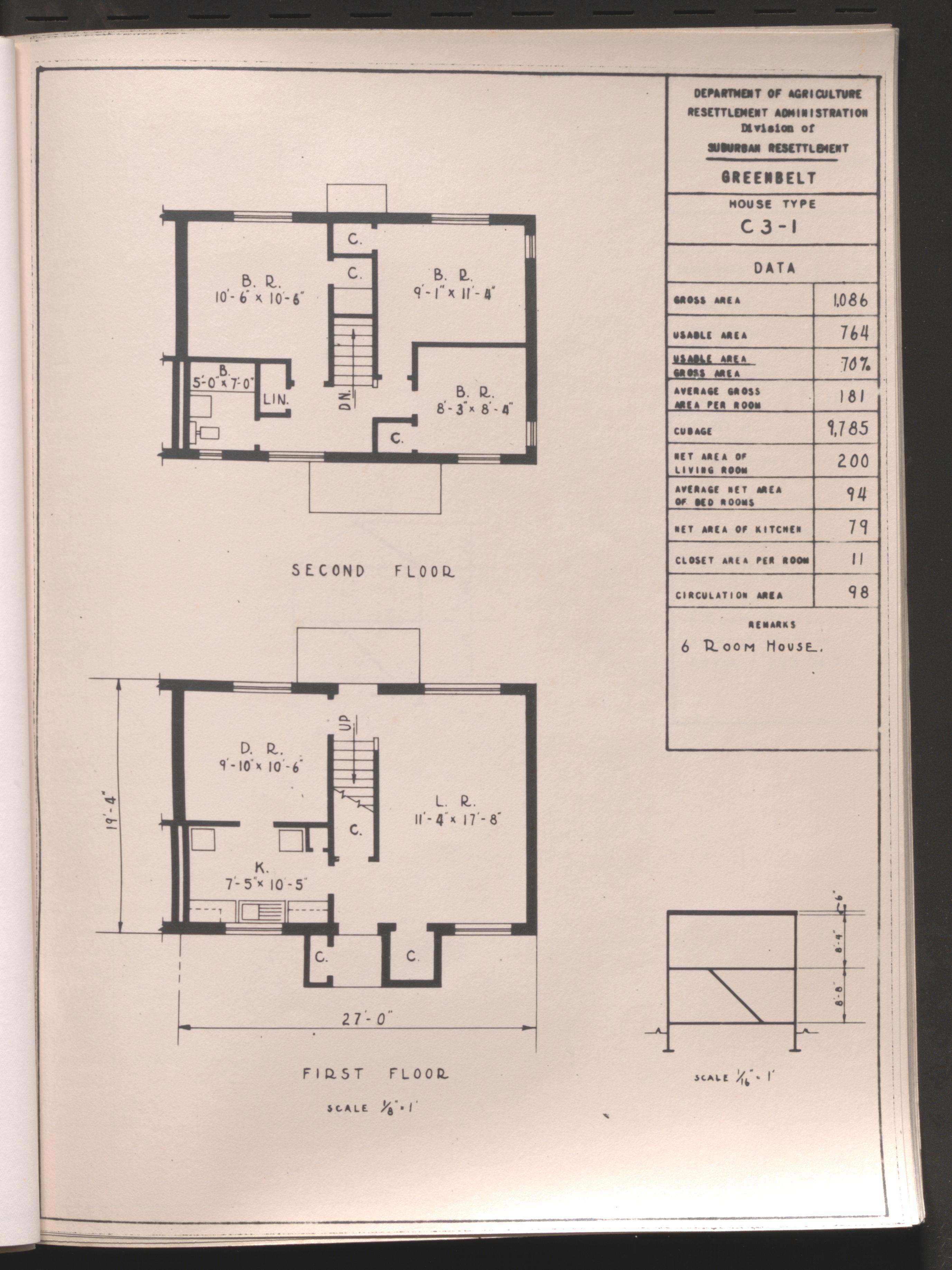
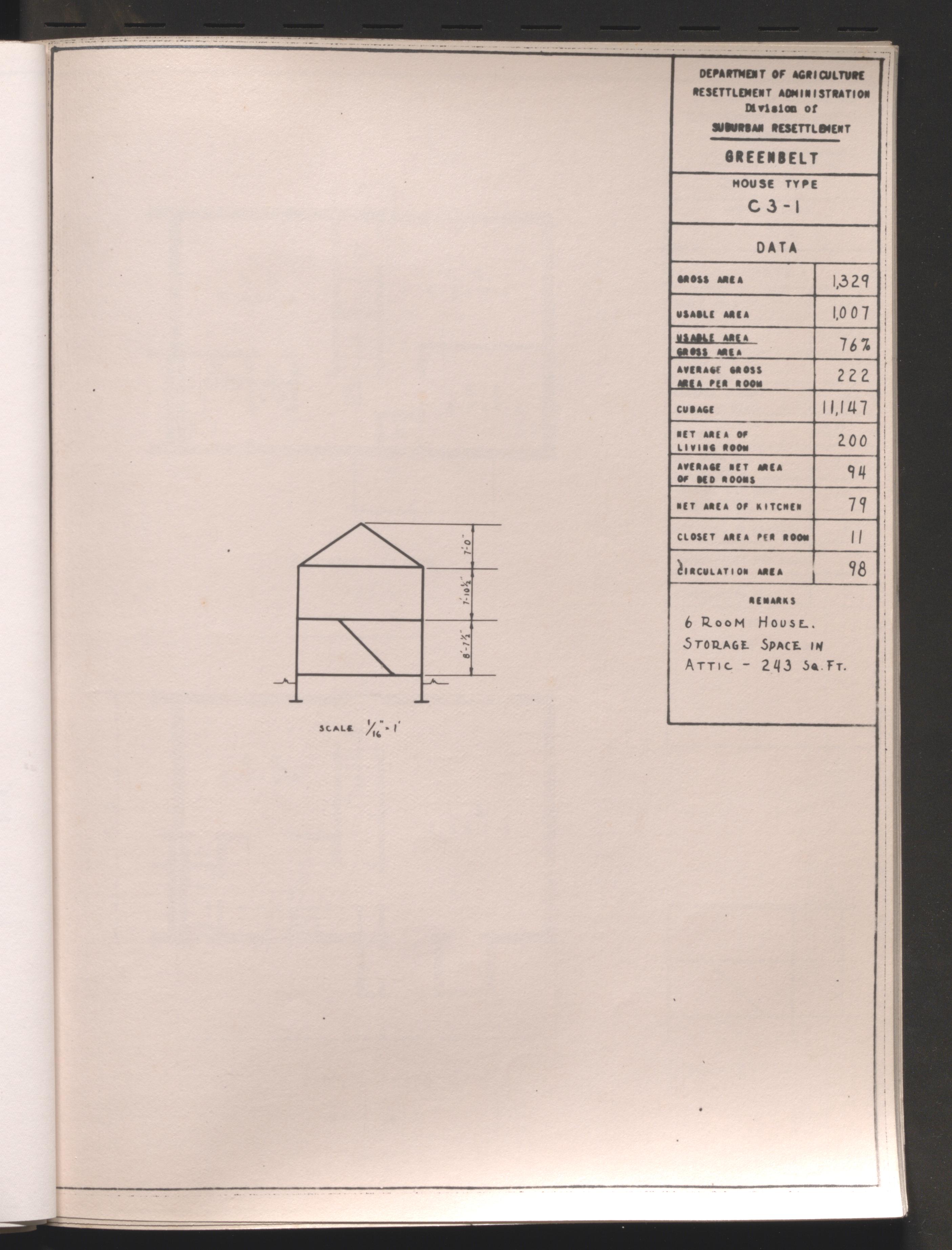
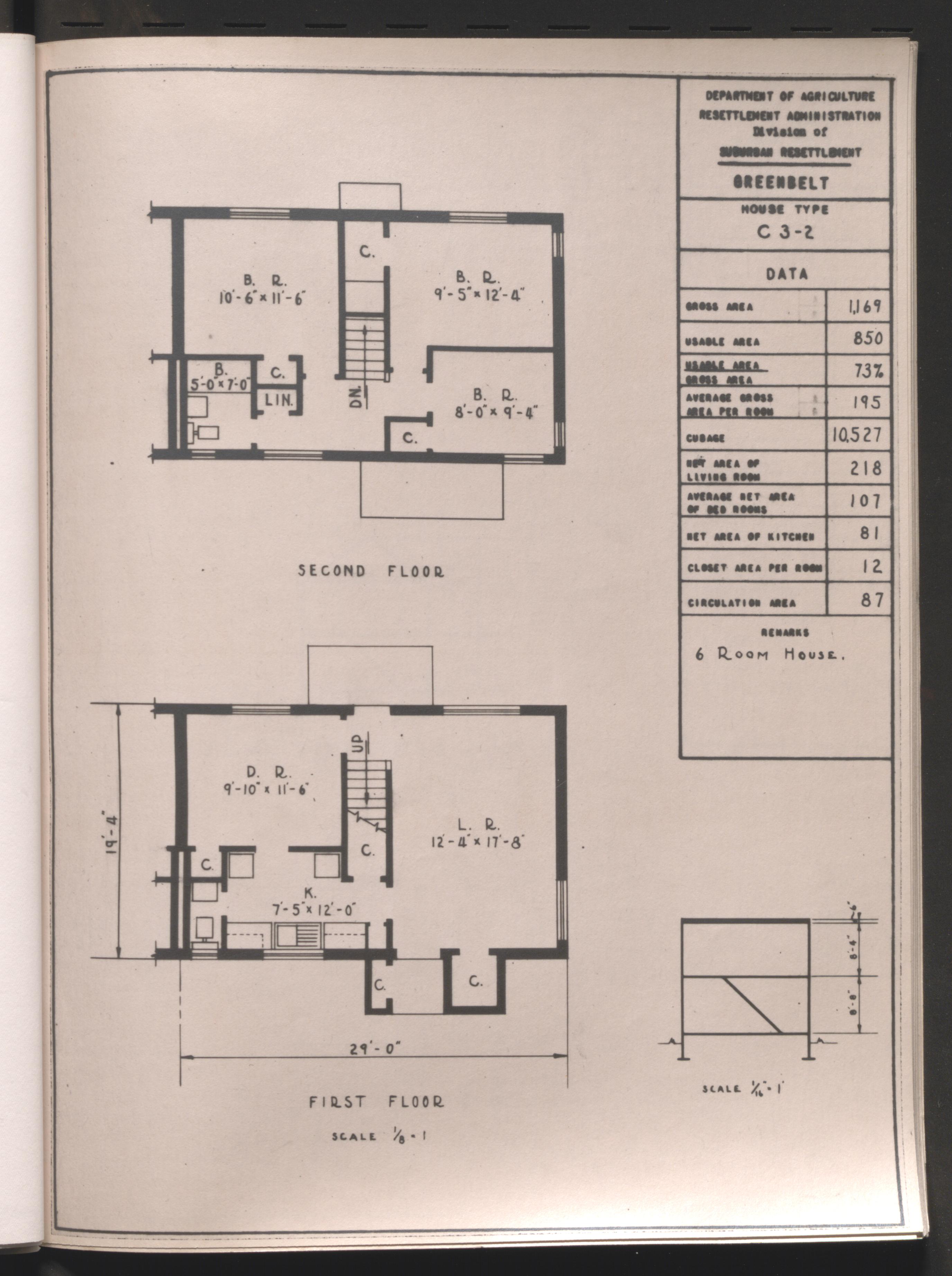
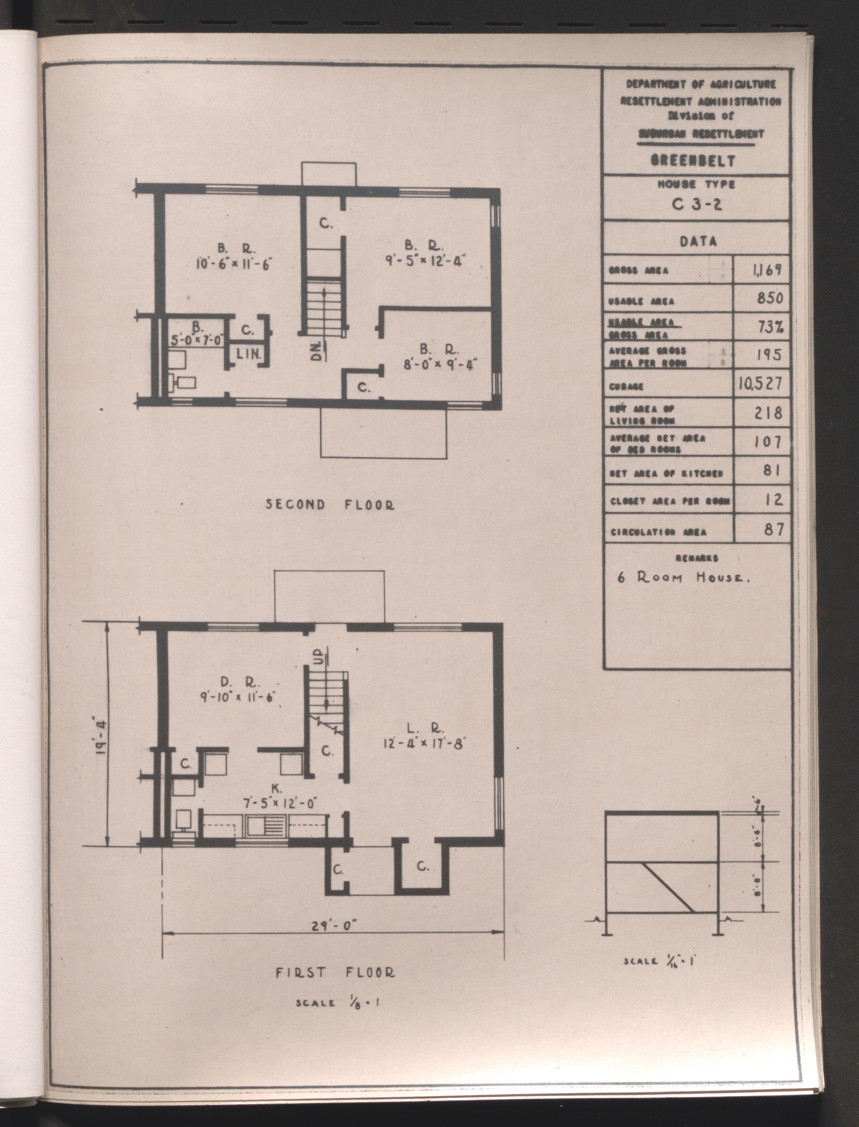
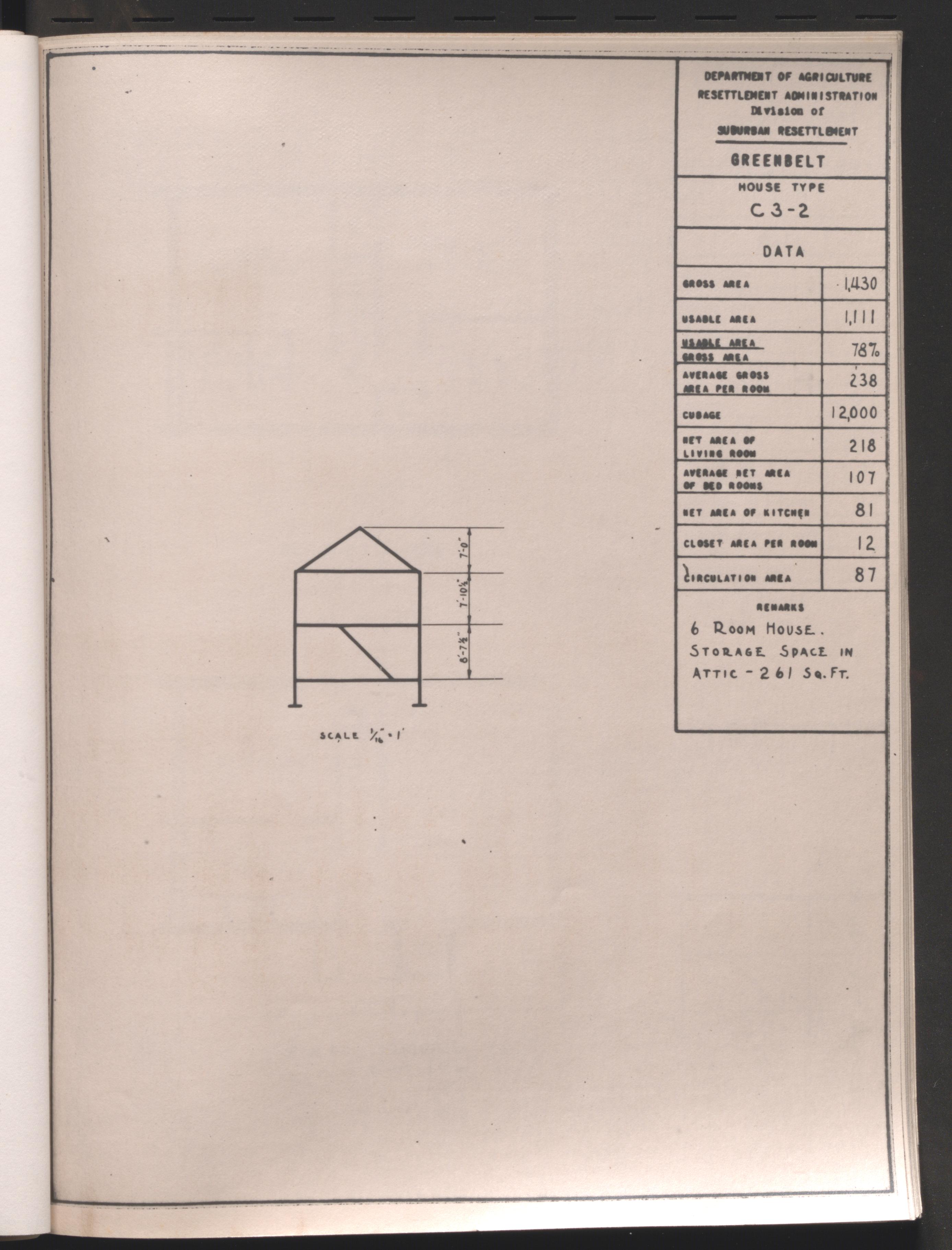
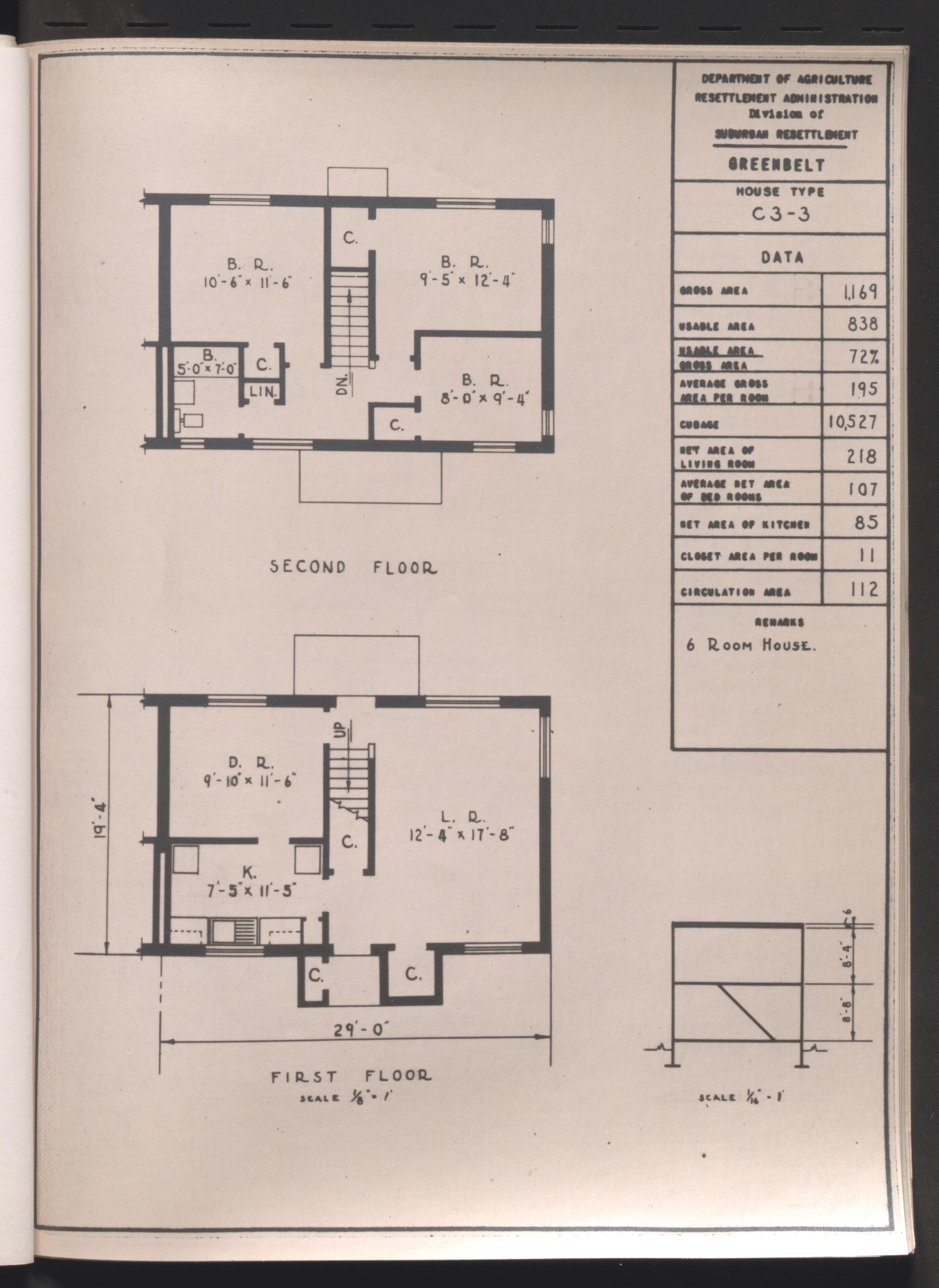
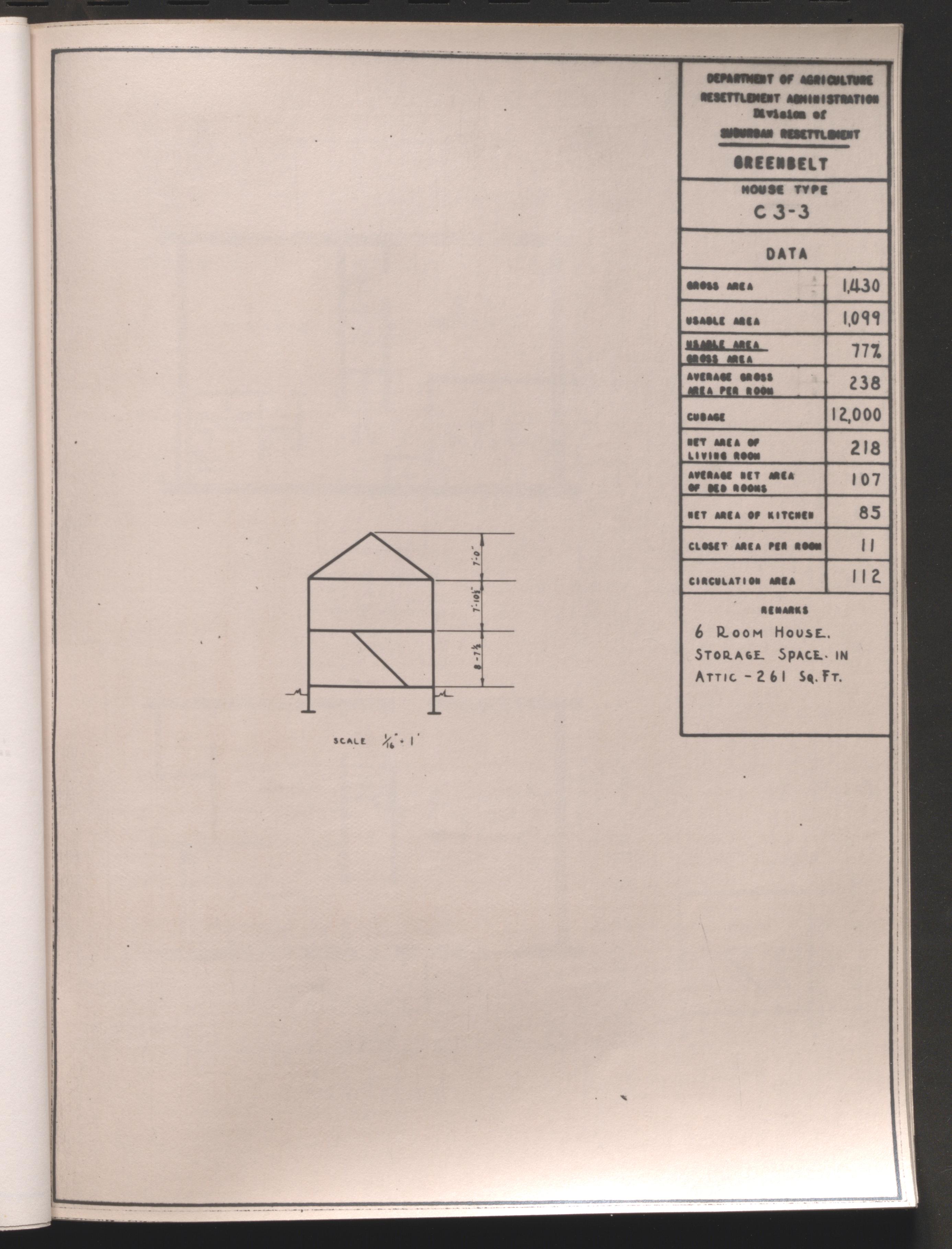
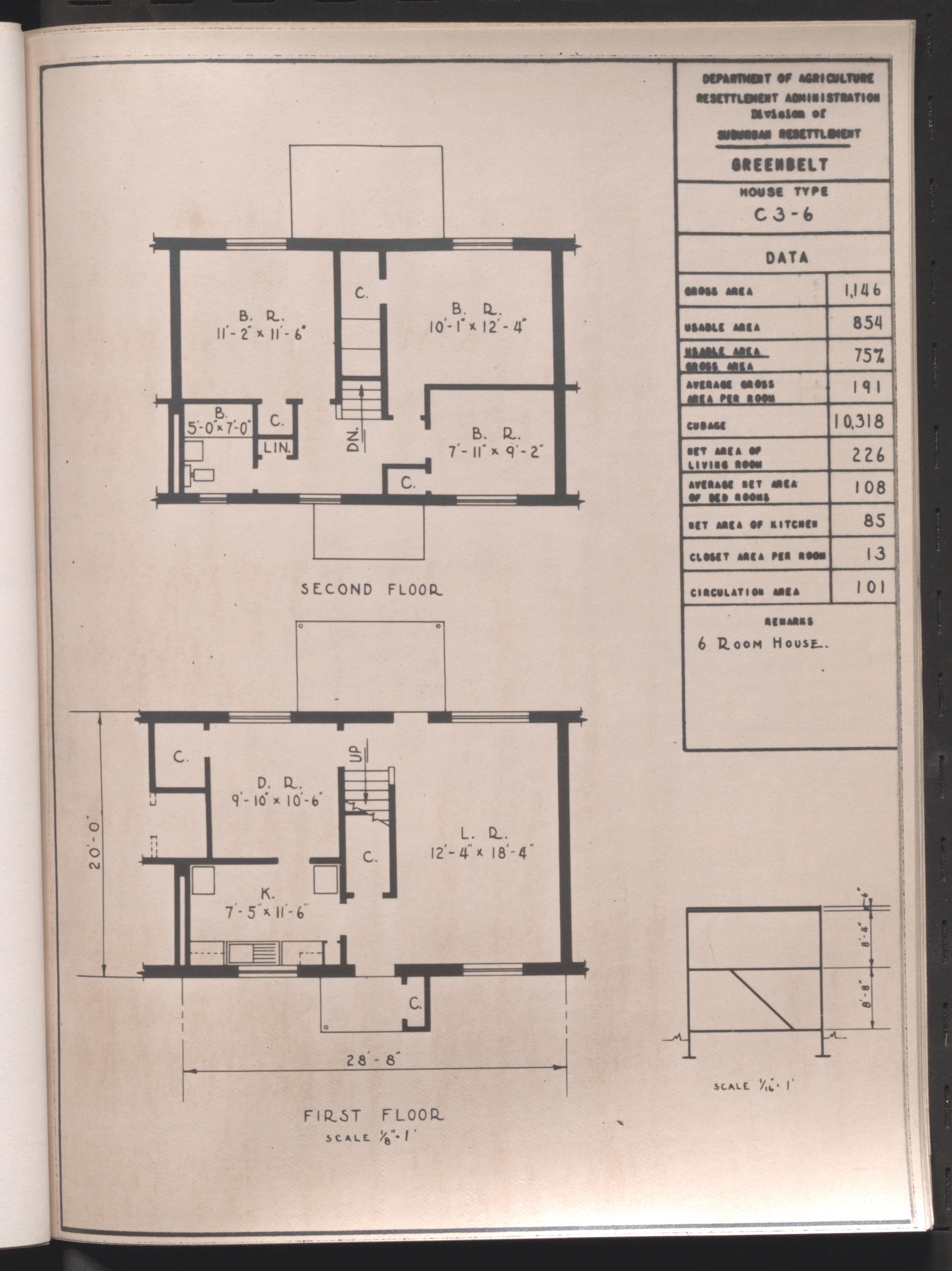
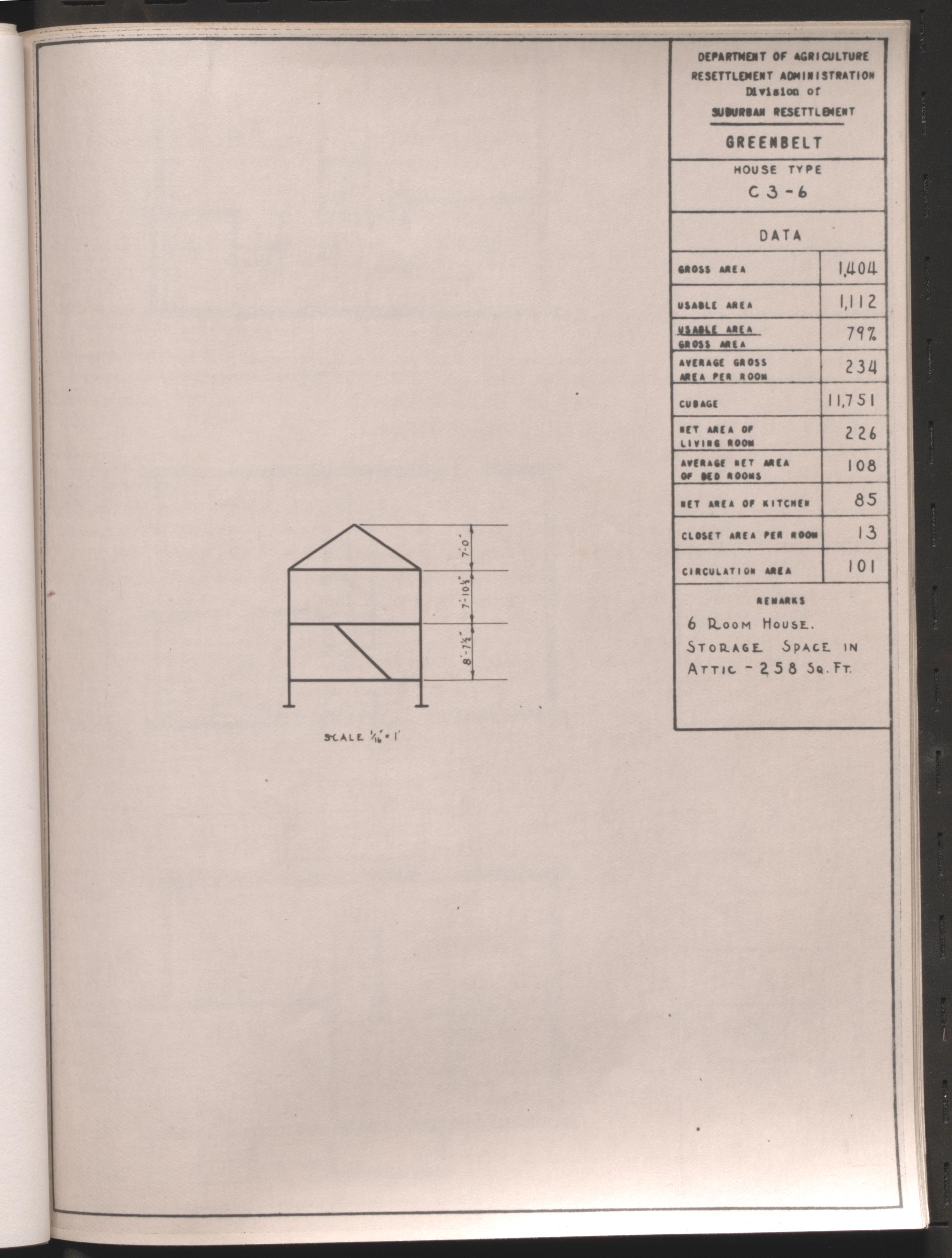
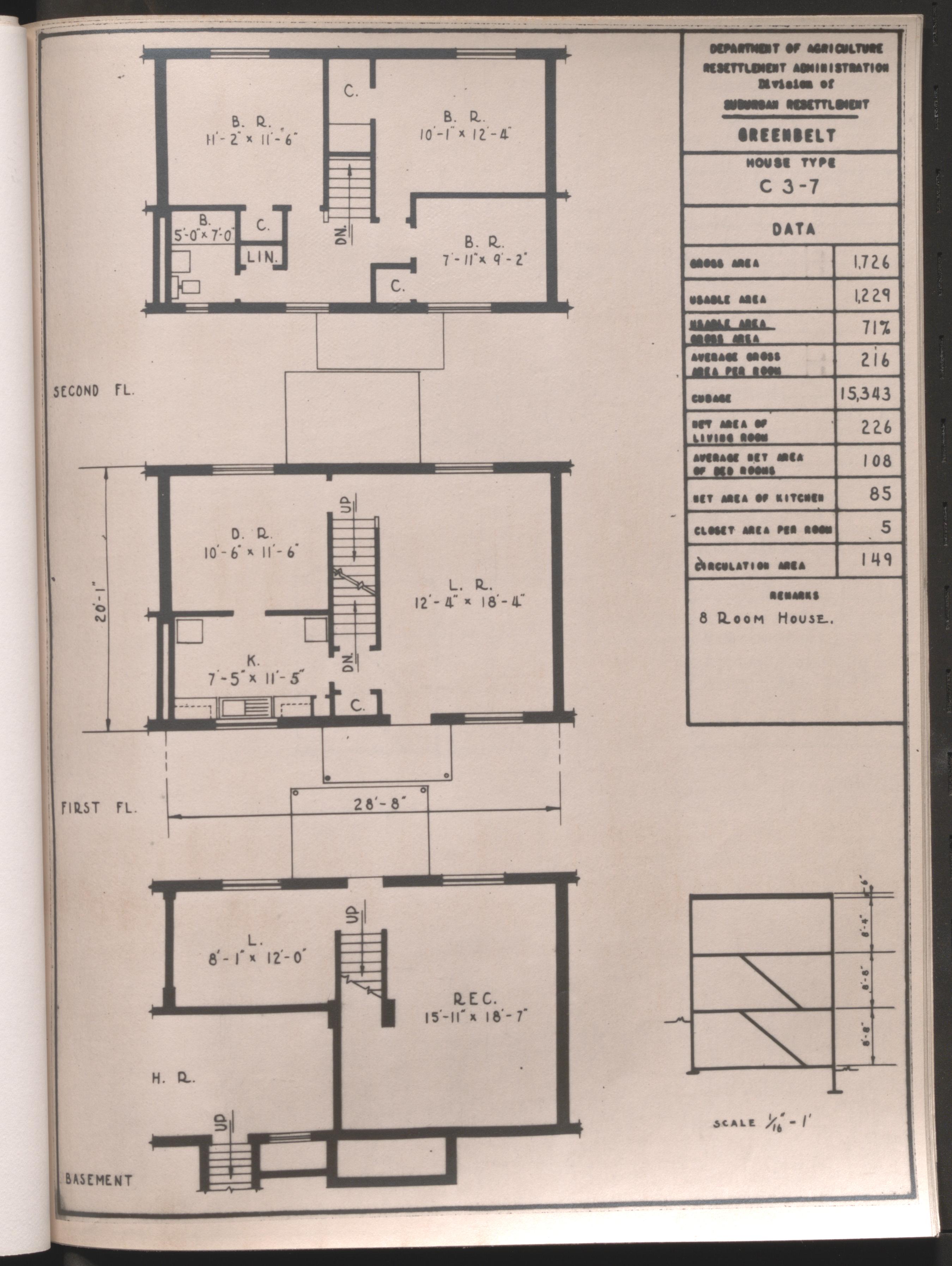
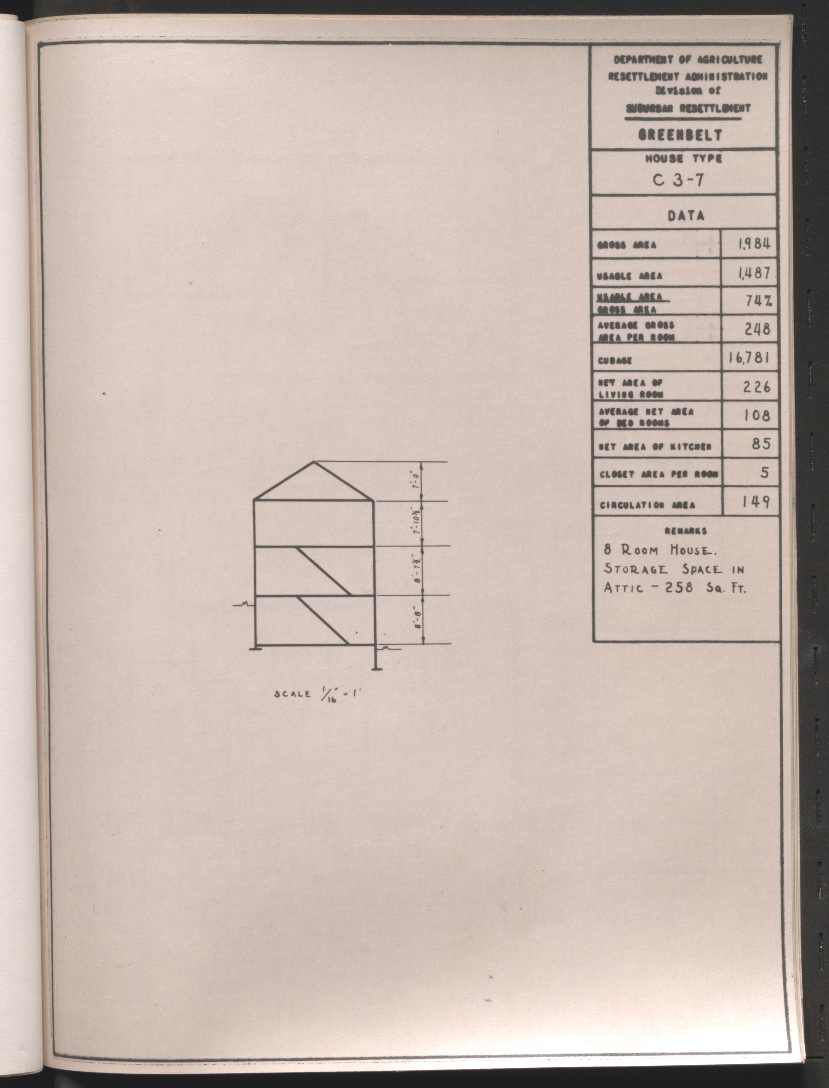
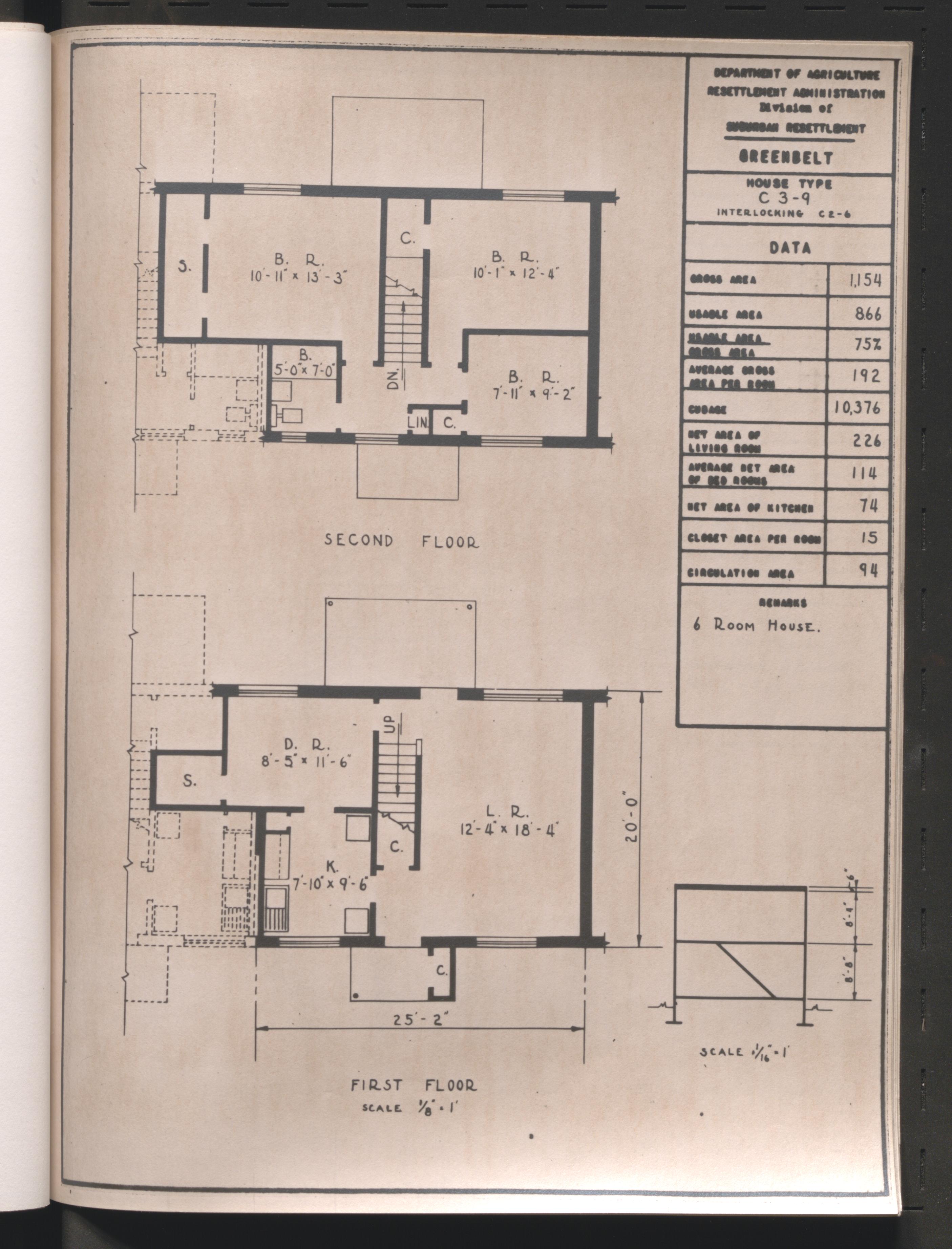
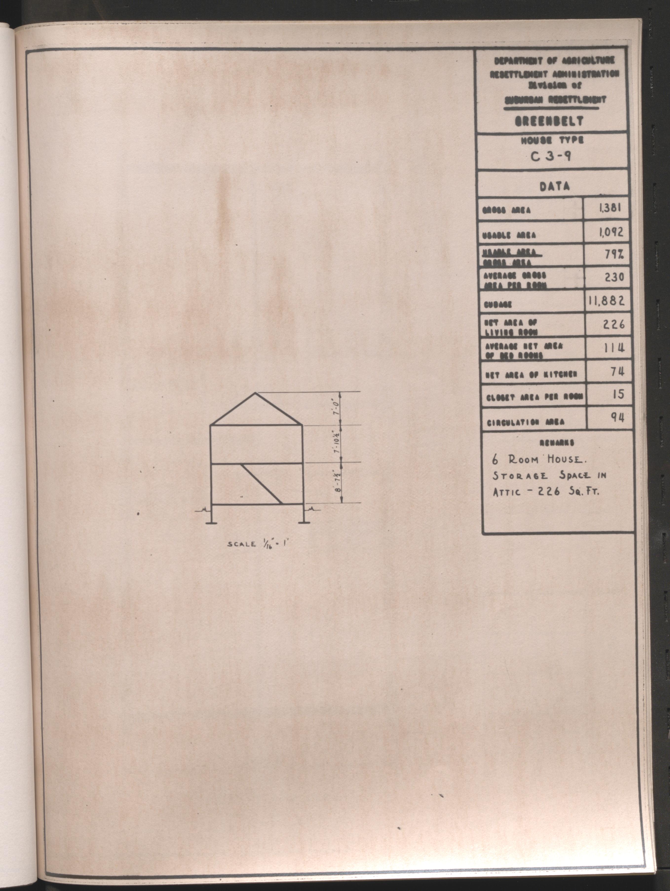
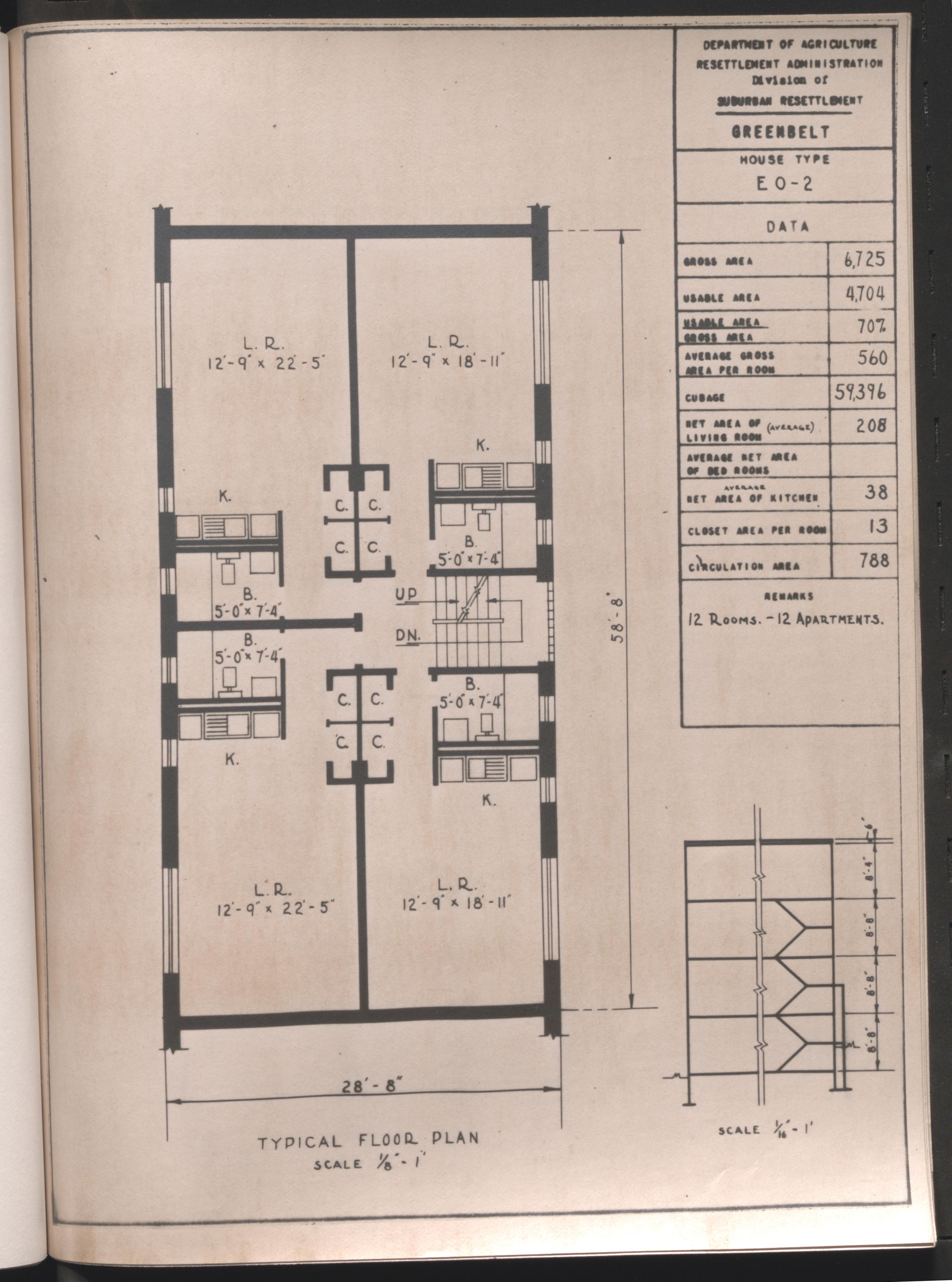
Greenbelt, Maryland, 1936-1938
Scope and Contents
The Greenbelt, Maryland series includes reports and publicity for the first town settled by the Greenbelt Towns project of the United States Resettlement Administration in 1937. Greenbelt provided affordable housing for federal government workers.
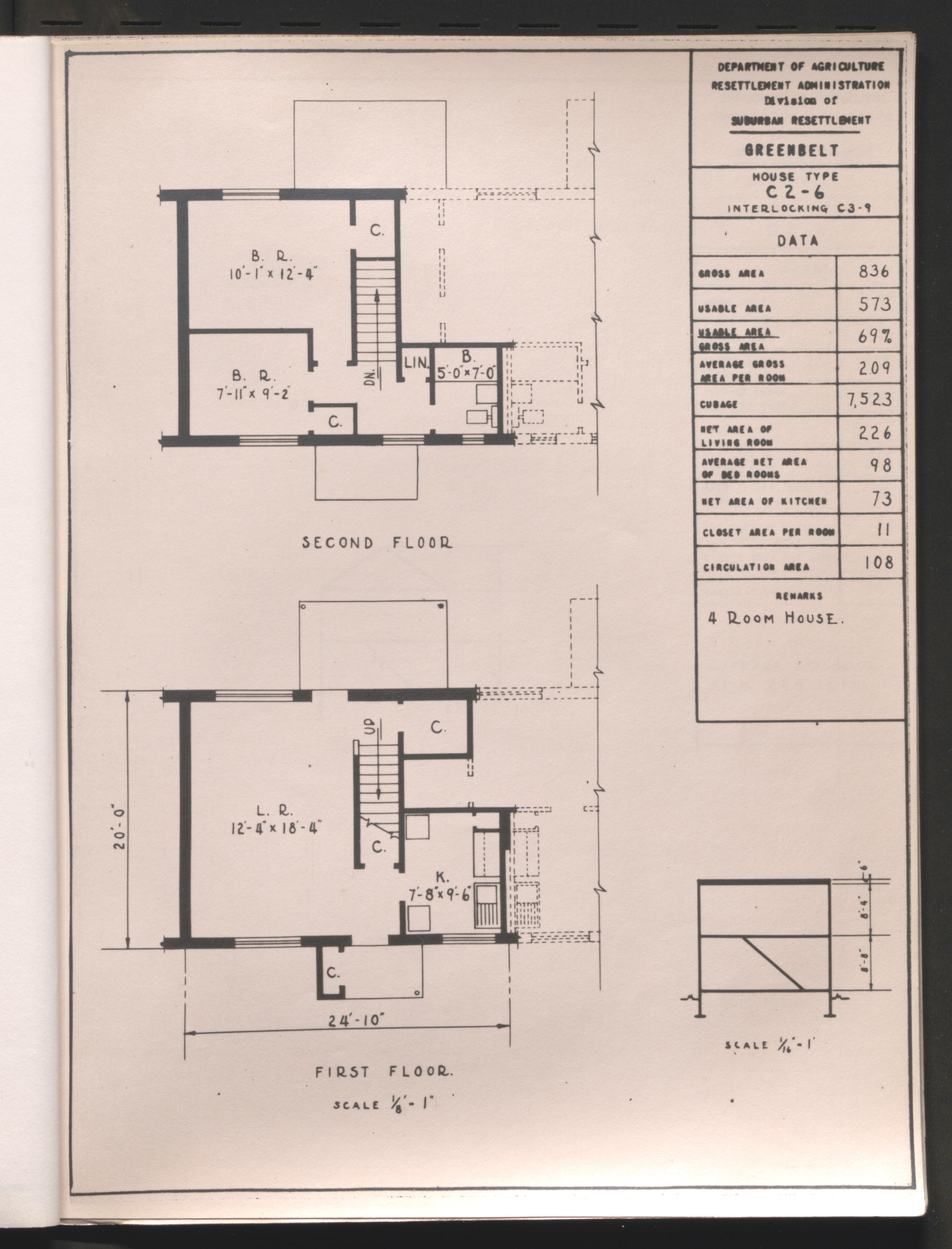
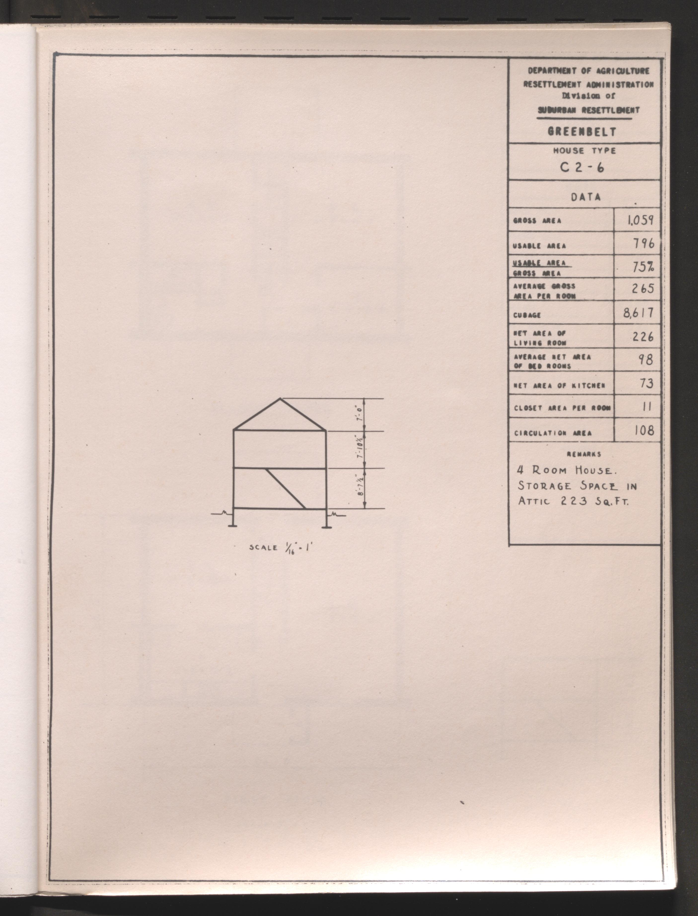
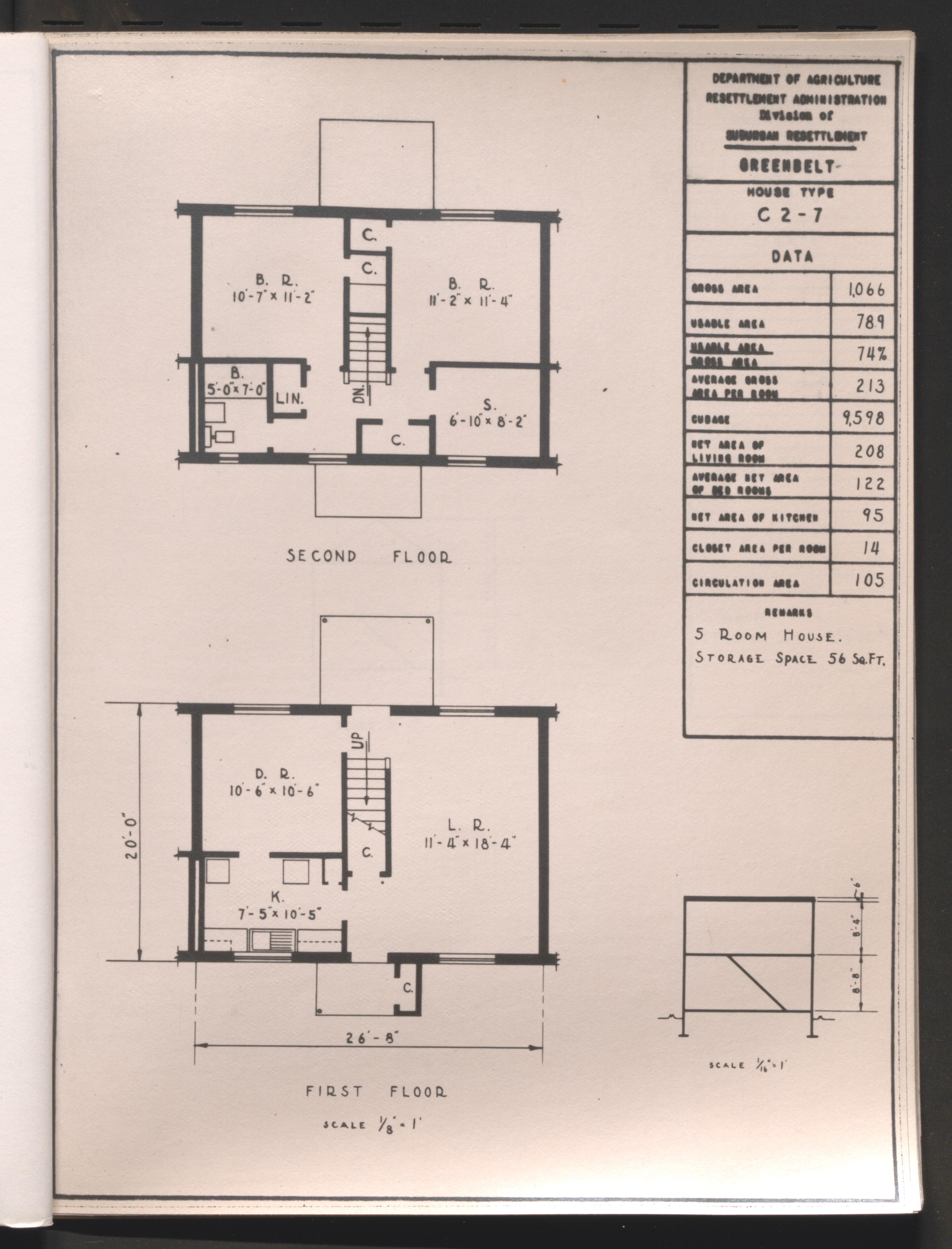
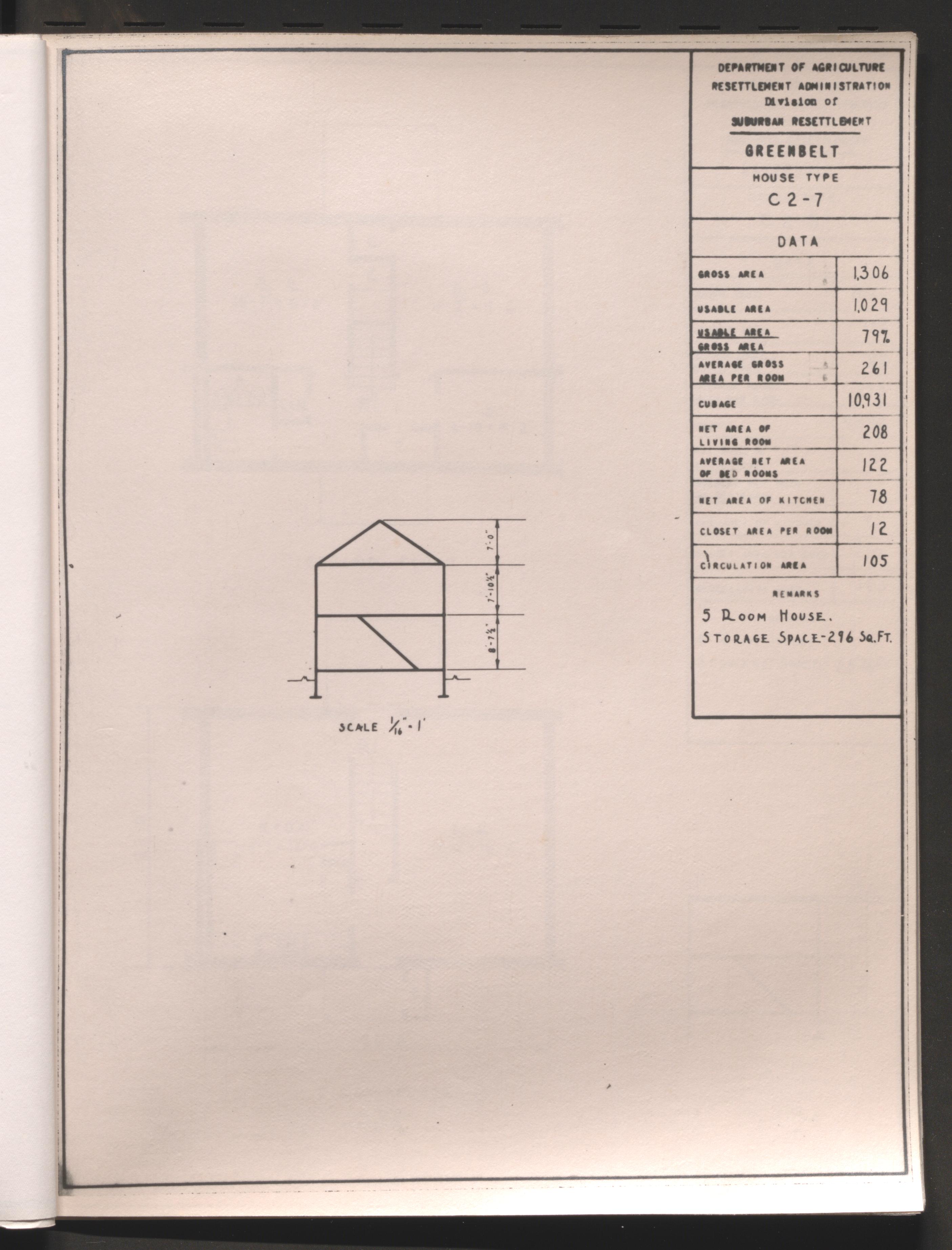
Experimental houses and plans, 1936
Project summary and recommendations, 1936-1937
Final Report I, 1936
Final Report II, 1936
Final Report III, 1936-1937
Magazine clippings, 1936-1937
Summary and tabulations, 1937-1938
Greenbrook, New Jersey, 1935-1937
Scope and Contents
The Greenbrook, New Jersey series includes planning and summary reports of the project to build a public cooperative in Roosevelt, New Jersey. The project was not completed because of differences with local government officials. The litigation papers used in an effort to mandate the project are included in the series. Also, advertisements and pamphlets promoting housing projects are a part of the series.
Preliminary plans, 1935
Project plans, 1935-1936
Report on utilities, 1935
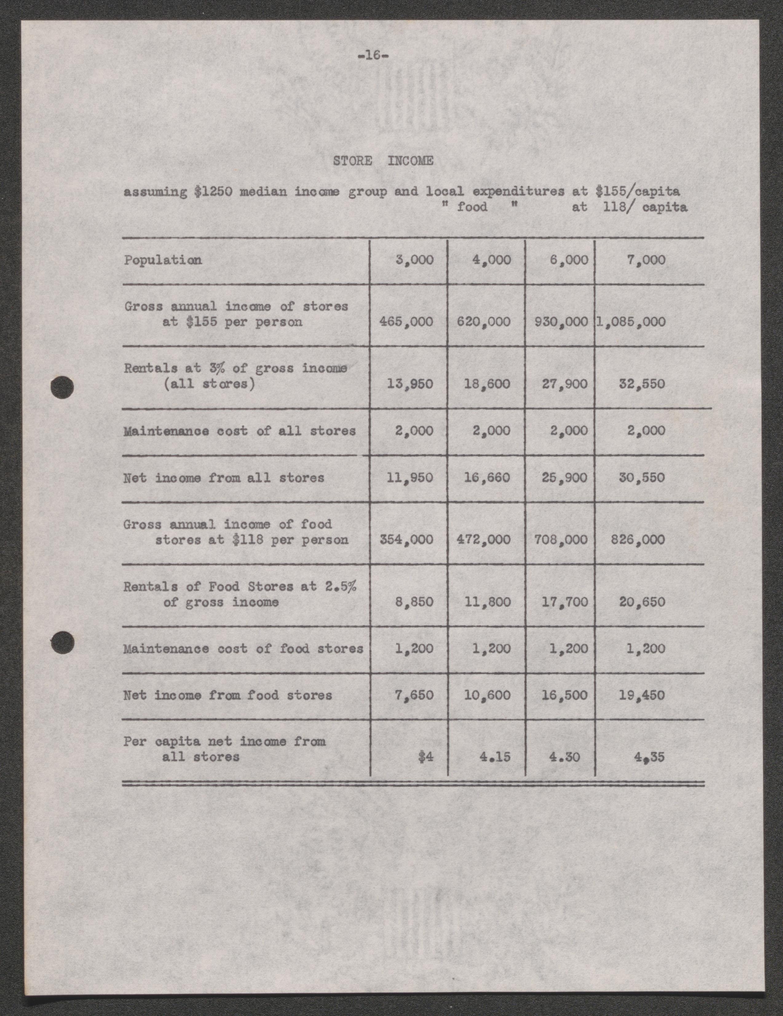
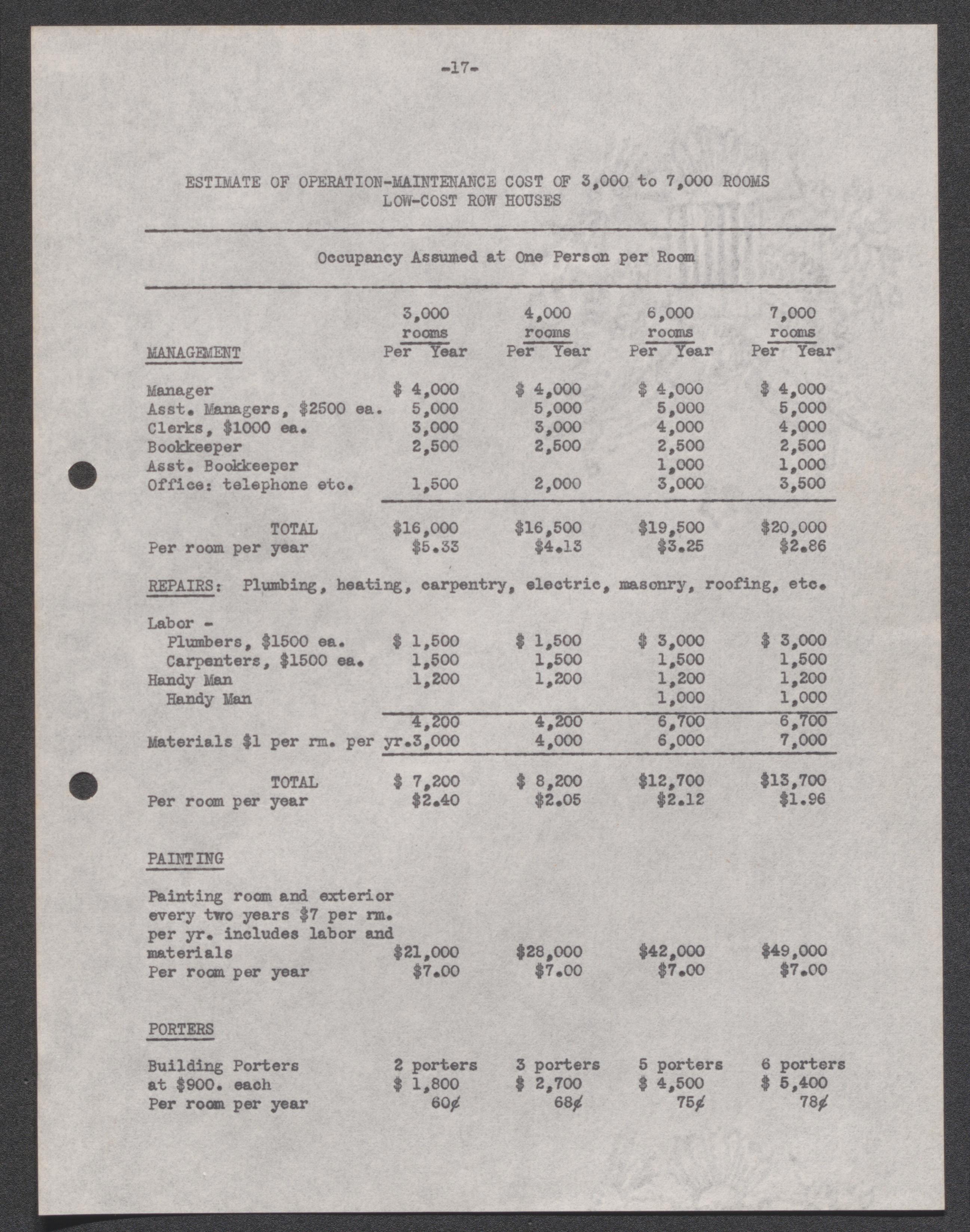
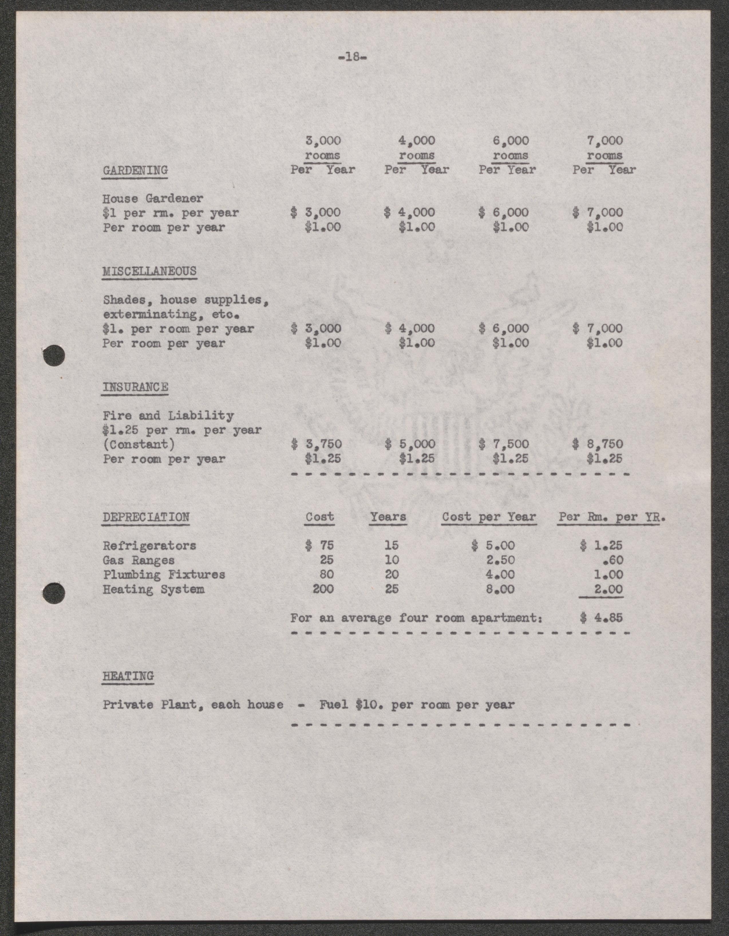
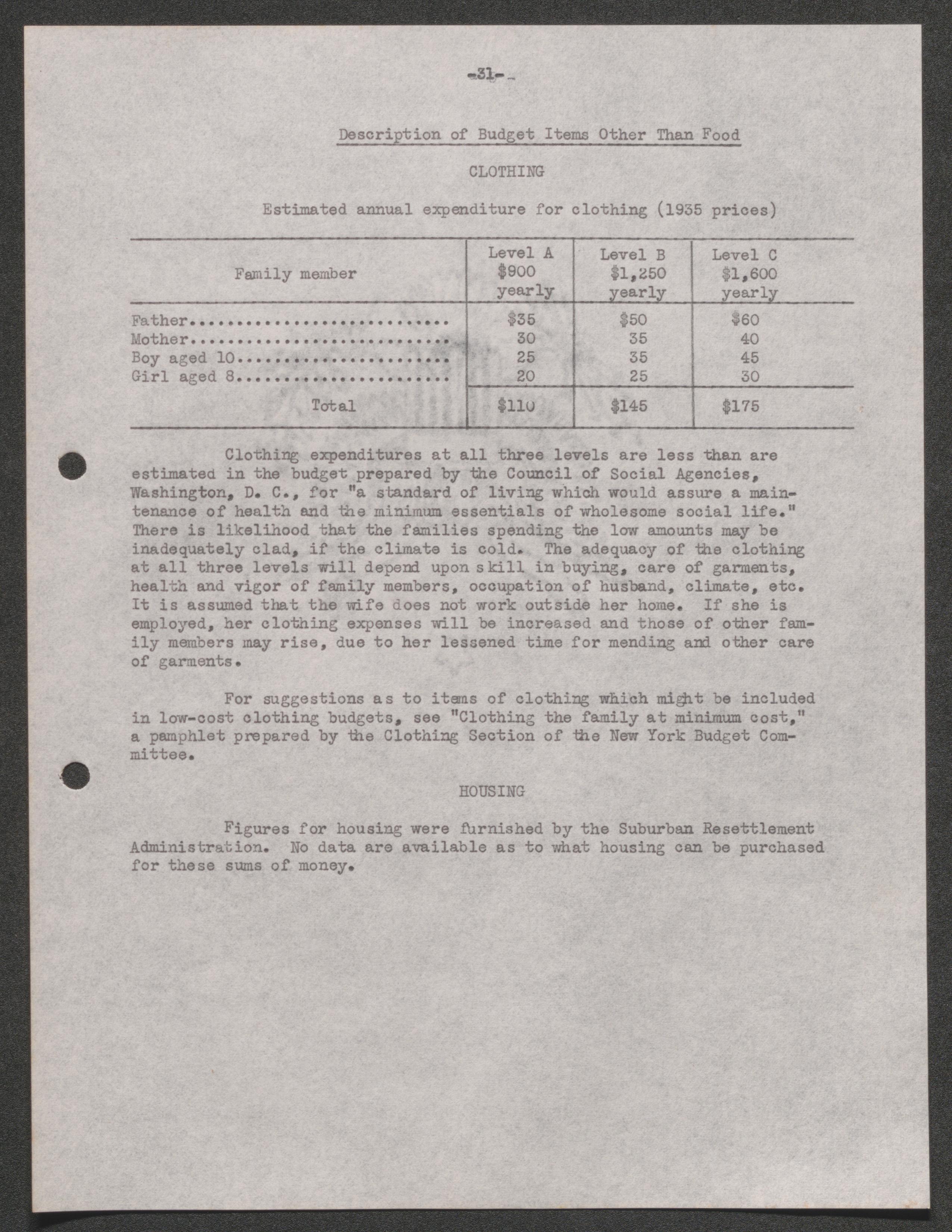
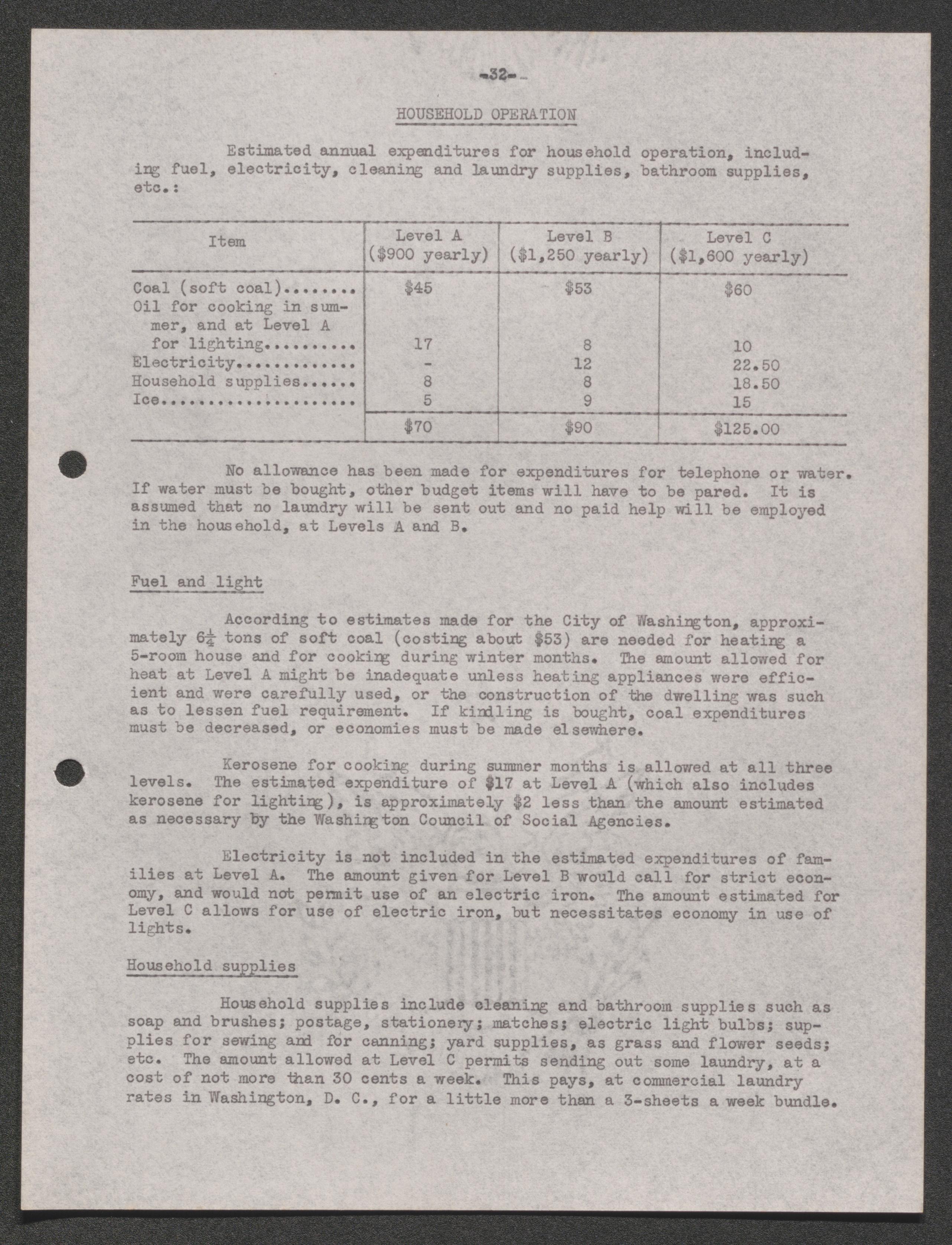
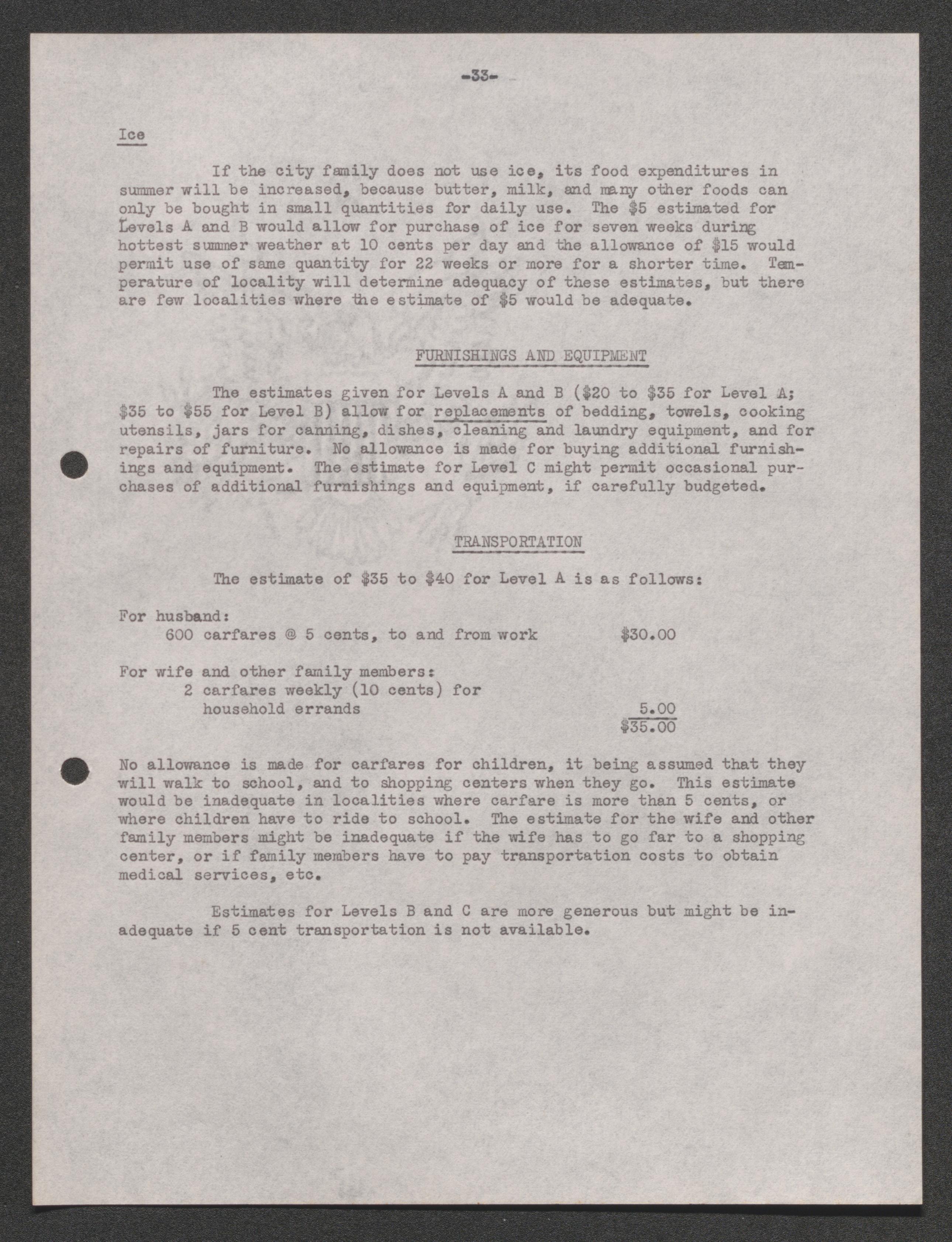
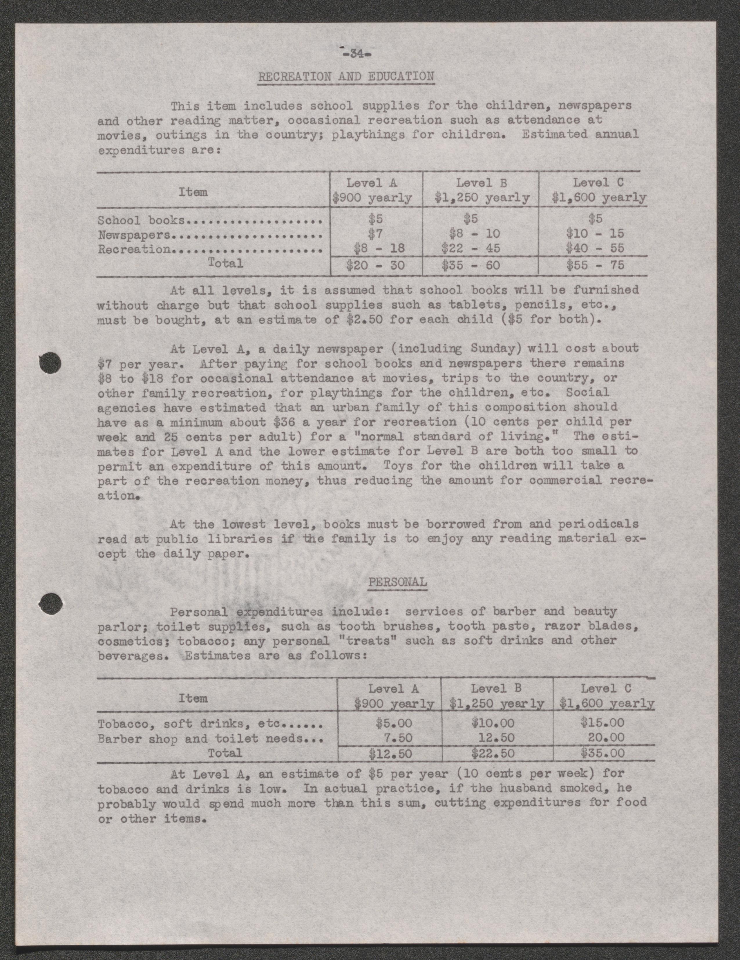
Report on Children, Living Costs, and Insurance, 1936
Summary report, 1935
Final Report, 1935
Final Report II, undated
Project history, 1935-1936
Litigation, 1936 January-May
Advertisements, blueprints, pamphlets, 1936
Project plans, 1936
Specifications, 1936-1937
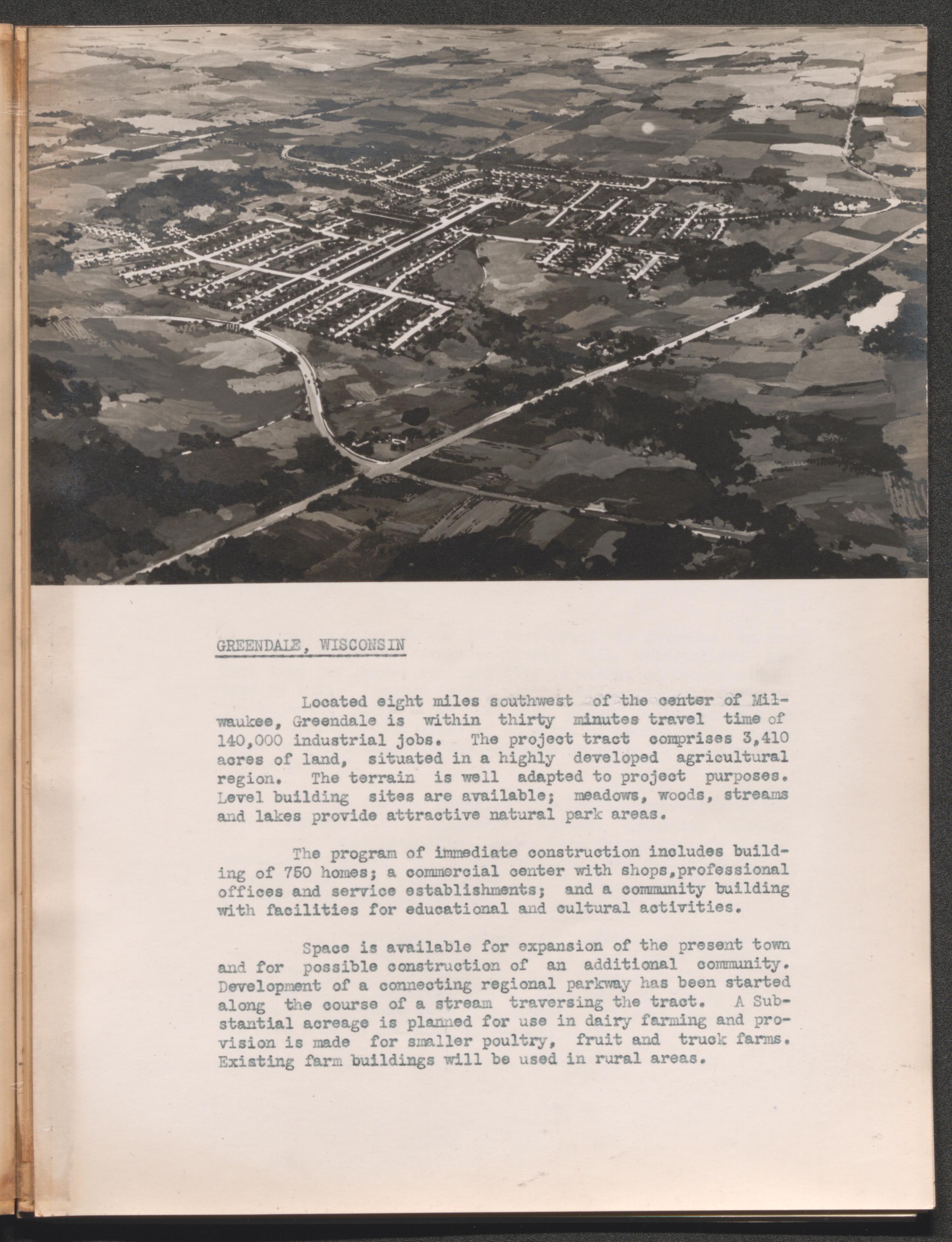
Greendale, Wisconsin, 1935-1938
Scope and Contents
The Greendale, Wisconsin series includes reports and blueprints about the construction of the Greenbelt Town near Milwaukee, Wisconsin. The reports include information about the costs of construction and living expenses for members of the community. The reports were created for the federal government by the United States Resettlement Administration Division of Suburban Development.
Summary report, 1936-1937
Final Report I, 1938
Final Report II, 1936
Final Report III, 1936
Project history, 1935-1936
Articles and reports, 1935-1936
Summary of information, 1936
Blueprints and development recommendations, 1935-1936
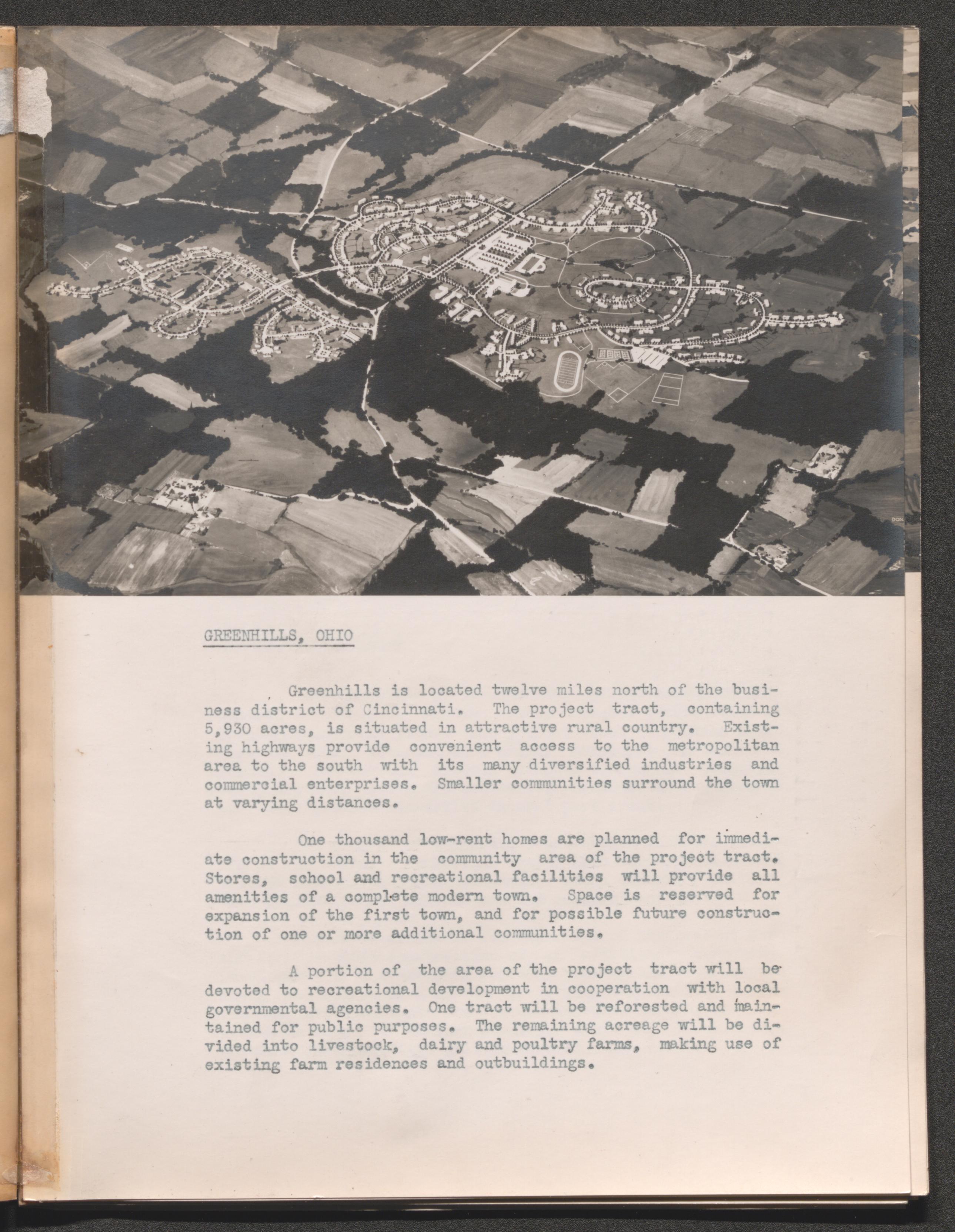
Greenhills, Ohio, 1936-1940
Scope and Contents
The Greenhills, Ohio series includes reports about the construction of housing in the Greenbelt Town Public Cooperative Project near Cincinnati. The town was commissioned by the United States Resettlement Administration under the authority of the Emergency Relief Appropriation Act. Also, the series includes reports on the study of the needs of potential residents of the community as well as the costs of living in the new homes. The series includes some immediate follow up on the conditions for the new residence of the Greenhills housing project.
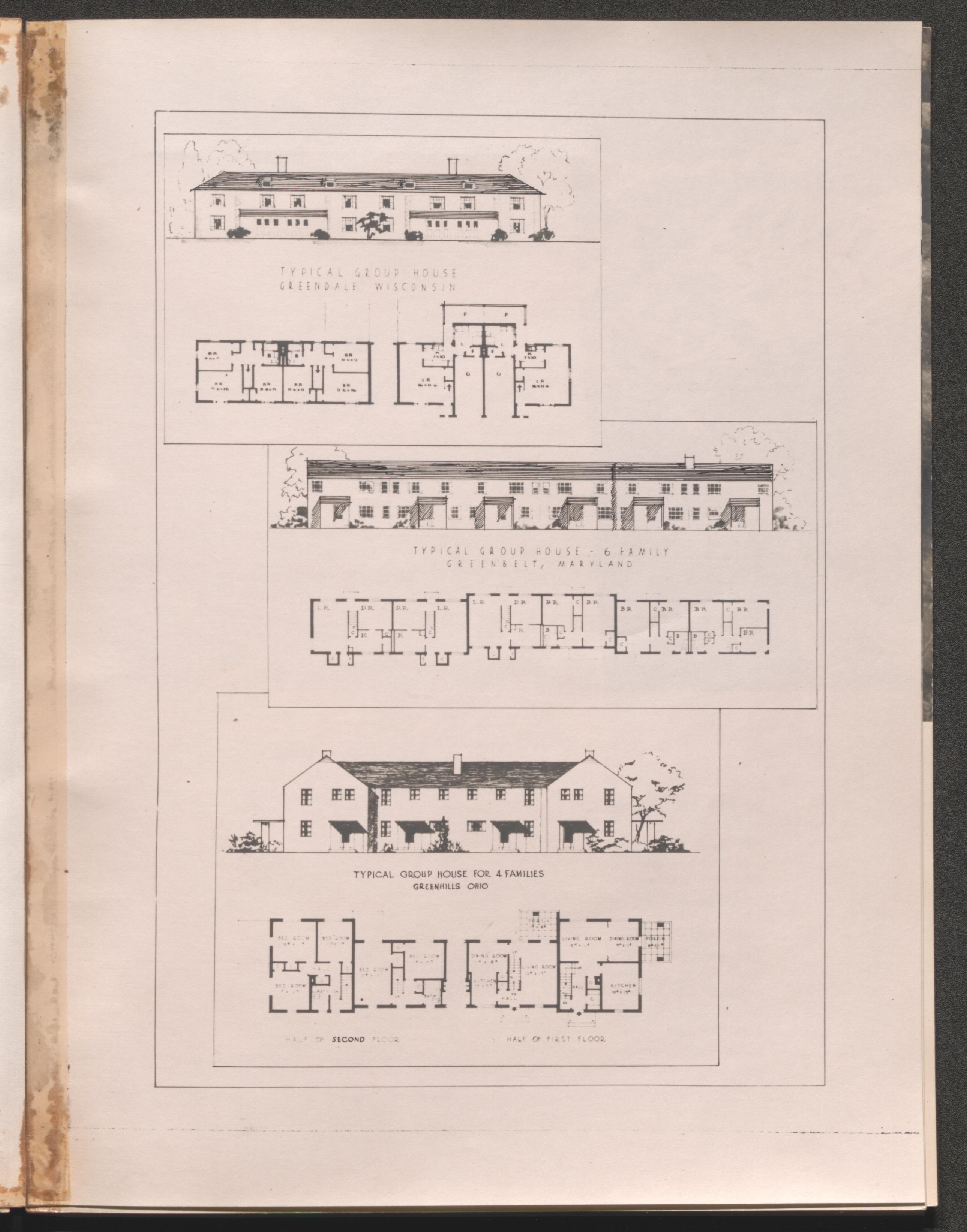
Final Report I, 1938
A Study of Characteristics, Customs, and Living Habits of Potential Tenants, 1936
Plans approved, 1936-1937
Specifications, 1936-1937
Summary Report I, 1936-1937
Summary Report II, 1937
Final Report I, 1936
Project history, 1936
Report of Facts Relative to the Settlement, Growth and Activity by the Project Appraiser, 1936
Correspondence and Pamphlets, 1939-1940
General Project Development Book, 1936 November
Other Resettlement Administration projects, 1936, undated
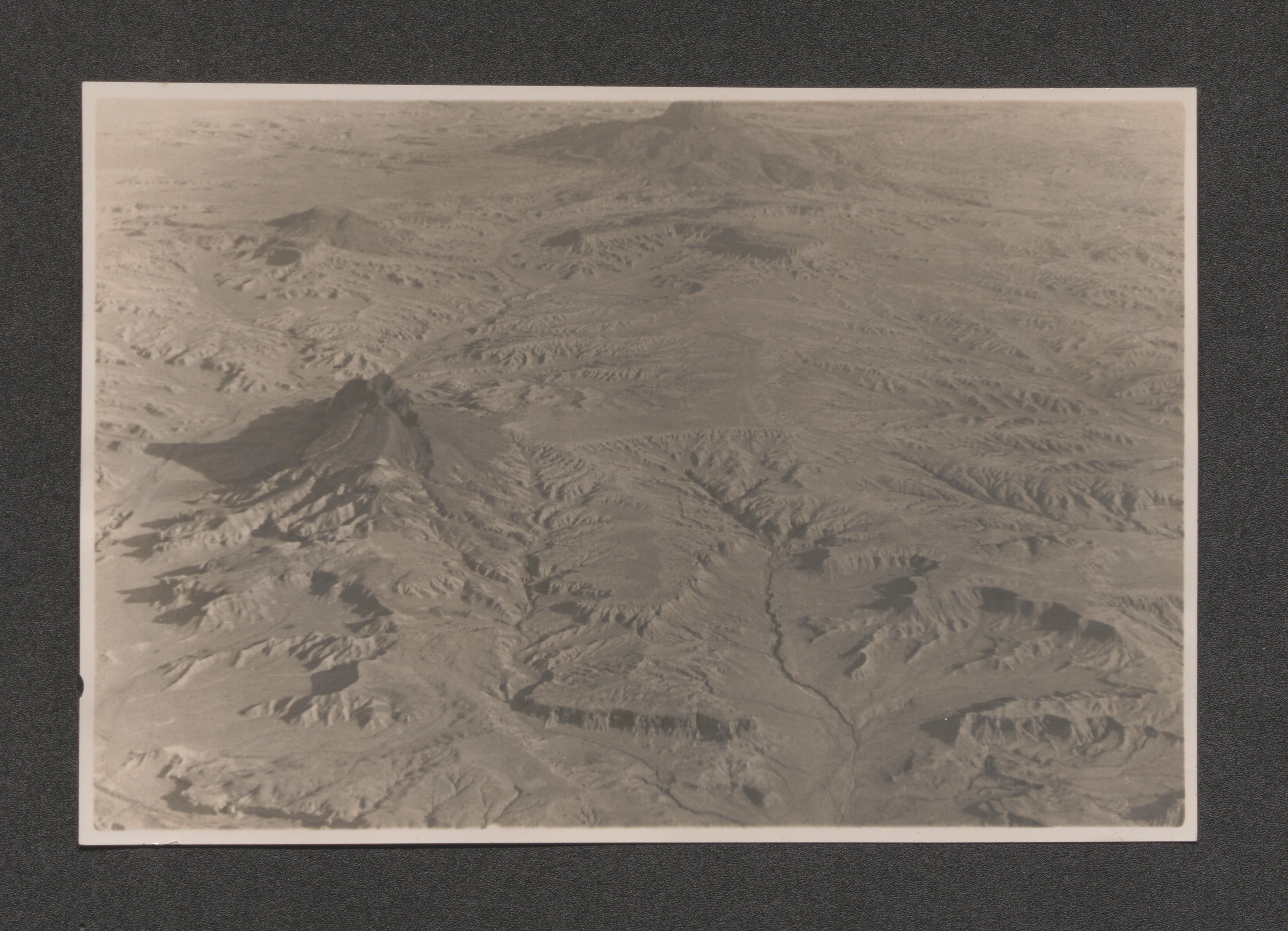
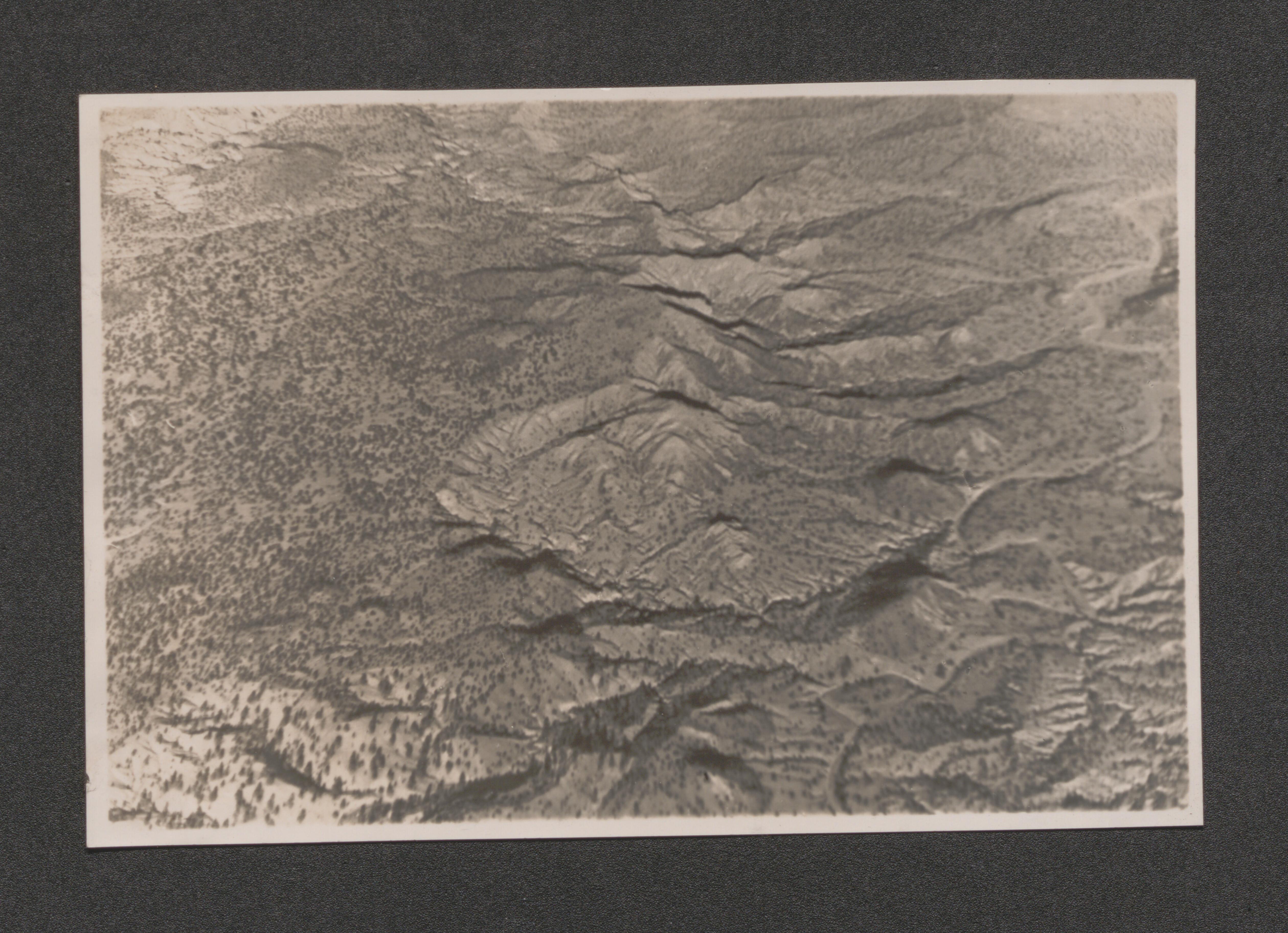
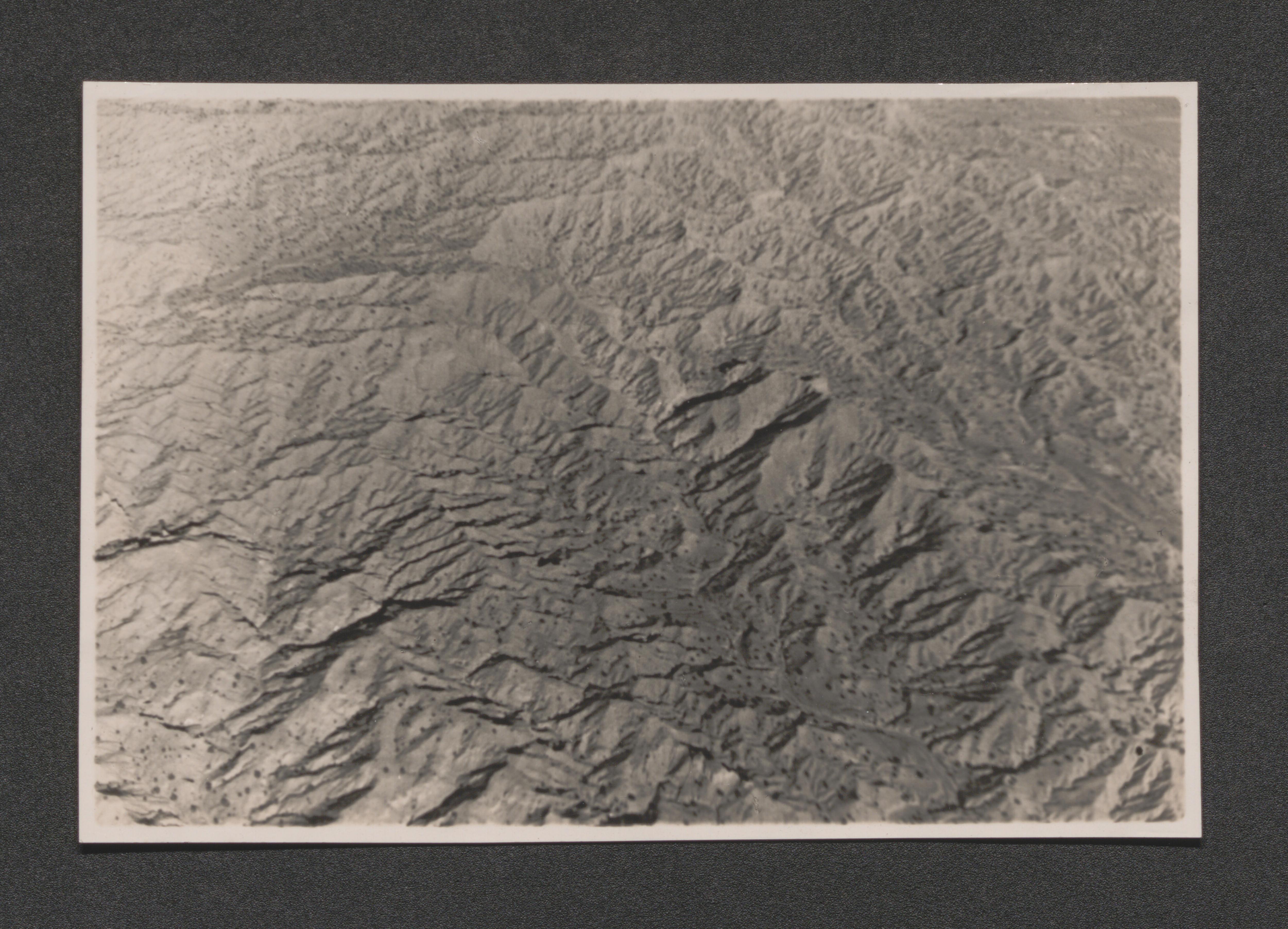
Scope and Contents
The Other Resettlement Administration Projects includes materials relating to undertakings of the New Deal era agency. Most of the materials are oversized books or loose maps and illustrations. The books document environmental issues that could be or were alleviated by a works project.
Atlas of the Tennessee Valley Region, 1936 June
Dixon Spings Agriculture Project, 1936 June
Indian Demonstration Project, 1936 June
Virginia Wayside Areas, 1936 June
Ozarks Recreational Area, 1936 June
Tewa Basin Study, undated
Federal Emergency Relief Administration Land Program Map, undated
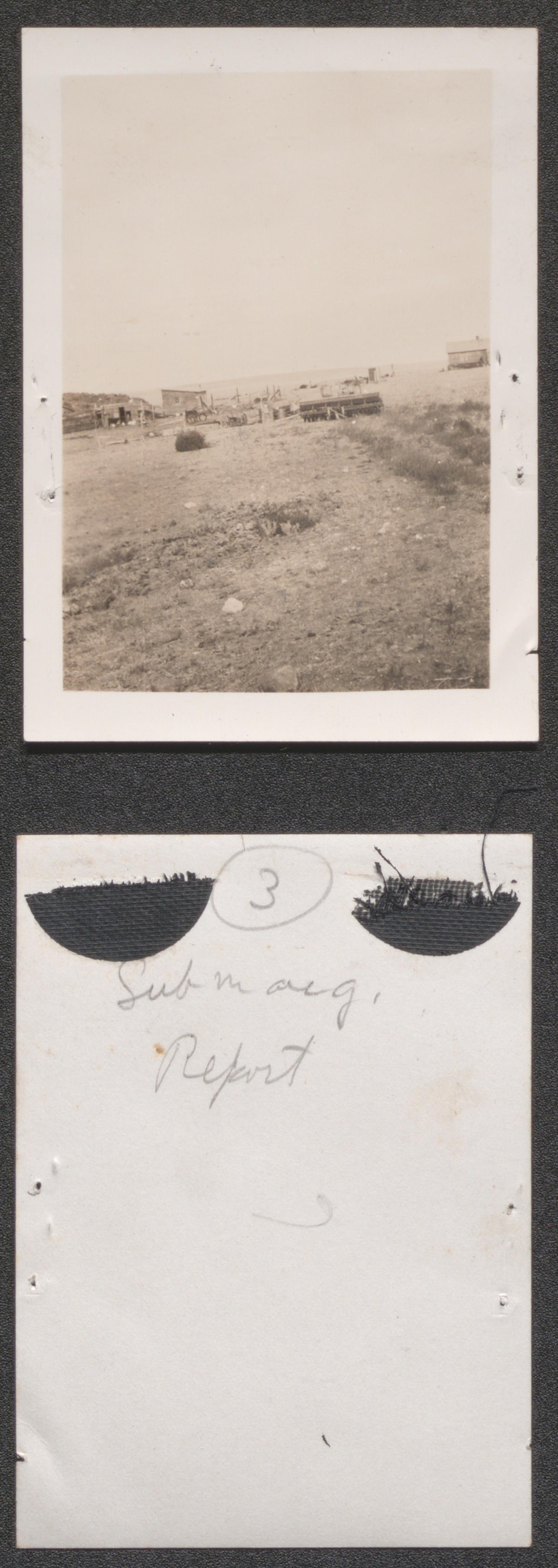
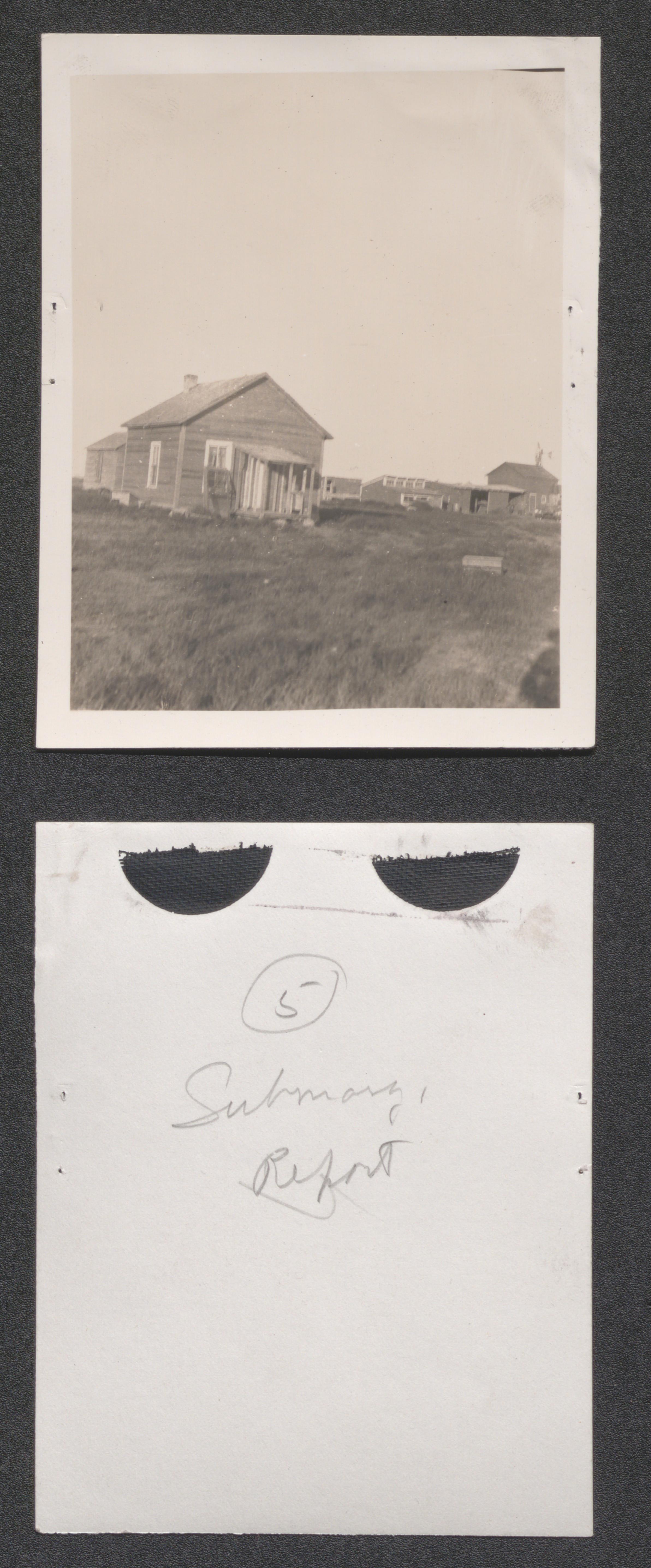
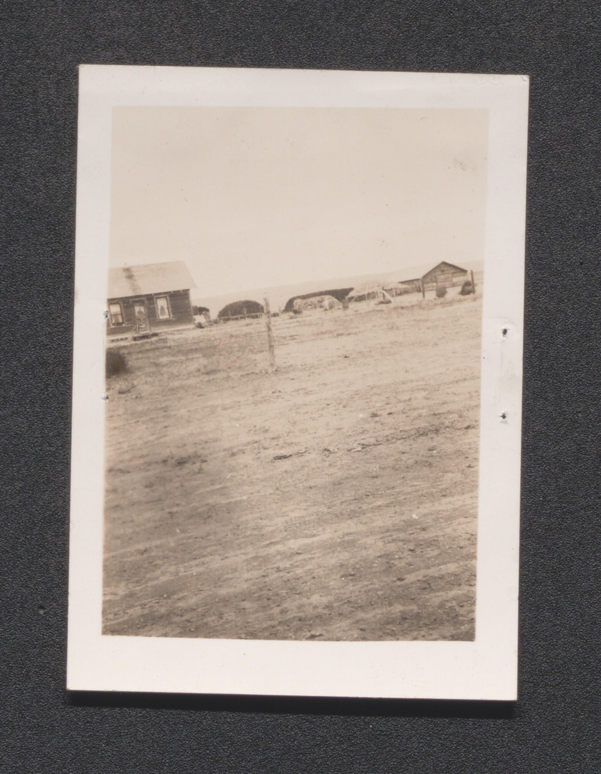
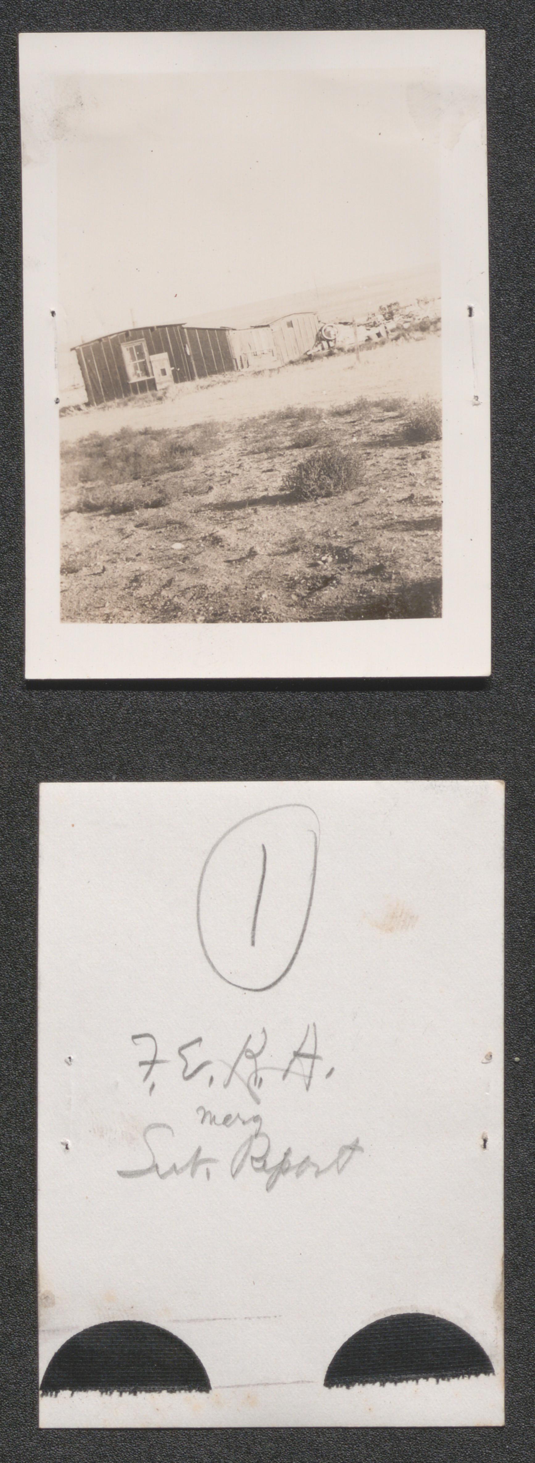
Photographs, 1935-1937, undated
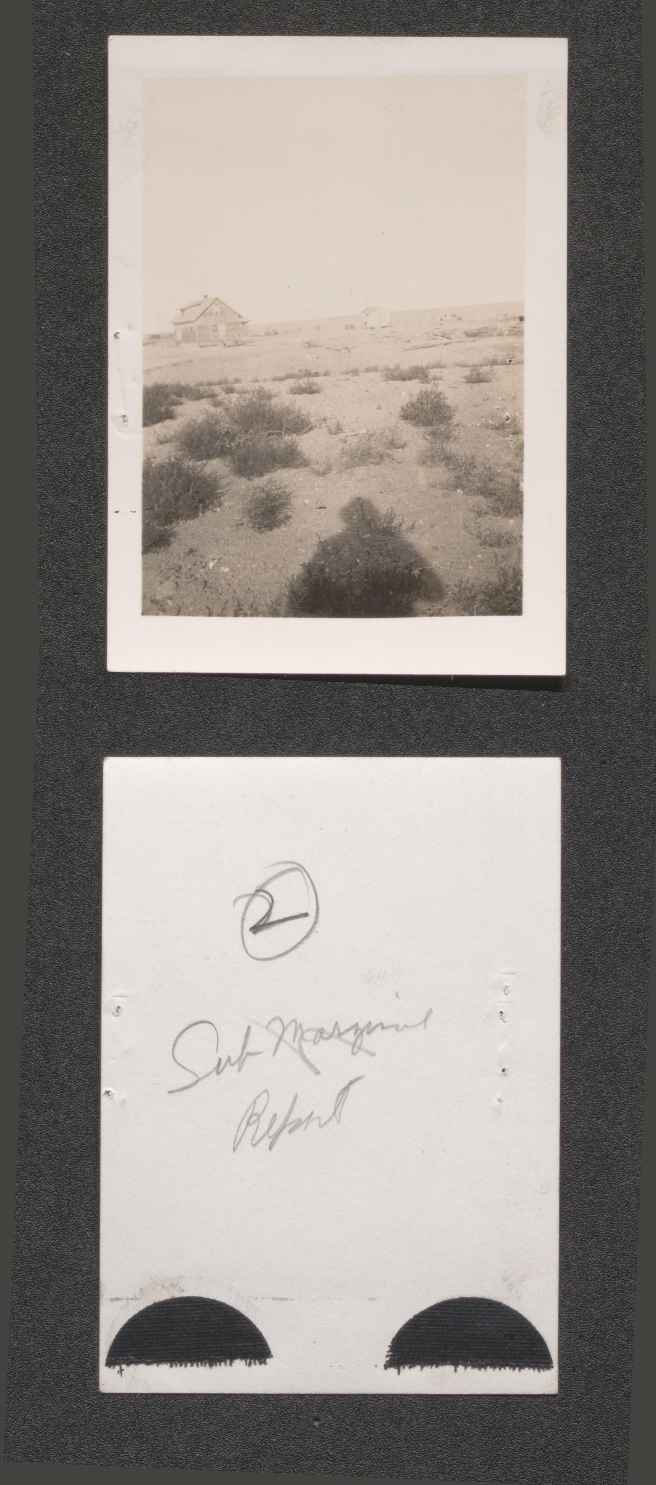
Scope and Contents
The Photographs series includes pictures taken by the Resettlement Administration and the Works Project Administration. The photographs contain images of model towns, aerial views of potential sites, and demonstration homes for the Greenbelt Towns project. Also in the series are photographs taken from impoverished rural and urban areas around the nation where emergency relief could be offered by the government. The photographs were originally found within the papers of the Greenbelt Towns project or in the books on other Resettlement Administration projects. The photographs have been arranged according to project.
The photographs series has been digitized. Duplicate photographs were digitized only when the content (front or back) varies from the original).
Dixon Springs, undated
Exhibit 19 no. 21 a type of erosion difficult to correct, undated
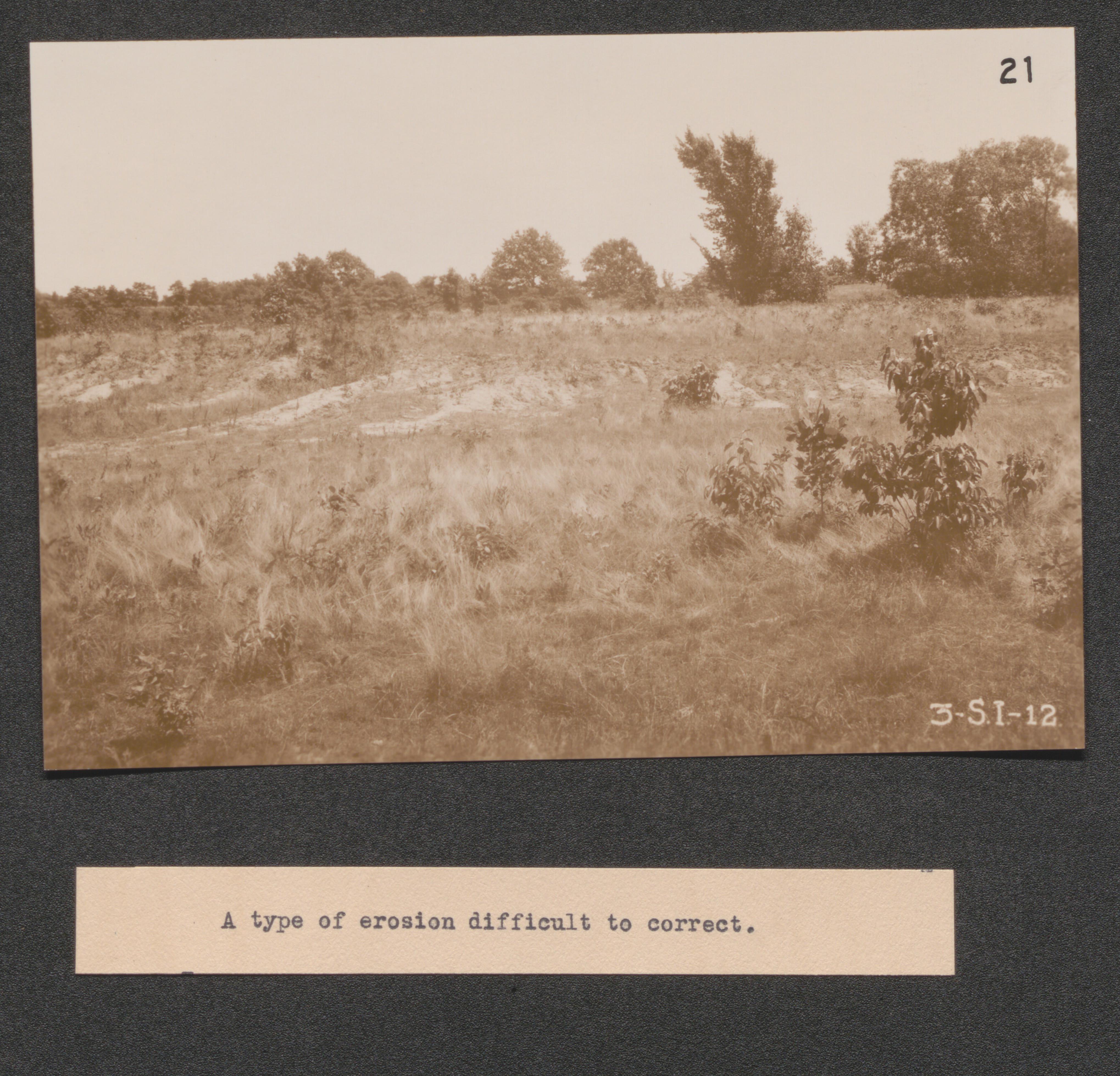
Exhibit 19 no. 19 illustrating manner in which erosion creeps up slope destroying the land, undated
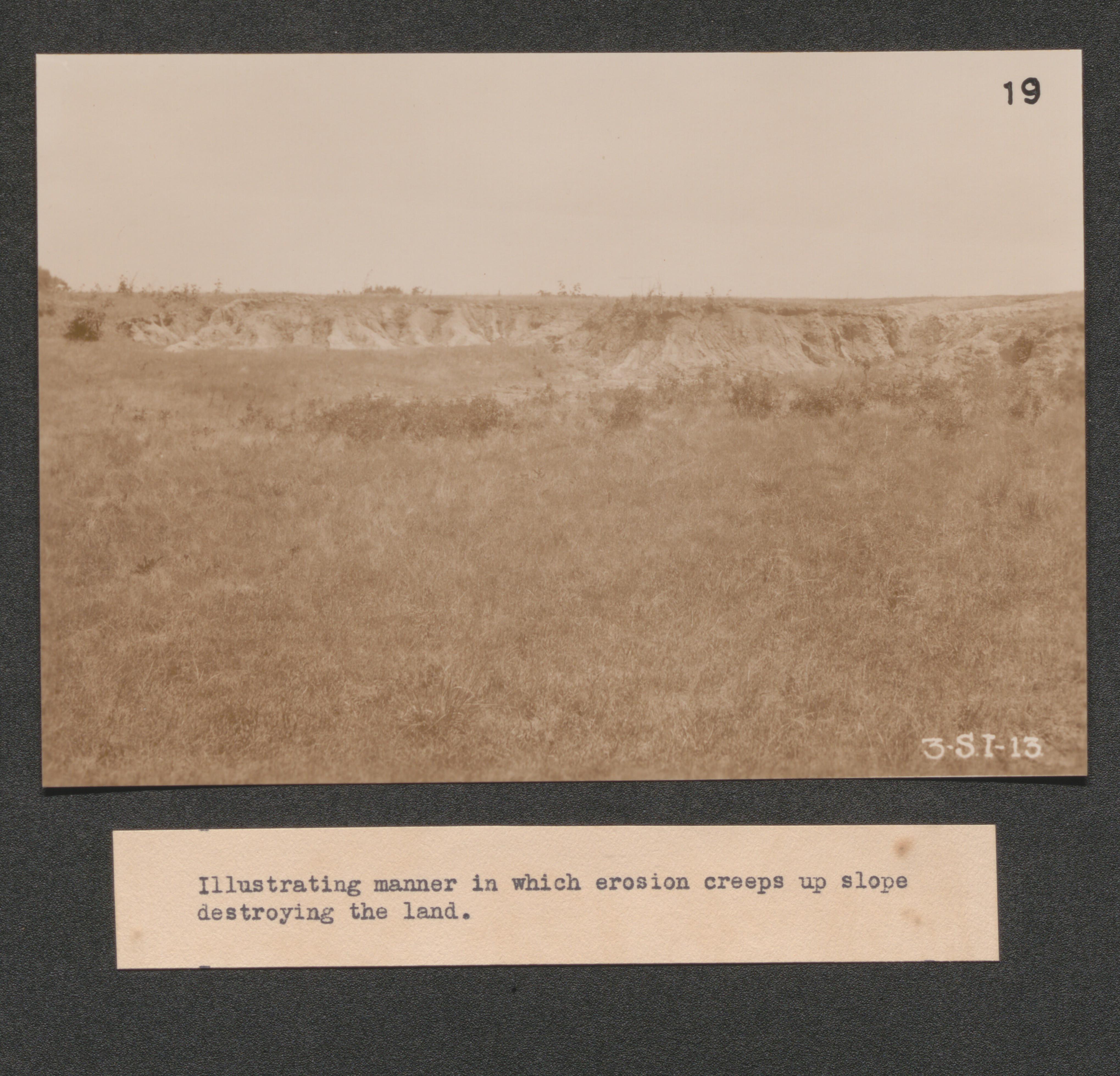
Exhibit 19 no. 6 a close up of no. 20, undated
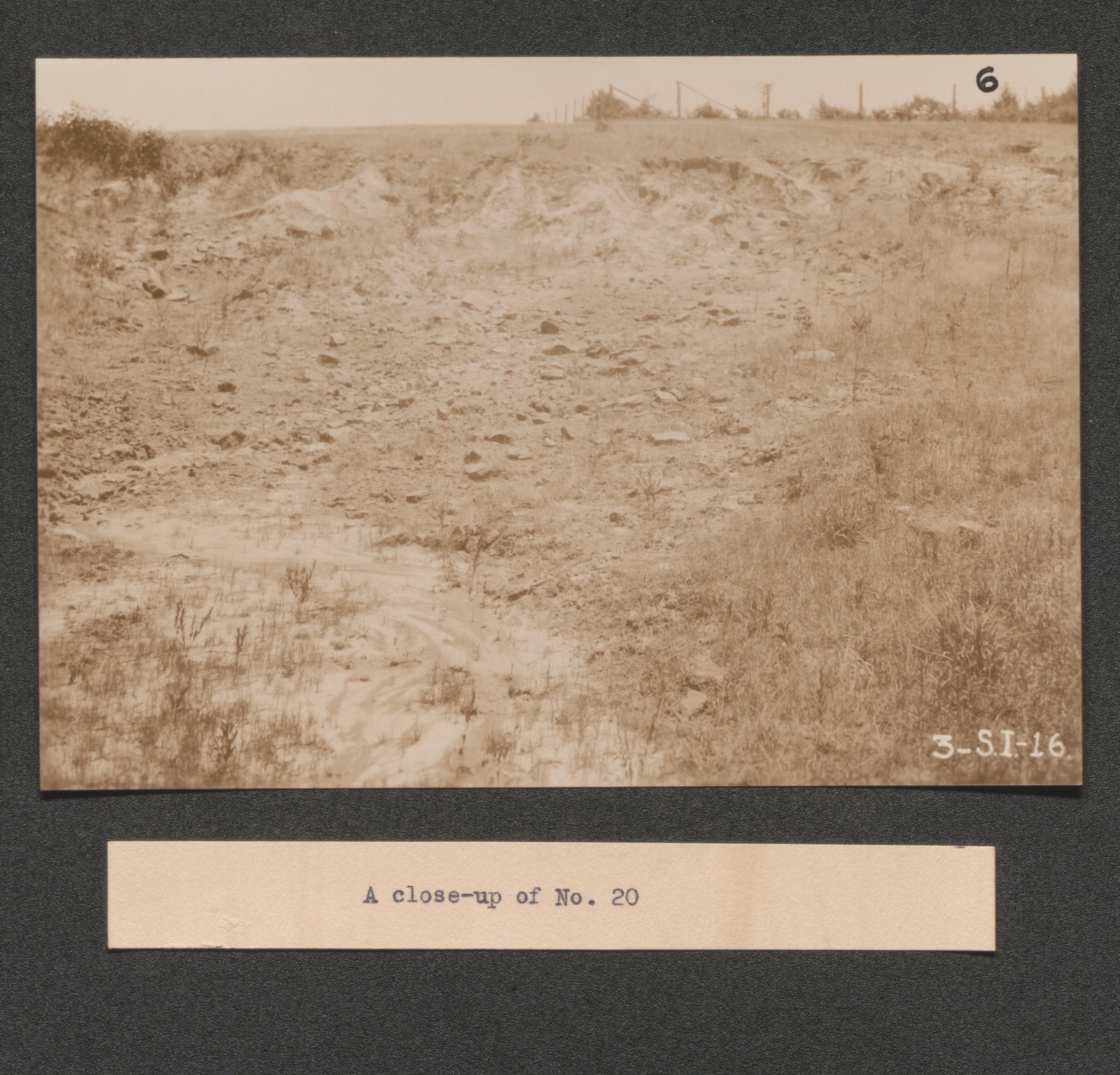
Exhibit 19 no. 24 what remains after ravage of erosion, undated
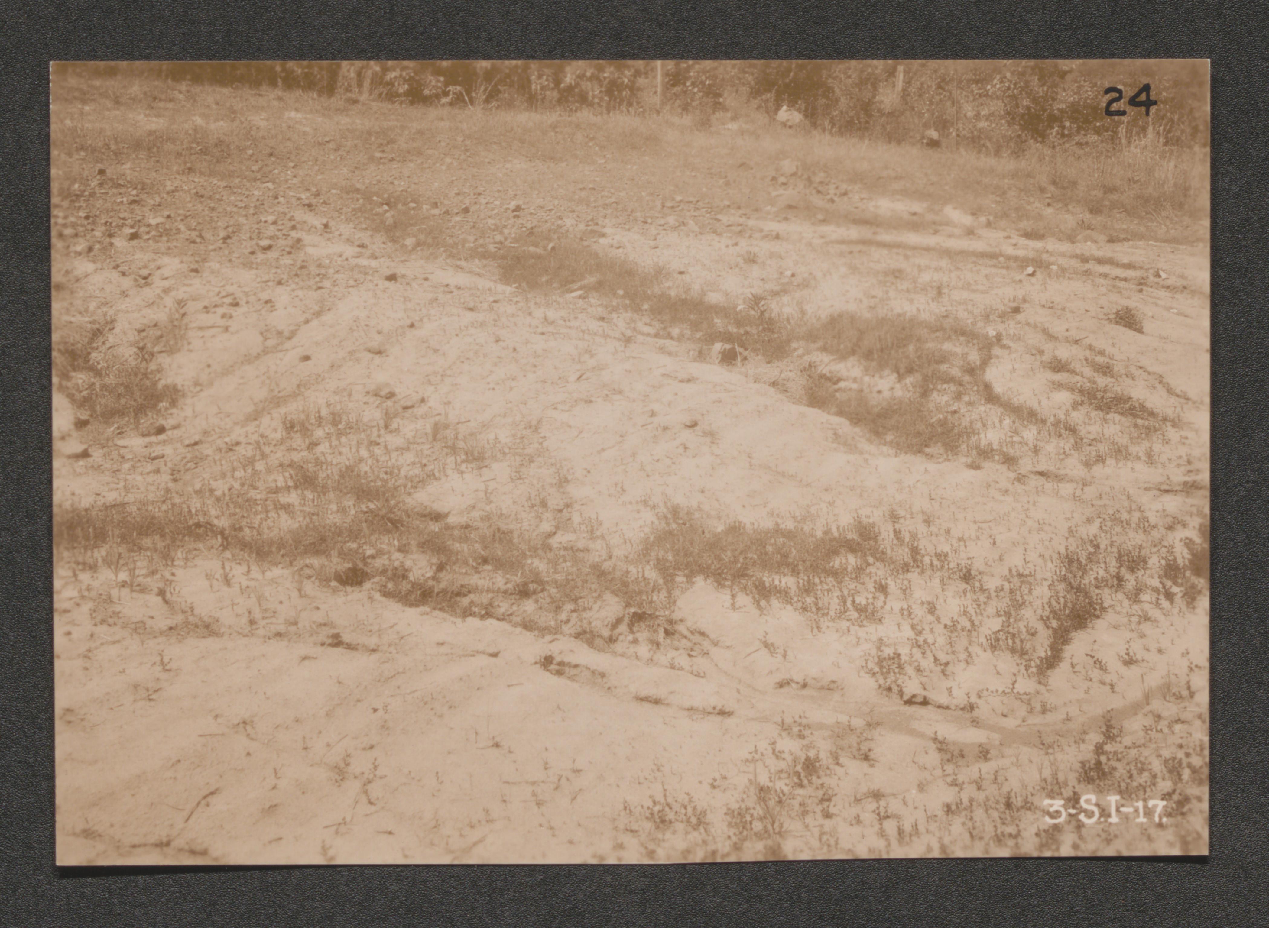
Exhibit 19 no. 10 erosion has totally destroyed this area can be reclaimed with timber only, undated

Exhibit 19 no. 10a same area as in no. 10 picture taken further down the slope, undated
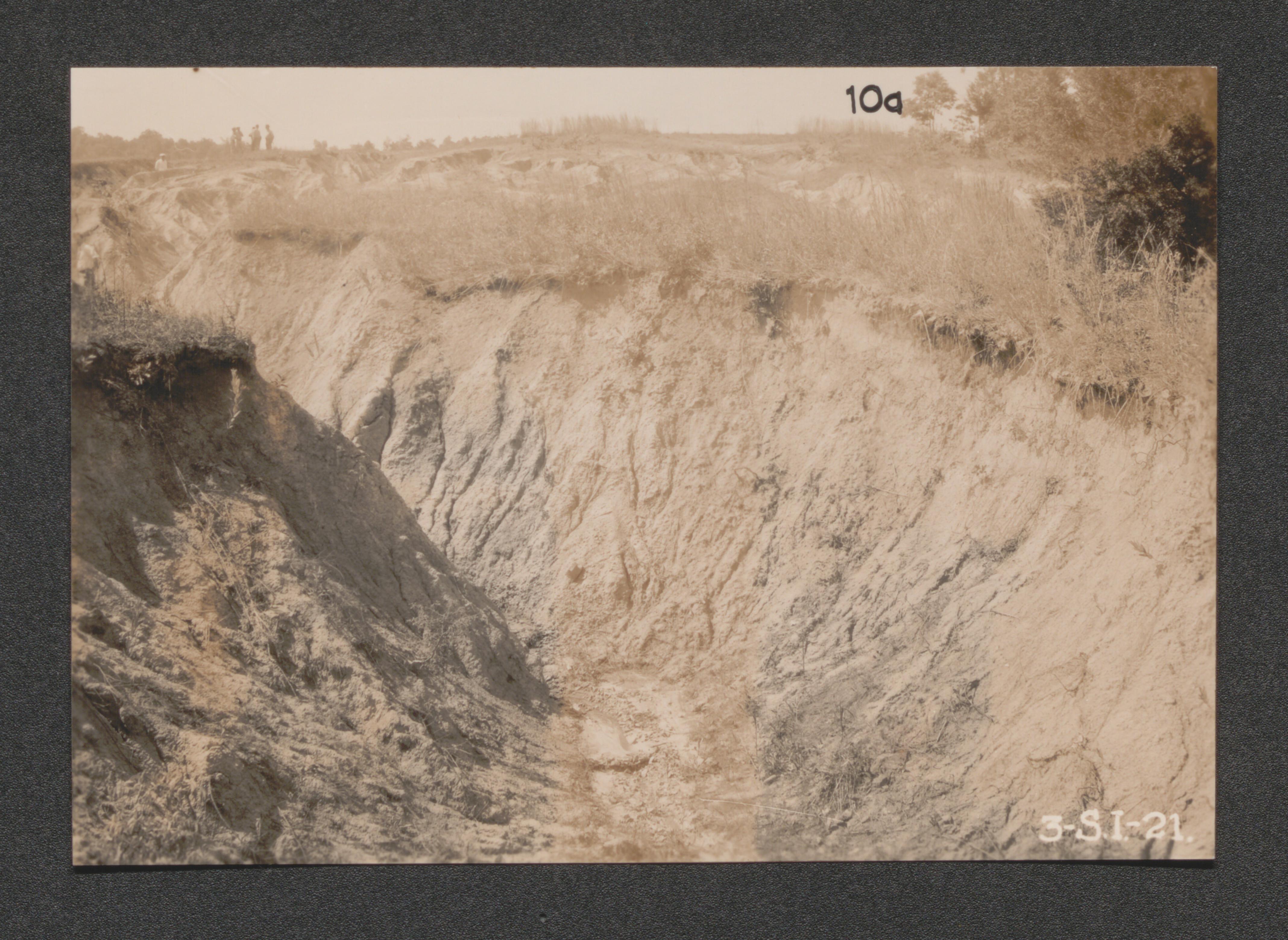
Exhibit 19 no. 20 erosion in grassland, undated
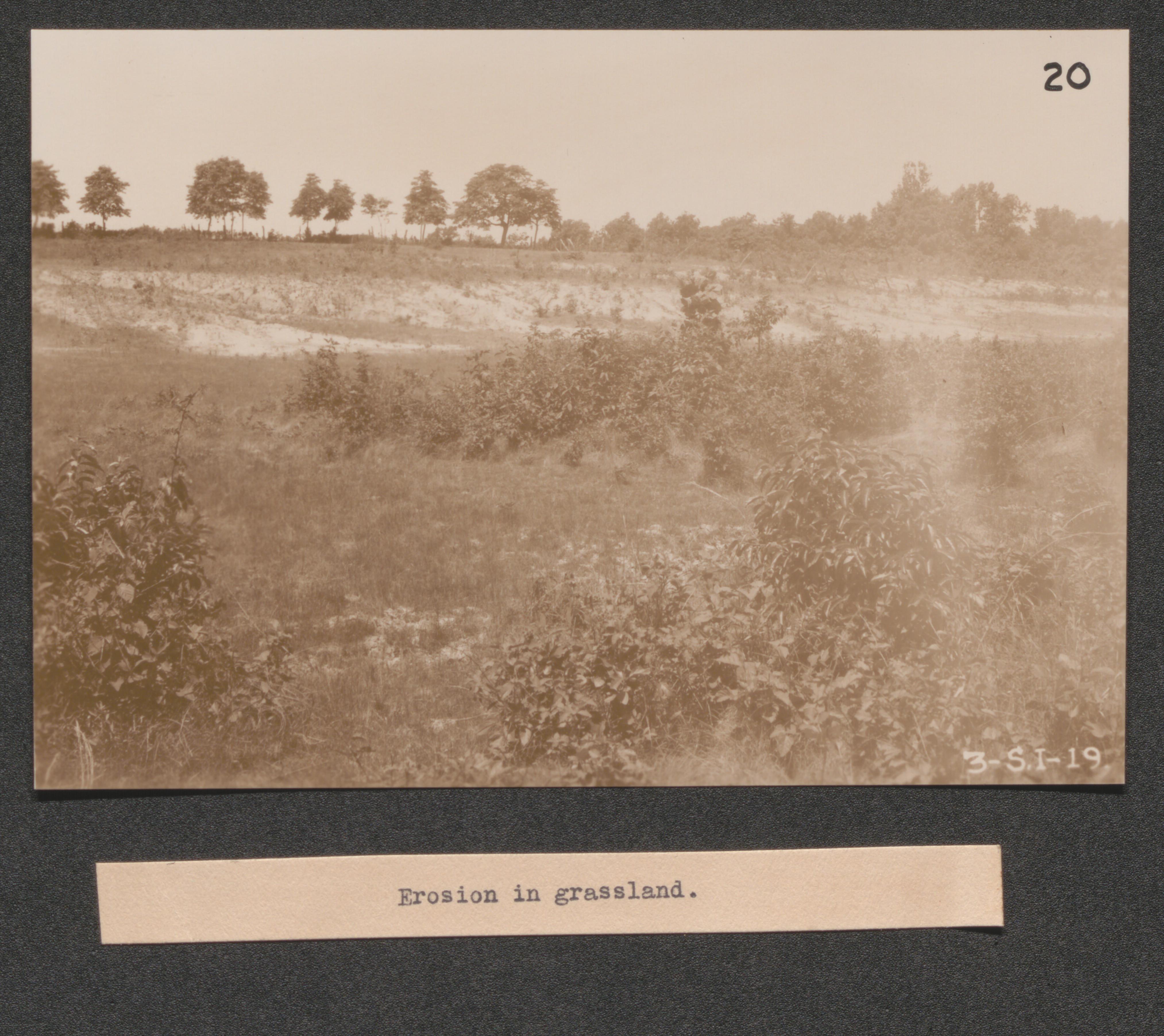
Exhibit 20 no. 22 log dams built to stop erosion in abandoned fields, undated
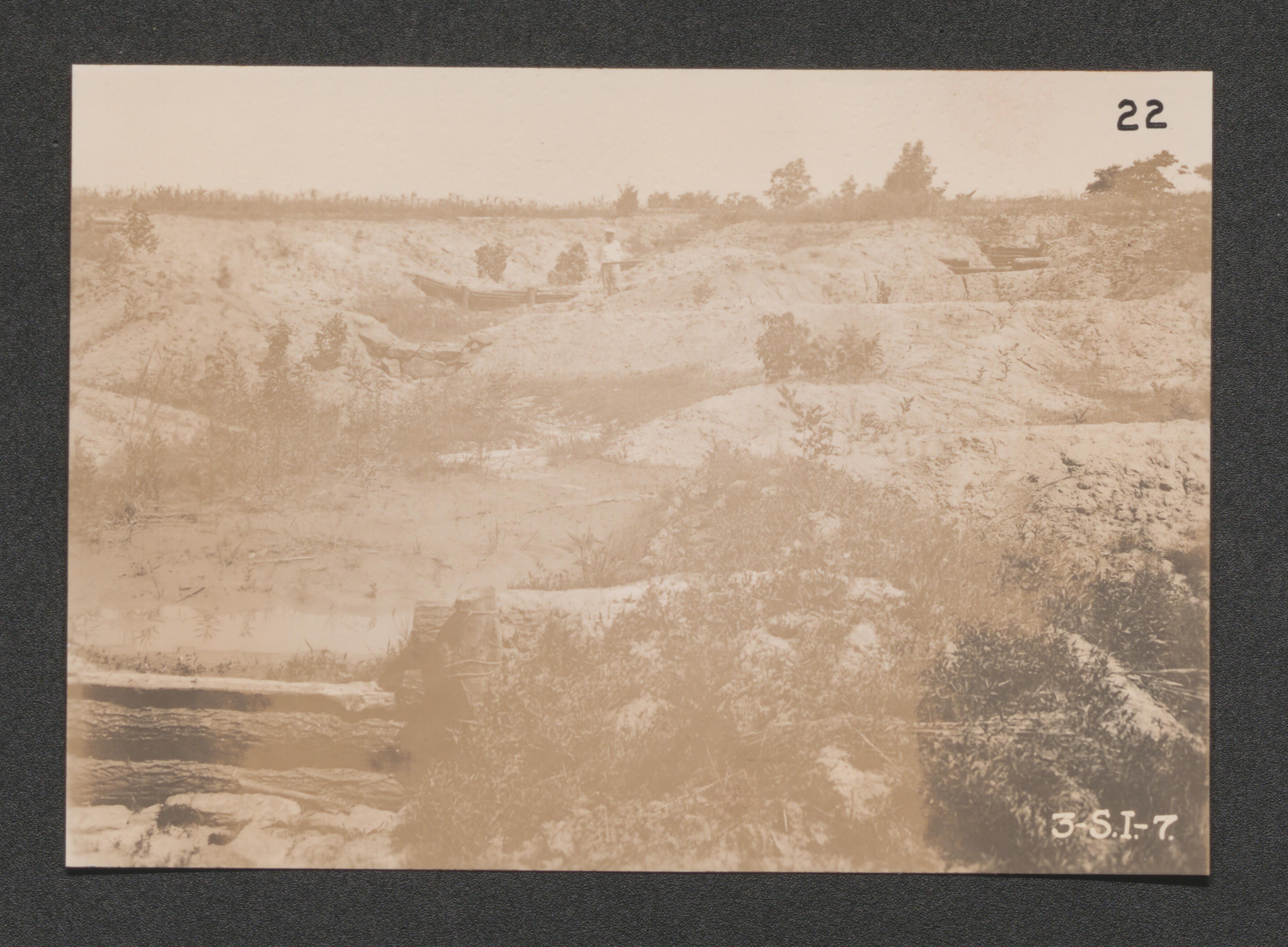
Exhibit 20 no. 9 a pitful condition of eroded farm land in the area, undated
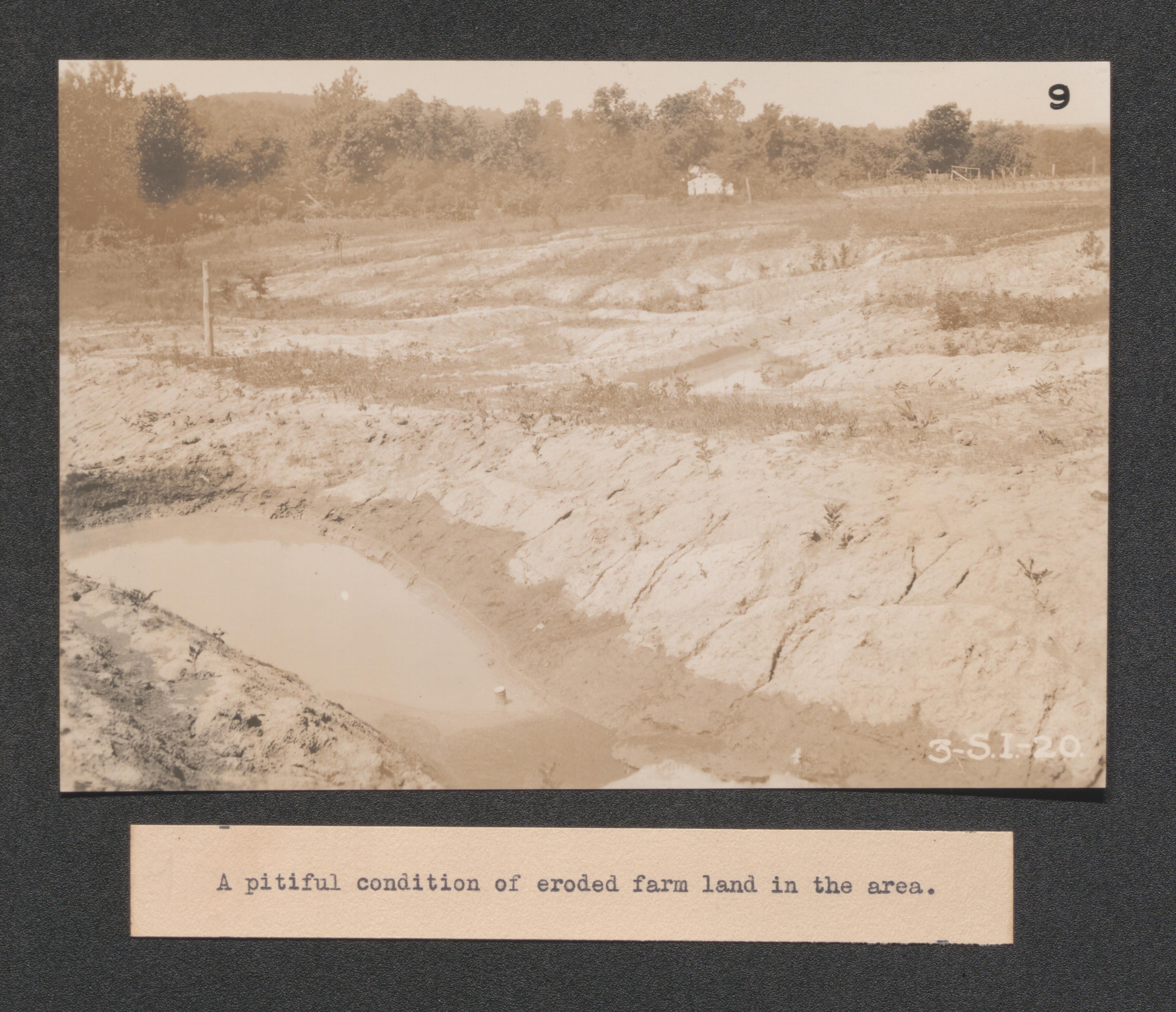
Exhibit 20 no. 8 series of dams to stop erosion in one small gully, undated
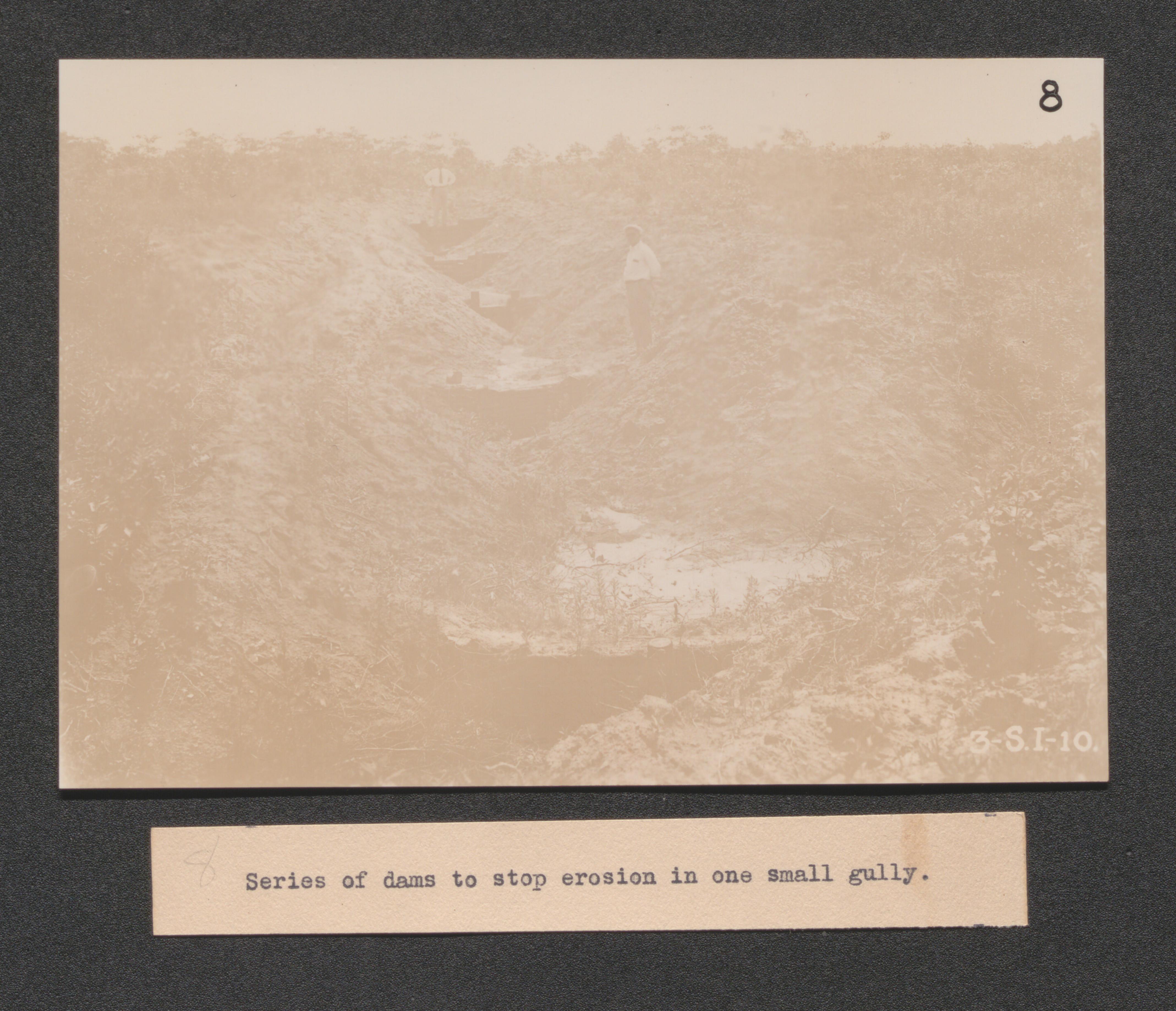
Exhibit 20 terraces ineffective on slopes, undated
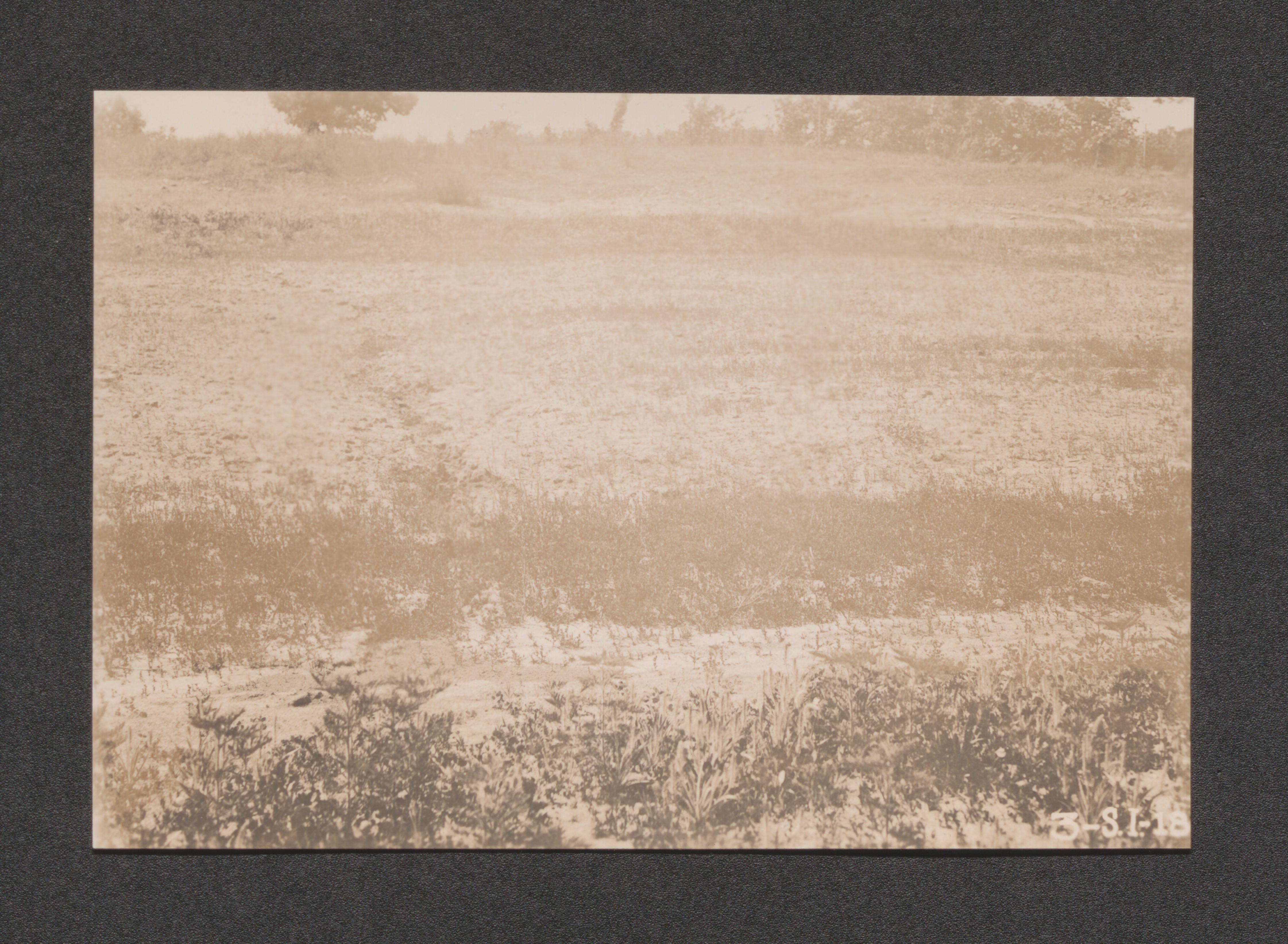
Exhibit 20 brush dams built in abandoned fields, undated
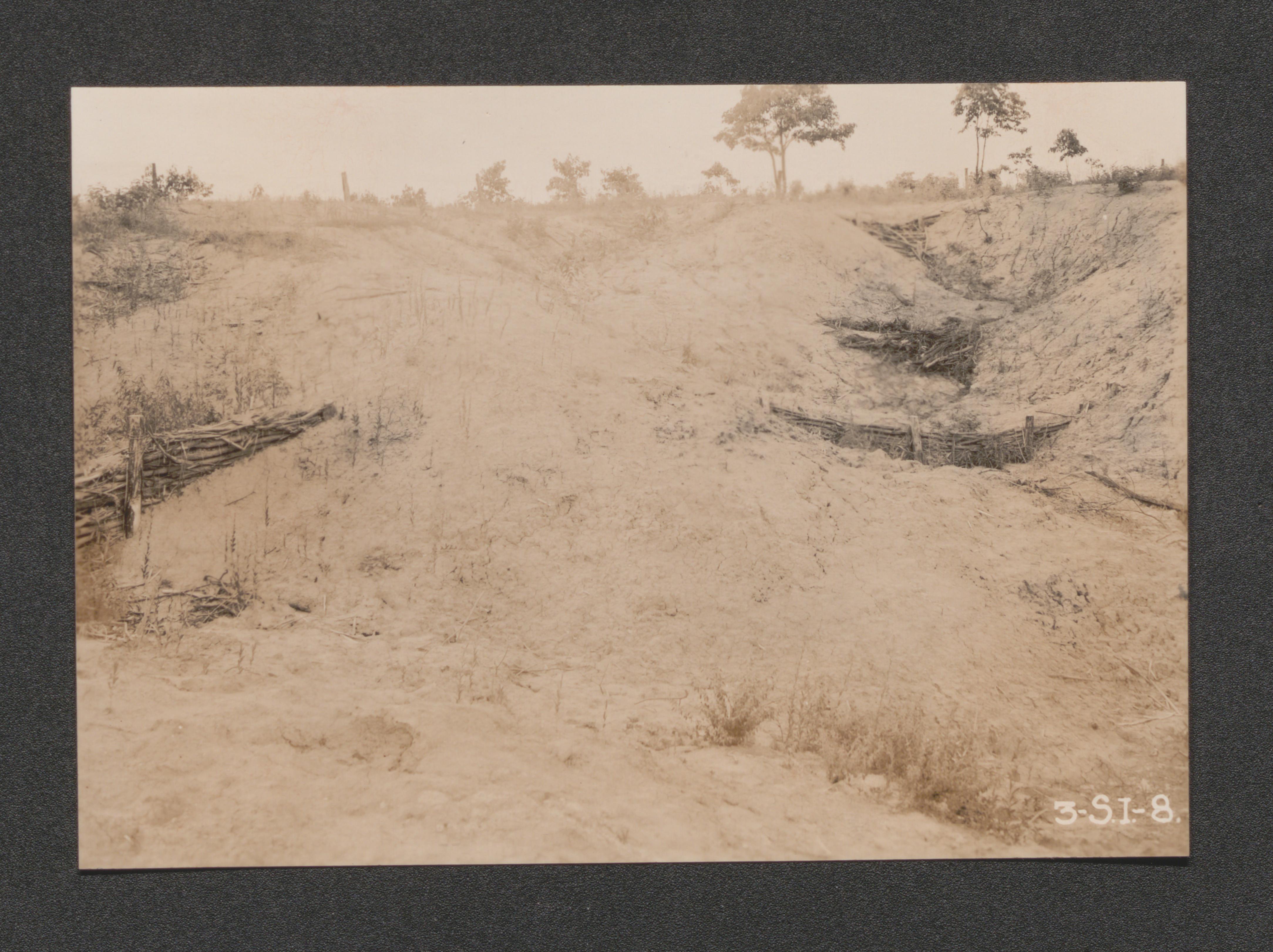
Exhibit 21 rear view of proposed headquarters for grazing and pasture land experiment, undated
Exhibit 21 no. 2 timber covered rock slope in background, what stubble on ava silt loam in foreground, Southeastern part of the area, undated
Exhibit 21 no. 17 corn on clement silt loam, view toward Northwestern corner of area, undated
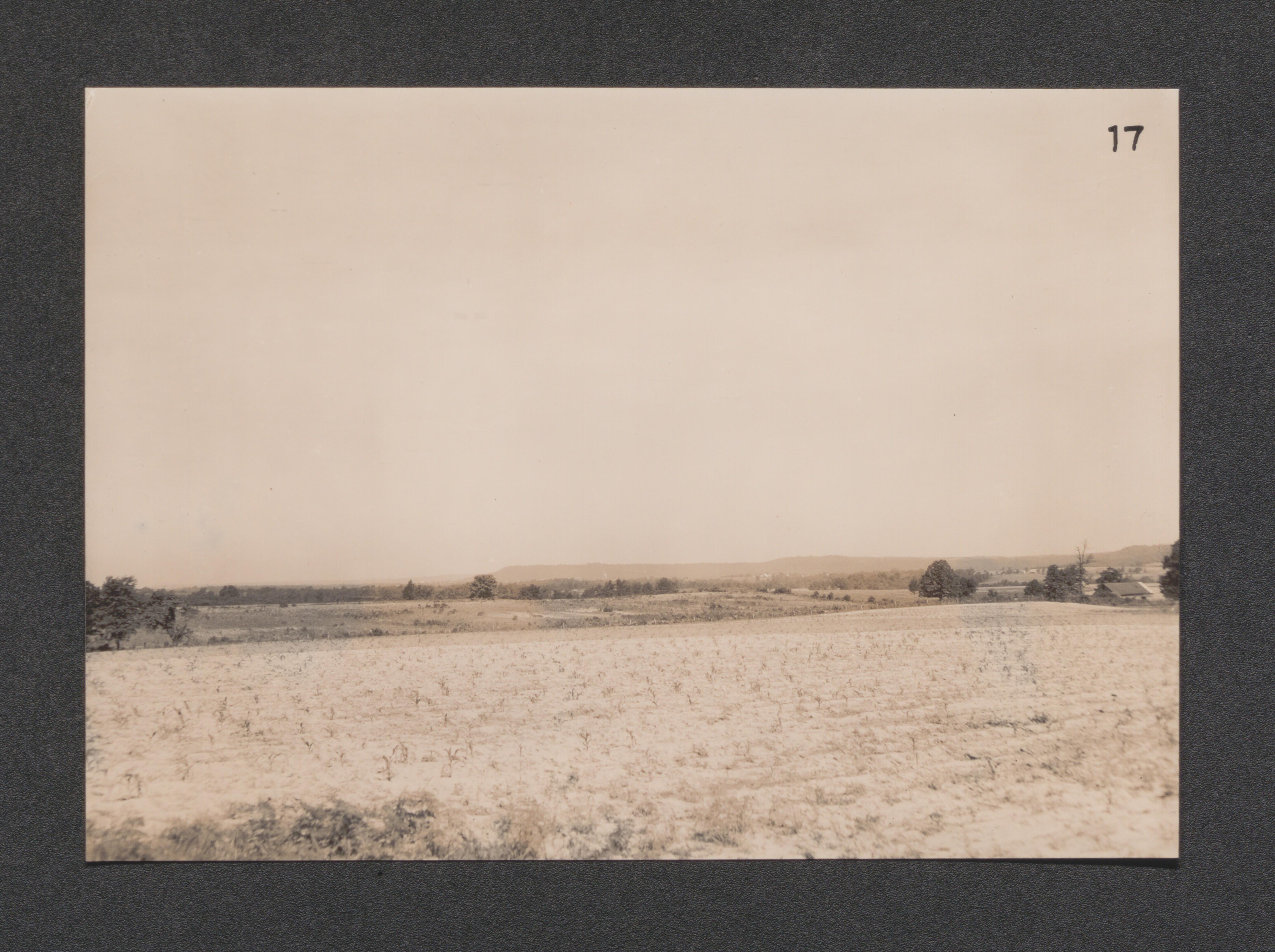
Exhibit 21 no. 16 corn on cahokia silt loam, land suitable for grazing in background, undated
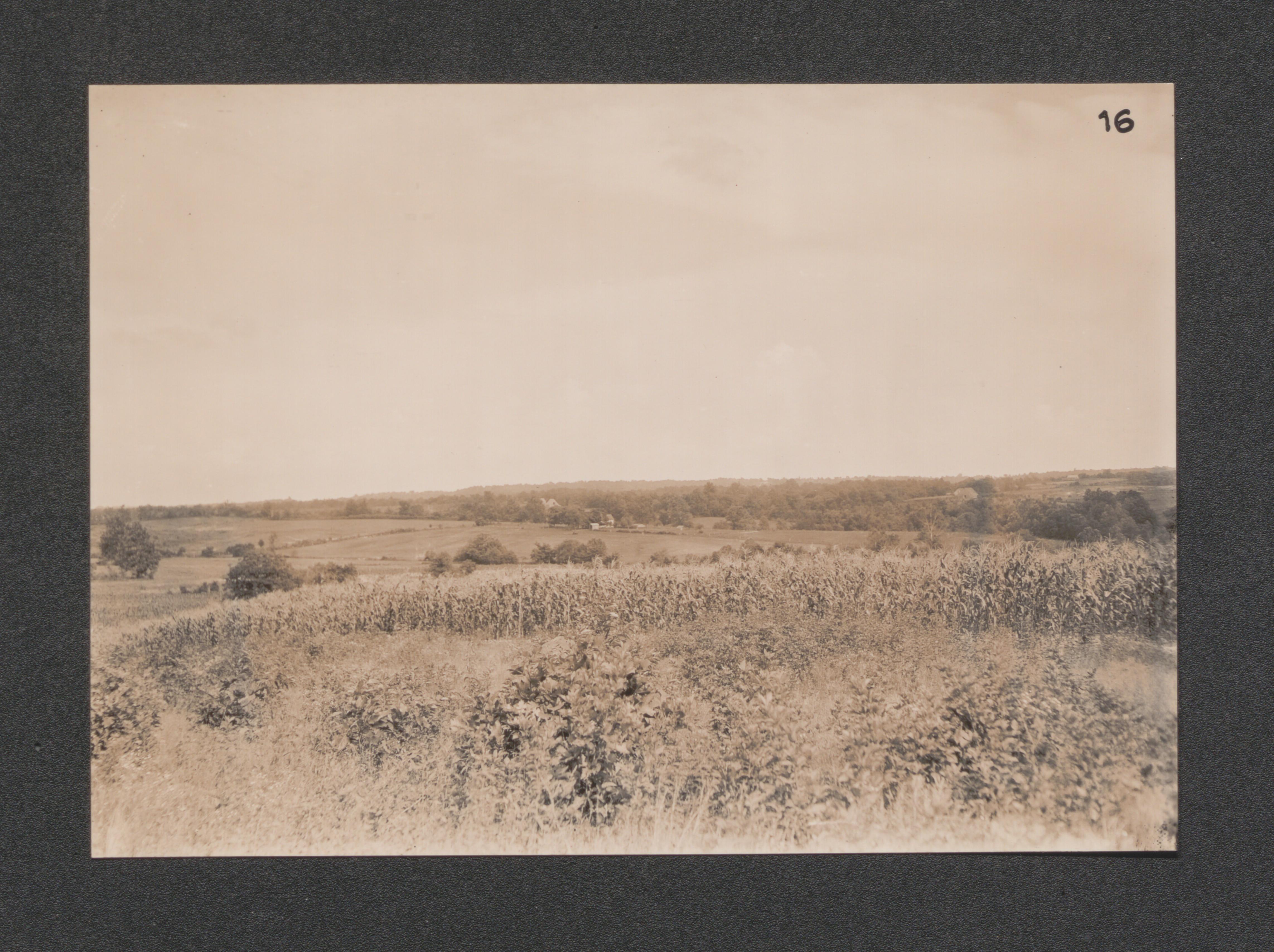
Exhibit 21 no. 15 cowpeas growing on area silt loam, view looking West in Western part of area, undated
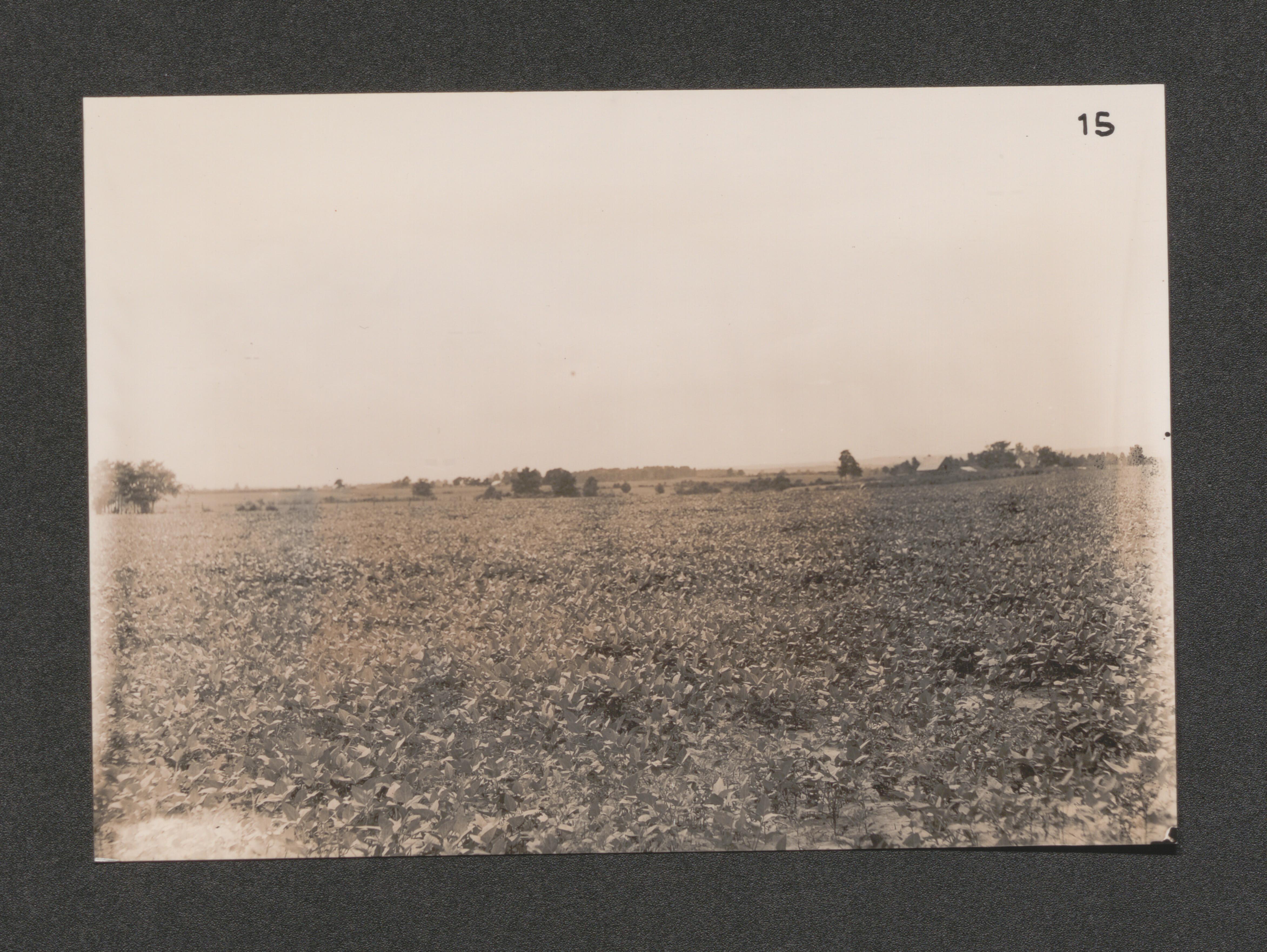
Exhibit 21 no. 7 corn on barren silt loam bottomland, undated
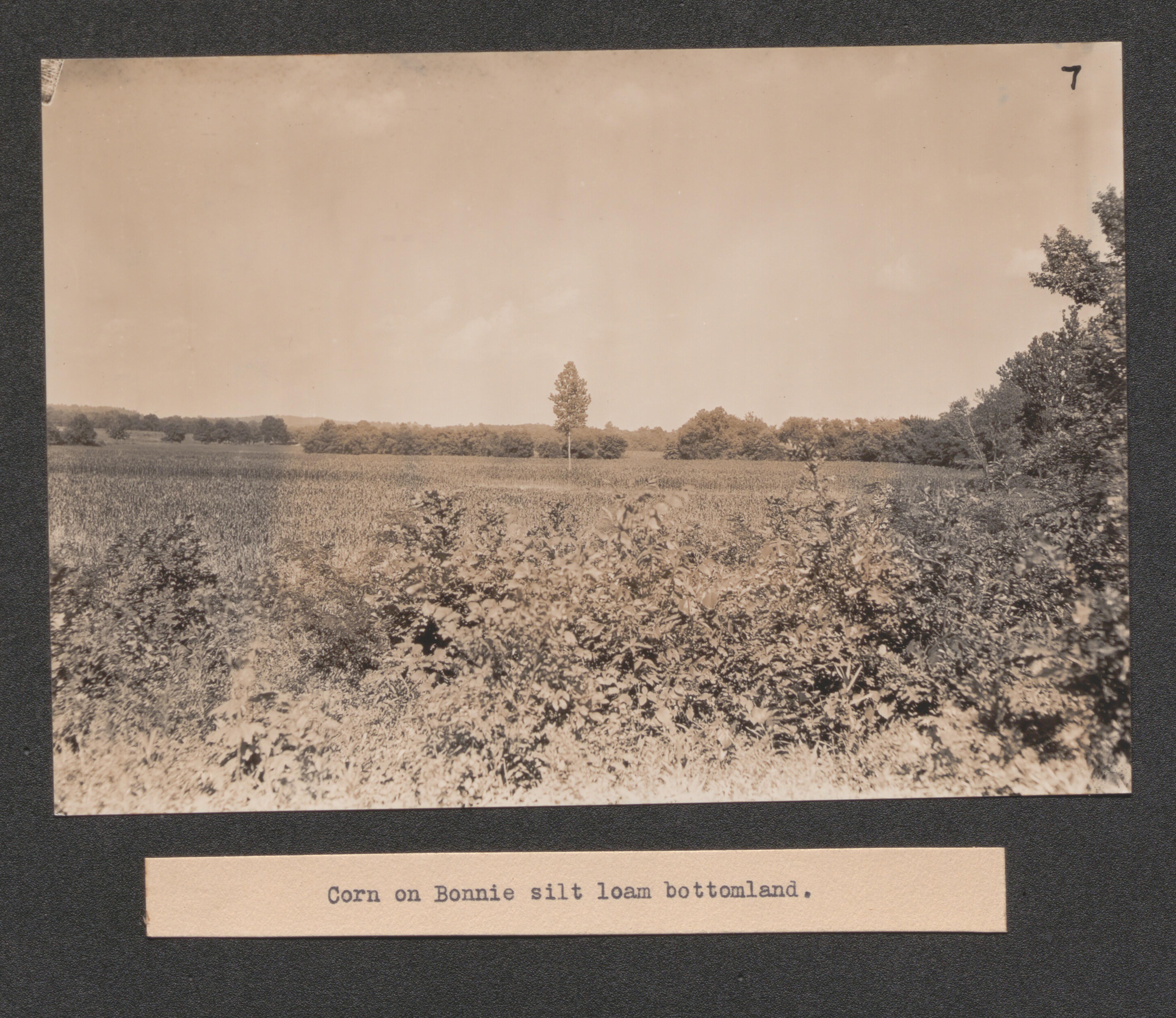
Exhibit 21 no. 14 view North from same location as no. 15, undated
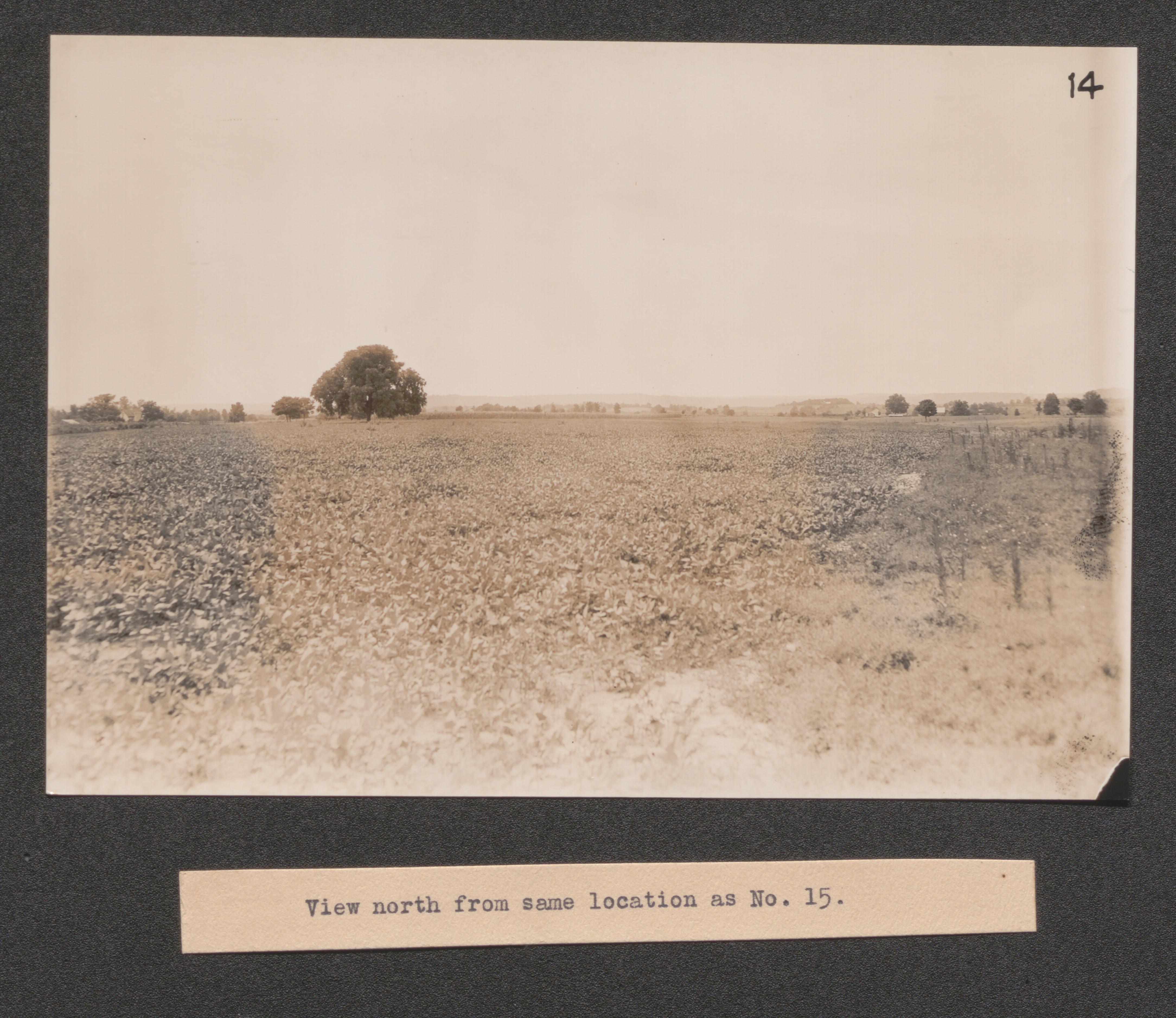
Exhibit 21 abandoned slope showing sassafras reclaiming the area, undated
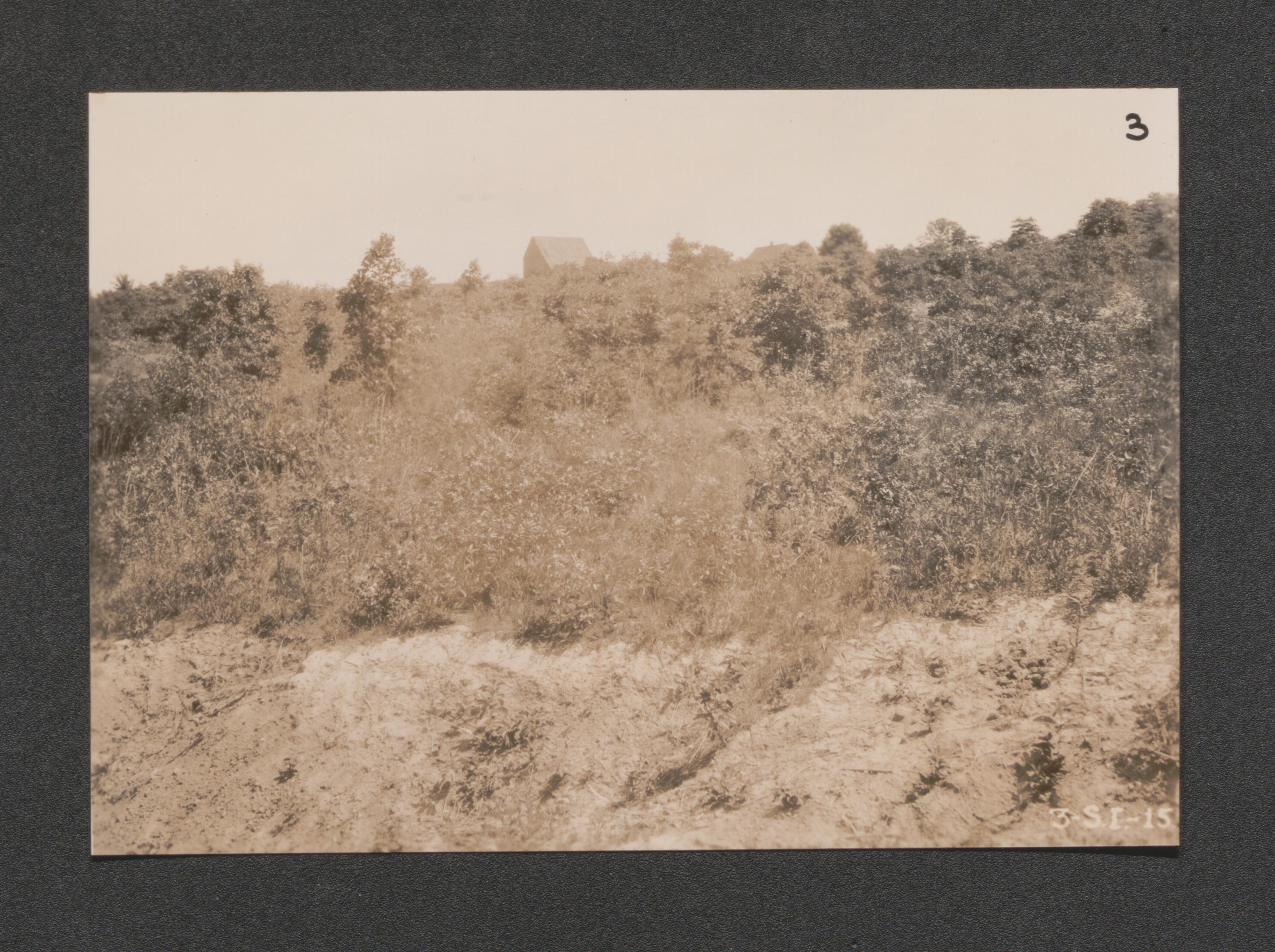
Exhibit 21 null erosion in grasslands, undated
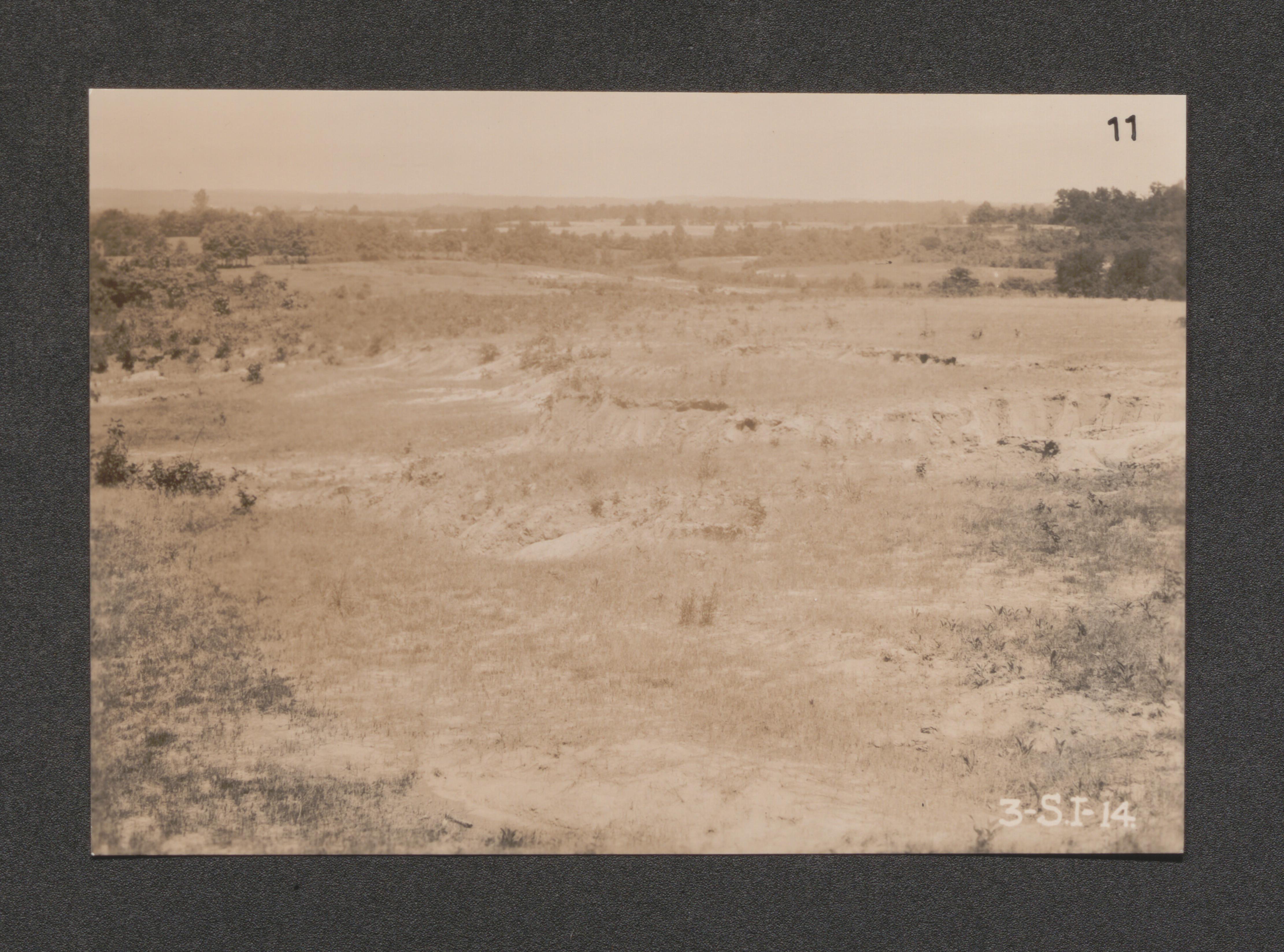
Exhibit 24 no. 1 view of Glendale looking West, undated
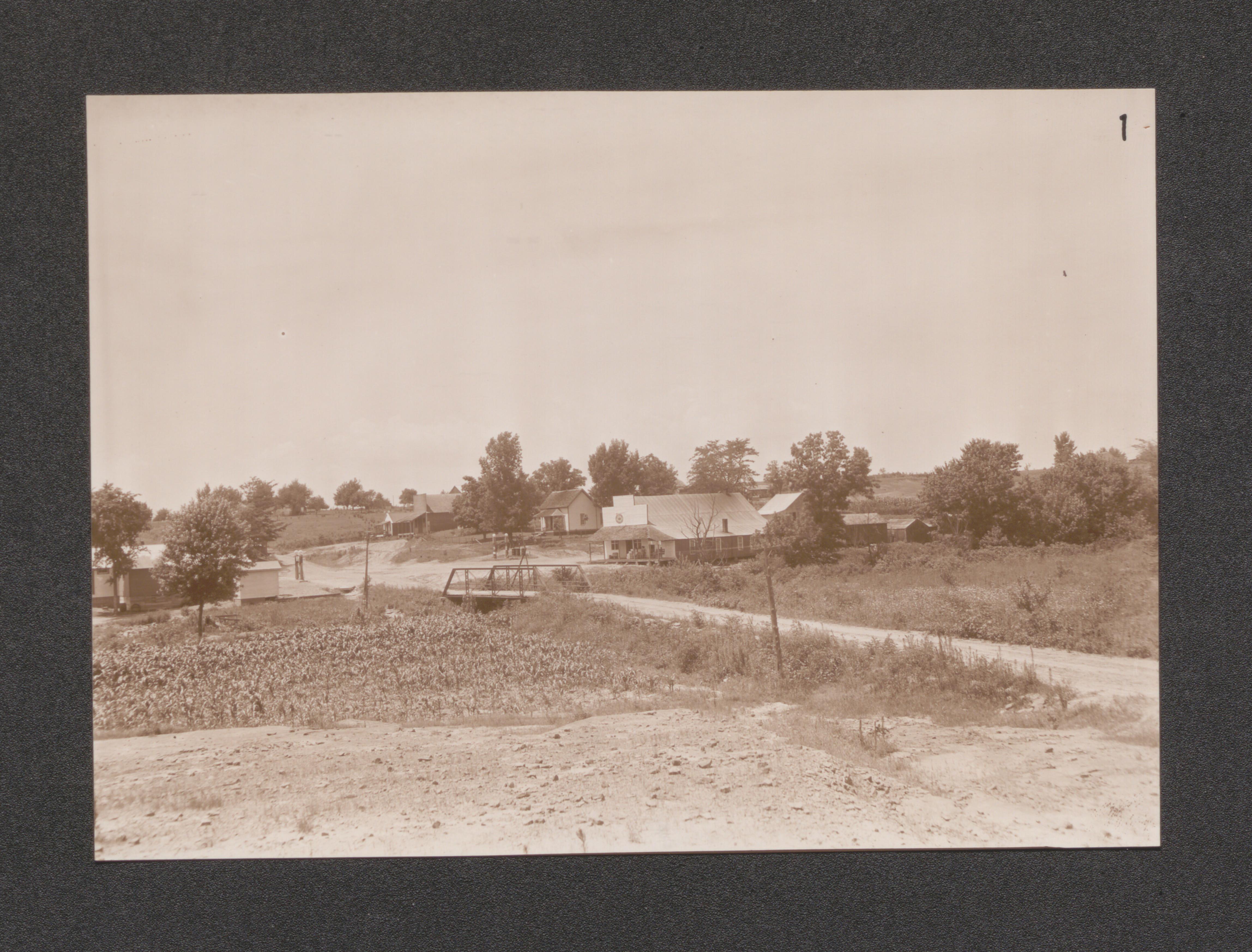
Exhibit 24 no. 25 Southside of street - Robbs, undated
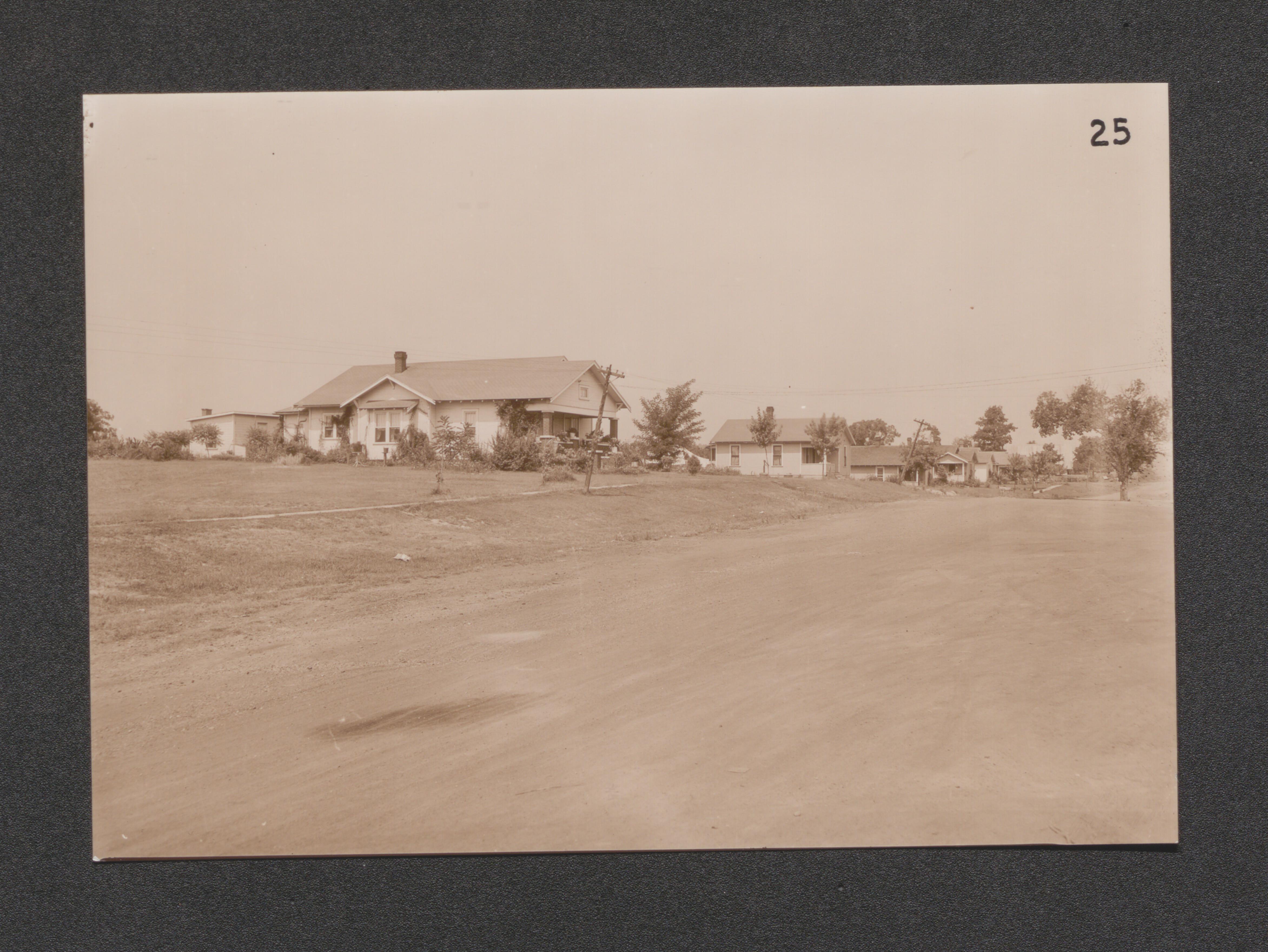
Exhibit 24 no. 26 business section - Robbs, undated
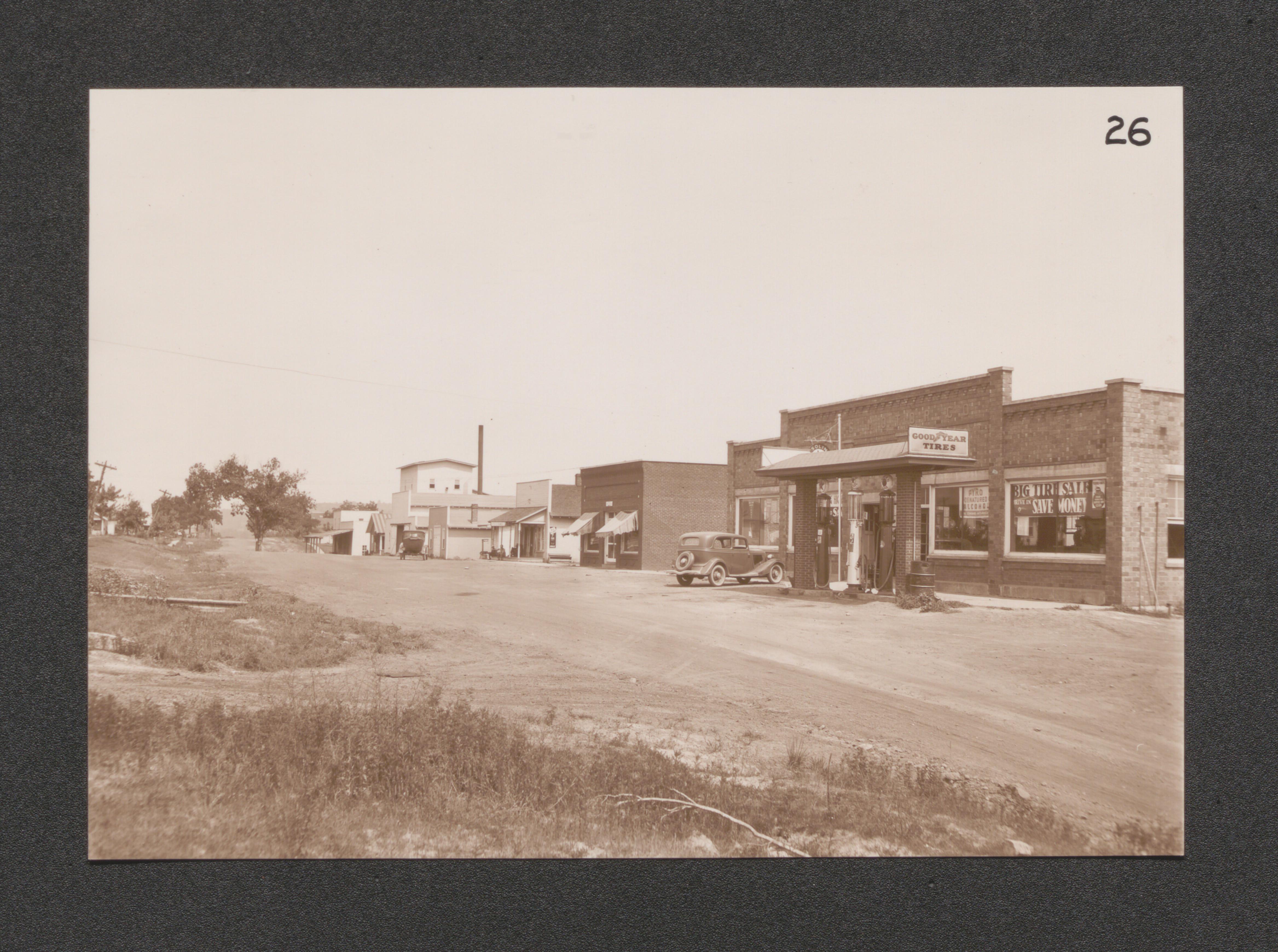
Exhibit 24 no. 5 typical highway unimproved in area, undated
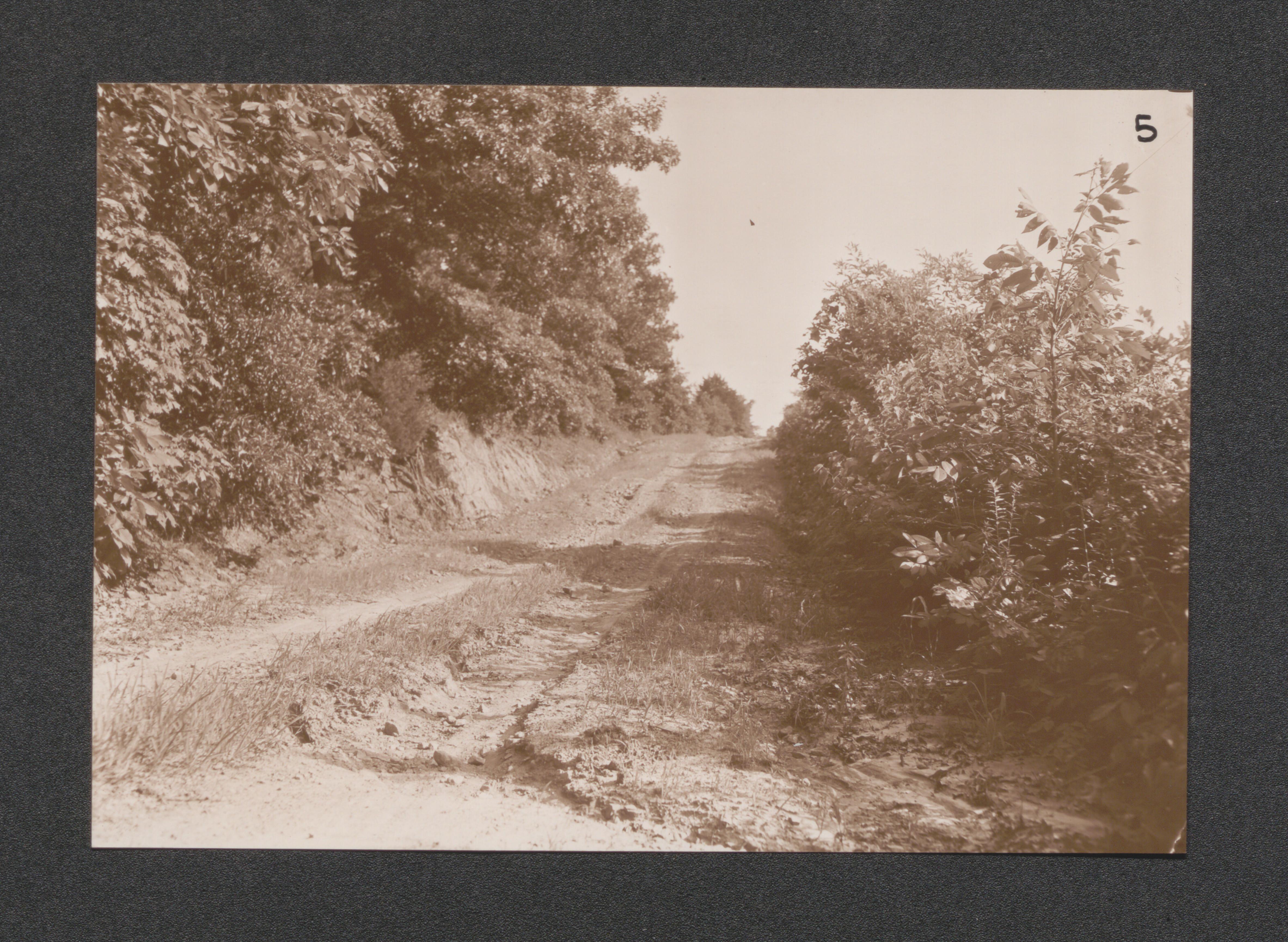
Exhibit 24 no. 28 section of typical improved highway, undated
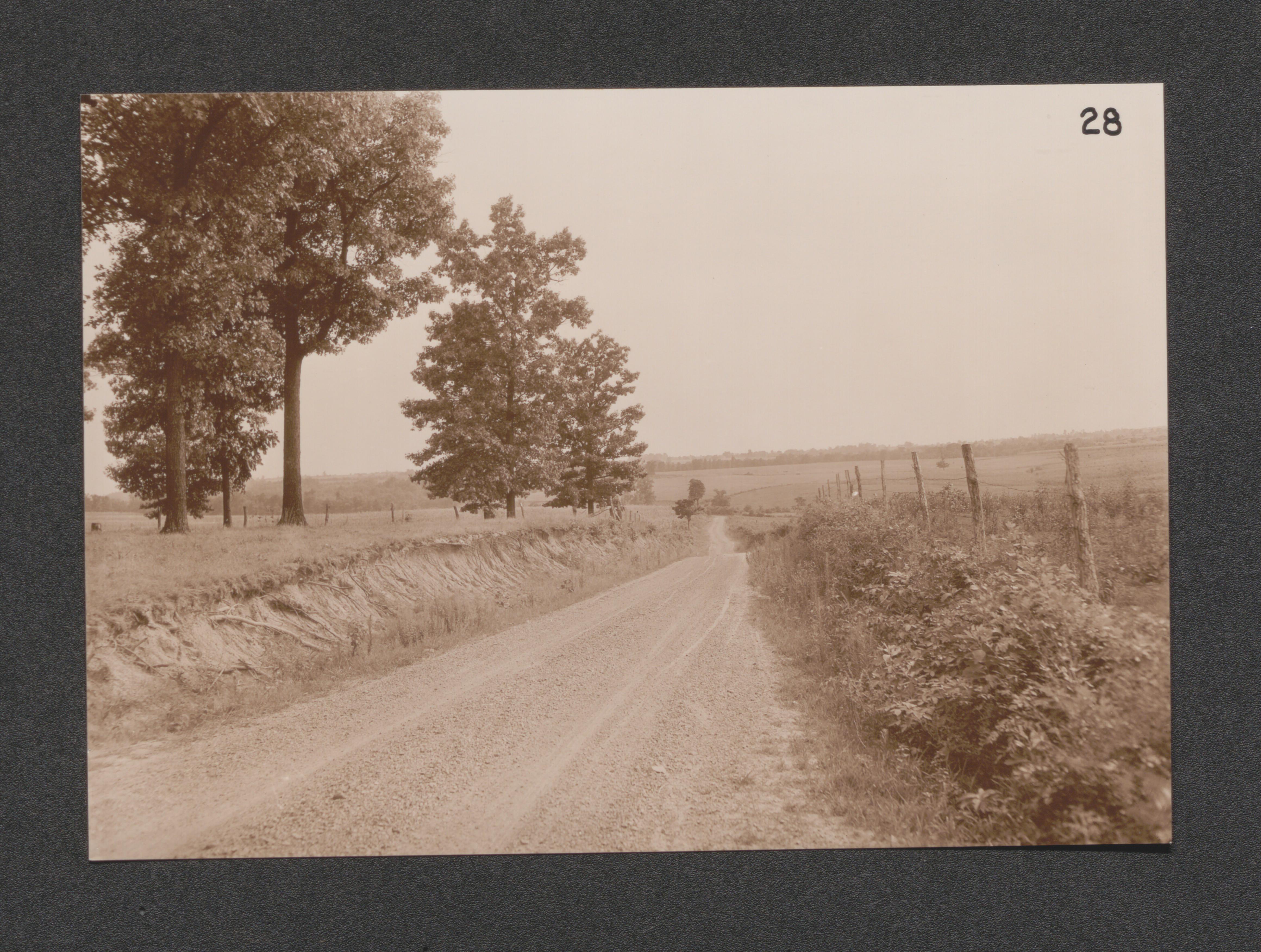
Exhibit 26 no. 38 Glendale School - to be continued, undated
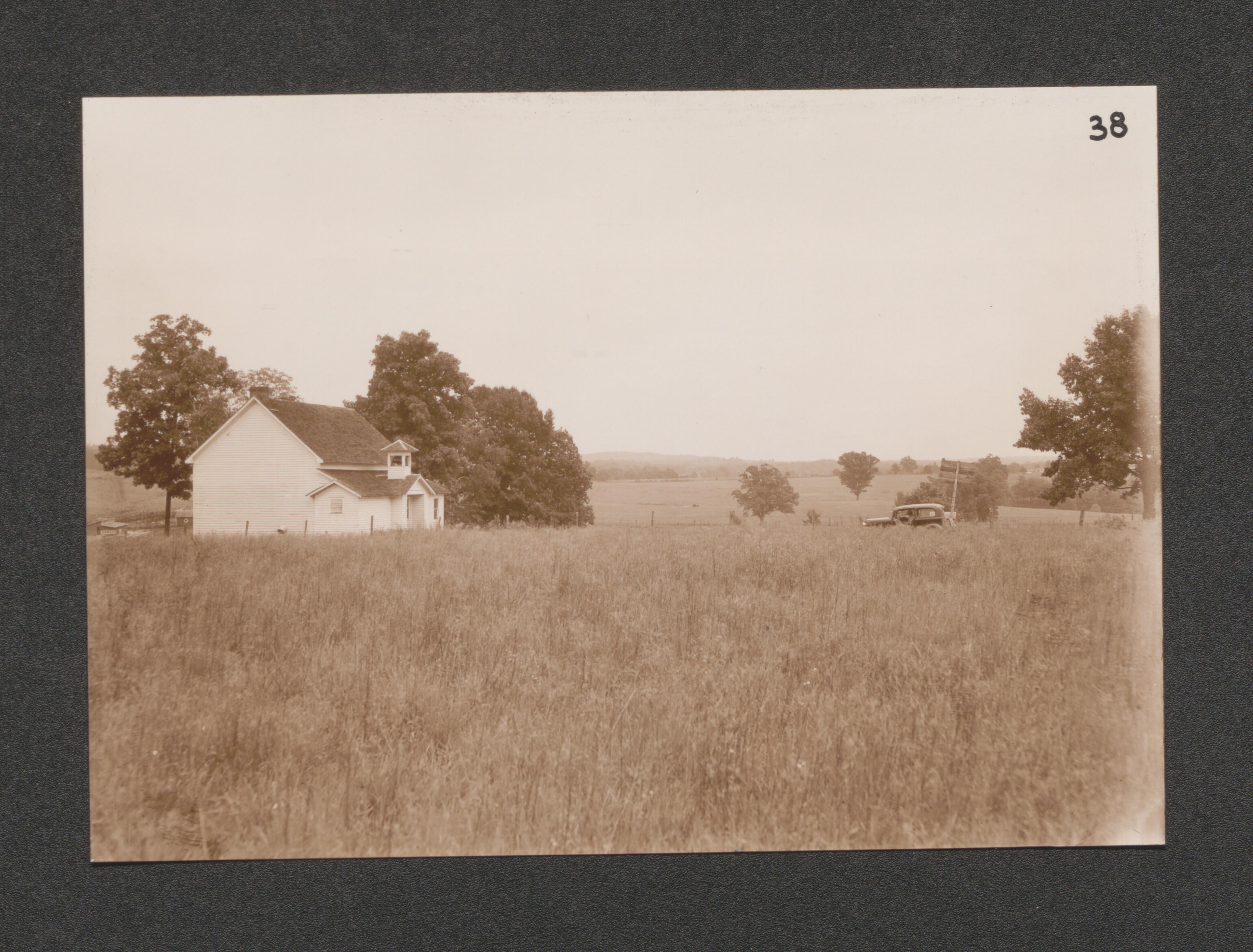
Exhibit 26 no. 30 Walnut Grove School - to be continued, undated
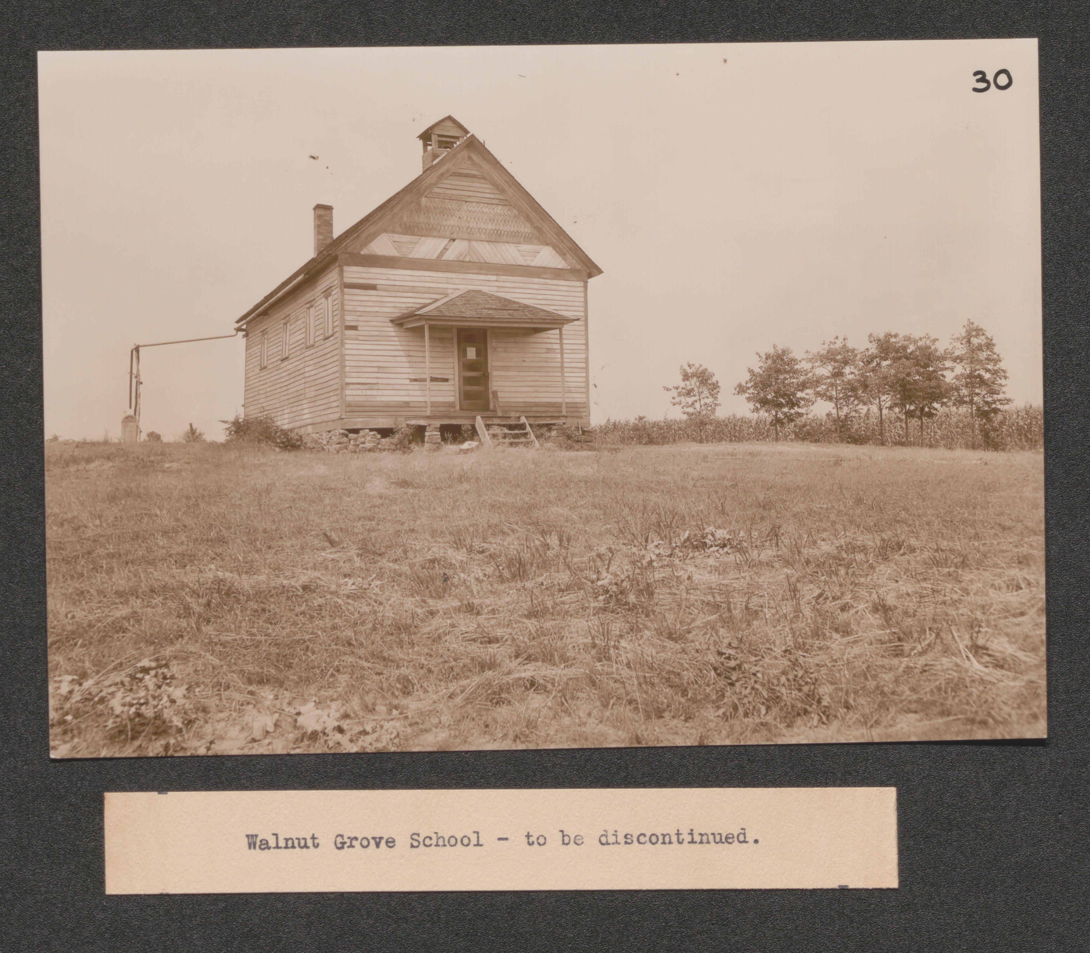
Exhibit 26 No. 18 Robbs Grade and High School building, undated
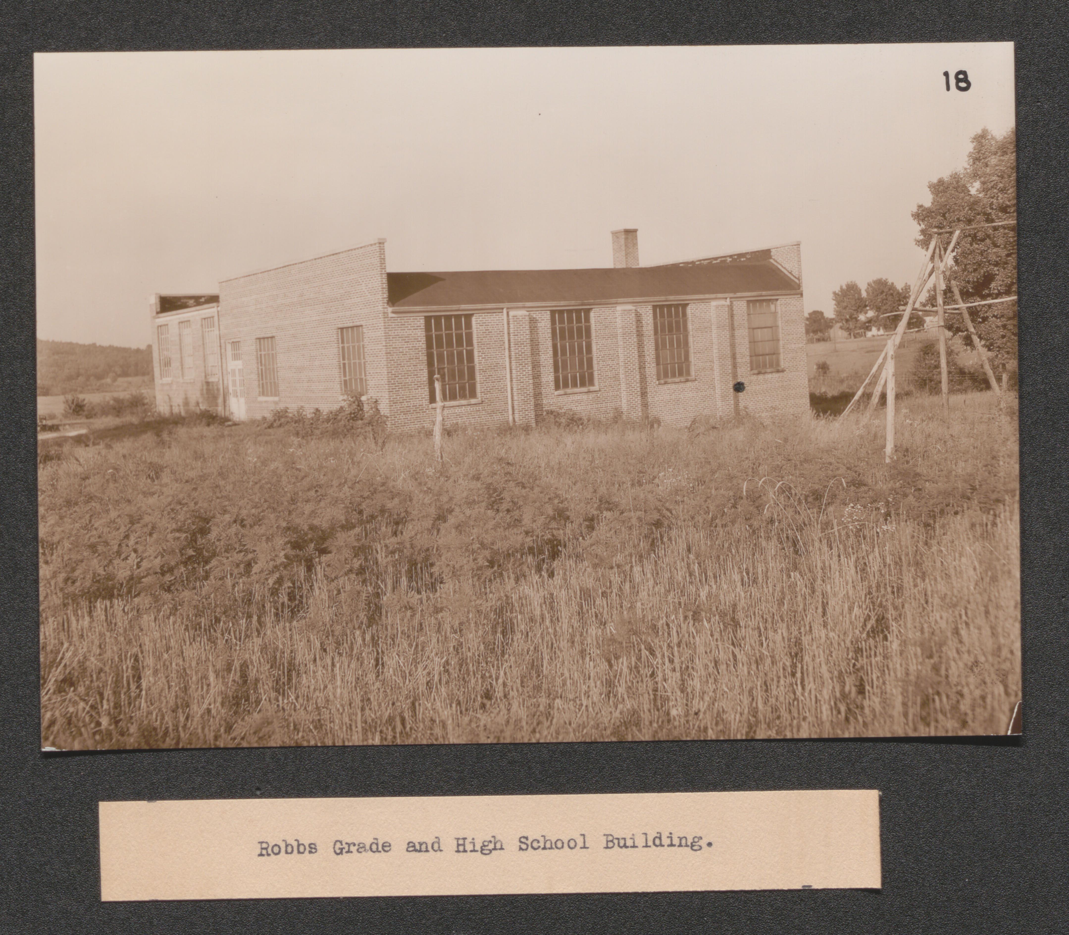
Exhibit 26 no. 34 resettlement area looking Northwest barn to extreme left marks proposed site of community building, undated
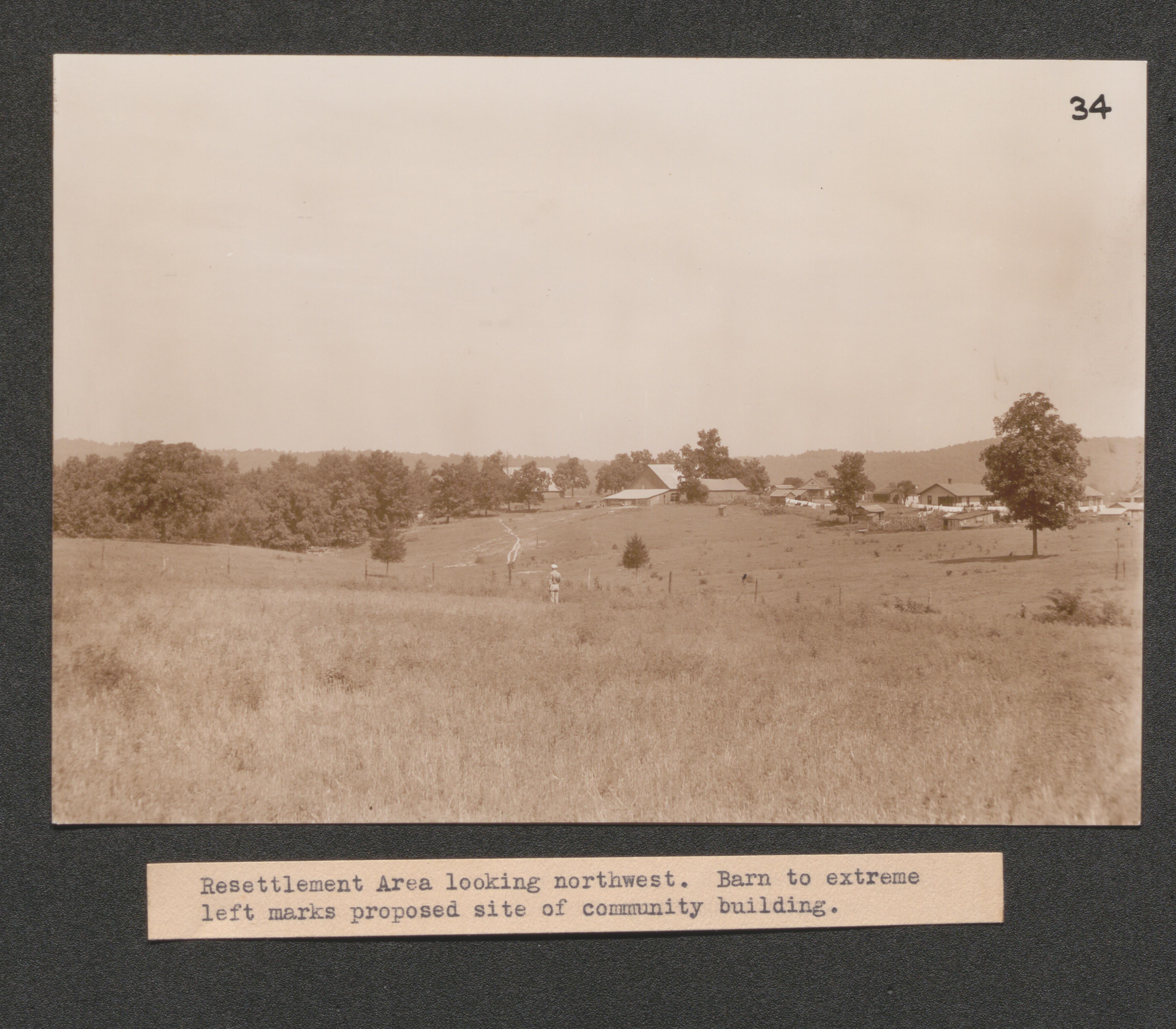
Exhibit 26 no. 36 view of resettlement area looking West, undated
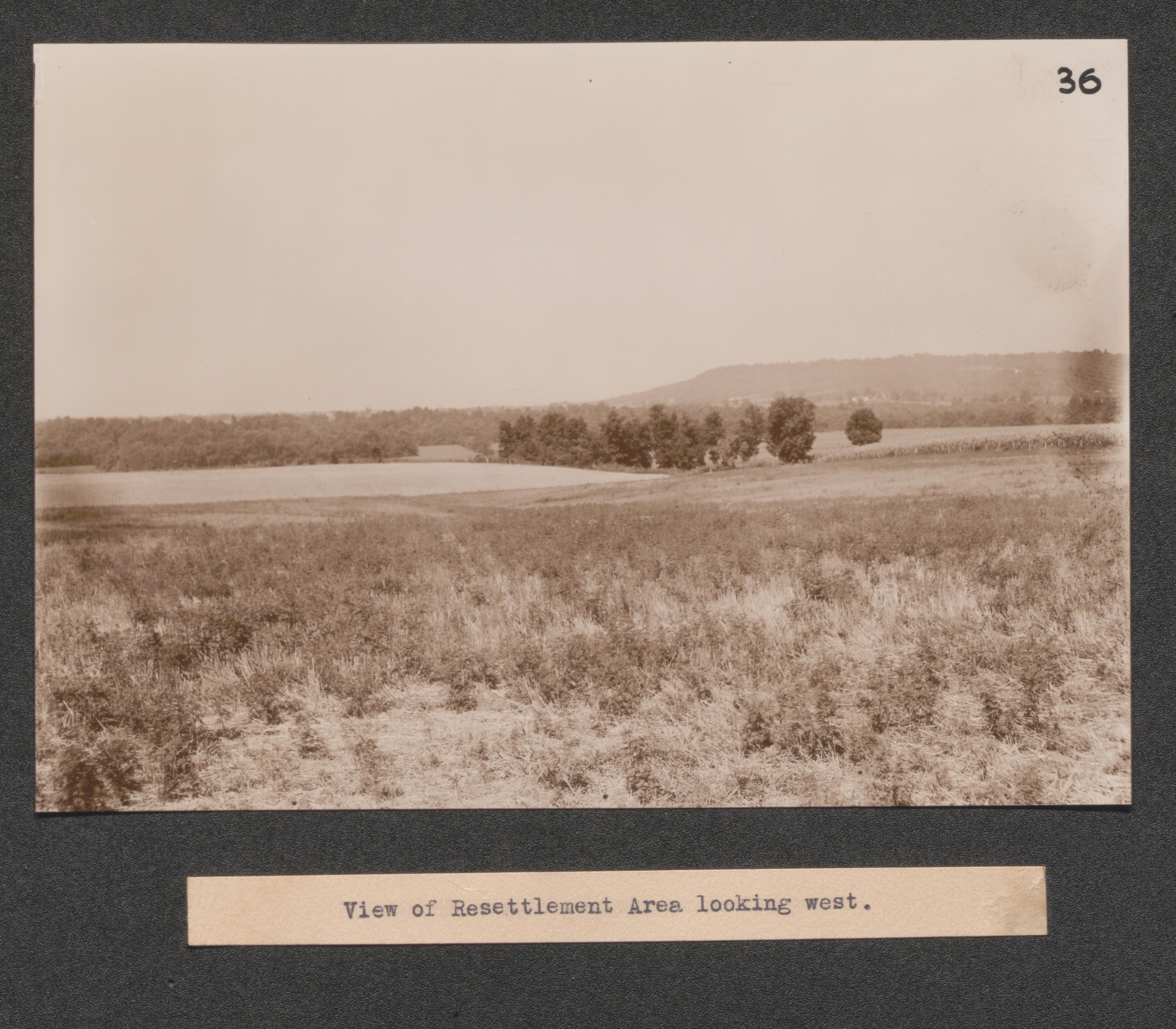
Exhibit 26 no. 35 resettlement areas view looking South, undated
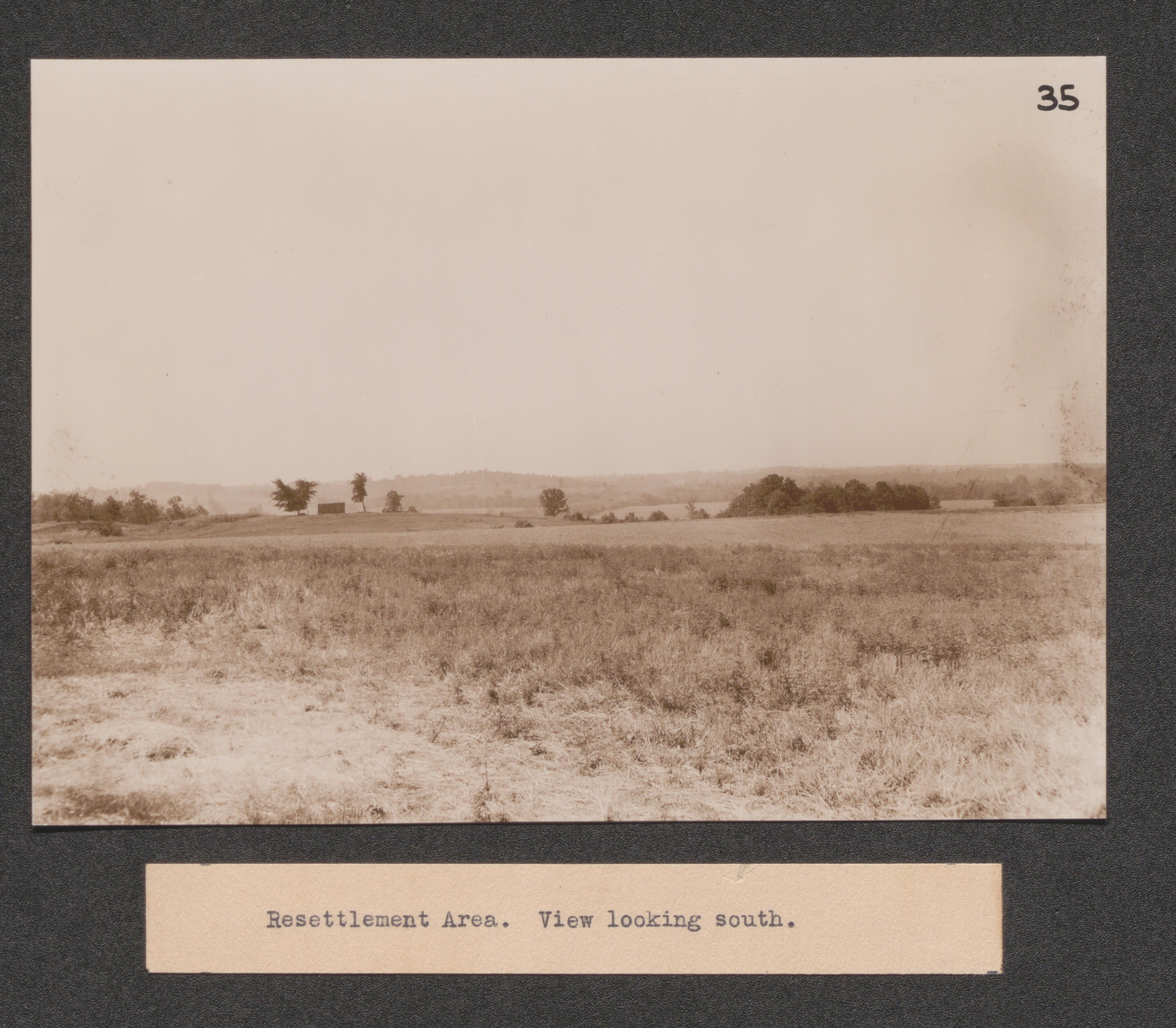
Exhibit 26 no. 37 view in a resettlement area showing bottomland, undated
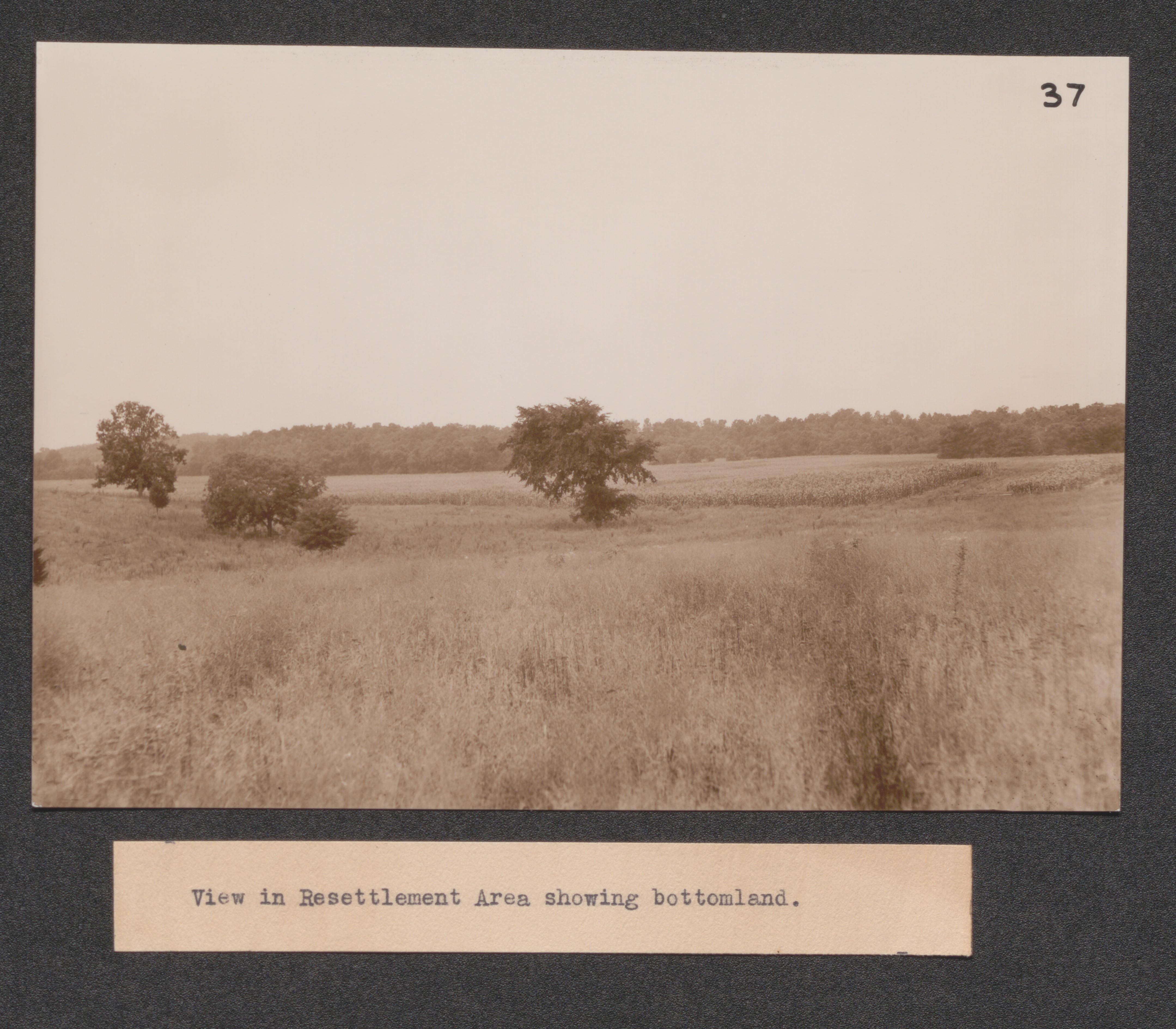
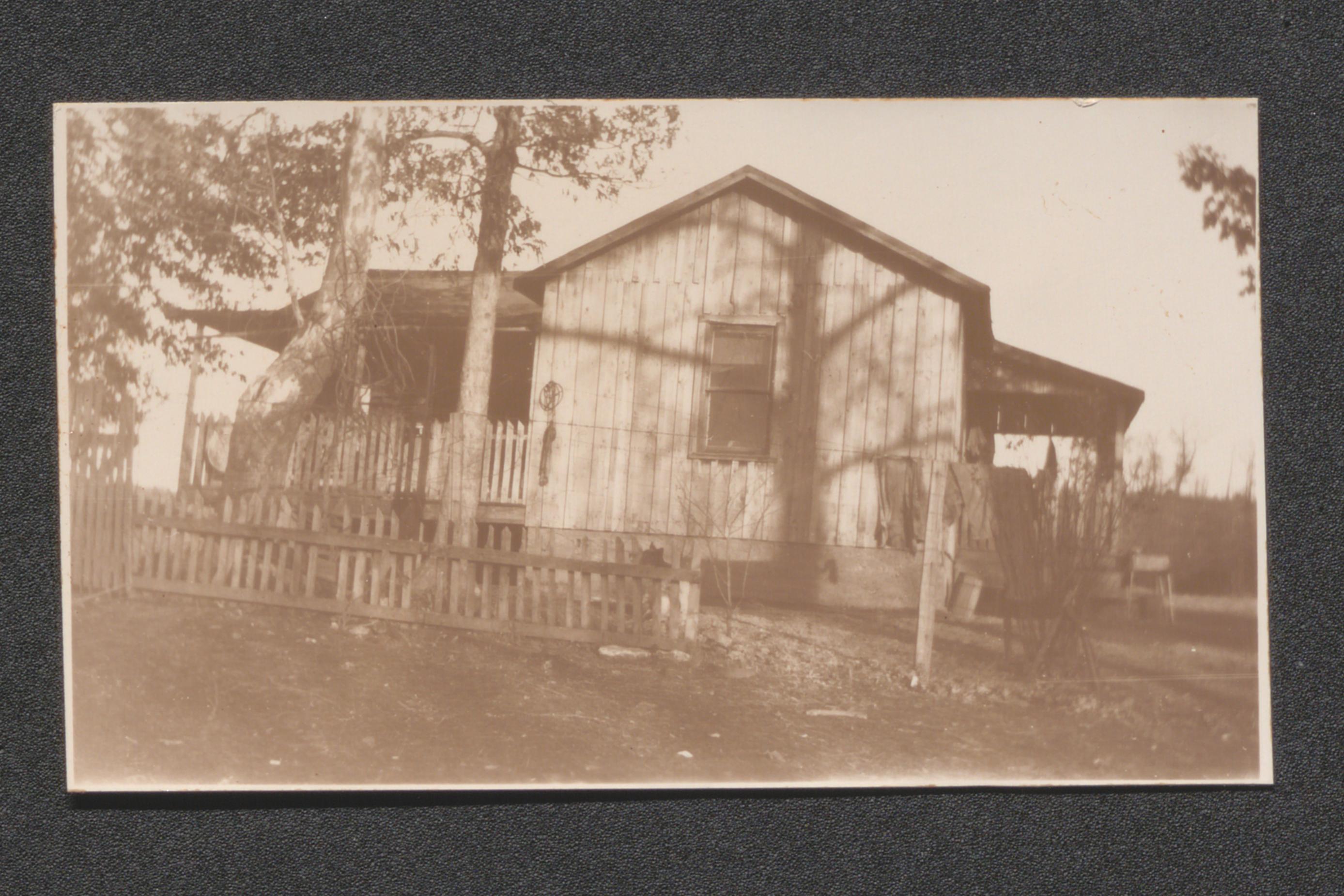
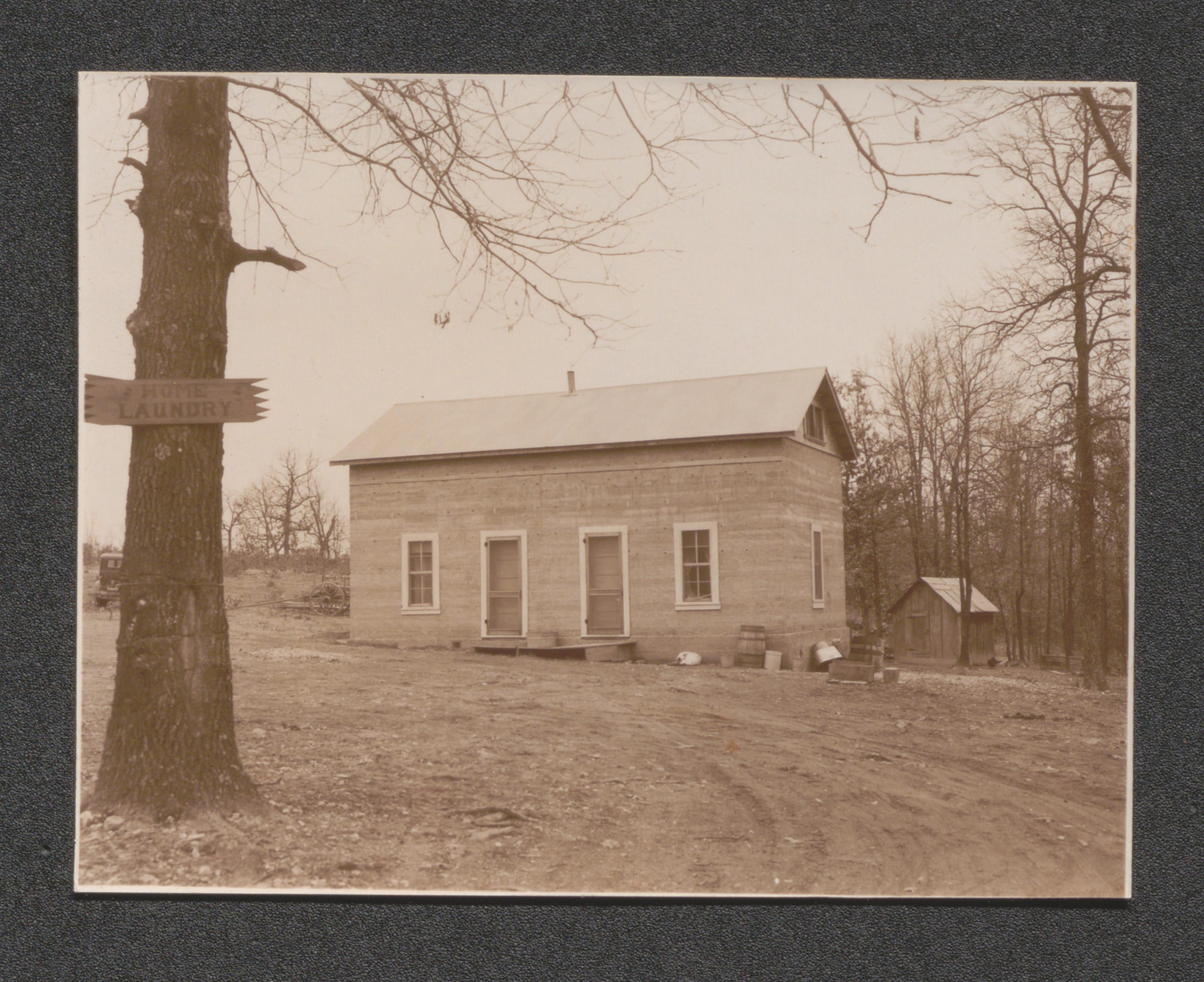
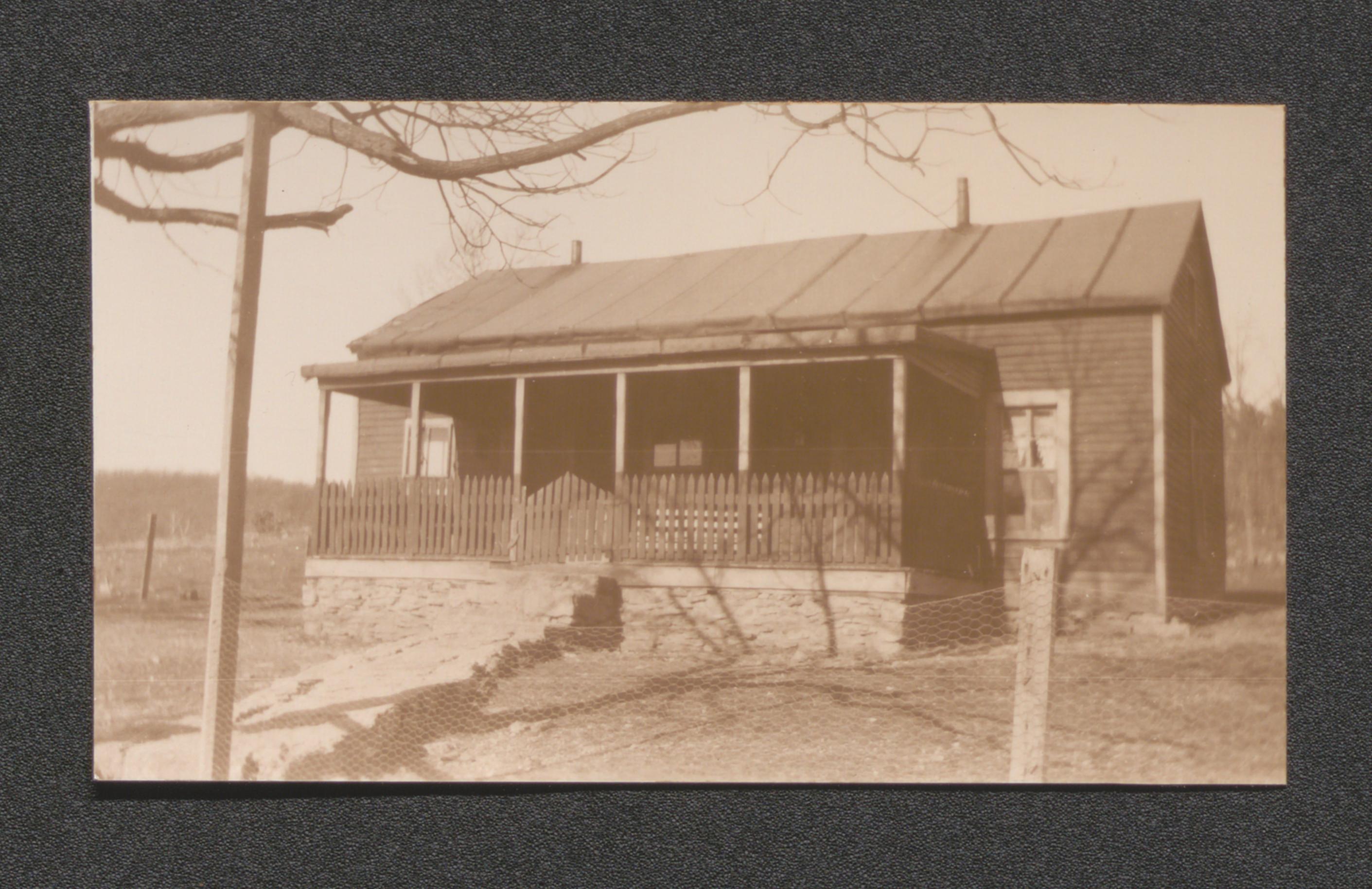
Exhibit 28 no. 12 a dilapidated house, now occupied. size indicates former prosperity, undated
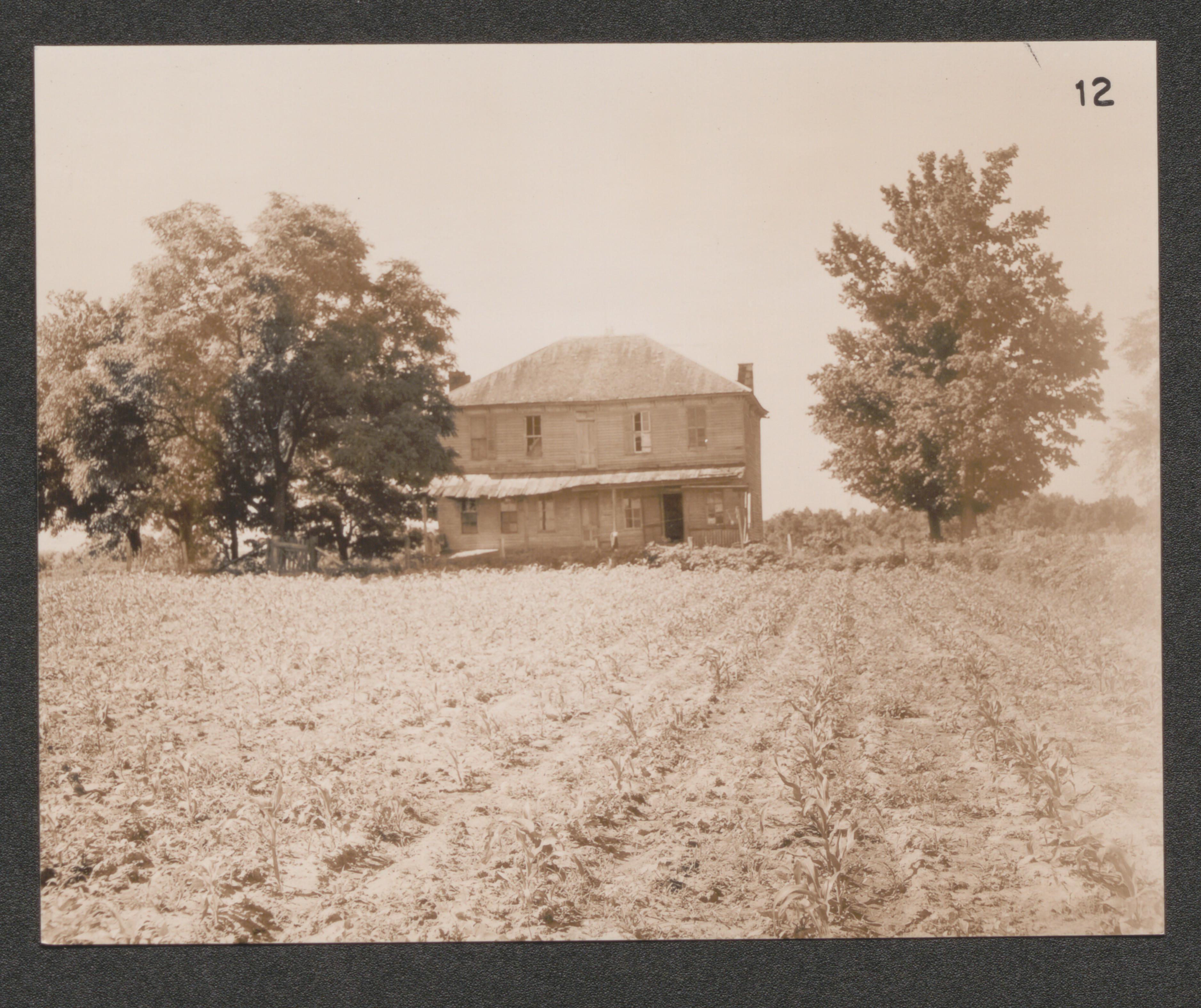
Exhibit 28 no. 31 an abandoned shack in the area, undated
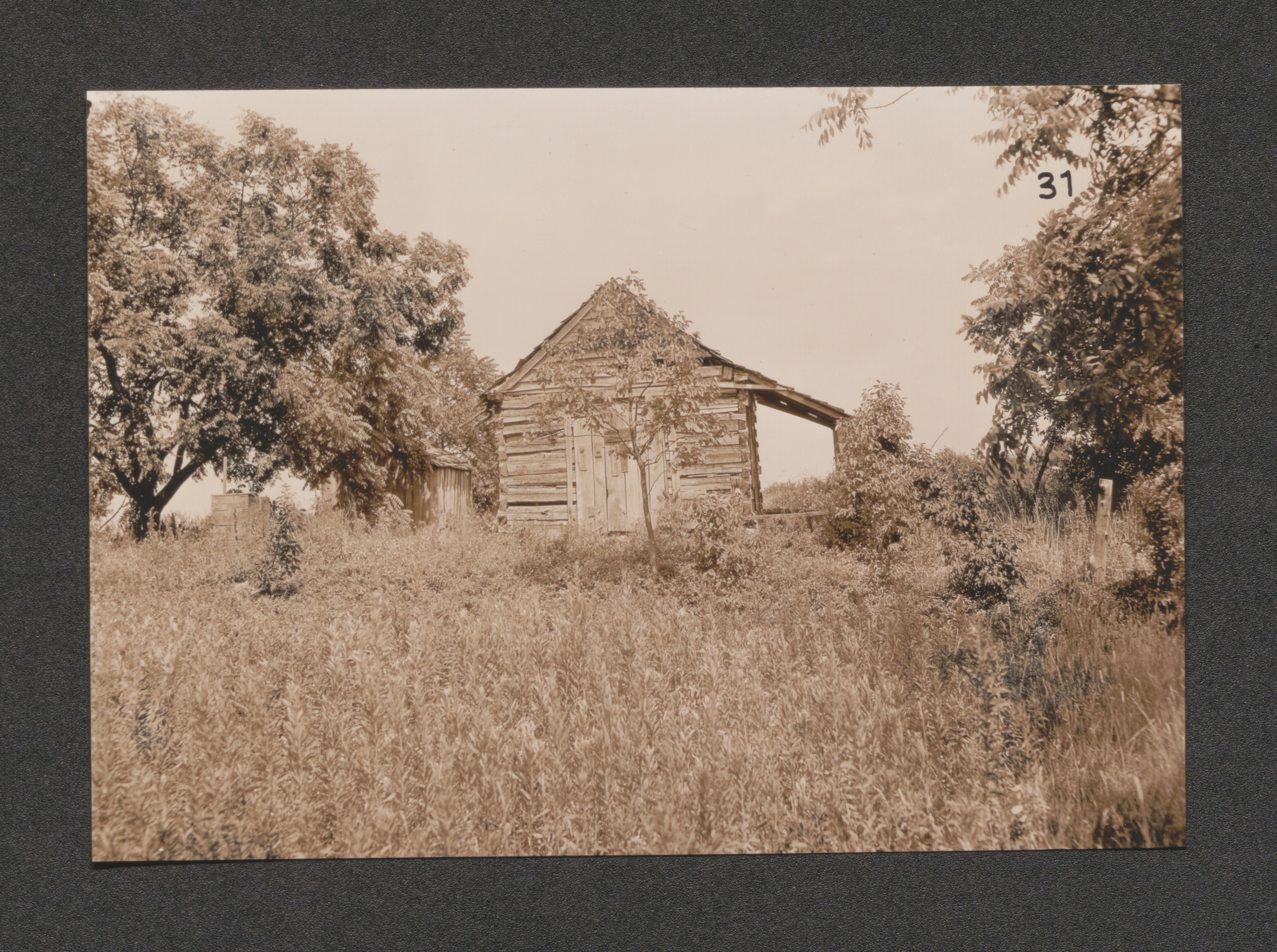
Exhibit 28 no. 4 a house typical of the poorer class, undated
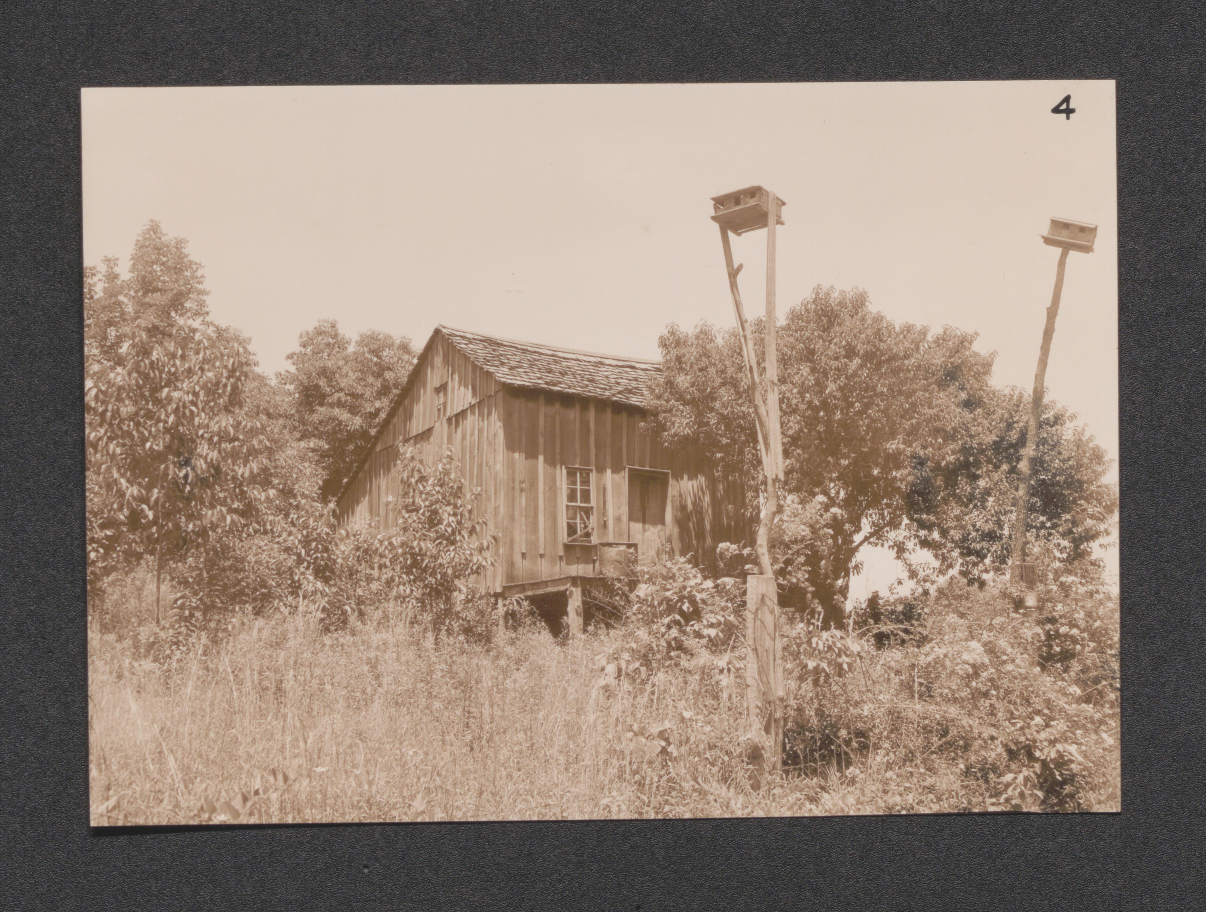
Exhibit 28 no. 27 a medium class farm site, undated
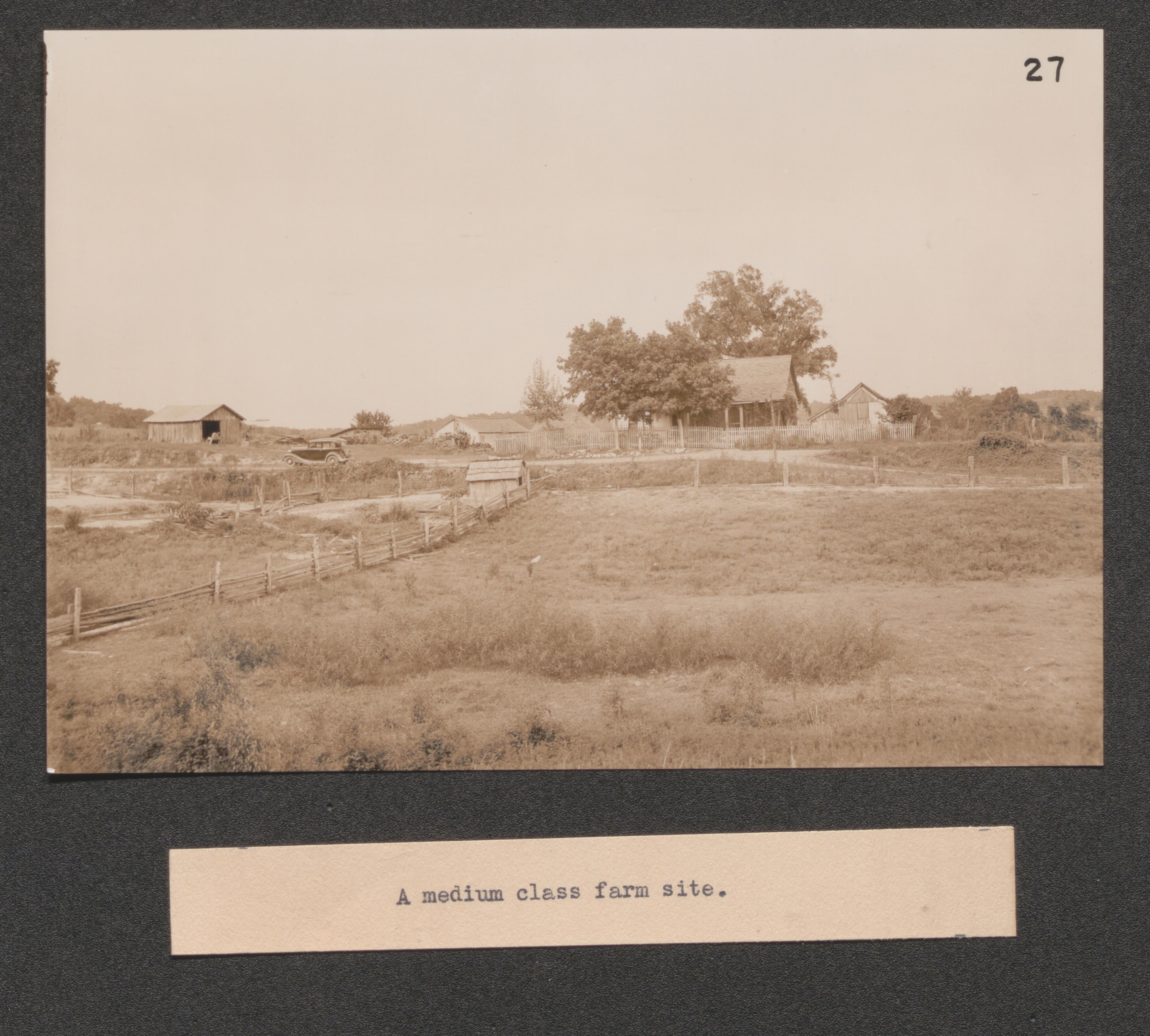
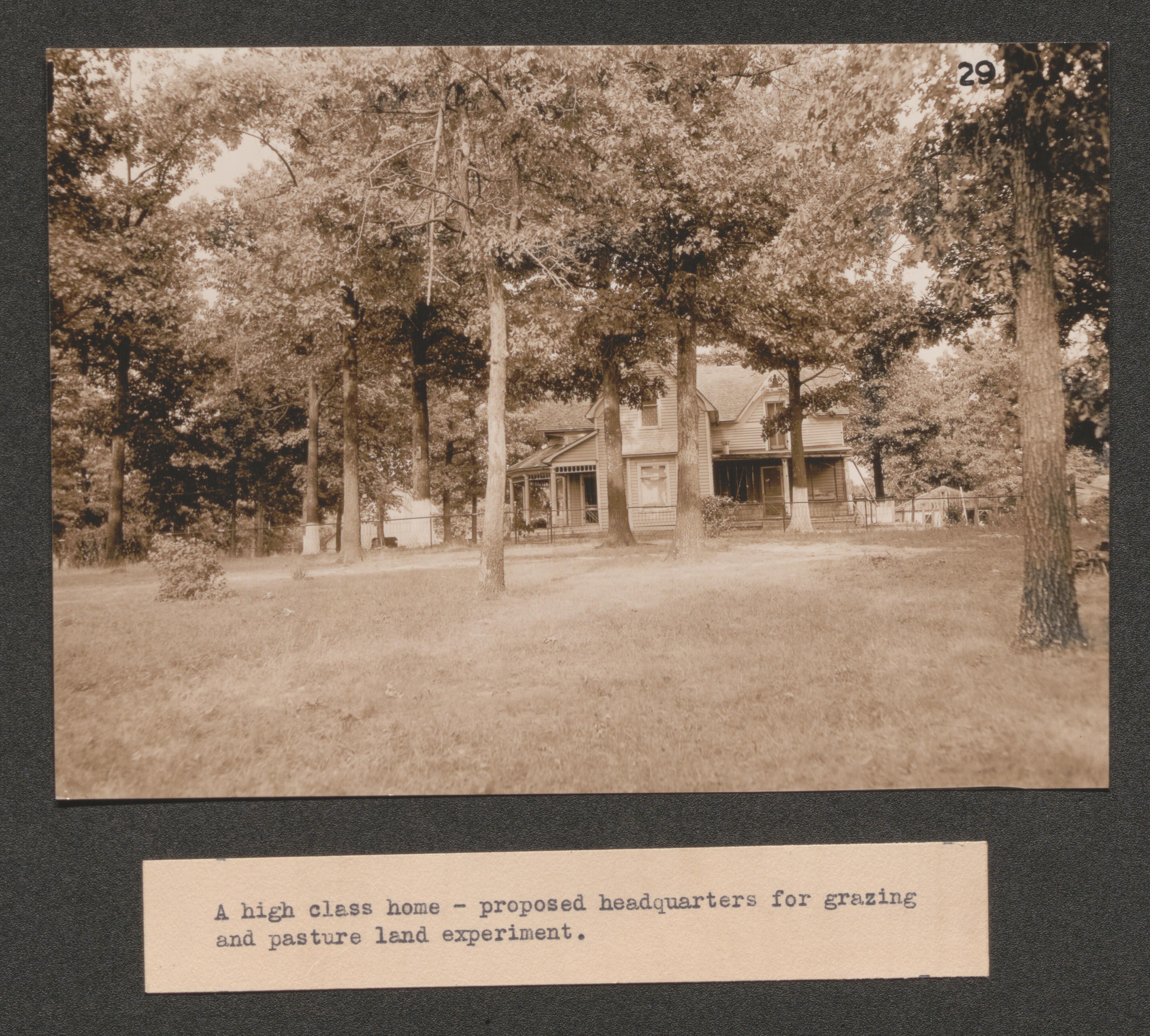
Exhibit 28 no. 29 a high class home proposed for headquarters for grazing and pasture land experiment, undated
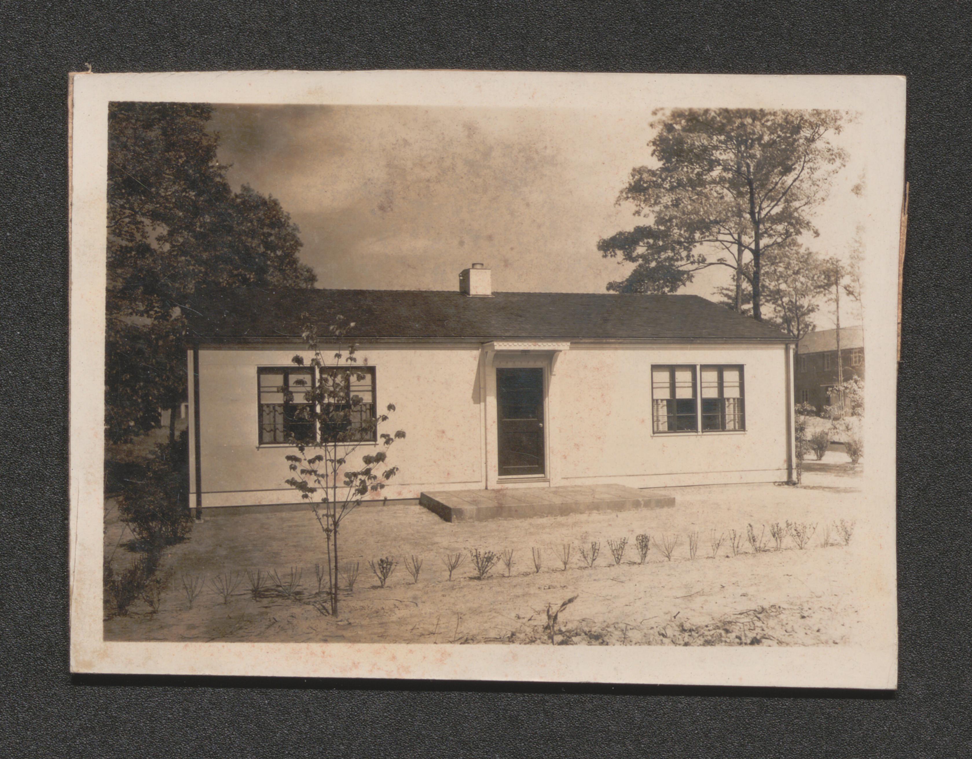
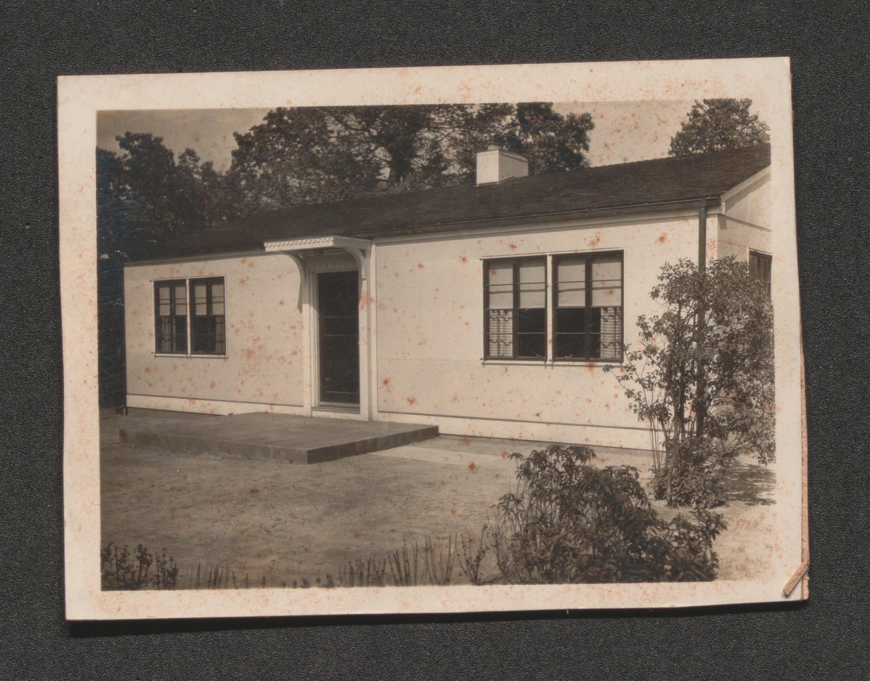
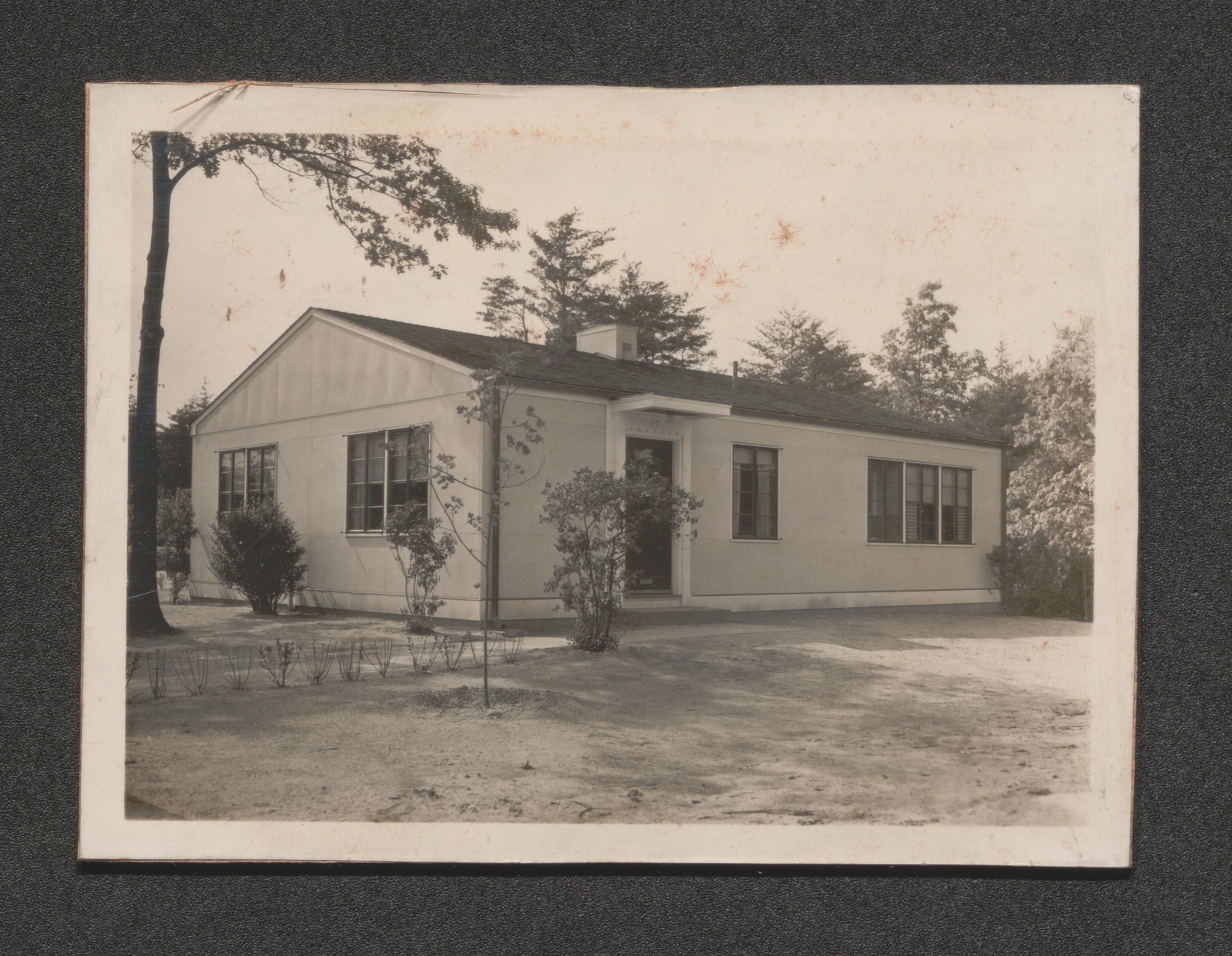
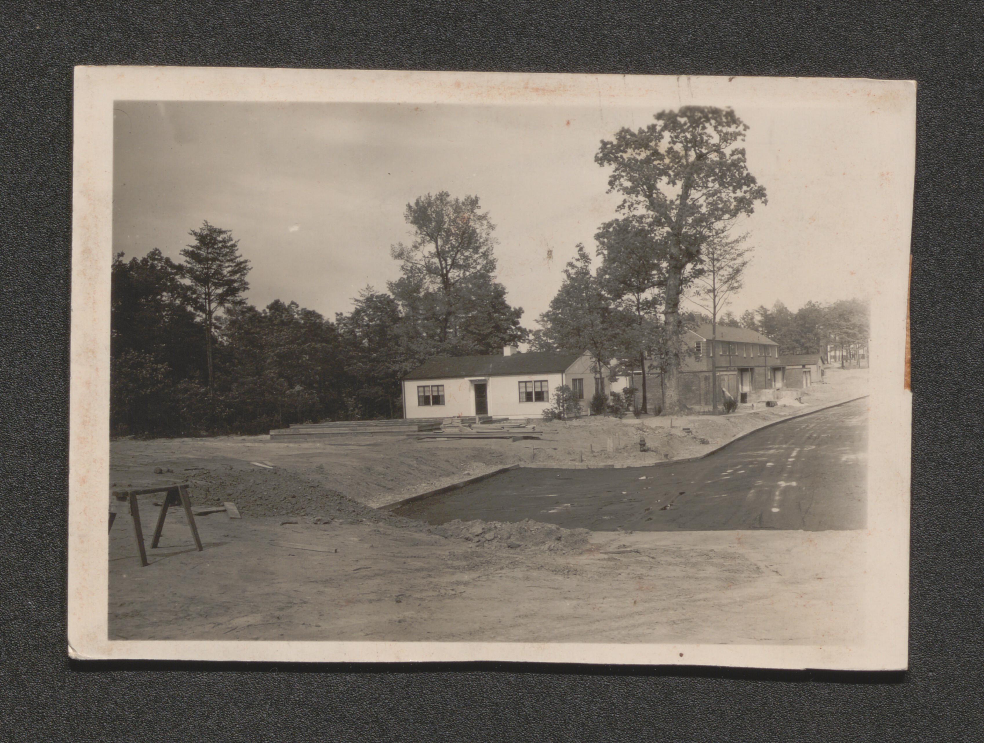
Greenbelt, Maryland, 1935-1937, undated
Experimental houses, undated
Subdivision map, undated
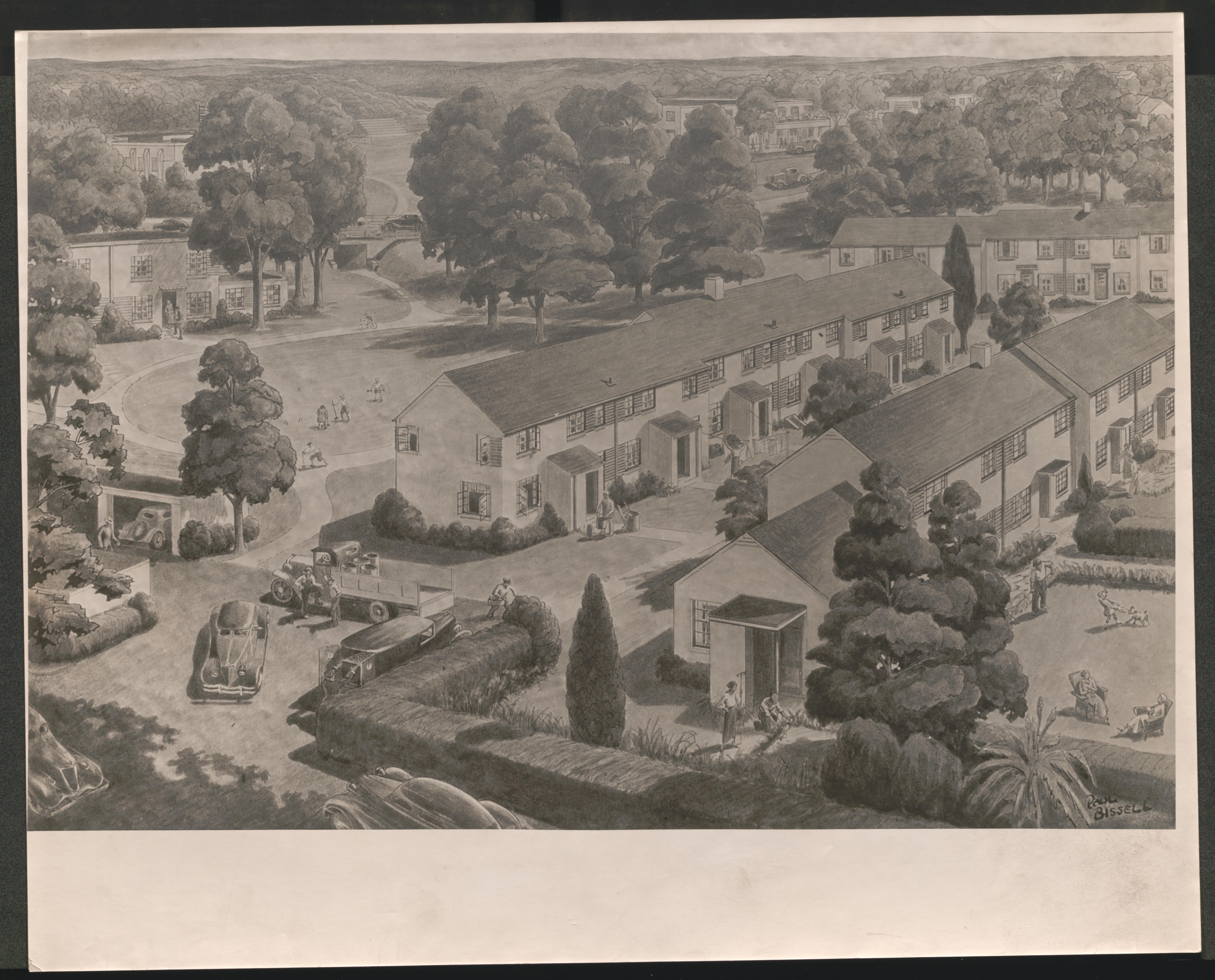
Illustration of neighborhood, undated
Illustration of the lake, undated
Illustration of airial view, undated
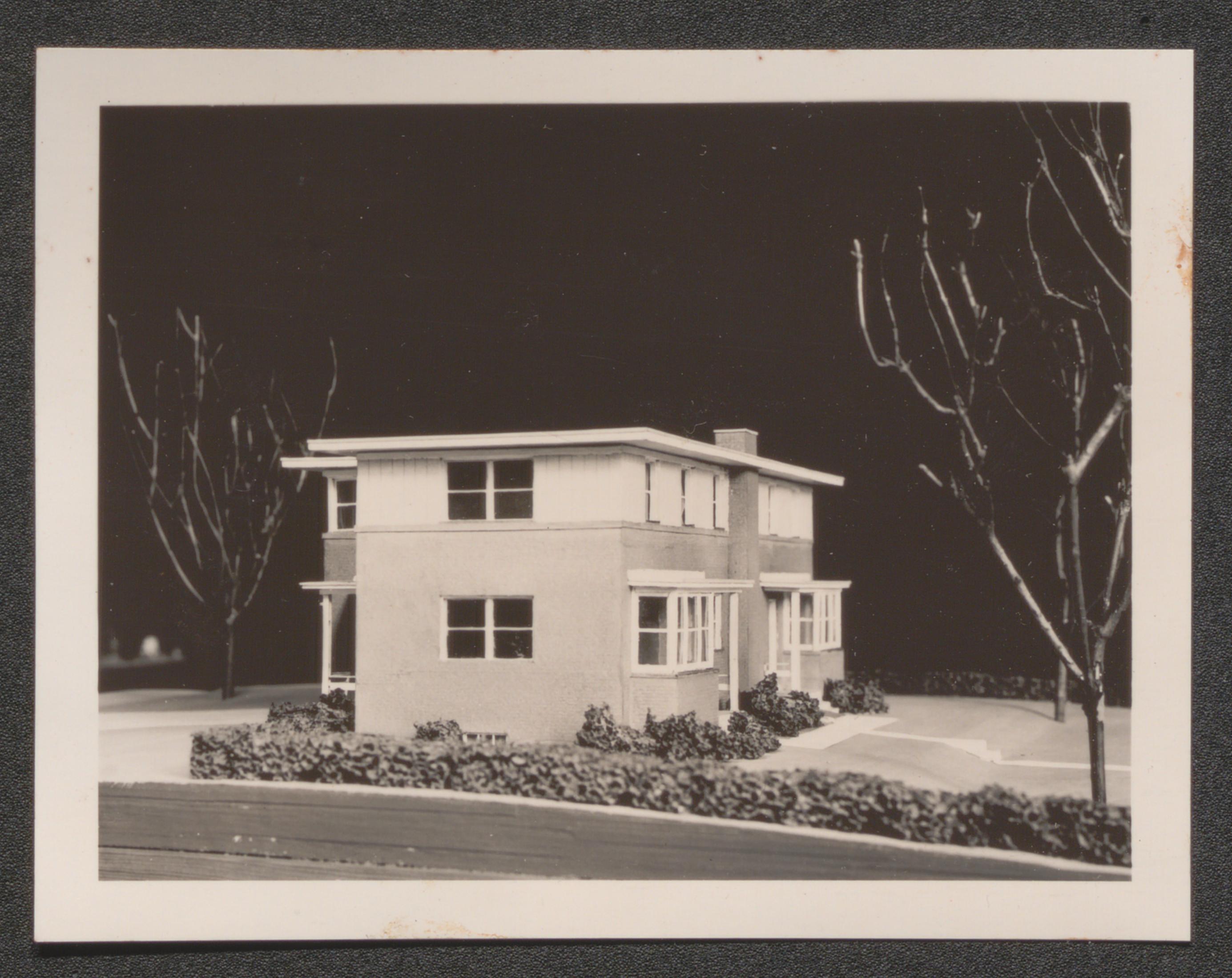
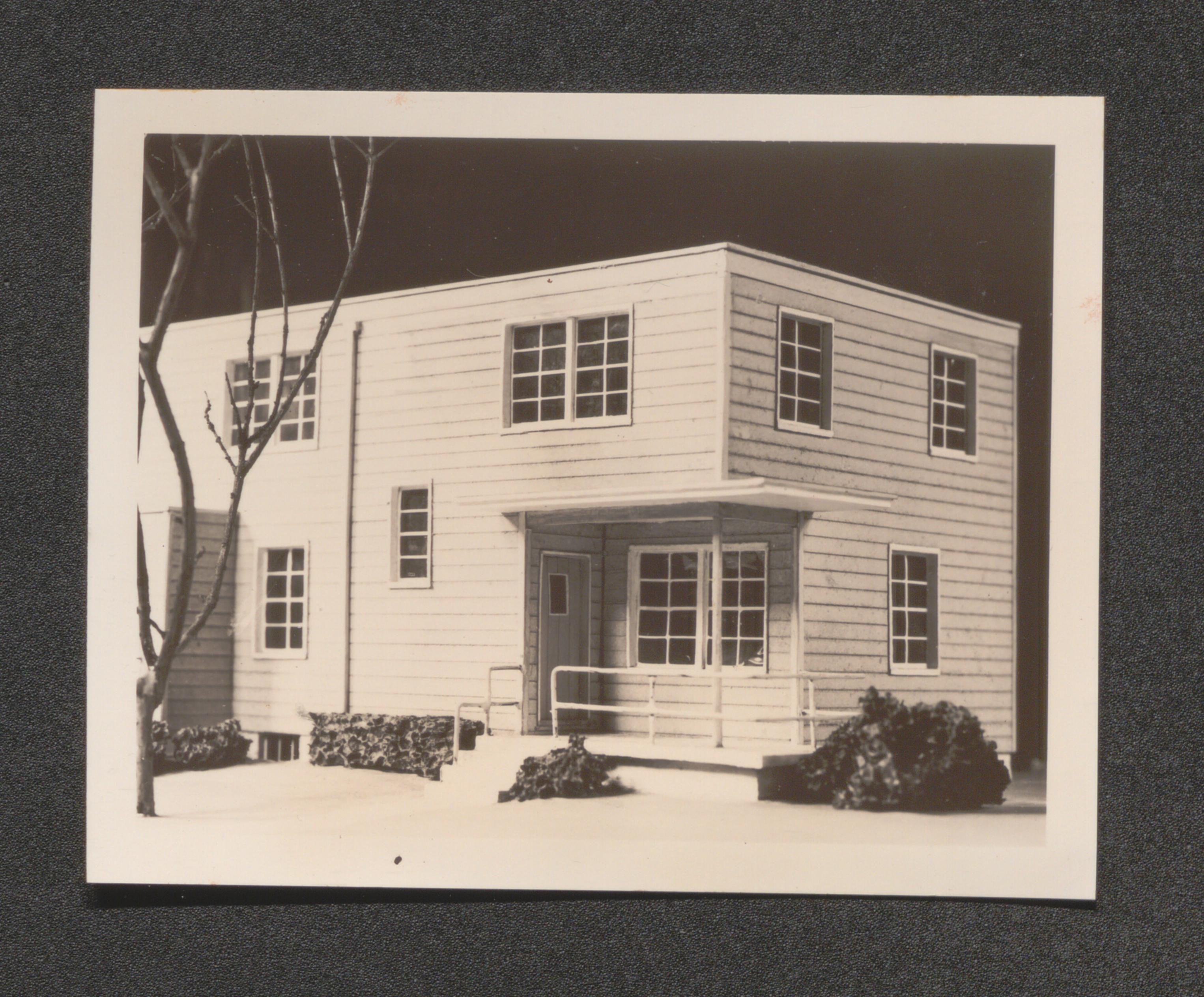
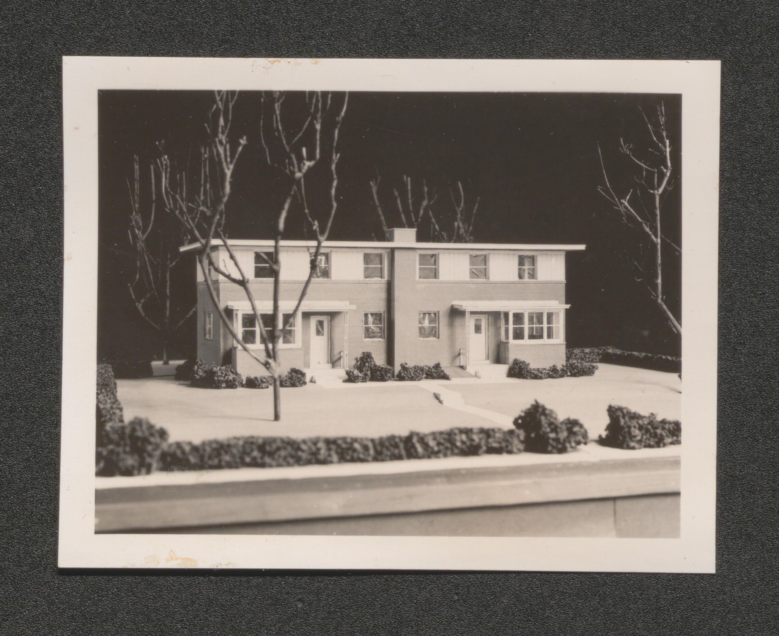
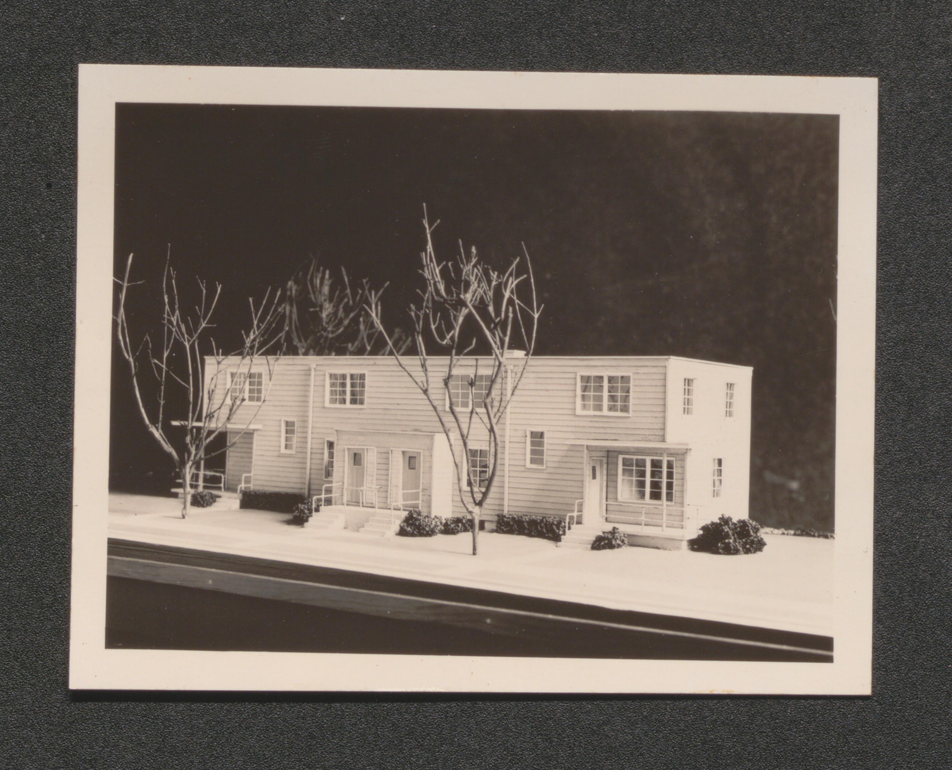
Model of typical superblock, undated
Model of single group of houses, undated
Aerial view from the north, undated
Aerial view, undated
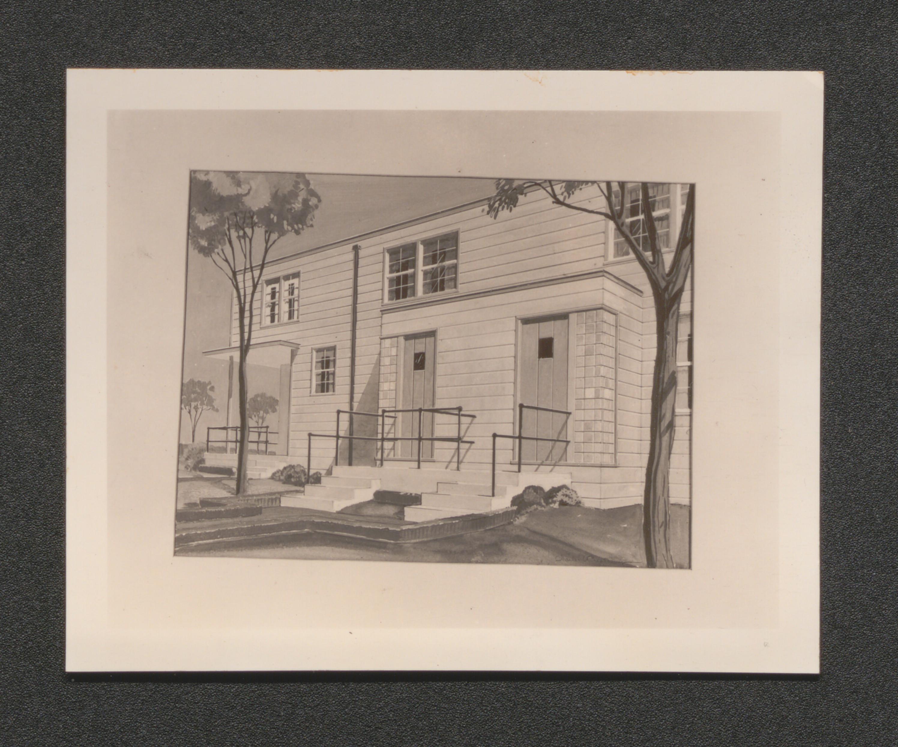
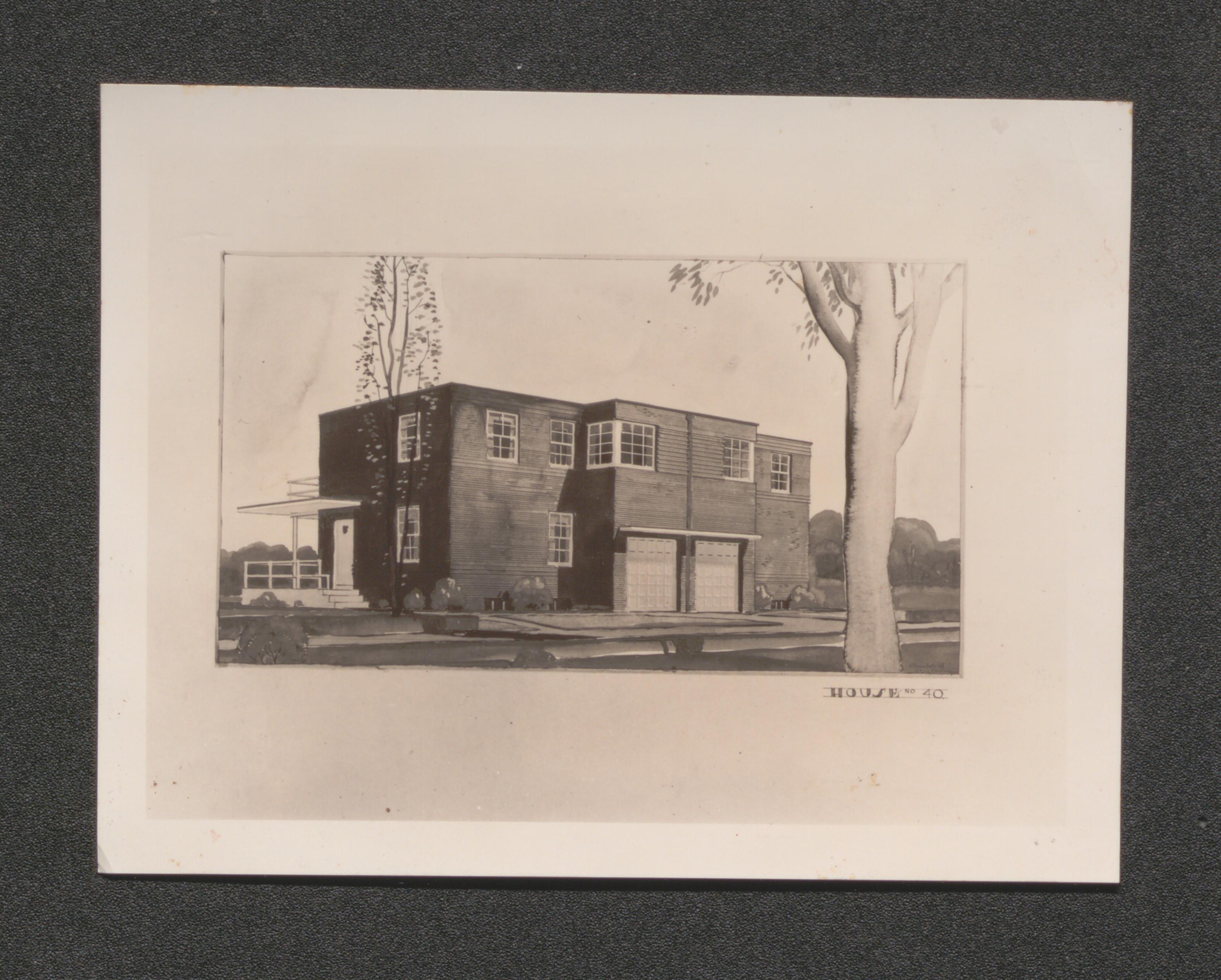
Illustration of house, undated
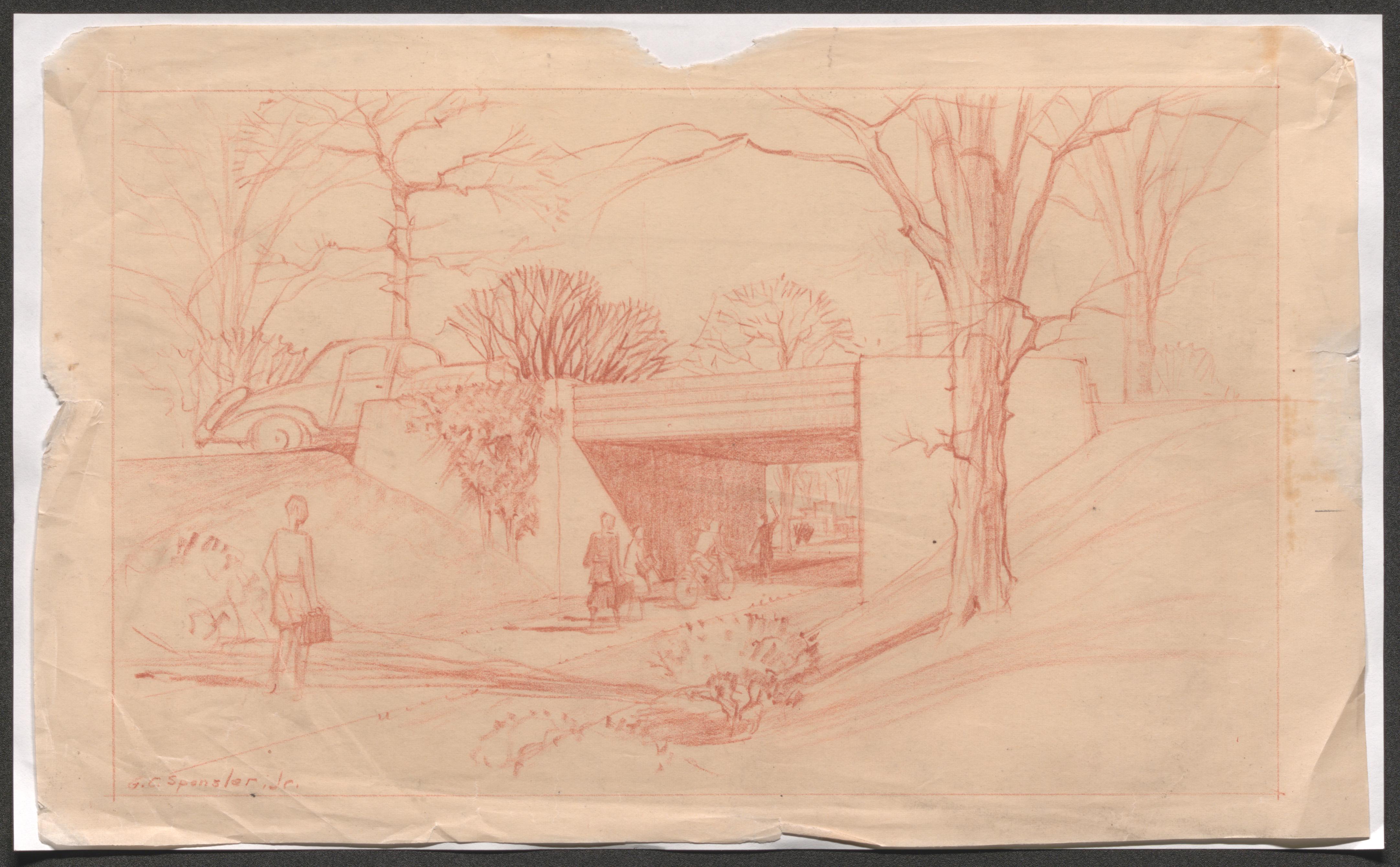
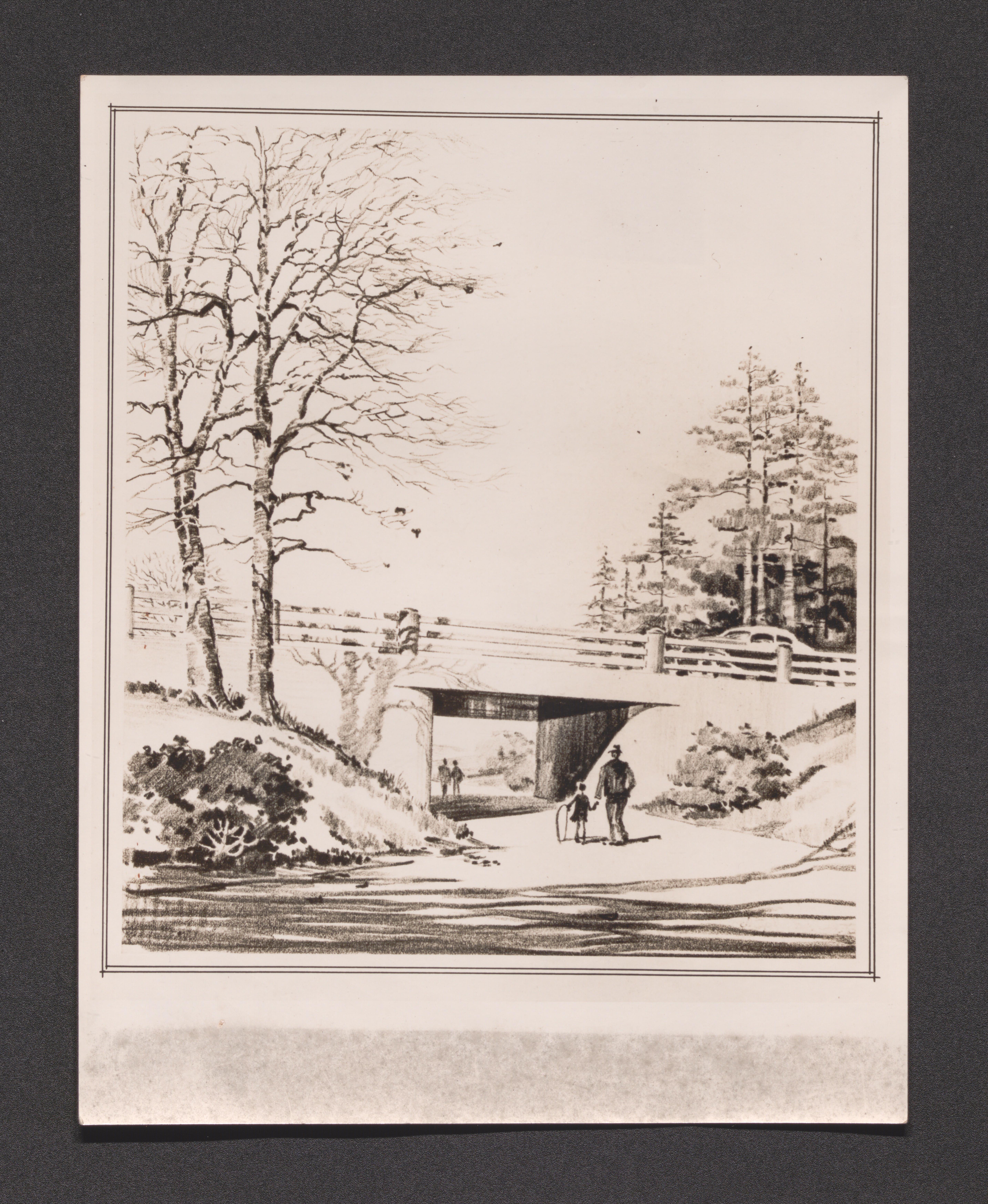
Children under a bridge, undated
Typical group house design layout and exterior, undated

Illustration of residents walking near houses, undated
Typical multi family building design layout and exterior view, undated
Bedroom illustration, undated
Commercial center design layout and exterior view, undated
Construction plans, undated
Exterior view of multiple family house, undated
Side view of multiple family house, undated
Several multiple family houses, undated
Front view of project housing, undated
Demonstration bedroom, undated
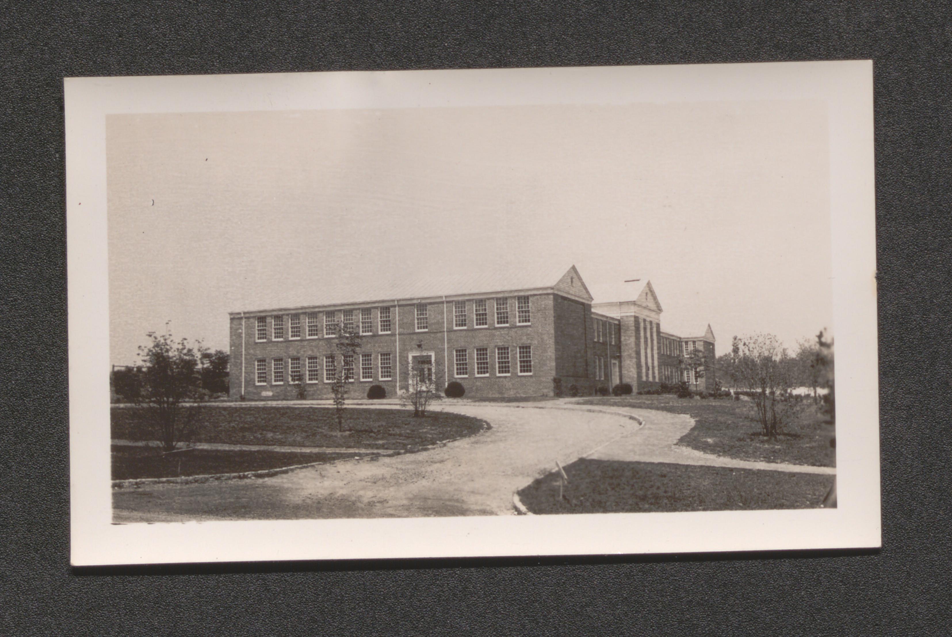
High school, undated
Elementary school, undated
Housing and road, undated
Multiple connected row houses, undated
Demonstration living room, undated
Demonstration family room, undated
Demonstration bedroom, undated
Art deco windows, tiles in stairway, undated
Exterior of single family house, undated

Foundation construction, undated
Workers clearing land, undated
View of greenbelt, 1936 January
Aerial view of construction, undated
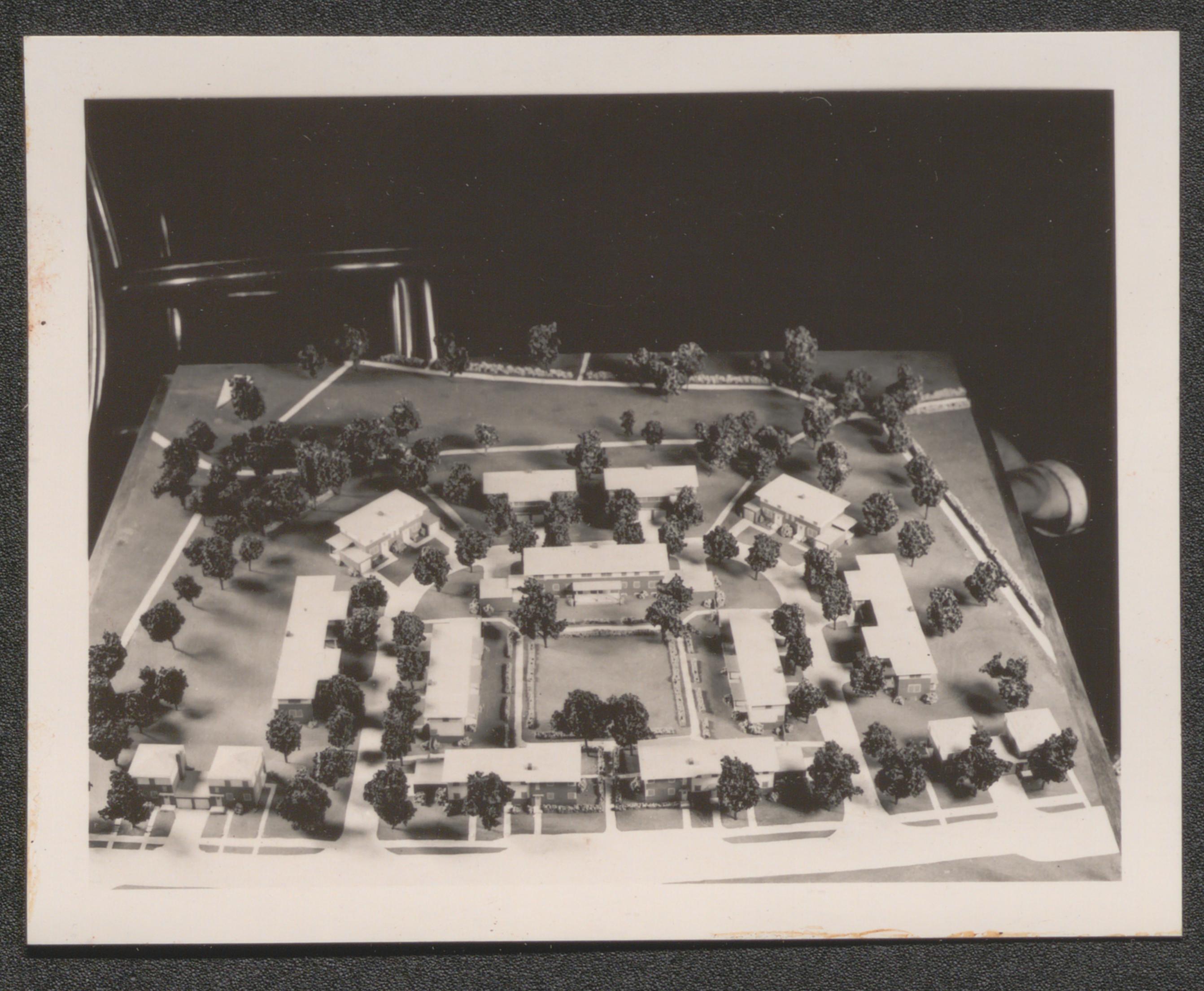
Model of project, undated
Construction of foundations, undated
Surveyor visit, undated
Close up of land clearing, undated
Sketch of houses and roads, undated
Aerial view, undated
Preliminary plan map, undated
Ultimate town map, undated
Project row homes, undated

Group of men working at drafting table, typed on back of image "Land acquisition group. Prince George County, Maryland", undated
Typed on back of image - "Typical shack on farmland, Maryland", undated
Typed on back of image - "Surveyor at work on the Greenbelt Project, Maryland"
Man operates bulldozer with other men nearby, typed on back of image - "Land clearing. Prince George County. Greenbelt, Maryland", undated
Crowd in line formation along road through open area, typed on back of image - "Noonday call. Greenbelt, Maryland", undated
Pond near road bridge in wooded area, typed on back of image - "Old iron mine on the property of the Resettlement Administration in Greenbelt, Maryland", undated
Several men building primitive log bridge over creek, hand written on back of image - "Bridge Building. Prince George Co. Beltsville", undated
One of the houses found on land bought by the Resettlement Administration for the construction of Greenbelt, brief essay, titled "Trophy to Defeat", attached to back of image, undated
Workers with shovel and ax work with timber in field, handwritten on back of image - "Transient workers. Prince George Co. Beltsville", undated
Typed on back of image - "Ancient shack on the Snowden Farm in Greenbelt, Maryland, which has jut been bought // by the Resettlement Administration. This shack is typical of what has been left // on this once very productive tobacco land", undated
Man, operating tractor, looks back from his seat, typed on back of image - "Tractor clearing land for lake and reservoir. Greenbelt, Maryland", undated
Workers in field with timber cut into logs, typed on back of image - "Transient workers. Beltsville, Maryland", undated
Land area cleared of timber, typed on back of image - "Progress picture of the Berwyn Project made November 5, 1935, looking towards project // from Addick Place. Maryland", 1935 November 5
Group of eleven men standing in construction area, undated
Two men working mound of plaster on interior table, typed on back of image - "Plasterers at work at Greenbelt, Maryland", undated
Men settled for lunch near trees in their work area, typed on back of image - "Lunch time for the workers at Greenbelt, Maryland", undated
Men standing in line for building service window, typed on back of image - "Workmen receiving paychecks at Greenbelt, Maryland", undated
Greenbelt Sewage Disposal System while still under construction, brief essay, titled "Science Brings Sanitation", attached to back of image, undated
Man operating machinery, typed on back of image - "Making cinder block for the Greenbelt Project, Maryland", undated
Cinder block crusher located near Greenbelt project, brief essay, titled "New Ways for Building Better Houses", in storage with print, undated
Man operating machinery, typed on back of image - "Making cinder block for the Greenbelt Project, Maryland", undated
Men climb off trucks to begin workday at Greenbelt project, brief essay, titled "Lets Get to Work", attached to back of image, undated
Cinder block stack, hand written on back of image - "Cinder blocks // used for building // Greenbelt, Maryland", undated
Wheelbarrows in upright storage, hand written on back of image - "Wheelbarrows- Greenbelt, Maryland", undated
Large pile of armored cable coils, typed on back of image - "Armored cable for wiring. Greenbelt, Maryland", undated
Large quantity of pipe in storage rack, typed on back of image - "Pipe storage at Greenbelt, Maryland", undated

Stacked bricks, hand written on back of image - "Bricks for building //Greenbelt", undated
Tractor pulling grading wheel, hand written on back of image - "Grading - // Greenbelt, Maryland", undated
Two men carry section of square pipe, typed on back of image - "Workmen unloading tile pipe, Greenbelt, Maryland", undated
Workman hammering nail into board, hand written on back of image - "Carpender - Greenbelt, Maryland", undated
Man in cab of truck with Resettlement Administration logo and number 84 on door, typed on back of image - "Resettlement truck at Greenbelt, Maryland", undated
Two men at table saw, hand written on back of image - "Workman at // Greenbelt, Md.", undated
Carpenter using plane in construction area, hand written on back of image - "Carpenter at // Greenbelt, Md.", undated
Hod carrying man with load of mortar, hand written on back of image - "Hod carrier - // Greenbelt, Md.", undated
Man at end of extension ladder painting building, hand written on back of image - "Painter - Greenbelt, Md.", undated

Two men laying electrical conduit across building foundation, hand written on back of image - "Electricians - Greenbelt, Md.", undated
Man puts cinder block in place forming building wall, hand written on back of image - "Cinder block construction // Greenbelt, Md.", undated
Hand written on back of image - "Worker leveling cement floor, // Greenbelt, Md.", undated
Trucks with Resettlement Administration logo on door parked in field line up, typed on back of image - "Resettlement trucks at Greenbelt, Maryland", undated
Typed on back of image - "Plumber cutting pipe at Greenbelt, Maryland", undated
Resettlement Administration/The Greenbelt Town; poster with development photos and alternative slum tenement photos, undated
Truck overloaded with lumber leaning severely to one side from broken chassis, typed on back of image - "Winter weather and poor roads delay the progress at the Greenbelt Project, Maryland. // Truck heavily loaded with lumber which has broken through to its body", undated
Typed on back of image - "Flooded foundation sites and ice delay progress on the first set // of houses at the Greenbelt Project, Maryland. Jan. 1936", 1936 January
Hand written on back of image - "Wooden mud sleds drawn by tractor furnish the only method of getting supplies through from the main road to the project at Berwyn, Maryland during the Winter months. Transportation at this time of year was the chief problem at the new construction", undated
Poster with two images of jumping and diving swimmers; one with message "In the Greenbelt ......The old Swimming Hole", and the other with message; "In the City ......The old Open Sewer", undated
Man watches as two workers plant trees, typed on back of image - "Administrator Tugwell at Greenbelt, Maryland", undated
Workers chopping and burning timber to clear land, hand written on back of image - "Clearing Land at Greenbelt, Maryland", undated
Typed on back of image - "Mechanical digger working on cellar foundation at one of the housing units at Berwyn, Maryland", undated
Typed on back of image - "Early March progress on the dam at the Lake Site at Greenbelt, Maryland, 1936", 1936 March
Man driving tractor, typed on back of image Foreman at Greenbelt Project, Maryland.
Man holding long handled cutting tool, typed on back of image - "Transient worker, Berwyn Project, Maryland", undated
Man sawing lumber while on a roof, hand written on back of image - "Carpenters working on shelter near lake site, Berwyn Project, Maryland", undated
Man, inspecting information on clipboard, with four other men, typed on back of image - "Time checker at the Greenbelt Project, Maryland", undated
Man hands ax to another man through service window at Tool House number one, hand written on back of image - "Tool house, Berwyn Project, Maryland", undated
Man sharpens ax at grinding wheel, hand written on back of image - "Tool job, Berwyn Project, Maryland", undated
Workers, with shovel and ax, clearing/leveling section in wooded area, hand written on back of image "Berwyn, Maryland", undated
Back of two seated men at large cab window/windshield, undated
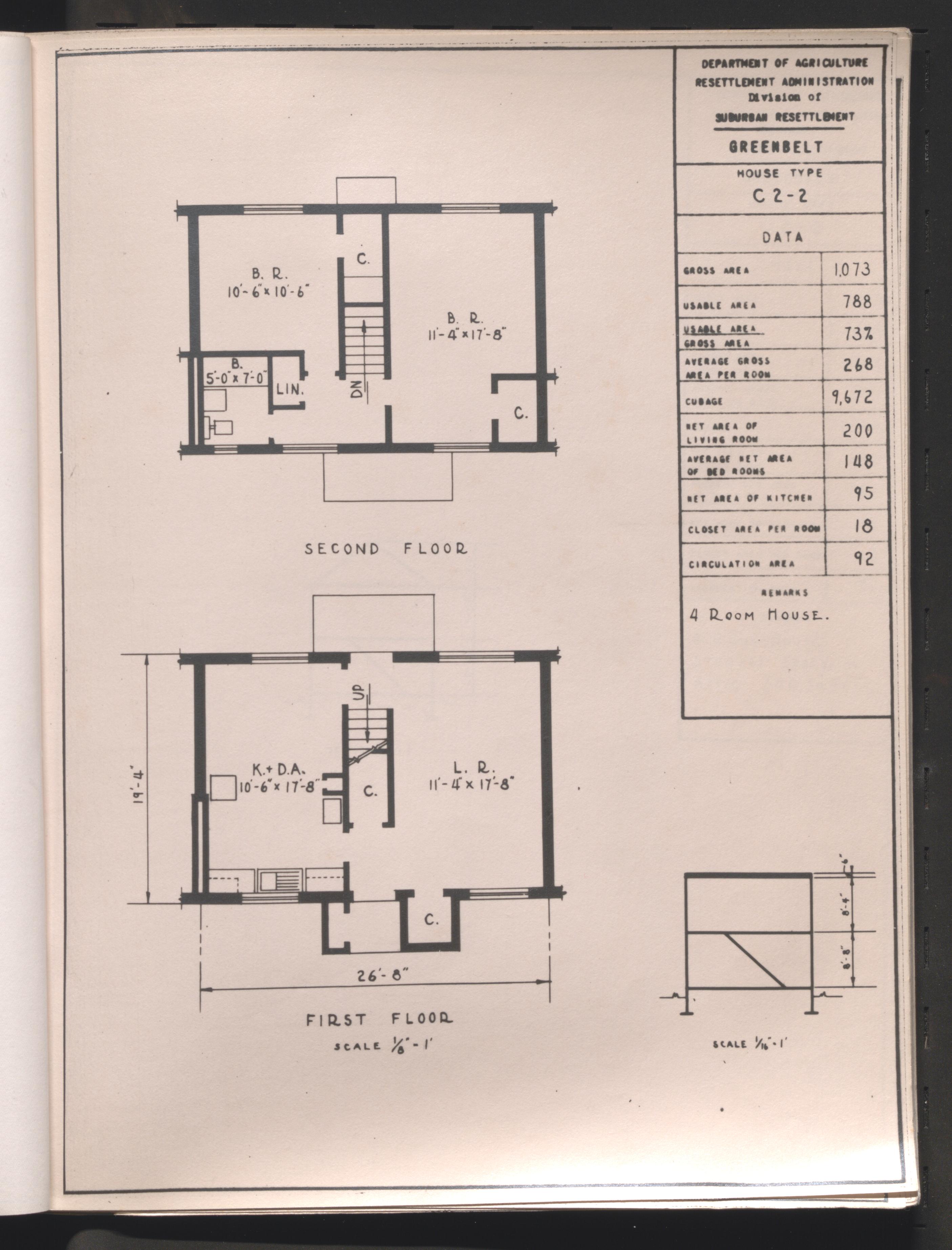
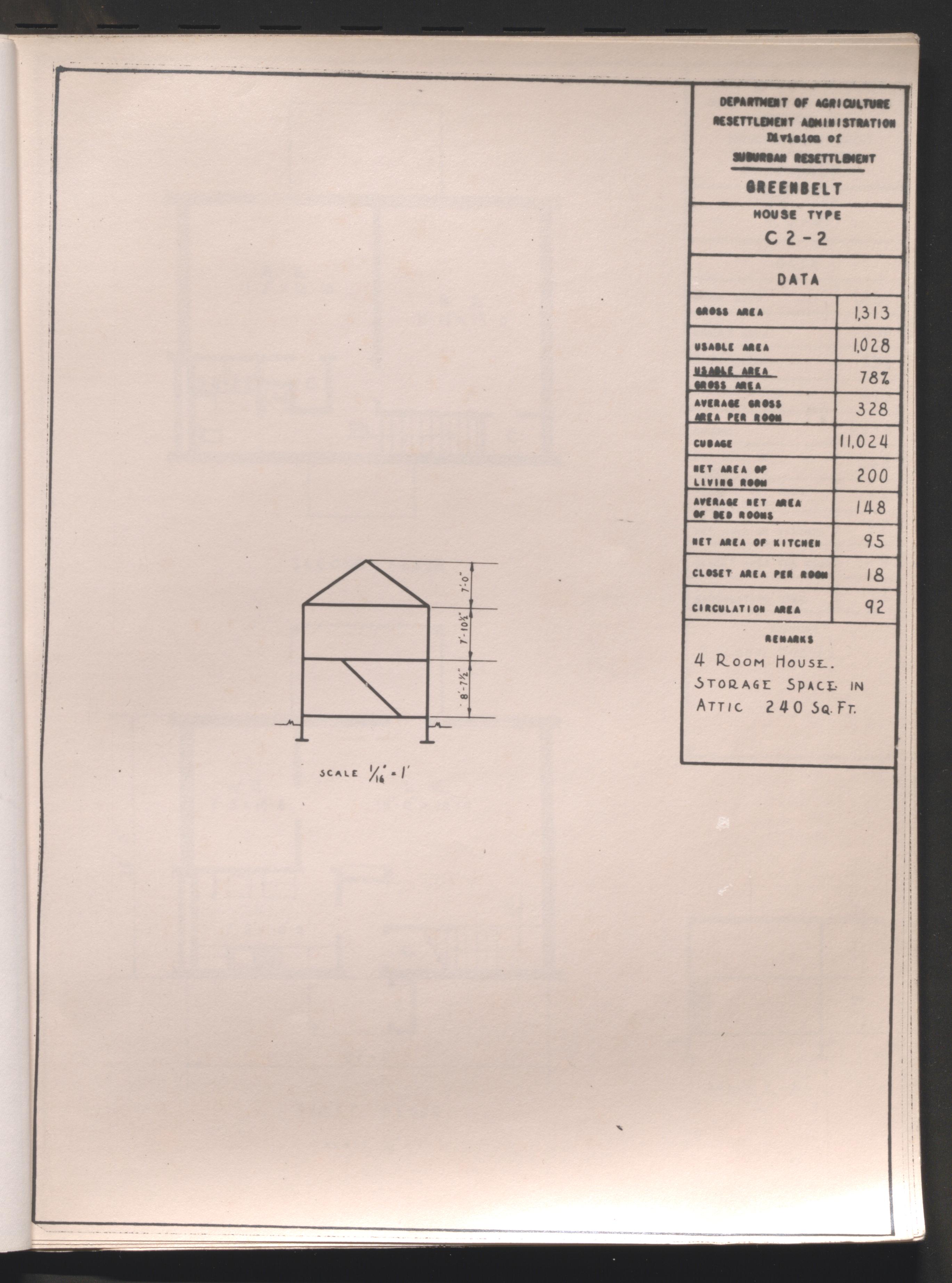
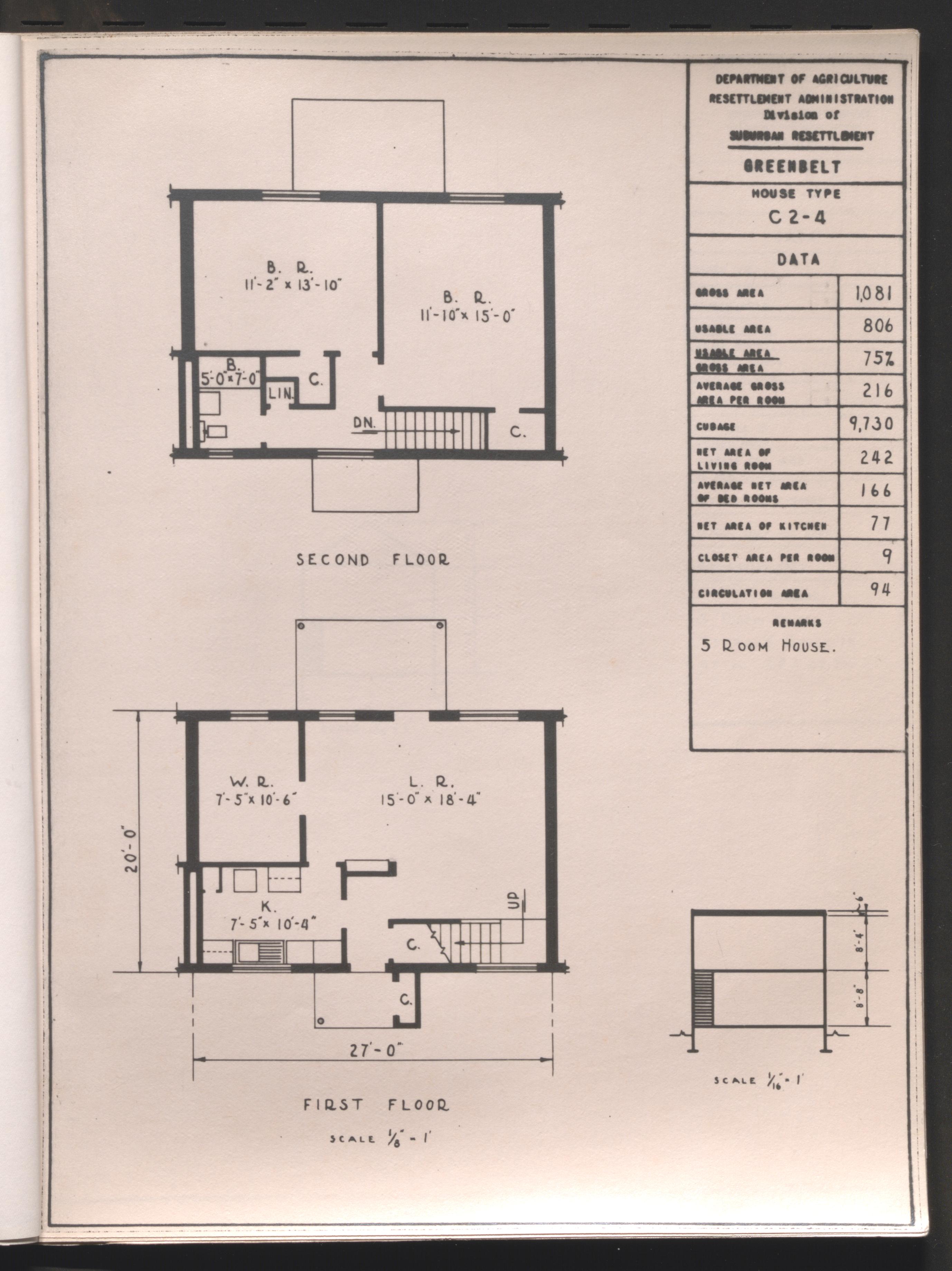
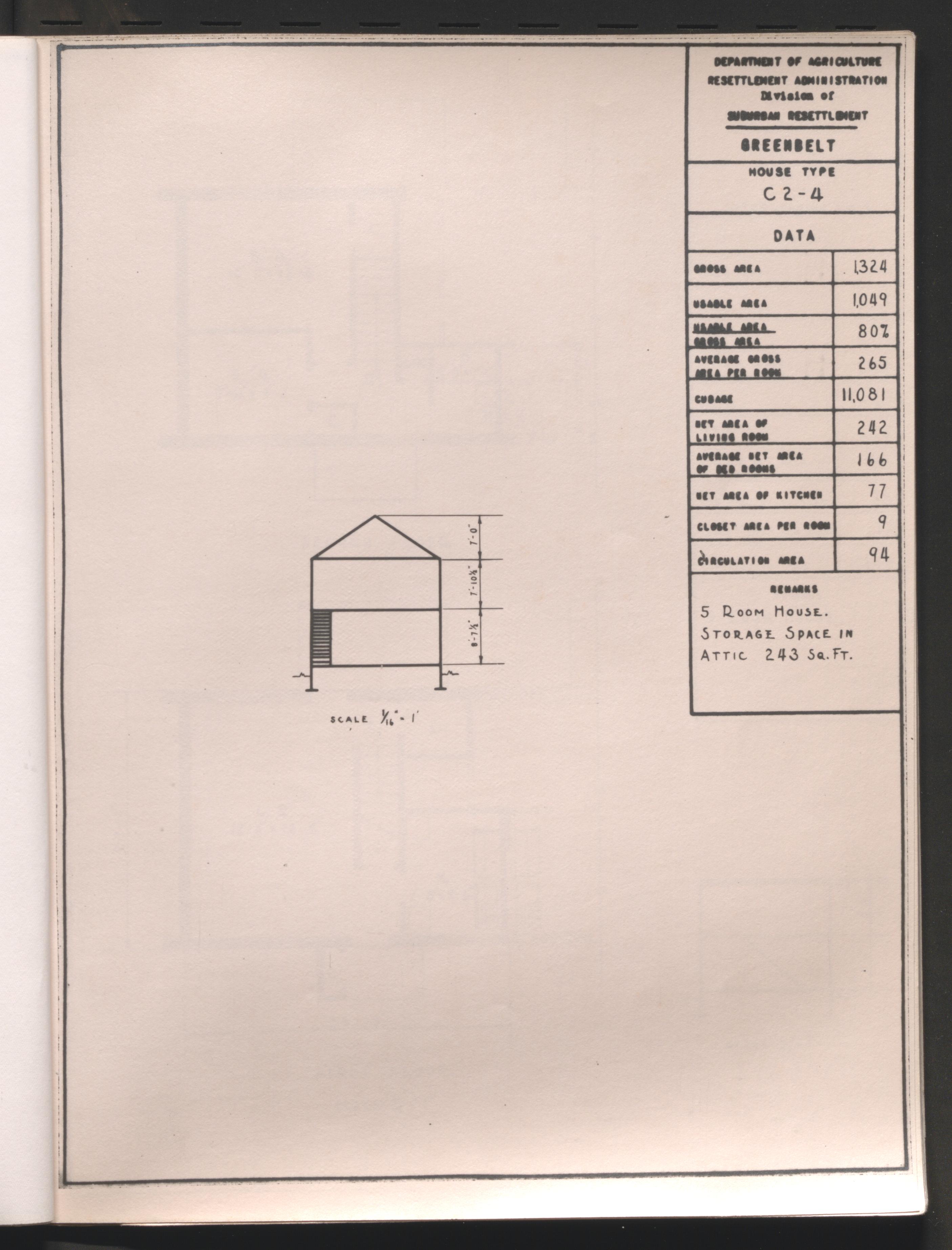
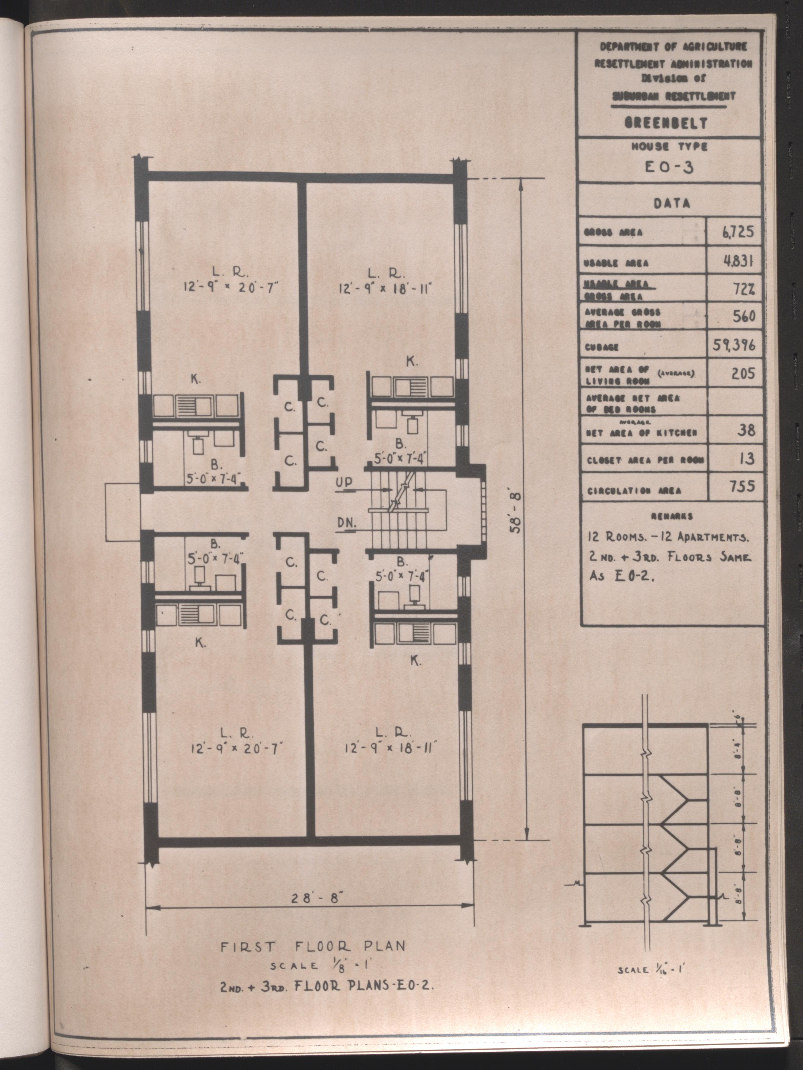
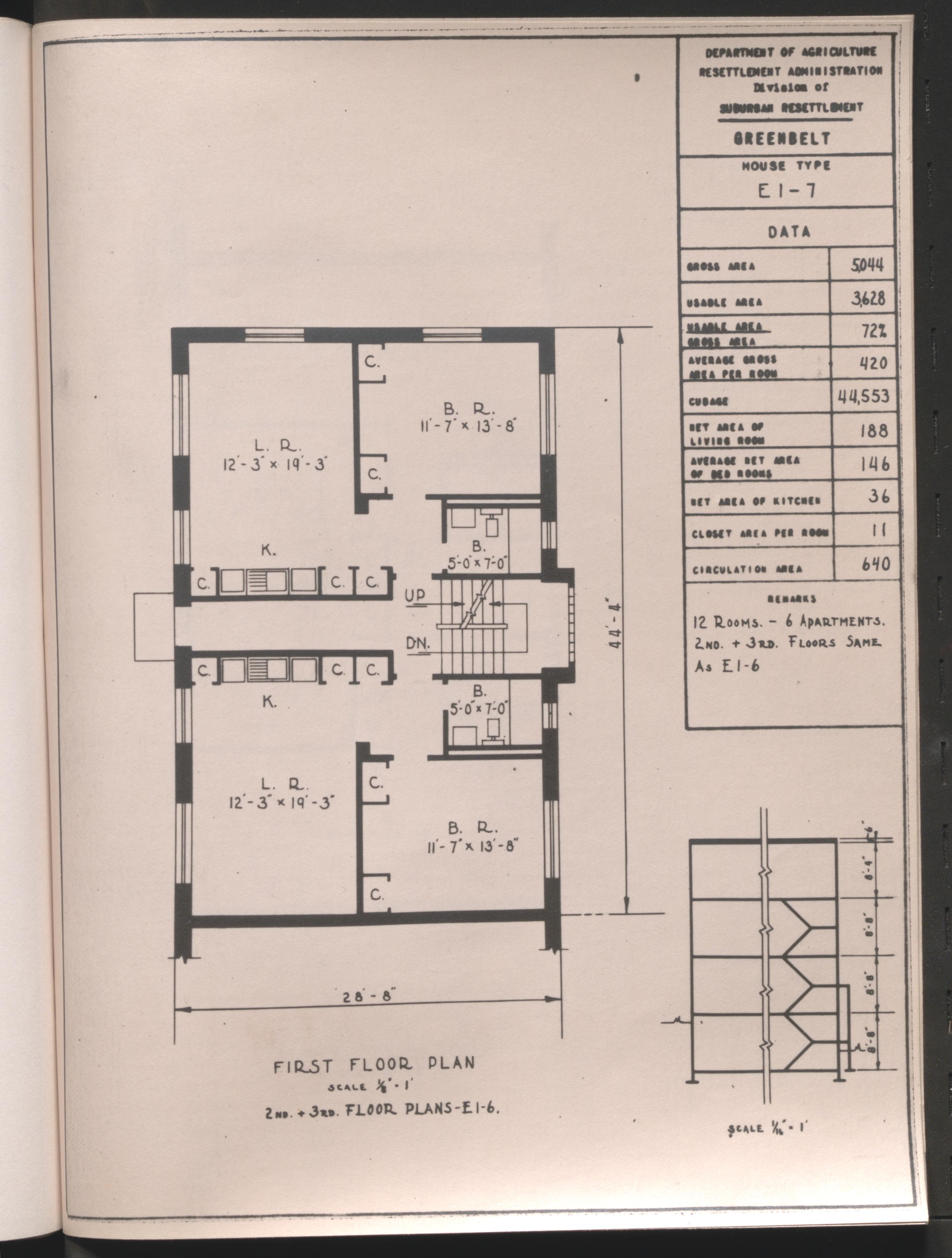
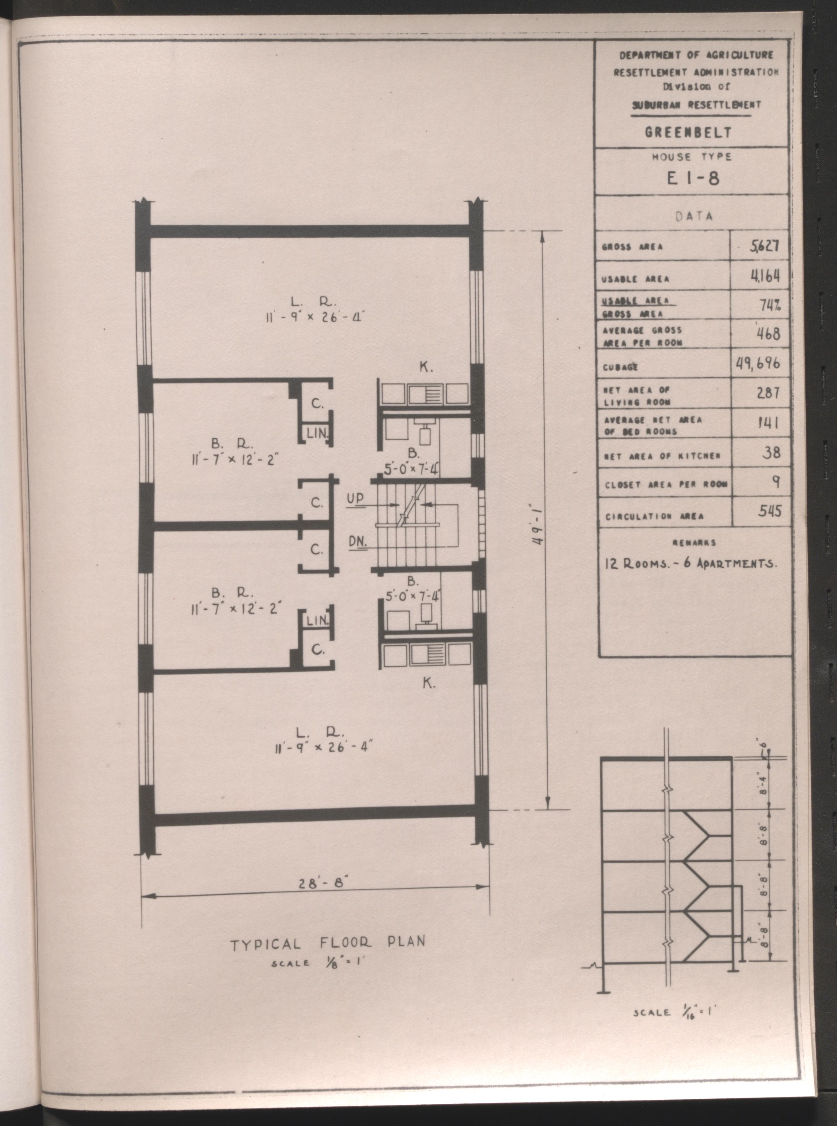
Sketch of Multi-family Building and individual unit floor plans, Greenbelt, Maryland, undated
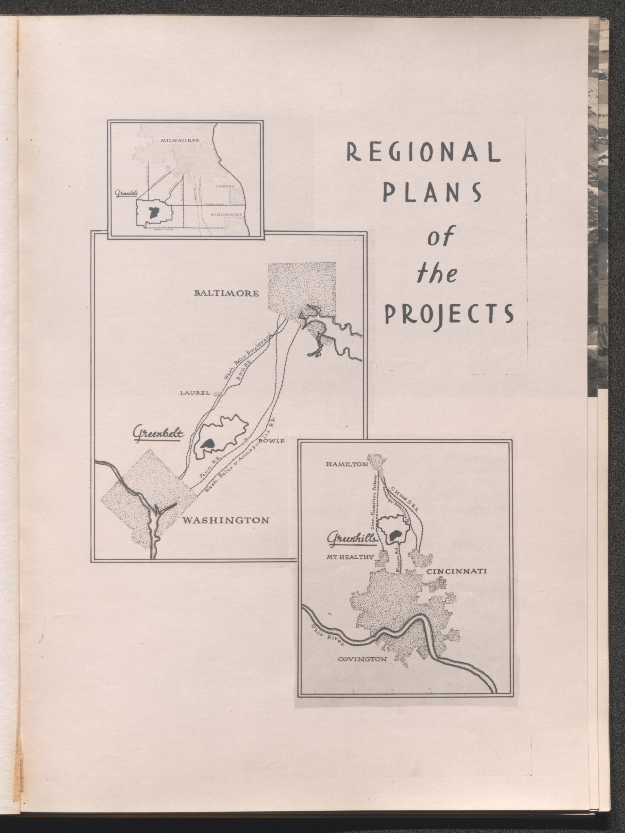
Regional plan Greenbelt, Maryland; map shows town site placement between Washington, DC and Baltimore, Md., undated
Poster of building material photos with messages; Private Industry Profited By and For materials used on Resettlement Administration Projects. This means jobs for thousands more., typed on back of image - "Resettlement Administration Exhibit", undated
Photo of artists sketch a typical super-block at Greenbelt, Maryland, brief essay titled "Designed For Living" in storage with print, undated
Workers in fenced line with steps to bed of Resettlement Administration truck, hand written on back of image - "Working men at // Greenbelt, Md.", undated
Typed on back of image - "Completed cinder-block house Greenbelt, Md.", undated
Two men handling paperwork on bank of built lake, hand written on back of image - "Lake at Greenbelt, Md.", undated
Dining table set for coffee for four, hand written on back of image - "Greenbelt, Md.", undated
Furnished living room, hand written on back of image - "Greenbelt, Md.", undated
Two men tip bucket releasing fish into lake with small crowd observing from shore, typed on back of image - "Stocking the 25-acre lake with fish at the Greenbelt, Md. Project", undated
Furnished bedroom, typed on back of image - "Bedroom interior, Greenbelt, Md.", undated
Furnished living room, hand written on back of image - "Greenbelt, Md.", undated
Furnished living room, typed on back of image - "Interior at Greenbelt, Maryland", undated
Multifamily building in Greenbelt near completion, brief essay, titled "Relief from Urban Congestion", attached to back of image, undated
Other construction begins adjacent to row of multifamily buildings near completion, brief essay, titled "No Jerry-Building Here", in storage with print, undated
Workers on scaffolding paint the cinder block exterior of a multifamily building, brief essay, titled "Finishing Touches to a Modern Design", attached to back of image, undated
Nurse providing treatment to mans hand as another man observes, typed on back of image - "First Aid Room at the Greenbelt Project, Maryland", undated
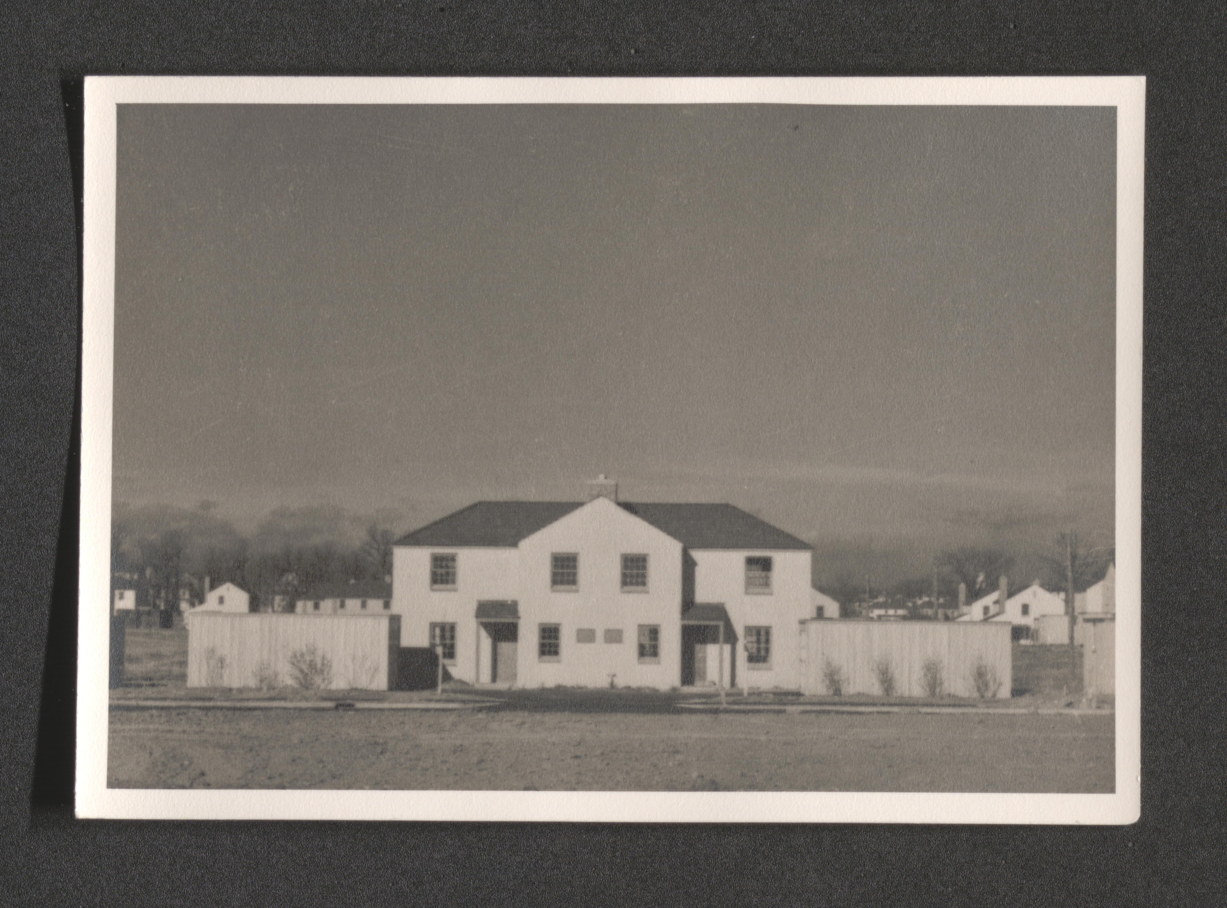
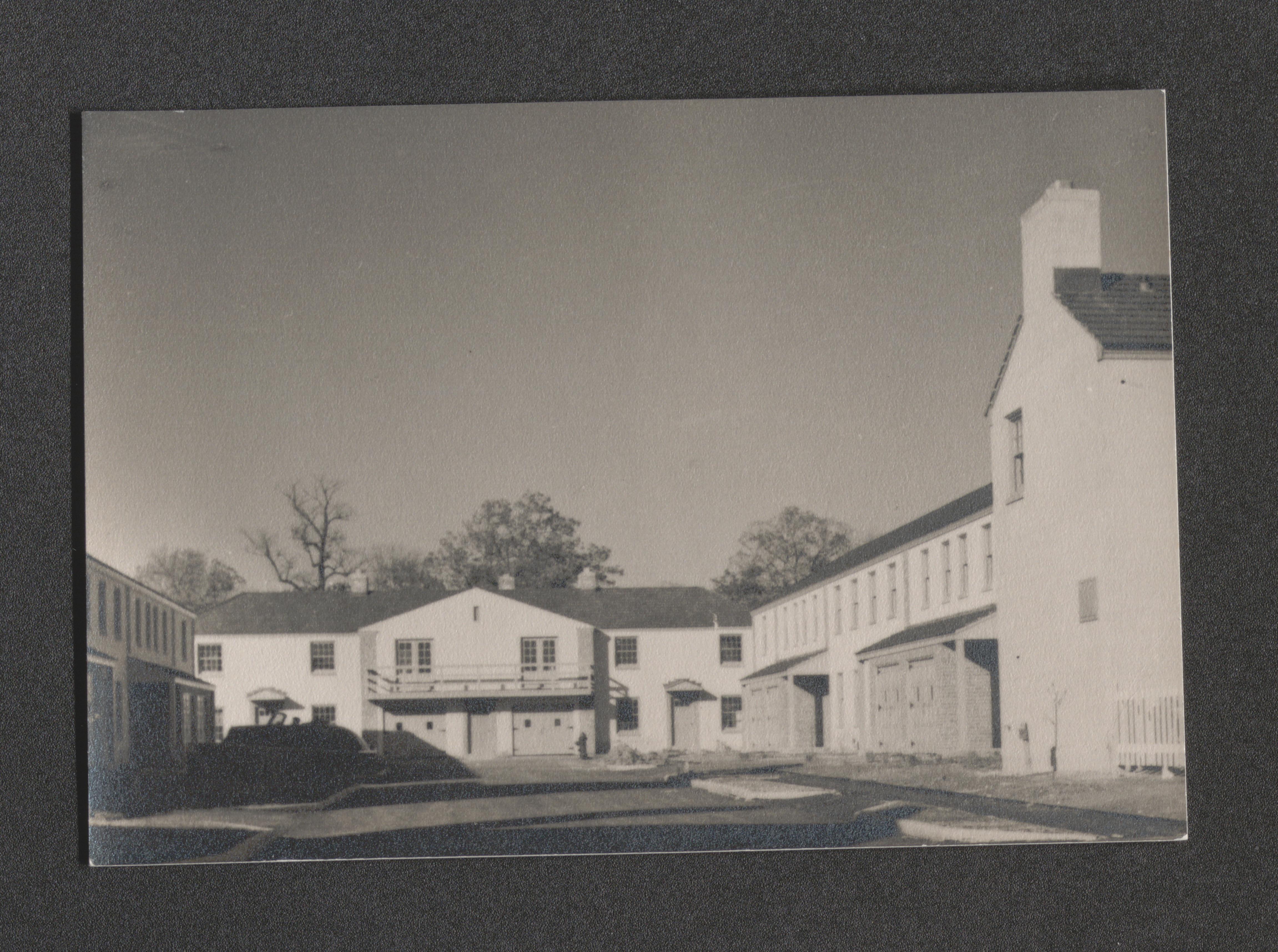
End of row completed multifamily buildings, hand written on back of image - "Greenbelt, Md.", undated
Completed multifamily building, hand written on back of image - "Greenbelt, Md.", undated
Hand written on back of image - "Old Snowden mansion included in Biological Survey at Greenbelt, Md. Built in 18th century", undated
Hand written on back of image - "Greenbelt nursery; shrubs taken from property", undated
Man pushing shovel into ground near timbers framing break in ground surface, hand written on back of image - "Remains of an old bridge on the Washington and Baltimore Road", undated
Fenced off portion of wooded area at edge of dirt road, hand written on back of image - "Graveyard of Walker family, old owners of Greenbelt area. Graves of three revolutionary soldiers were found here", undated
Man stands with arm against tree trunk, hand written on back of image - "Angus B. McGregor, landscapist and nursery manager at Greenbelt, Md. Formerly worked at Scone Palace, Scotland and for J.P. Morgan", undated
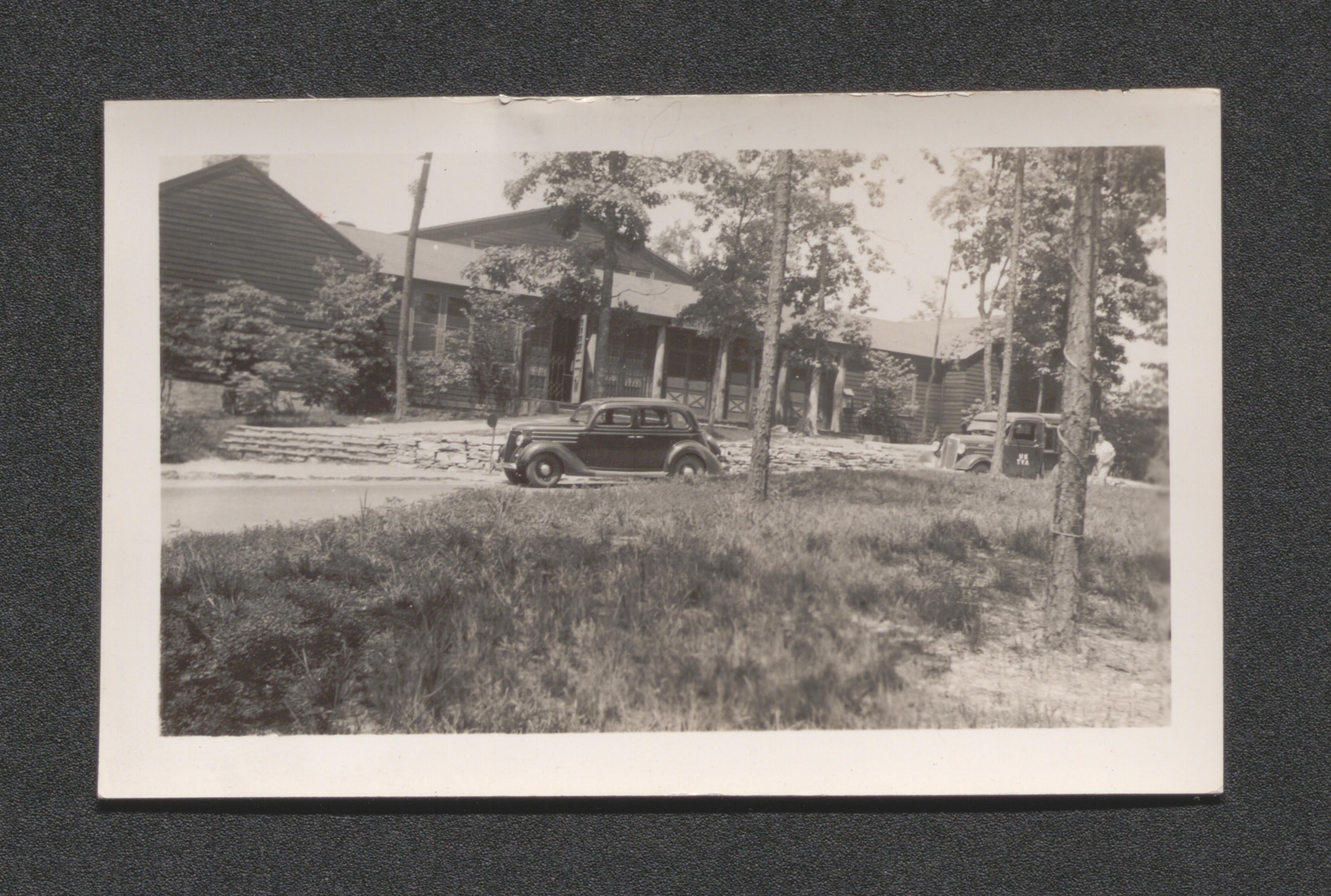
Hand written on back of image - "One of the supply depots at Greenbelt, Md. Tile pipes and lumber"
Back of surveyor viewing over construction, hand written on back of image - "Sewage disposal plant. Greenbelt", undated
Work crew laying building foundation with further developed buildings in background, hand written on back of image - " Construction at Greenbelt. July 1936", 1936 July
- Box 21, item 78
Scope and Contents
Resettlement Administration Photograph by Brooks. Oversize duplicate Box 24, Item 16.
Men working at lumber pile near buildings under construction, hand written on back of image - "Construction at Greenbelt, Md.", undated
- Box 21, item 79
Scope and Contents
Resettlement Administration Photograph by Brooks. Oversize duplicate Box 24 Item 17.
Workers and truck on dirt road near buildings under construction, hand written on back of image - "Construction at Greenbelt", undated
Two well dressed men standing on floor where two workers are preparing for cement pouring, undated
Four men conversing while standing in construction area clearing, undated
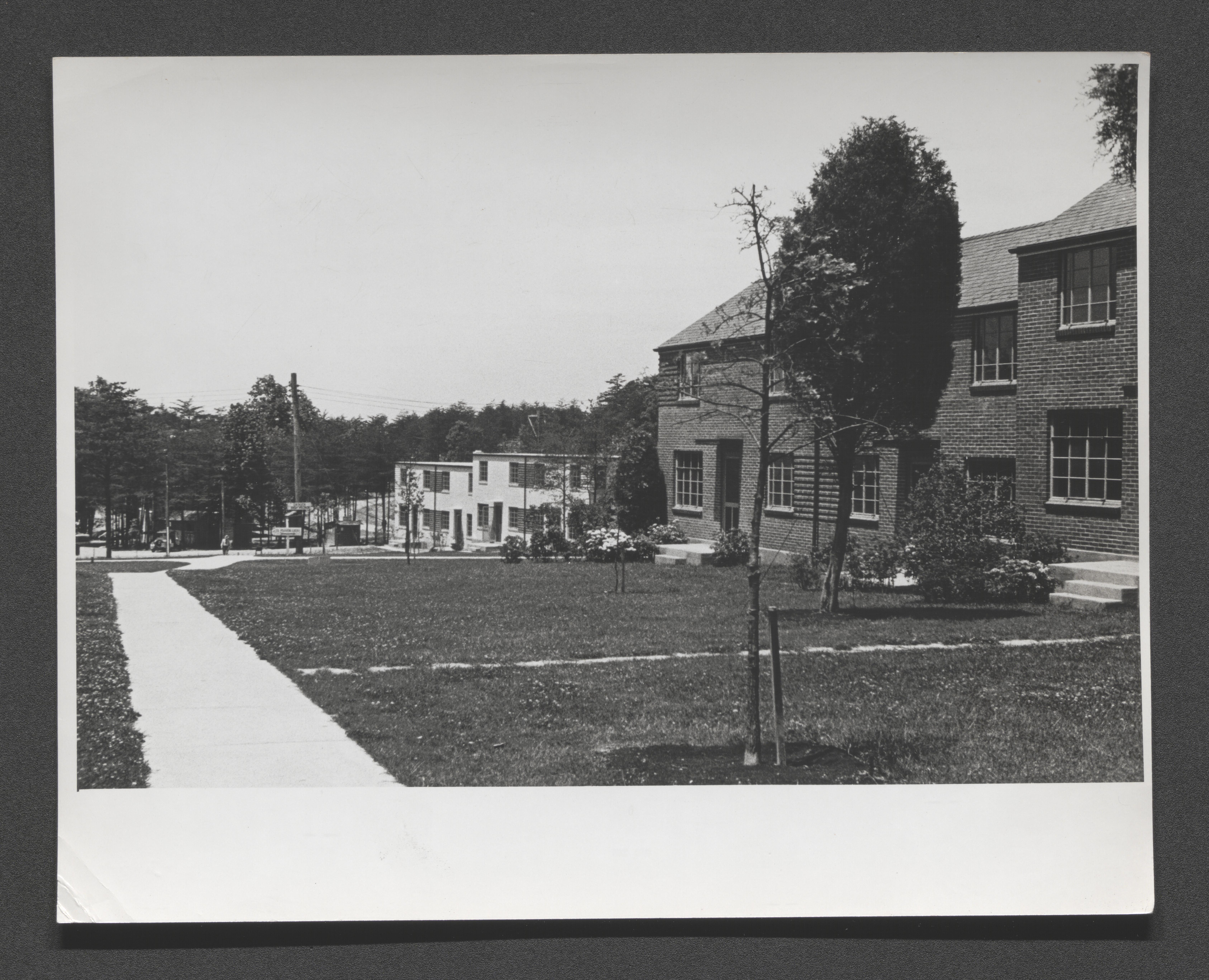
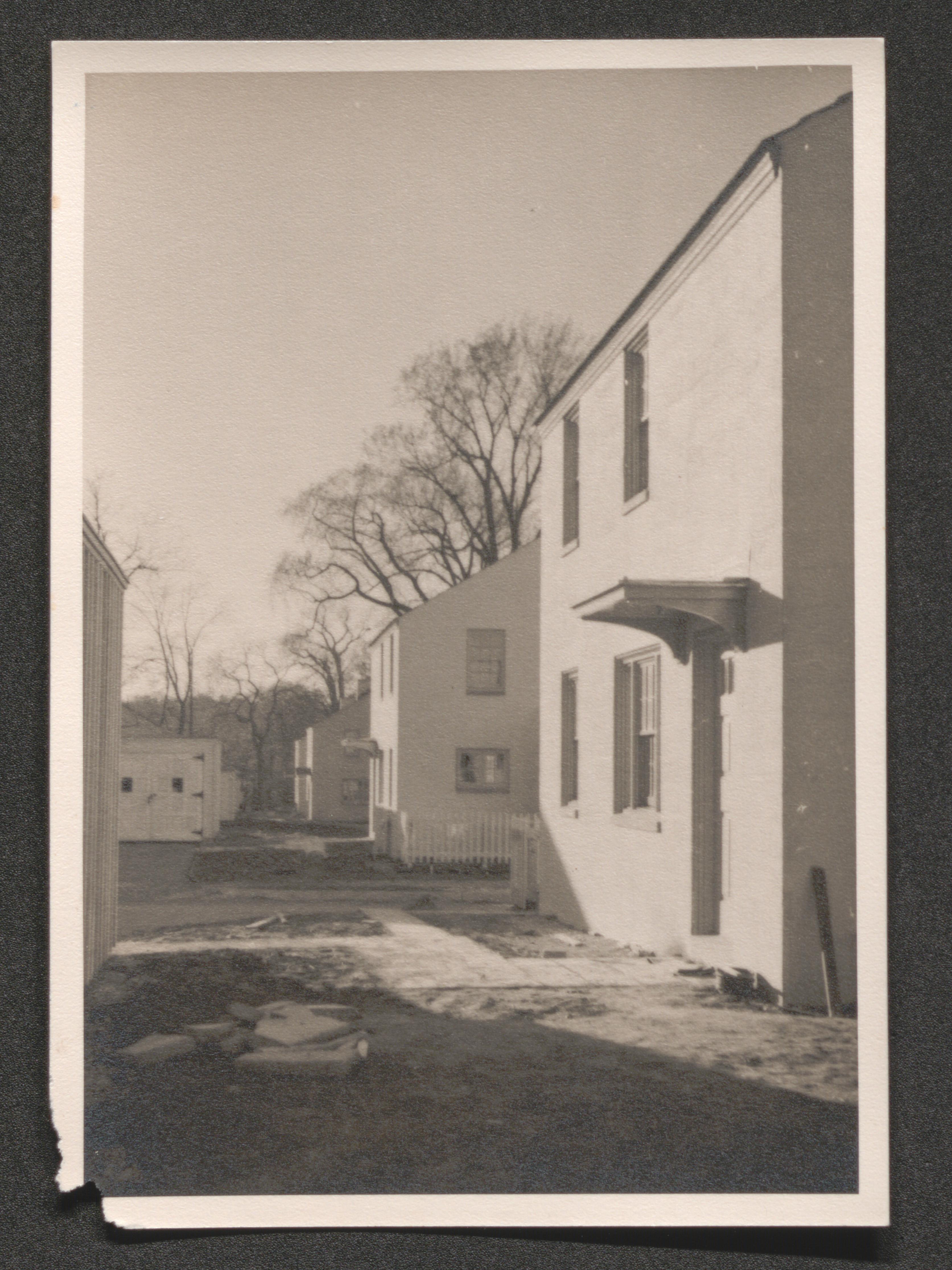
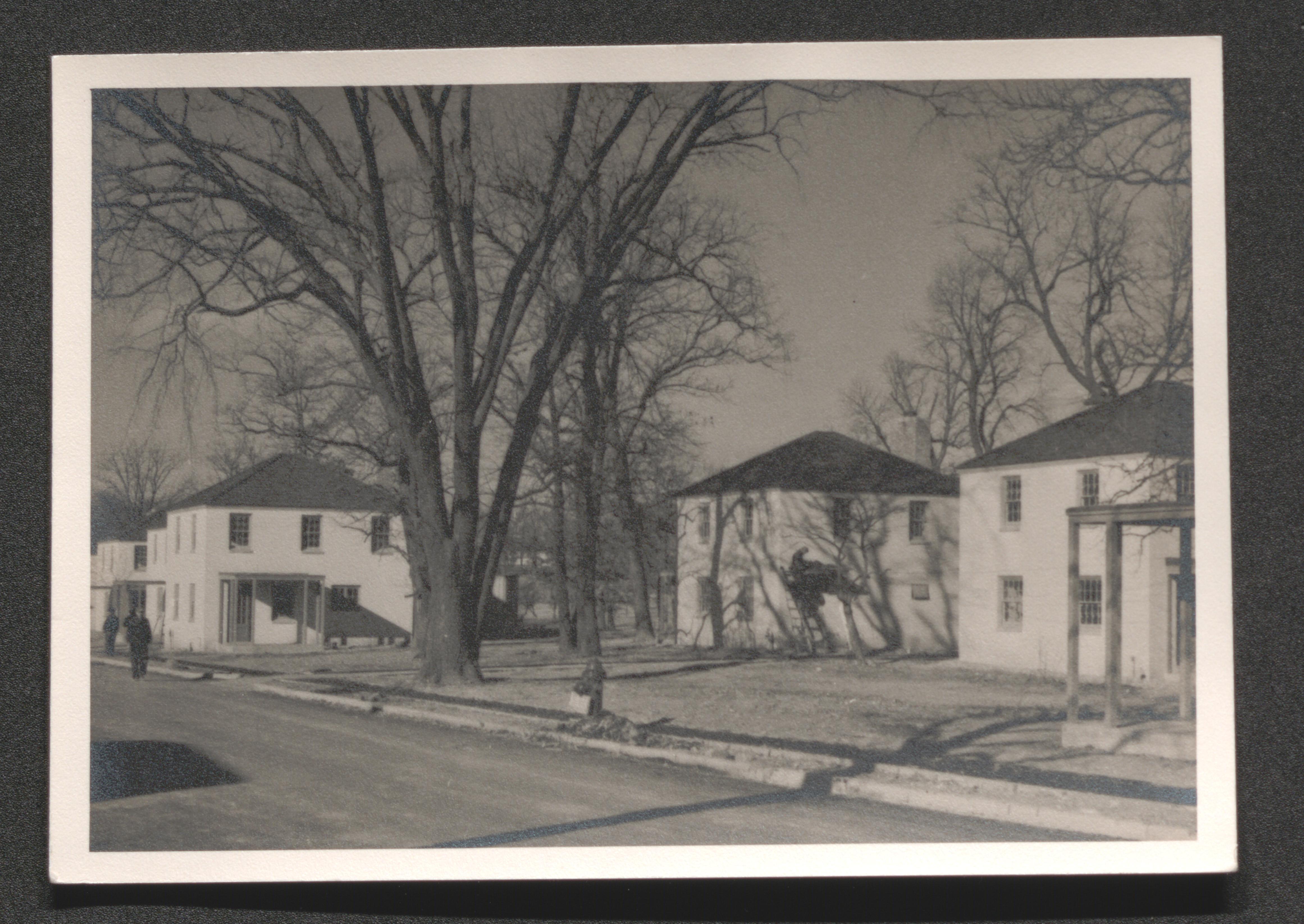
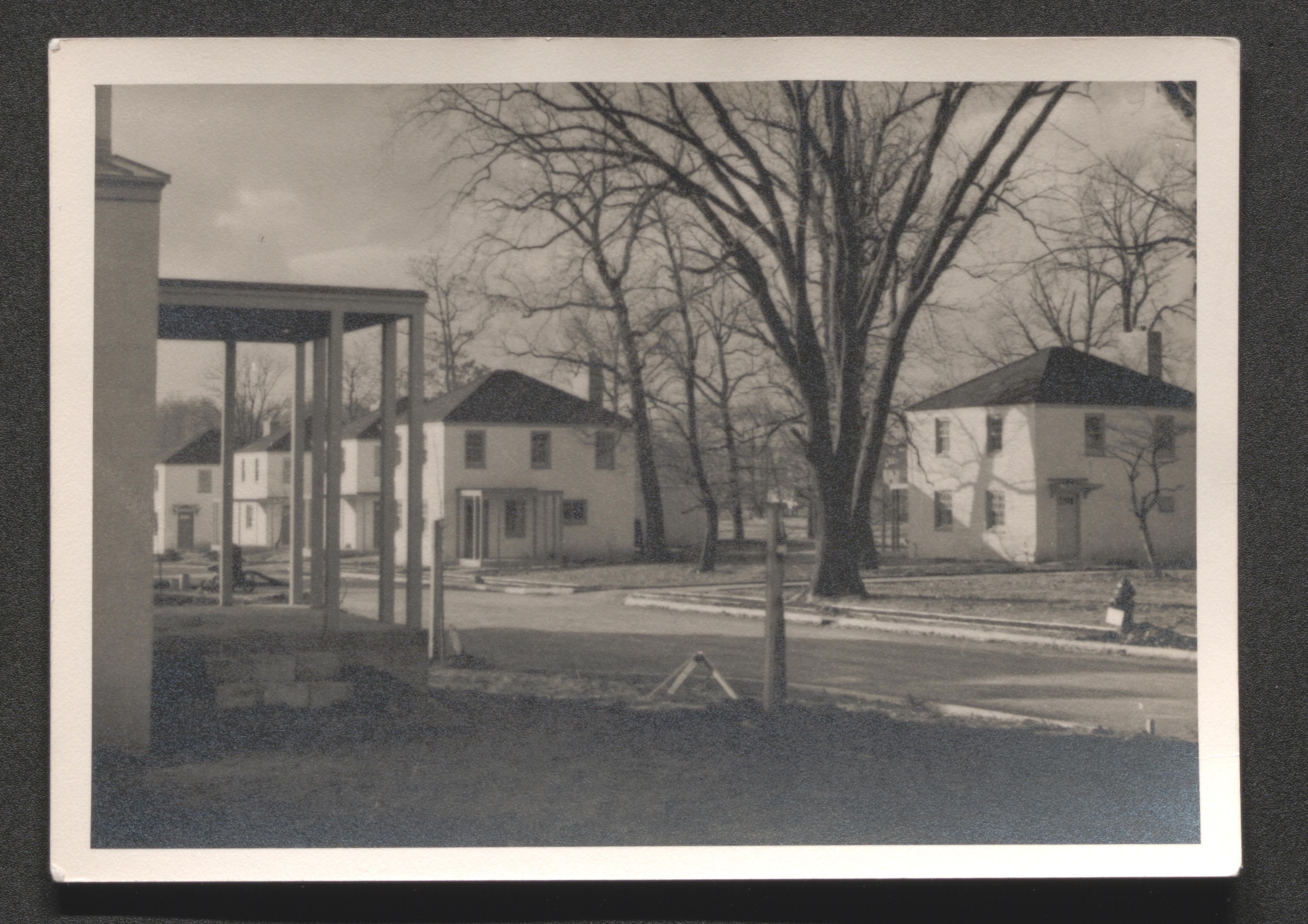
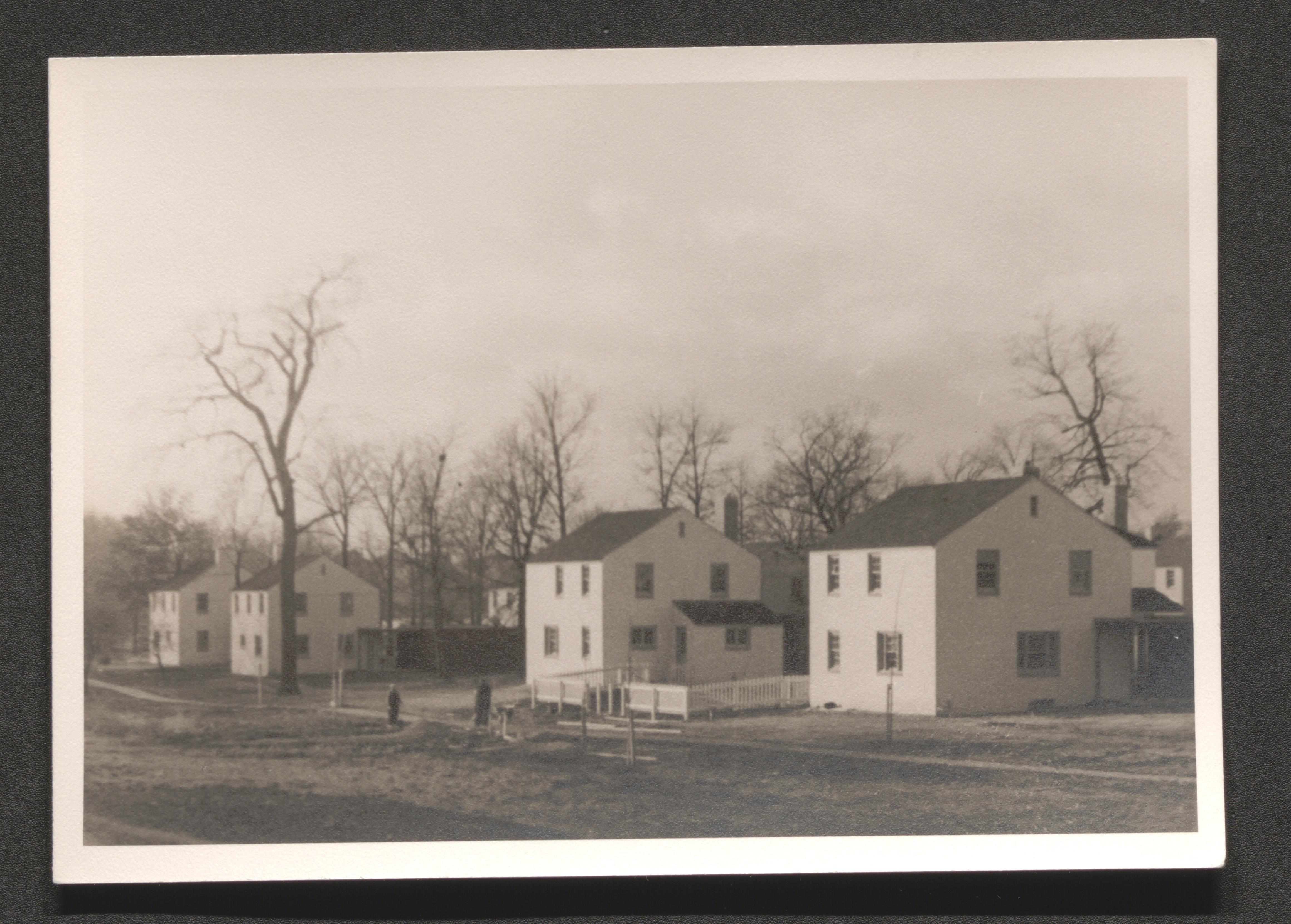
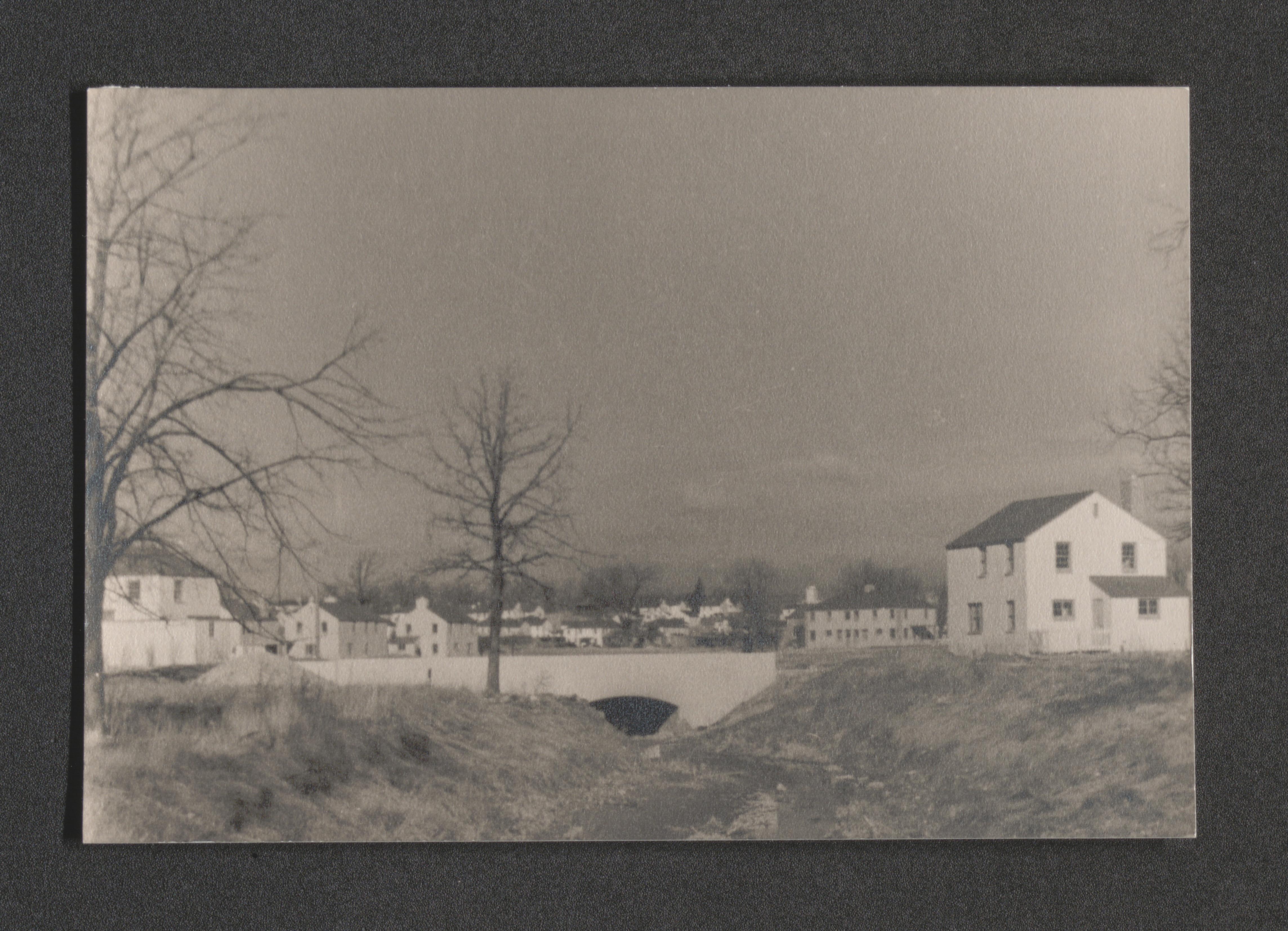
Two completed multifamily buildings on edge of grassy plot, hand written on back of image - "Greenbelt Md.", undated
Courtyard with many trees and housing units surrounding, hand written on back of image - "Greenbelt Md.", undated
View of one end of a completed multifamily housing unit, hand written on back of image "Greenbelt Md.", undated
Road bridge over sidewalk, hand written on back of image - "Greenbelt Md.", undated
Typed on border below image - "Site staked out ready for excavation", undated
Four men at edge of dig by track excavator, typed on border below image - " Machine excavation underway", undated
Typed on border below image - "Machine excavation complete - Start of excavation for footing", undated
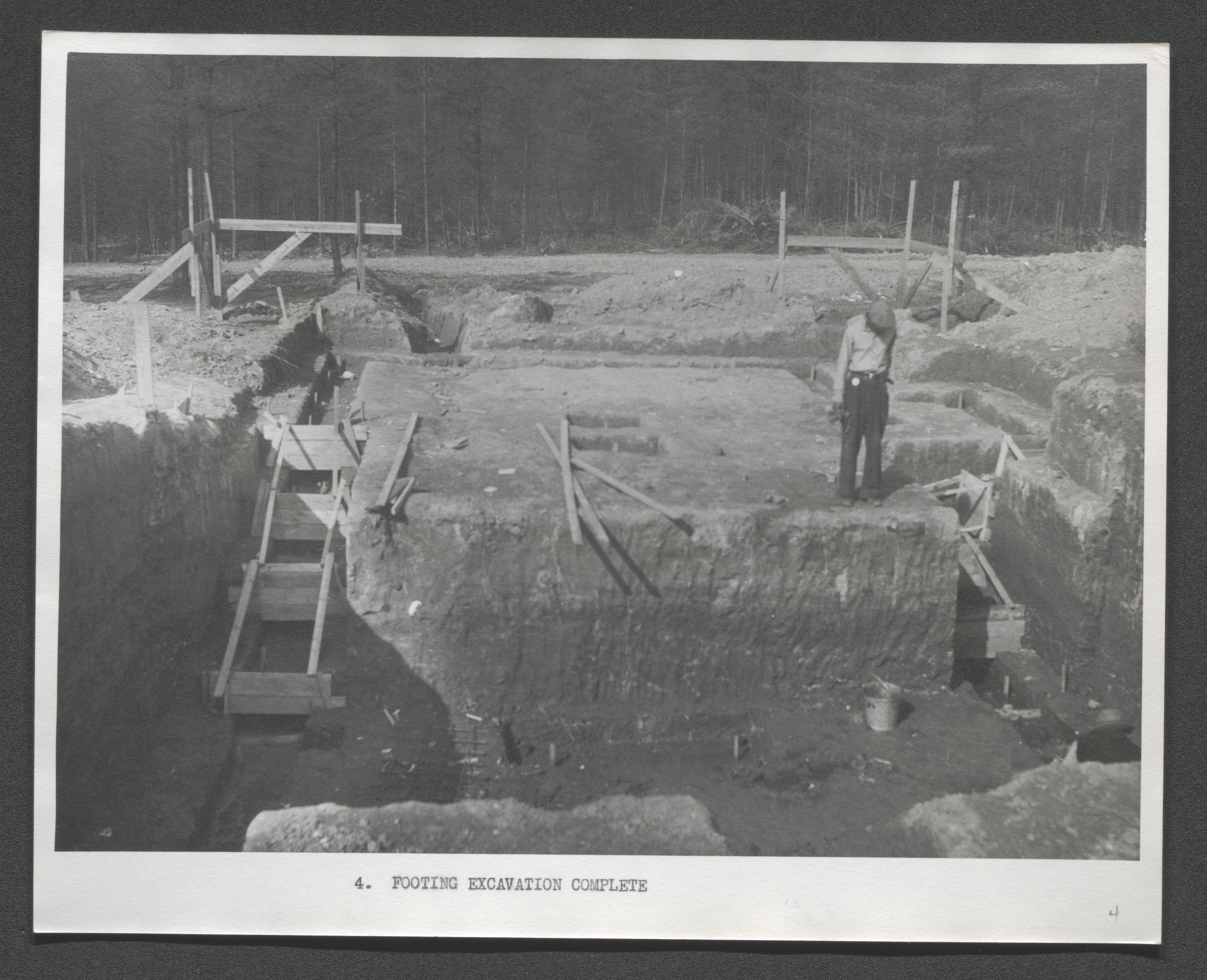
Typed on border below image - "Footing excavation complete", undated
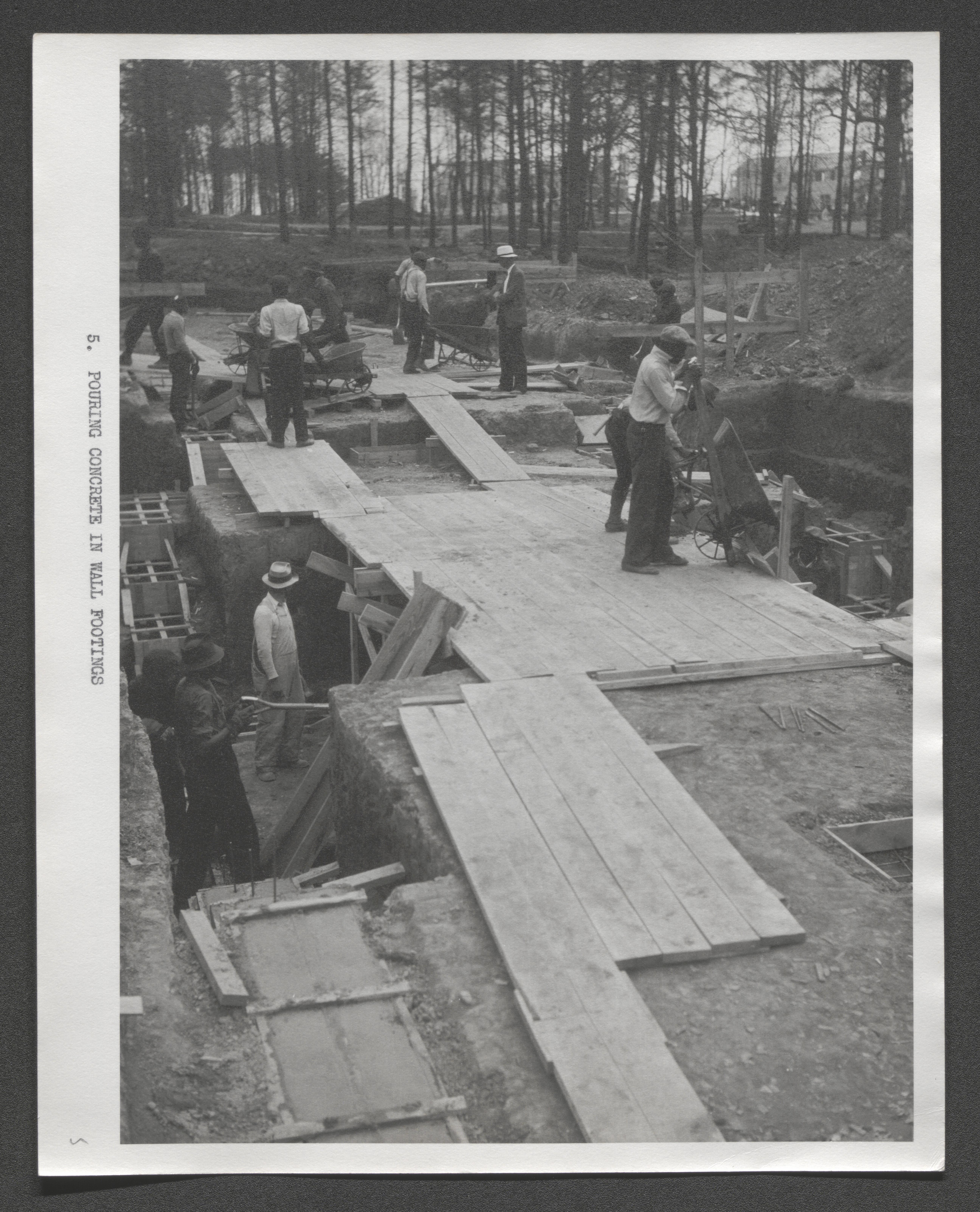
Many men working above and below ground with concrete footings, typed on border below image - "Pouring concrete in wall footings", undated
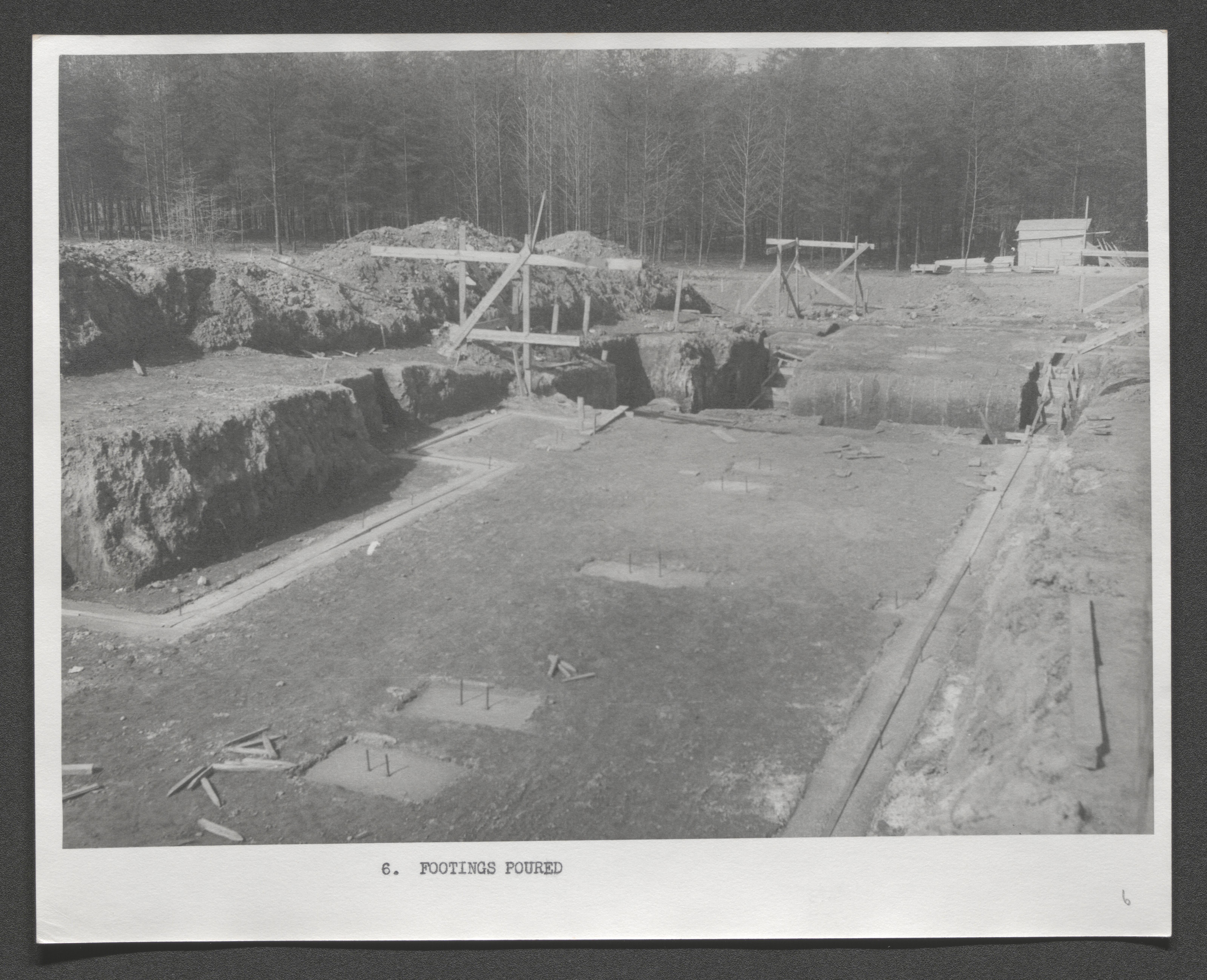
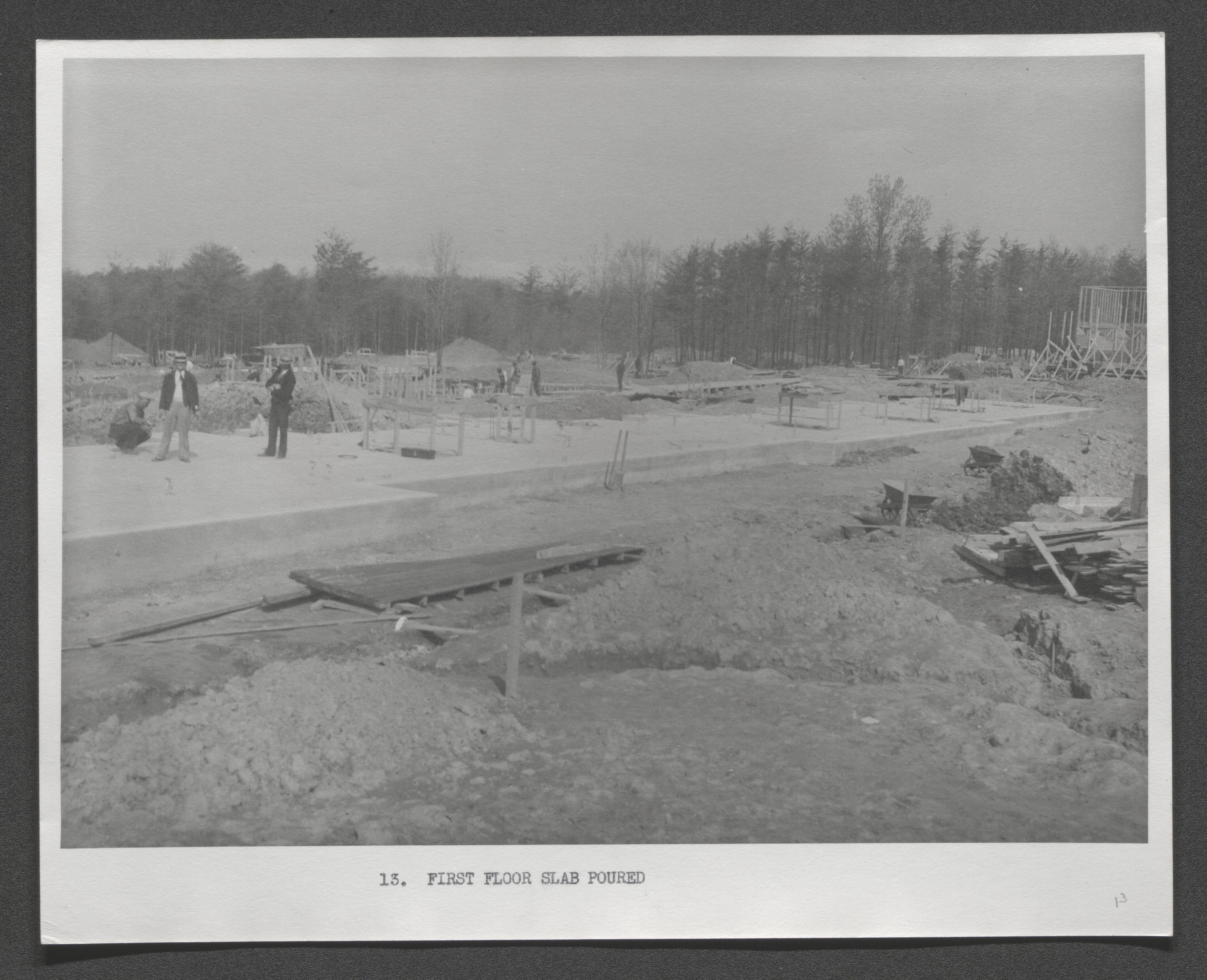
Typed on border below image - "Footings poured", undated
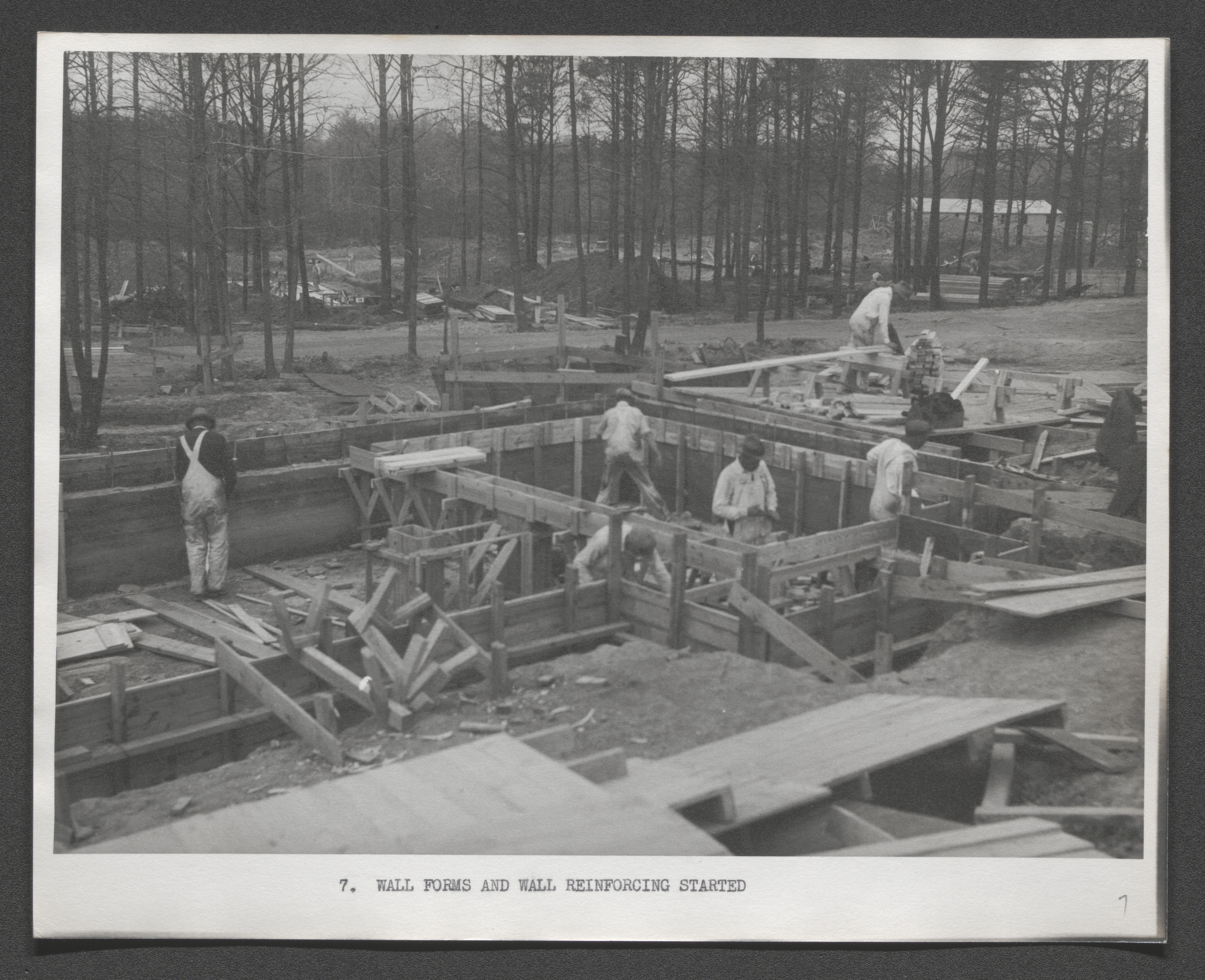
Building crew at work, typed on border below image - "Wall forms and wall reinforcing started", undated
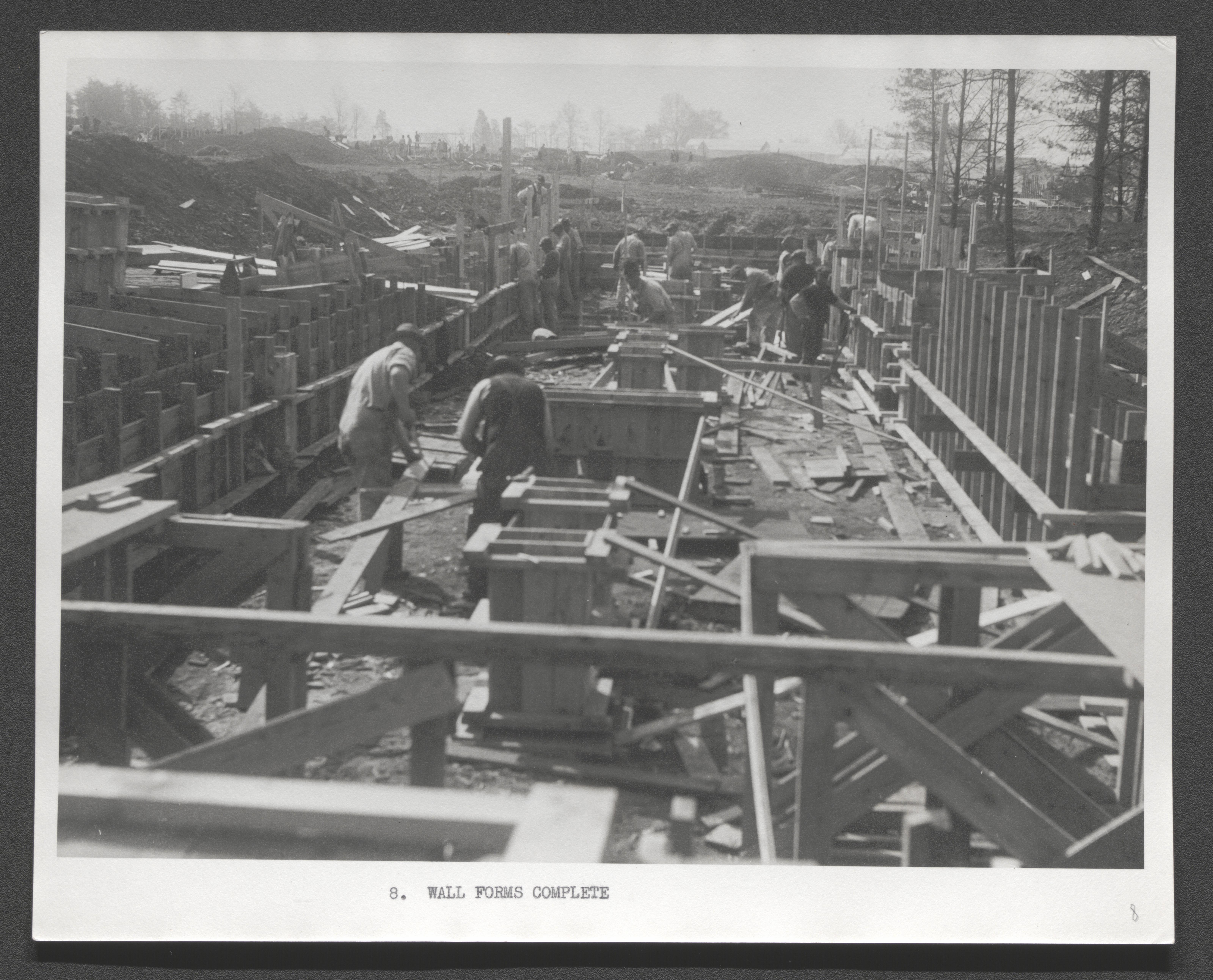
Building crew at work, typed on border below image - "Wall forms complete", undated
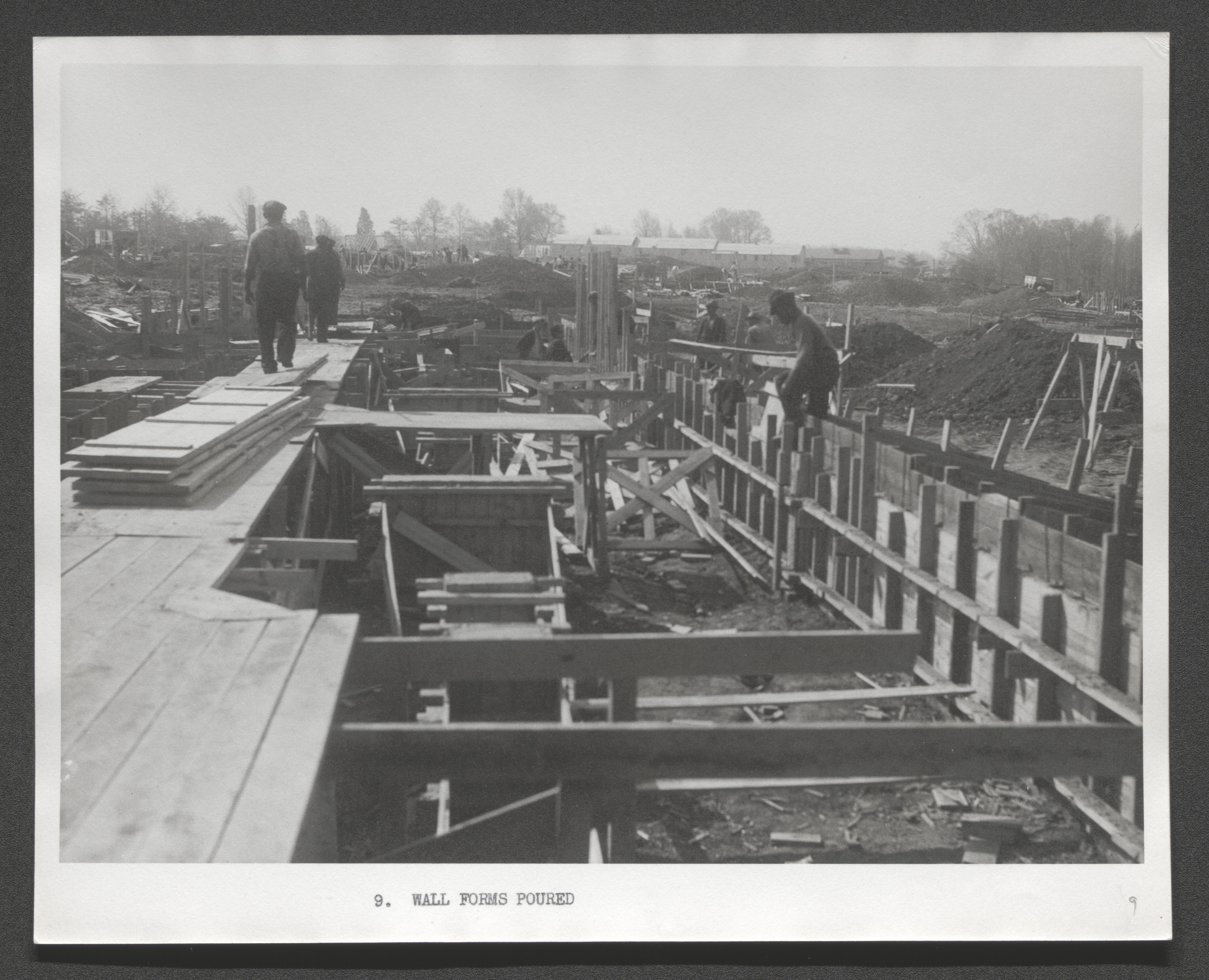
Building crew at work, typed on border below image - "Wall forms poured", undated
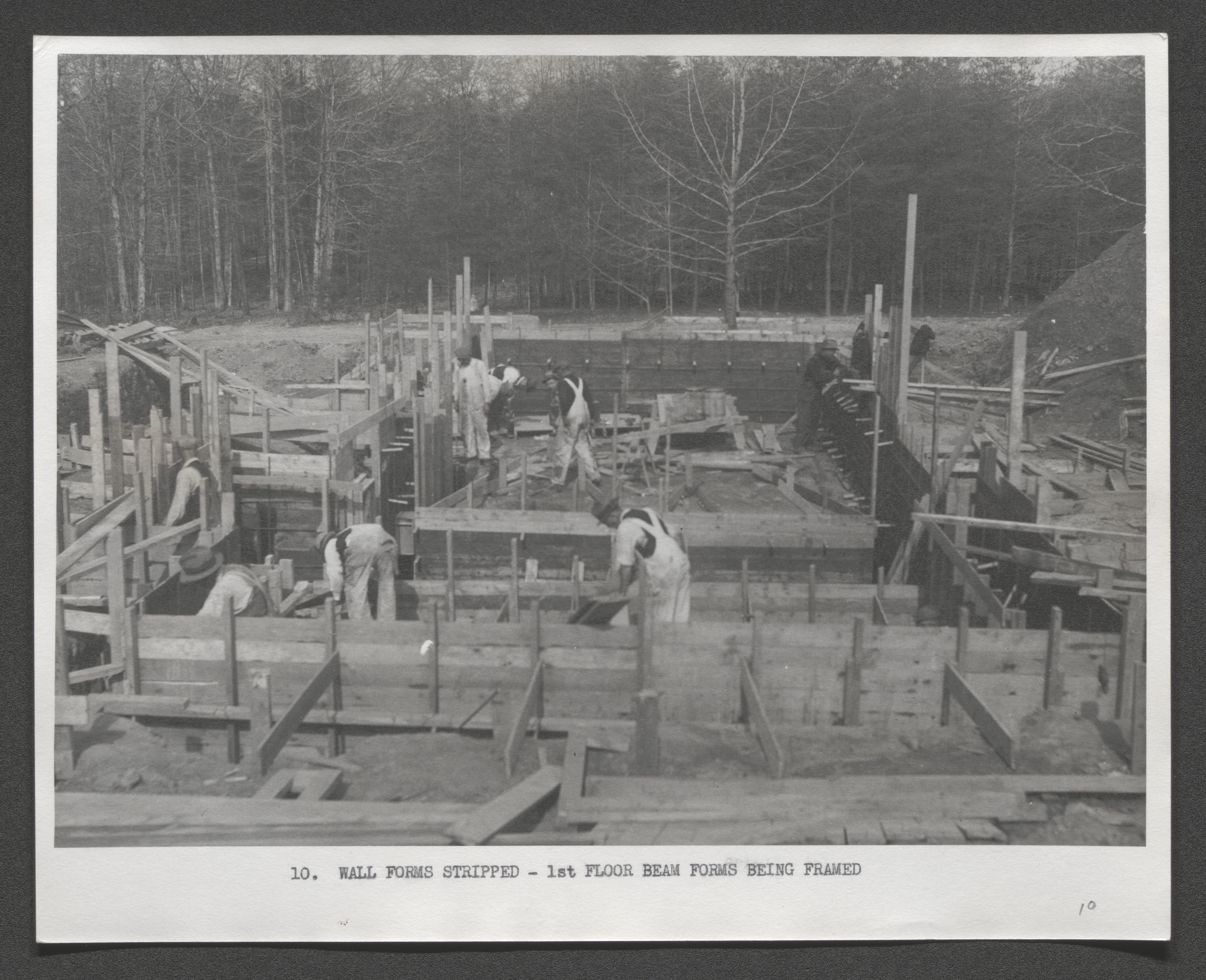
Building crew at work, typed on border below image - "Wall forms stripped - 1st floor beam forms being framed", undated
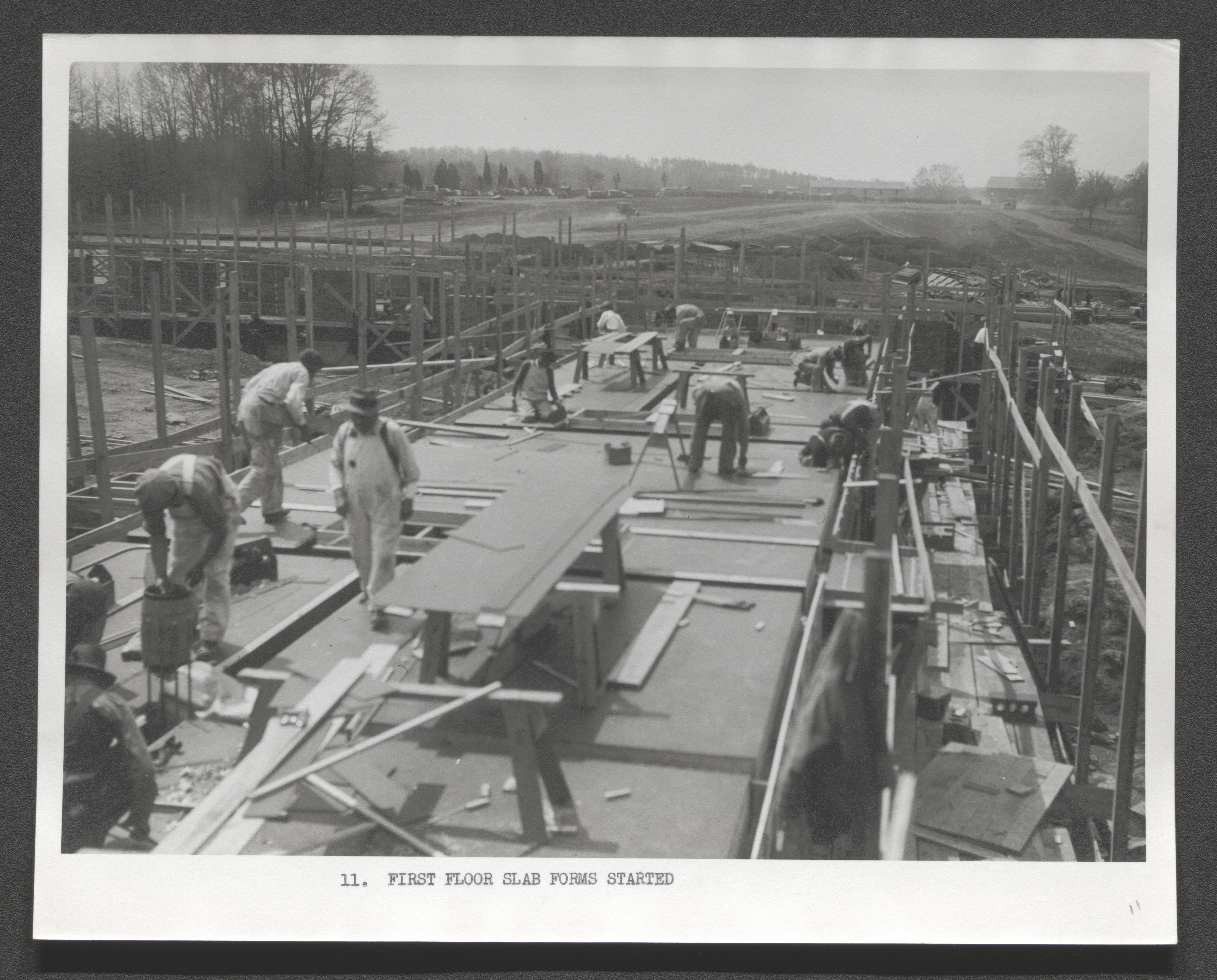
Building crew at work, typed on border below image - "First floor slab forms started", undated
Building crew at work, typed on border below image - "First floor ready for concrete, Reinforcing steel, plumbing and heating sleeves, and electric conduit set", undated
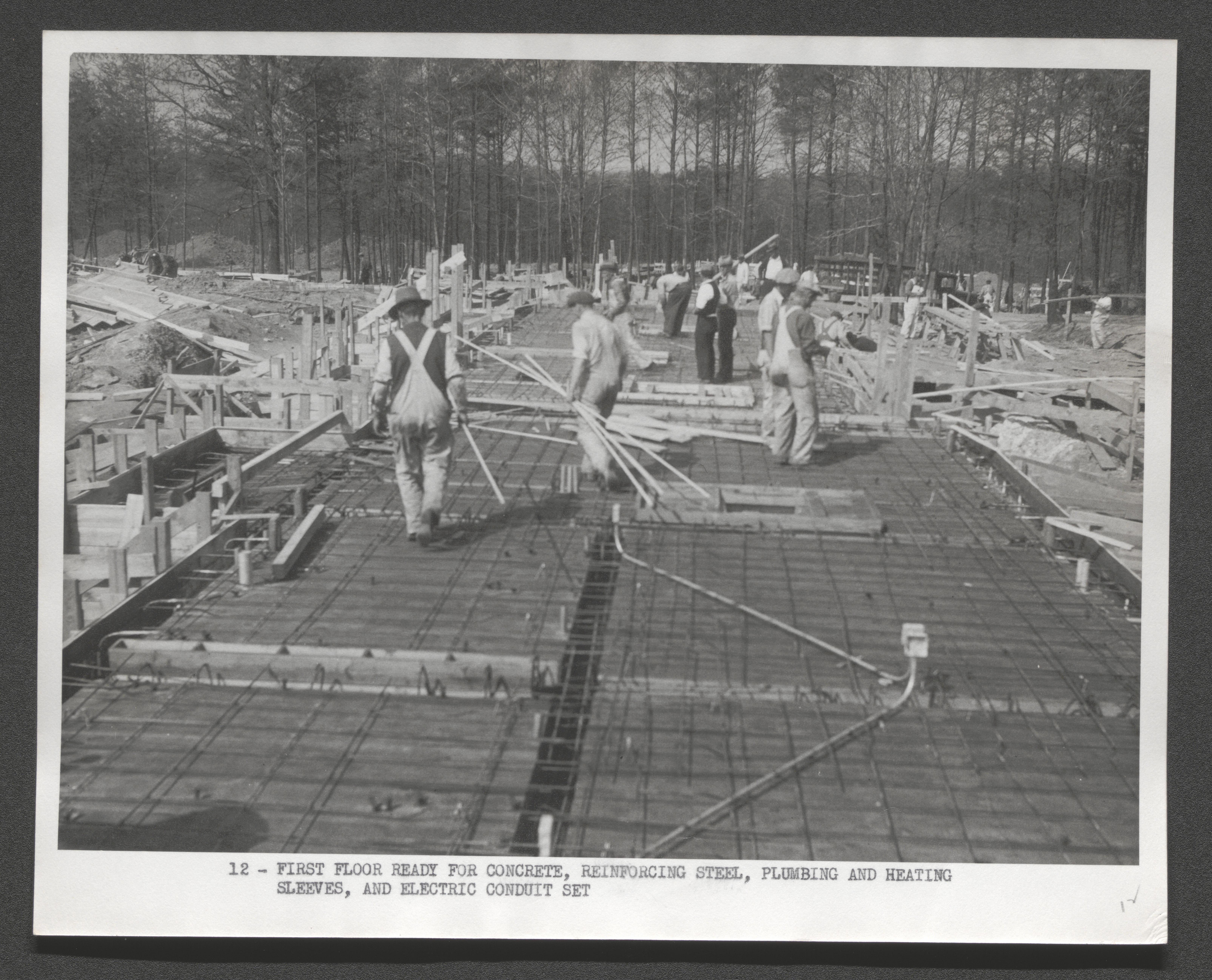
Typed on border below image - "First floor ready for concrete, Reinforcing steel, plumbing and heating sleeves, and electric conduit set", undated
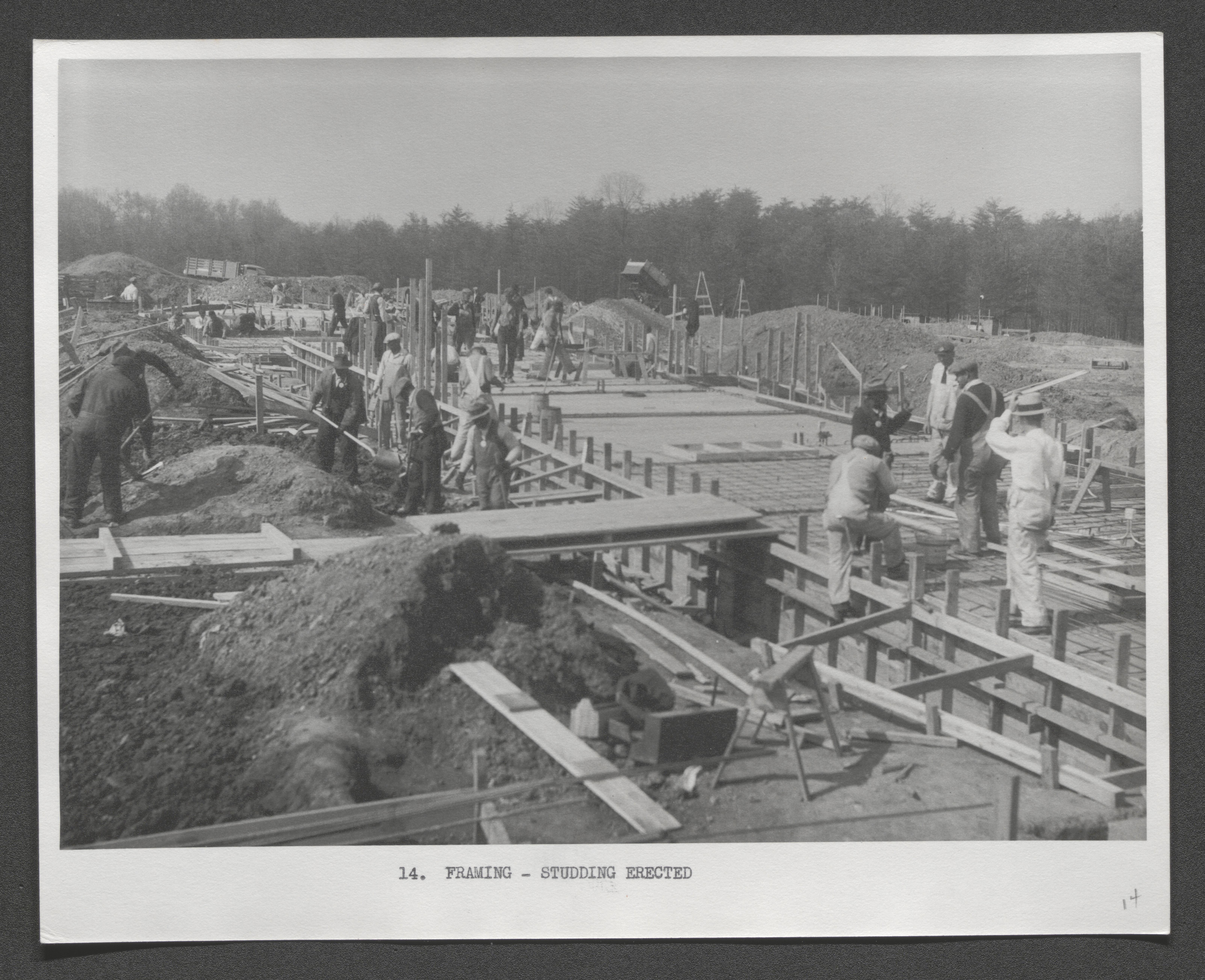
Building crew at work, typed on border below image "Framing - studding erected", undated
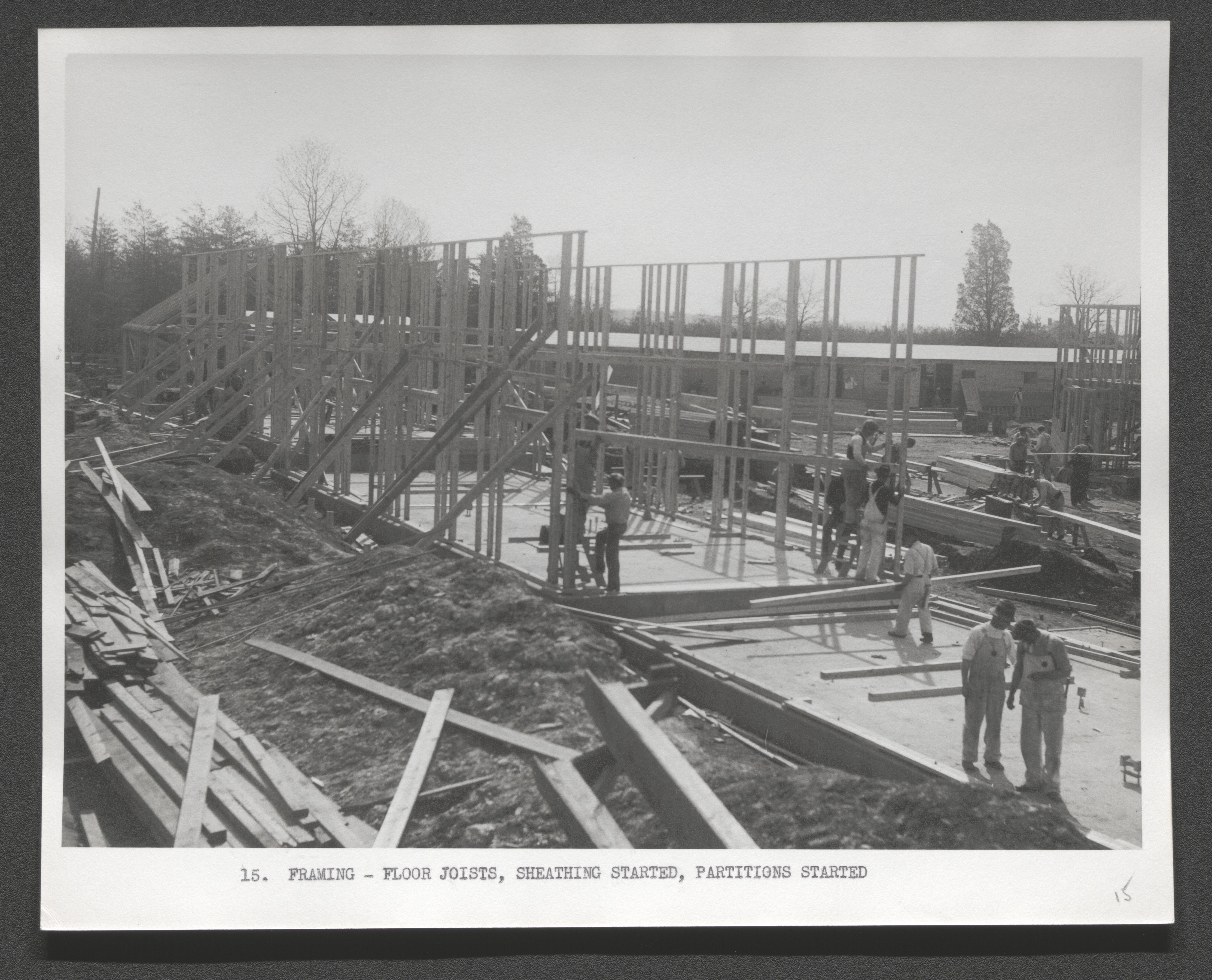
Building crew at work, typed on border below image - "Framing - floor joists, sheathing started, partitions started", undated
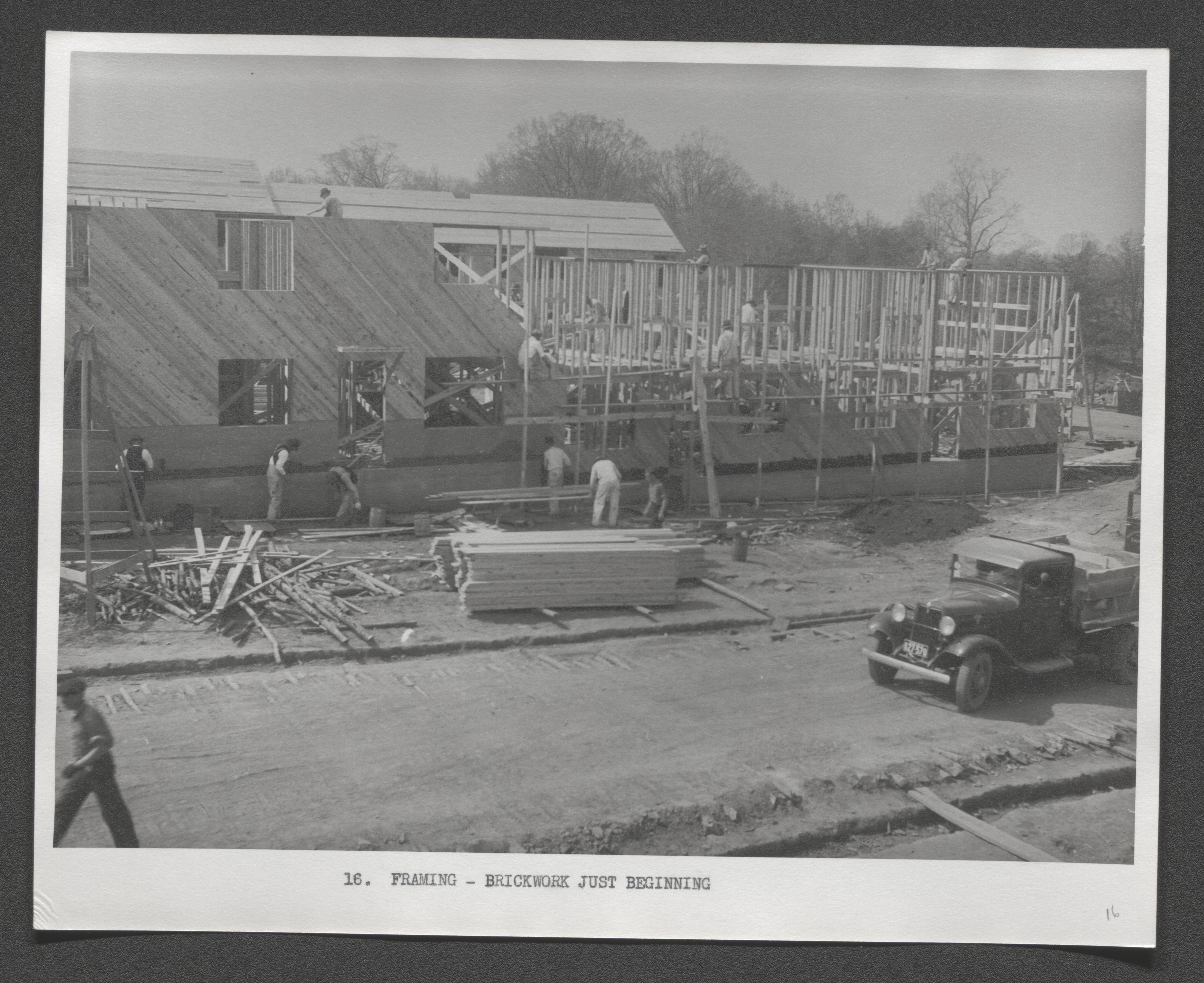
Building crew at work, typed on border below image "Framing - brickwork just beginning", undated
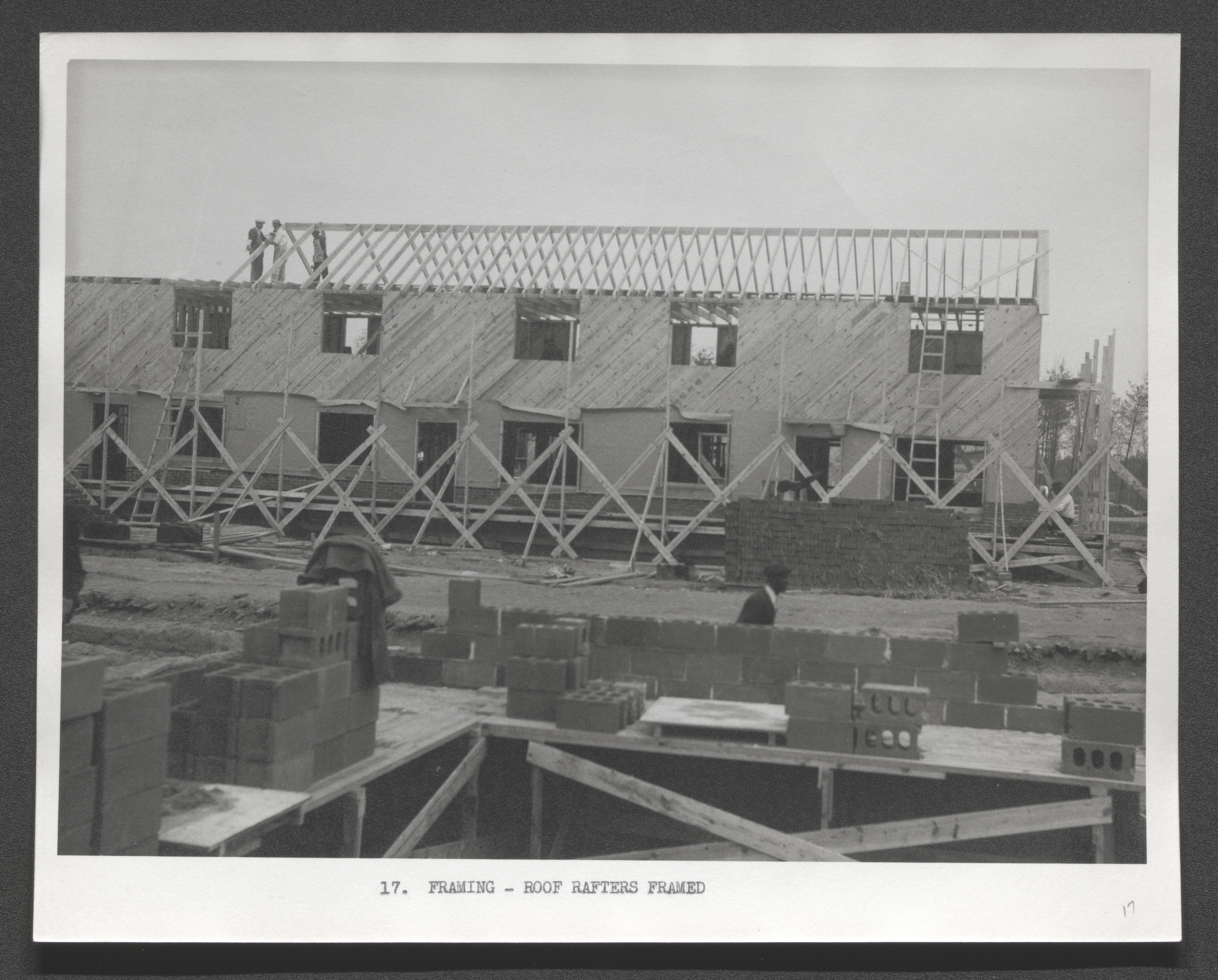
Building crew at work, typed on border below image - "Framing - roof rafters framed", undated
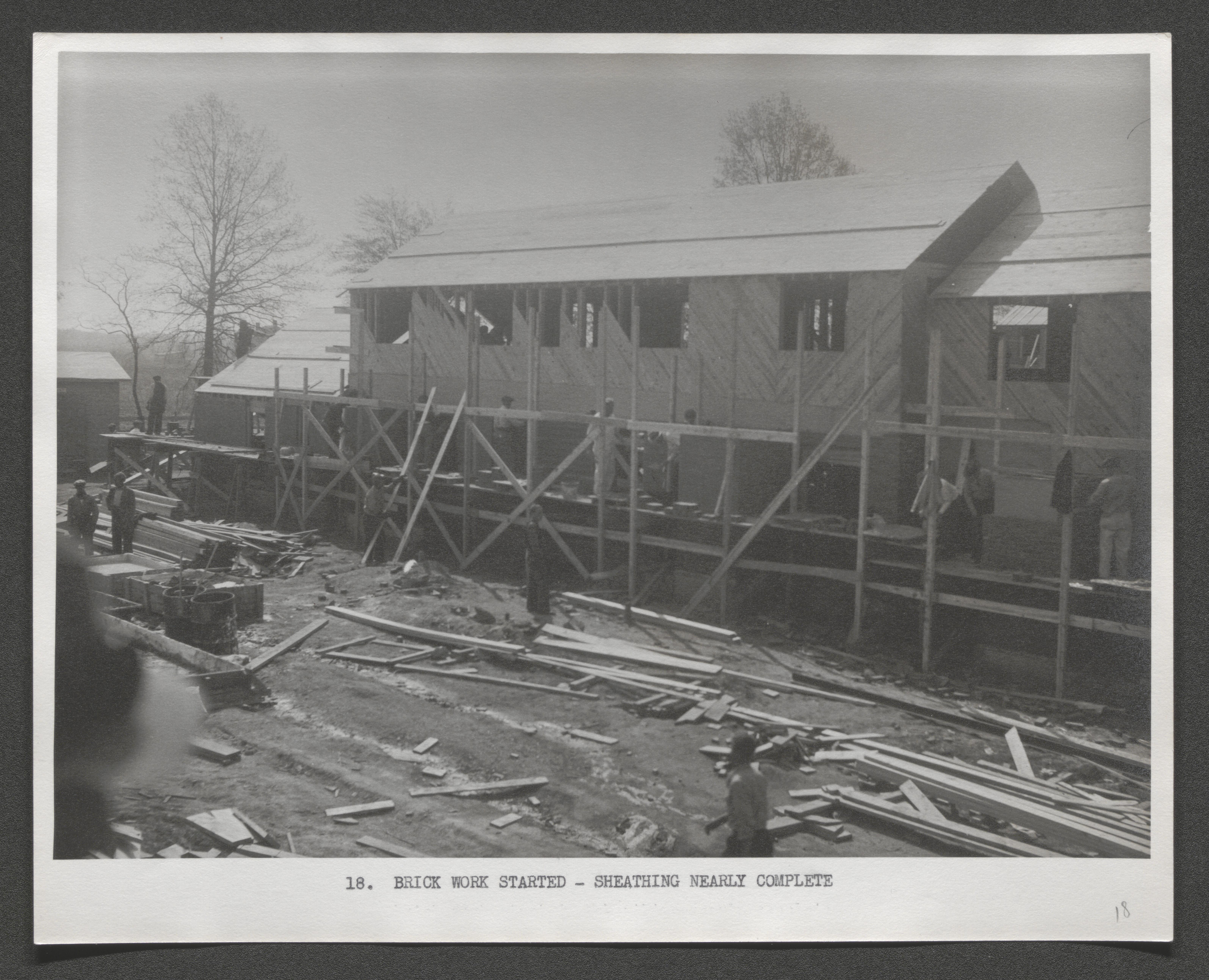
Building crew at work, typed on border below image - "Brick work started - sheathing nearly complete", undated
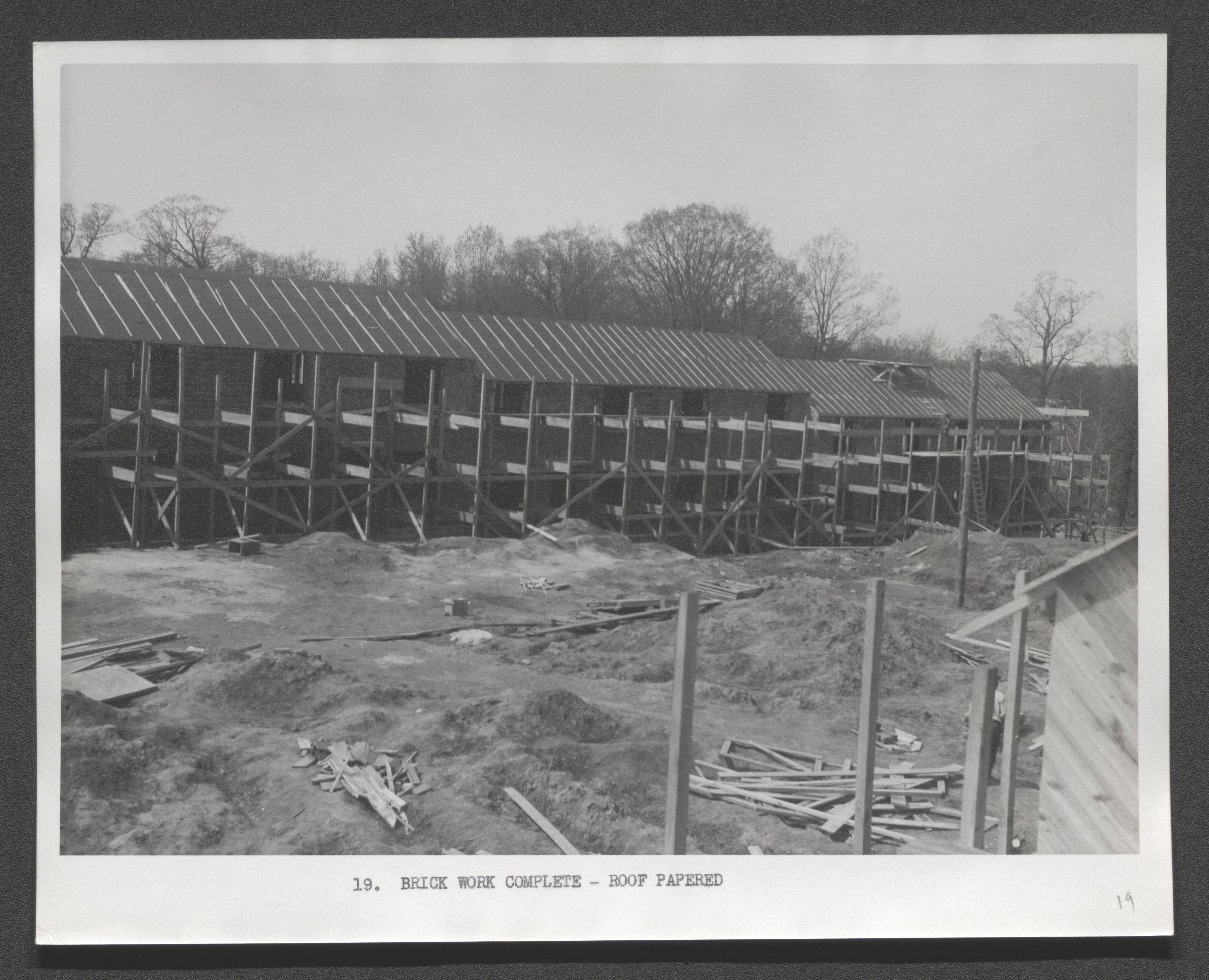
Scaffolding structure across building, typed on border below image - "Brick work complete - roof papered", undated
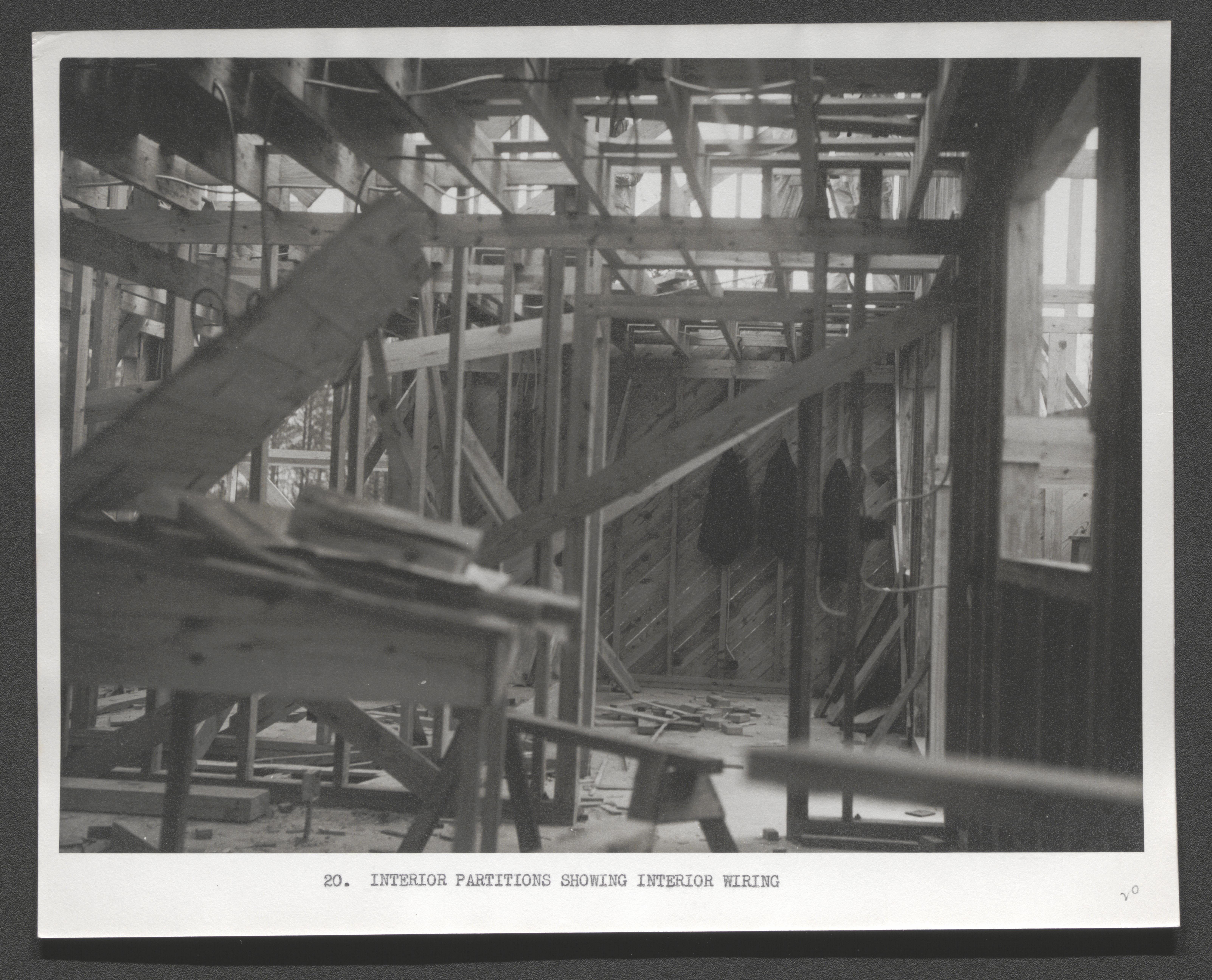
Interior construction view of ceiling joists and wall studs, typed on border below image - "Interior partitions showing interior wiring", undated
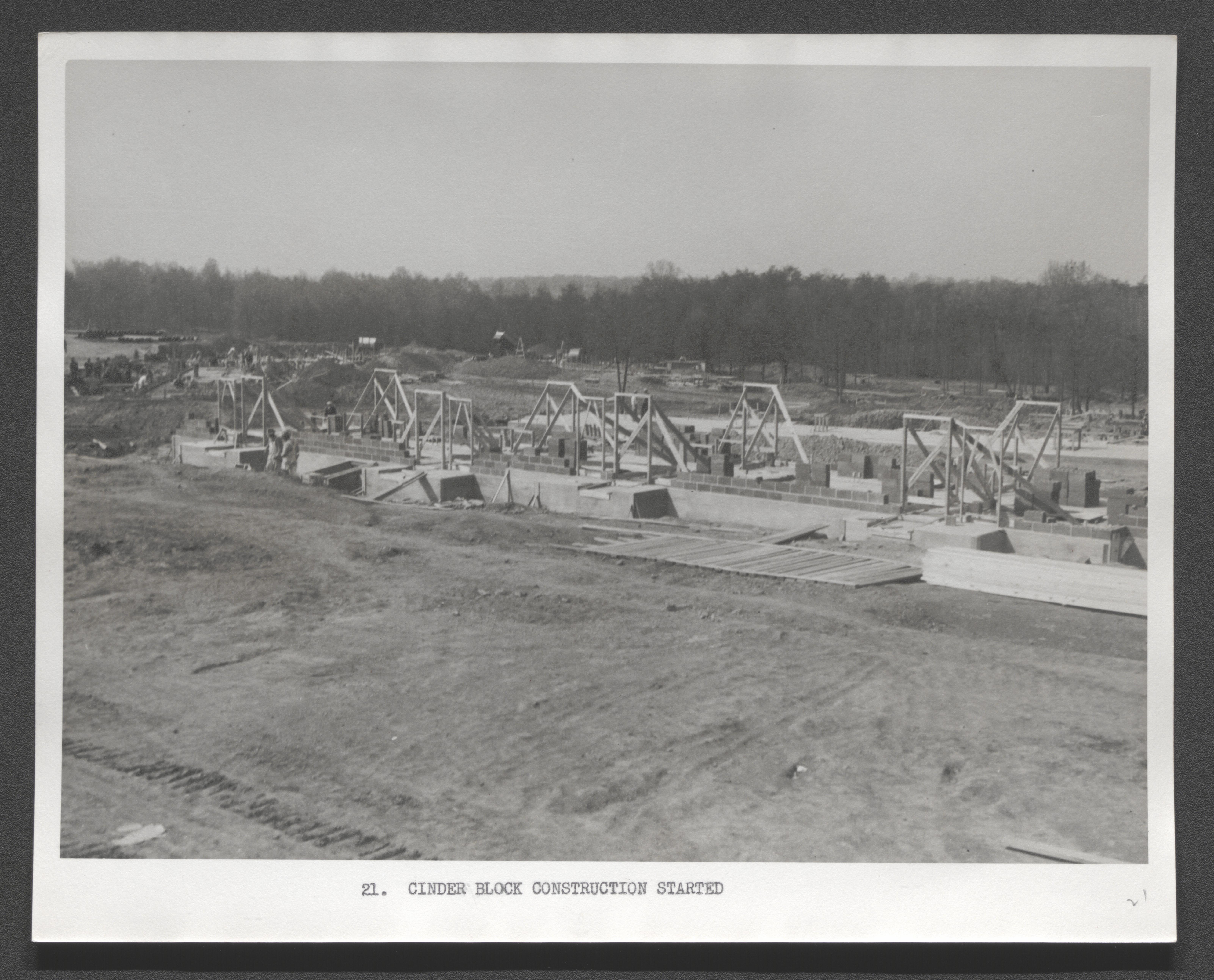
Beginning of cinder block wall at edge of building foundation, typed on border below image "Cinder block construction started", undated
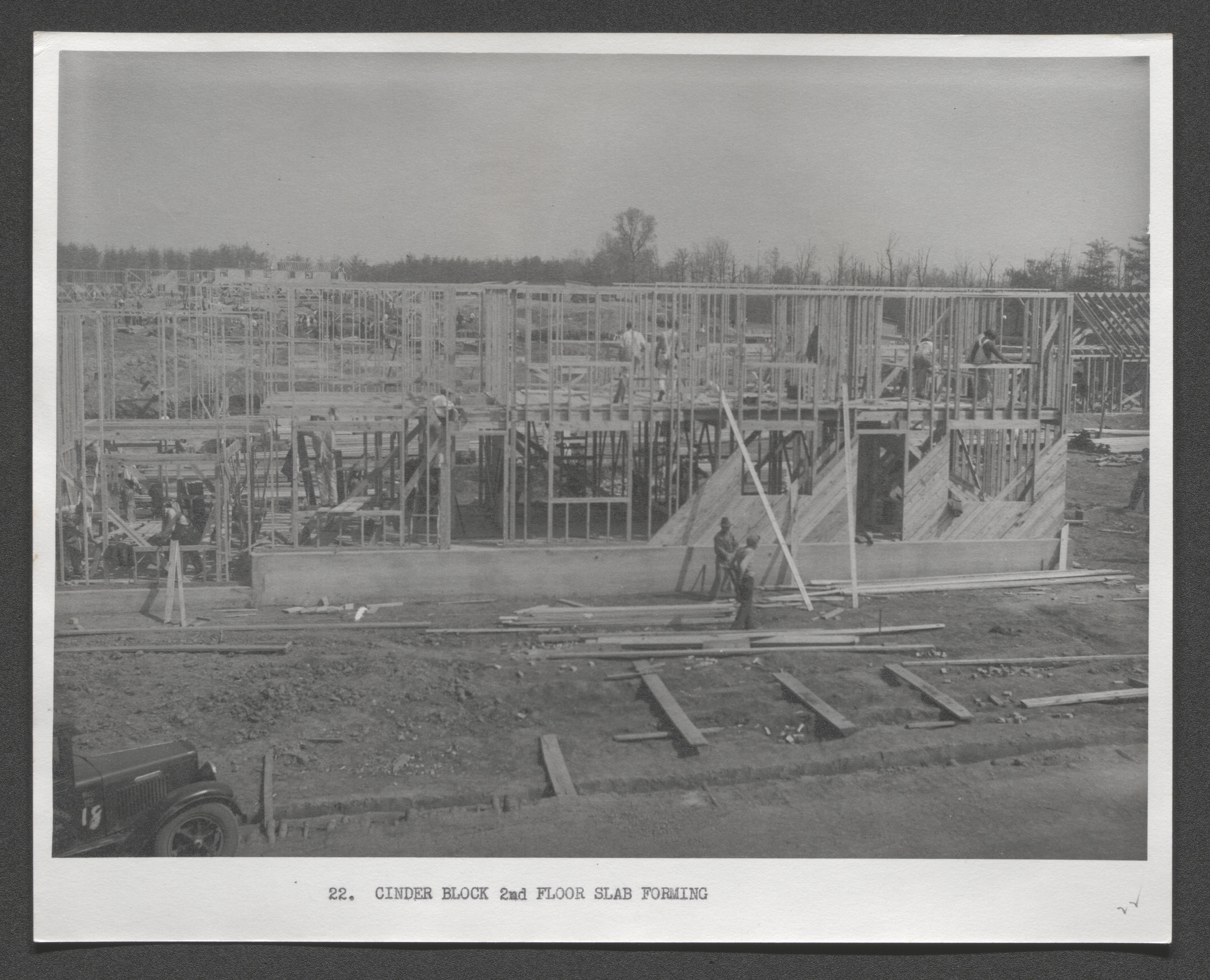
Framing and wall studs of two story construction with partial completion of second floor surface, typed on border below image "Cinder block 2nd floor slab forming", undated
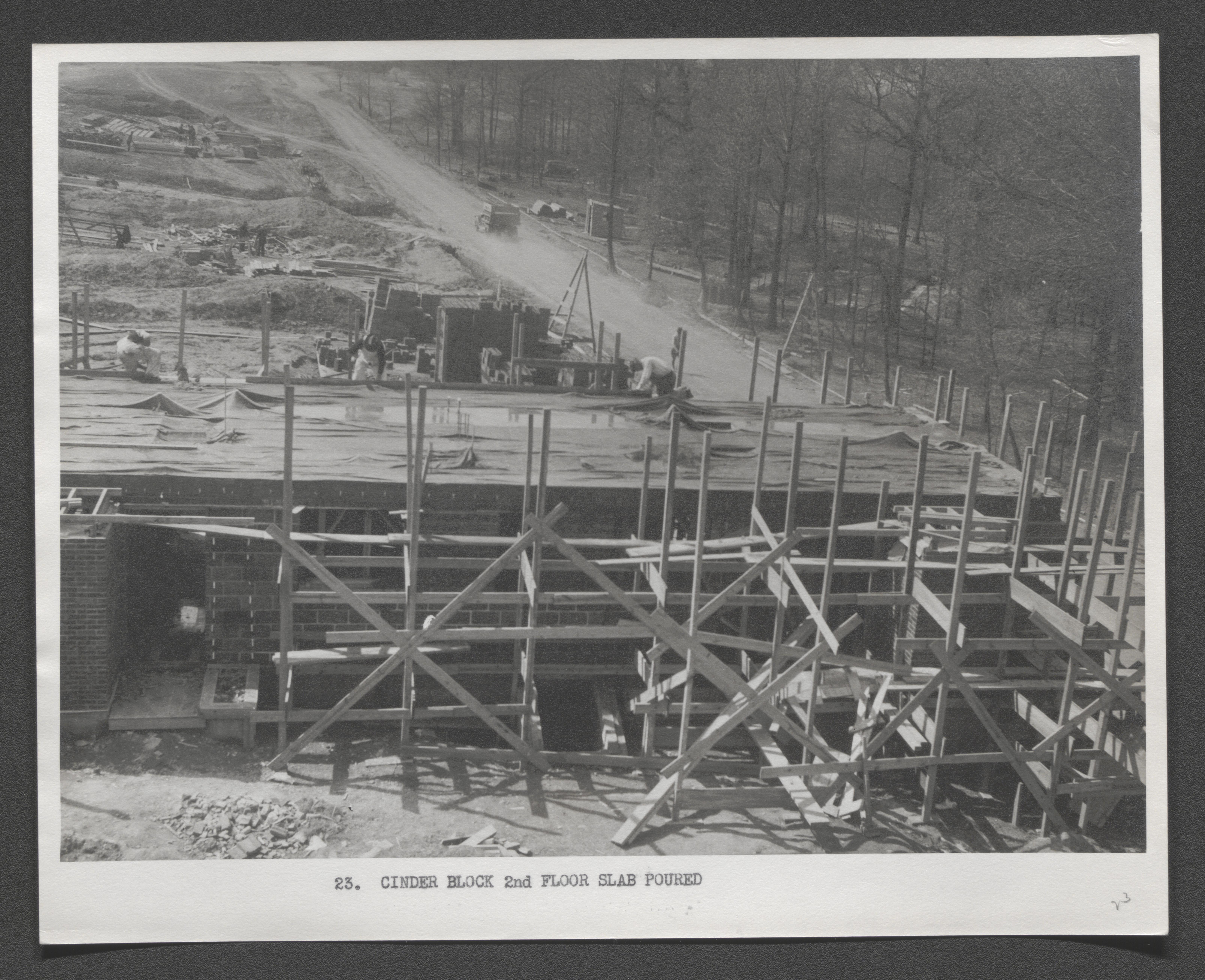
Scaffold framework in front of second floor surface of cinder block building, typed on border below image - "Cinder block 2nd floor slab poured", undated
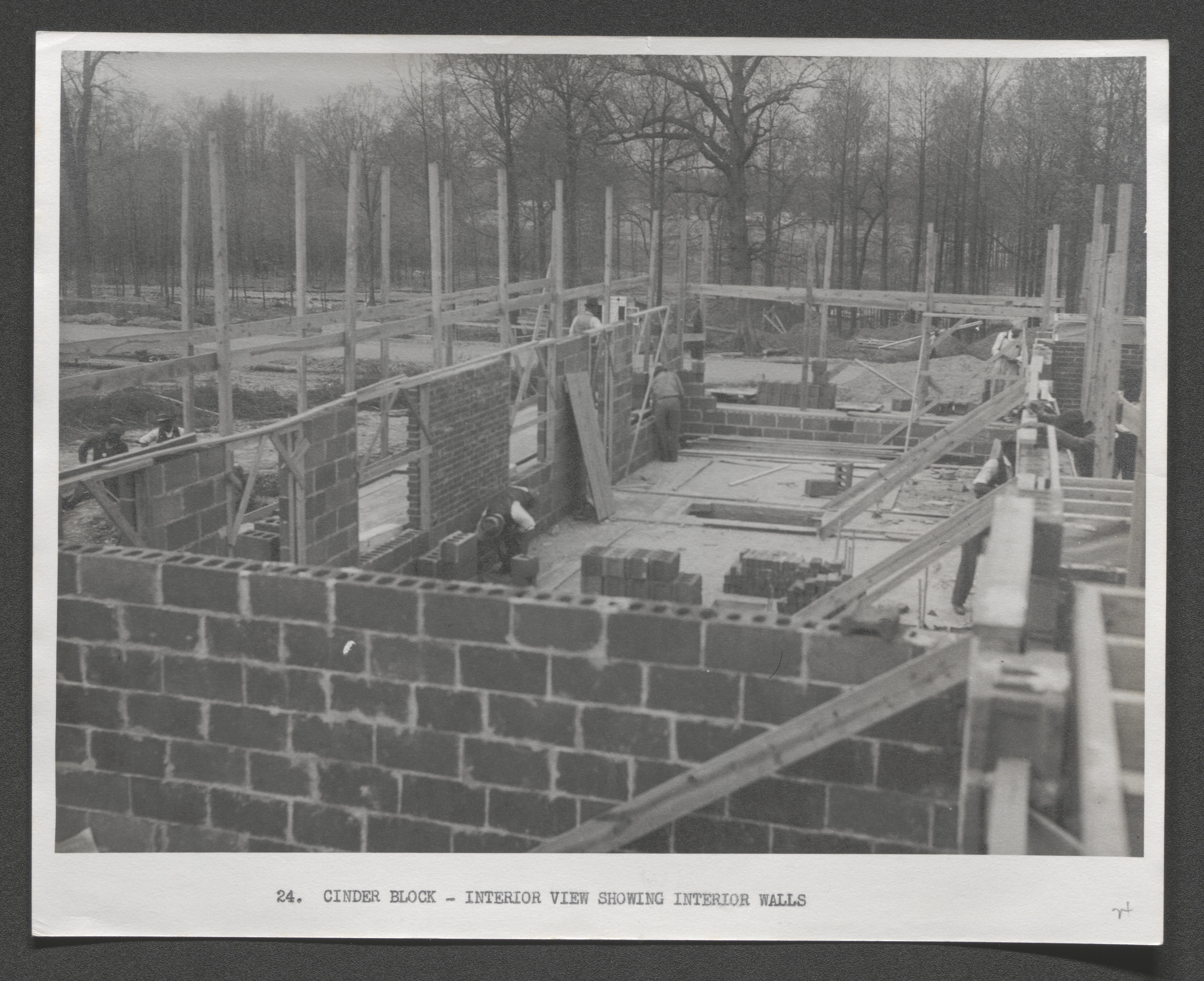
View over cinder block wall of interior construction, typed on border below image - "Cinder block - Interior view showing interior walls", undated
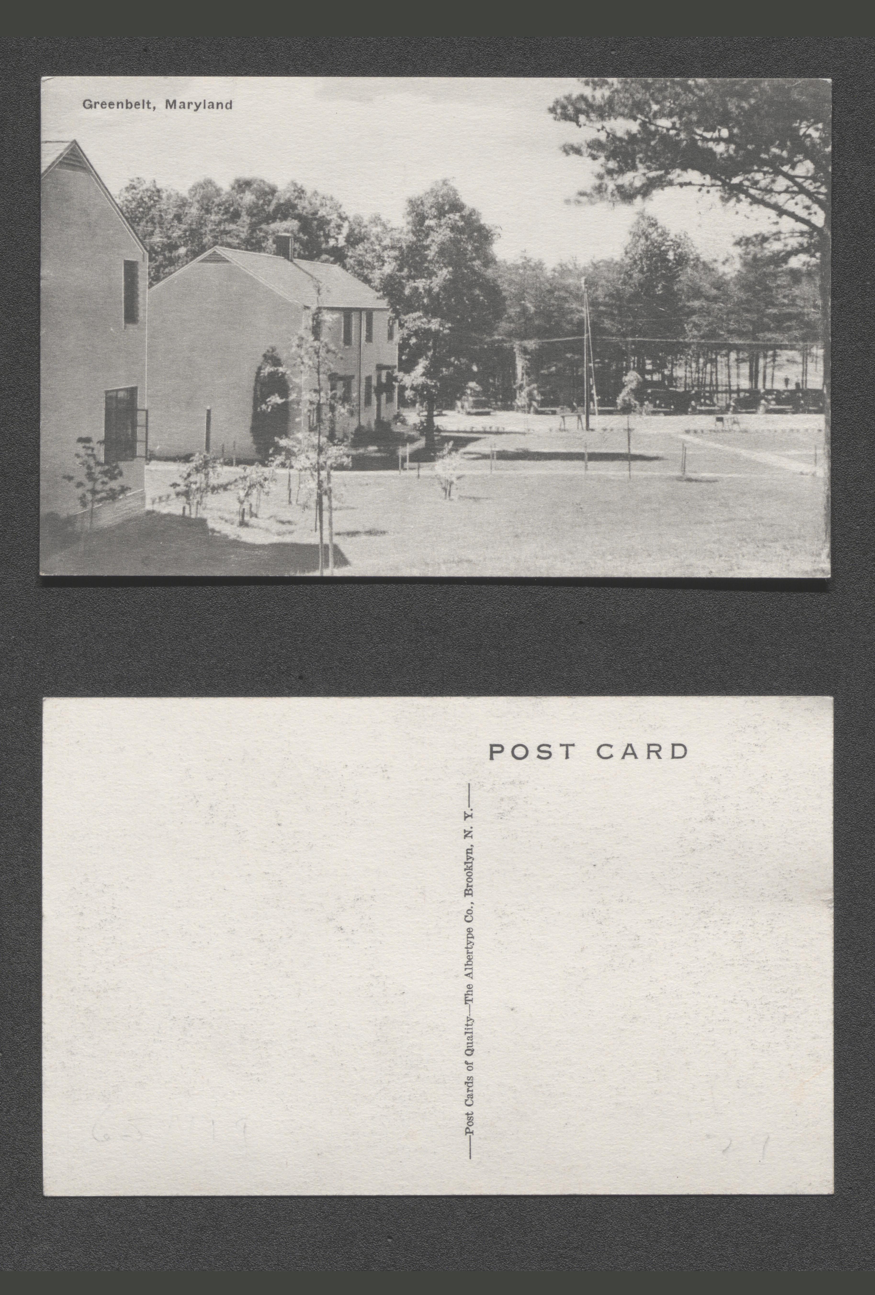
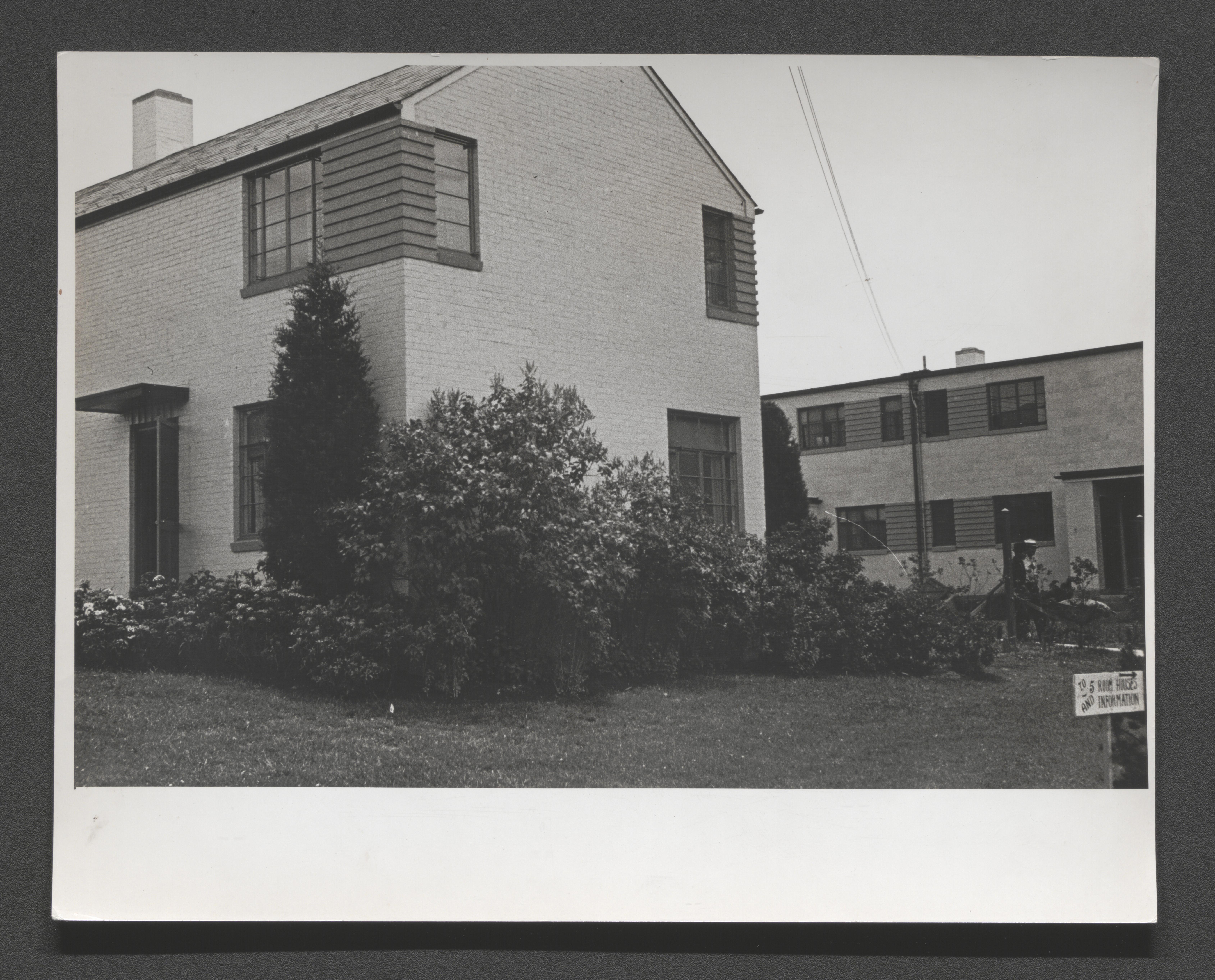
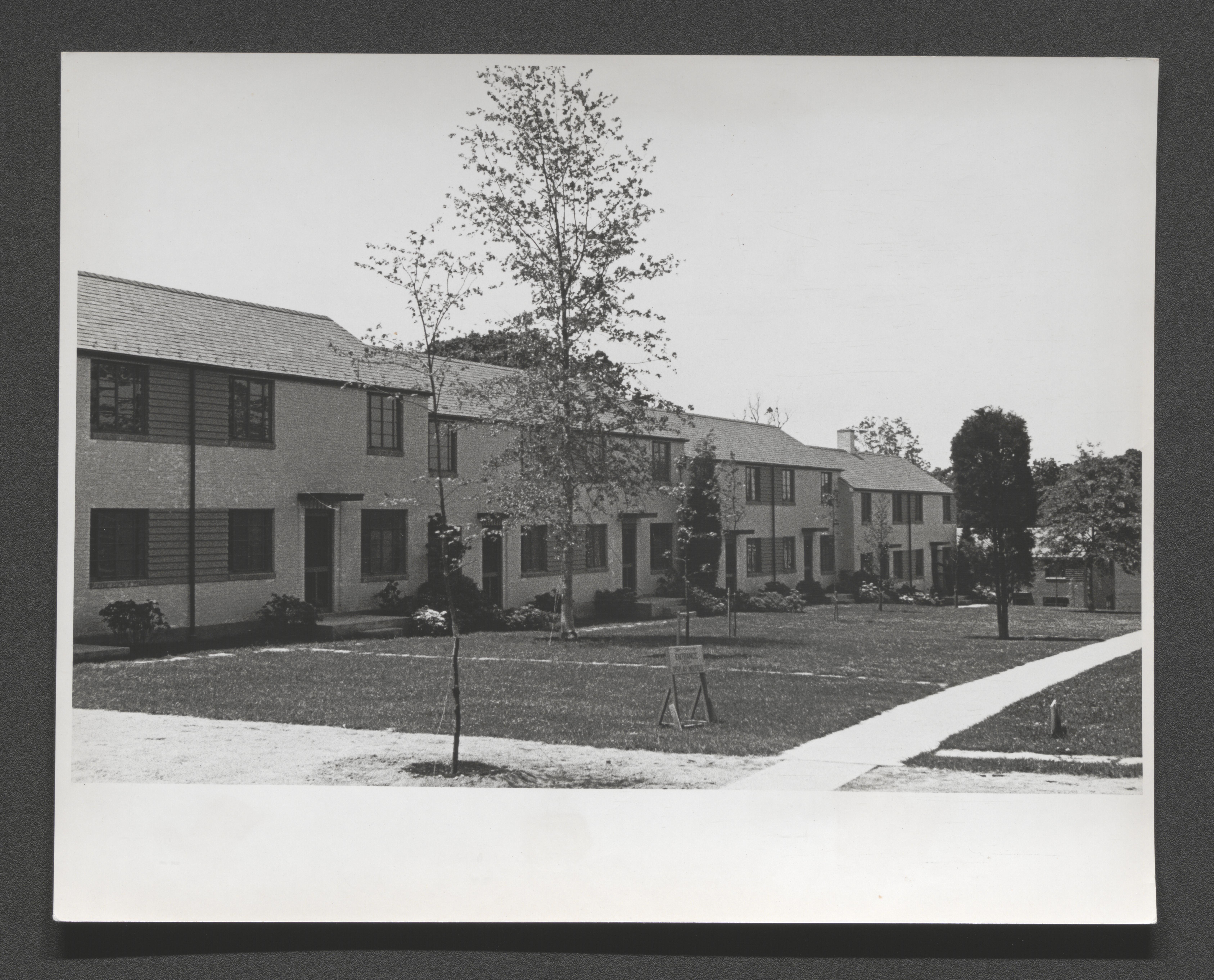
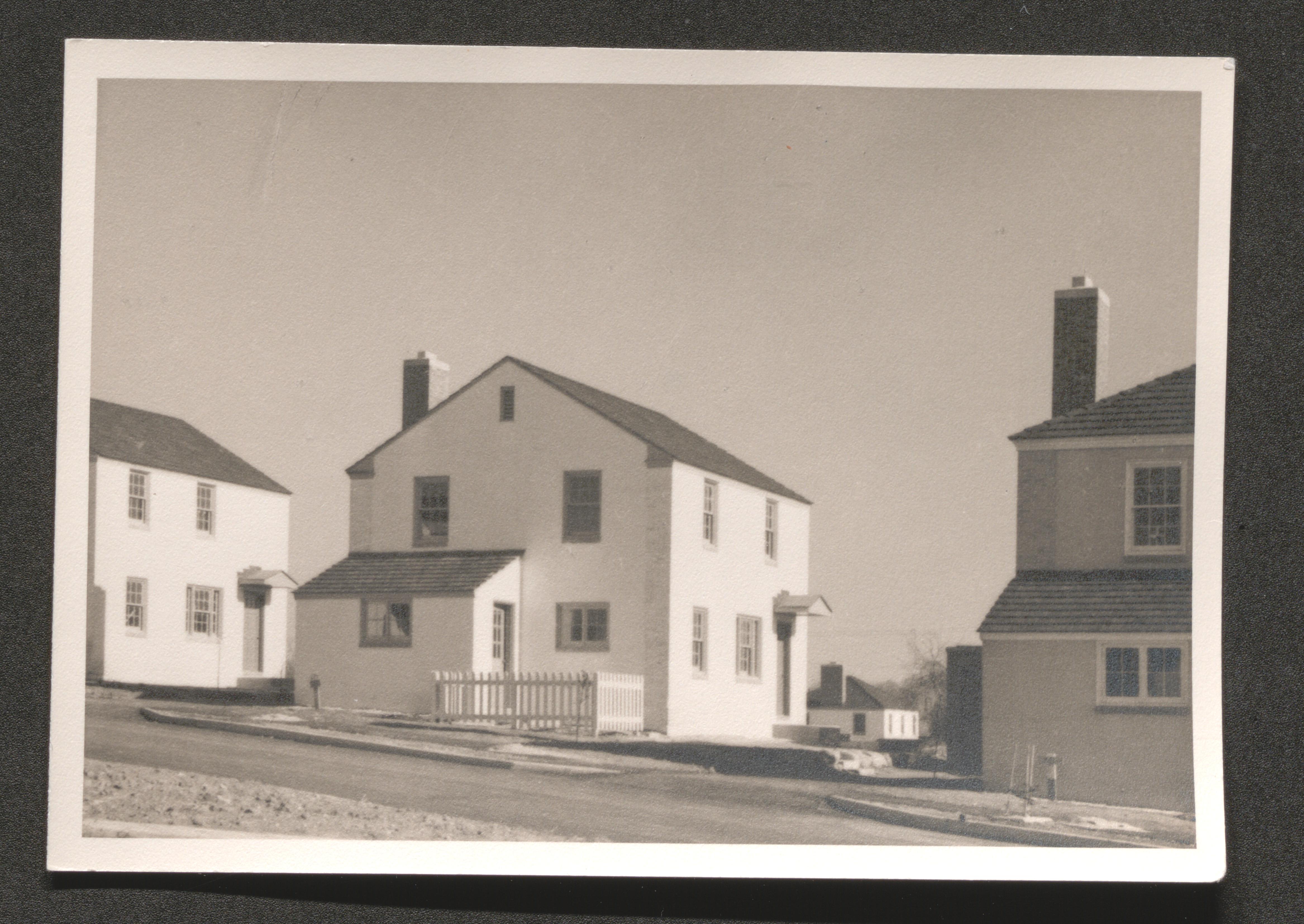
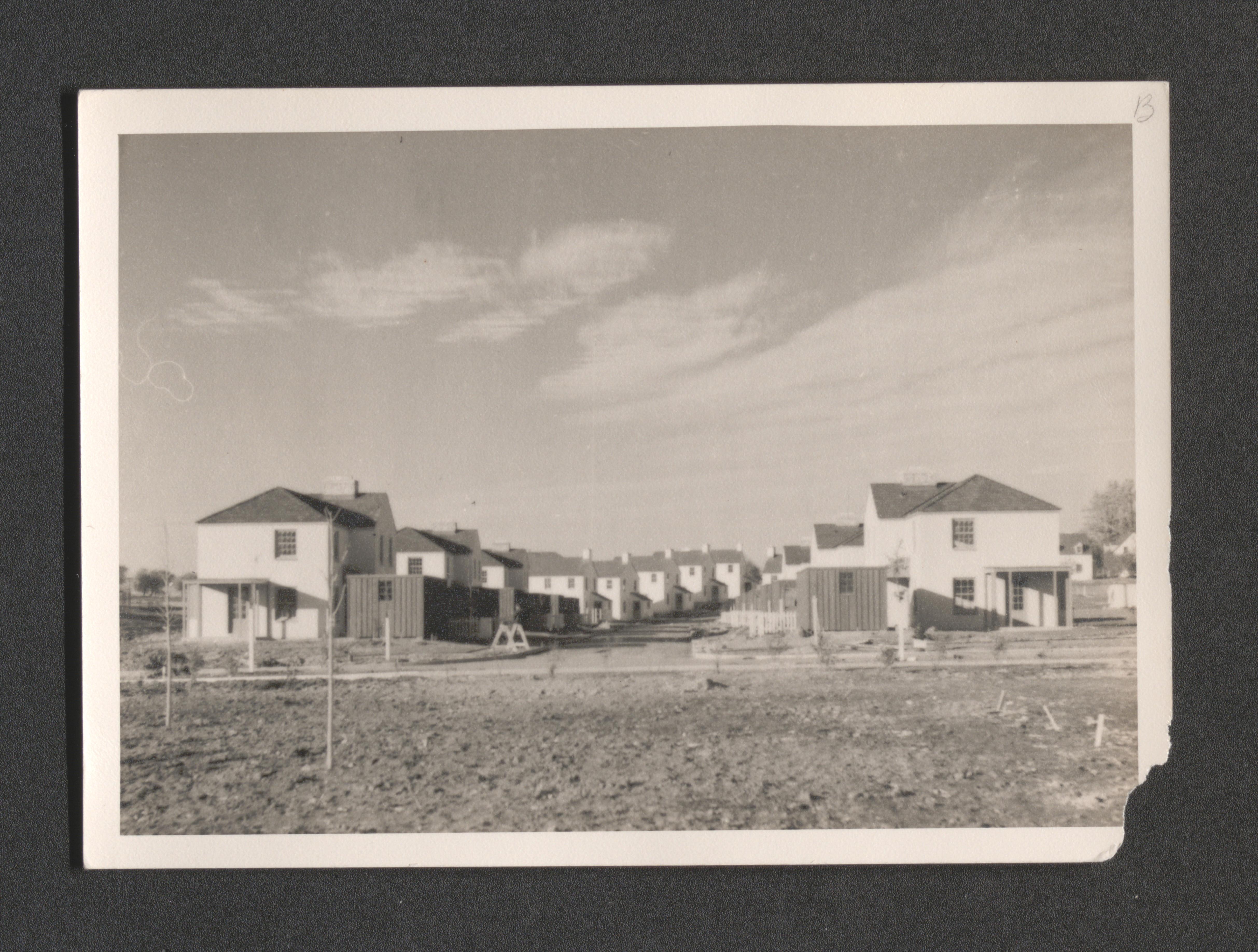
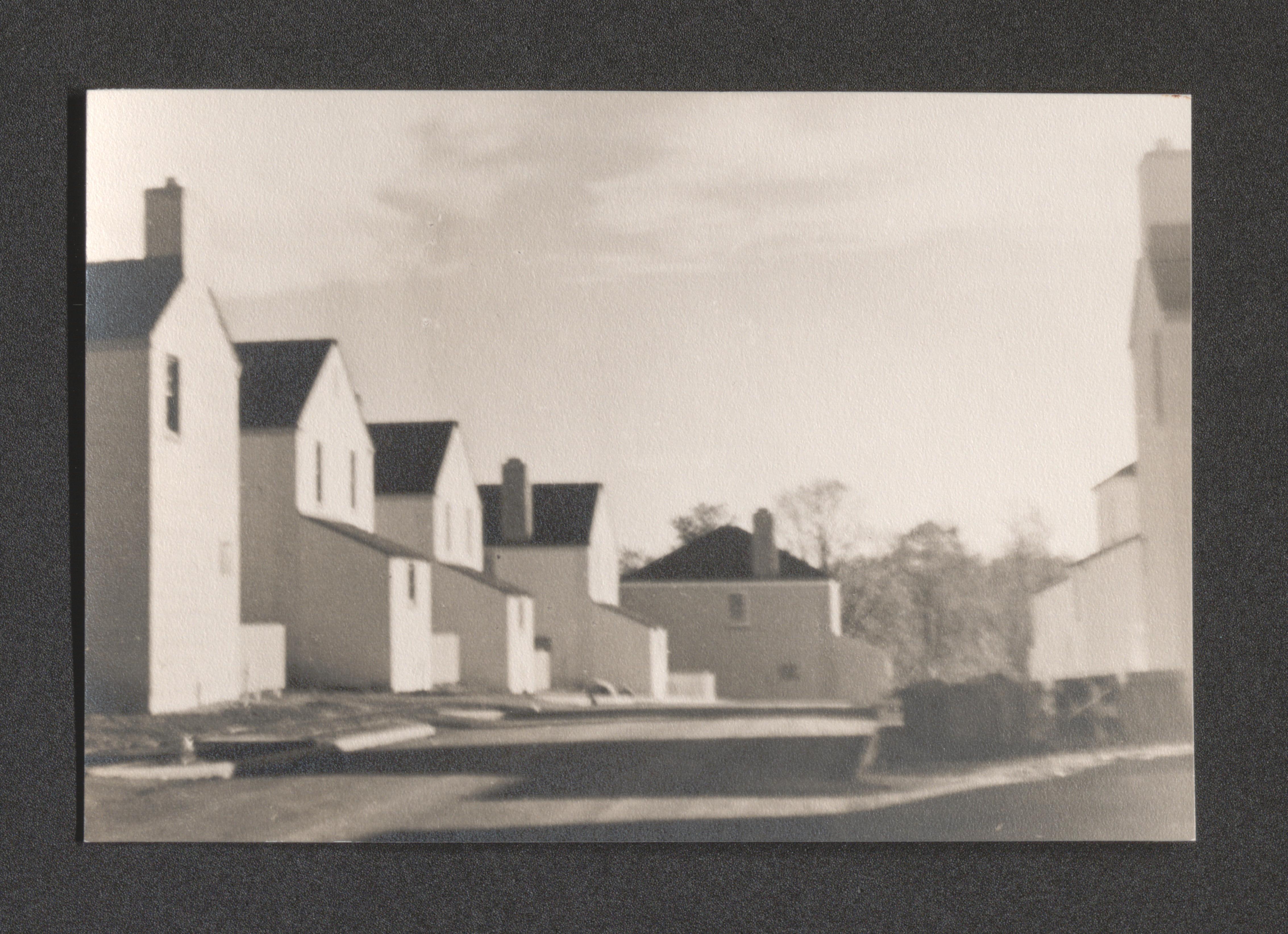
Housing units and yard, postcard caption "Greenbelt, Maryland", undated
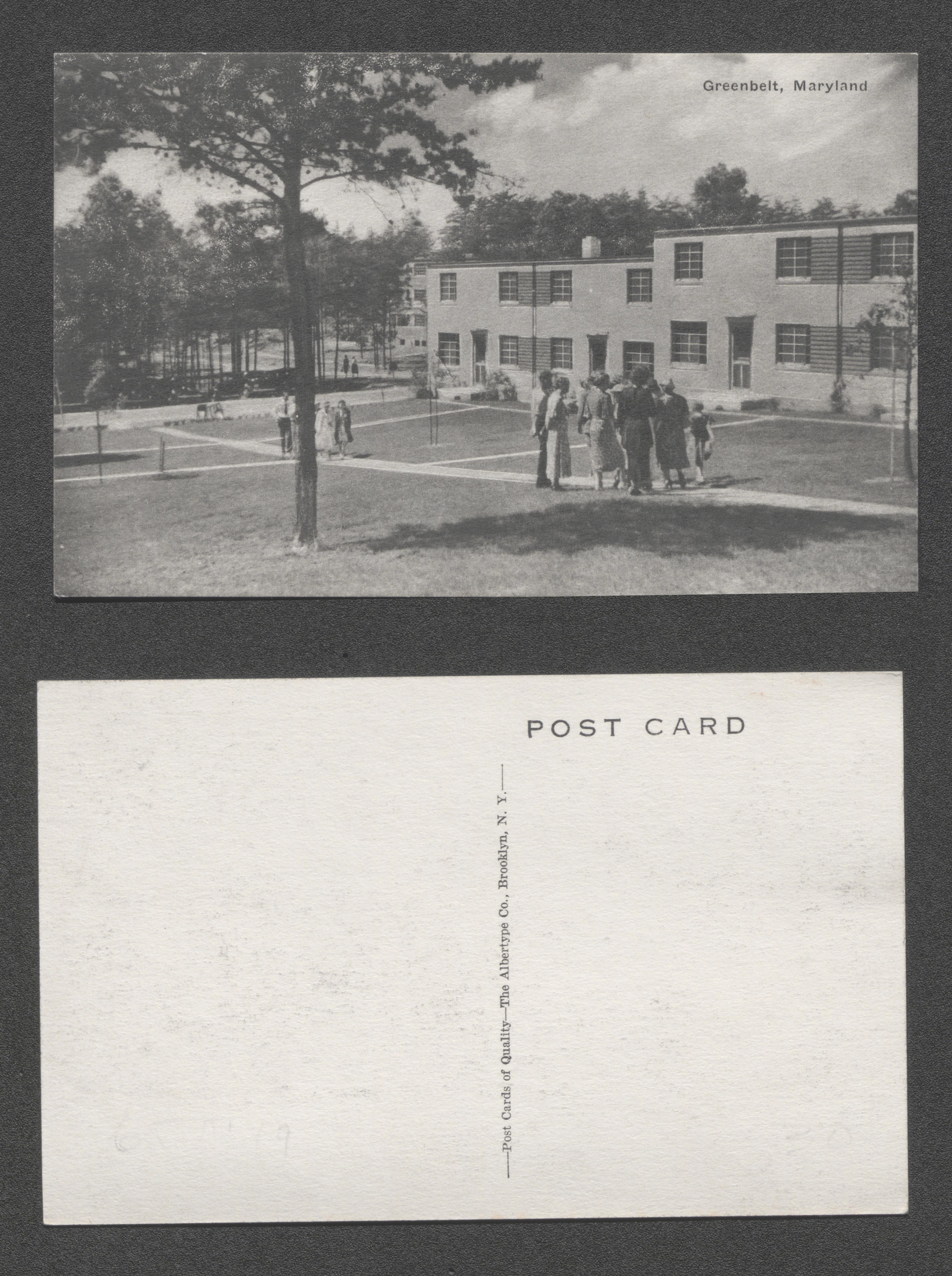
Groups on sidewalk through yard in front of housing units, postcard caption - "Greenbelt, Maryland", undated
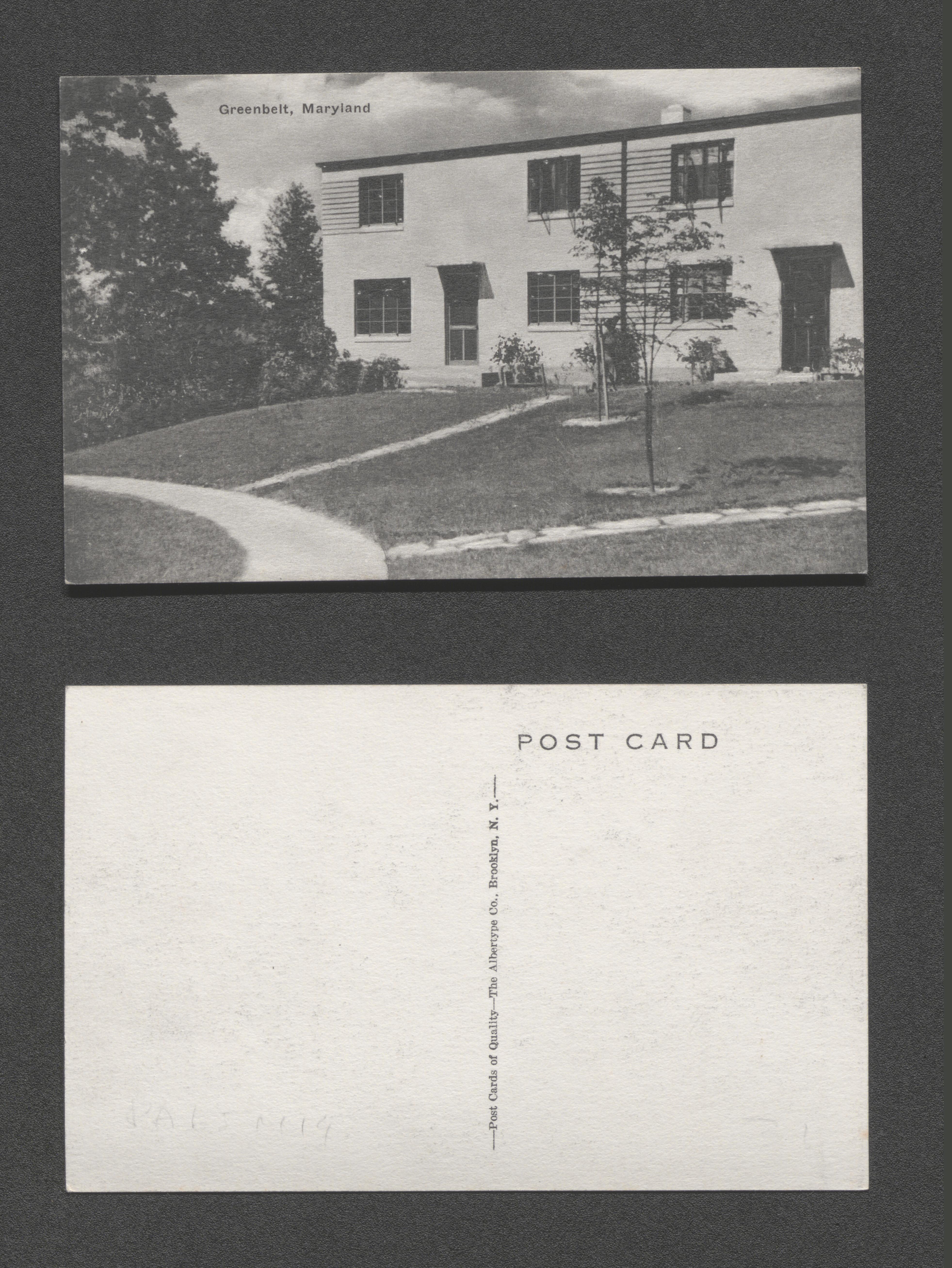
Duplex housing unit and its front yard, postcard caption - "Greenbelt, Maryland", undated
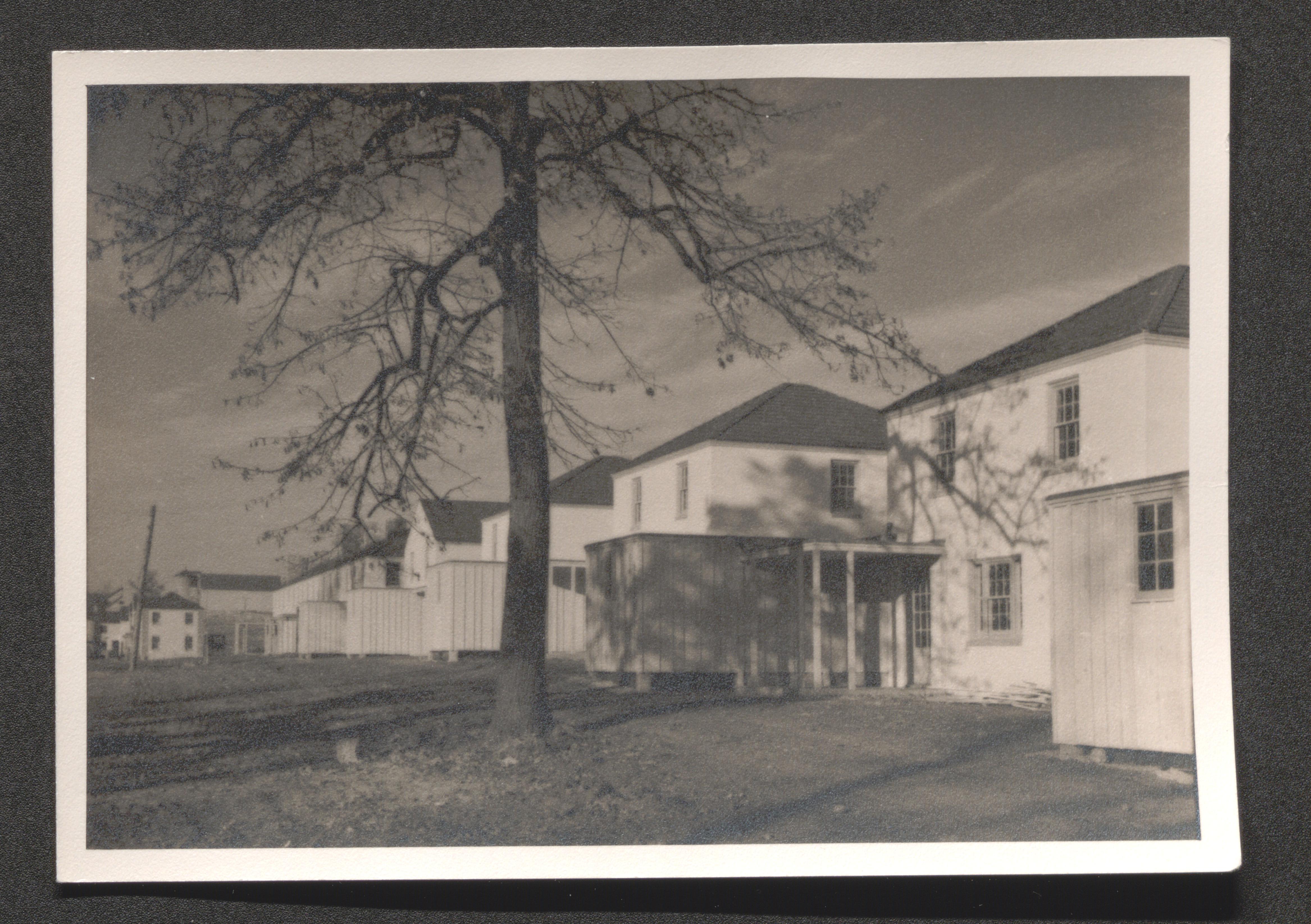
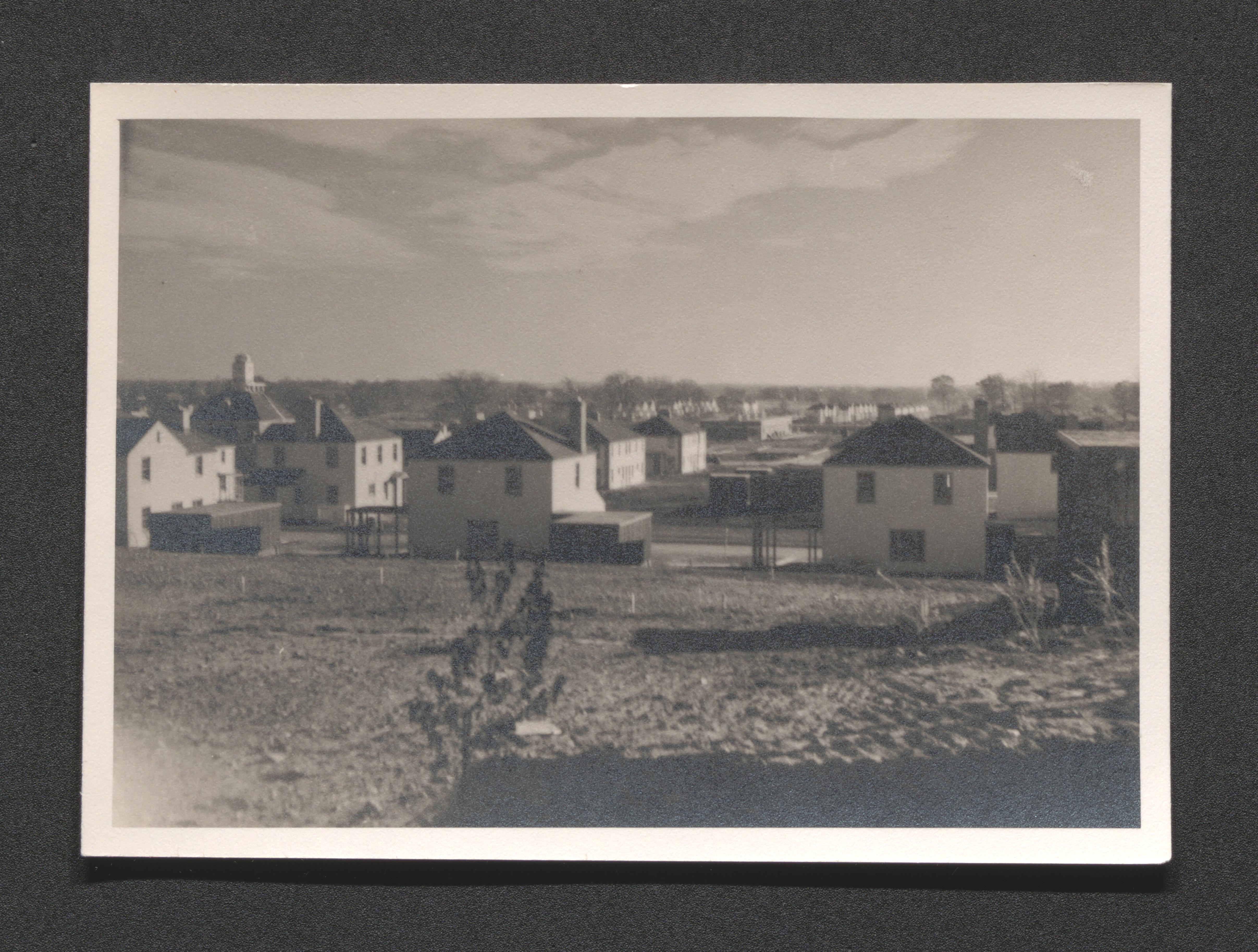
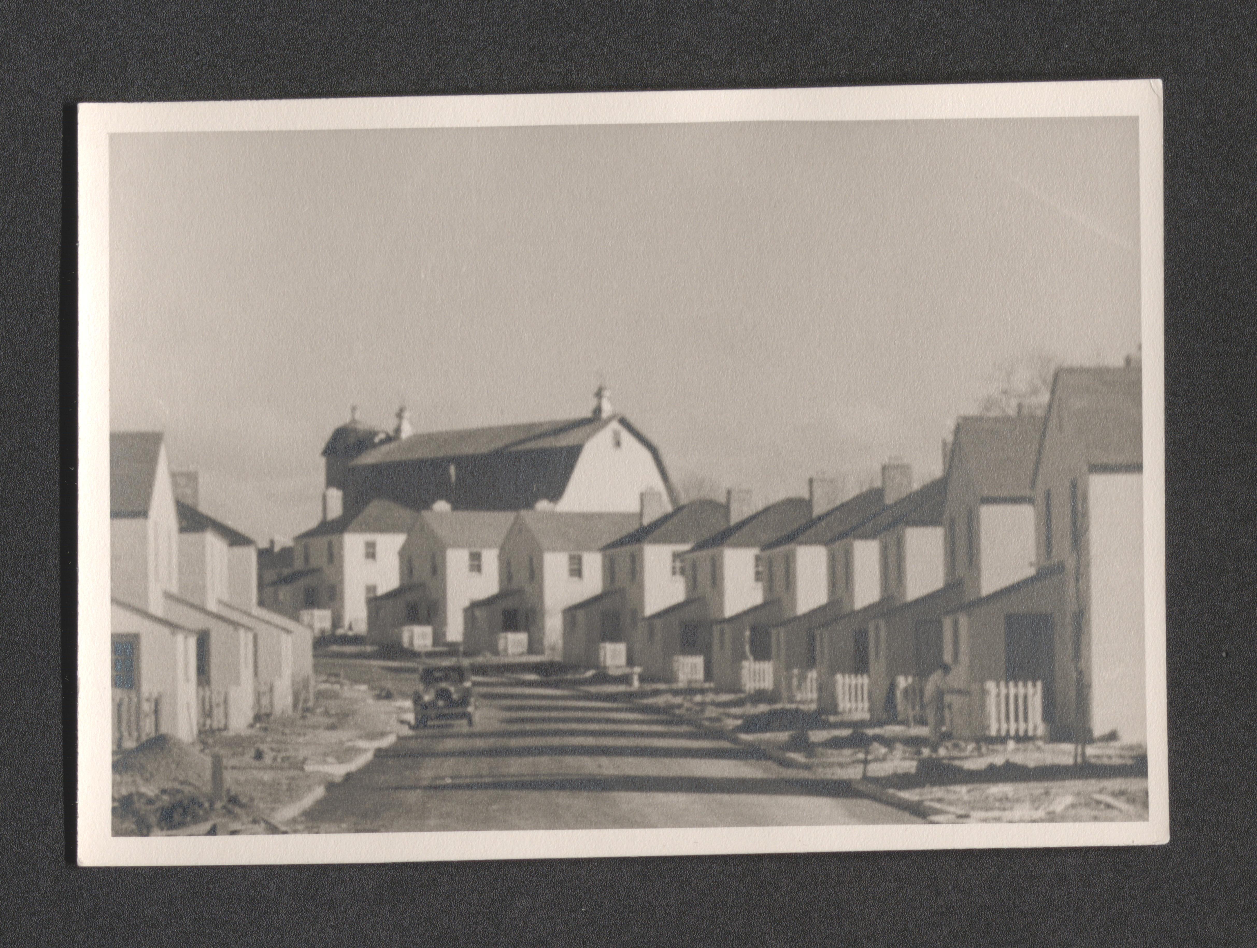
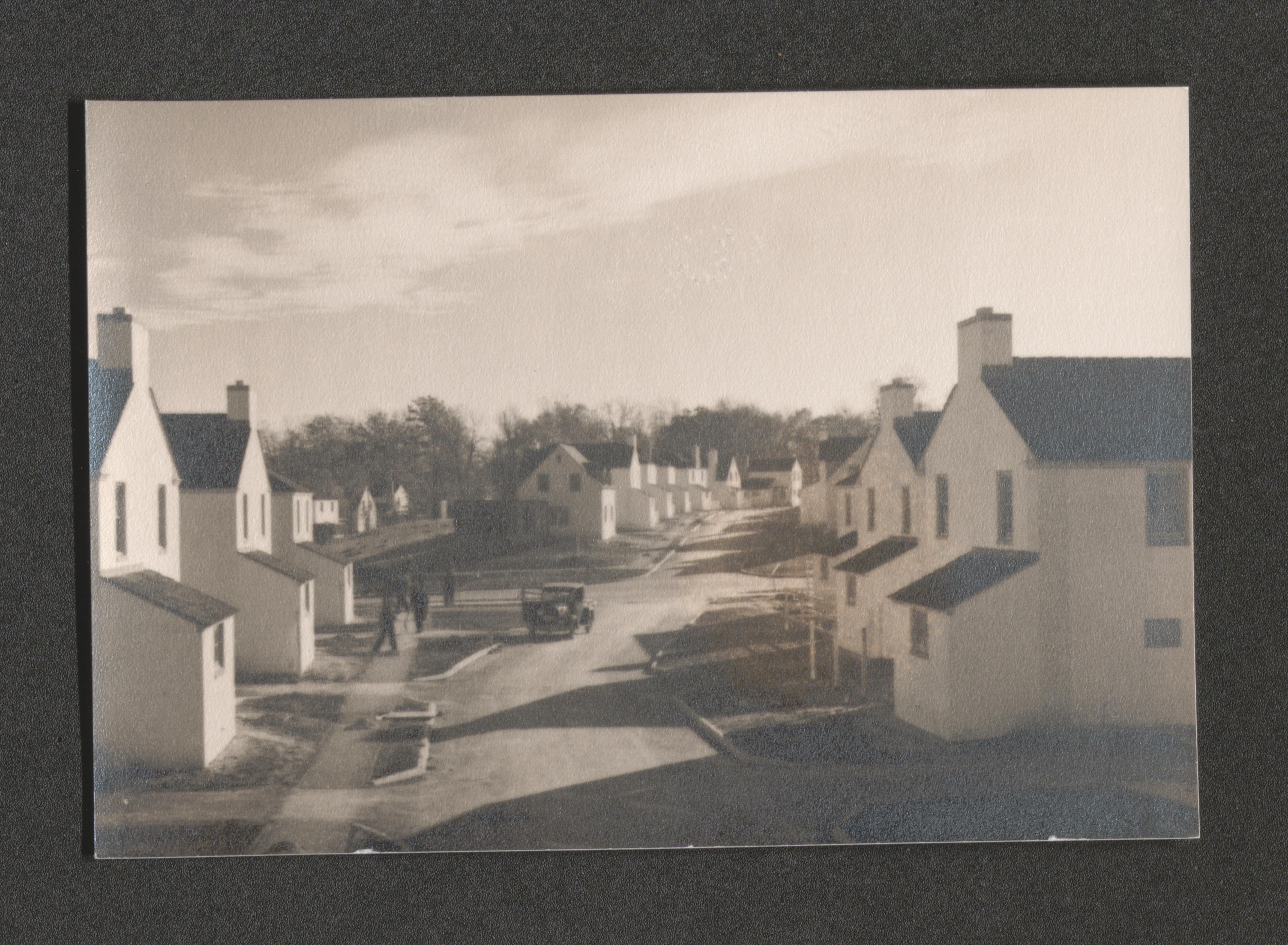
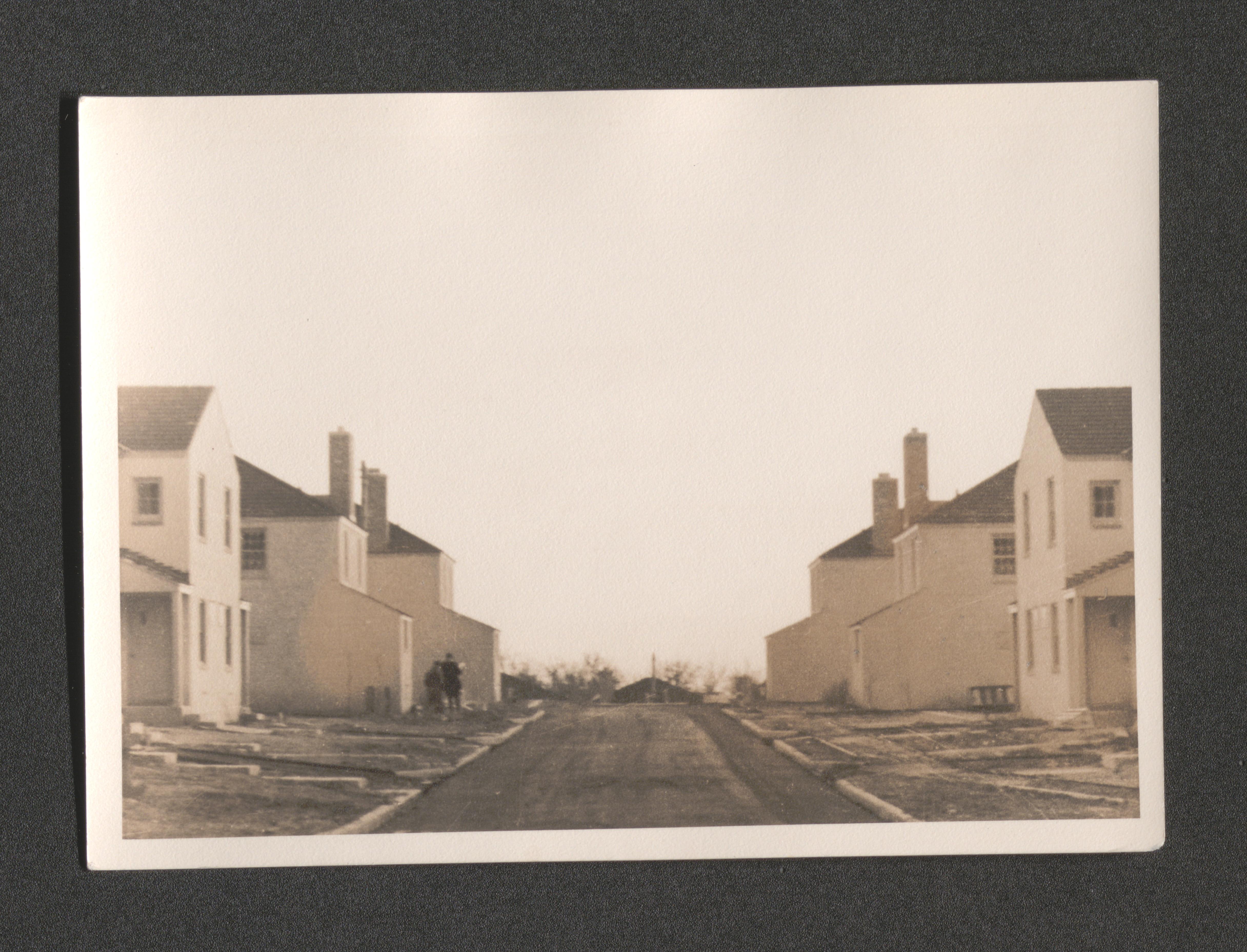
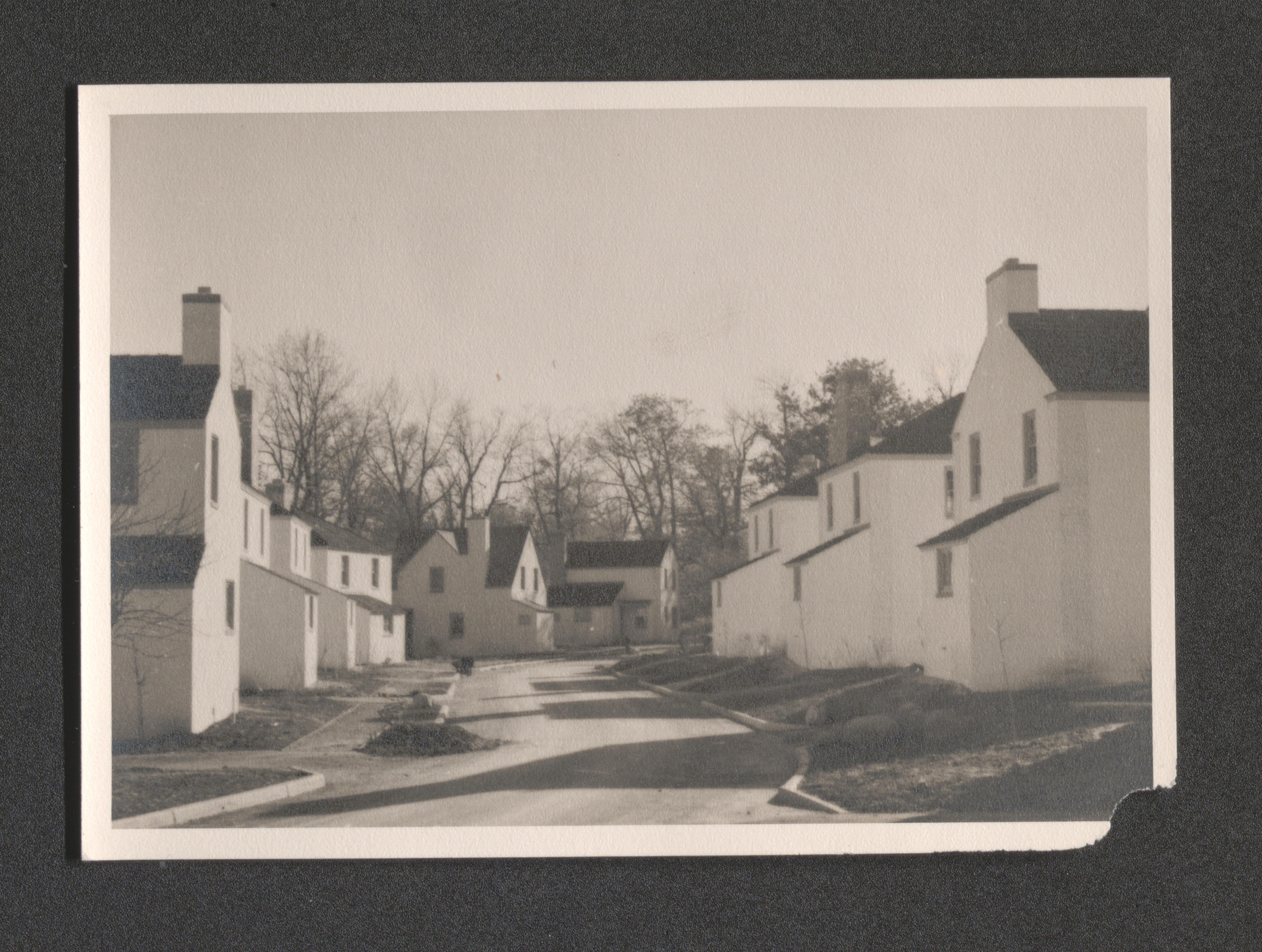
Construction neighborhood; completed housing units, units under construction, and building supply yard, undated
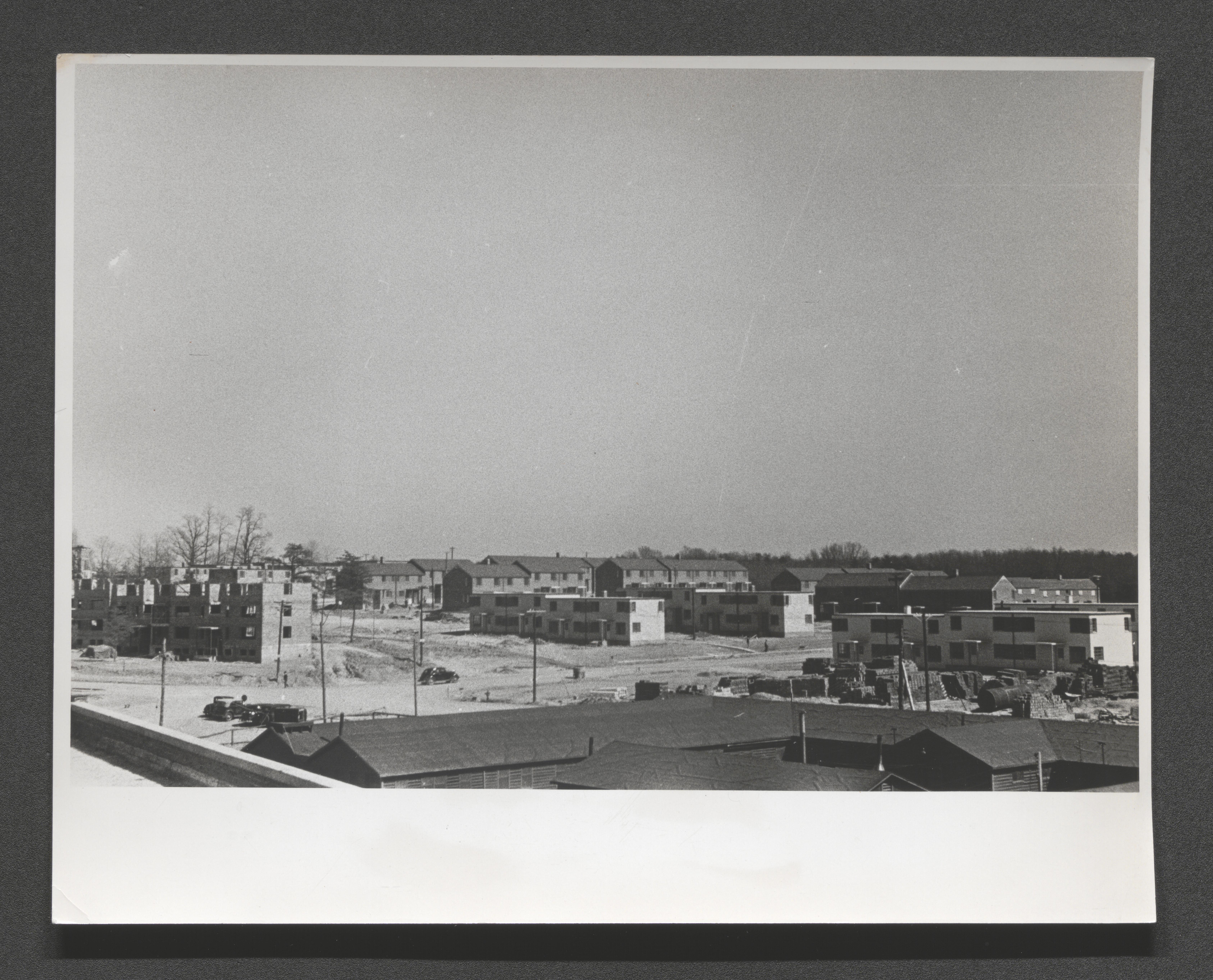
Construction neighborhood; completed housing units, units under construction, and building supply yard, undated
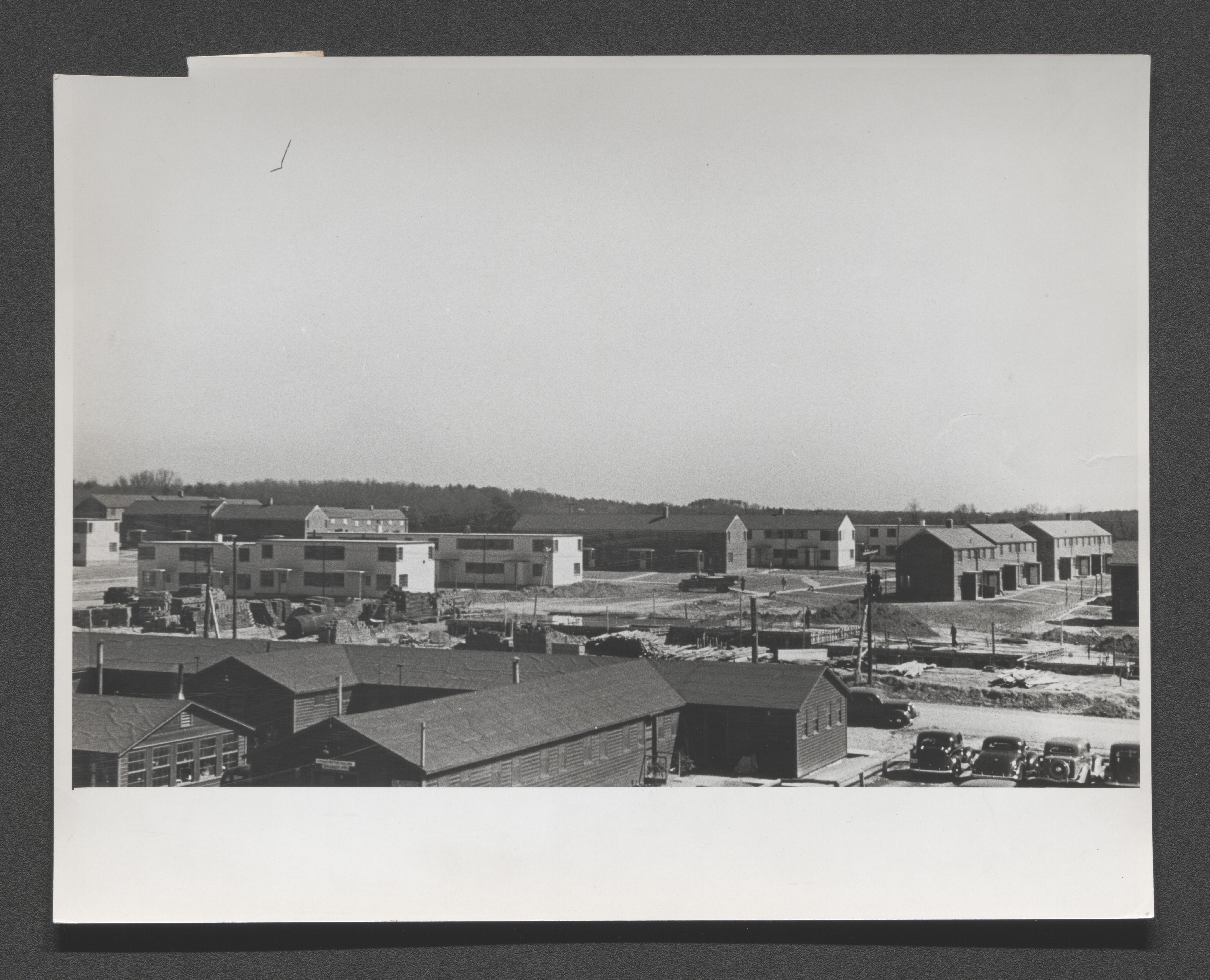
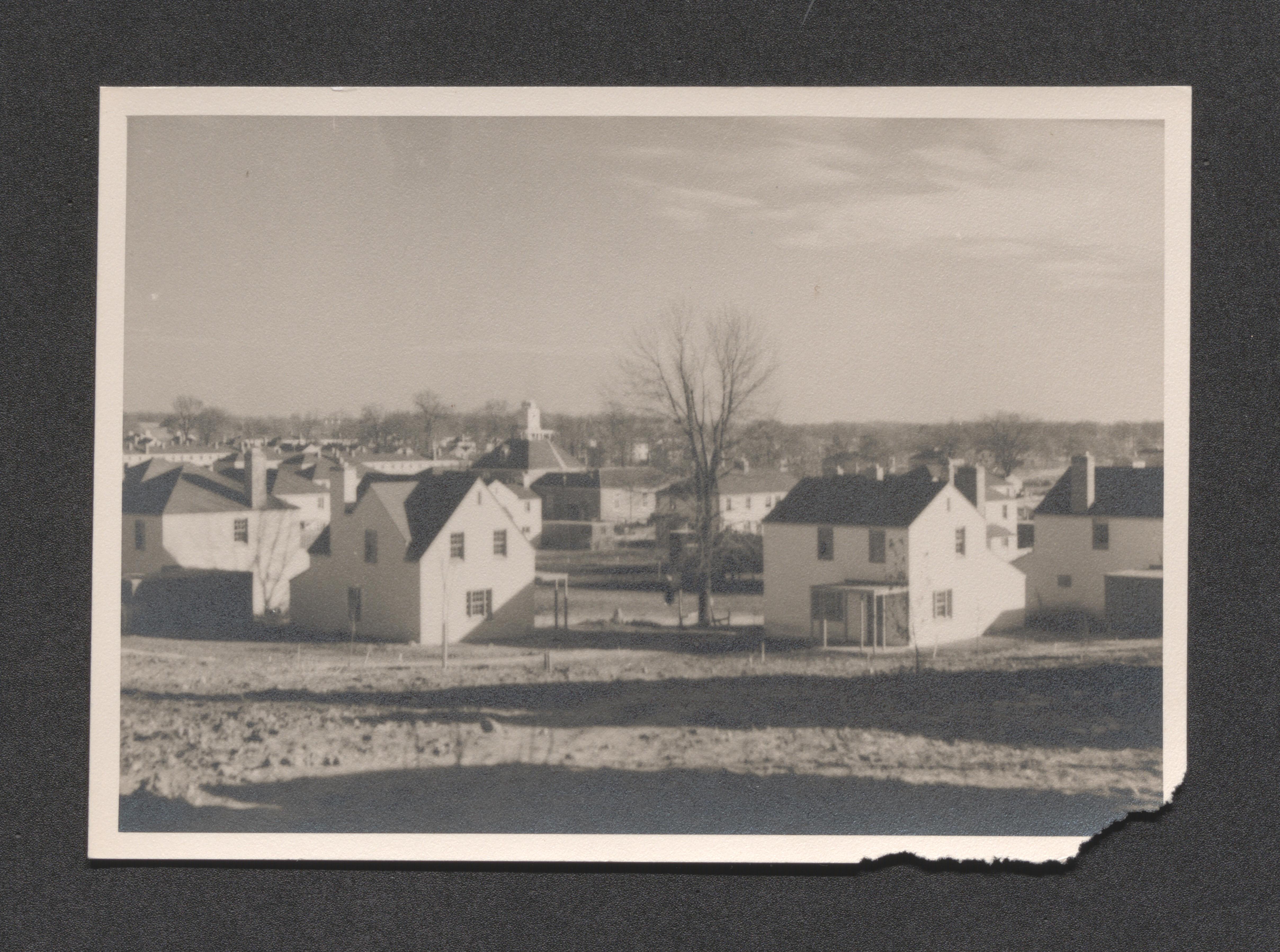
Construction neighborhood; completed housing units, and units under construction, undated

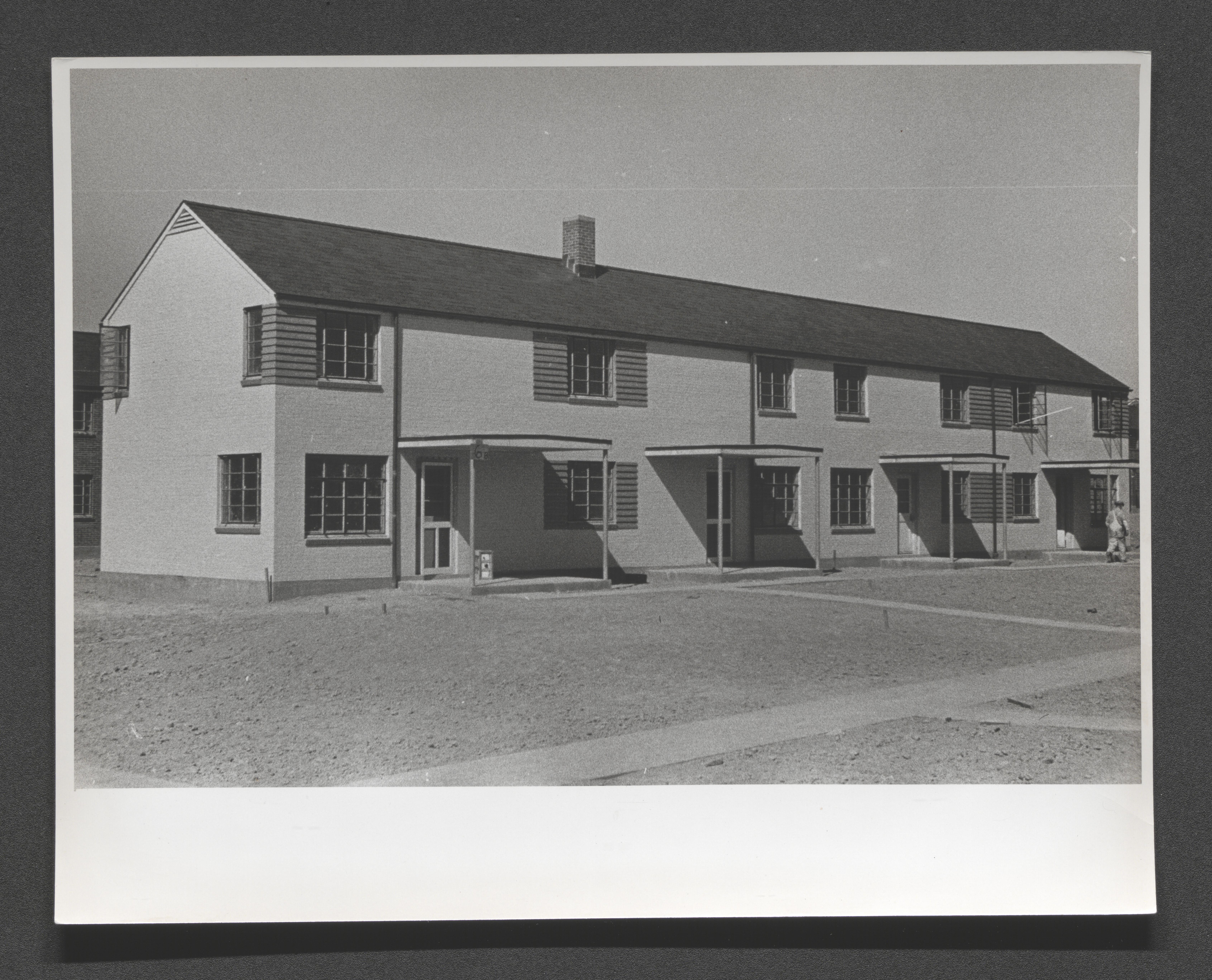
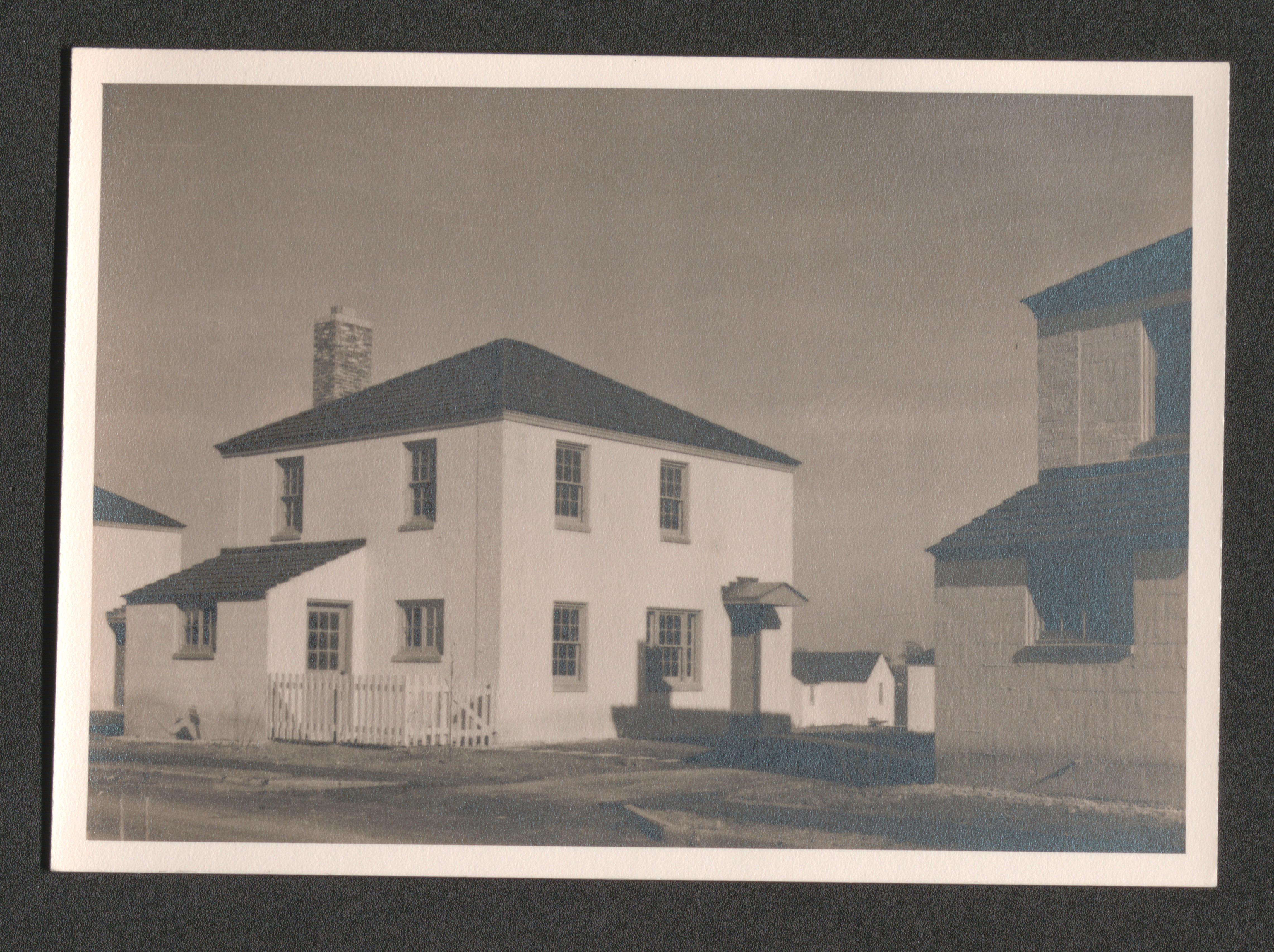
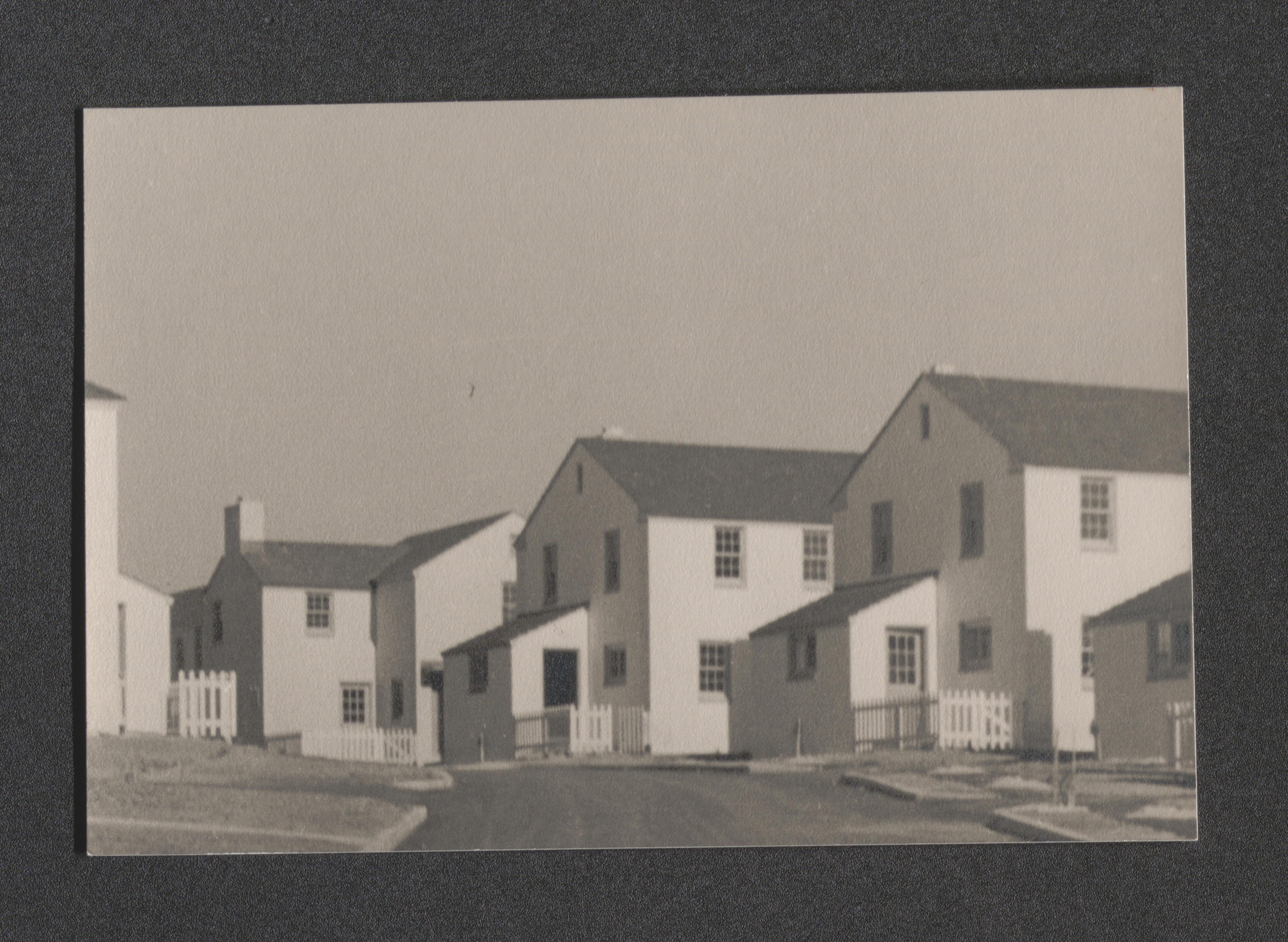
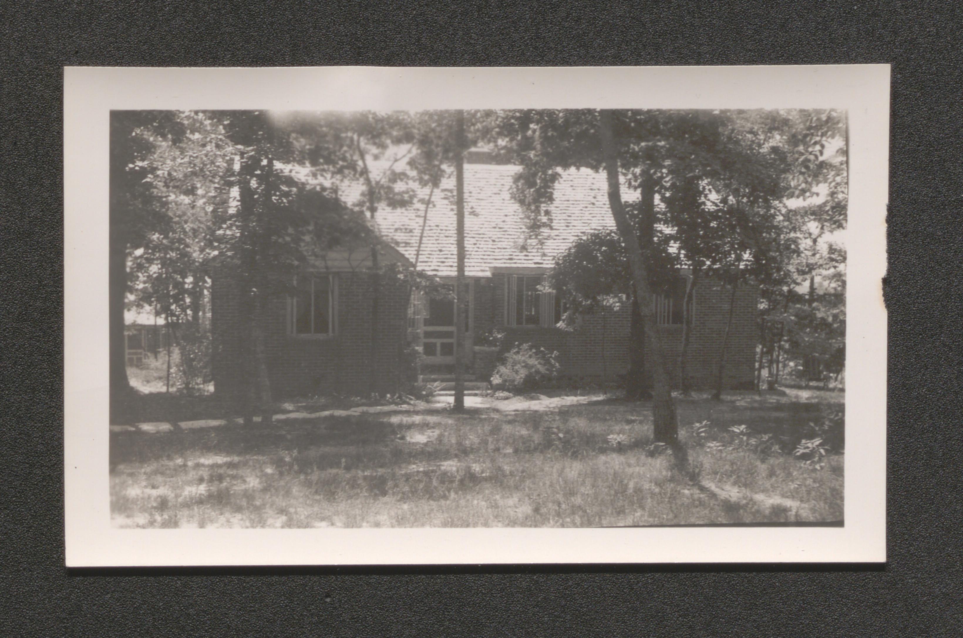
Completed multifamily housing unit with four entrances, undated
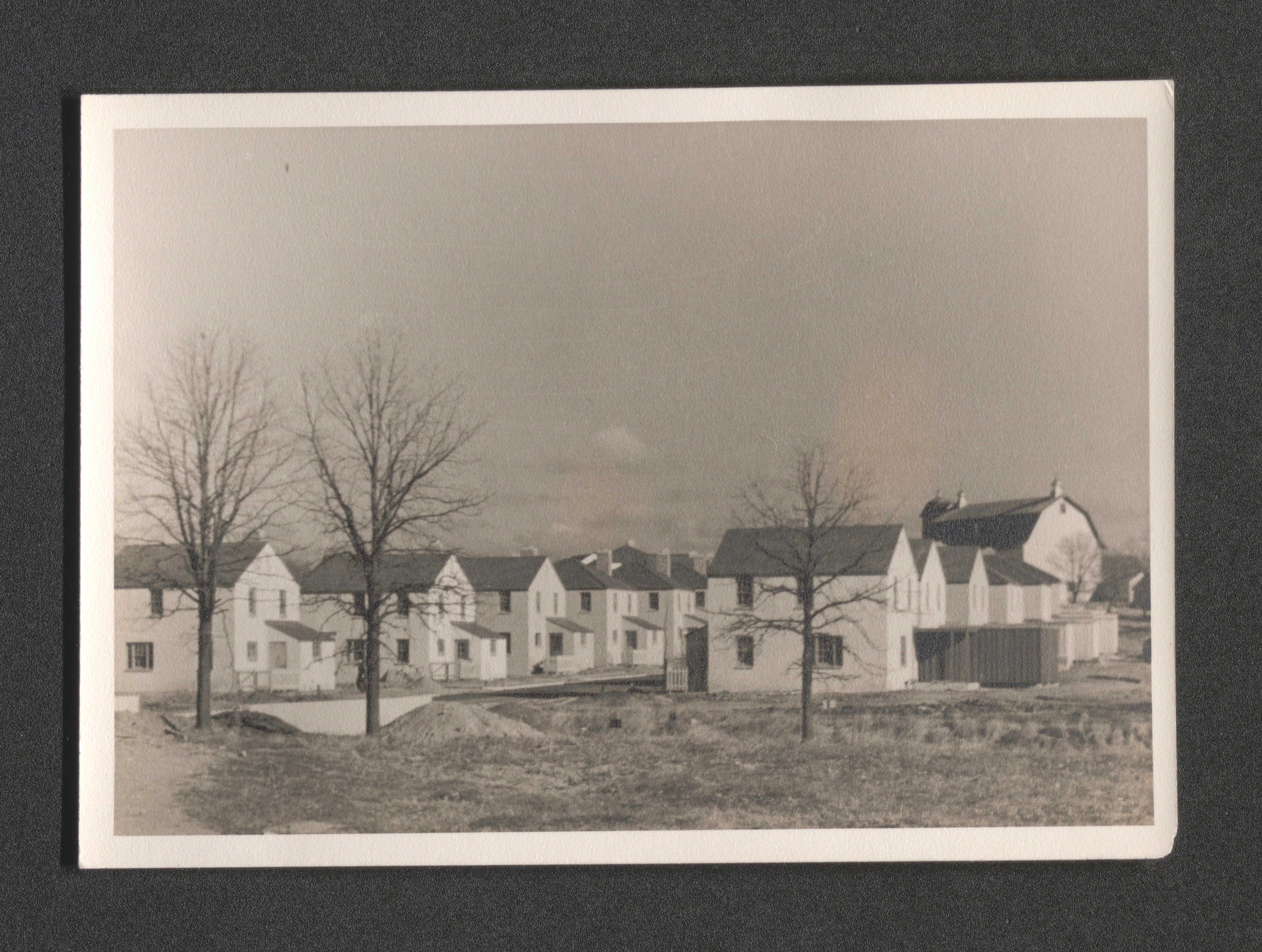
Completed multifamily housing units and yard in terraced area, undated
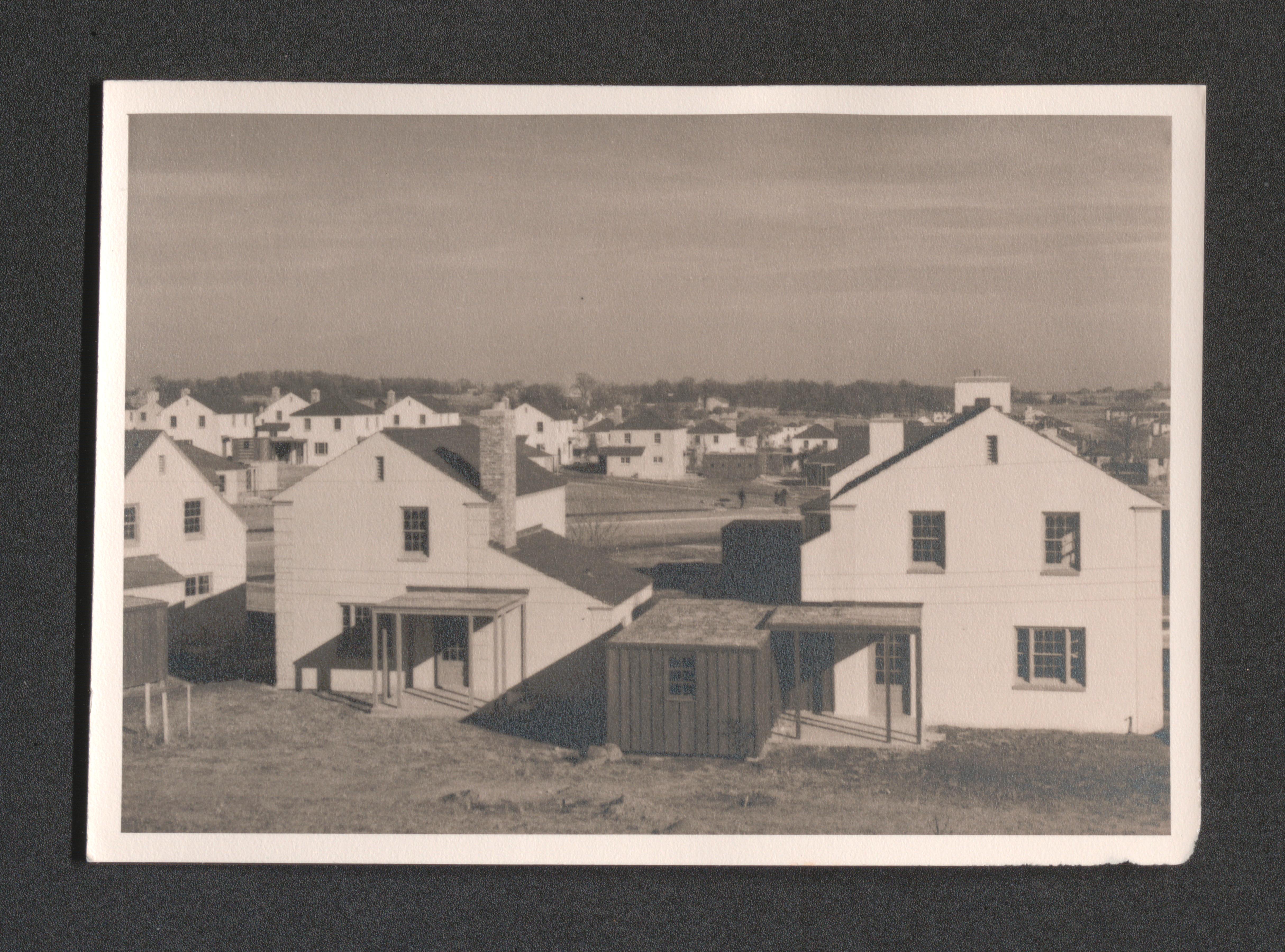
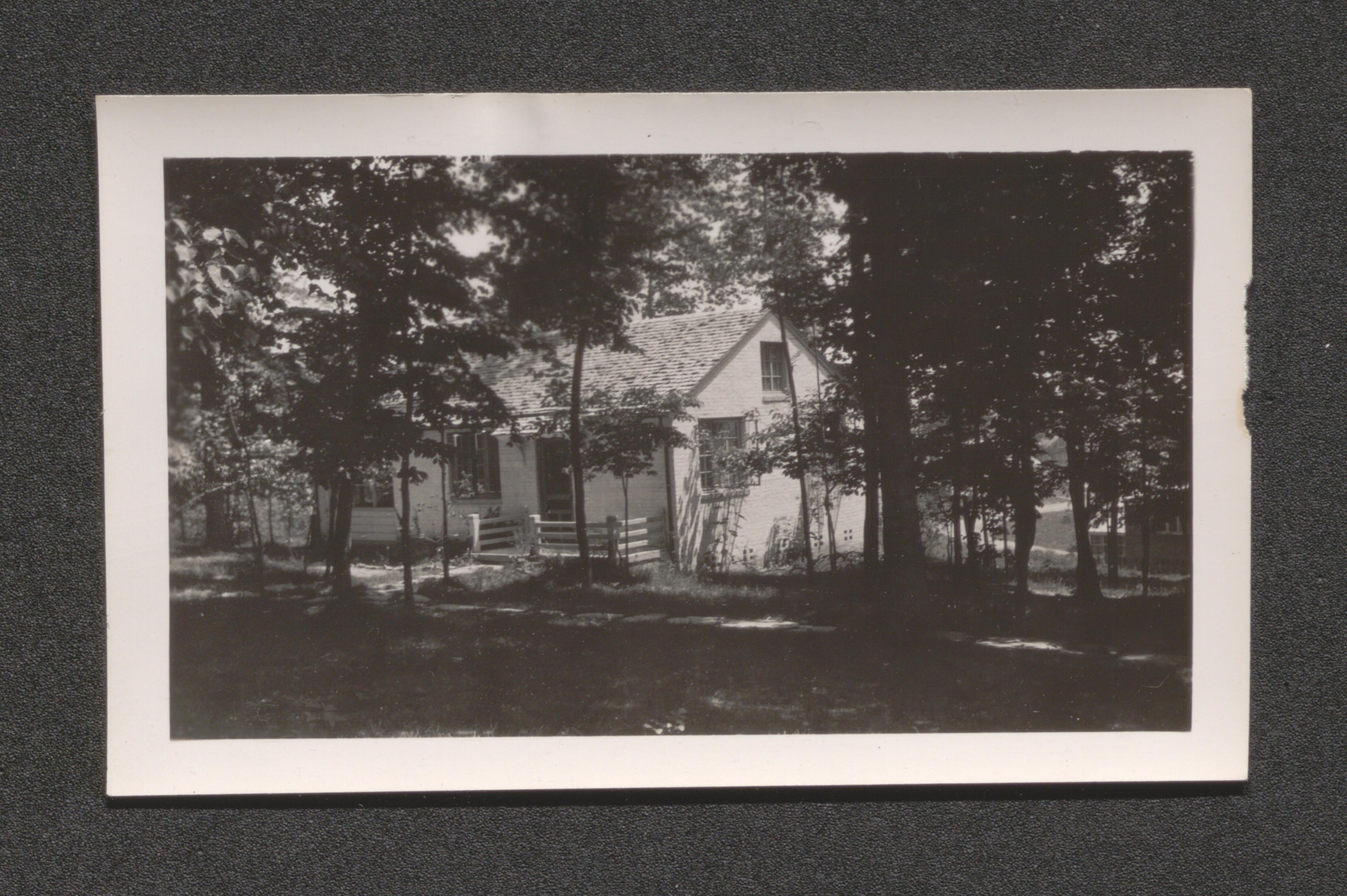
Corner of Completed housing unit, undated
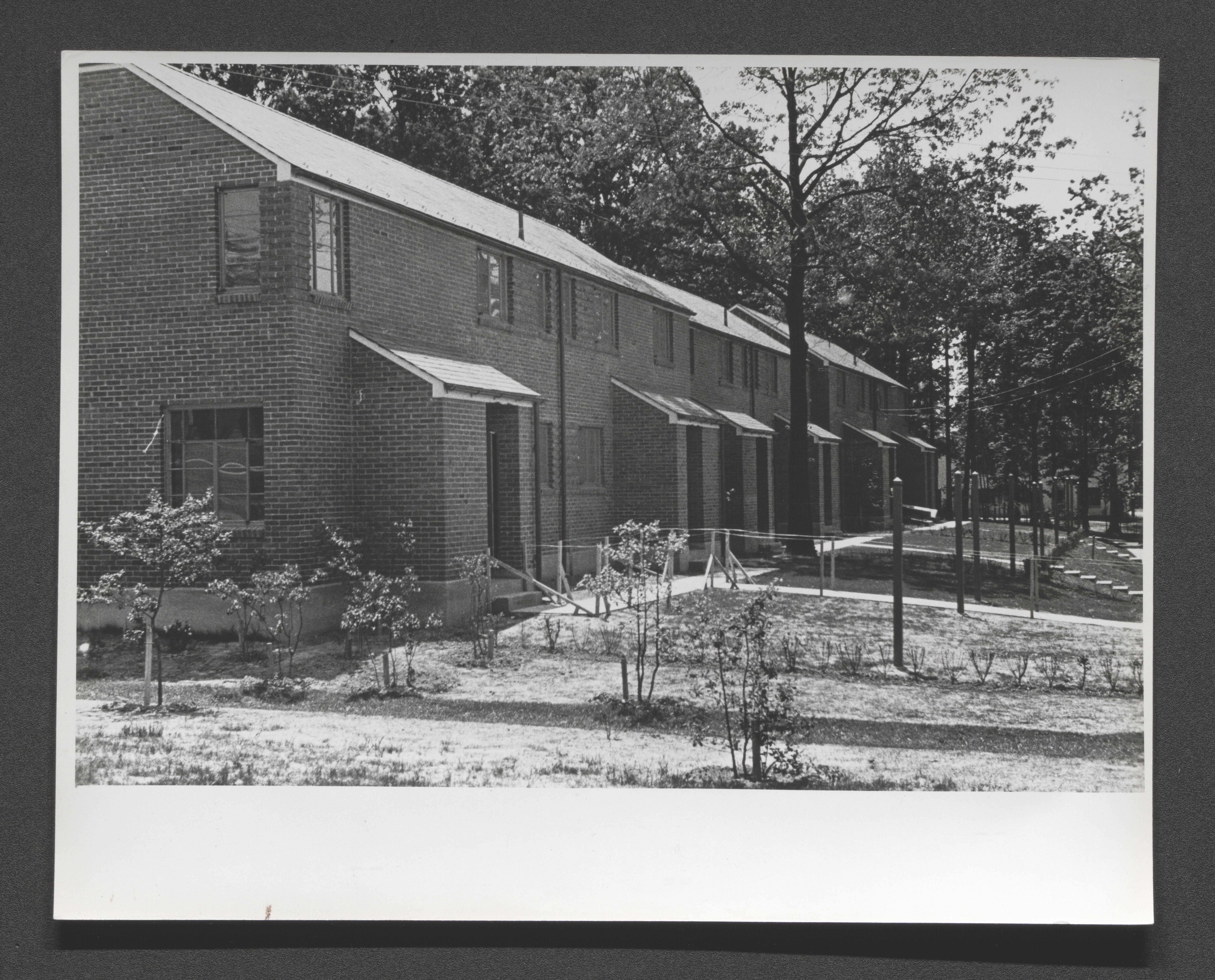
Row of four attached multifamily housing units, undated
Brick housing unit in trees close up contrasts with white cinder block units in background, undated
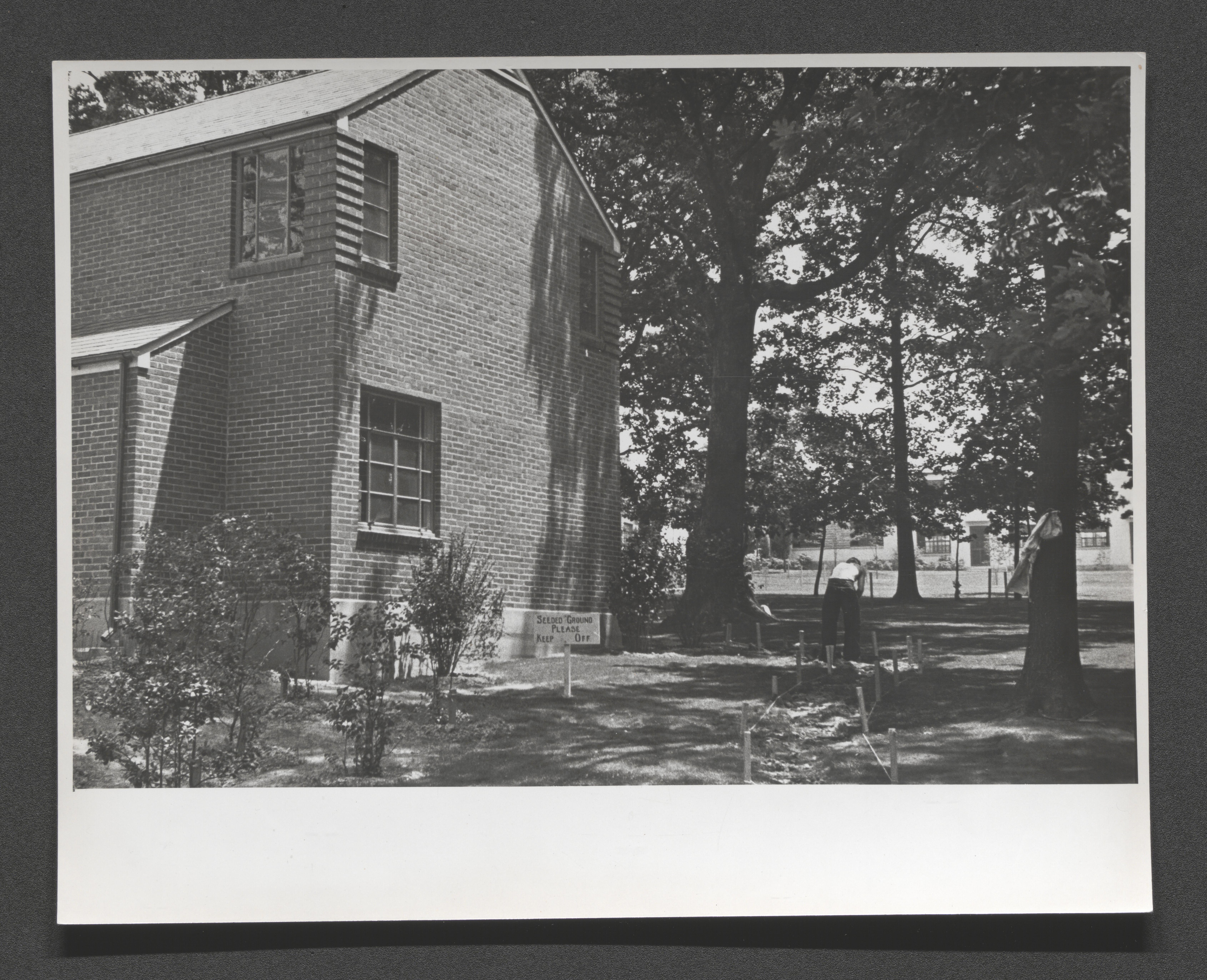
Landscaping in progress around brick housing unit, undated
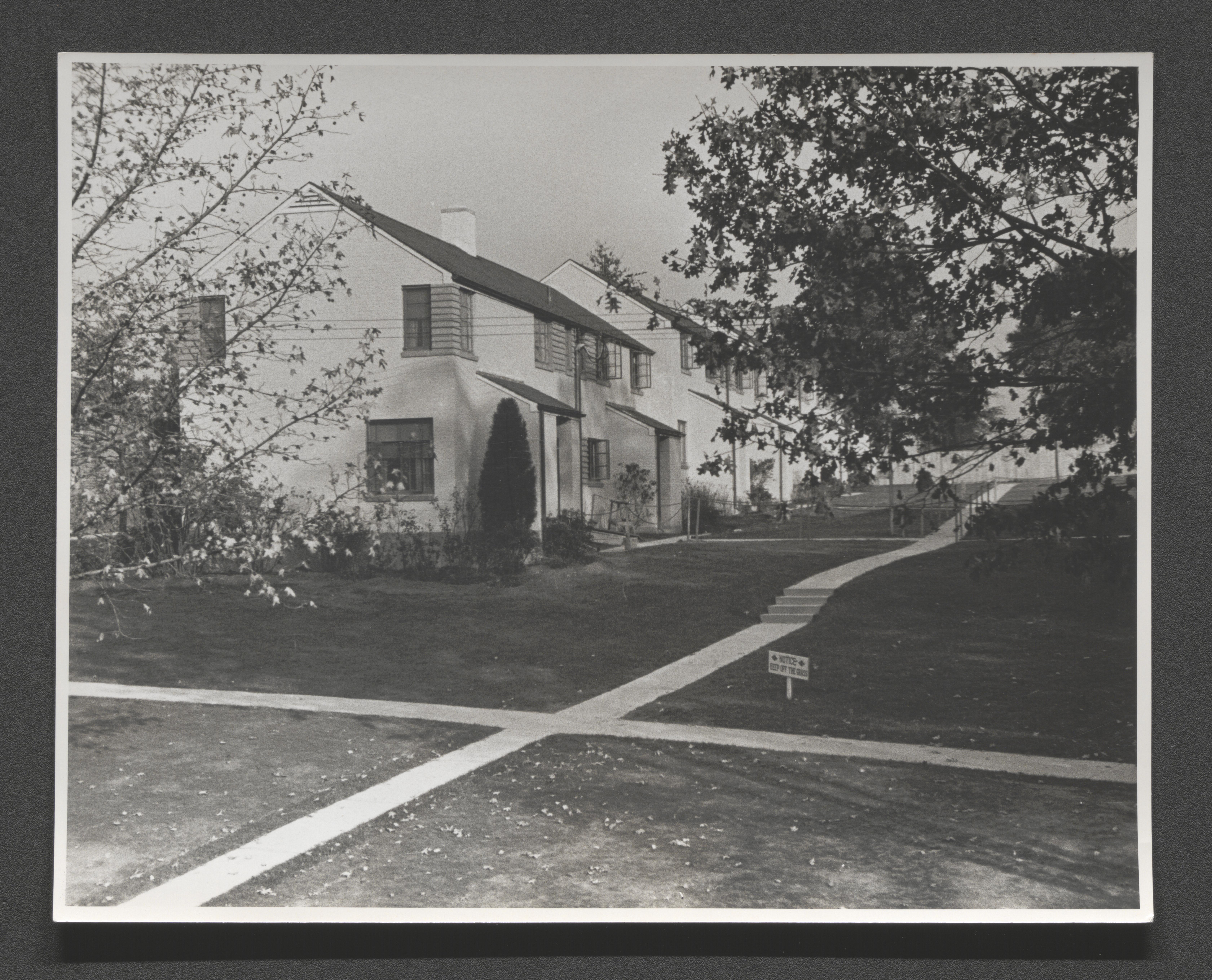
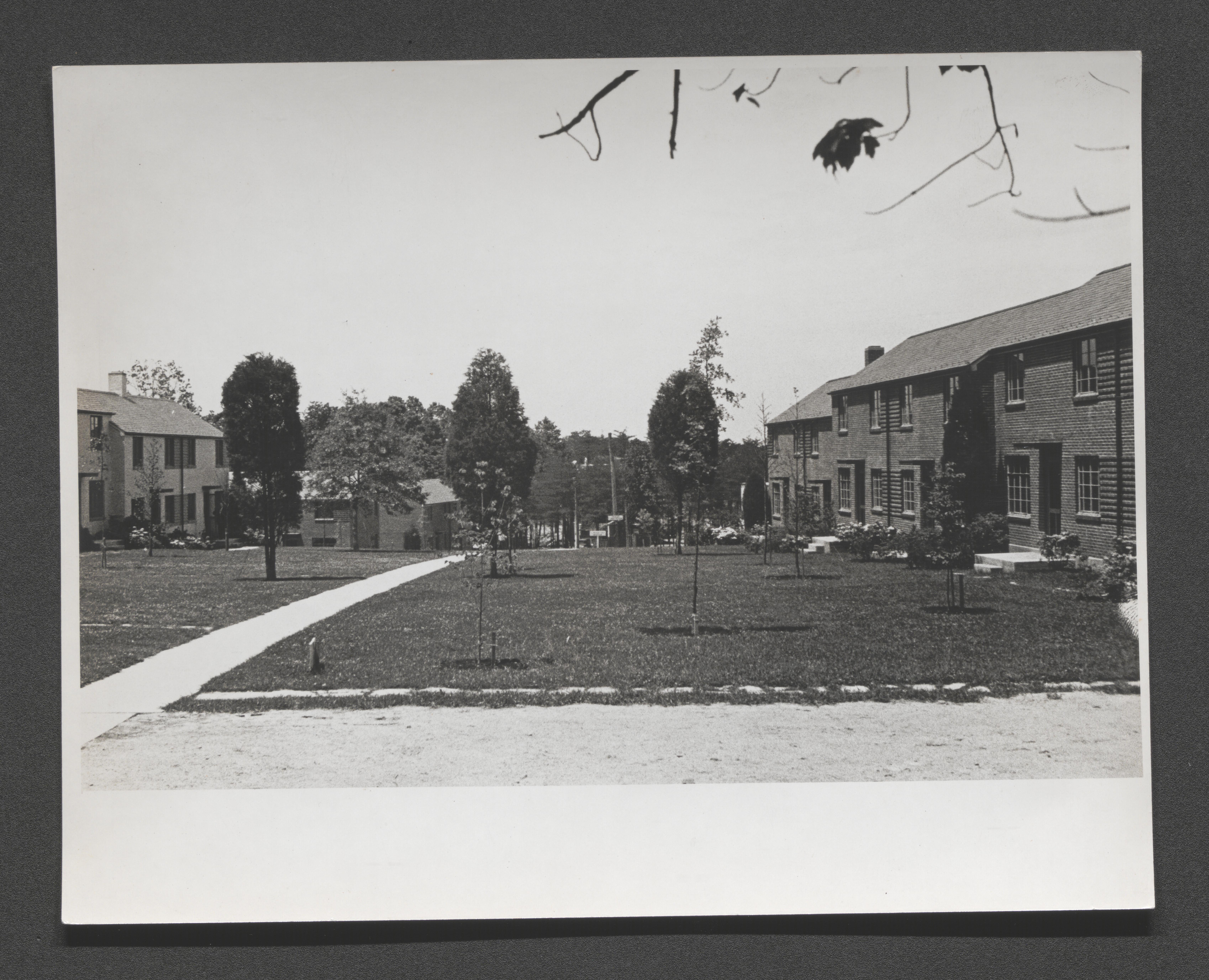
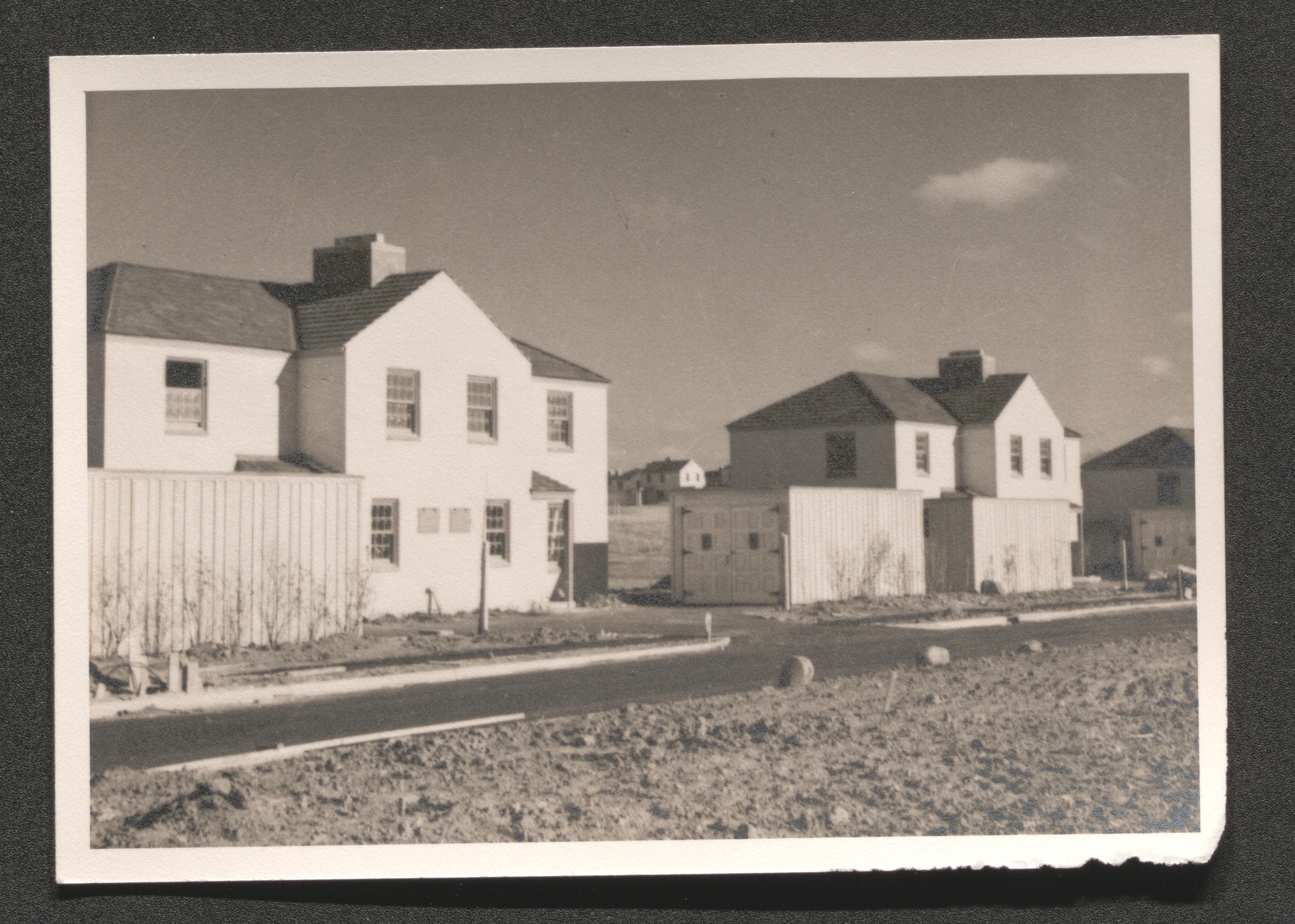
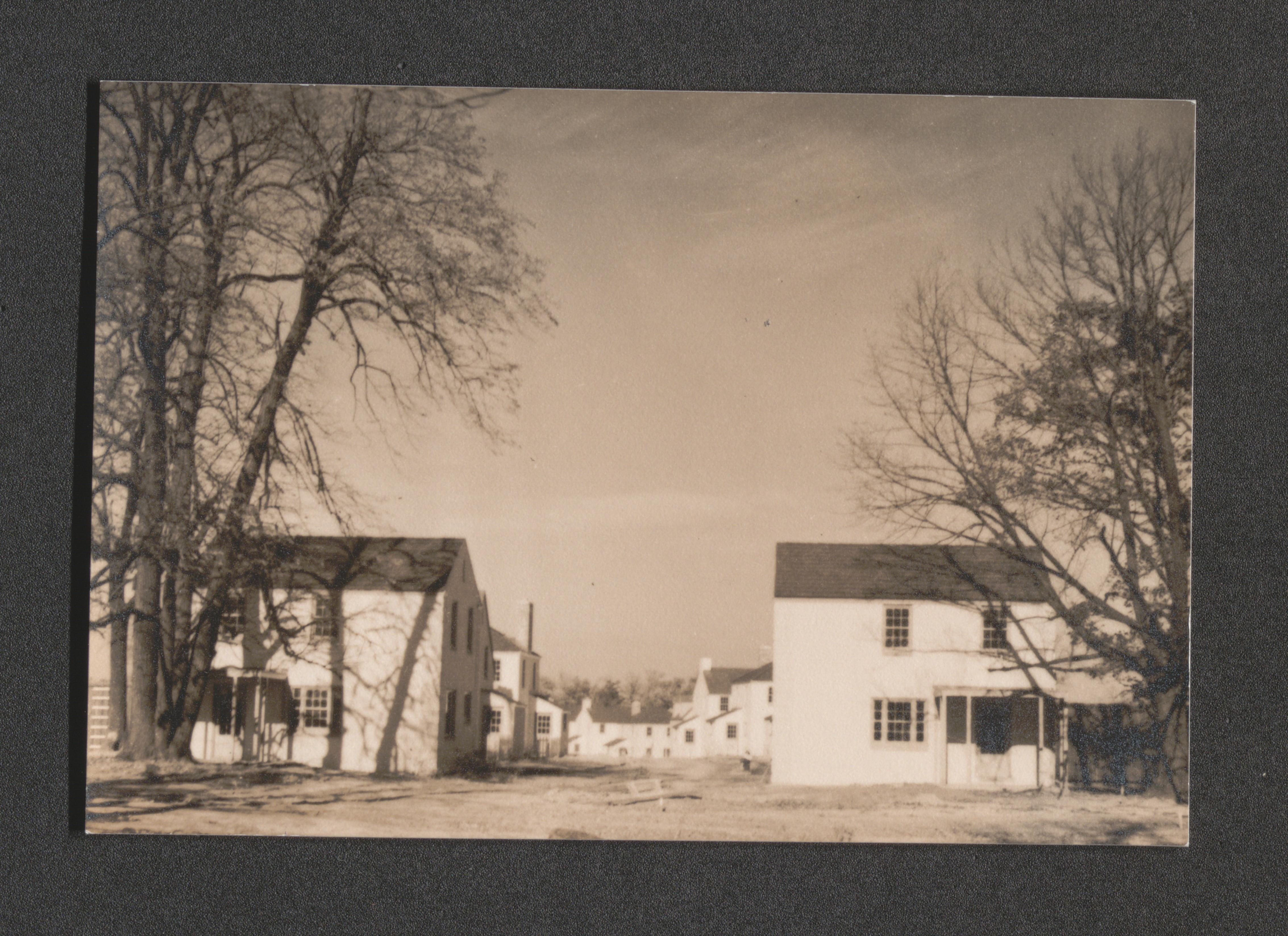
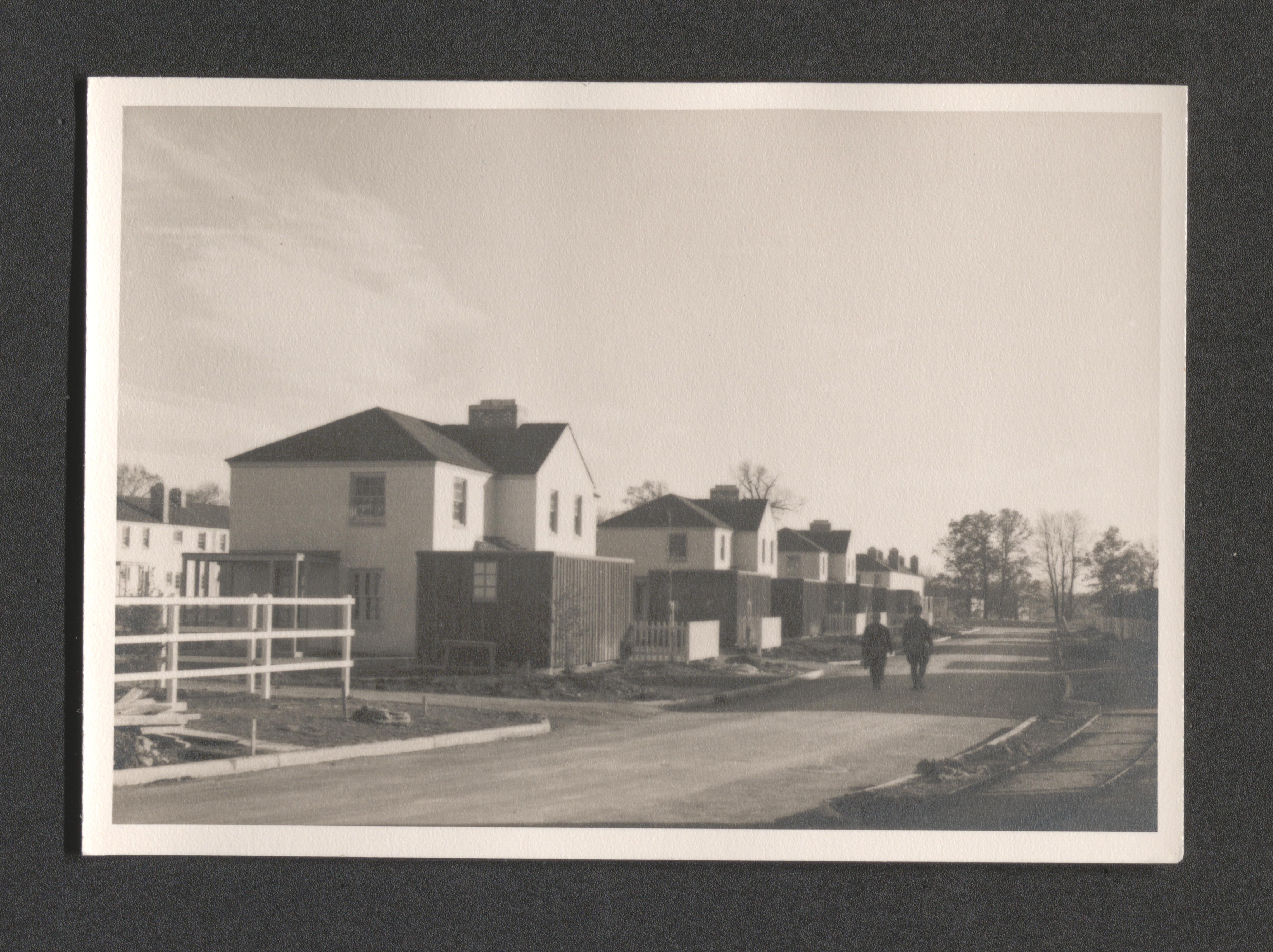
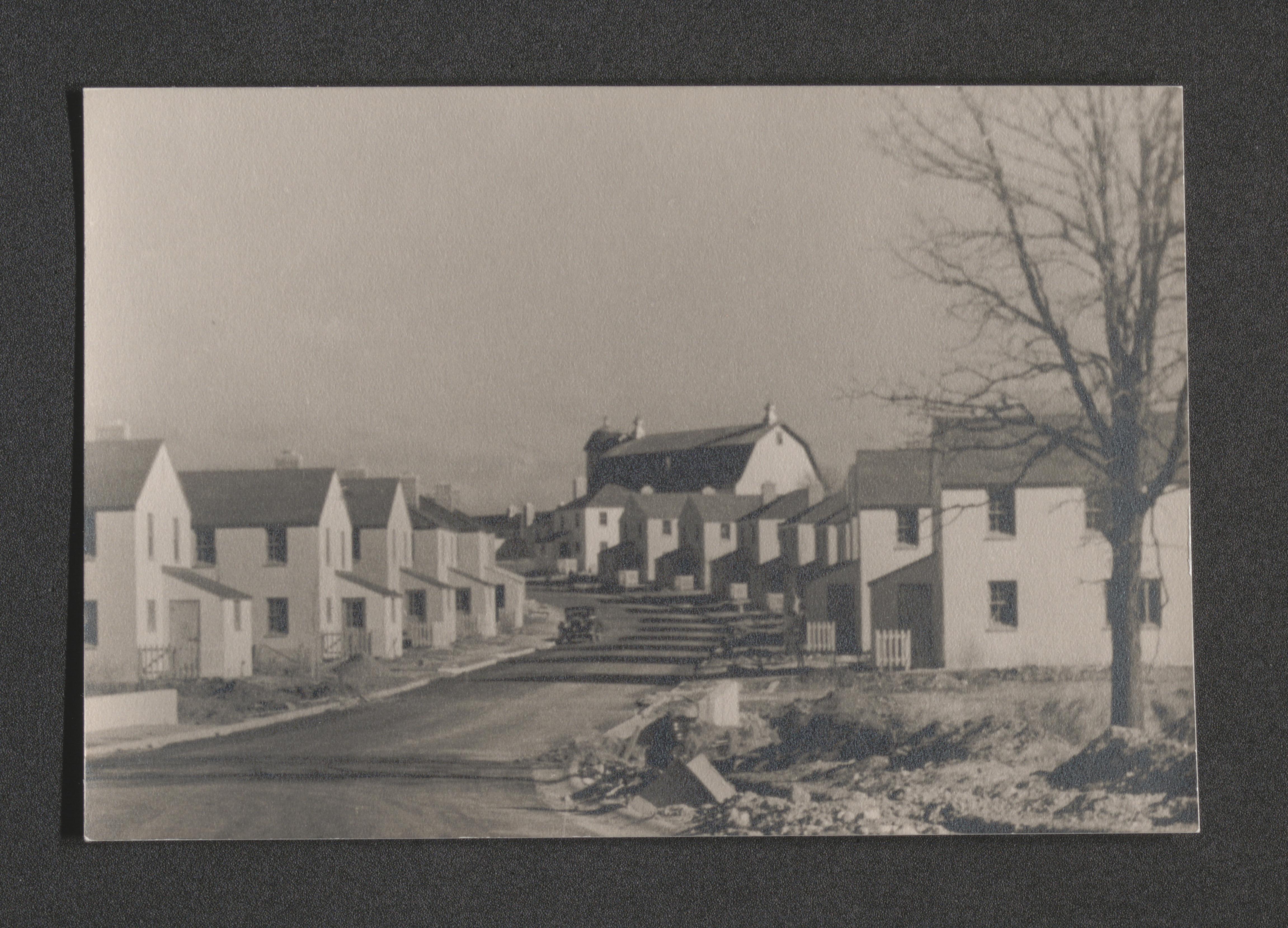
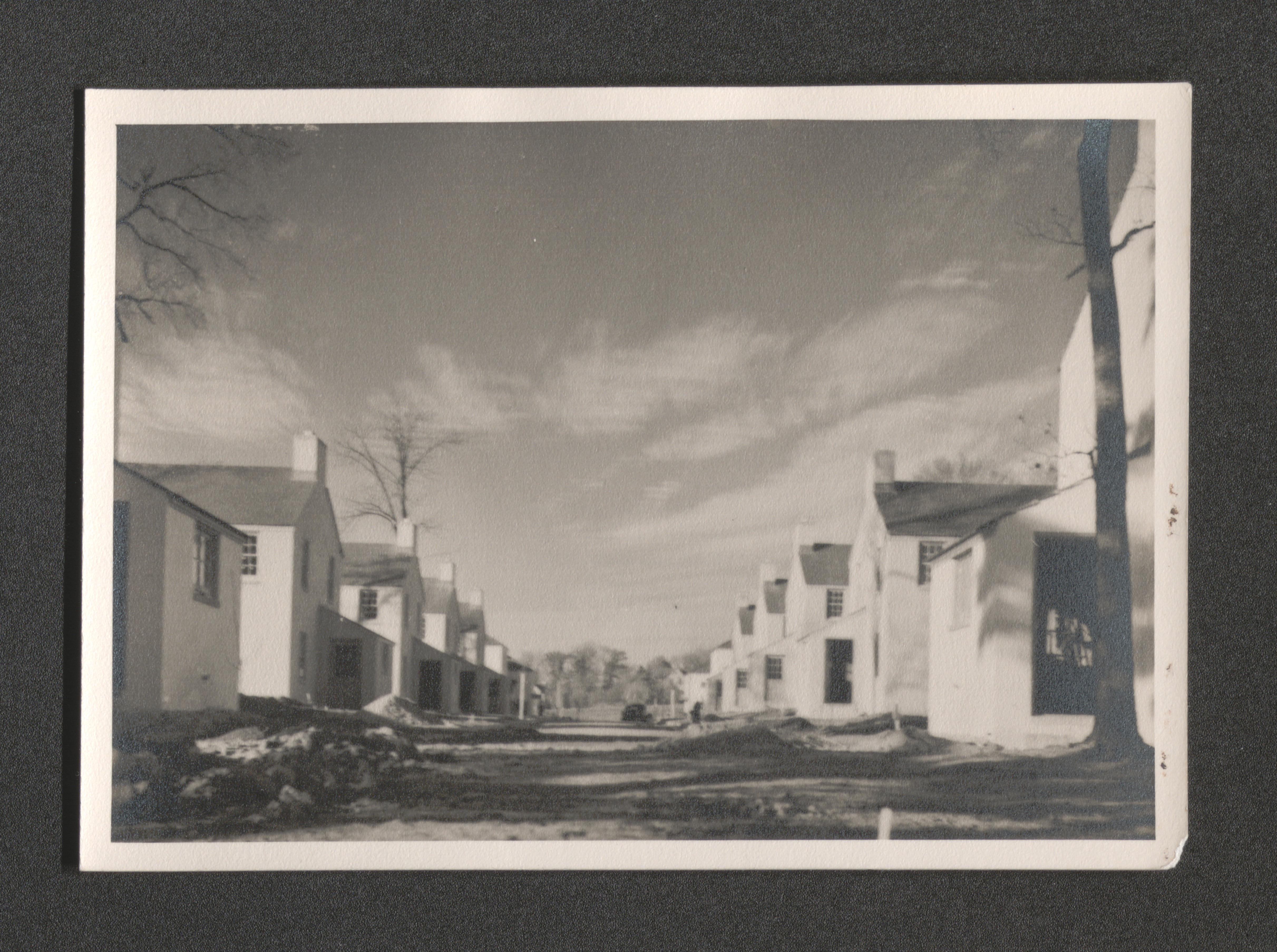
Sidewalk and front yards with housing unit row, undated
Sidewalk with pedestrians through housing unit area, undated
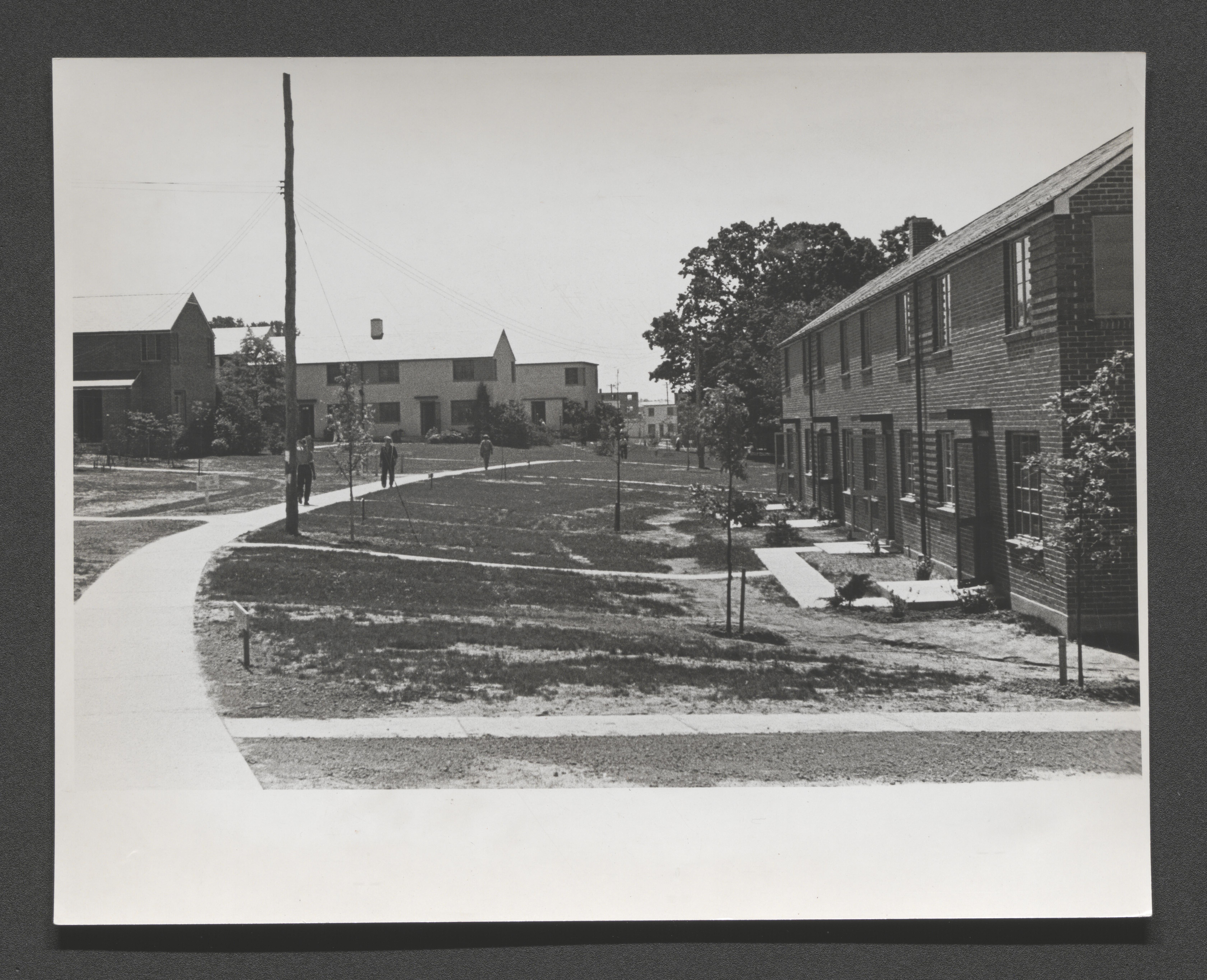
Sidewalk between housing unit rows facing each other, undated
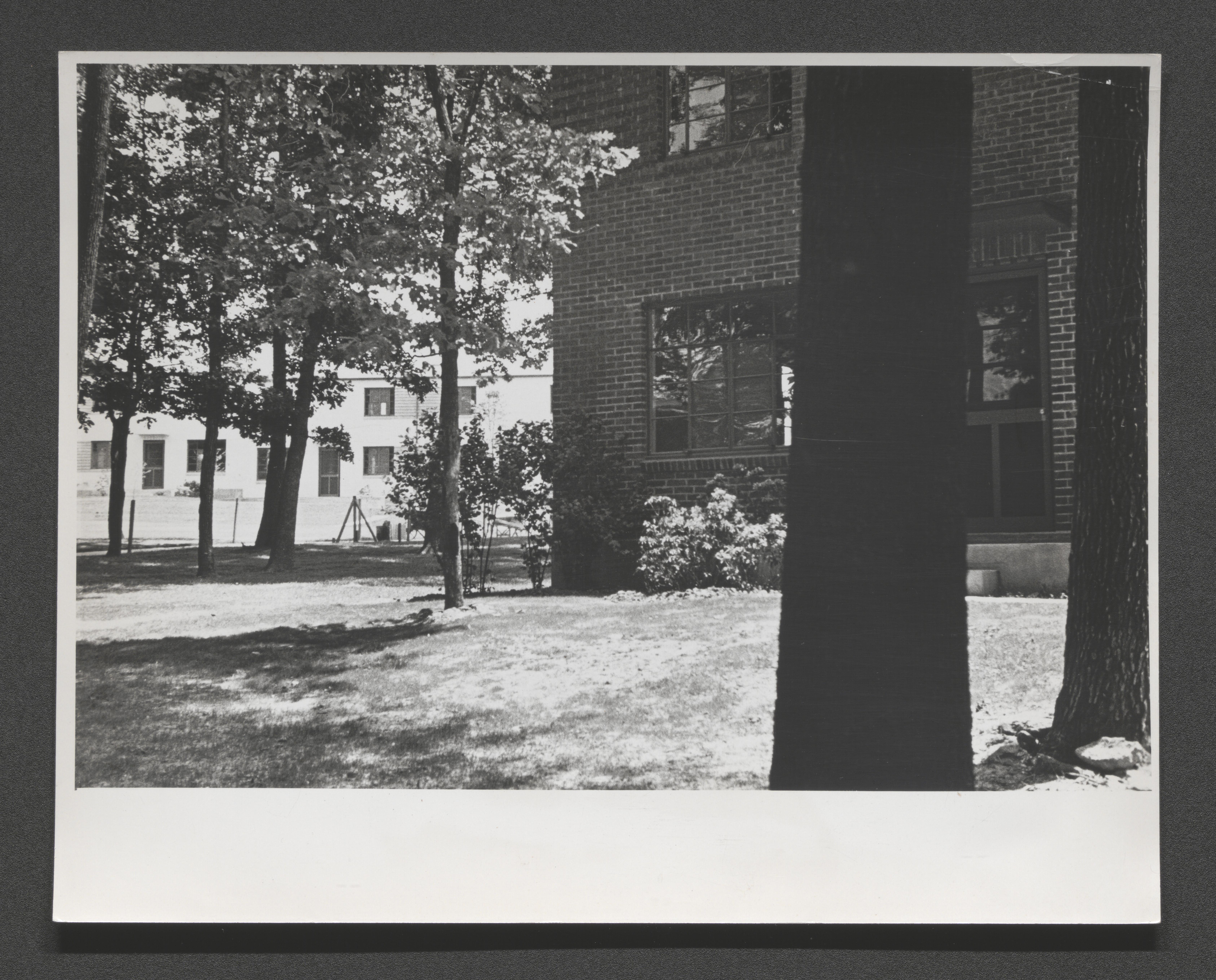
Wooded rear of housing unit row, undated
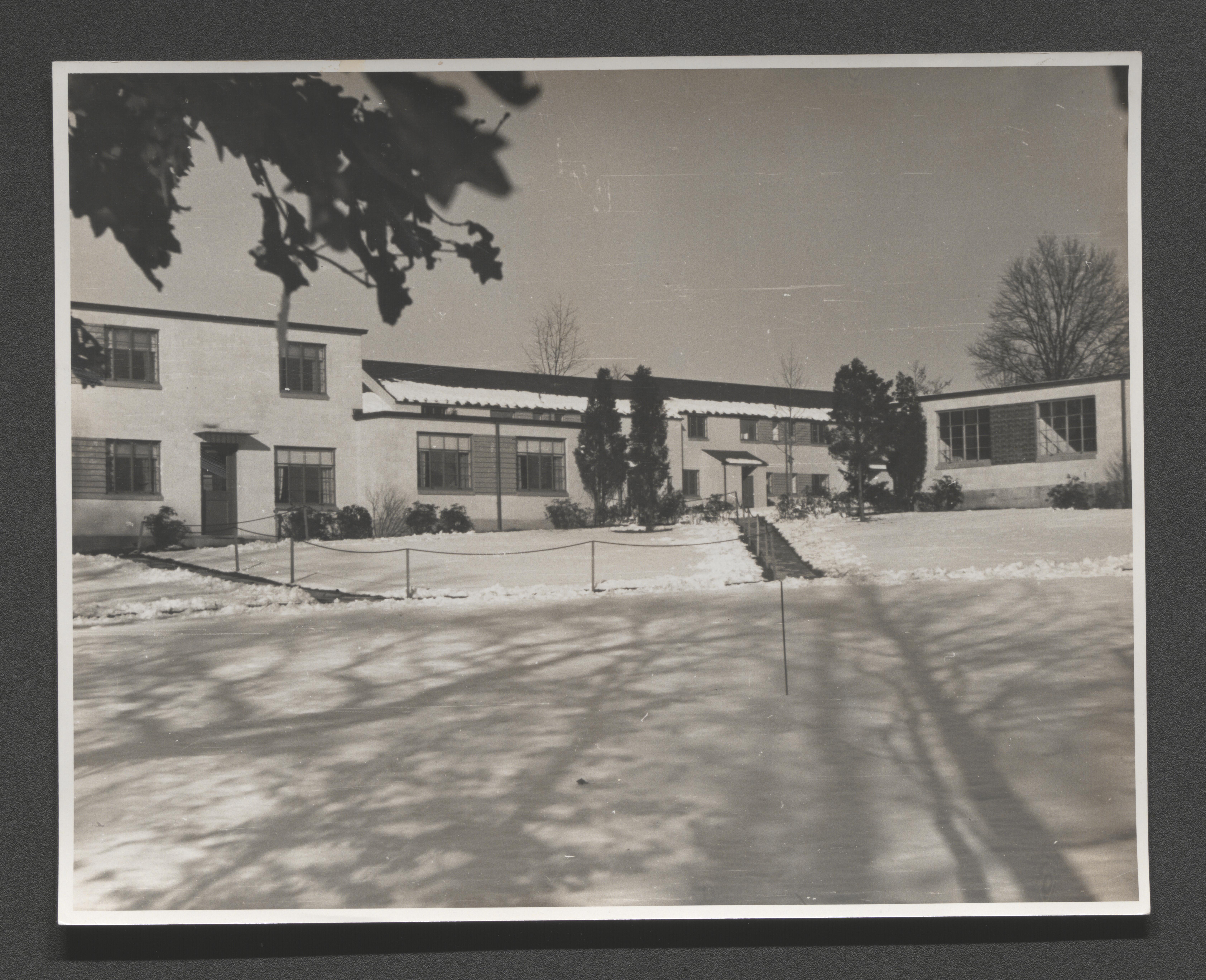
Snow on roof and yard of housing units, undated
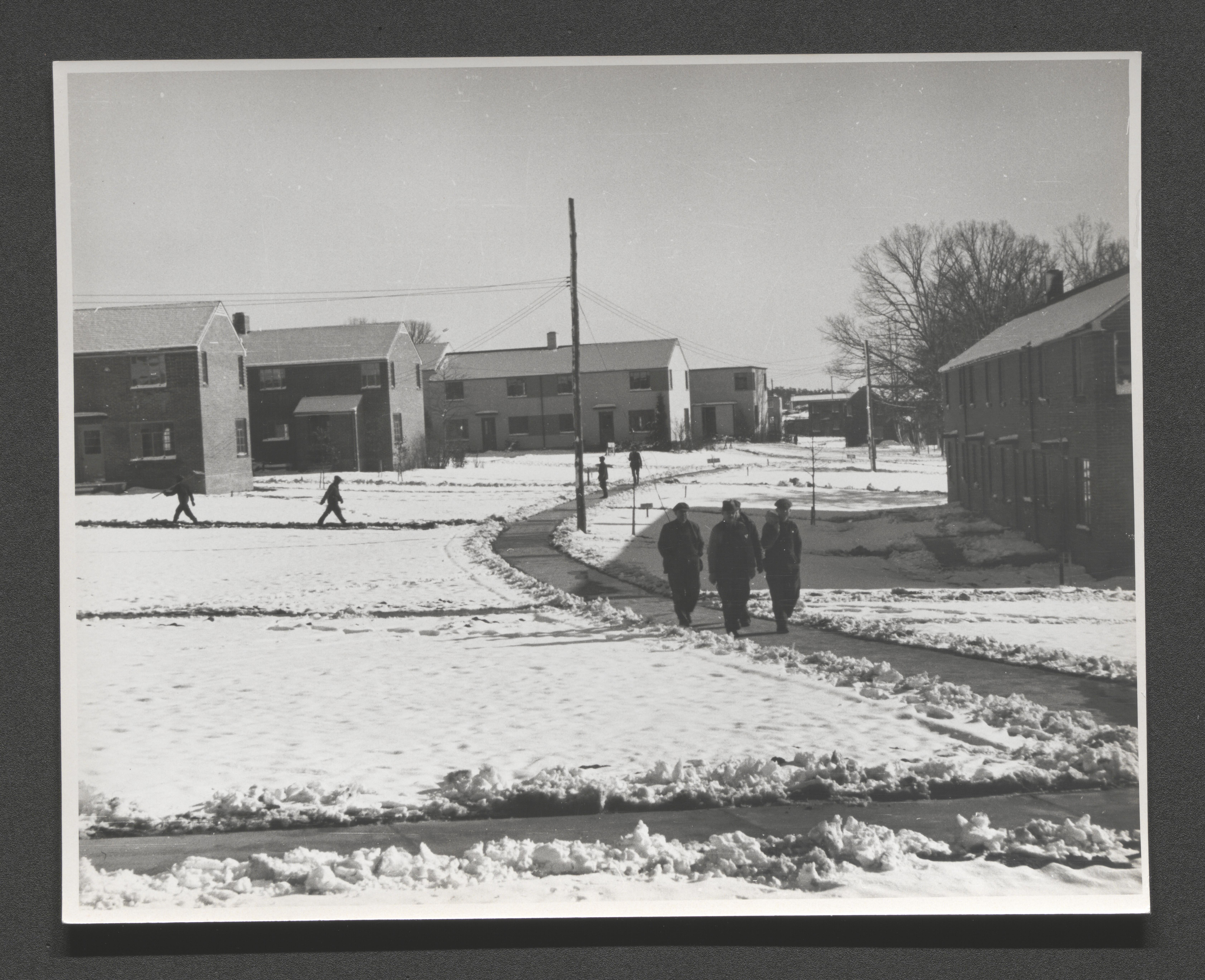
Cleared sidewalk with pedestrians through housing unit area with snow on ground, undated
Snow covered ground with cleared sidewalks in housing unit area, undated

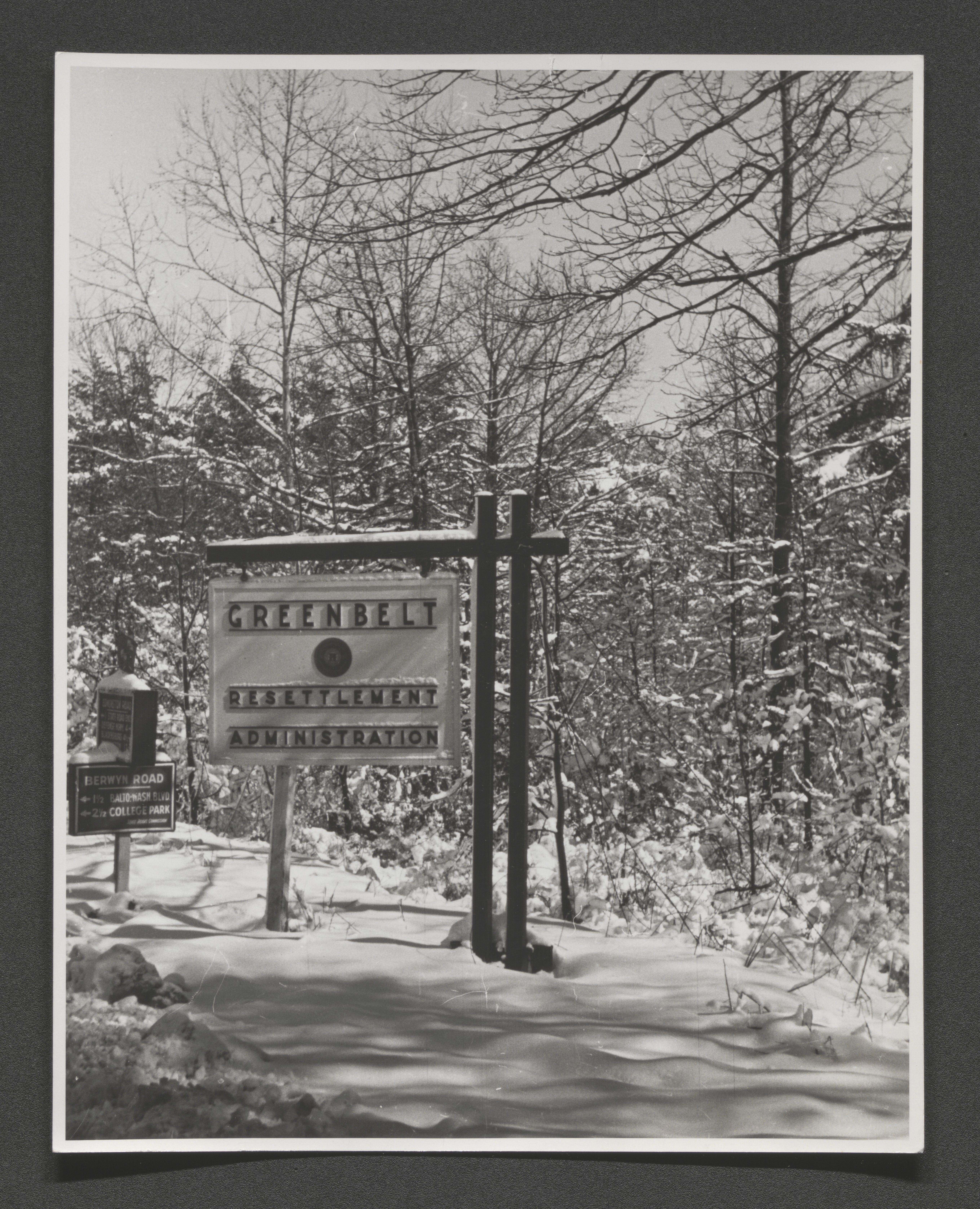
Greenbelt/Resettlement Administration sign in snow at edge of wooded area, undated
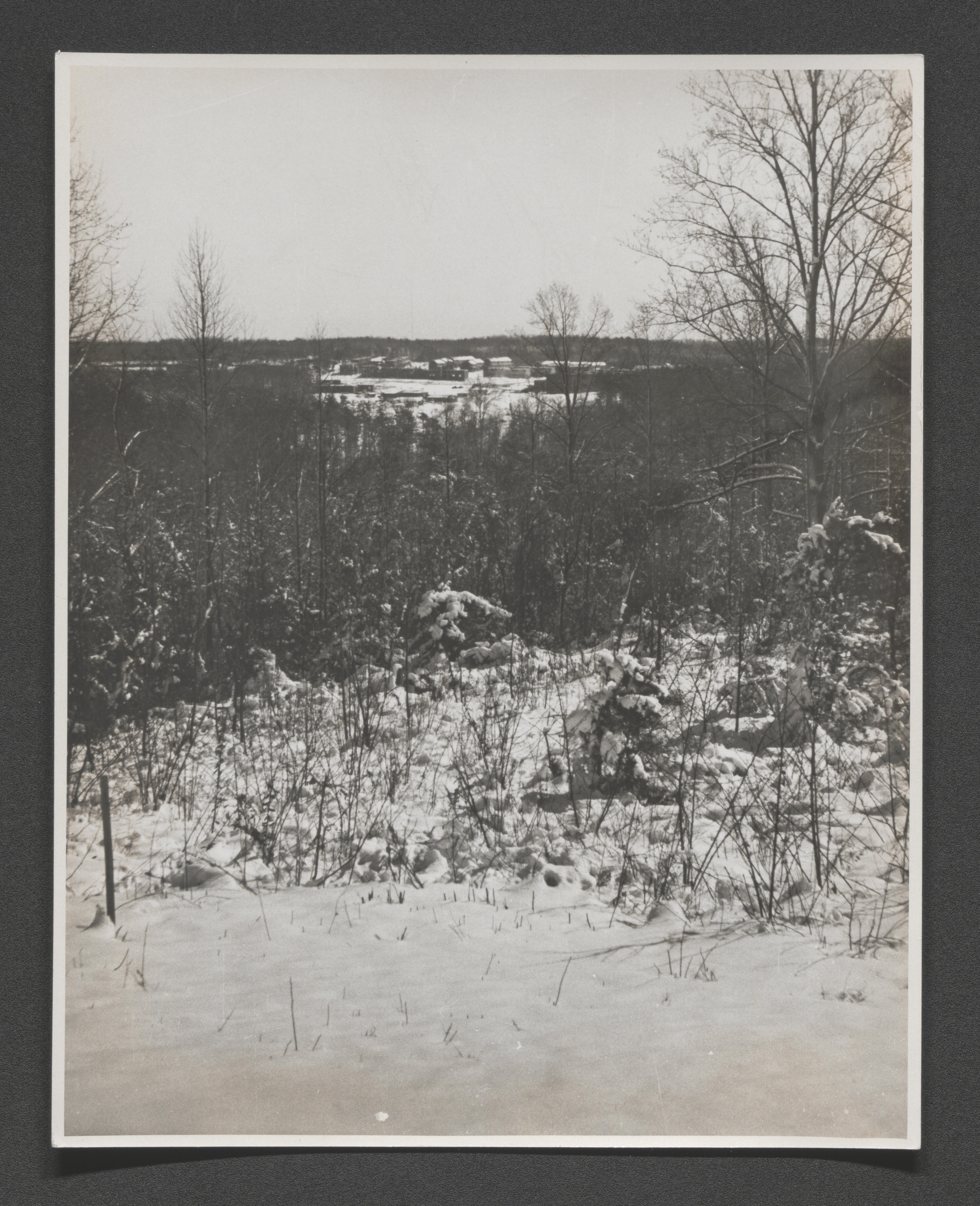
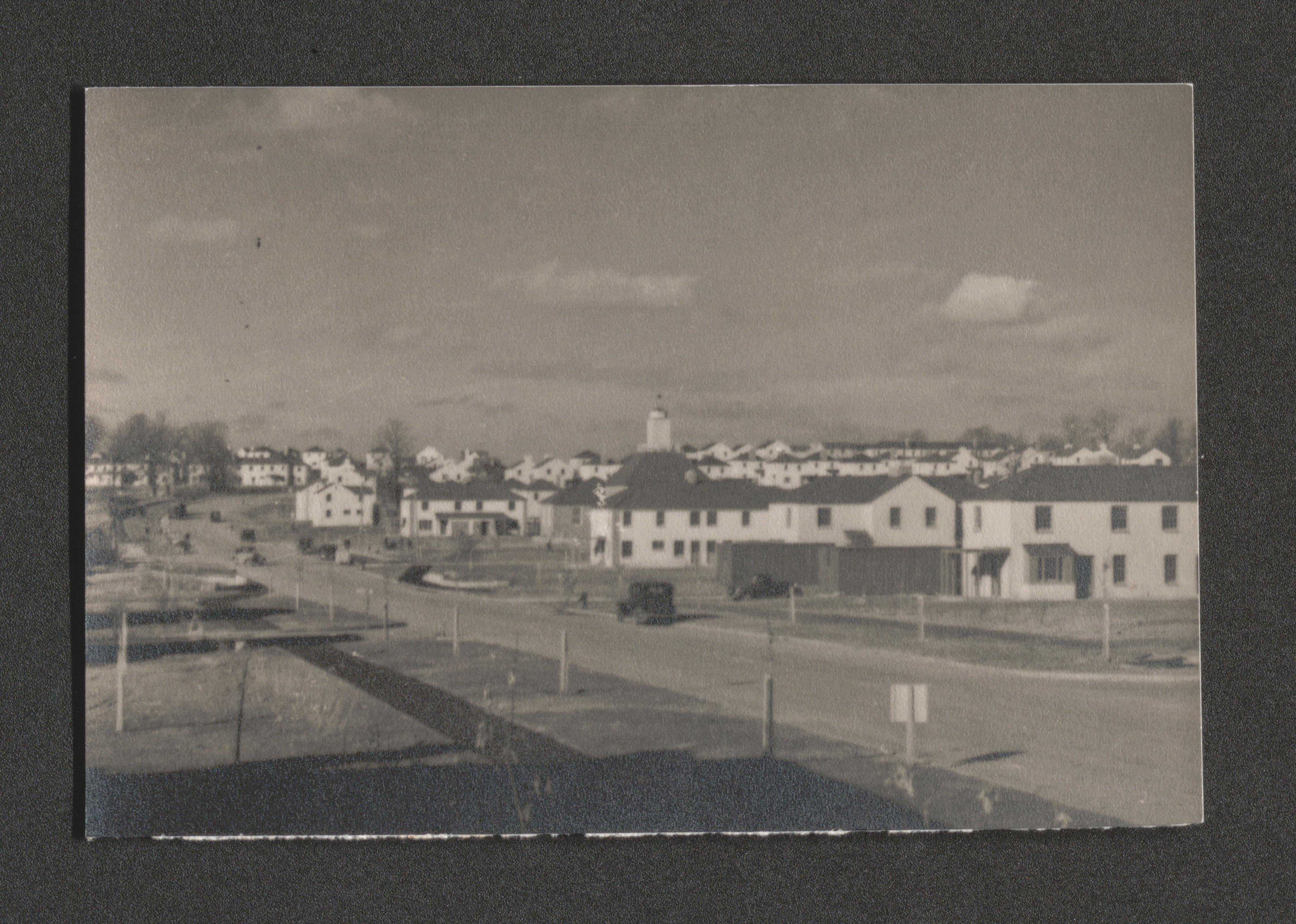
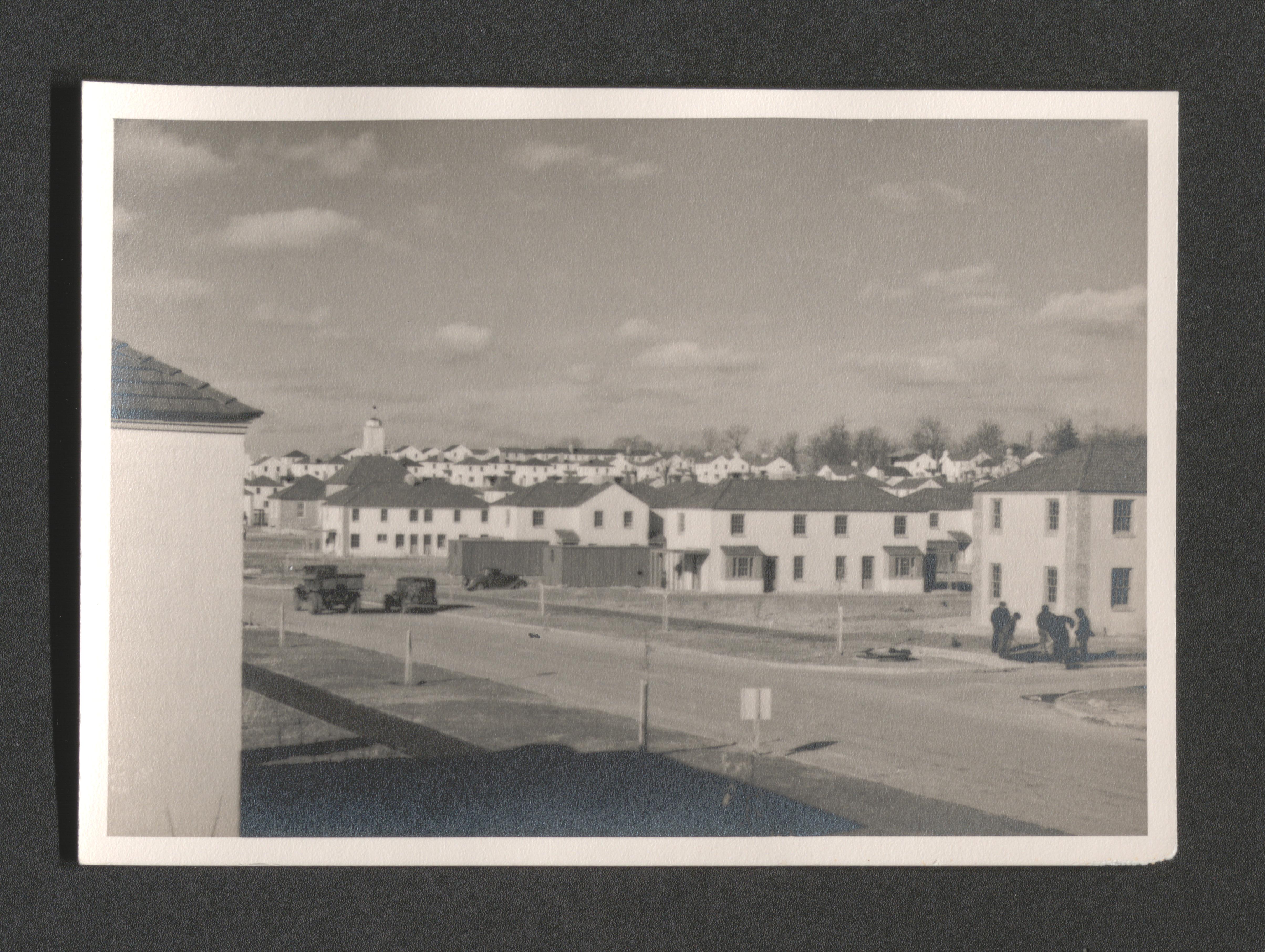
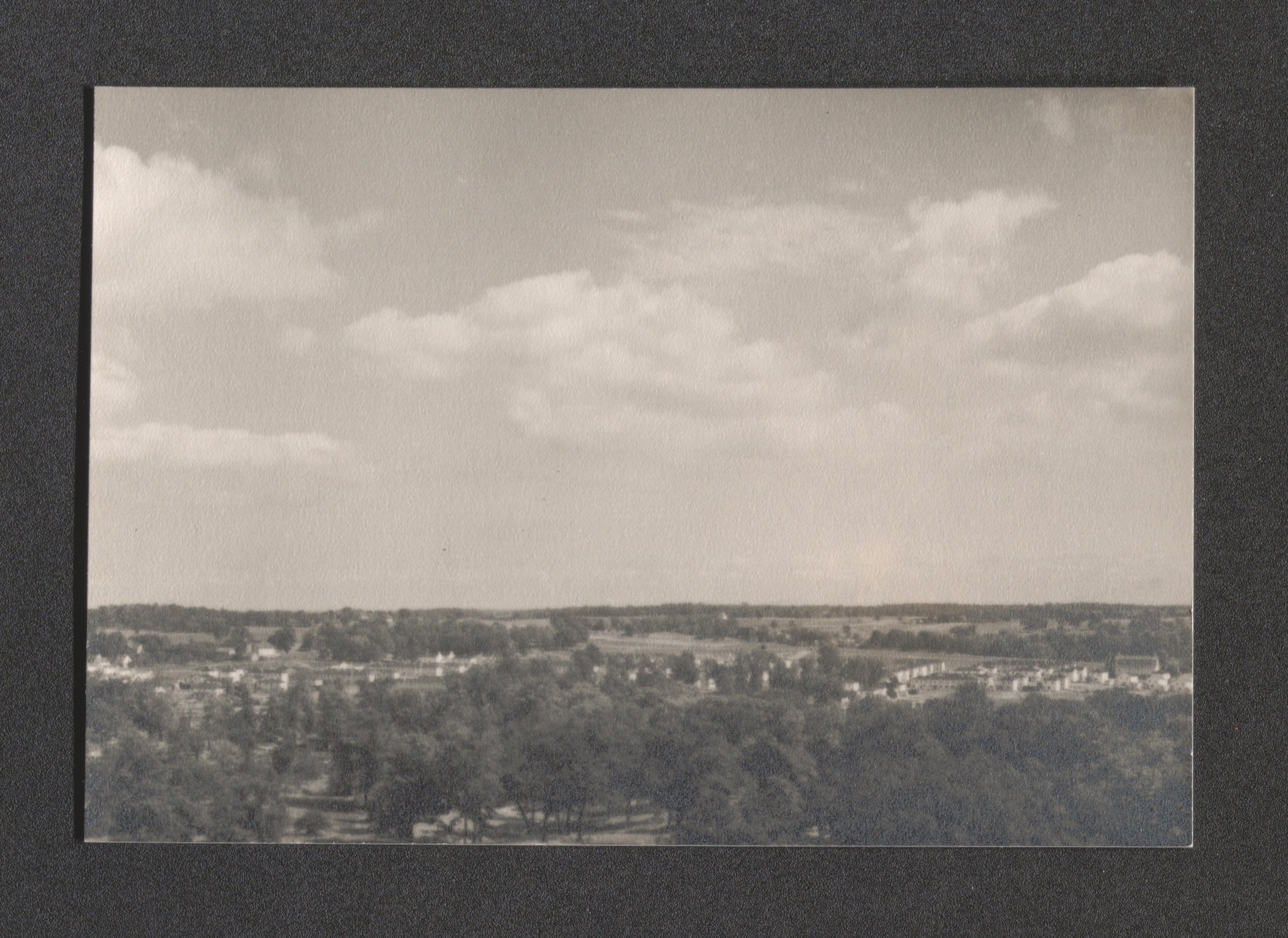
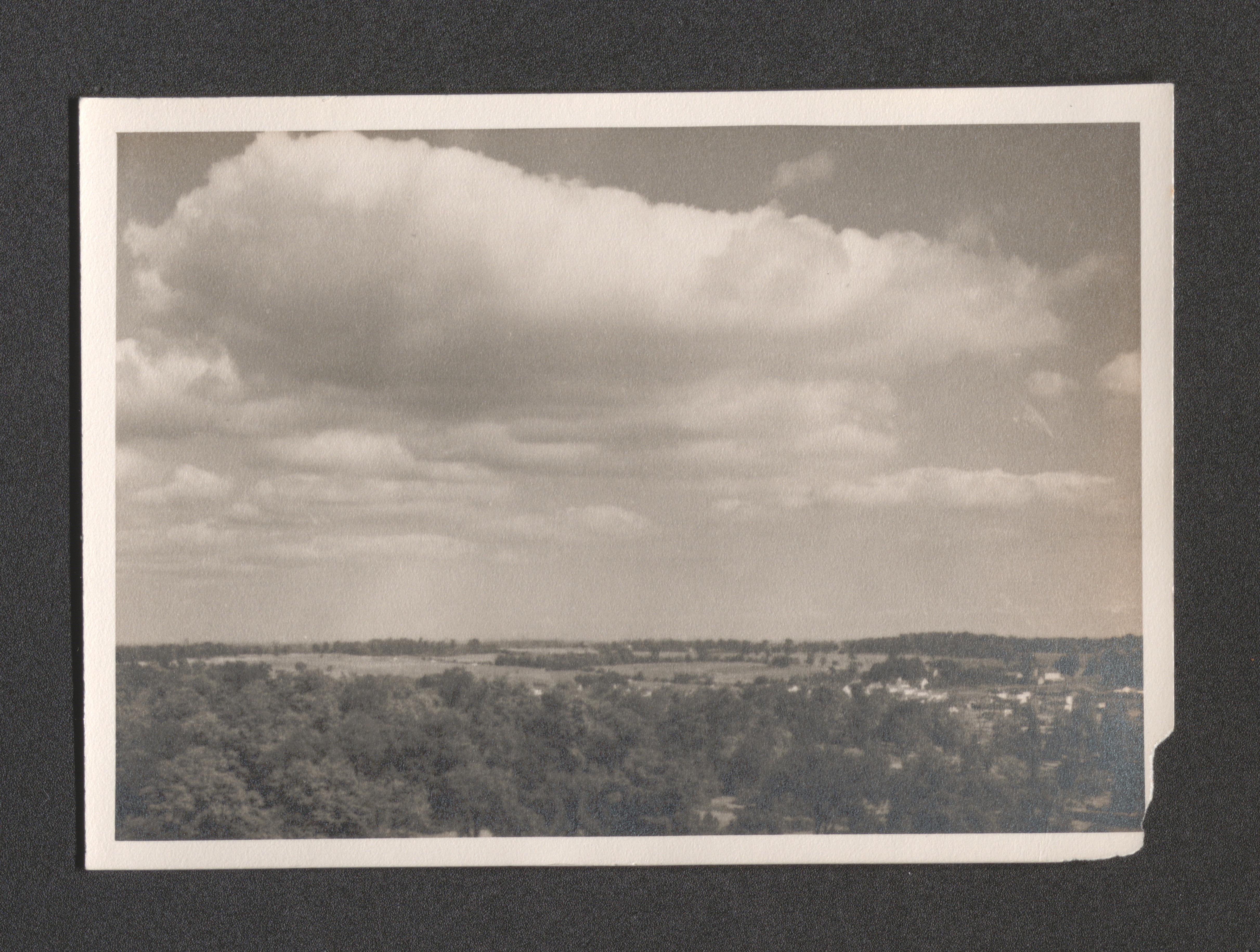
Greenbelt development with snow from distant vantage point, undated
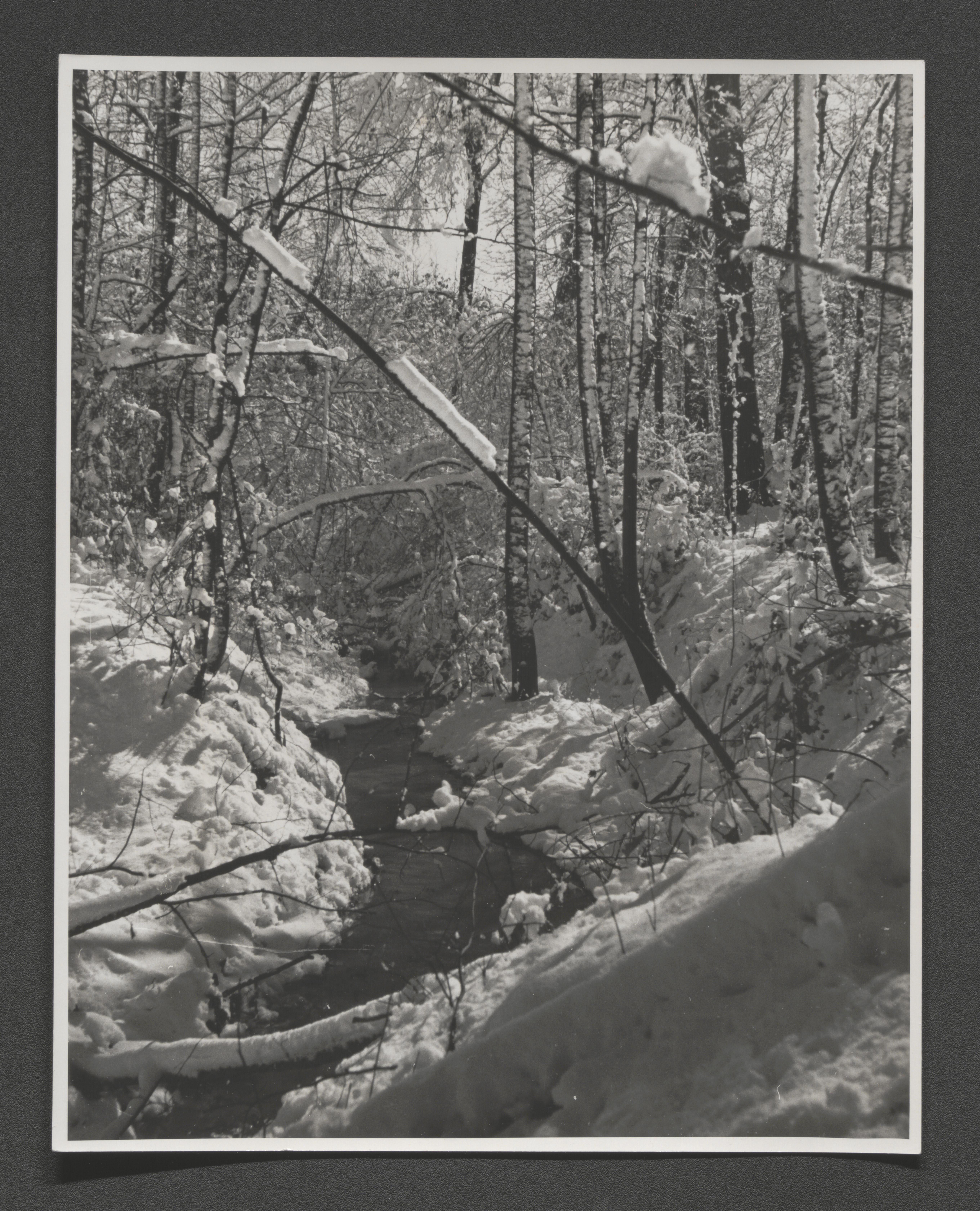
Creek bed through thick woods with snow, undated
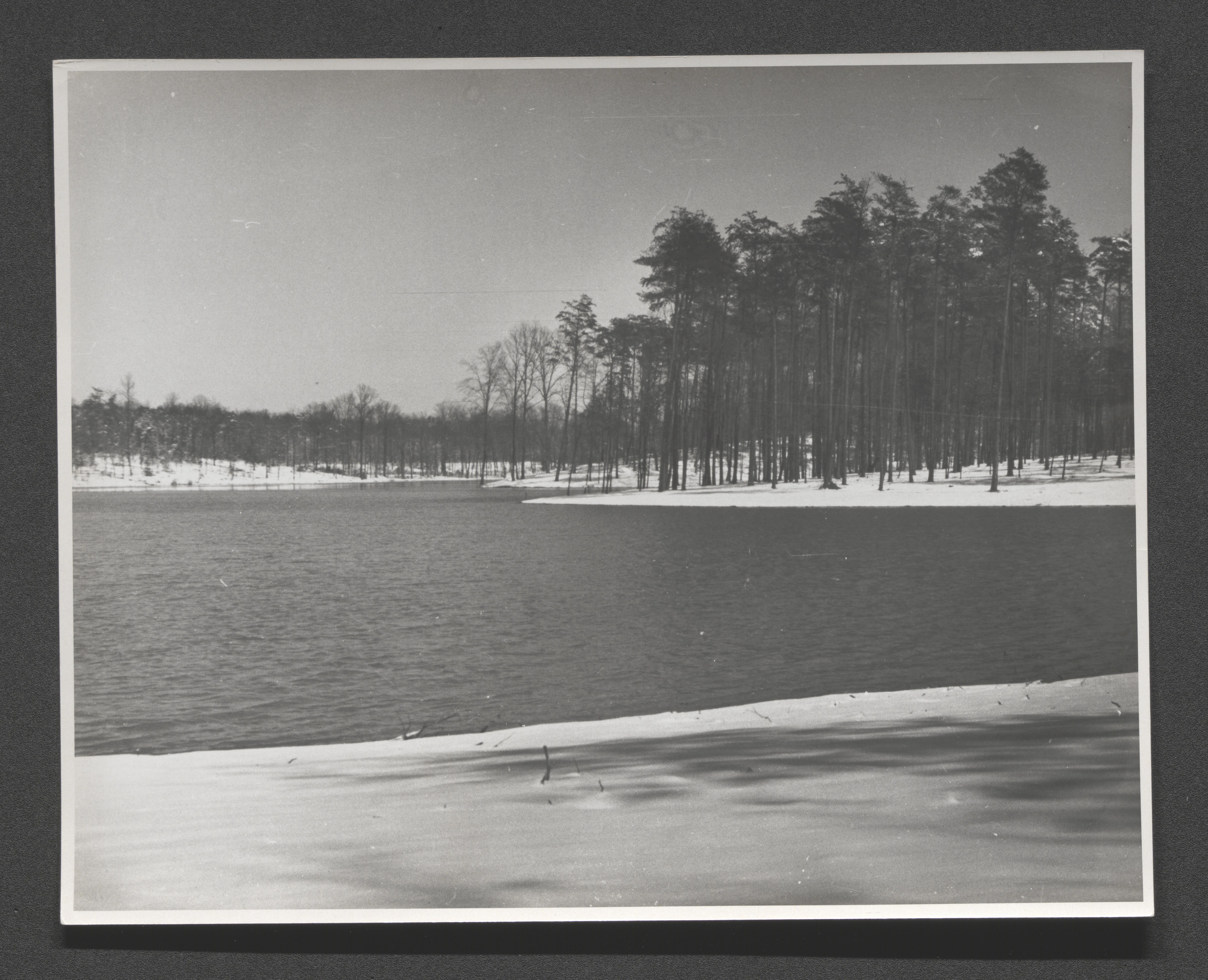
Lake at Greenbelt development with trees and snow surrounding, undated
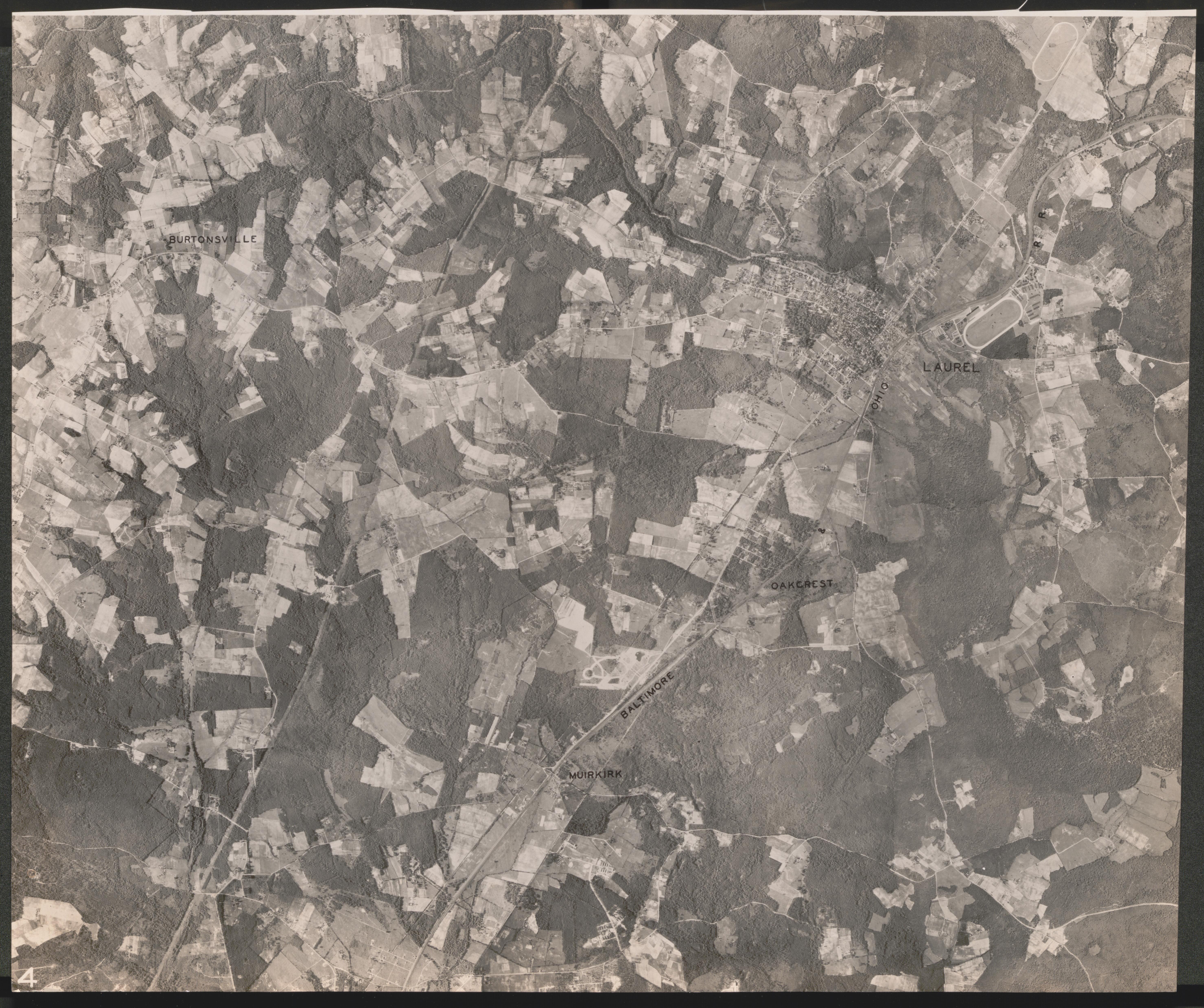
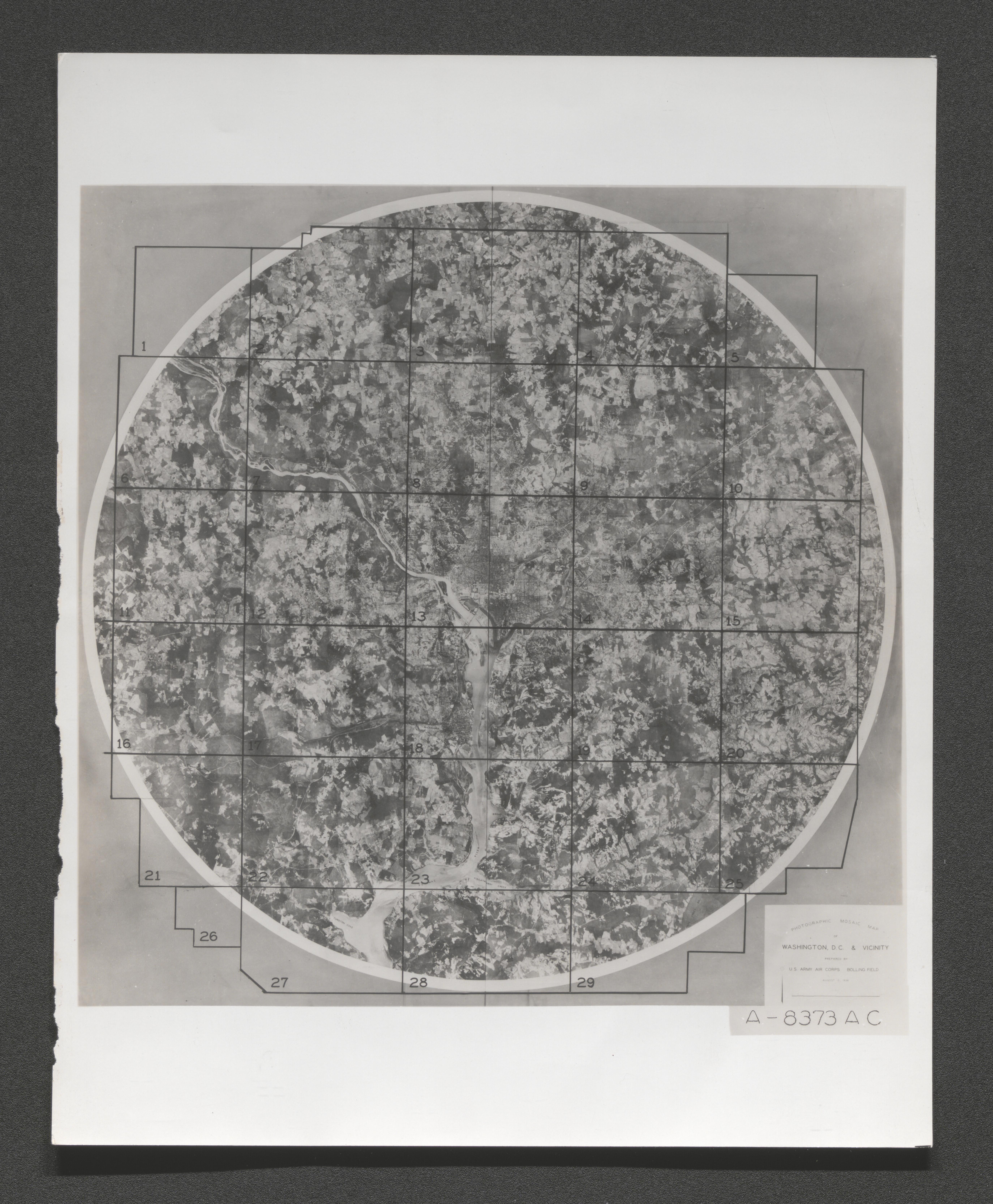
High altitude photographic mosaic map of Washington DC and vicinity, 1936 August 2
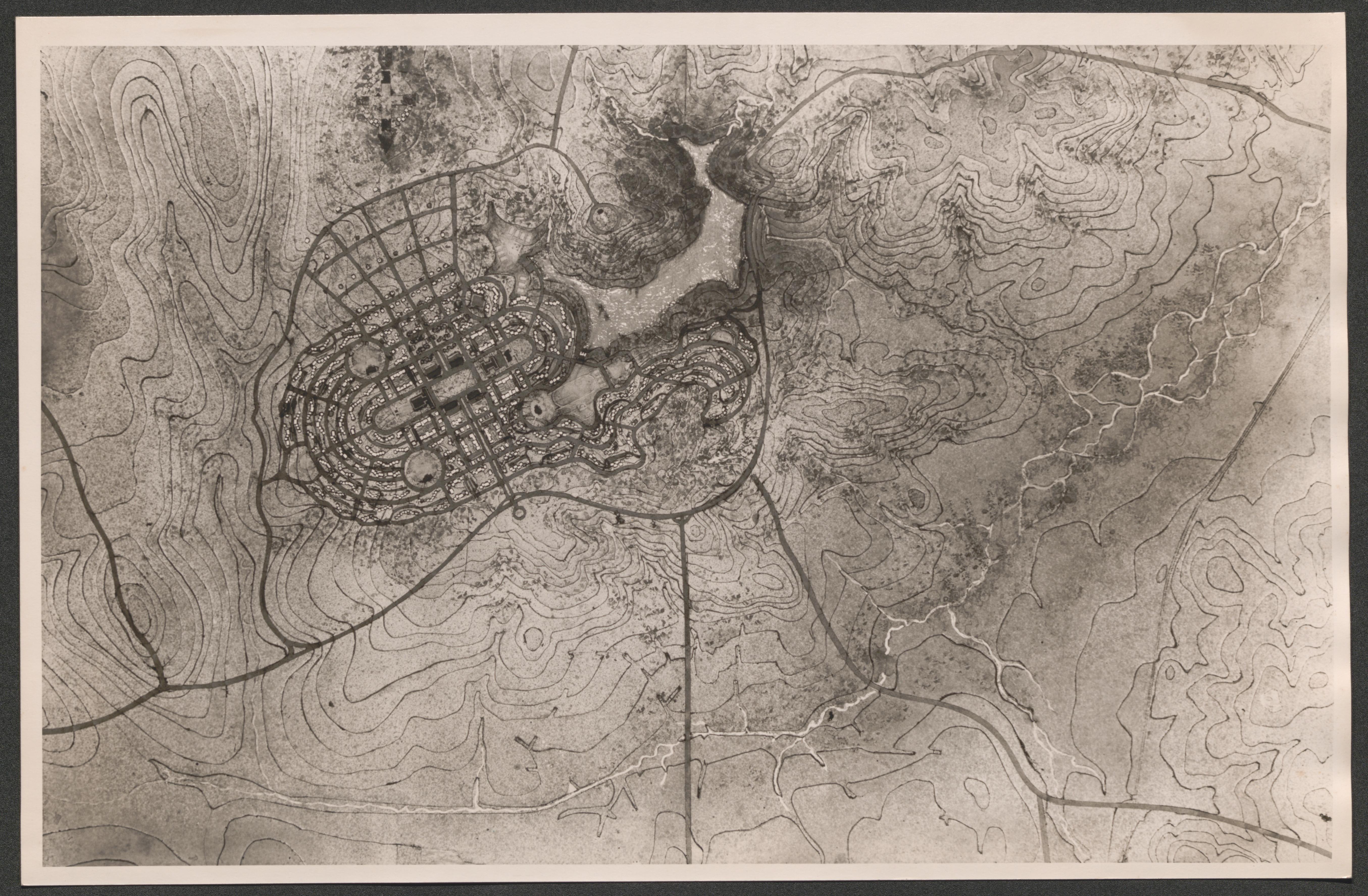
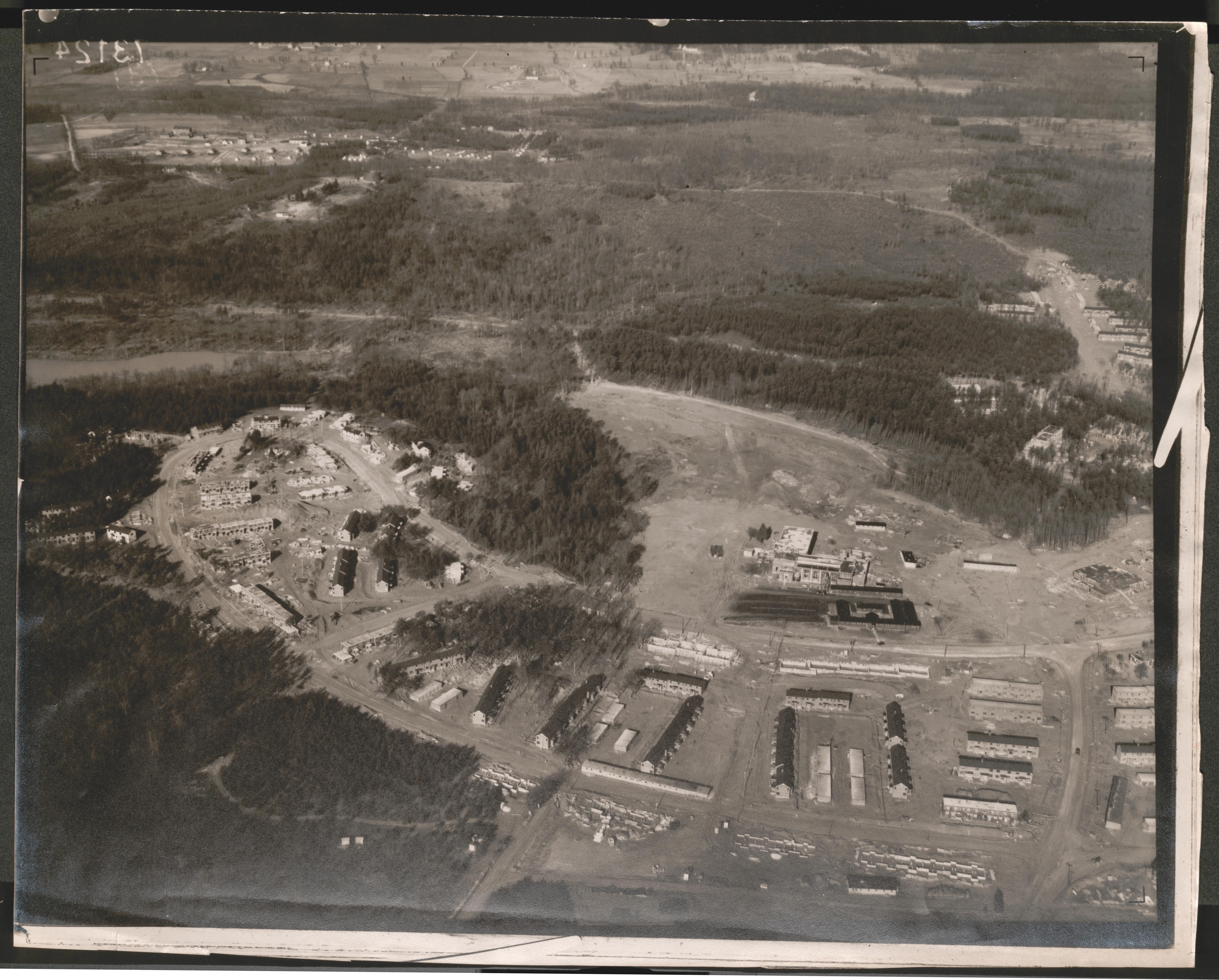
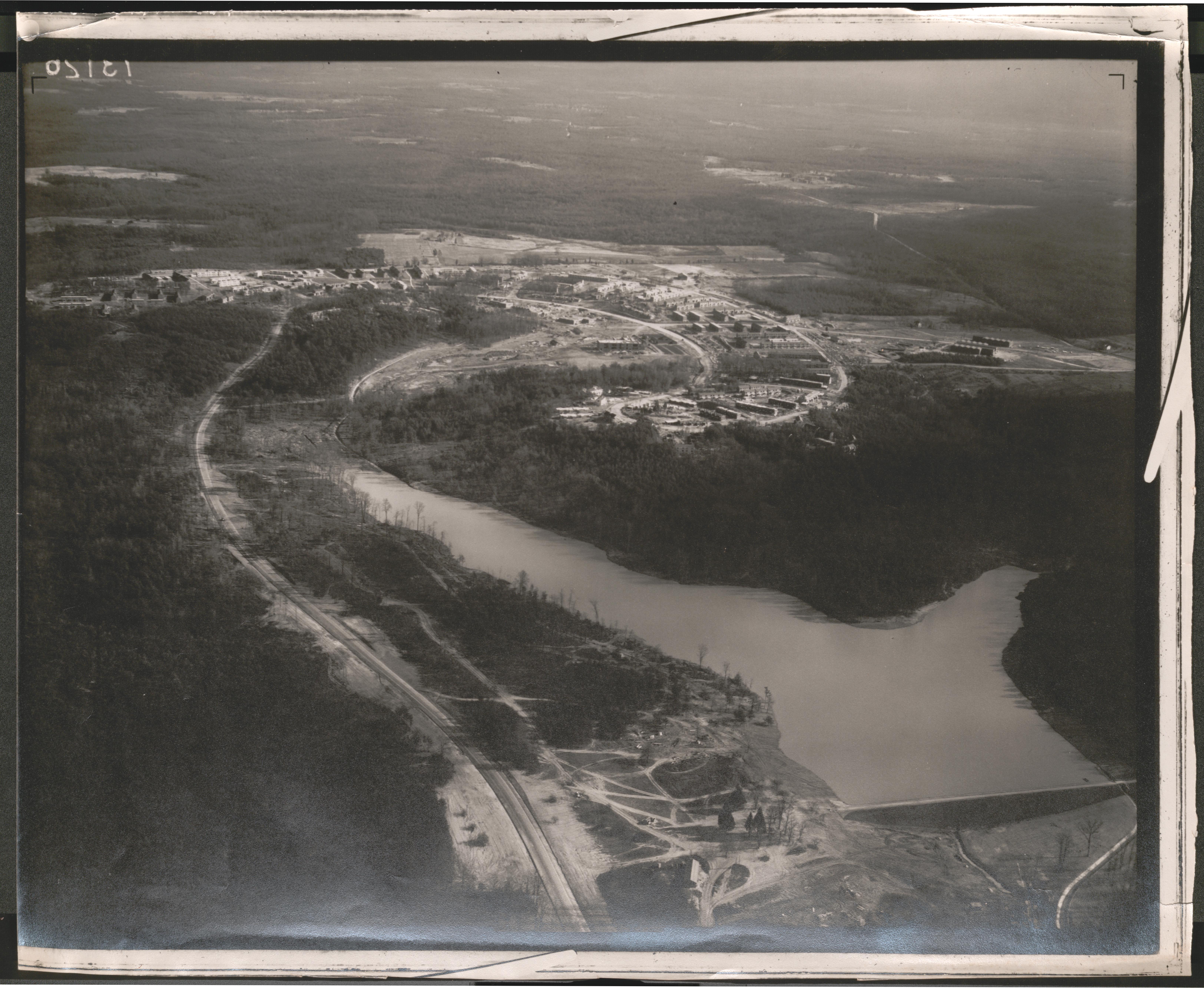
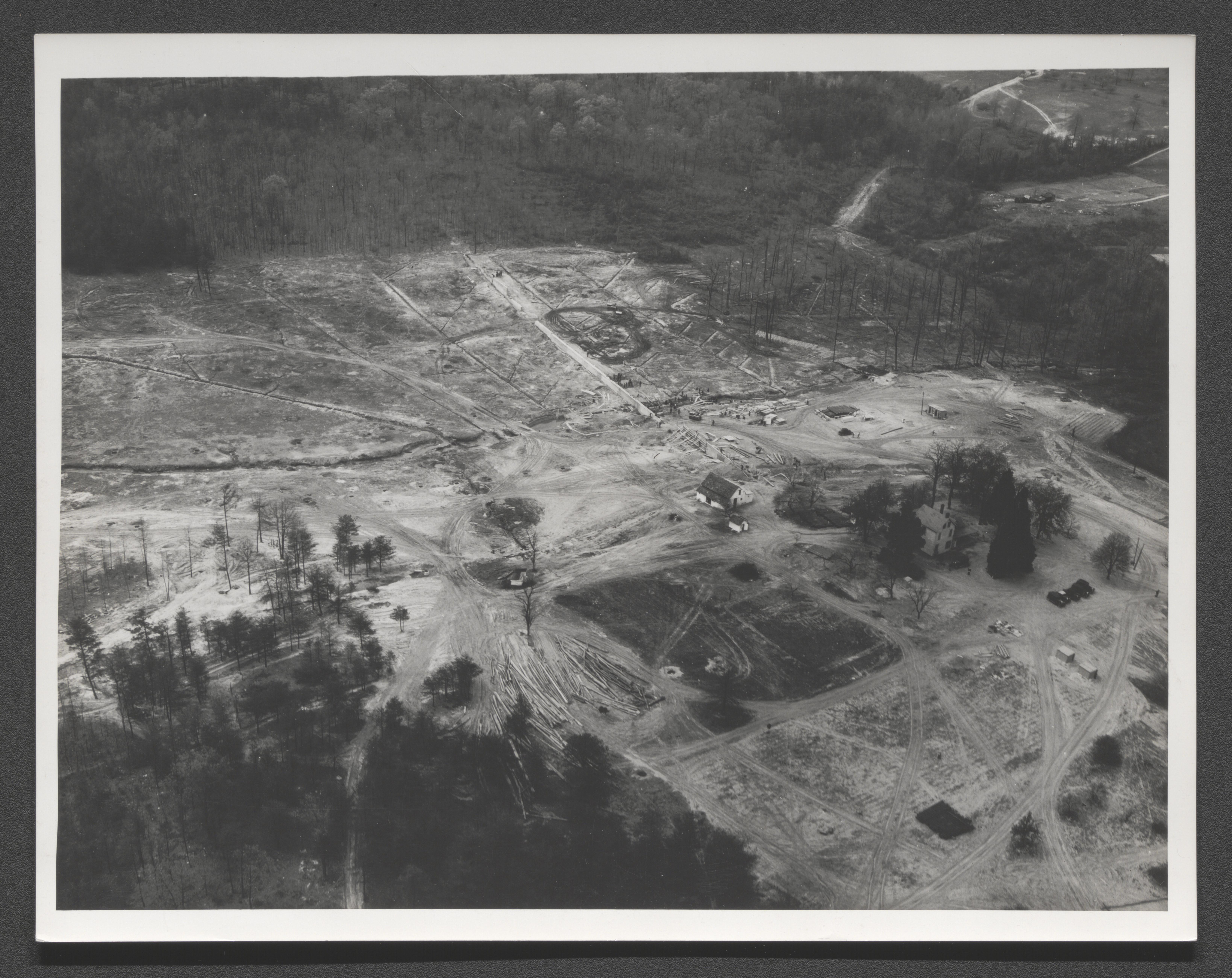
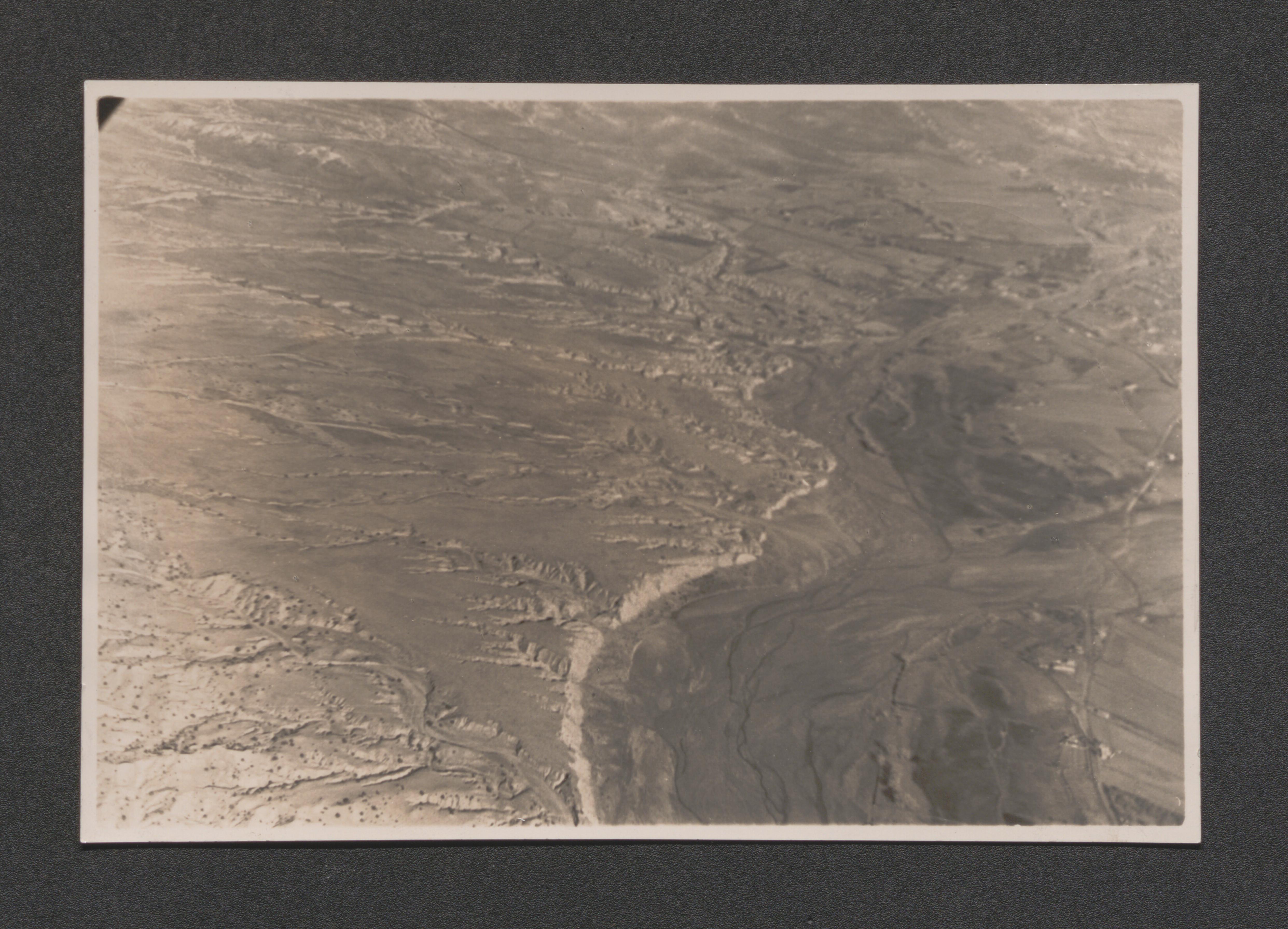
Aerial view of Greenbelt, Maryland, undated
Aerial view of Greenbelt, Maryland, undated
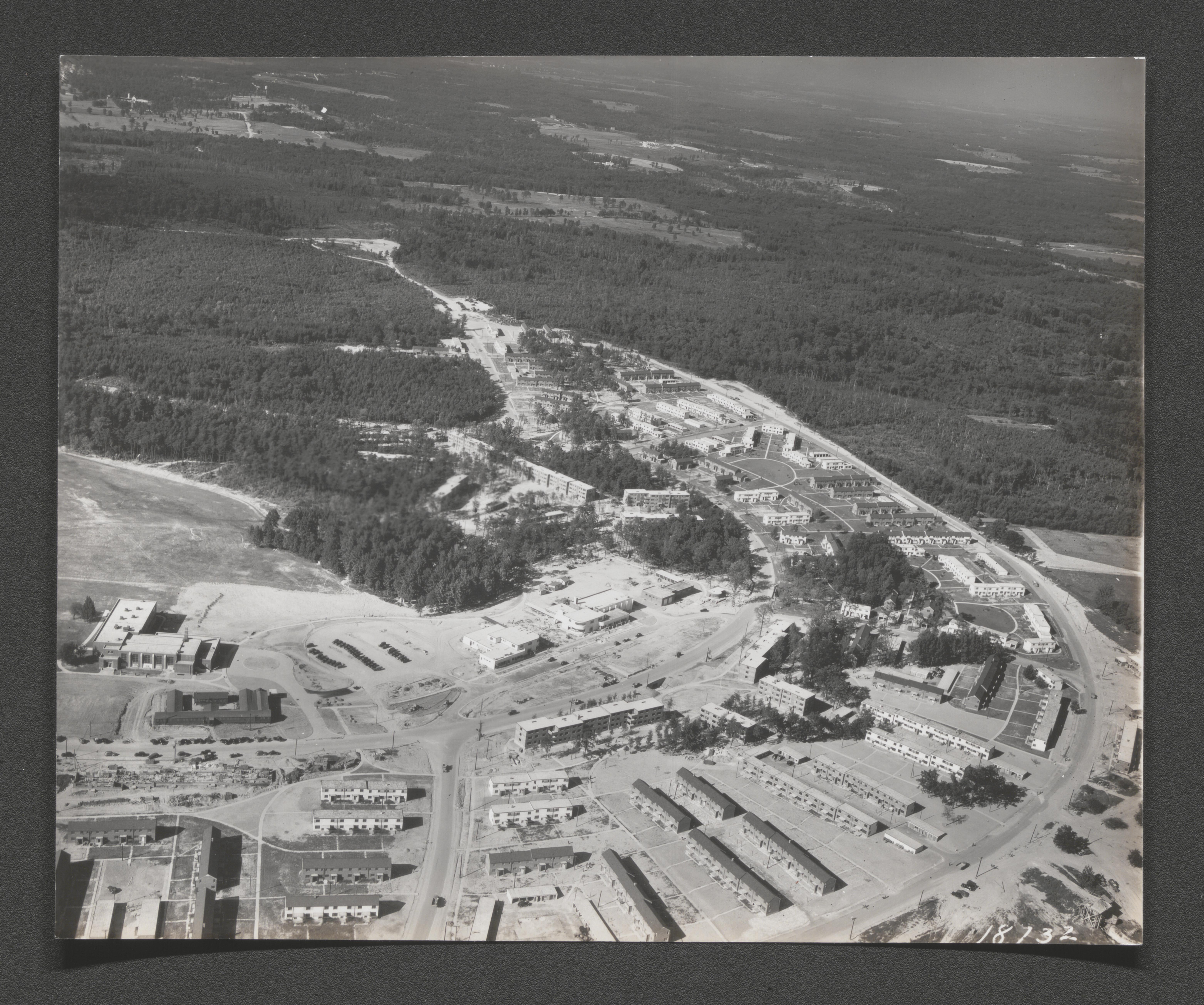
Aerial view of Greenbelt, Maryland, undated
Aerial view of Greenbelt, Maryland, undated
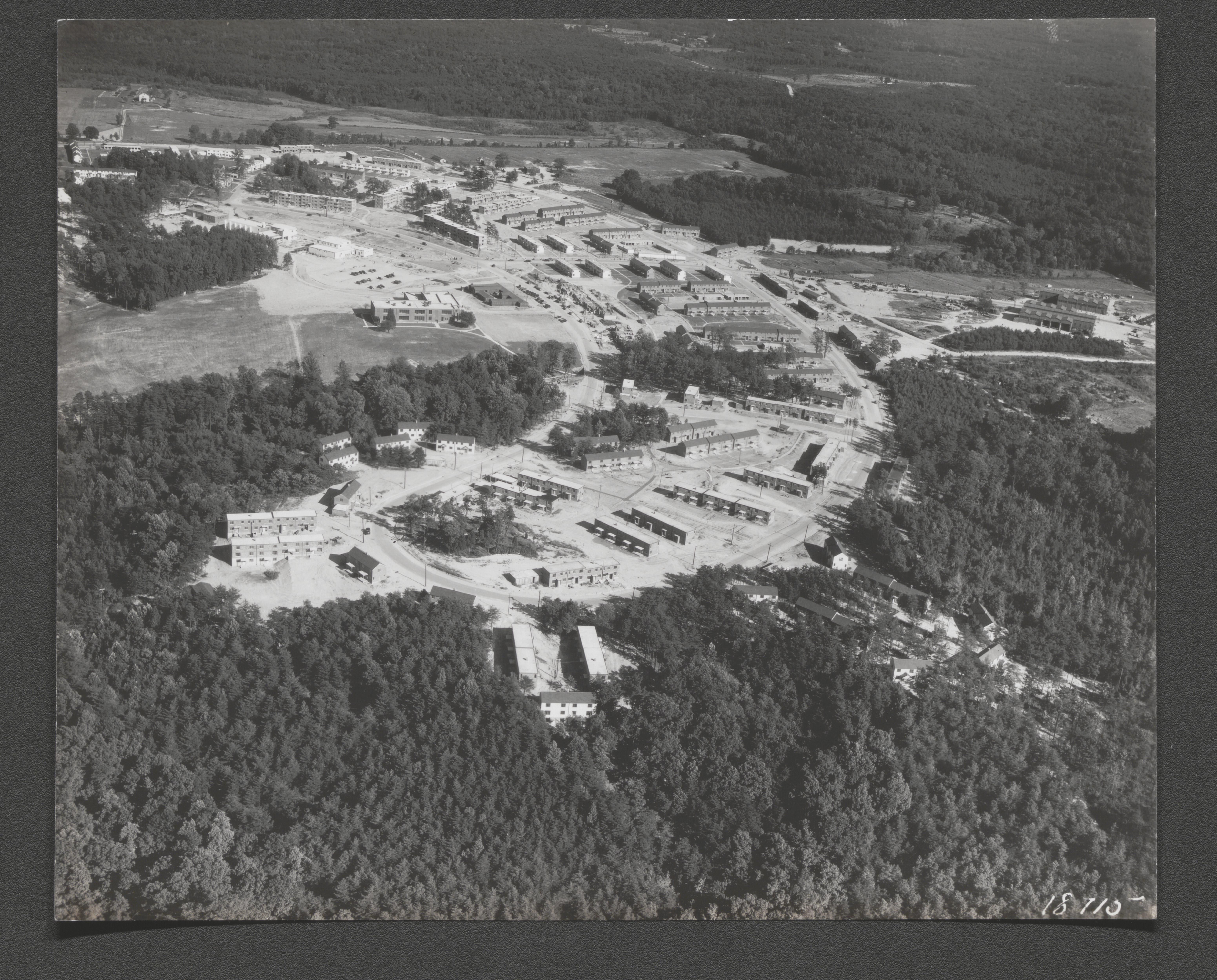
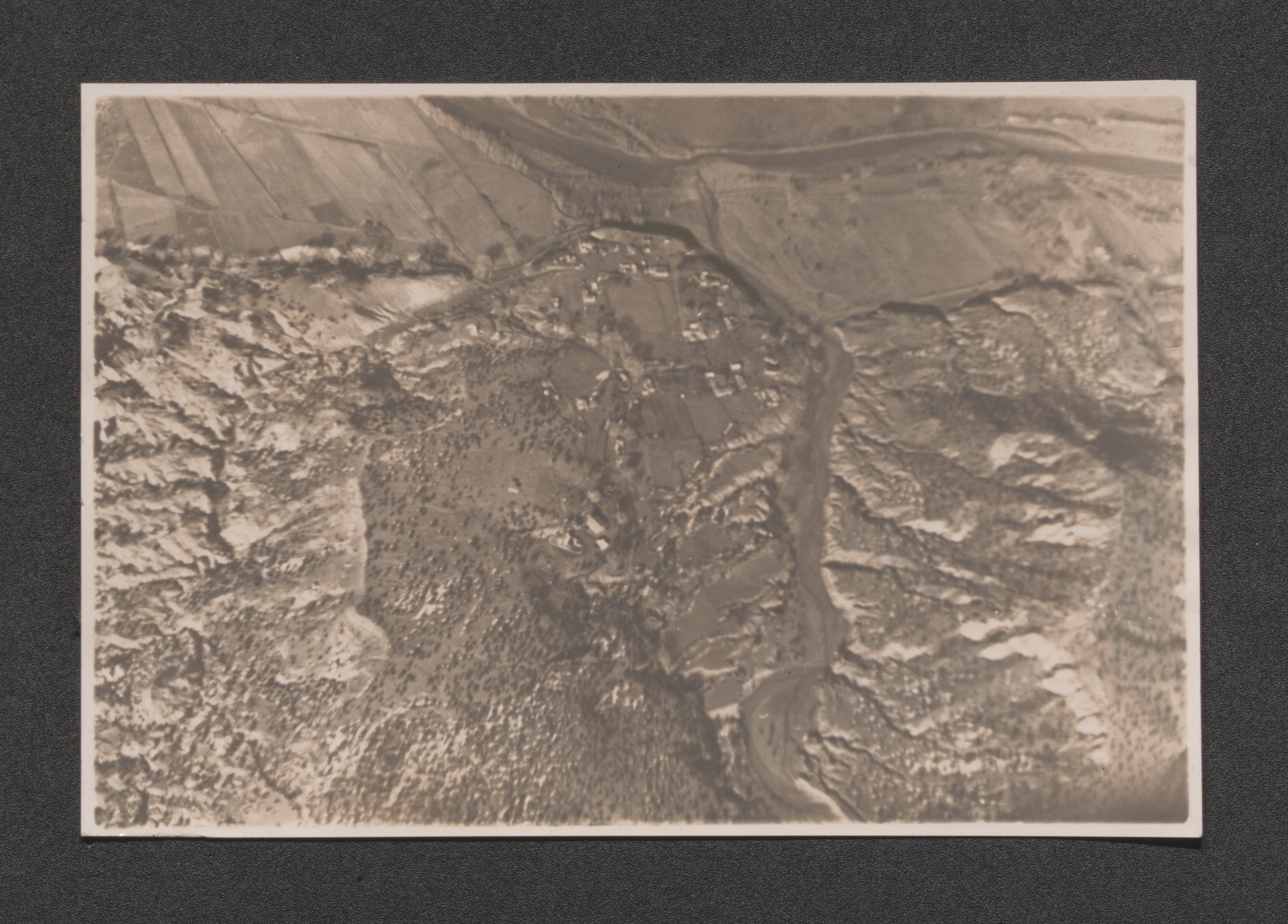
Closer to ground aerial view of Greenbelt, Maryland segment, undated
Closer to ground aerial view of Greenbelt, Maryland segment, undated
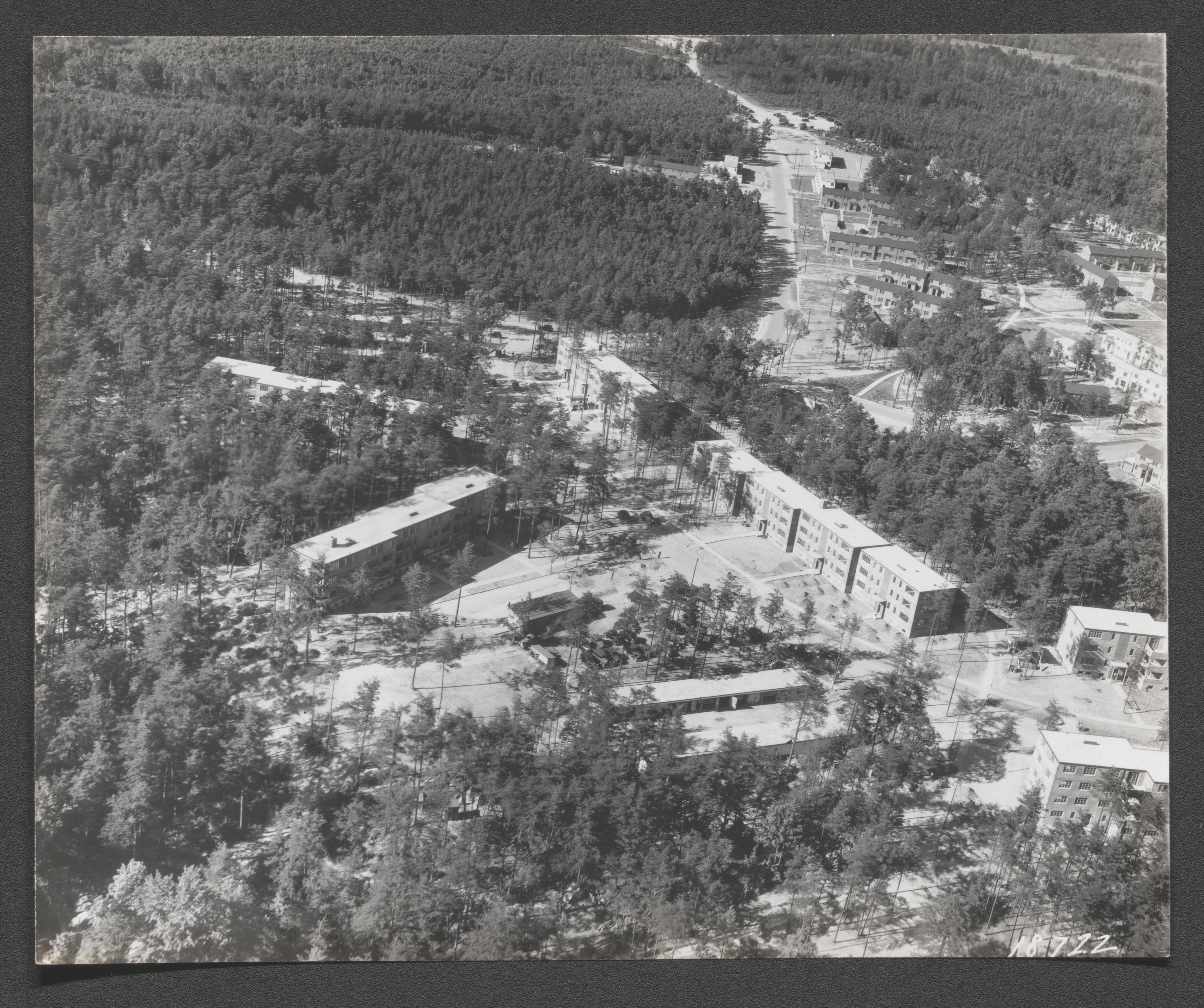
Aerial view of Greenbelt, Maryland, undated
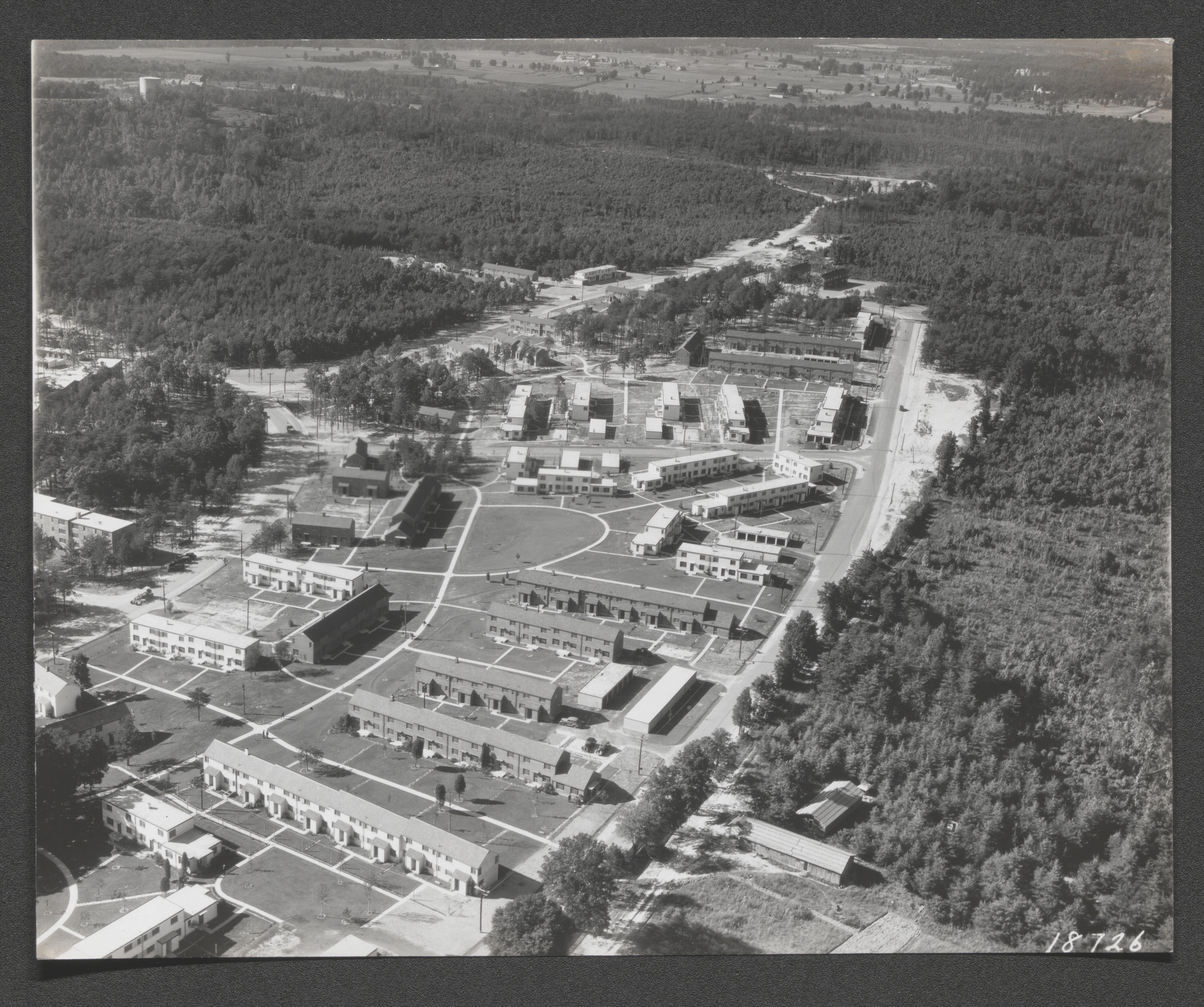
Aerial view of Greenbelt, Maryland, undated
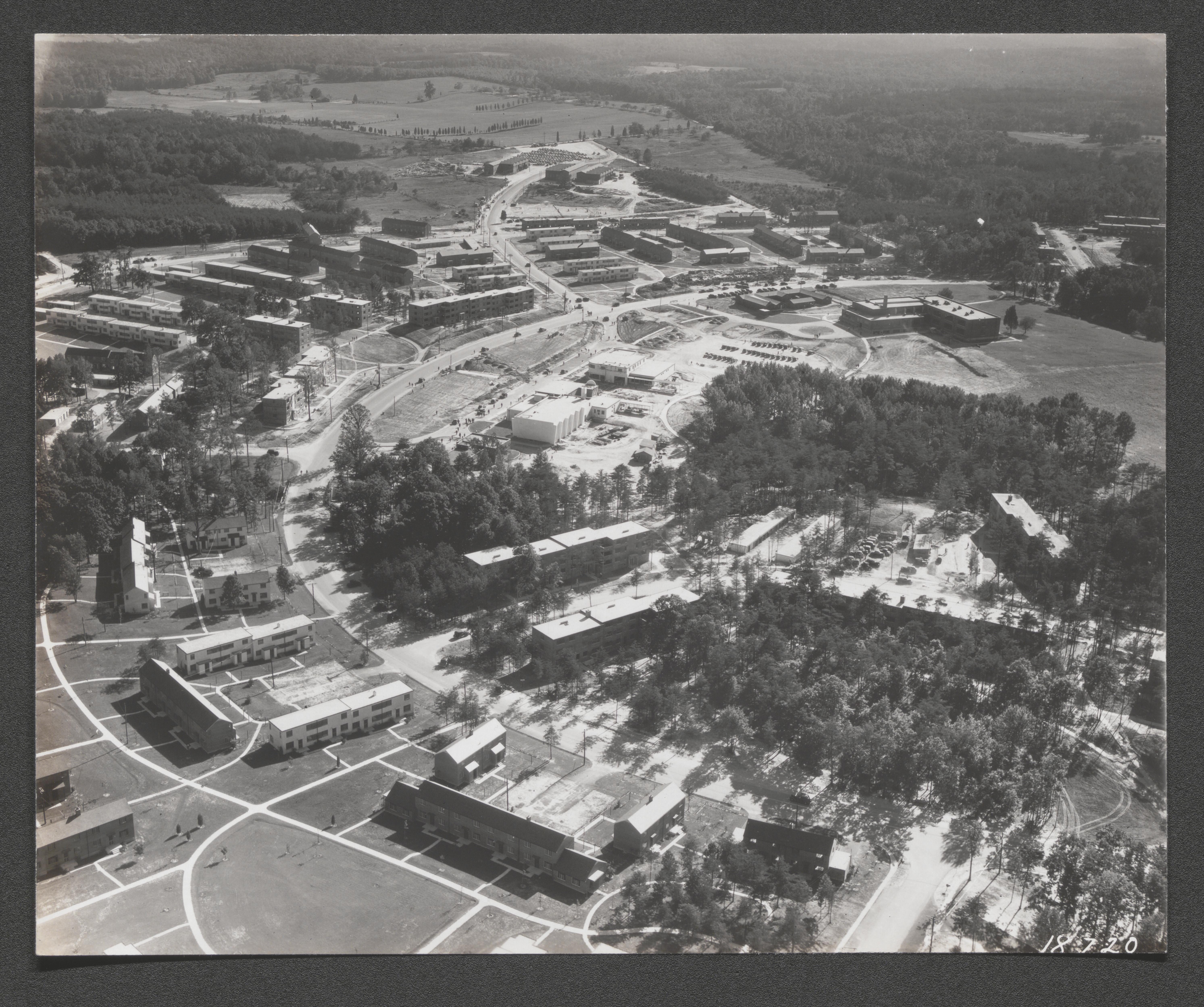
Aerial view of Greenbelt, Maryland, undated
Aerial view of Greenbelt with lake, Maryland, undated
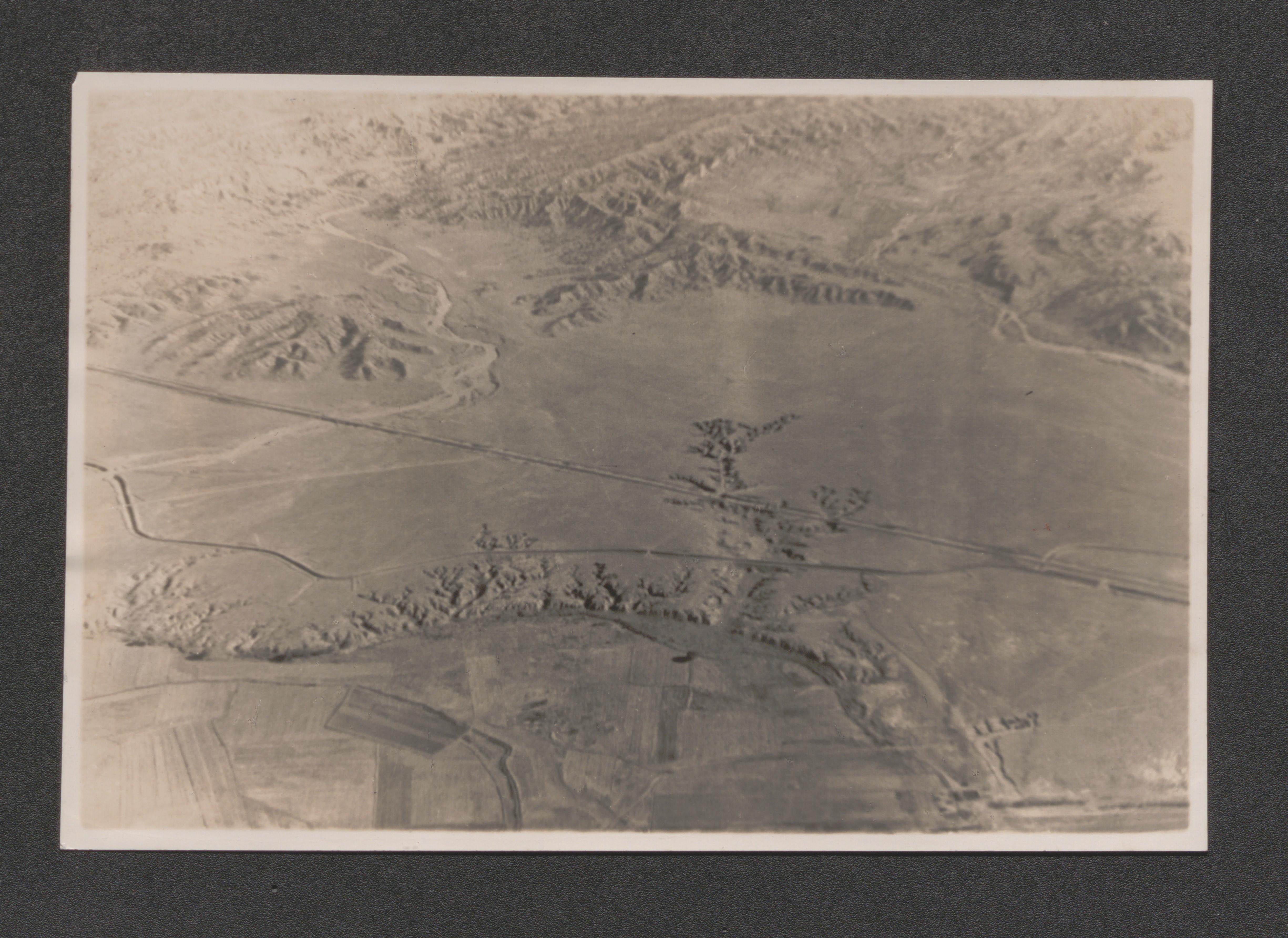
Aerial view of rural roadway intersection, undated
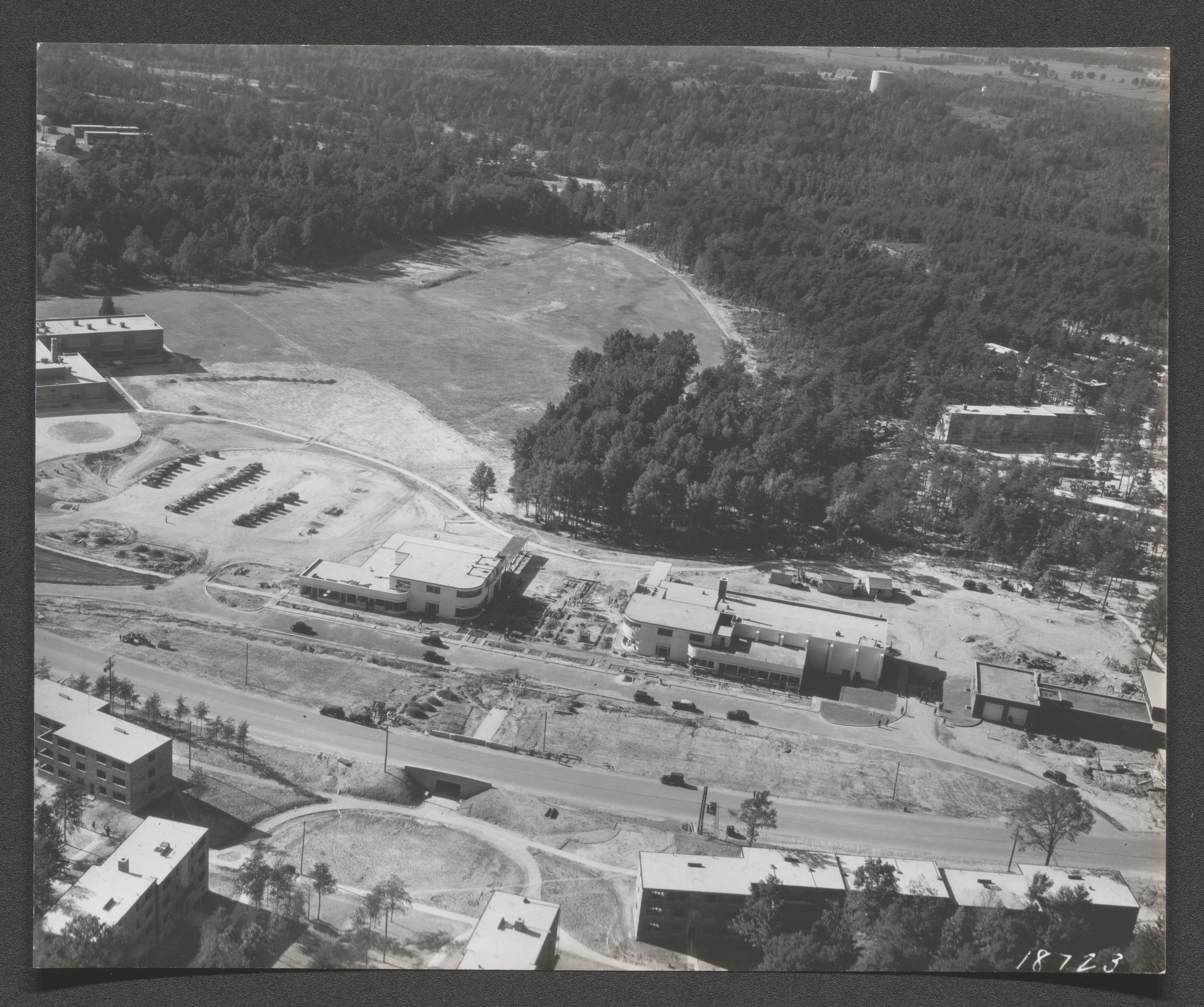
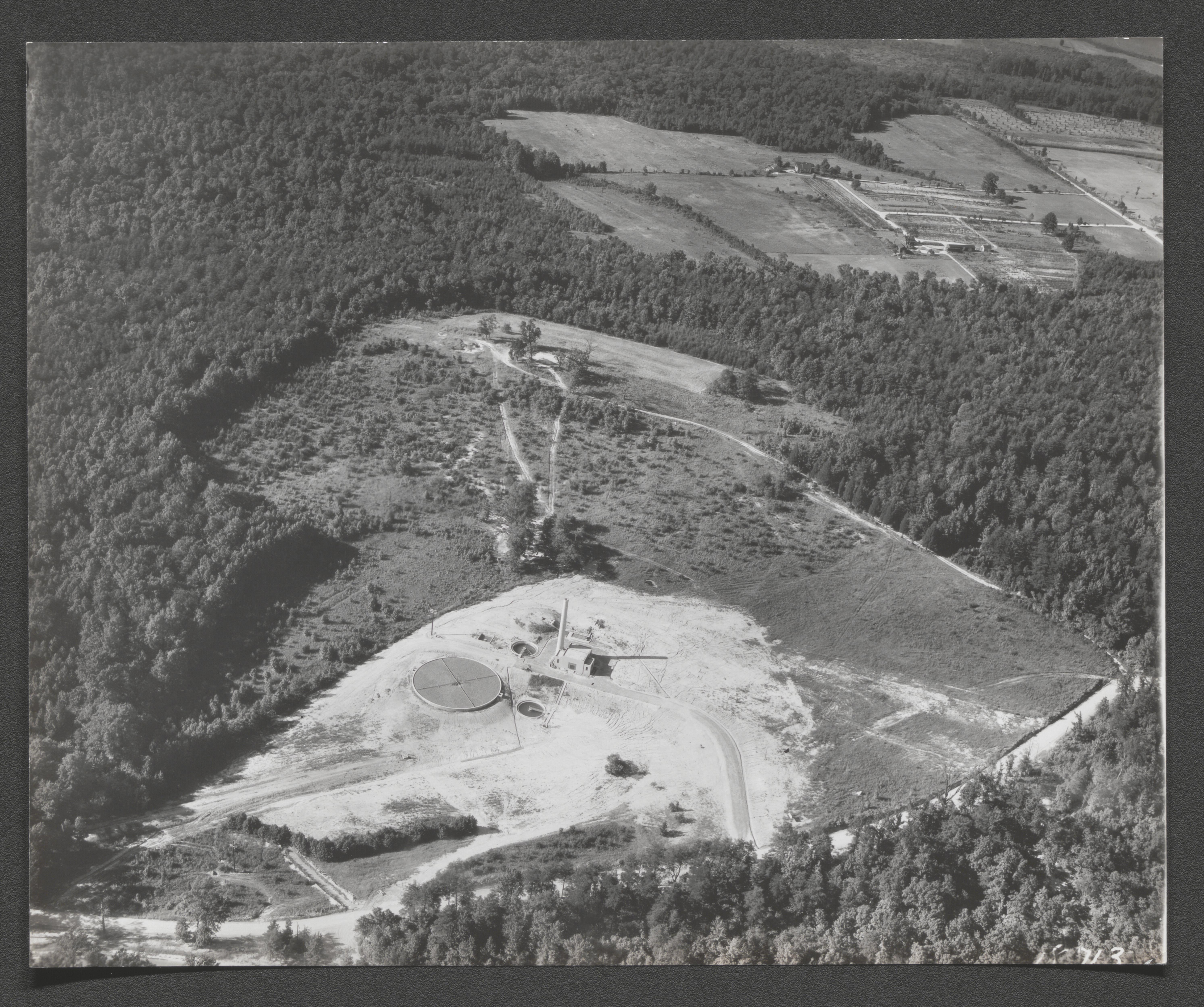
Aerial view of Greenbelt sewage treatment facility, undated
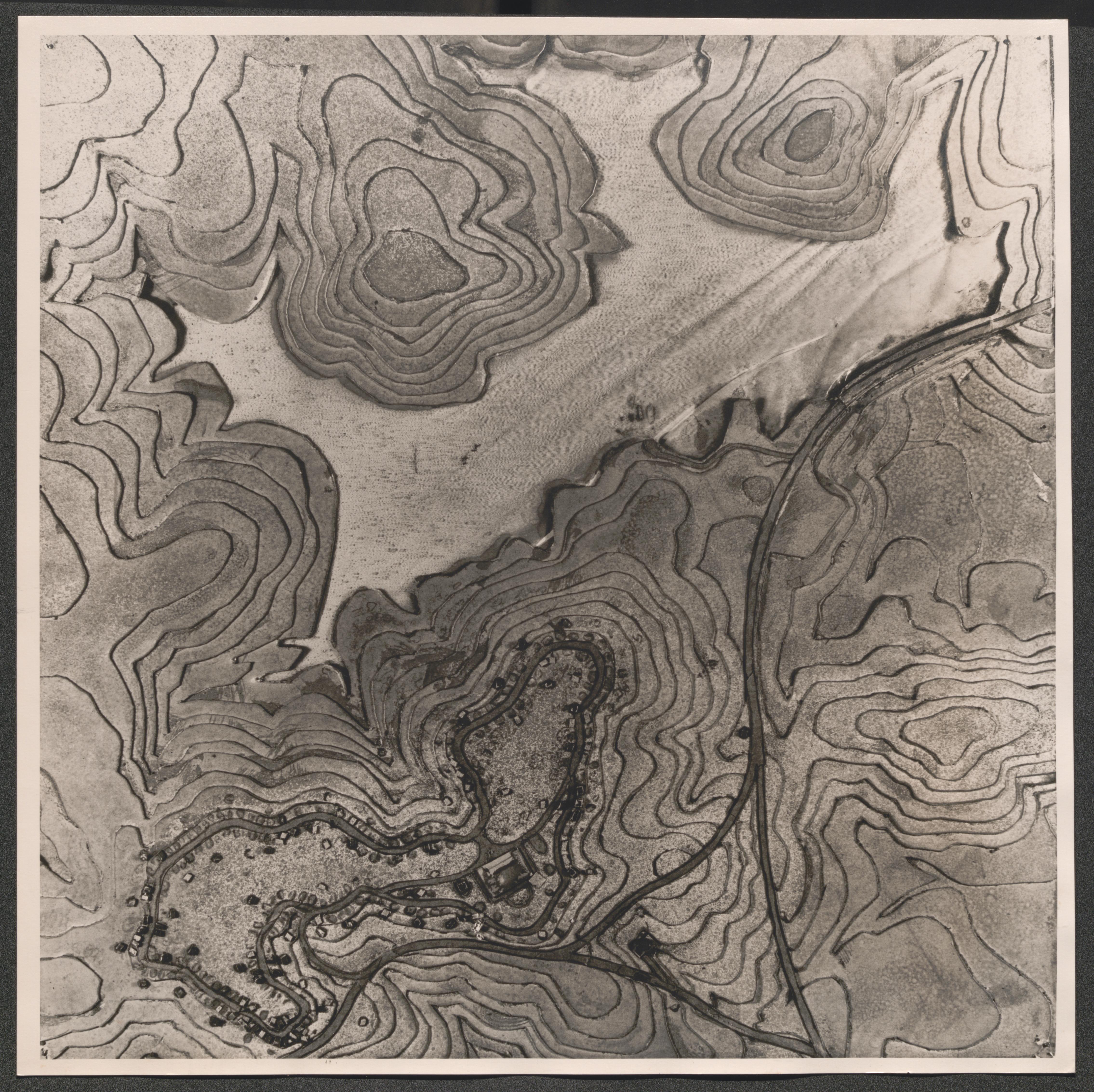
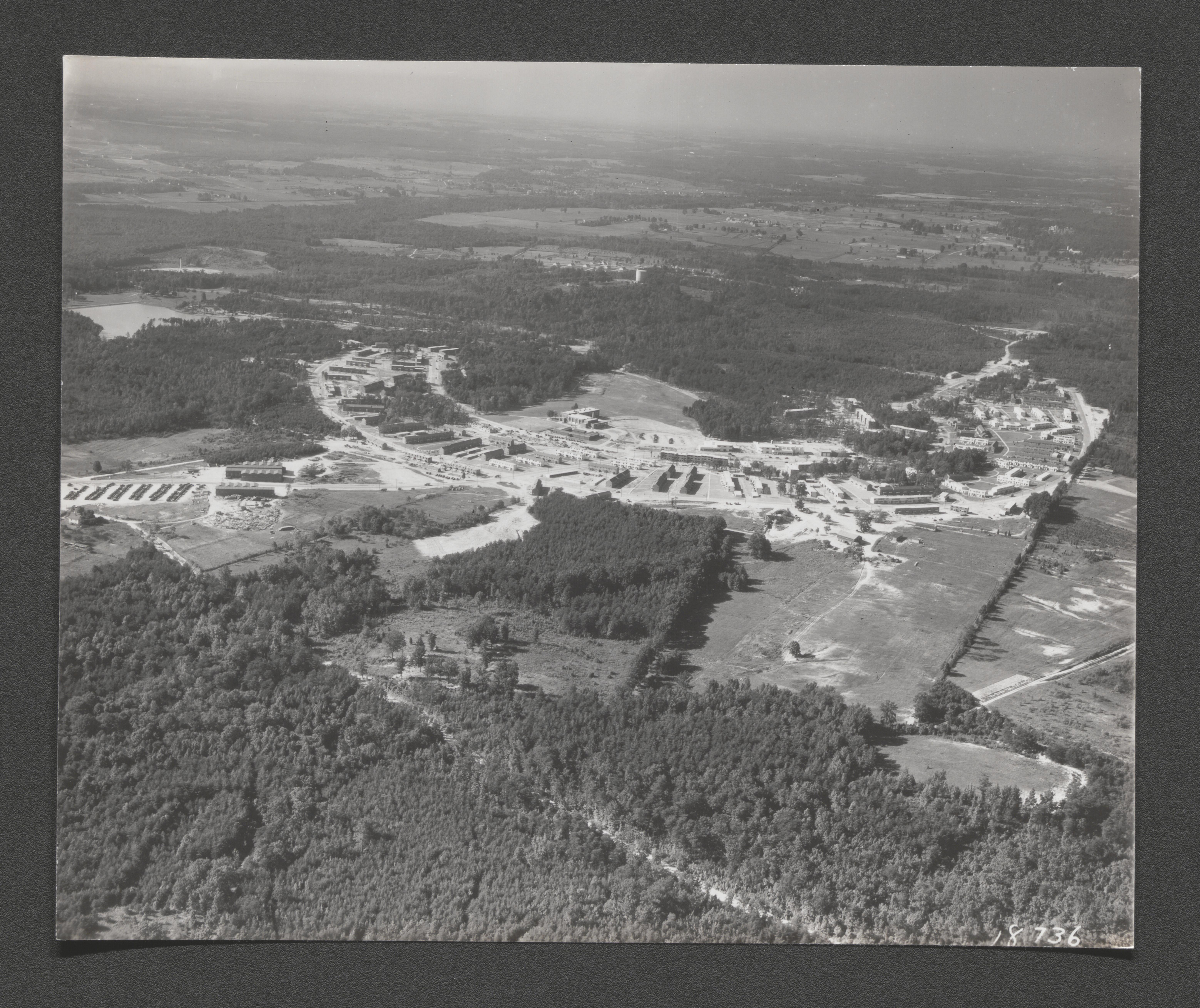
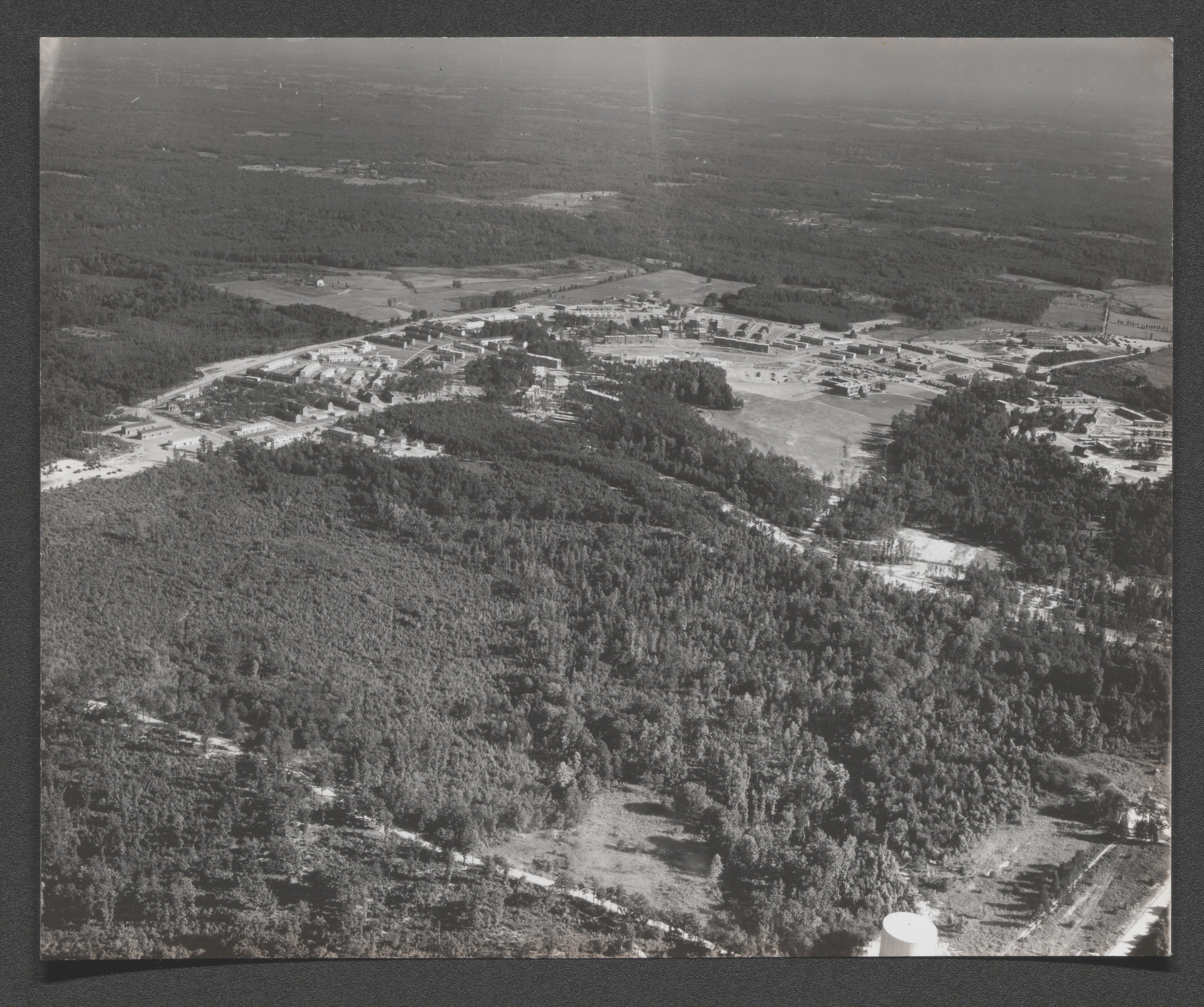
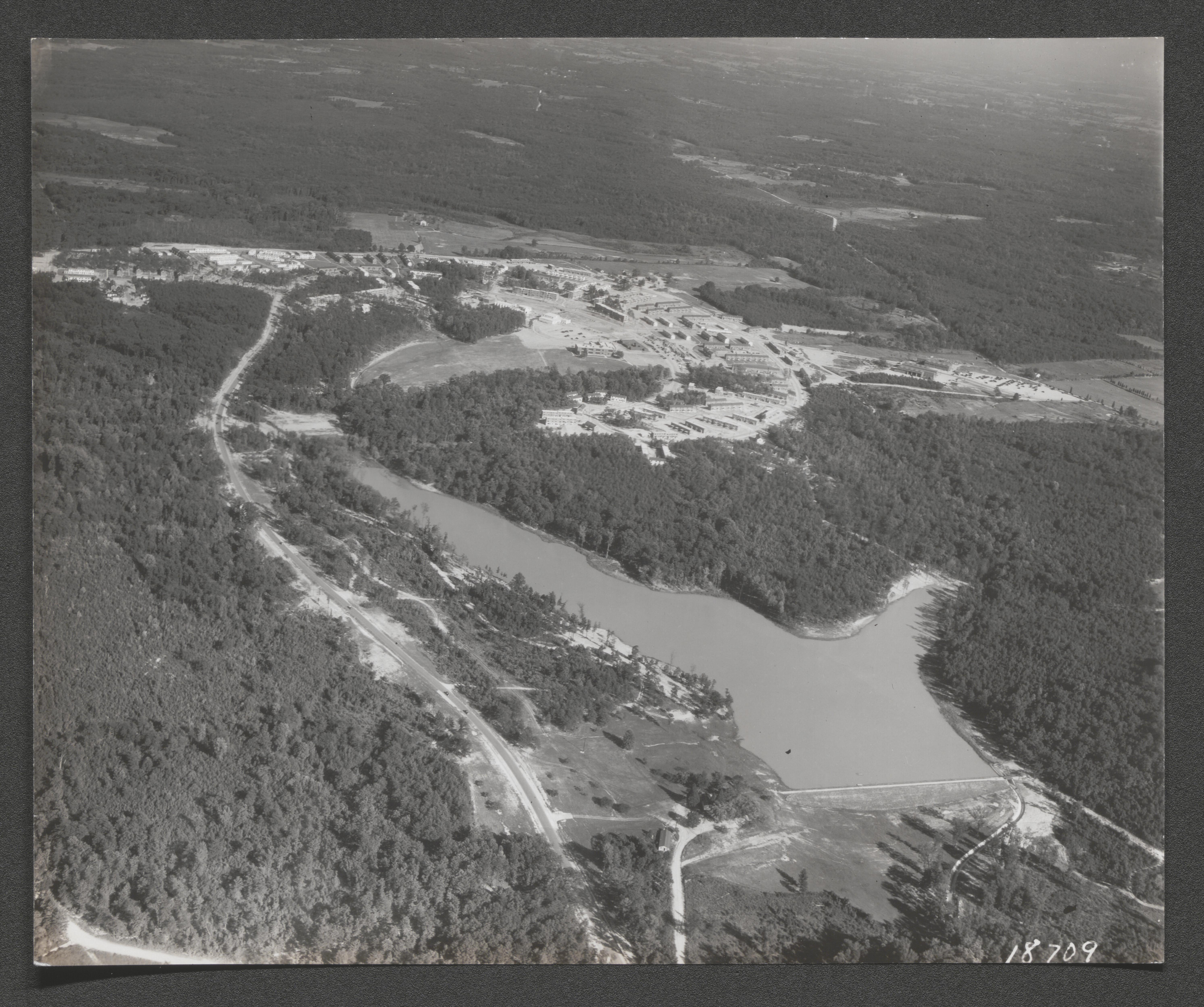
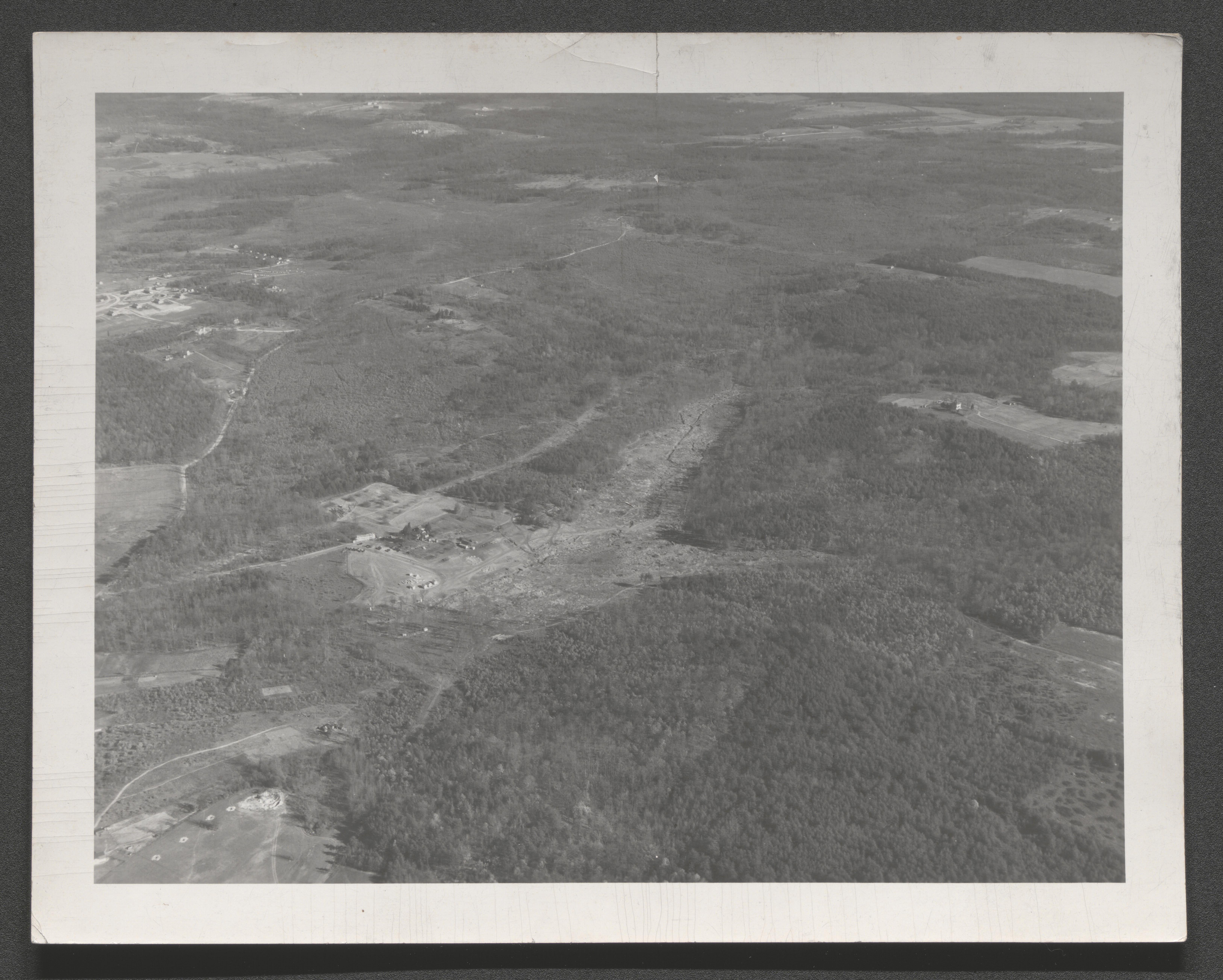
Aerial view of Greenbelt, Maryland and surrounding area, undated
Aerial view; segment of area of Greenbelt construction, hand written on back of image Aerial view of Greenbelt, Maryland taken from Goodyear blimp, undated
Aerial view; of Greenbelt, hand written on back of image Aerial view of Greenbelt, Maryland taken from Goodyear blimp, undated
Aerial view; segment of area of Greenbelt construction, hand written on back of image Aerial view of Greenbelt, Maryland taken from Goodyear blimp, undated
Aerial view; segment of area of Greenbelt construction, undated
Aerial view; segment of area of Greenbelt construction, hand written on back of image "Aerial view of Greenbelt, Maryland taken from Goodyear blimp", undated
Aerial view; segment of Greenbelt area cleared prior to construction, undated
Aerial view of early construction on Greenbelt sewage treatment facility, undated
Aerial view of Greenbelt, Maryland, hand written on back of image General air view of Greenbelt, Maryland, undated
Aerial view; segment of early Greenbelt construction, undated
Aerial view of Greenbelt, Maryland, undated
Aerial view; segment of area of Greenbelt construction, undated
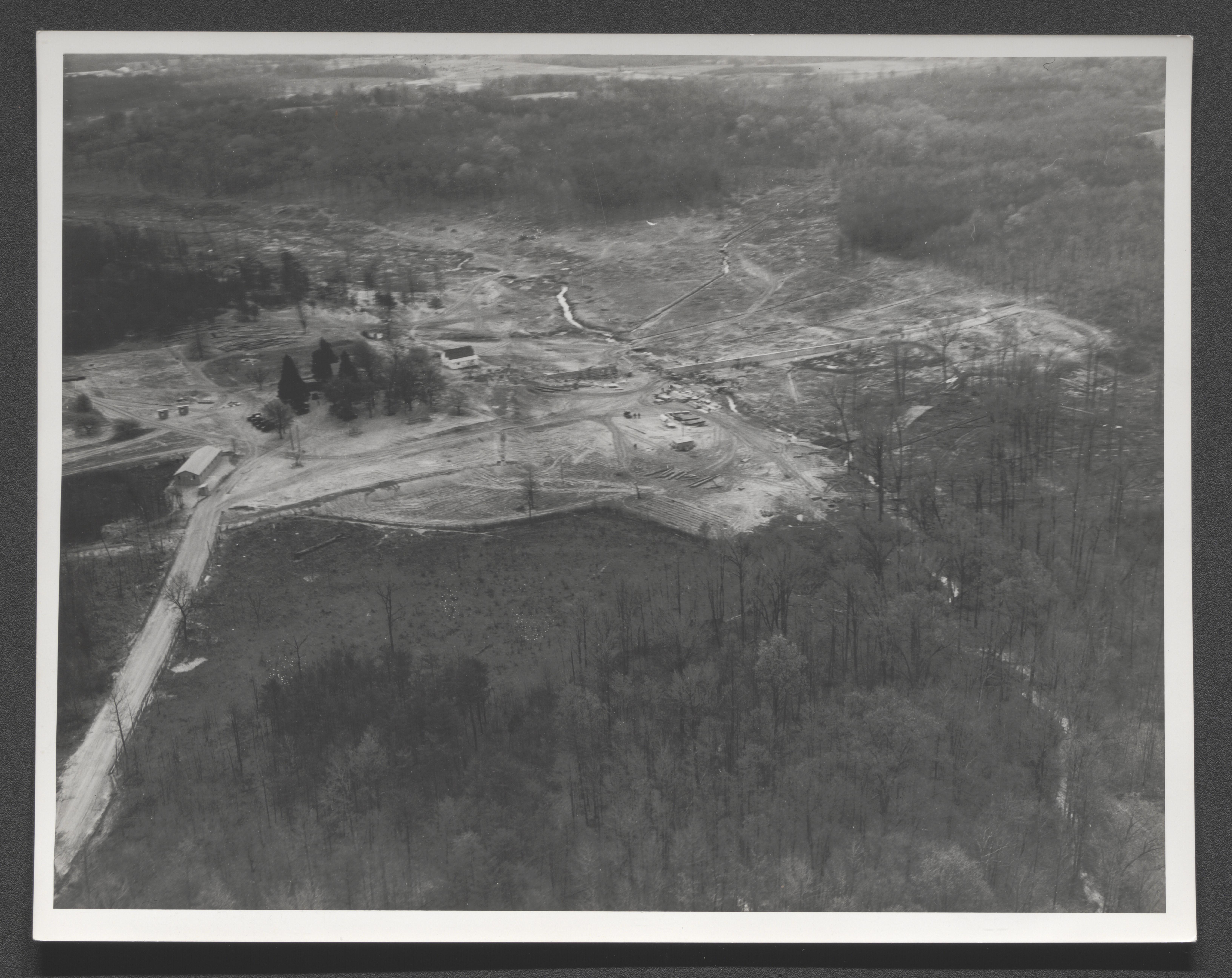
Aerial view; segment of area of Greenbelt construction, undated
Aerial view; segments of Greenbelt construction, undated
Aerial view; segment of area of Greenbelt construction, hand written on back of image Aerial view of Greenbelt, Maryland, undated
Aerial view; segment of area of Greenbelt construction, undated
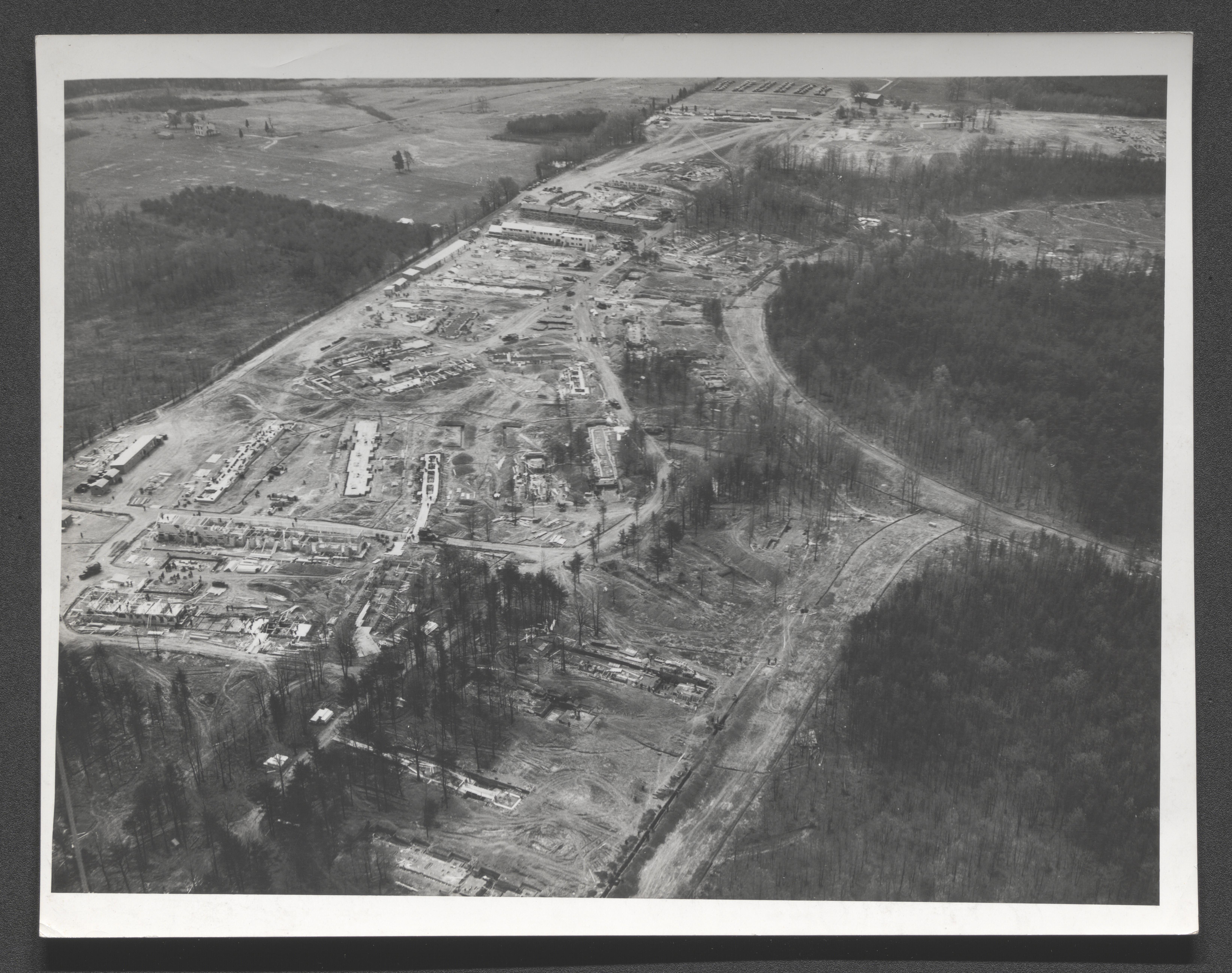
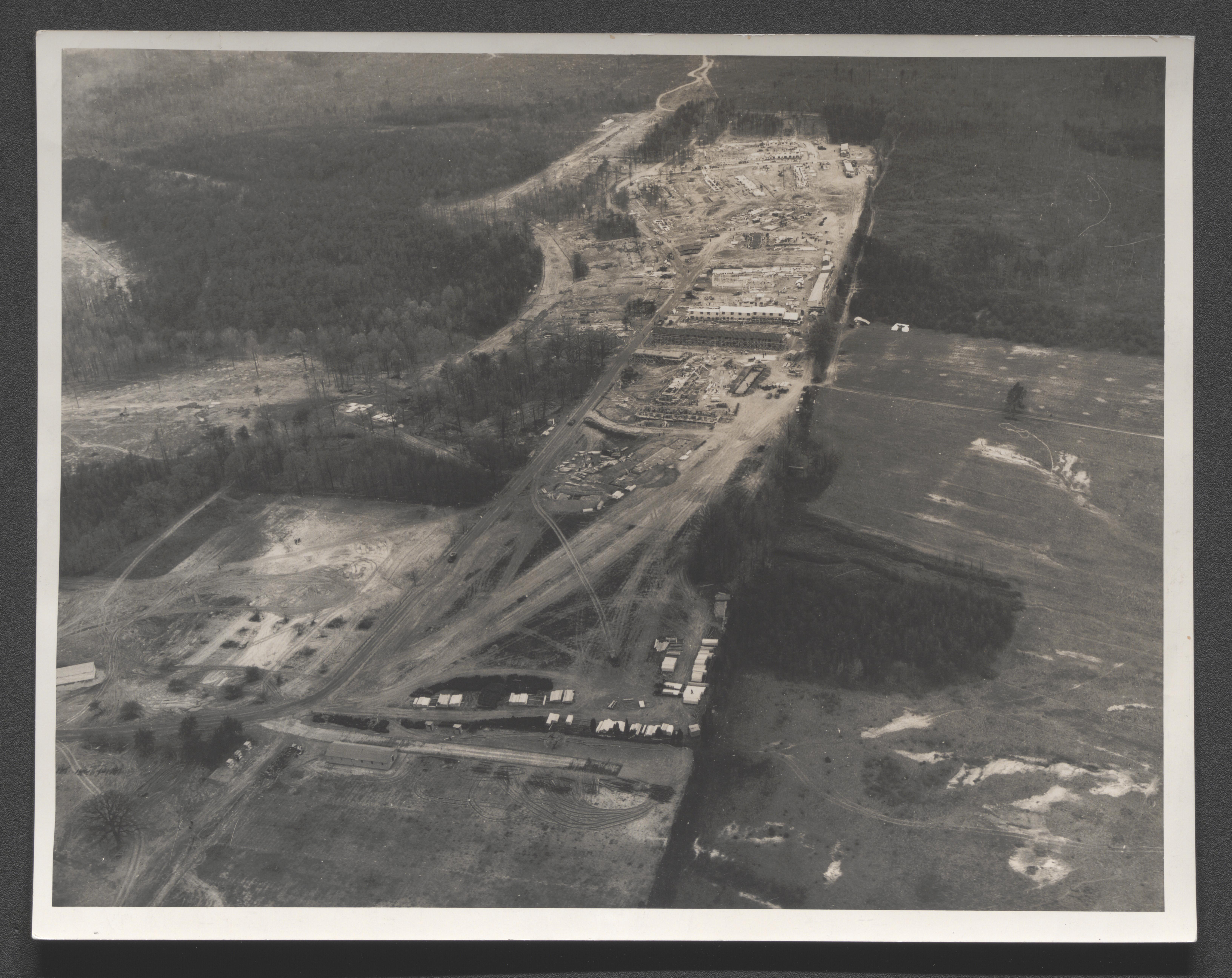
Aerial view; segment of early Greenbelt construction, typed on back of image "Air view of construction at Greenbelt, Maryland"
Photo collage of individuals at their jobs, undated
Aerial view of Greenbelt and surrounding area, Maryland, in print as part of lower edge of image "Air view Greenbelt Maryland", undated
Display board map with legend of Greenbelt community features and accompanying map locating Greenbelt between Baltimore and Washington, DC, typed on back of image - "Model of Greenbelt Project", undated
Greenbelt, Maryland Town Plan poster that maps lake, school and community center, police station, undated
Aerial view; Greenbelt housing units under construction, hand written on back of image Air view of Greenbelt, Md. March 1937, 1937 March
Aerial view of Greenbelt, Maryland, hand written on back of image - "Air view of Greenbelt, Md. March 1937", 1937 March
Aerial view of Greenbelt and surrounding area, Maryland, hand written on back of image - "Air view of Greenbelt, Md. March 1937", 1937 March
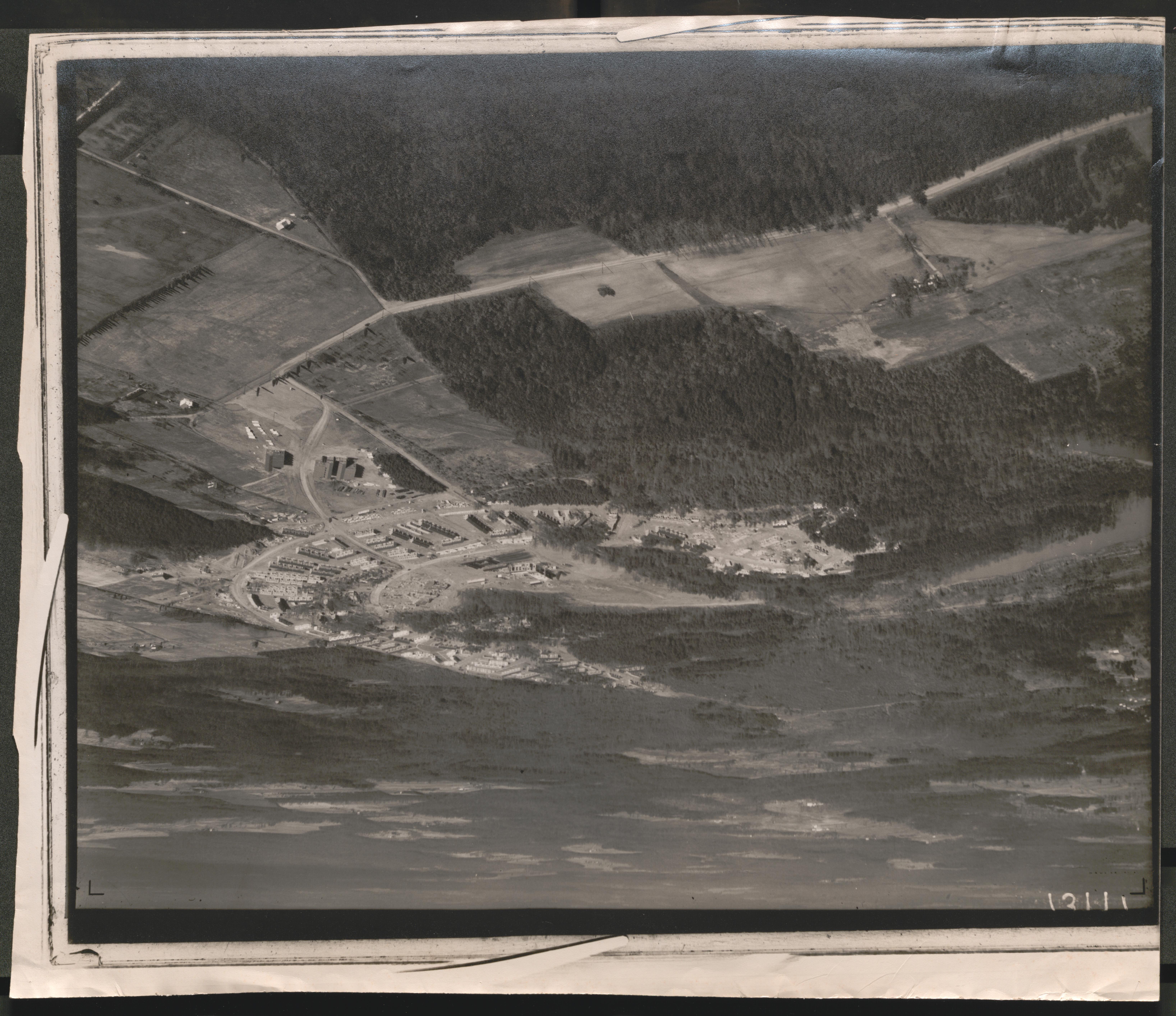
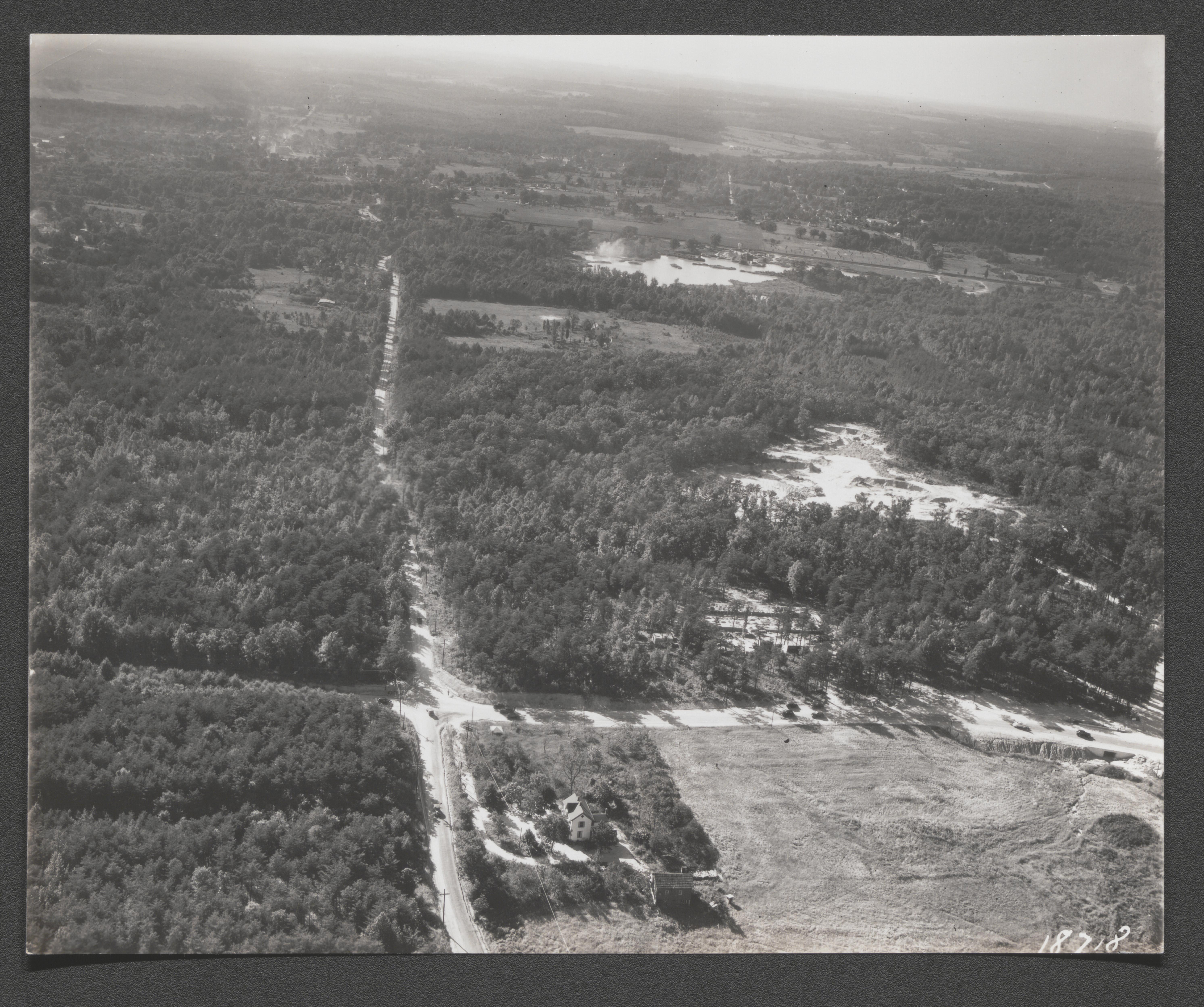
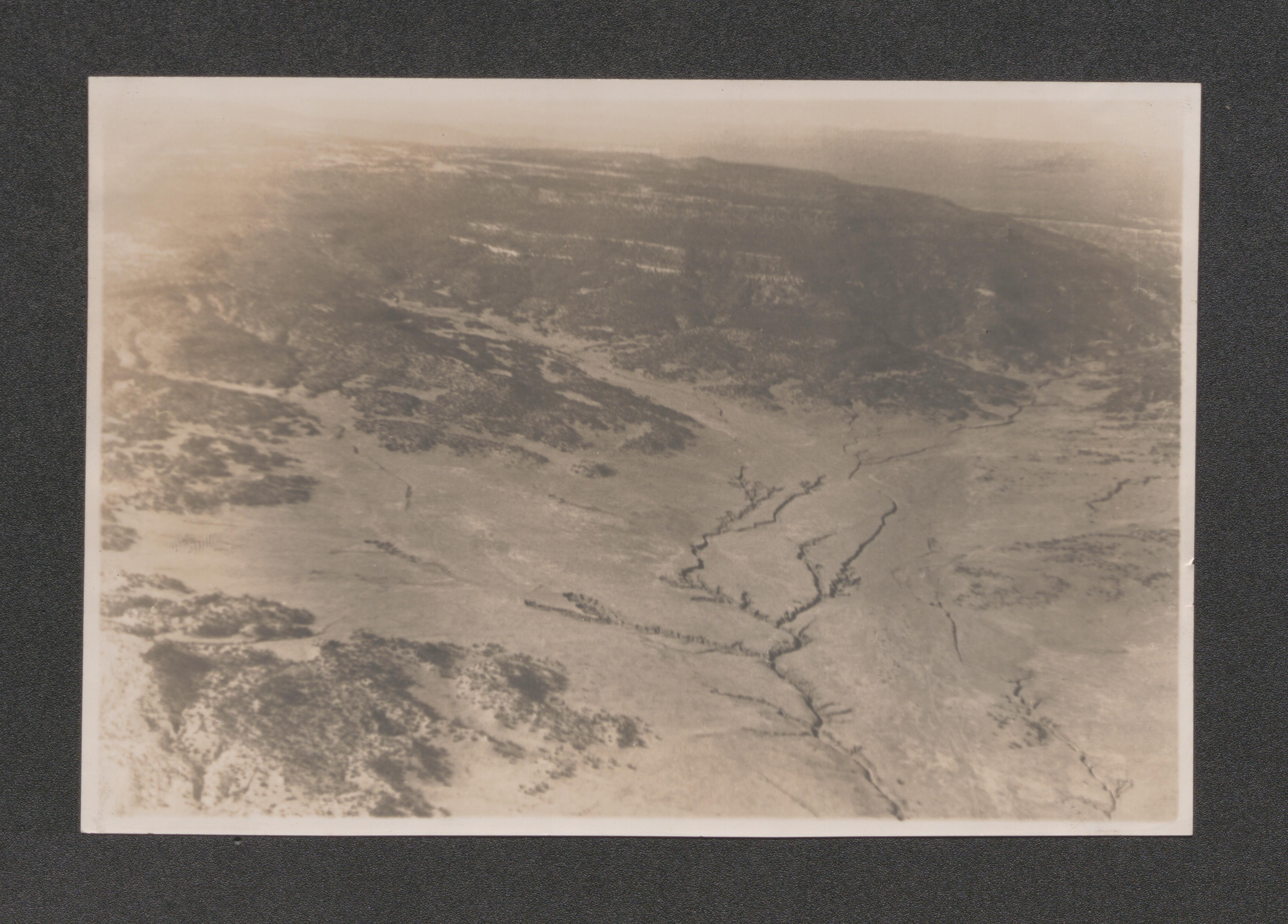
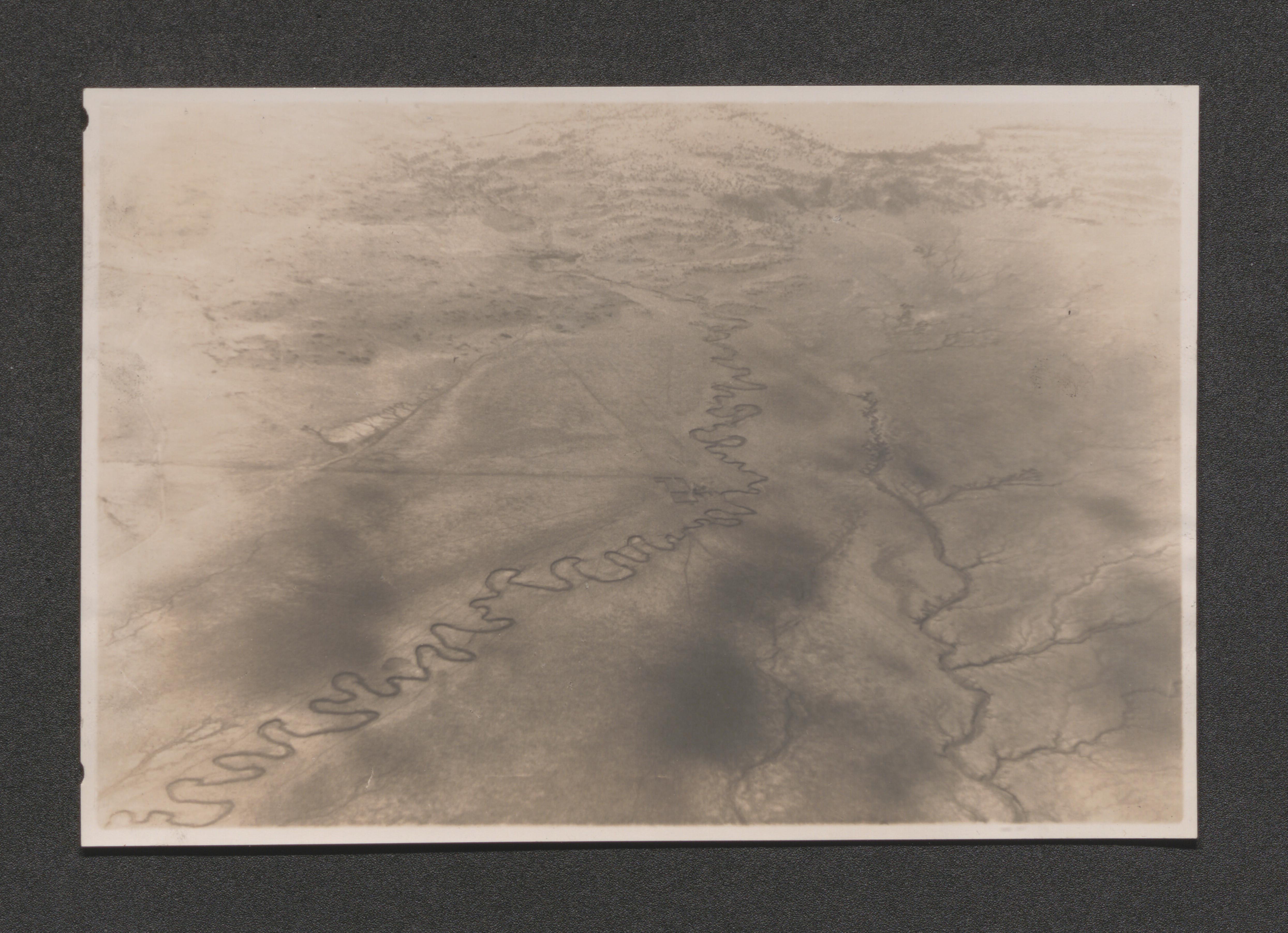
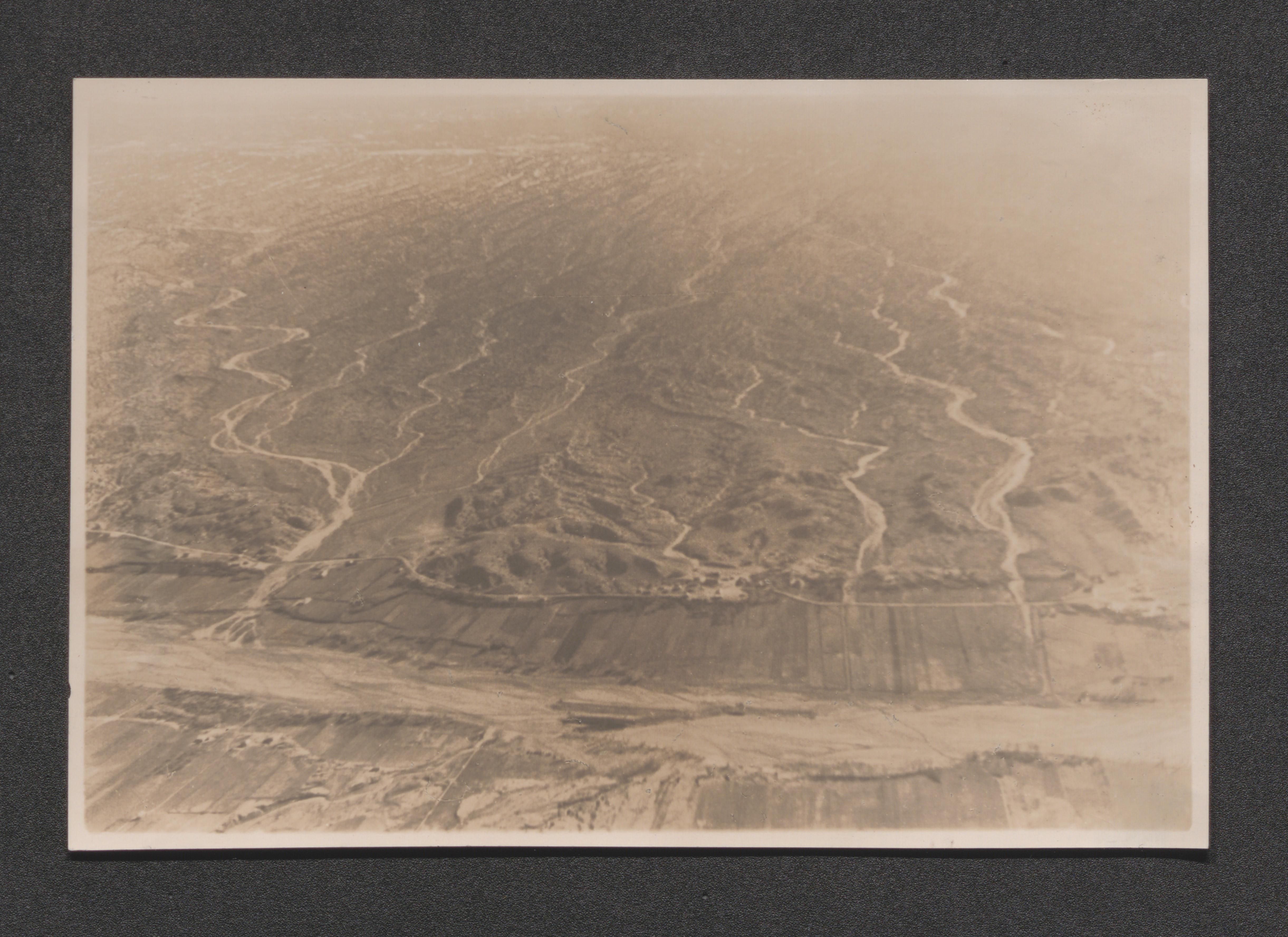
Aerial view of forested area near Berwyn, Maryland, undated

Aerial view of forested area near Berwyn, Maryland, undated

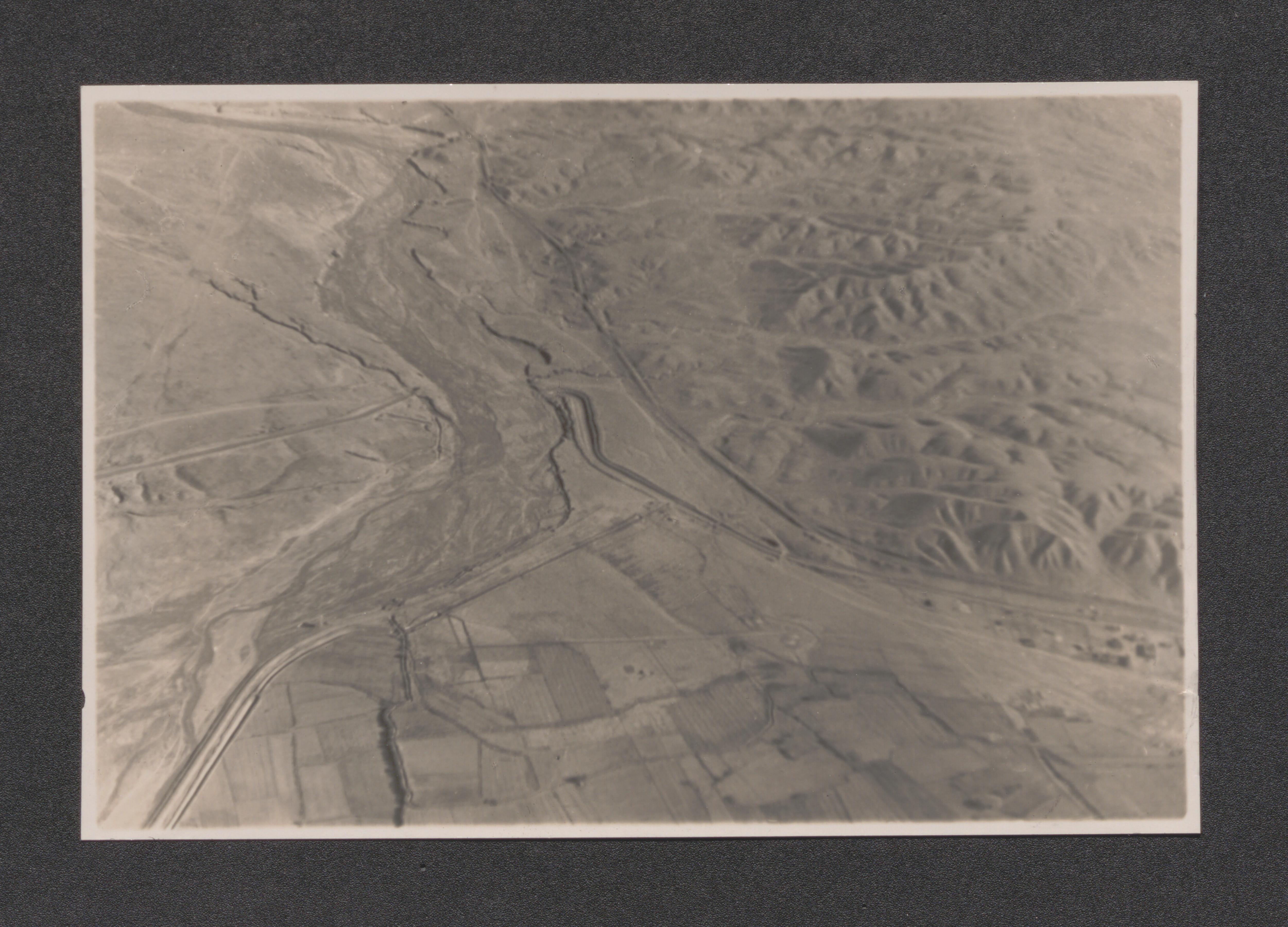
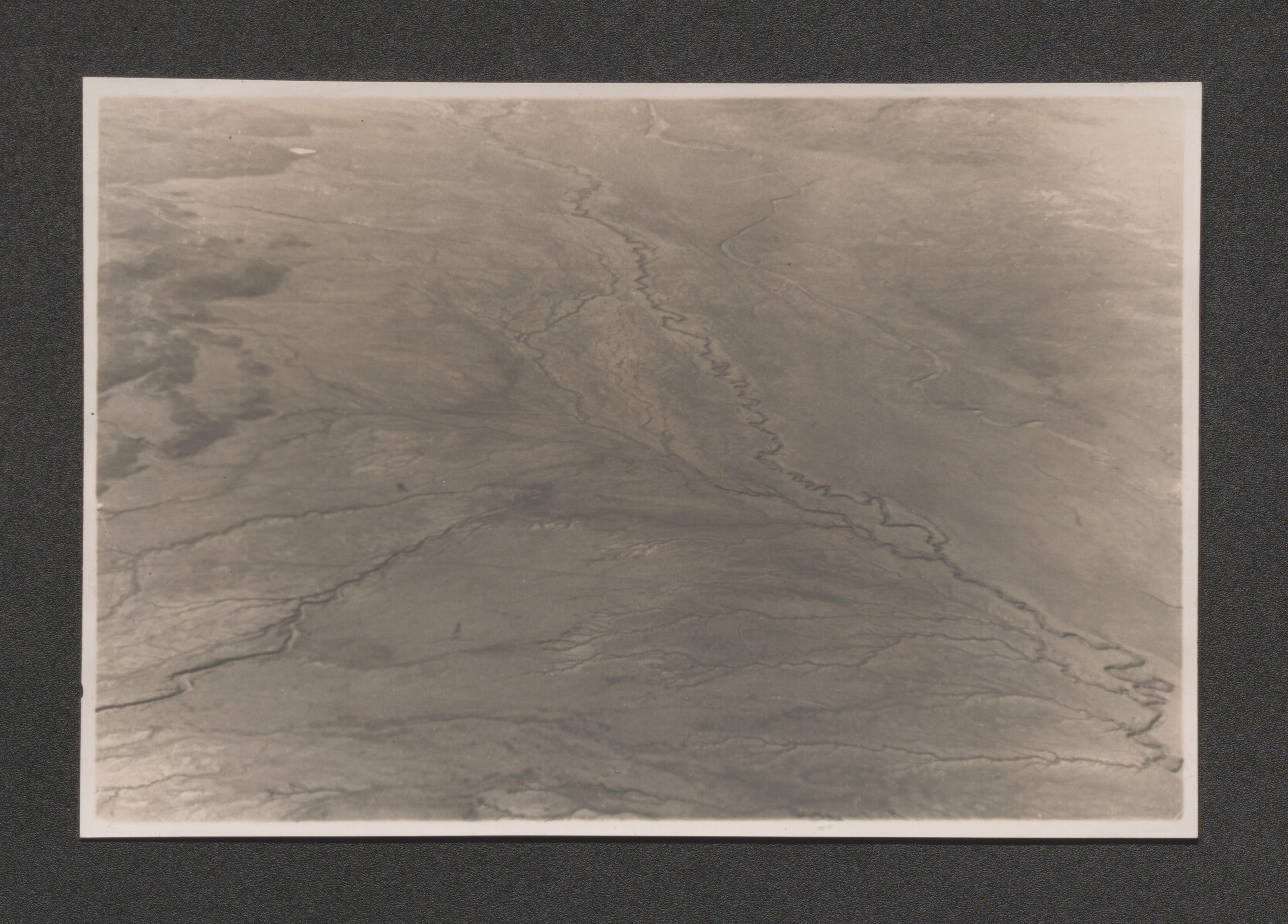
Aerial view of area near Berwyn, Maryland, undated

Aerial view of area near Berwyn/Greenbelt Maryland, undated

Aerial view of area near Berwyn, including Greenbelt, Maryland, undated

Aerial view of construction in Greenbelt housing area, Maryland, undated

Aerial view of construction in Greenbelt housing area, Maryland, undated

Aerial view of Greenbelt Lake and all of Greenbelt development in background, undated

Two images: aerial view of urban tenements and yard with trees in front of new housing, corresponding print messages "Life by the square foot vs. Life by the acre", undated
Ten images involving landscapes and people in recreational activity, printed message "Room to live in", undated
Poster; Resettlement Administration Introduces the Greenbelt Community with diagrams and essay: "What is a Greenbelt Community?", undated
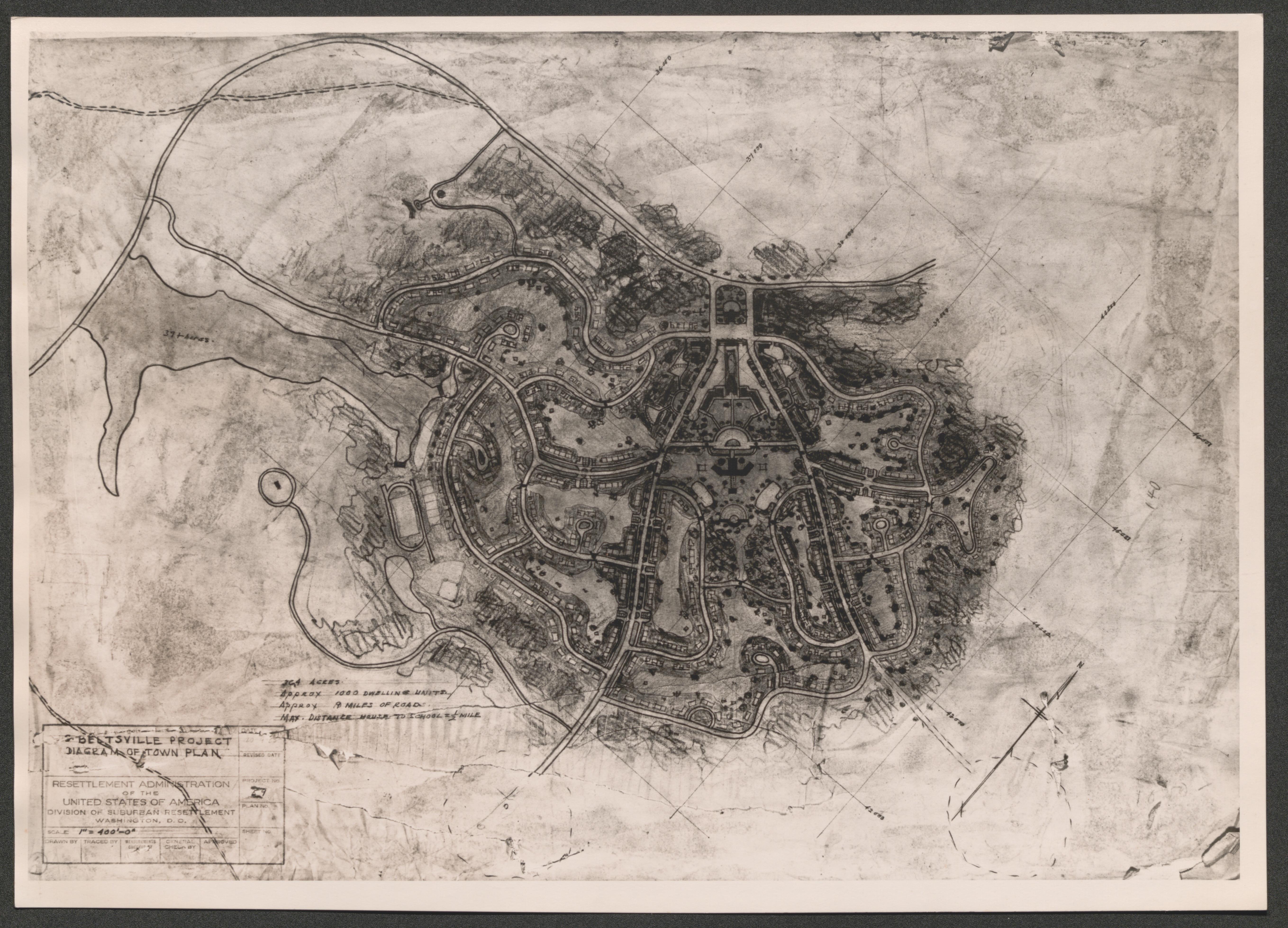
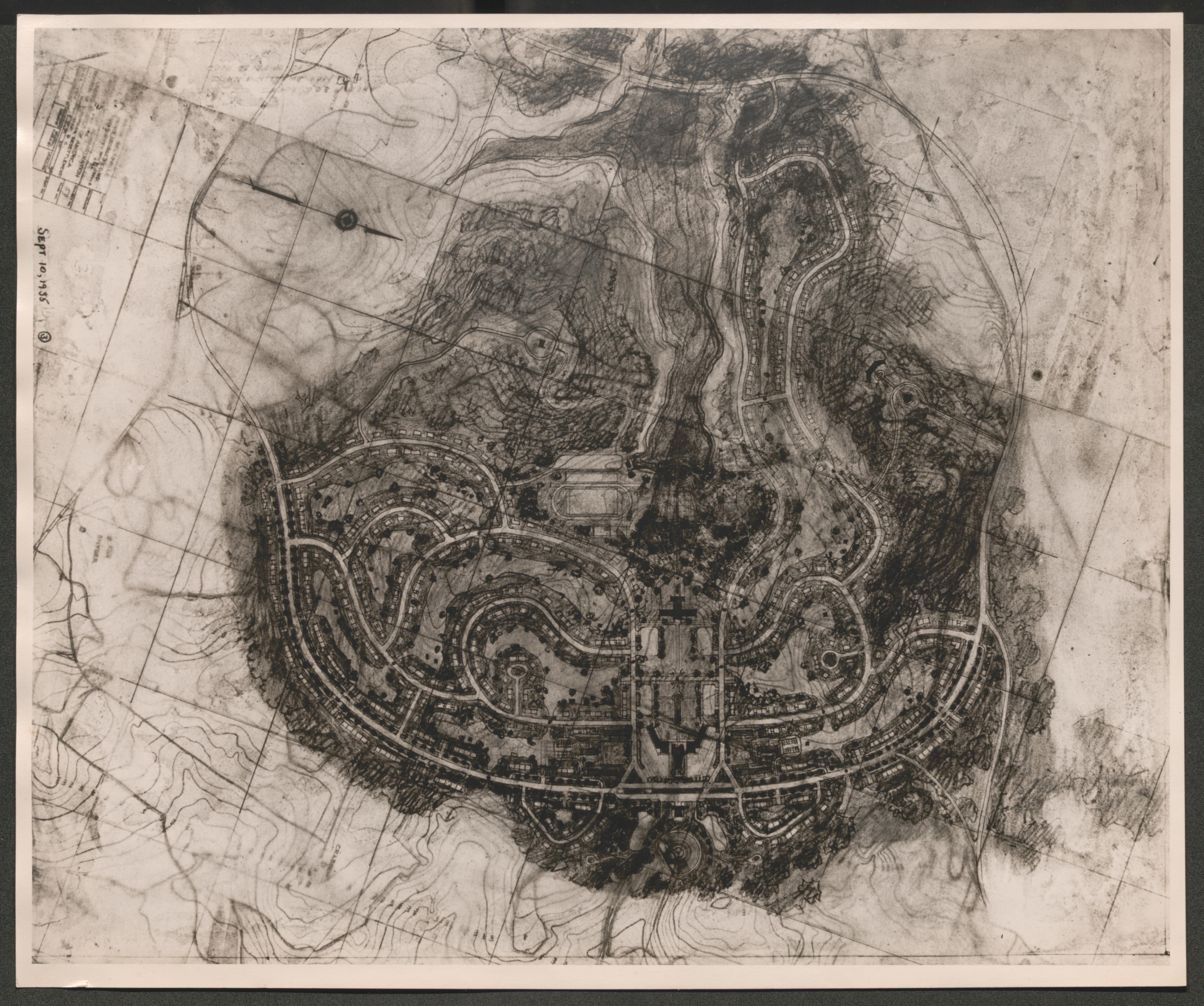
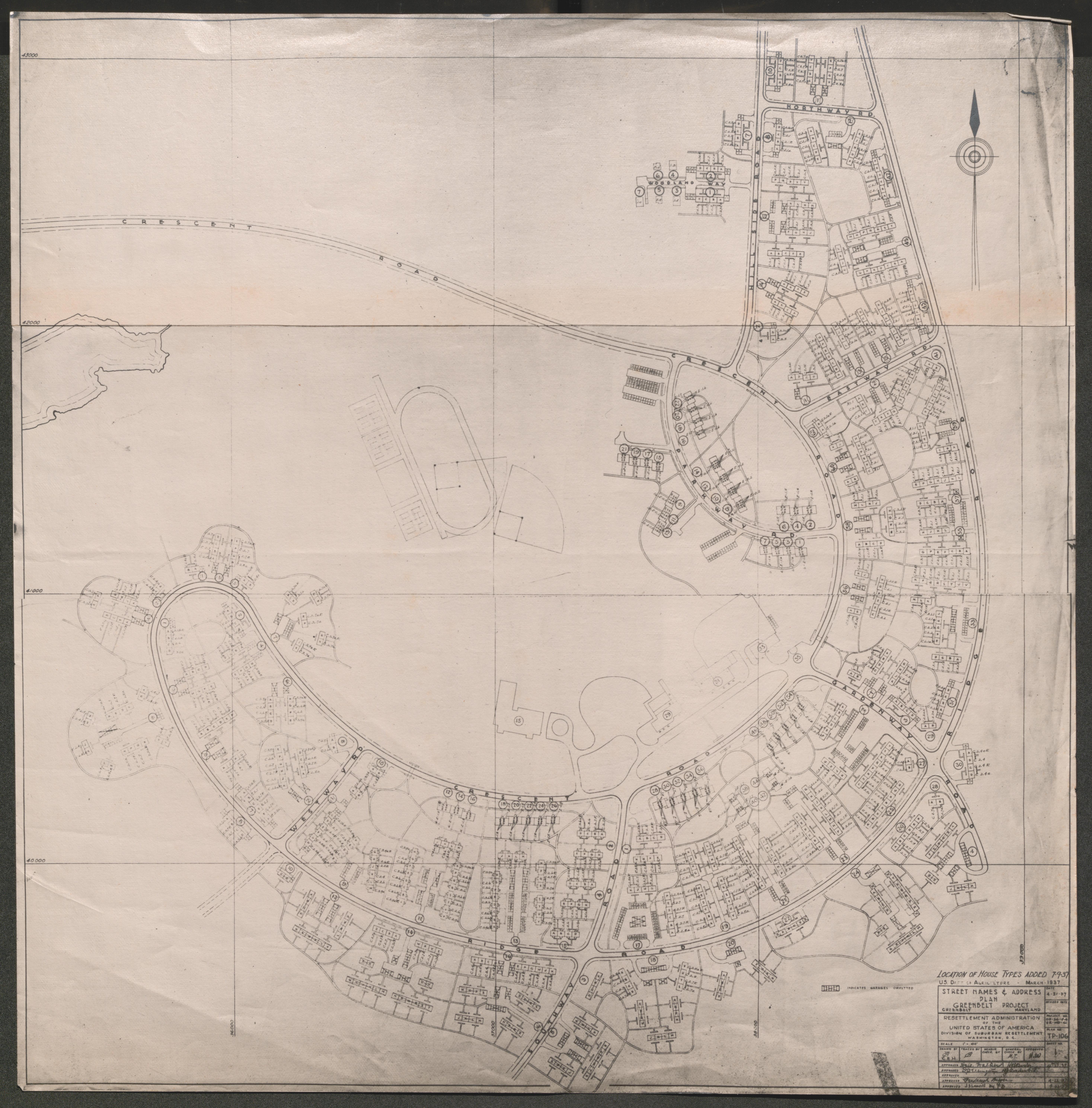
Map of Greenbelt, labeled "Ultimate Town Greenbelt Maryland", undated
Map of Greenbelt, labeled "First Town Unit Greenbelt Maryland", undated
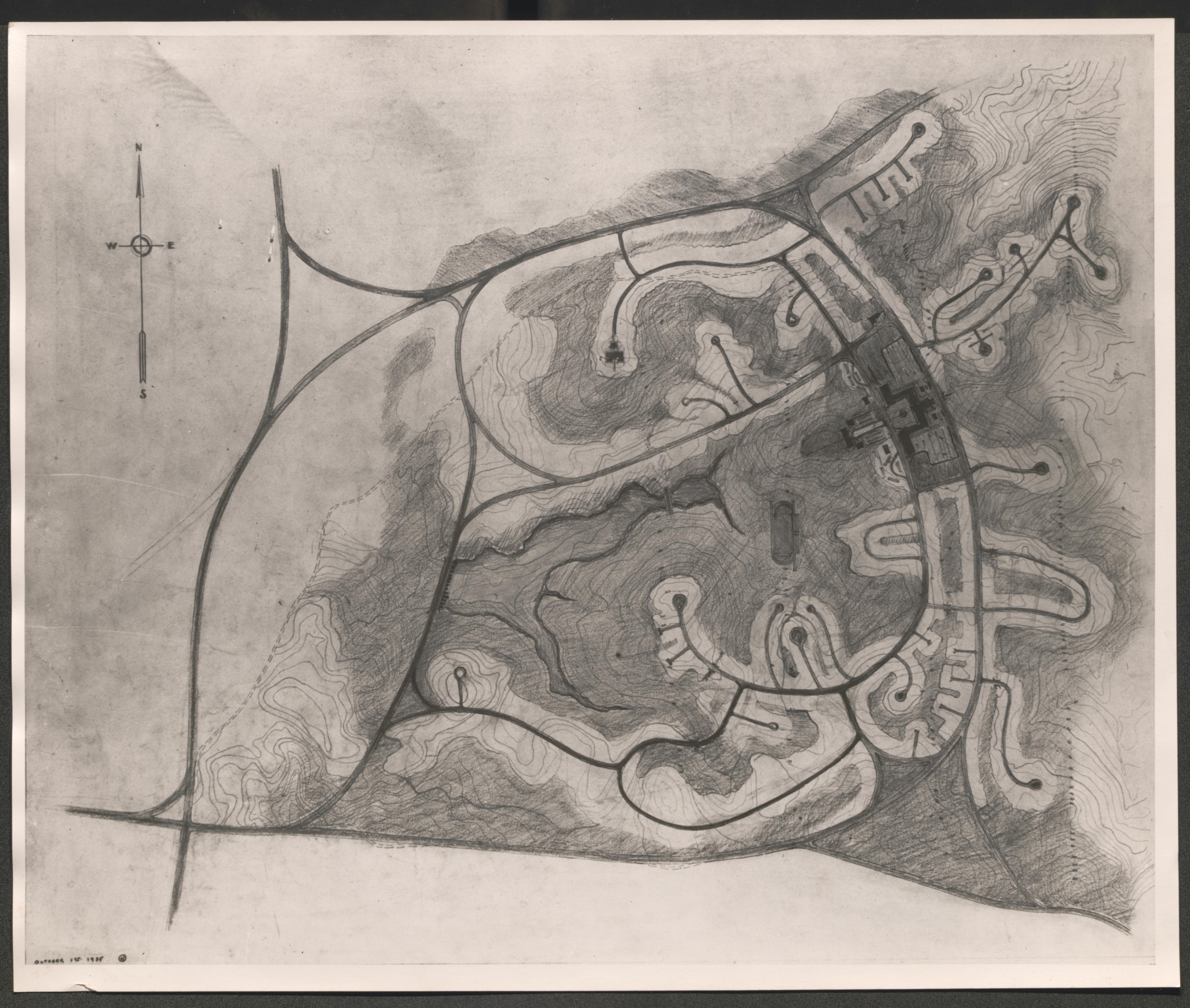
Map of Greenbelt, labeled "Preliminary Plan Greenbelt Maryland // Resettlement Administration of the United States of America Division of Suburban Resettlement // Washington D.C. March 1st 1936 Project no. OP56-84-SR-MD-6 Plan no. TP-100-2", 1936 March 1
- Box 23, item 18
Scope and Contents
Resettlement Administration. Oversize duplicated Box 24 Item 18.
Aerial view of Greenbelt, Maryland, in print at bottom of image - "Greenbelt Maryland // Resettlement Administration // Division of Suburban Resettlement, brief essay titled Greenbelt Panorama in storage with print", undated
Table top model mock-up of Greenbelt development section, undated
Table top model mock-up of Greenbelt development section, hand written on back of image "Model of Berwyn Project", undated
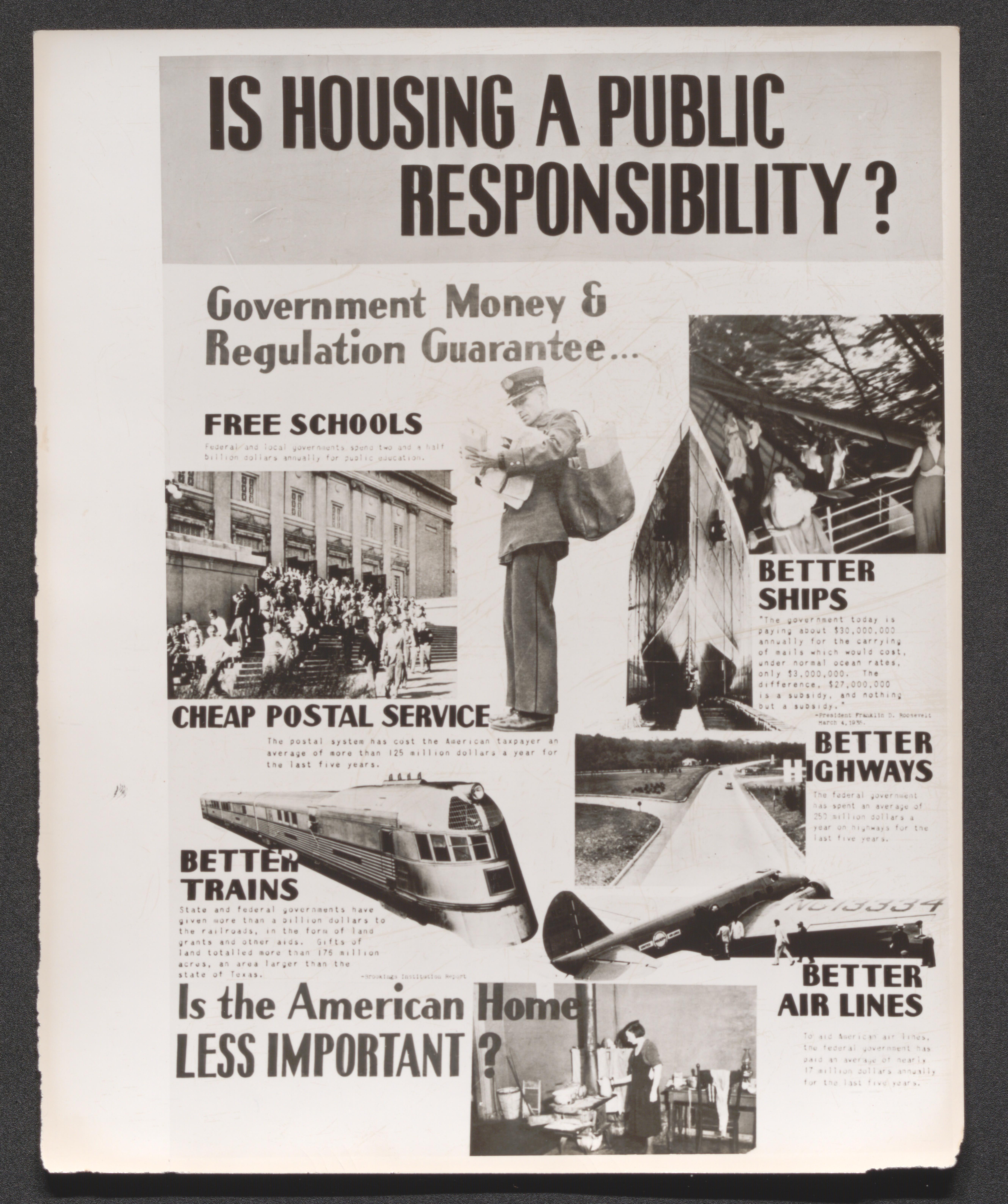
Poster; "Is Housing a Public Responsibility? Government Money and Regulation Guarantee... Free Schools, Cheap Postal Service, Better Trains, Better Ships, Better Highways, Better Airlines. Is the American Home Less Important?, image and message per segment of overall message", undated
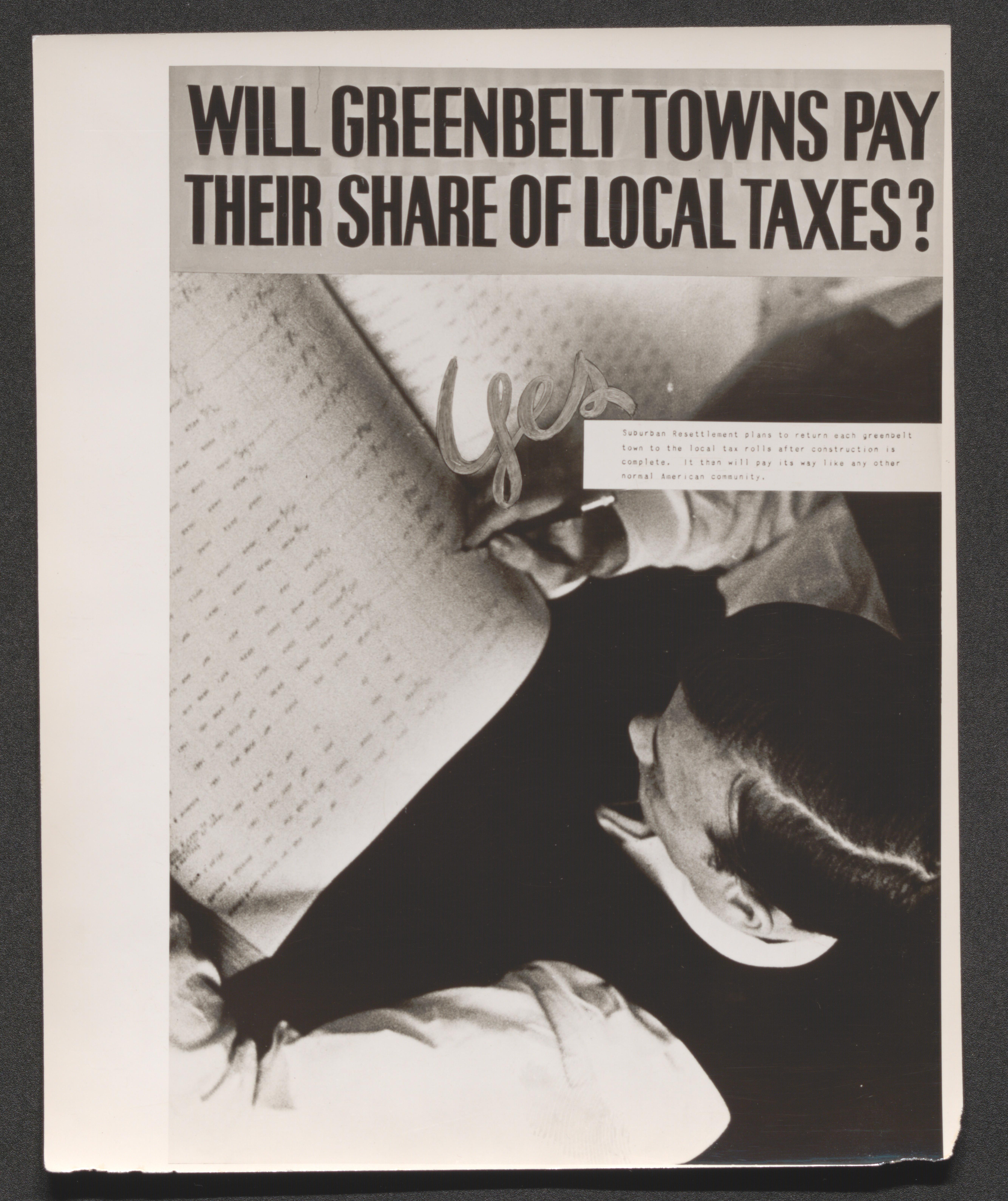
Poster; "Will Greenbelt Towns pay their share of local Taxes? Yes, overhead view of man writing numbers in open ledger, with smaller print message Suburban Resettlement plans to return each Greenbelt Town to the local tax rolls after construction is complete. It then will pay its way like any other normal American community", undated
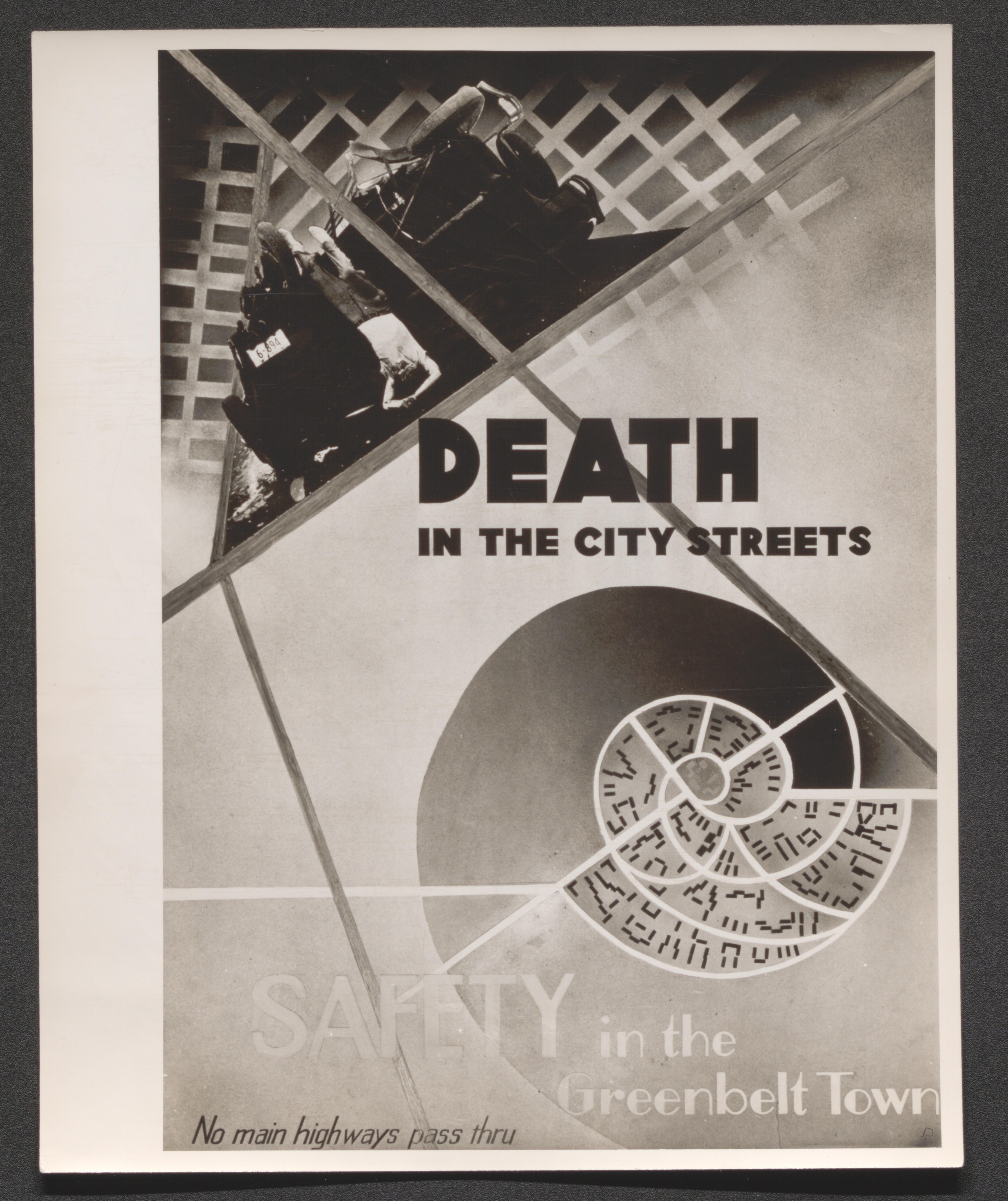
Poster with split image; "Car wreck with diseased and Greenbelt road diagram, corresponding messages Death in the City Streets and Safety in the Greenbelt Town No main highways pass thru", undated
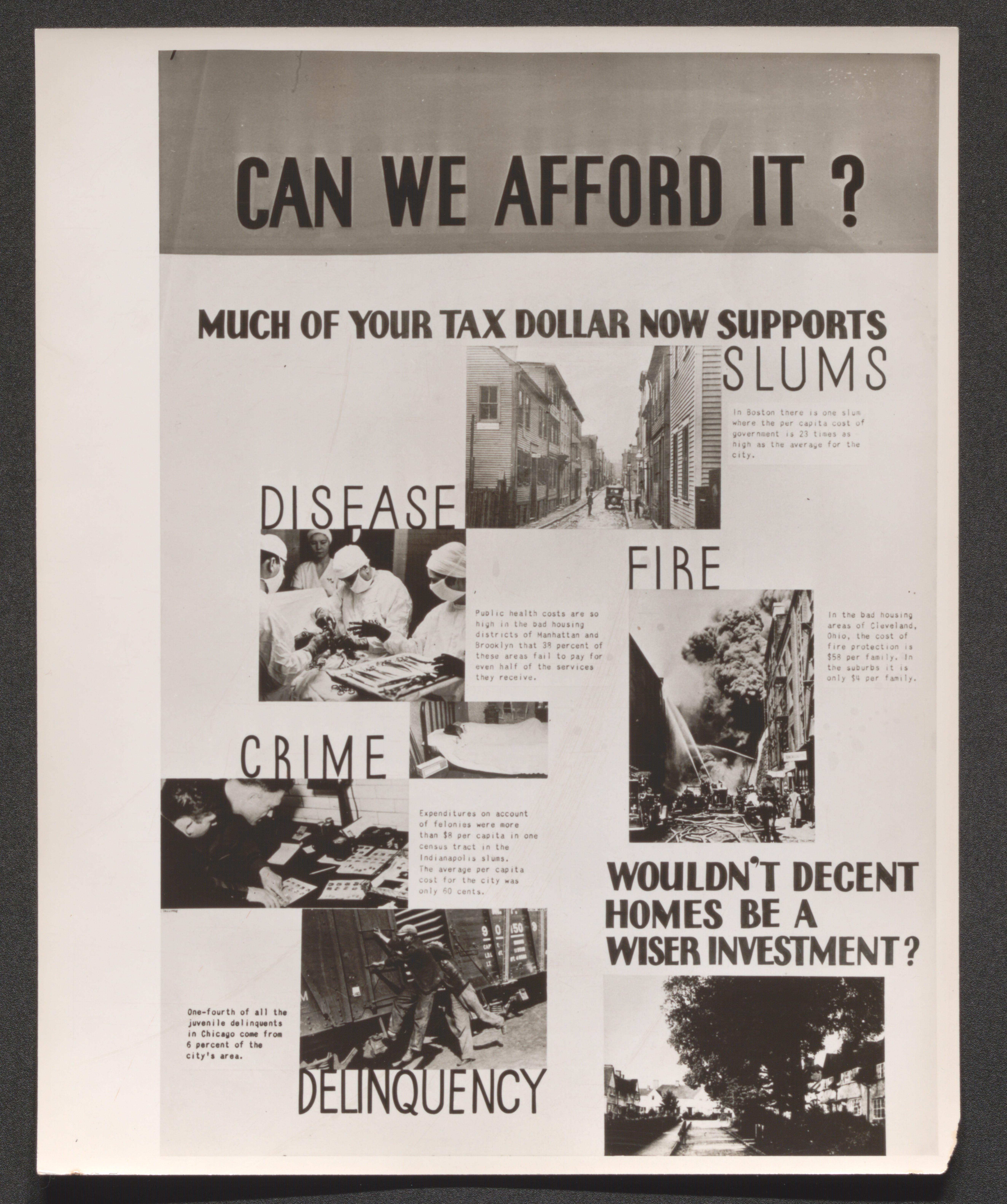
Poster; "Can we Afford it? Much of your Tax Dollar Now Supports Slums, Disease, Fire, Crime, Delinquency. Wouldnt Decent Homes be a Wiser Investment?", image and message per segment of overall message, undated
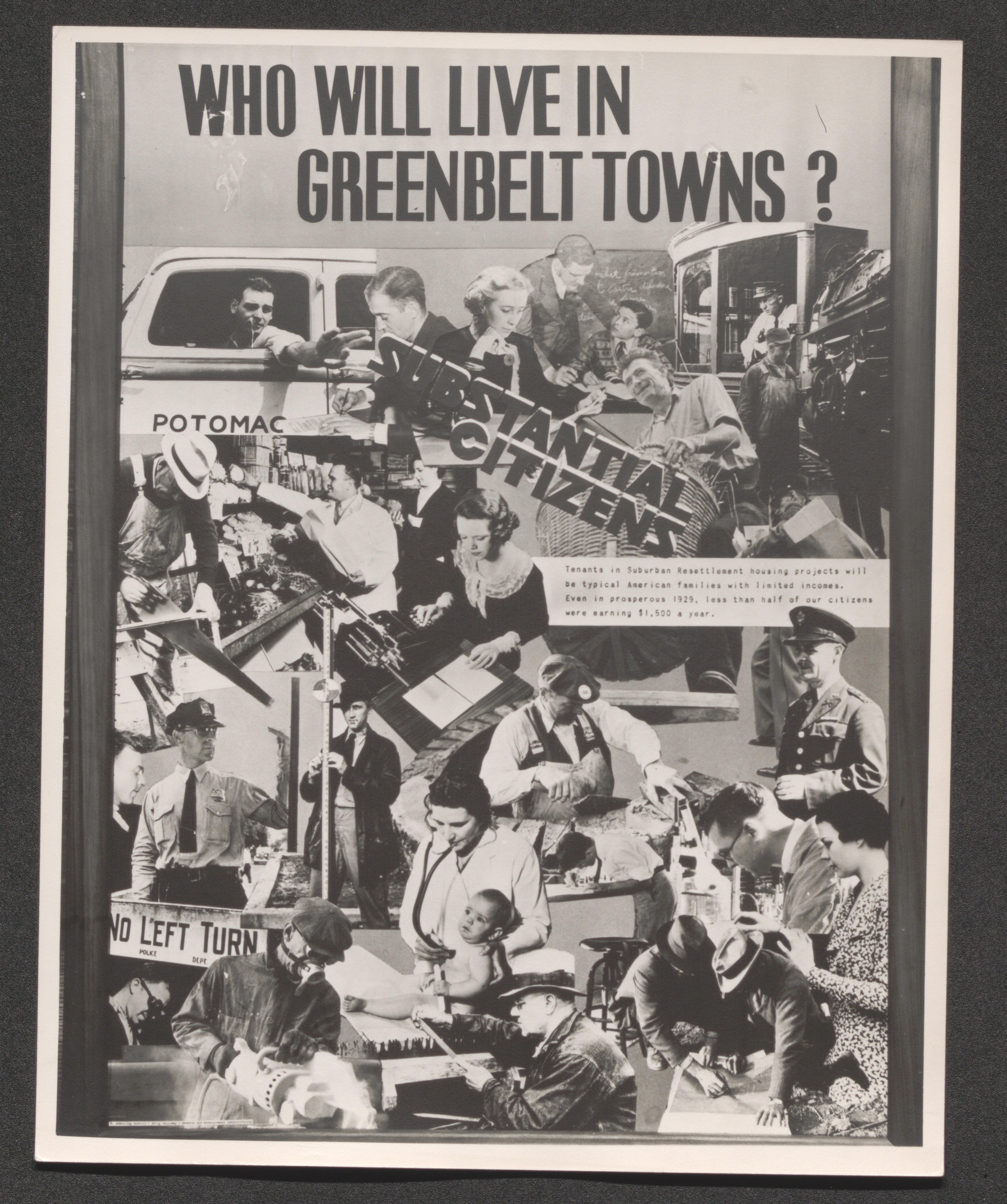
Poster; "Who Will Live in Greenbelt Towns? Substantial Citizens, photo collage of people at their jobs, with smaller print message Tenants in Suburban Resettlement housing projects will be typical American families with limited incomes. Even in prosperous 1929, less than half of our citizens were earning $1,500 a year", undated
Poster; "Which Playground for your Child? Greenbelt or Gutter, corresponding images; children at wooded creek side and children in street/alley", undated
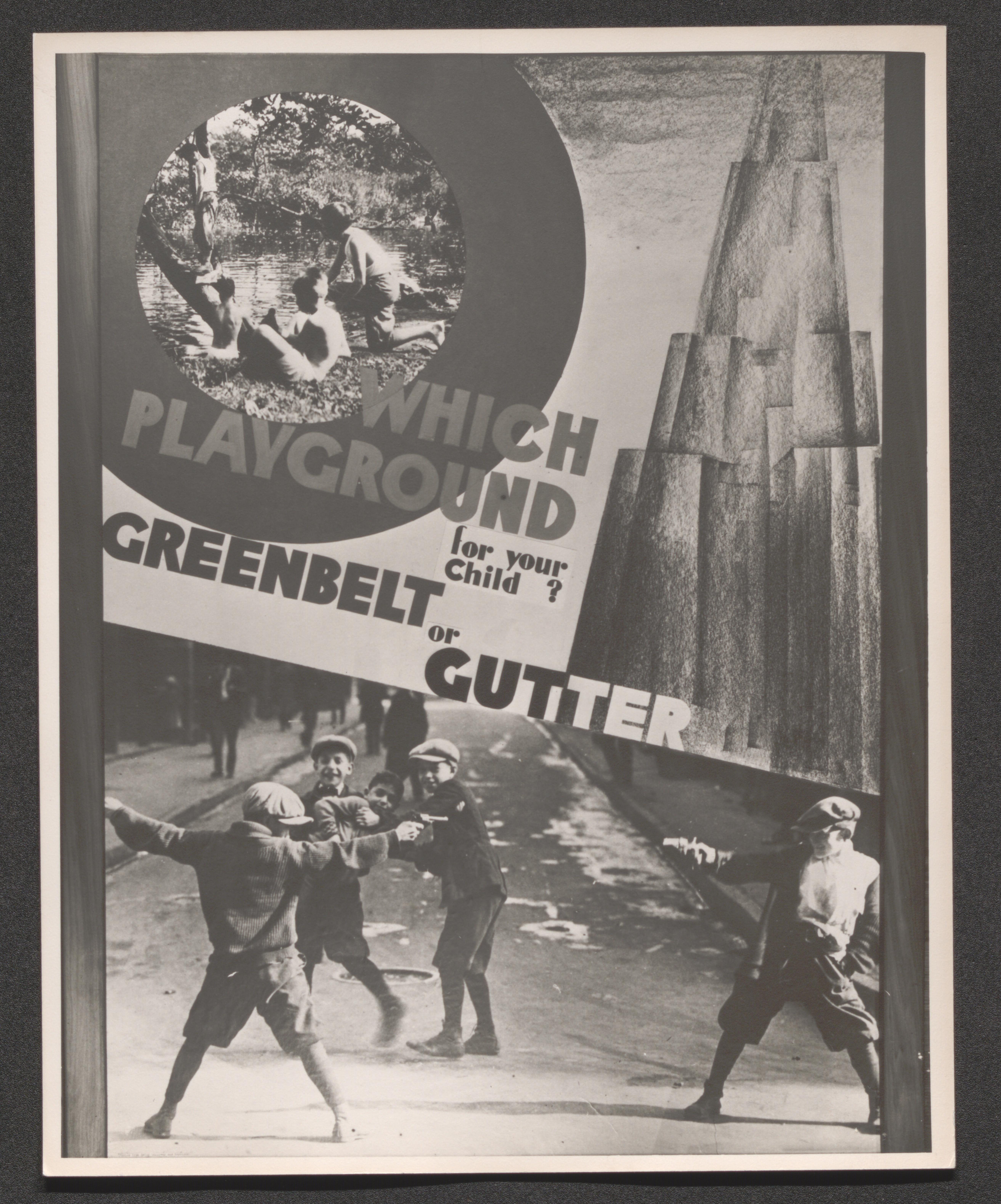
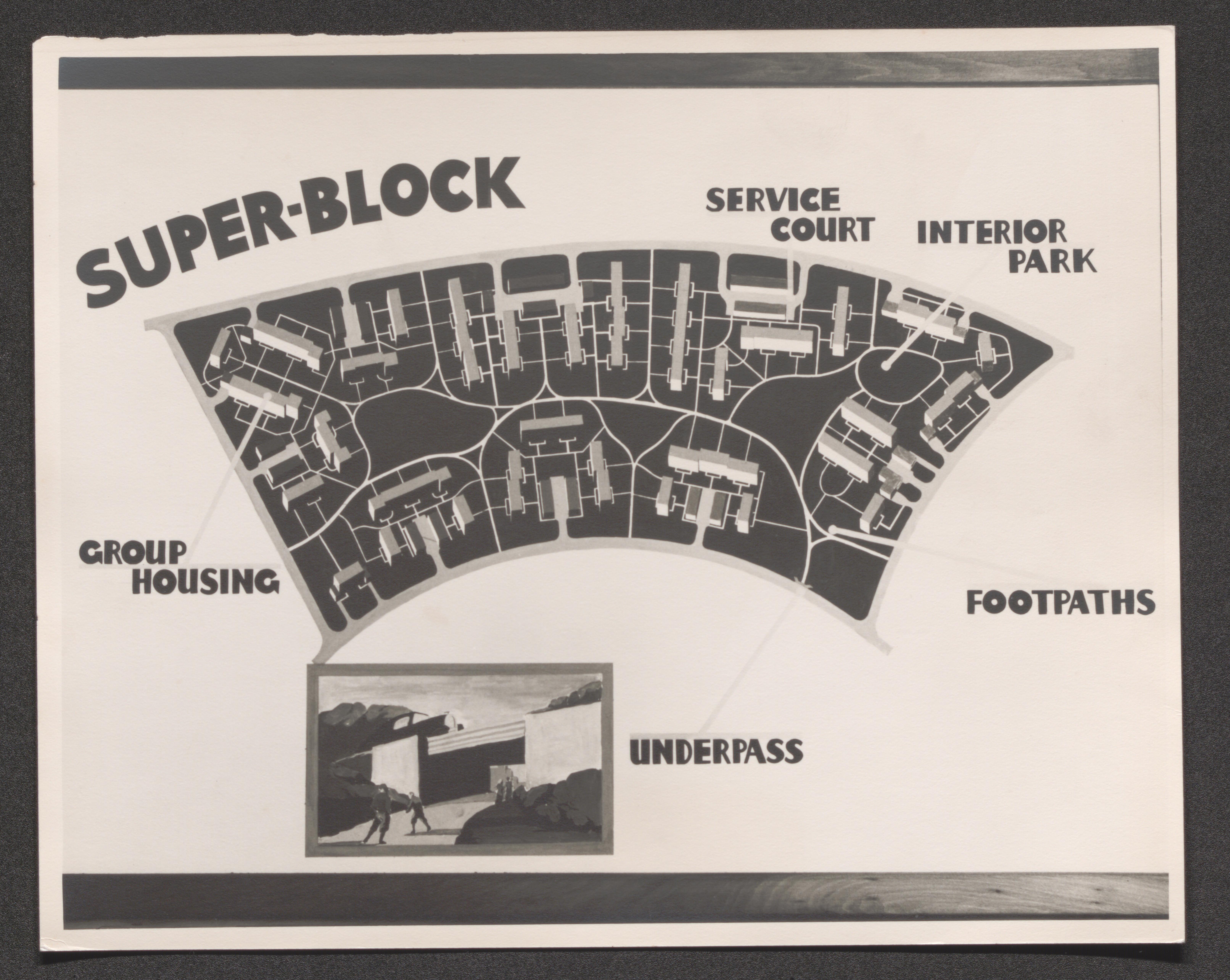
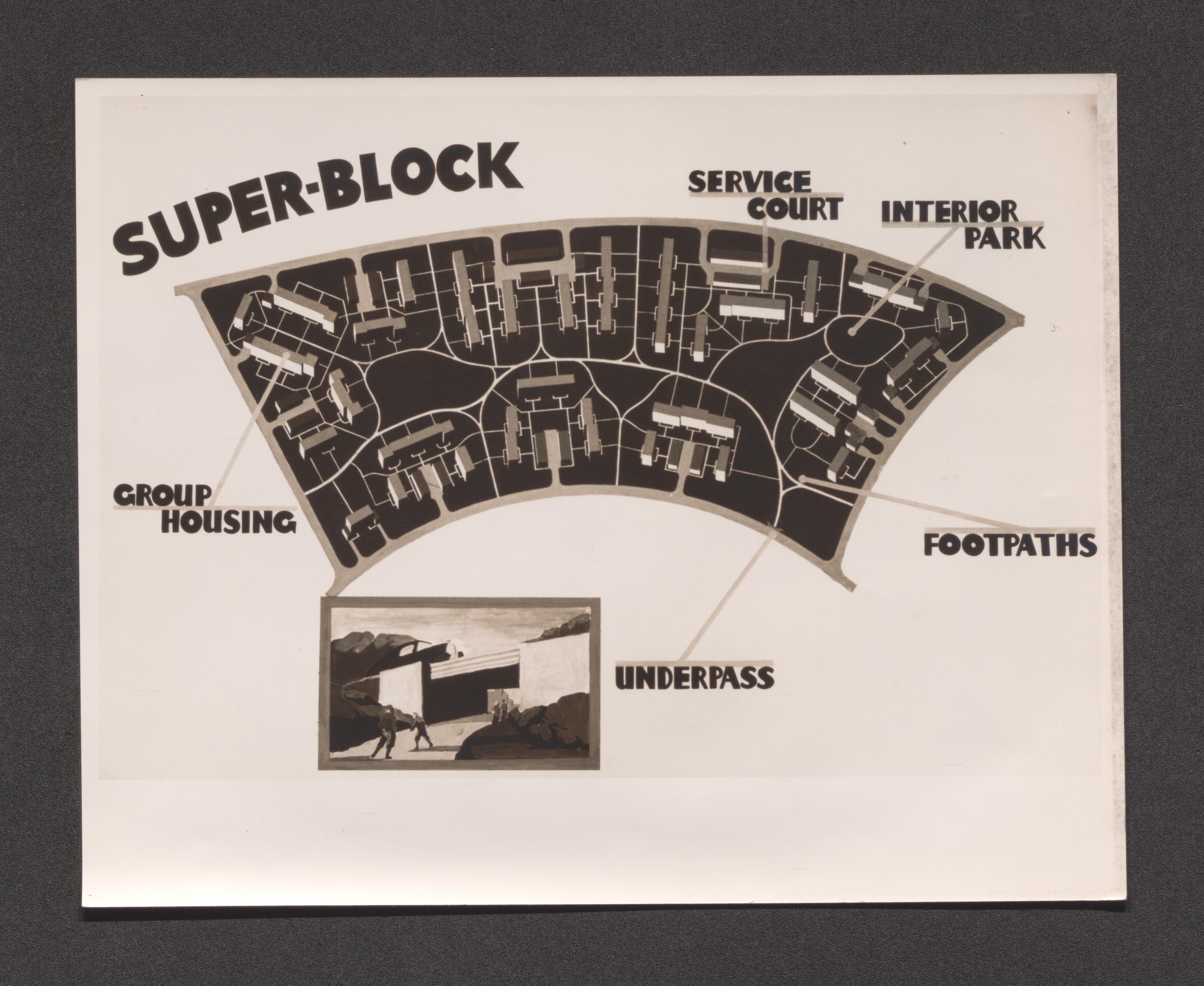
Diagram of development Super-Block with pointers to Group housing, Service court, Interior park, Footpaths, and Underpass, undated
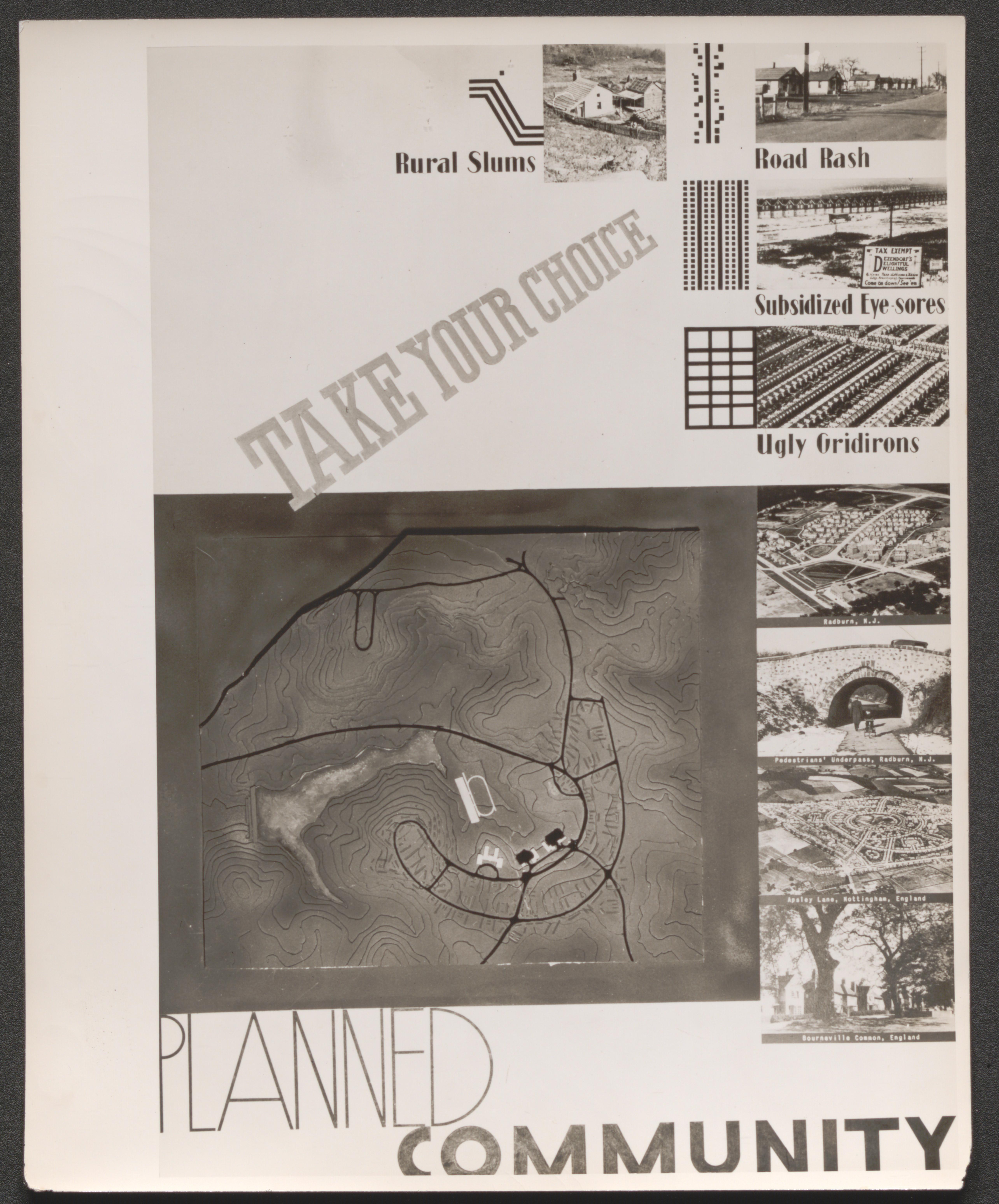
Poster; "Take Your Choice" [four small photos, each with accompanying graphic pattern, titled Rural Slums, Road Rash, Subsidized Eyesores, and Ugly Gridirons on top half]; [Greenbelt road graphic with four photos at its side labeled Radburn, N.J.; Pedestrians underpass at Radburn; Apsley Lane, Nottingham, England; and Bourneville Common, England; with Planned Community label on bottom half], undated
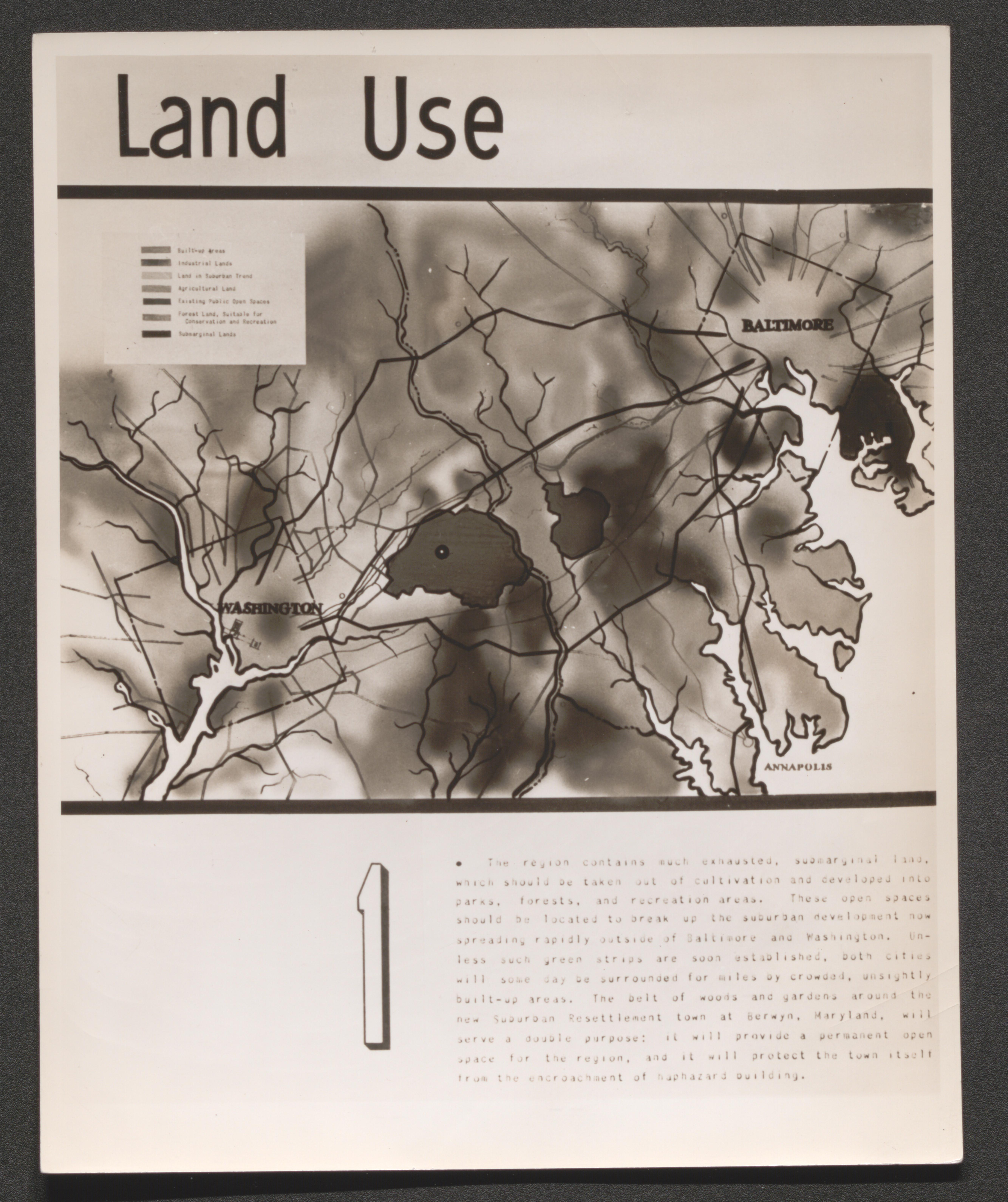
Poster; Land Use [1] Map/diagram showing Washington, DC and Baltimore with Greenbelt in-between, color key legend to show land uses, and an accompanying brief essay, undated
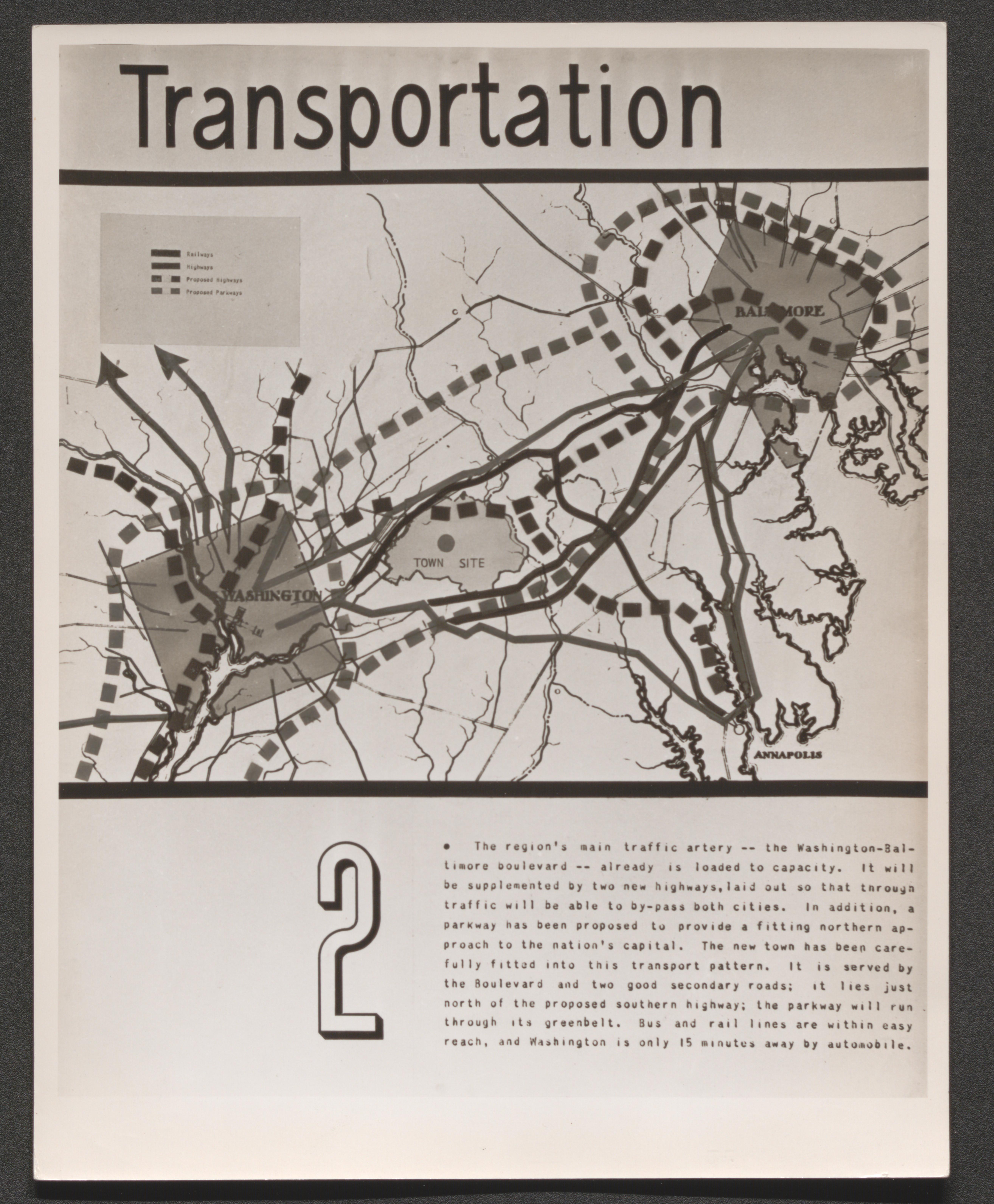
Poster; Transportation [2] Map/diagram showing Washington, DC and Baltimore with Town site in-between; color key legend to show railways, highways, and proposed highways; and an accompanying brief essay, undated
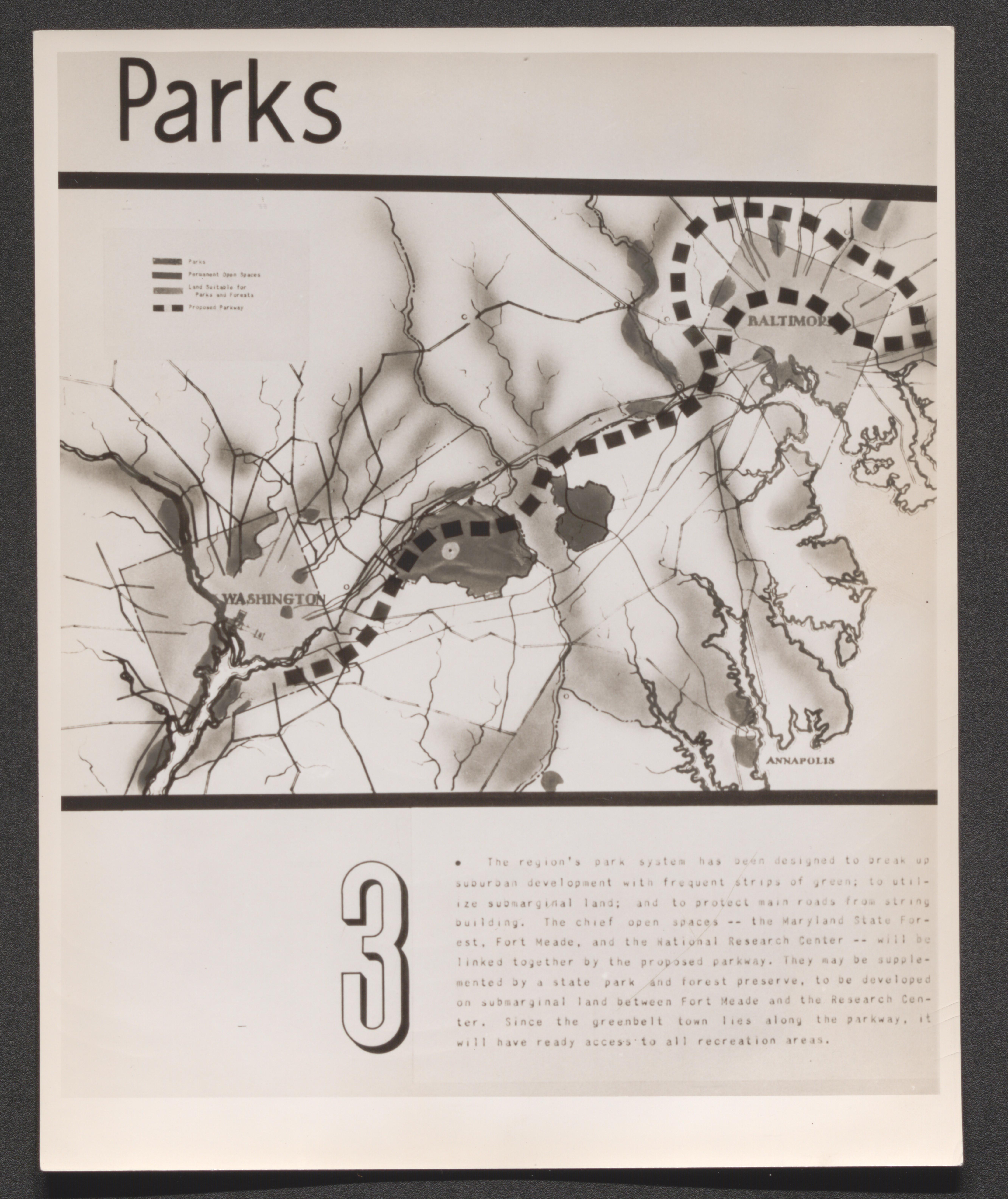
Poster; Parks [3] Map/diagram showing Washington, DC and Baltimore with Town site in-between; color key legend to show parks, land suitable for parks, and open spaces; and an accompanying brief essay, undated
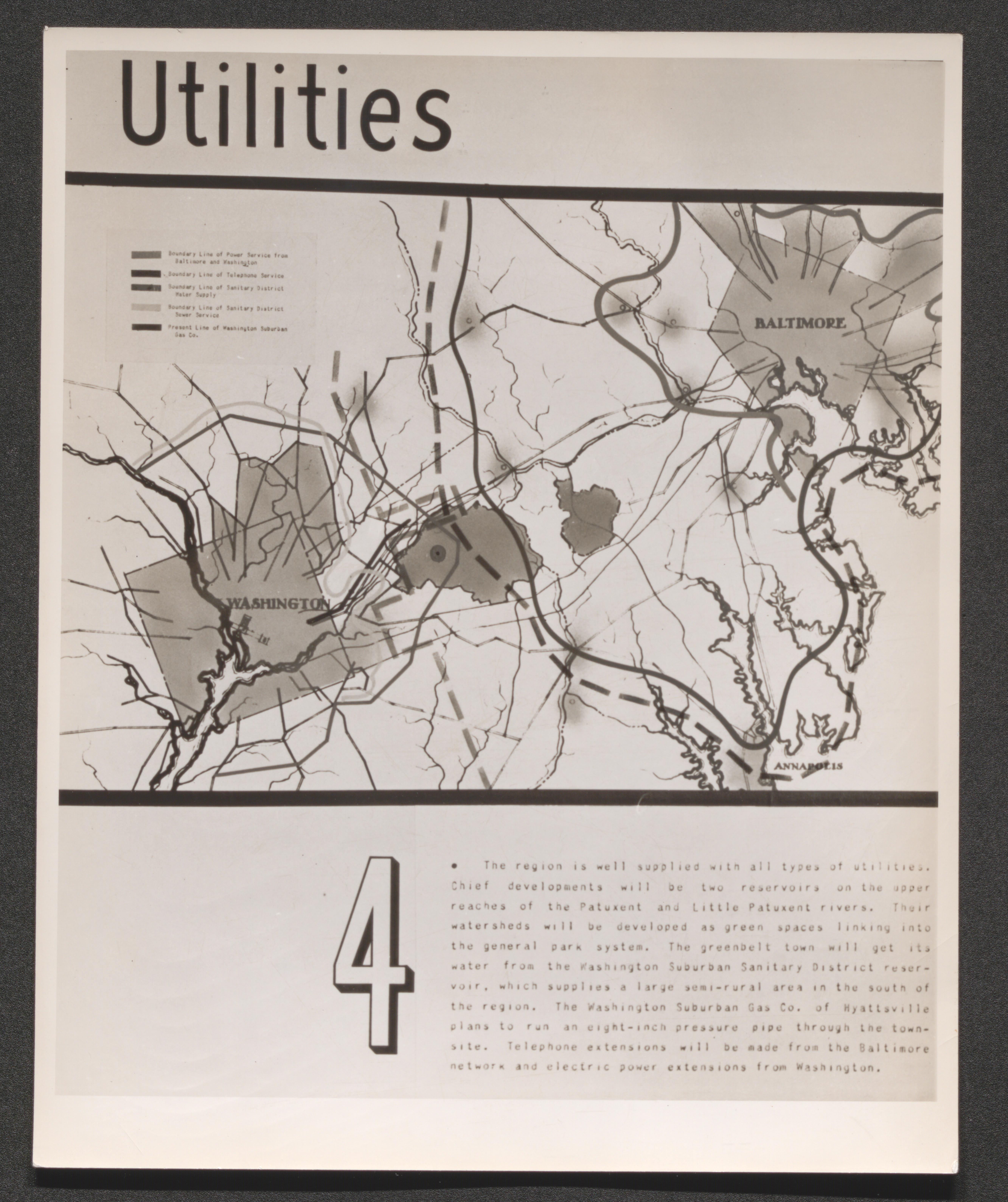
Poster; Utilities [4] Map/diagram showing Washington, DC and Baltimore with Town site in-between; color key legend to show boundary lines for available power, telephone, and water service; and an accompanying brief essay, undated
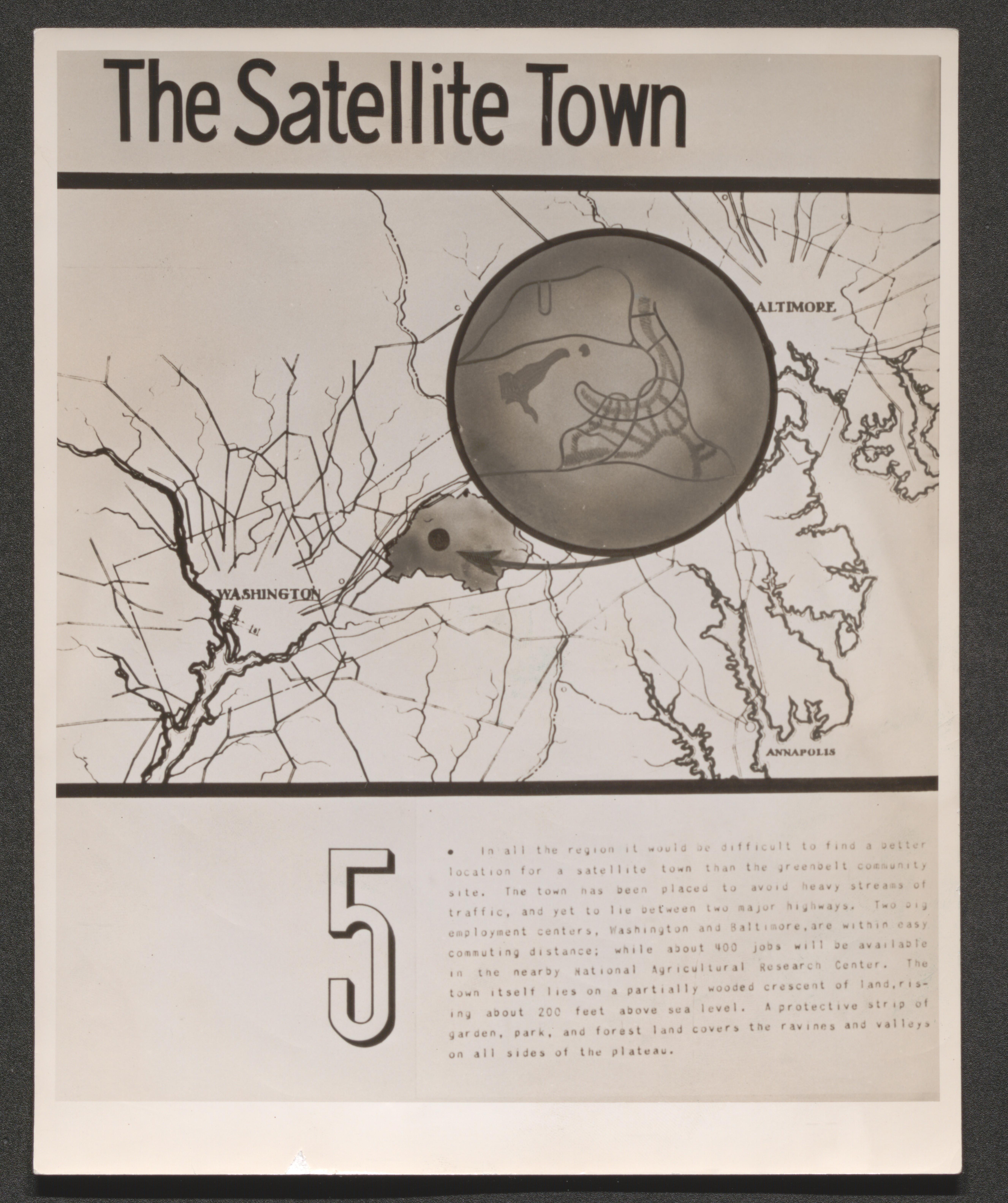
Poster; The Satellite Town [5] Map/diagram showing Washington, DC and Baltimore with Greenbelt in-between, an enlargement of Greenbelt to show road plan, and an accompanying brief essay, undated
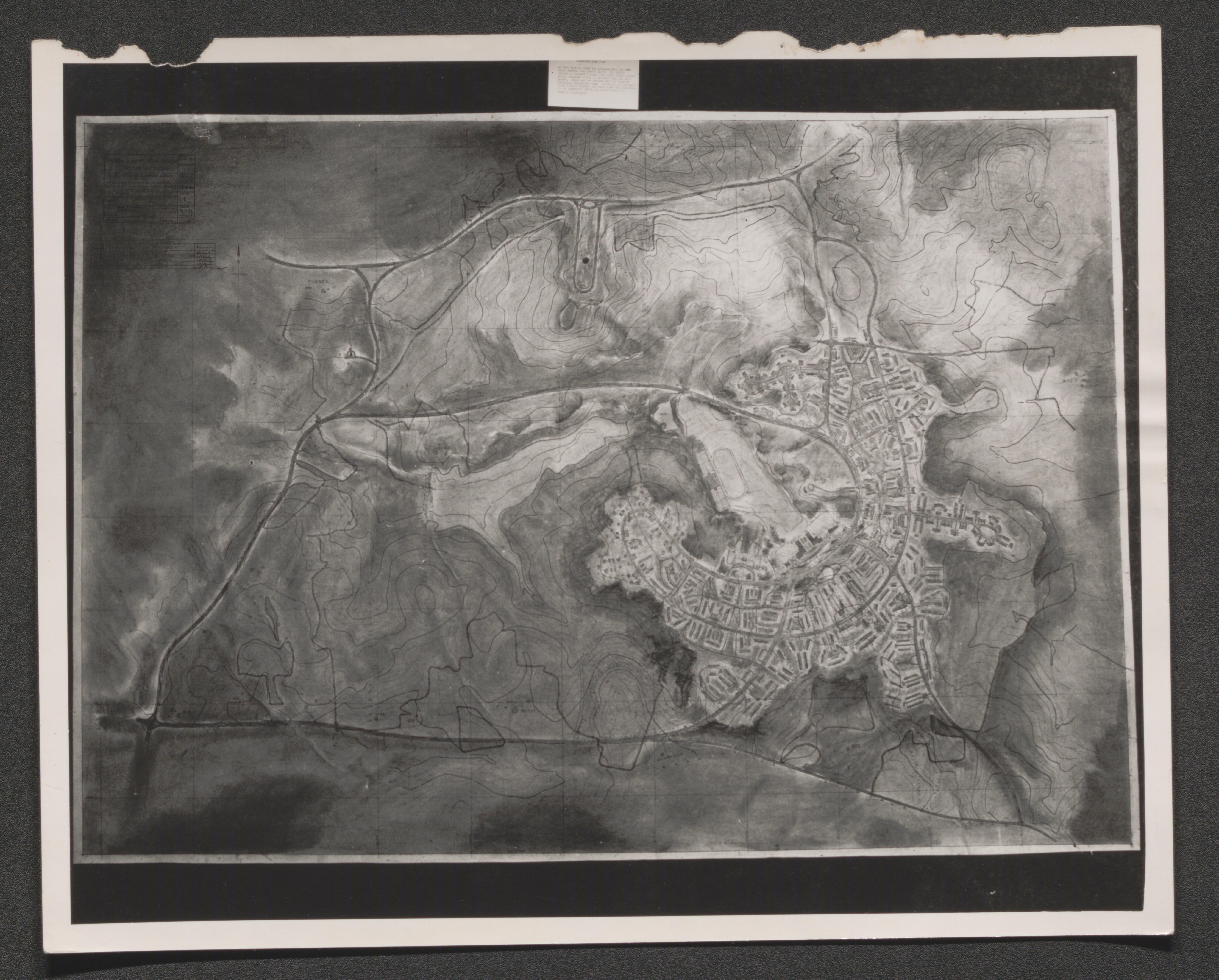
Map of Greenbelt, Maryland and surrounding area with topographic lines, undated
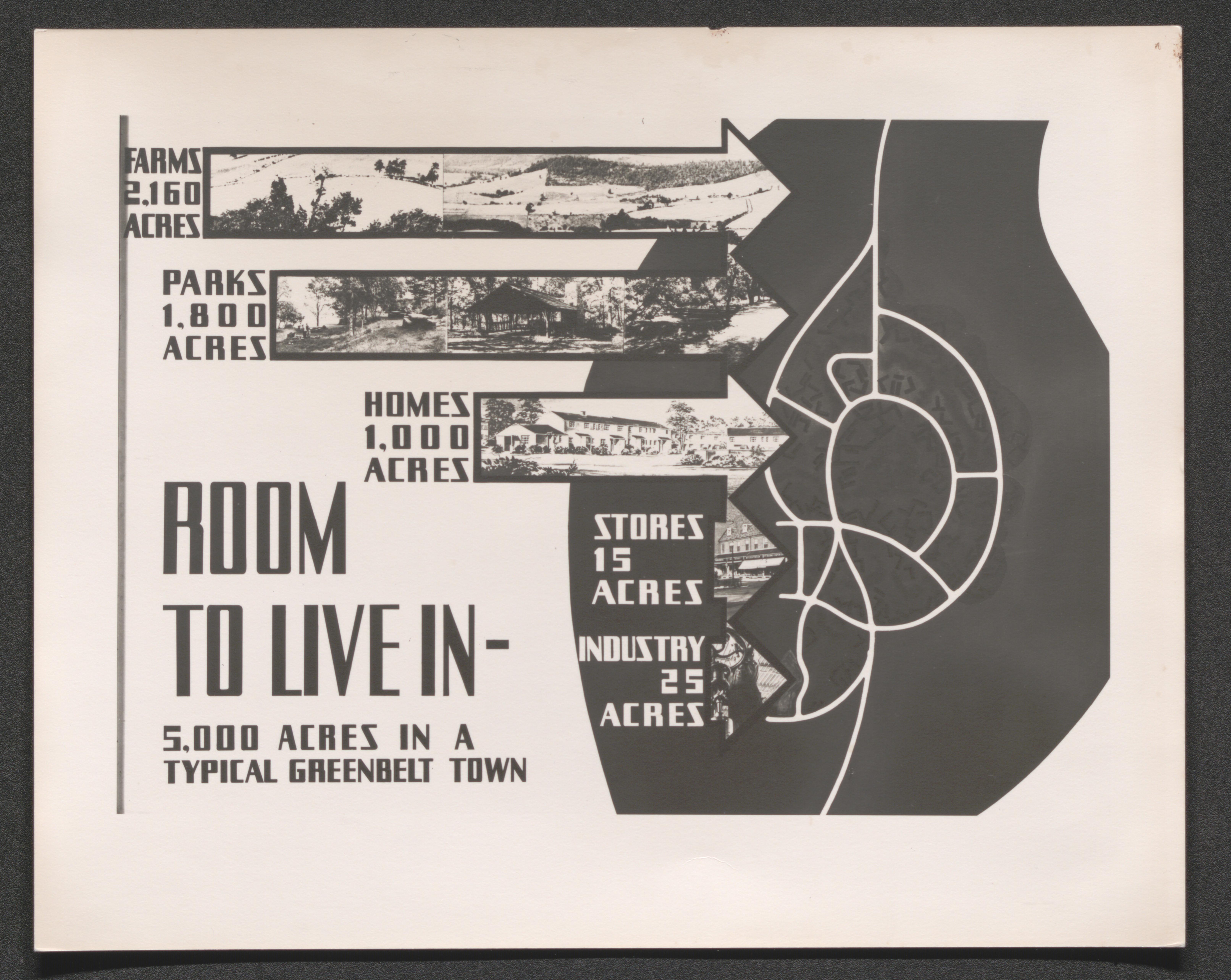
Poster; "Room to Live In - 5,000 Acres in a Typical Greenbelt Town", pictorial arrows to Greenbelt road graphic list acres for farms, parks, homes, stores, and industry, undated
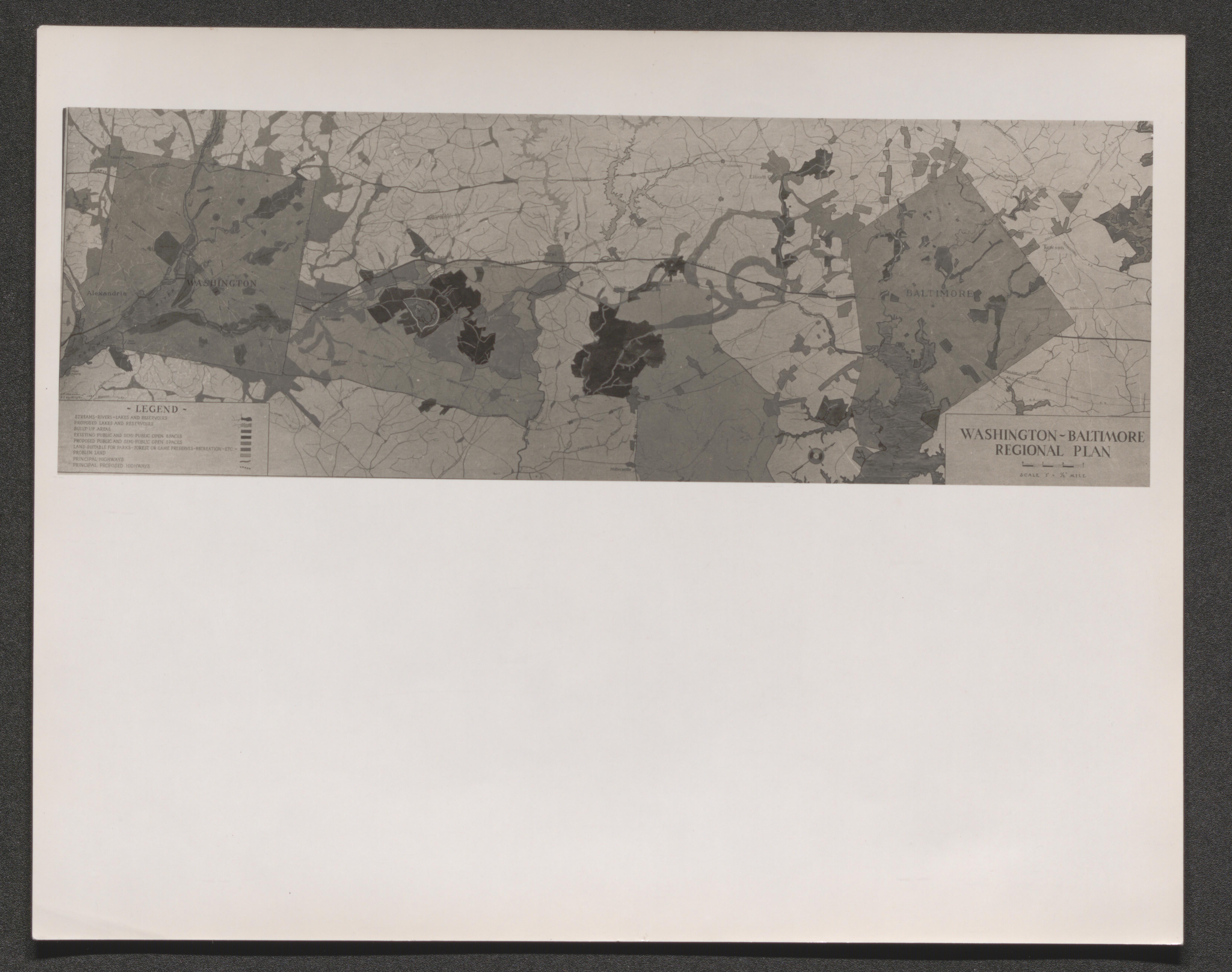
Map labeled "Washington Baltimore Regional Plan", including Greenbelt in-between, with color key legend to indicate land usage, undated
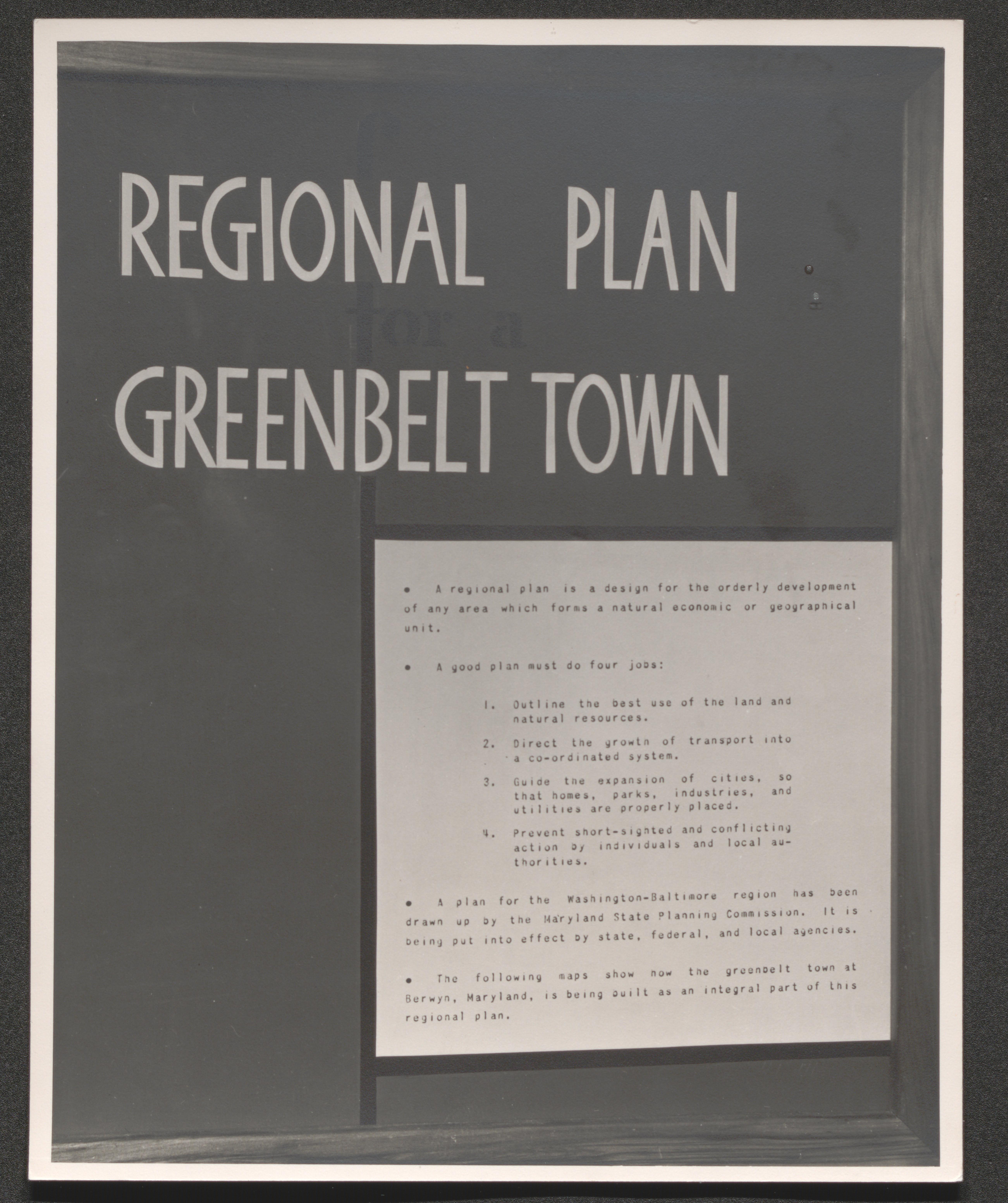
Large message Regional Plan for a Greenbelt Town on display board with a sheet listing what a good plan must do and the status of a plan for the Washington - Baltimore Region, undated
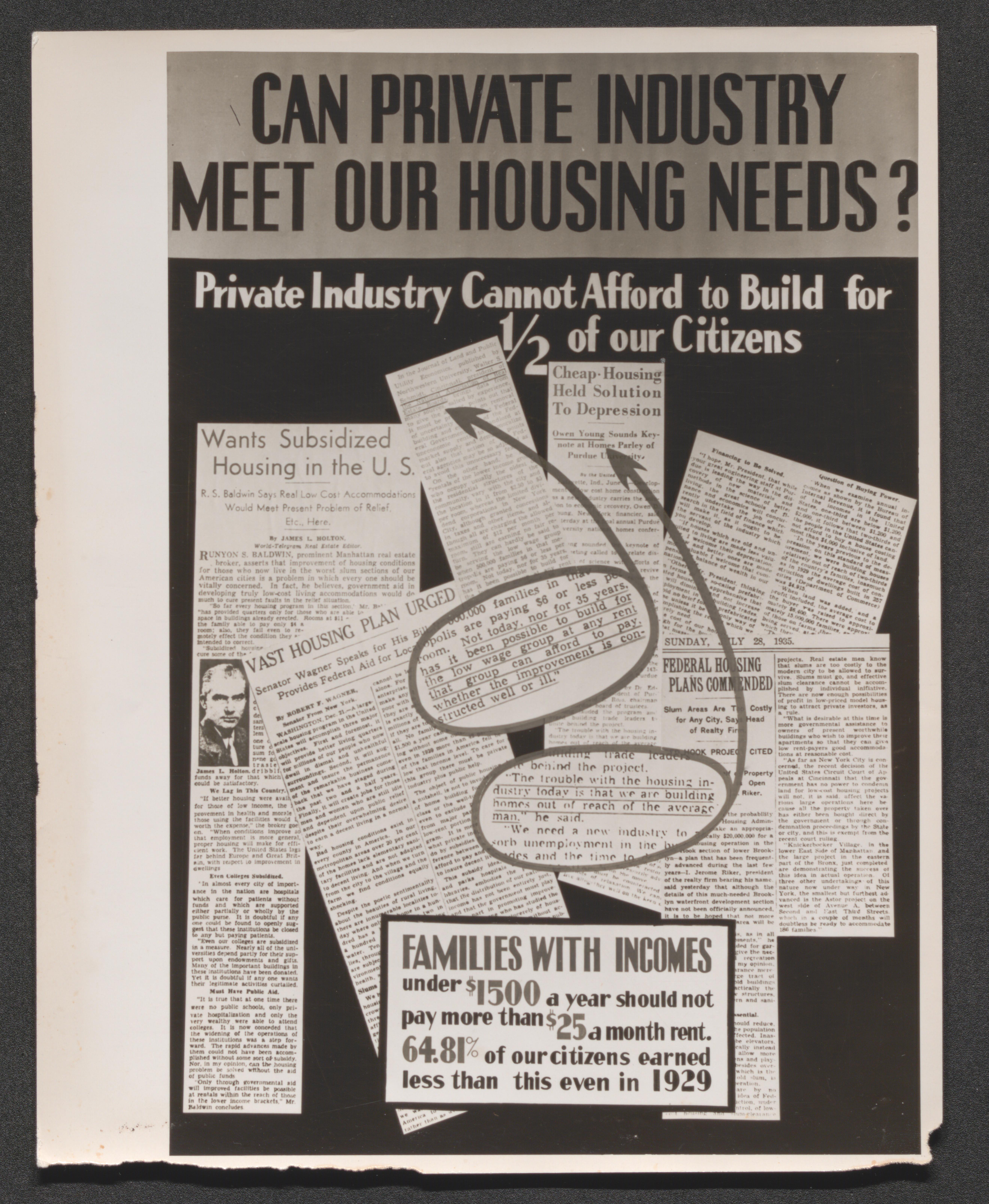
Poster; "Can Private Industry Meet our Housing Needs? Private Industry Cannot Afford to Build for 1/2 of our Citizens." Newspaper cutouts with enlargements from some articles, undated
Two men in hats with shirt and tie observe construction, undated
Two men in suits observe construction, undated
Two men and a woman seated at a counter, undated

Two men and a woman behind a partition and by an exit door, undated

Three men clearing underbrush in forest area, undated
Furnished living room, undated

Men working outside unfinished multifamily housing unit, undated
White cinder block multifamily housing unit contrasts with brick multifamily unit on lower terrace, undated
End corner of white brick multifamily housing unit, undated
Side and back of white cinder block multifamily housing unit, undated
Furnished living room, undated
Graph titled "Jobs for Workers" with grid of jobs in thousands per October 1935 - February 1937 timeline and images of Greenbelt construction as grid cells
Graph titled "Business for Private Industry" with grid of millions of dollars per October 1935 - February 1937 timeline and images of Greenbelt building supplies as grid cells
Greenbrook, New Jersey, 1937, undated
Mayer houses, undated
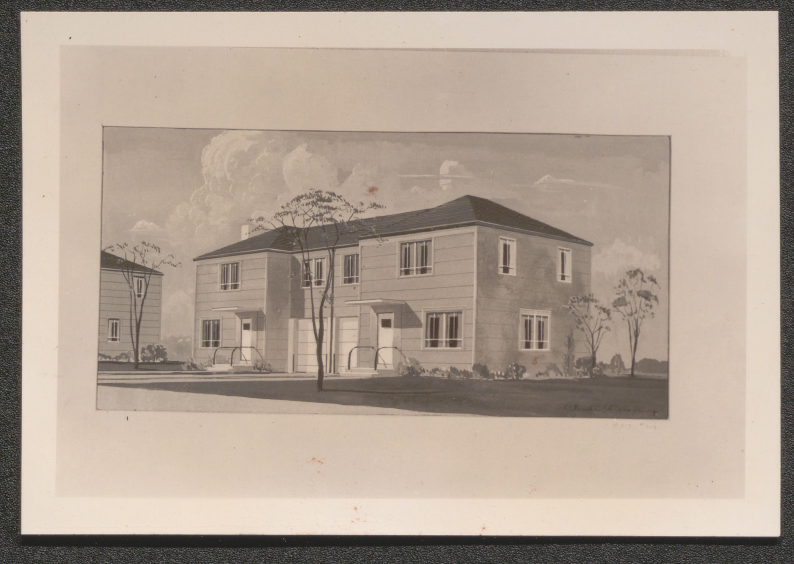
Churchill houses, undated
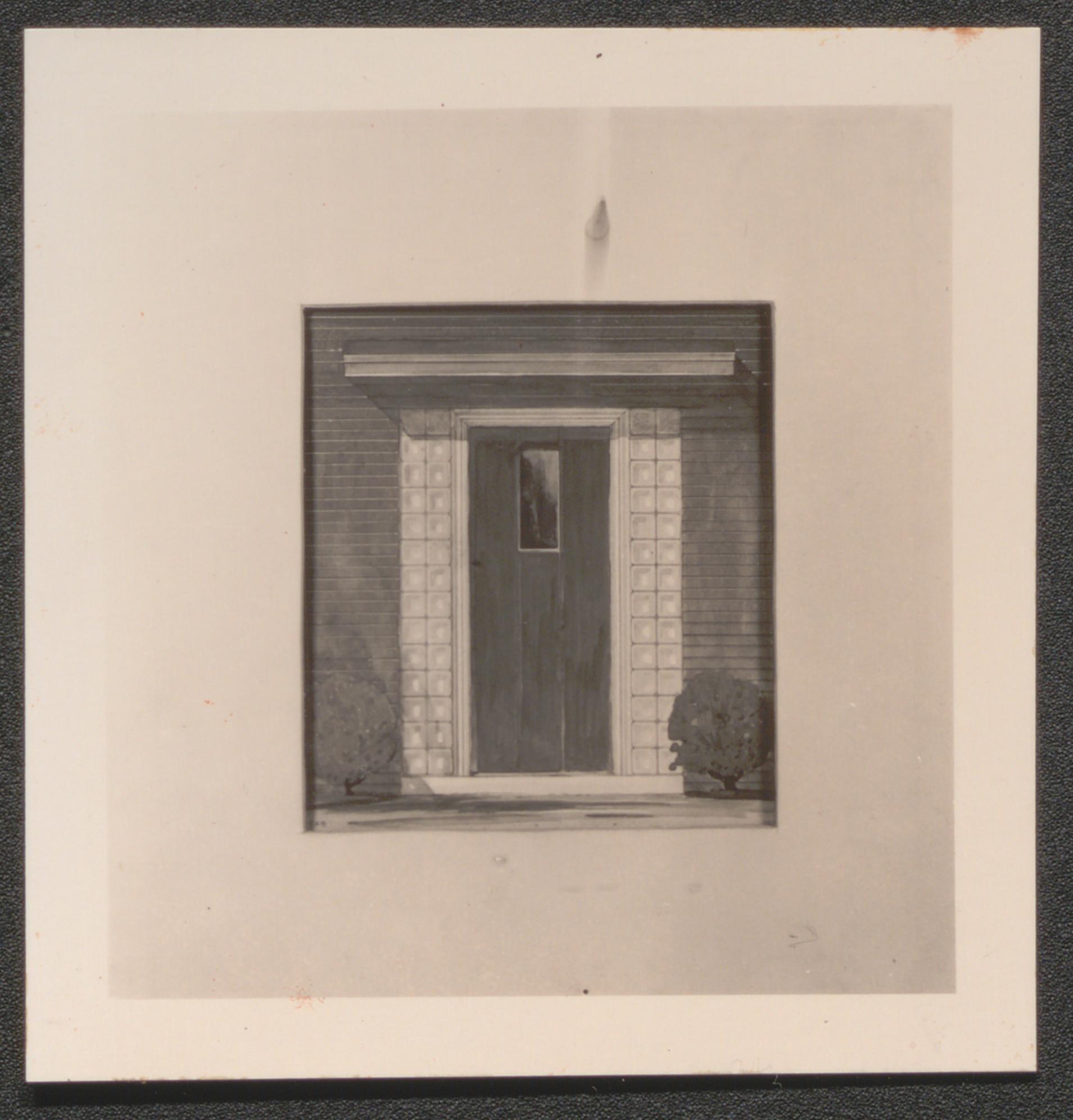
Detail of entrance to mayer house showing use of glass brick, undated
Detail of churchill house, undated
Vollmer house, undated
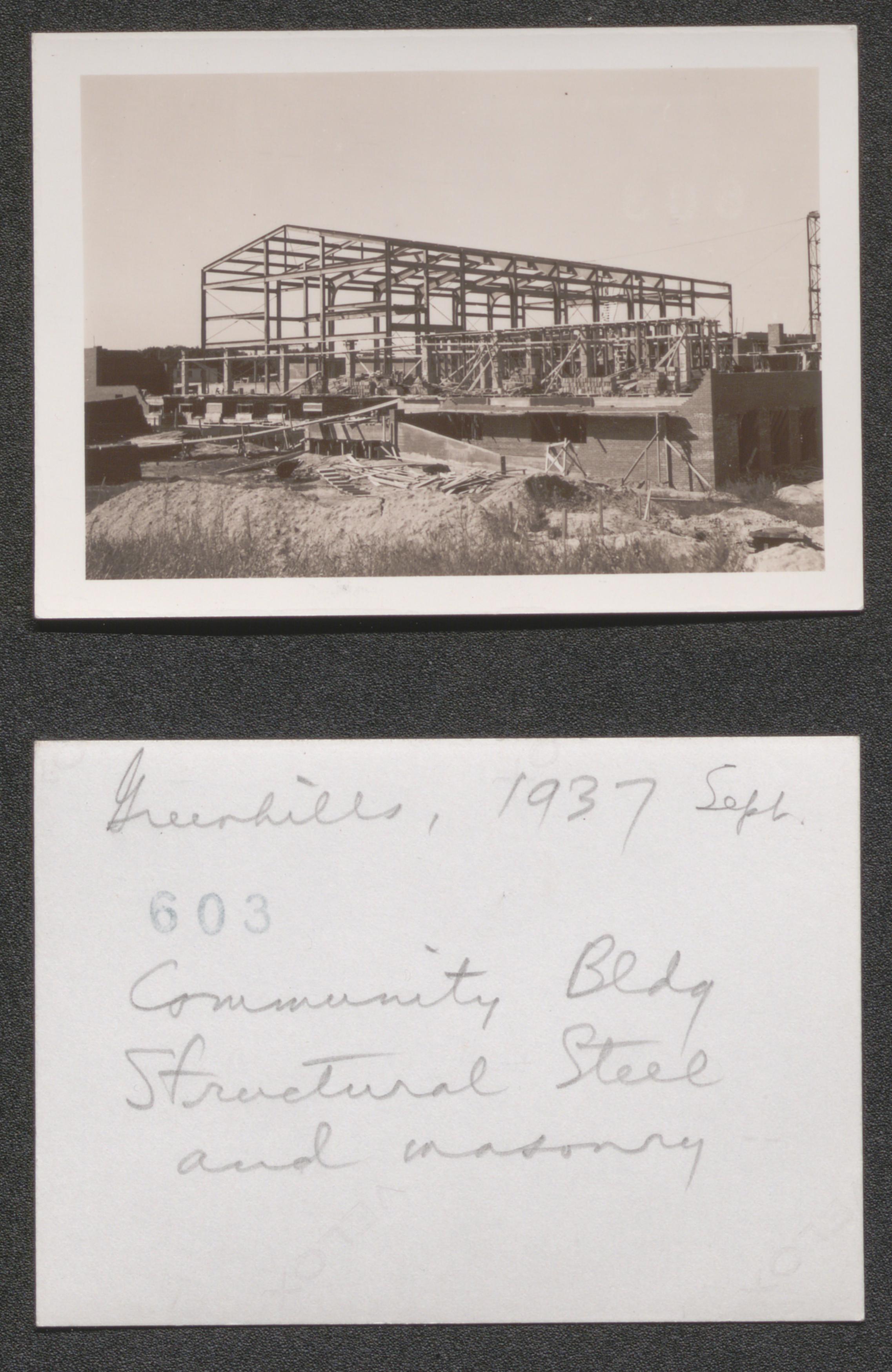
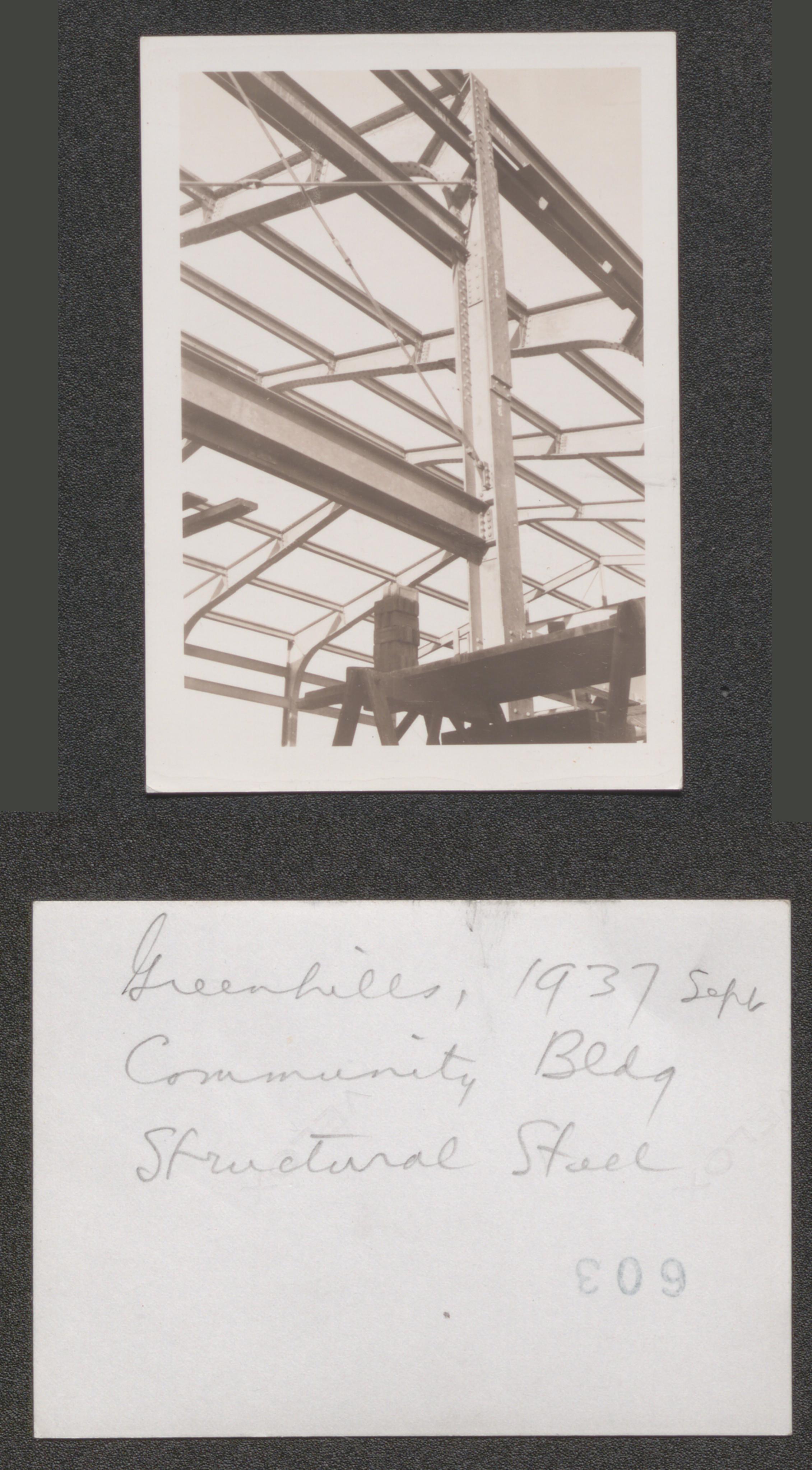
Community building structural steel and masonry, 1937 September
Community building structural store, 1937 September
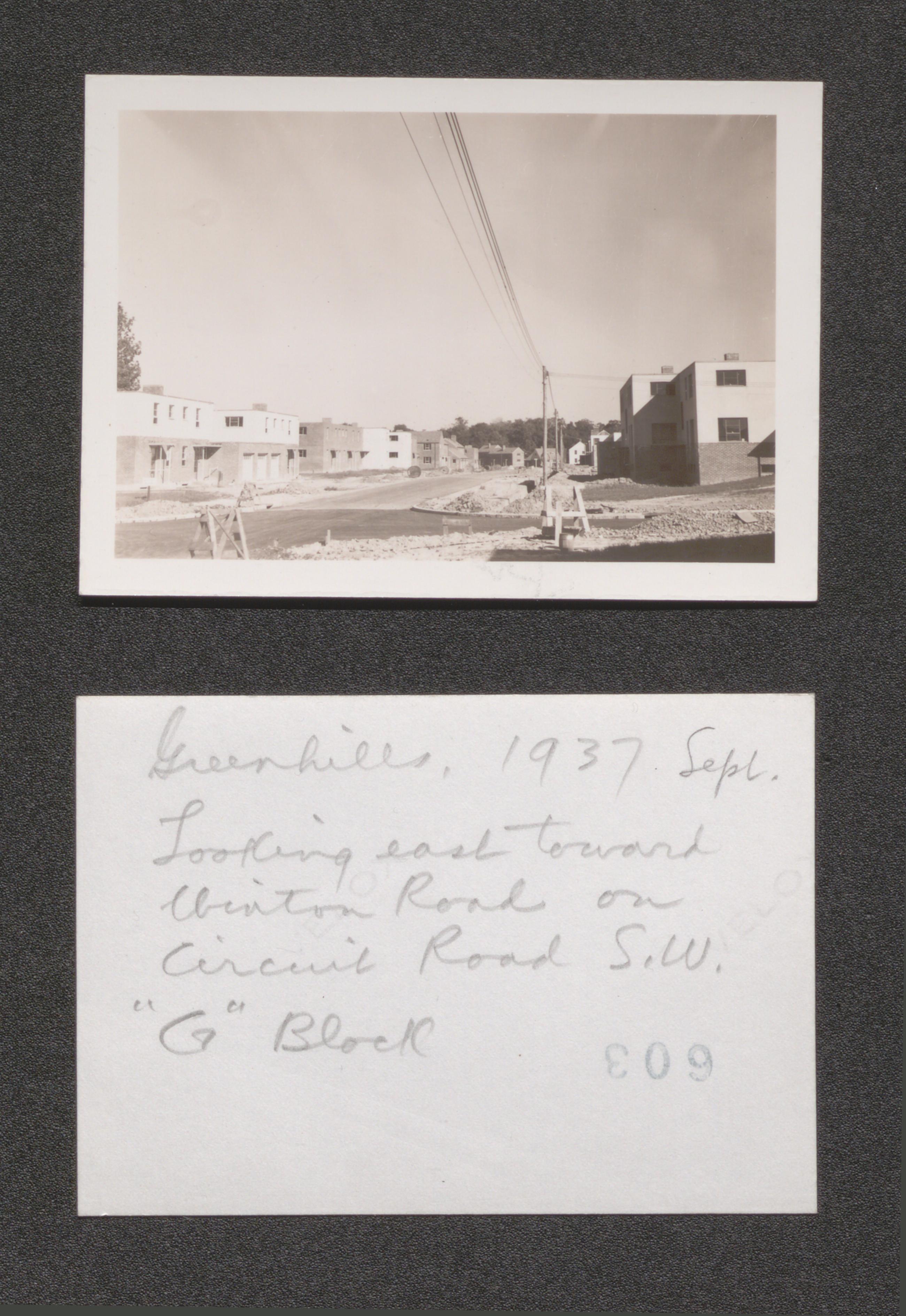
Looking east toward Clinton Road on Circuit Road Southwest, G block, 1937 September
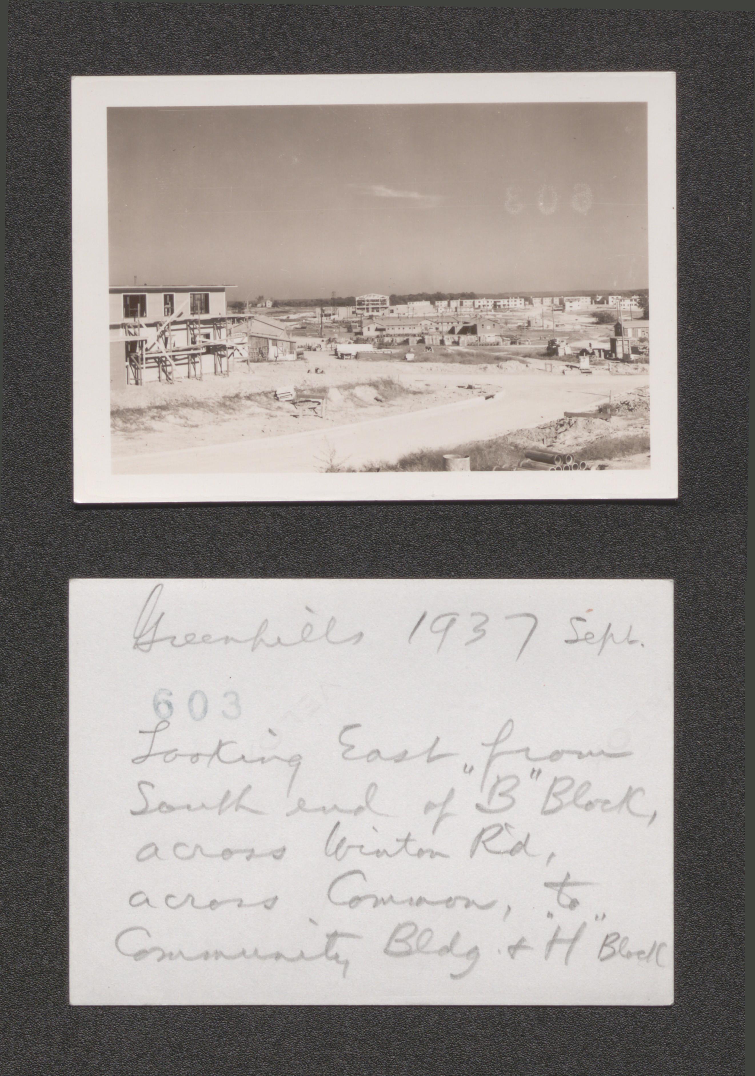
Looking east from south end of B block across Winter Road across Common to community building and H block, 1937 September
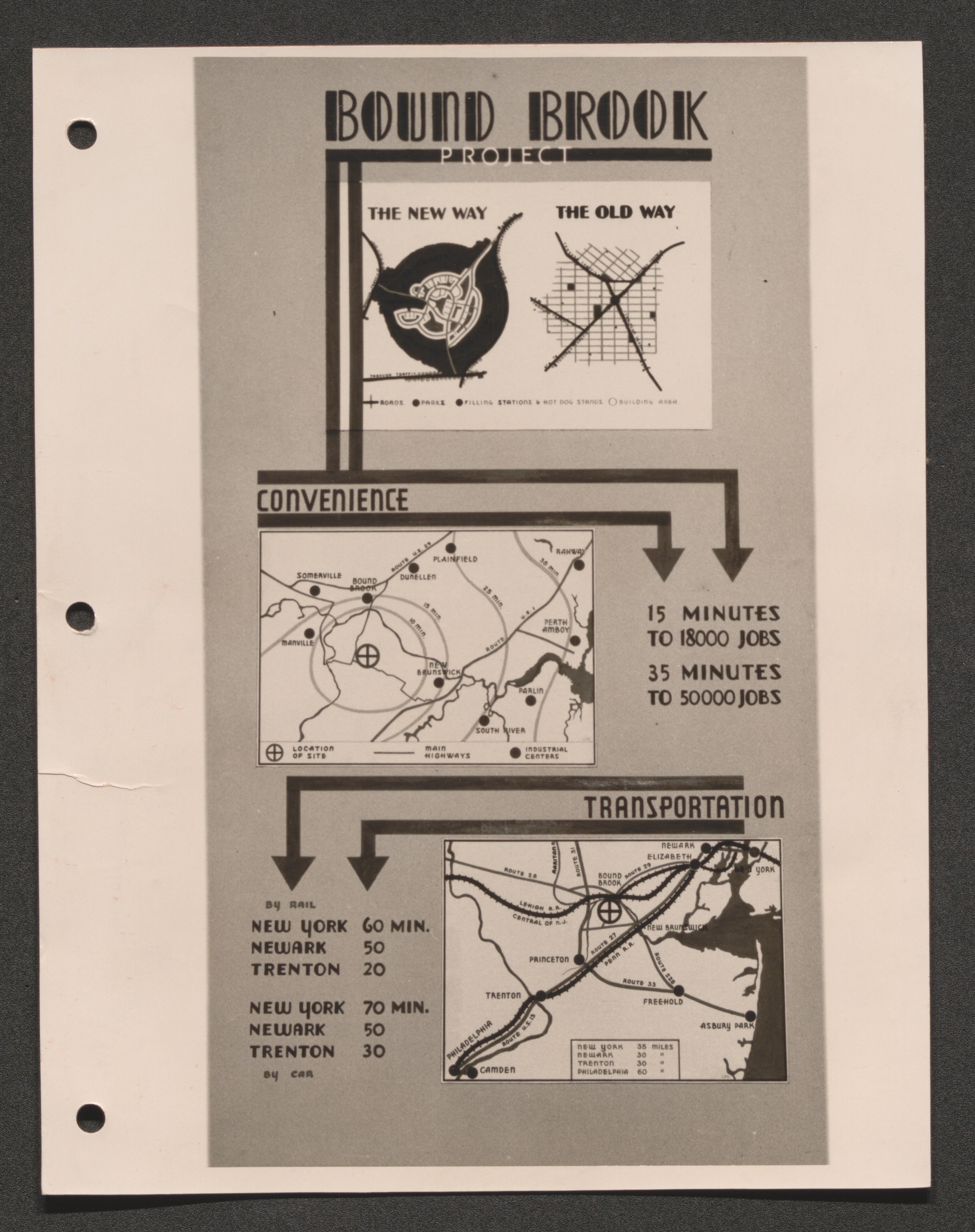
Bound Brook Project convenience and transportation map, undated
Superblock diagram, undated
Aerial view, undated
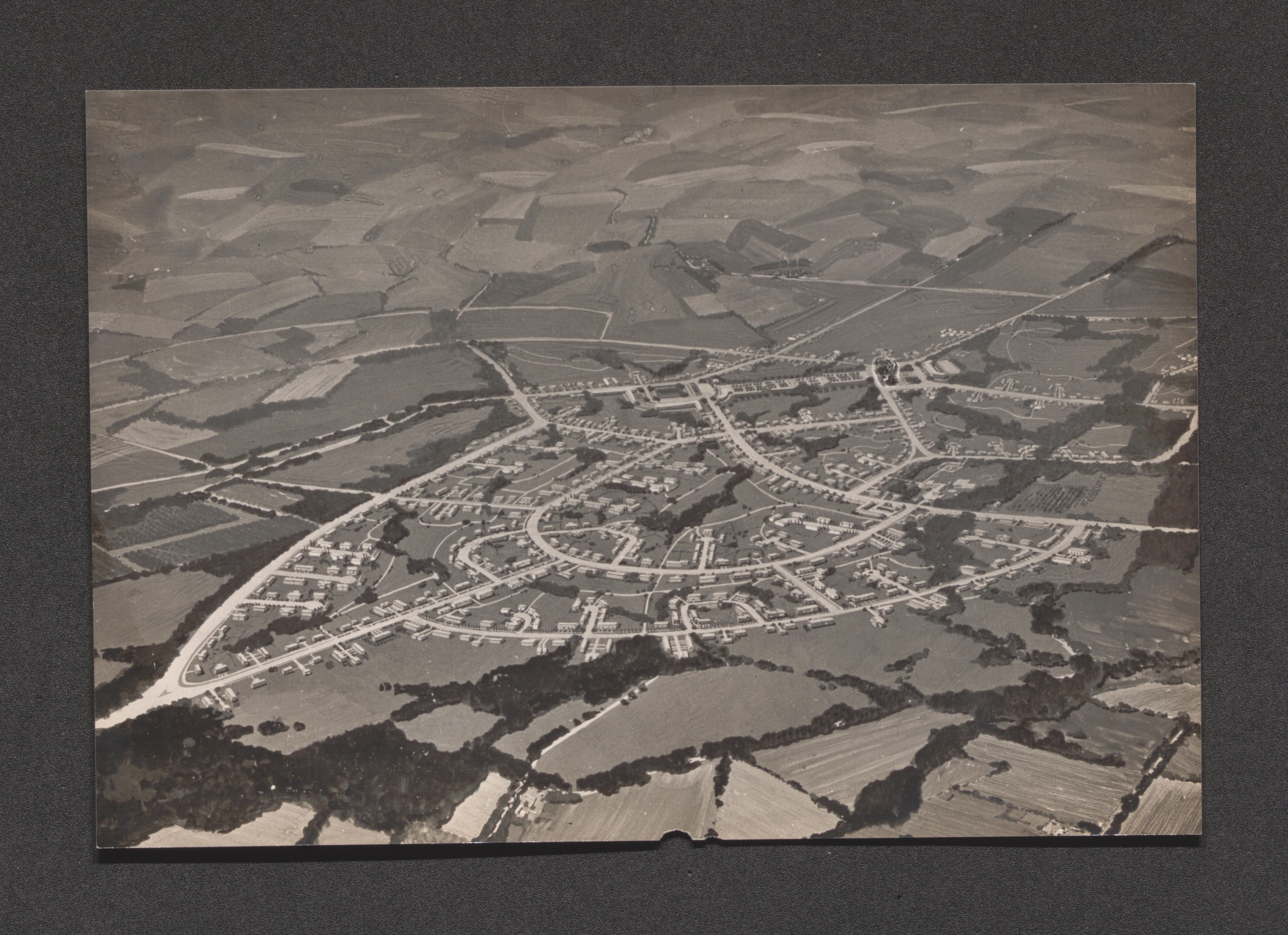
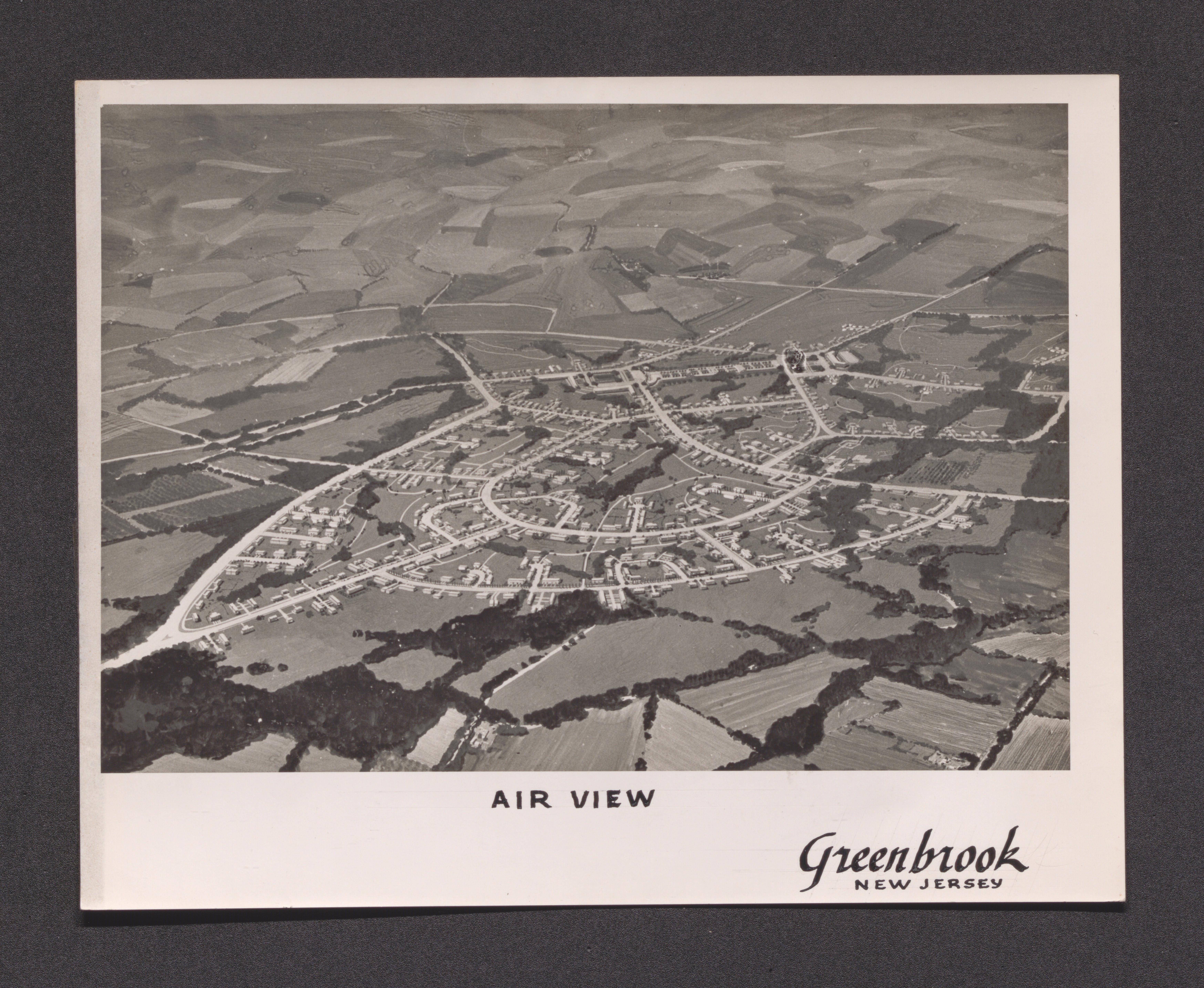
Illustration of people in a park, undated
Map of Bound Brook region, undated
Aerial view, undated
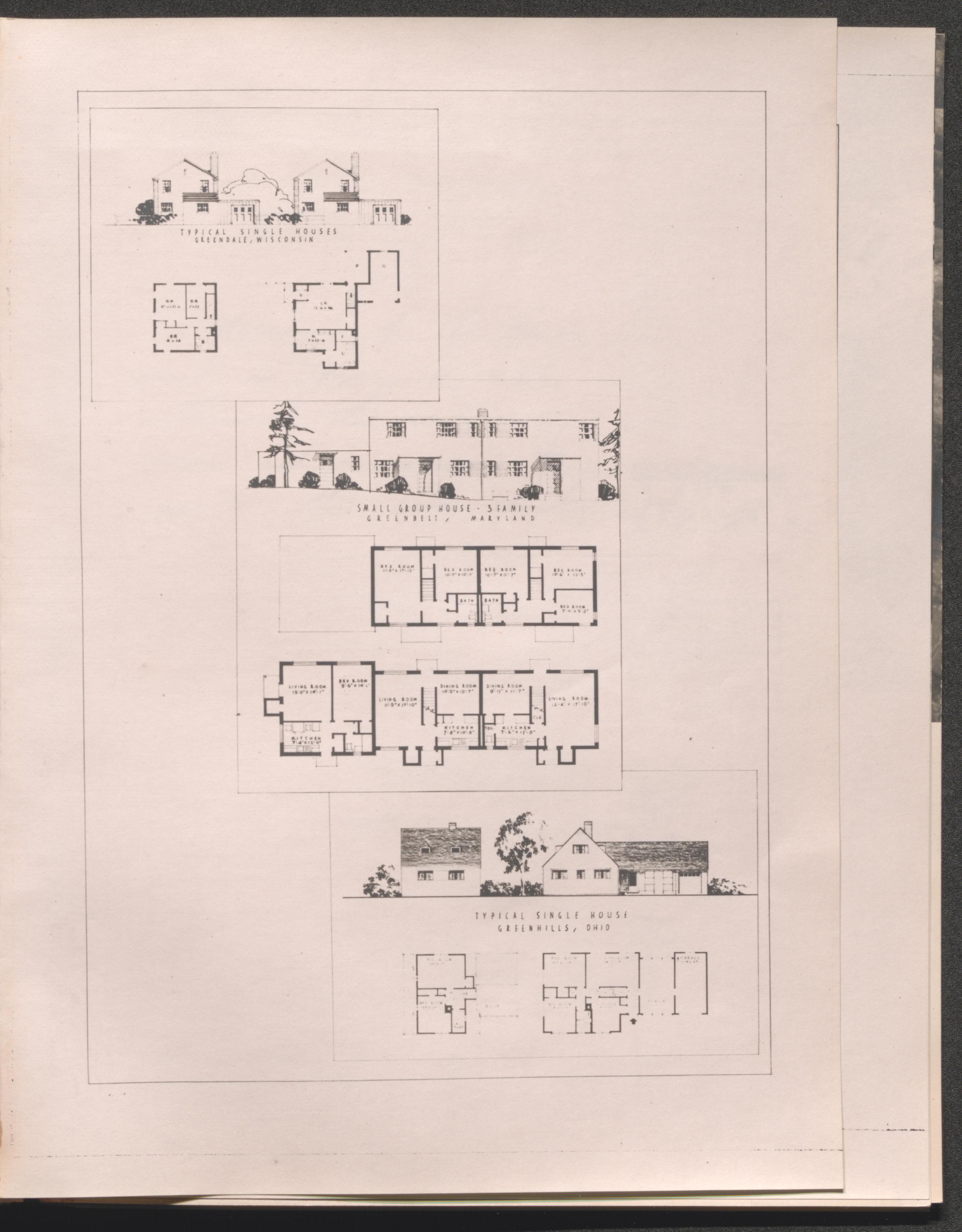
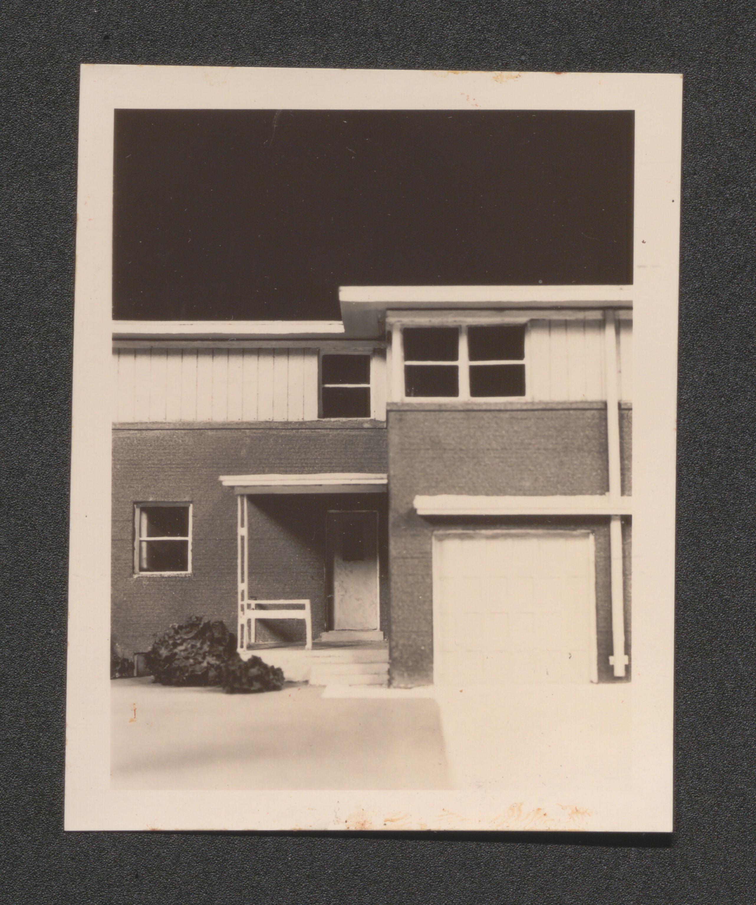
Four family house model and floor plan, undated
Aerial view, undated
Single family house illustration and floor plan, undated
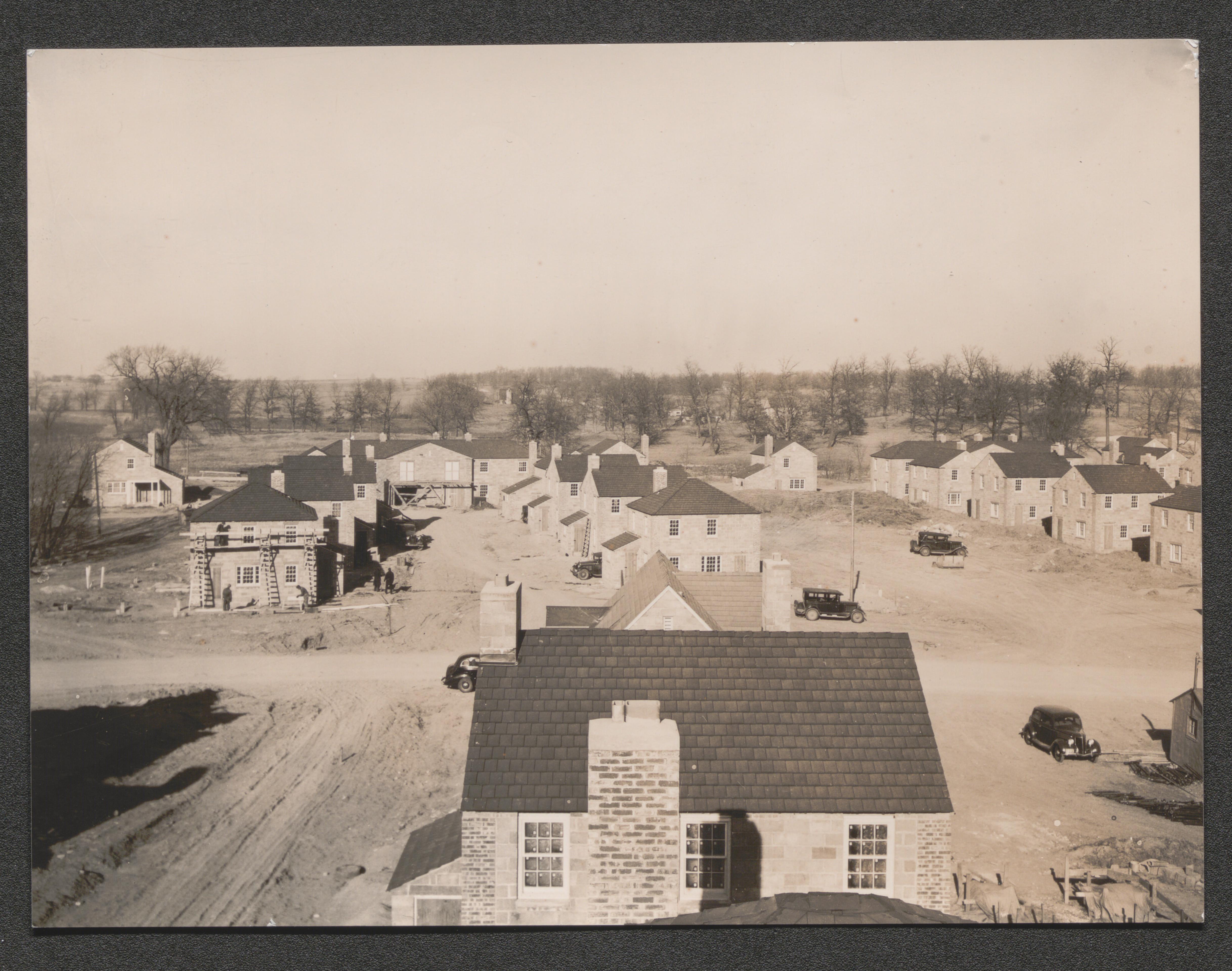
Greendale, Wisconsin, 1936-1937, undated
Aerial view, undated
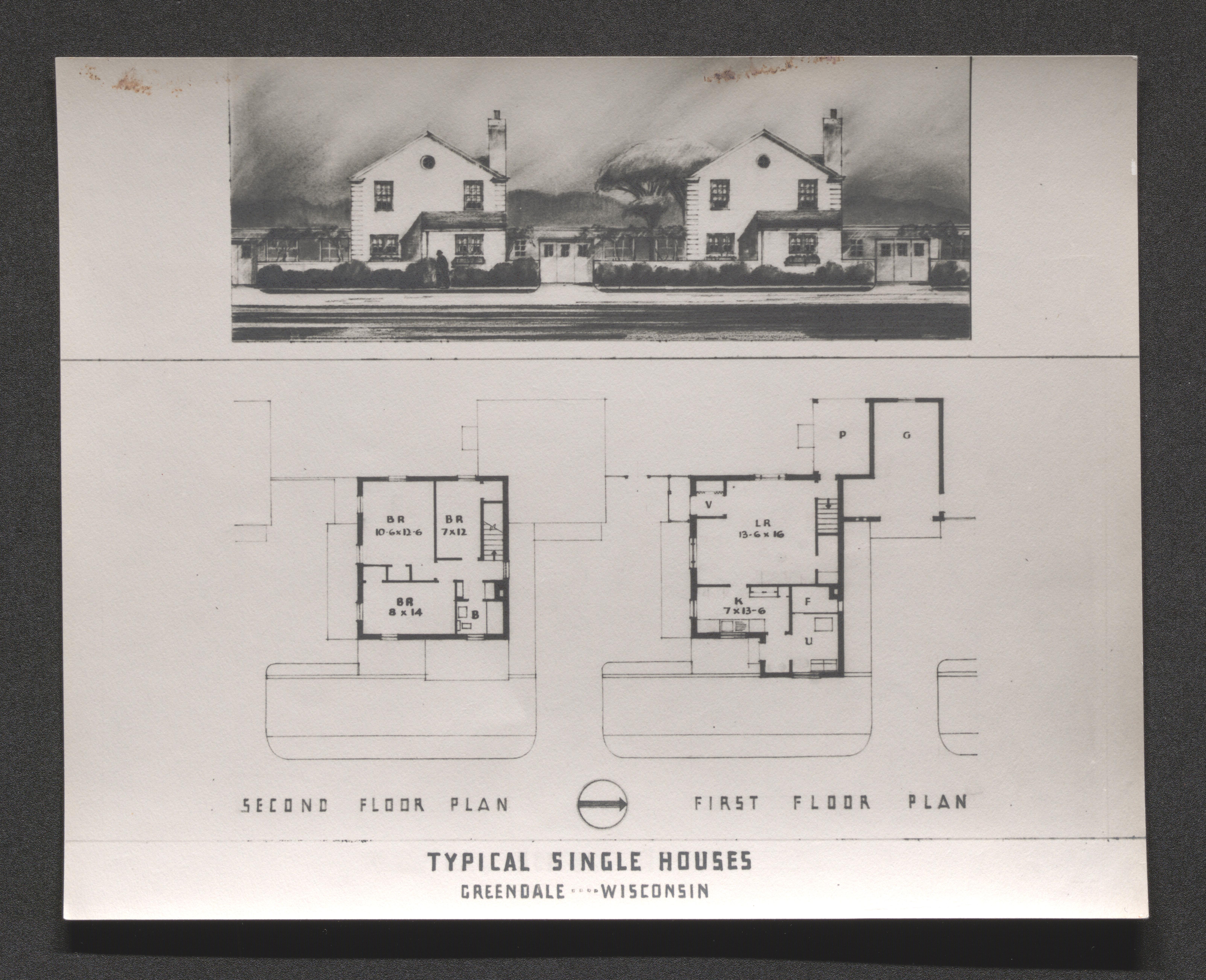
Image of typical single house and design layout, undated
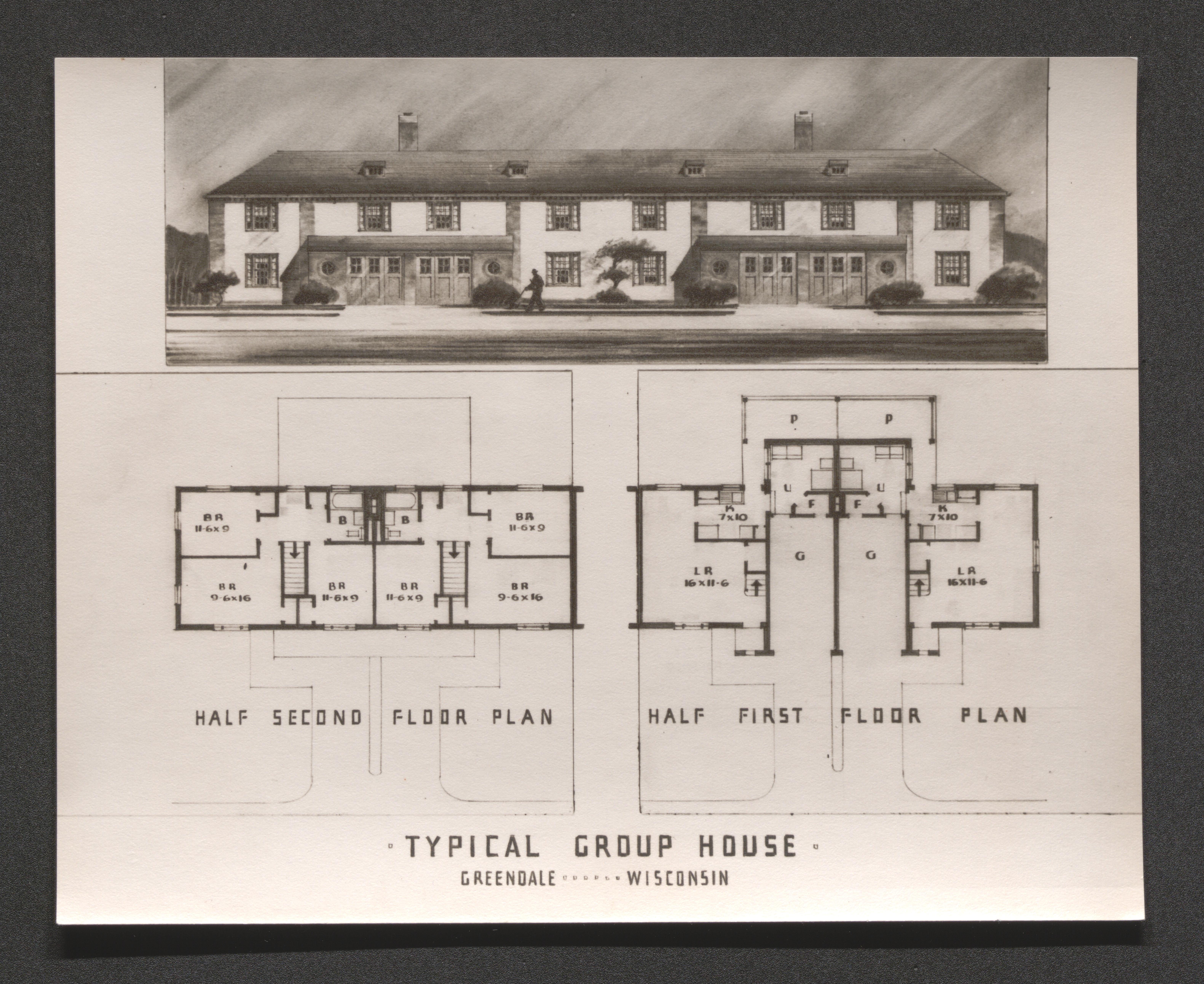
Image of typical group house and design layout, undated
Houses under construction, undated

Precast joints and first floor reinforcing, undated
Bedroom in demonstration house, undated
Kitchen in demonstration house, undated
Living room in demonstration house, undated
Dining alcove in demonstration house, undated
Visitor's day at demonstration house, undated
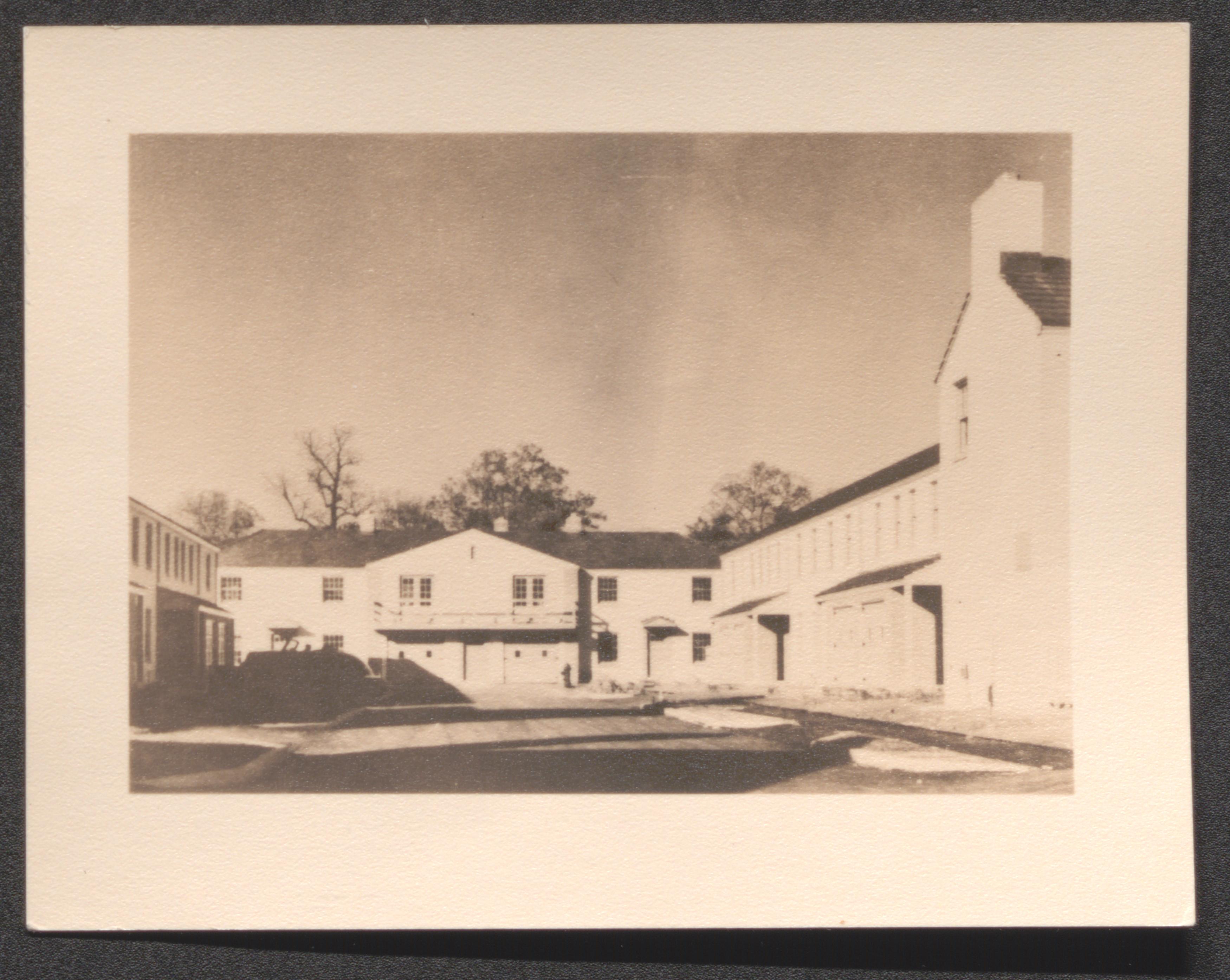
Alder and Cherry Street, undated
Heather and Grape Street, undated
Garage and porch on Cherry Street, undated
Cherry and Twin Street house, undated
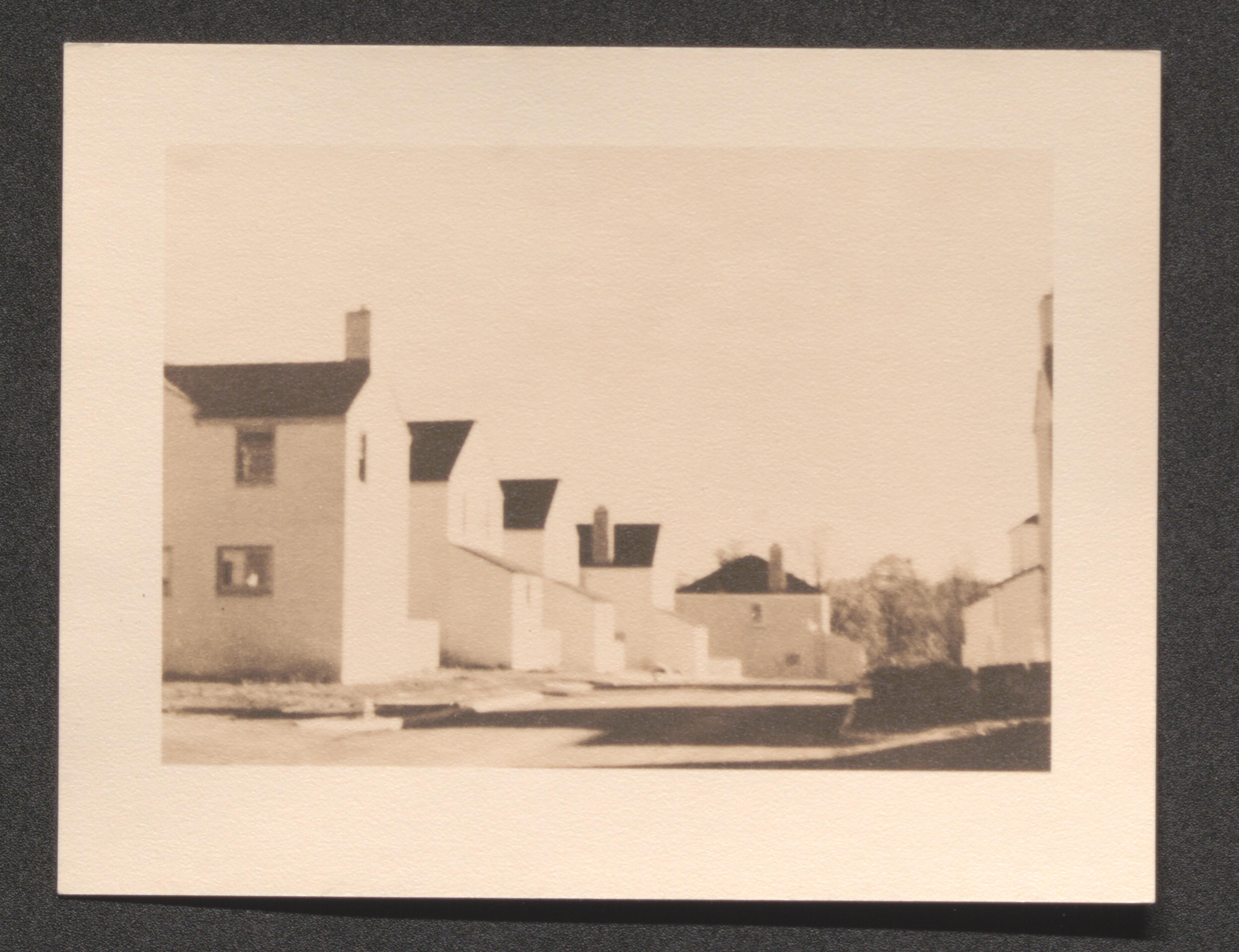
Side view; housing structures amid trees, undated
End of road housing unit cluster, undated
Housing units along road, undated
Road through housing development, undated
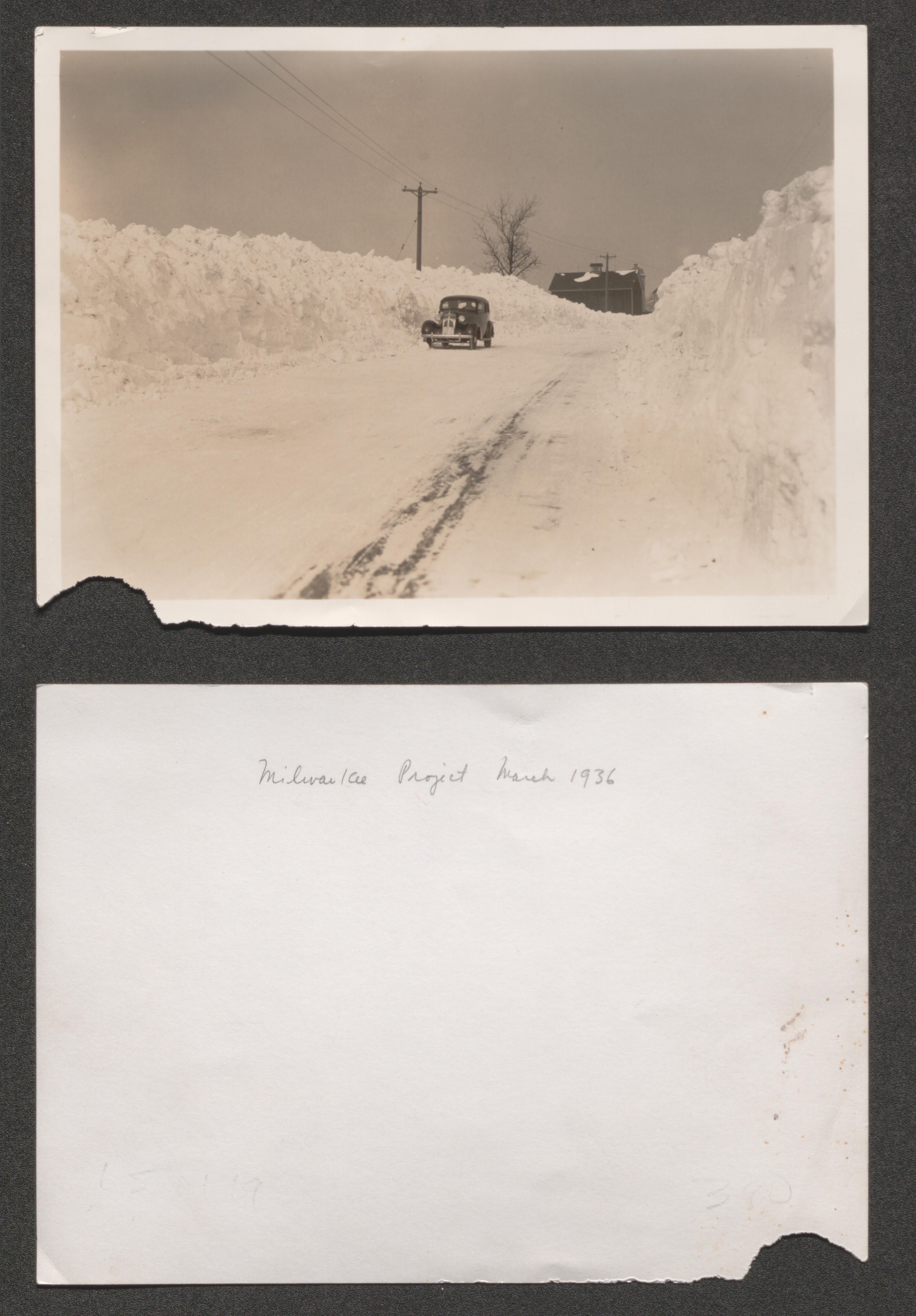
Car on road plowed through heavy snow pack, hand written on back of image Milwaukee Project March 1936, 1936 March
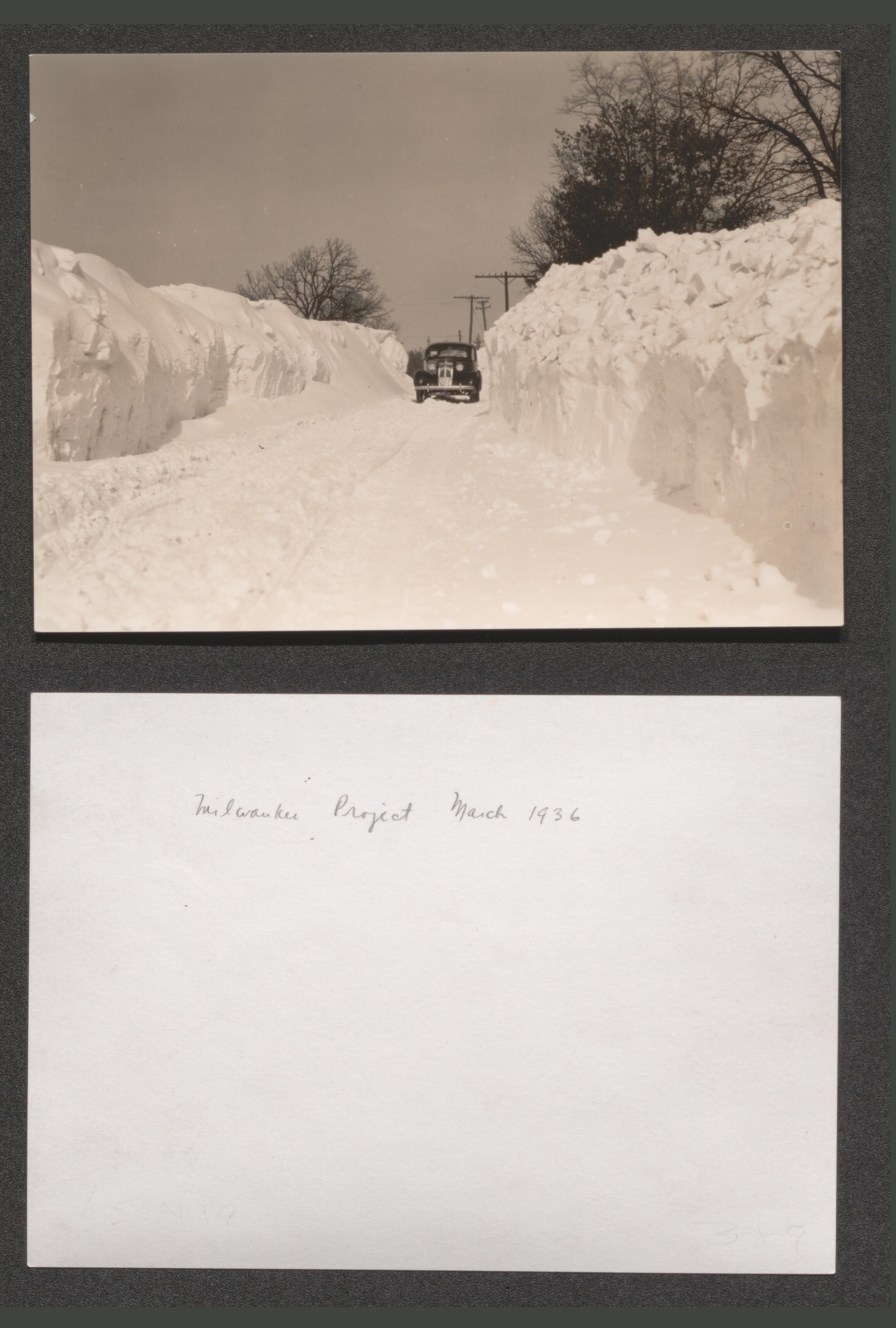
Car on road plowed through heavy snow pack, hand written on back of image Milwaukee Project March 1936, 1936 March
Side view; housing structure in wooded area, undated
Housing development prior to landscaping, information printed and written on back of image RESETTLEMENT ADMINISTRATION // PROJECT SR-WI-1 // MILWAUKEE, WISCONSIN // PHOTO NO__197__DATE__1-18-37__ // Description //__View N from Tower__, 1937 January 18
Side view; housing structures amid trees, undated
View across housing unit back yards, undated
View of housing units from road, undated
Other housing units from housing unit yard, undated
Housing units adjacent to open land, undated
Housing units near road from across road, undated
Housing unit from road, undated
Back side of housing unit lineup, undated
Housing units near road from across road, undated
Housing development from adjacent open land, undated
Housing units from adjacent open land, undated
Two housing units with more of same development in background, undated
Two housing units with background of more in center, undated
Housing unit lineup along road from adjacent open land, undated
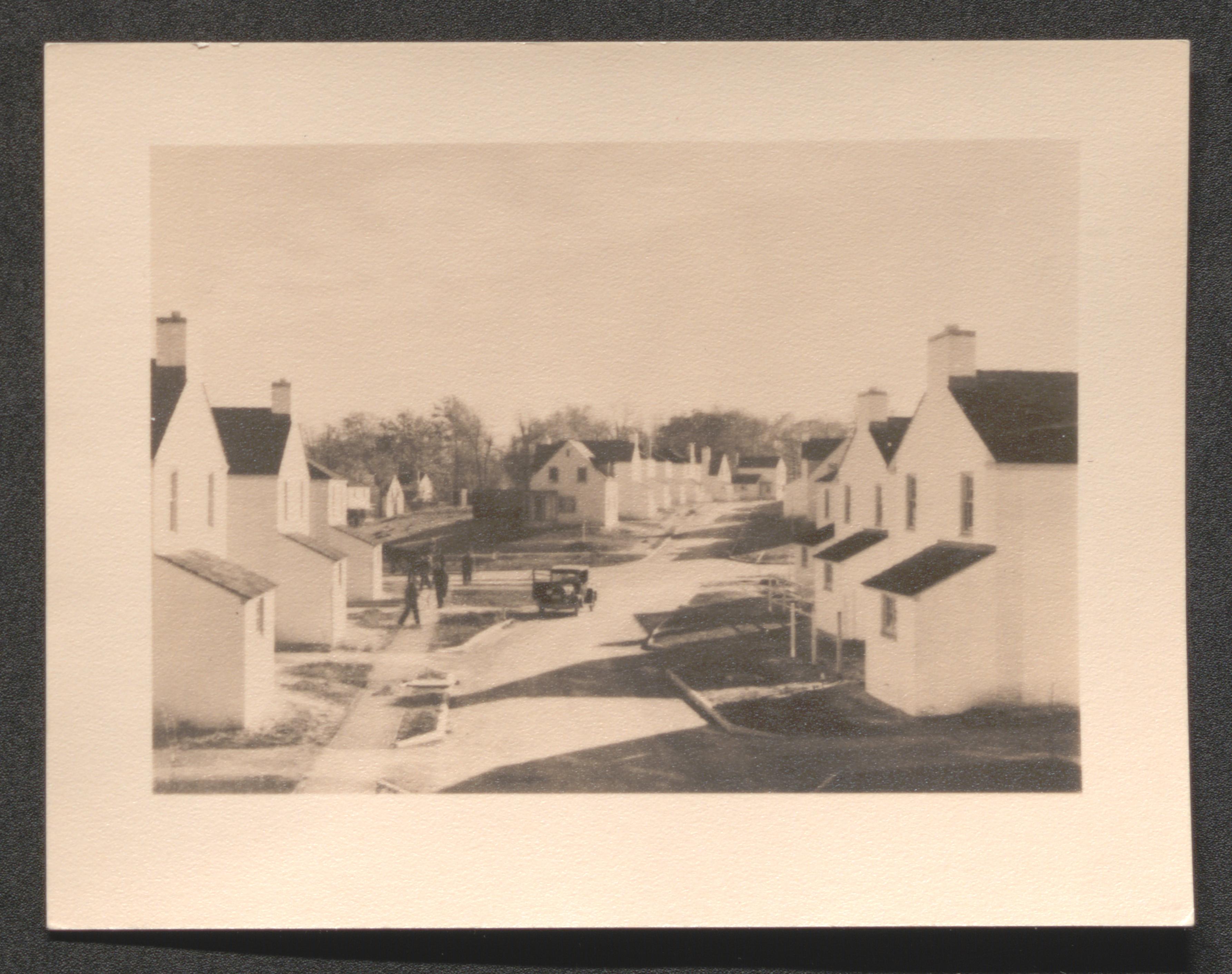
Two individuals walk down road with housing unit lineup on one side, undated
Road with light automobile traffic through housing development, undated
Road with light automobile traffic through housing development and men working near one housing unit, undated
Multiunit housing structure, undated
Bridge over creek in housing development, undated
View down road with housing unit lineup on each side and barn roof in background, undated
View of many housing units from adjacent open land, undated
View down road with housing unit lineup on each side and barn roof in background, undated
View down unpaved road with housing unit lineup on each side, undated
Car on road through housing development, undated
View up road incline with housing units on each side, undated
View of housing units from road, undated
Road with housing units on each side, undated
Housing units to right of road curving left, undated
End of road housing unit cluster, undated
Elevated view of countryside and housing project, undated
Elevated view of countryside and distant housing project, undated
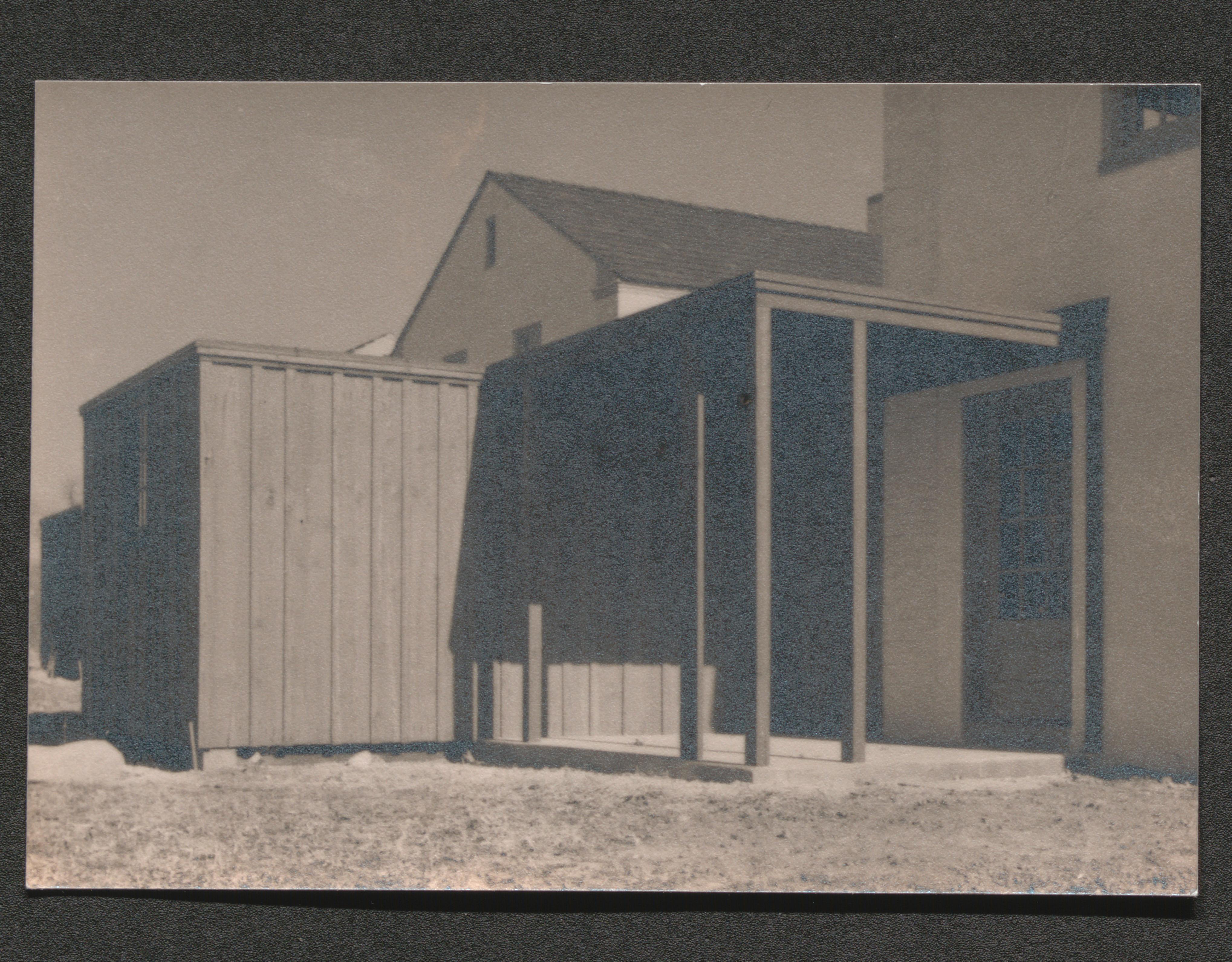
Close up; exterior structures of housing unit, undated
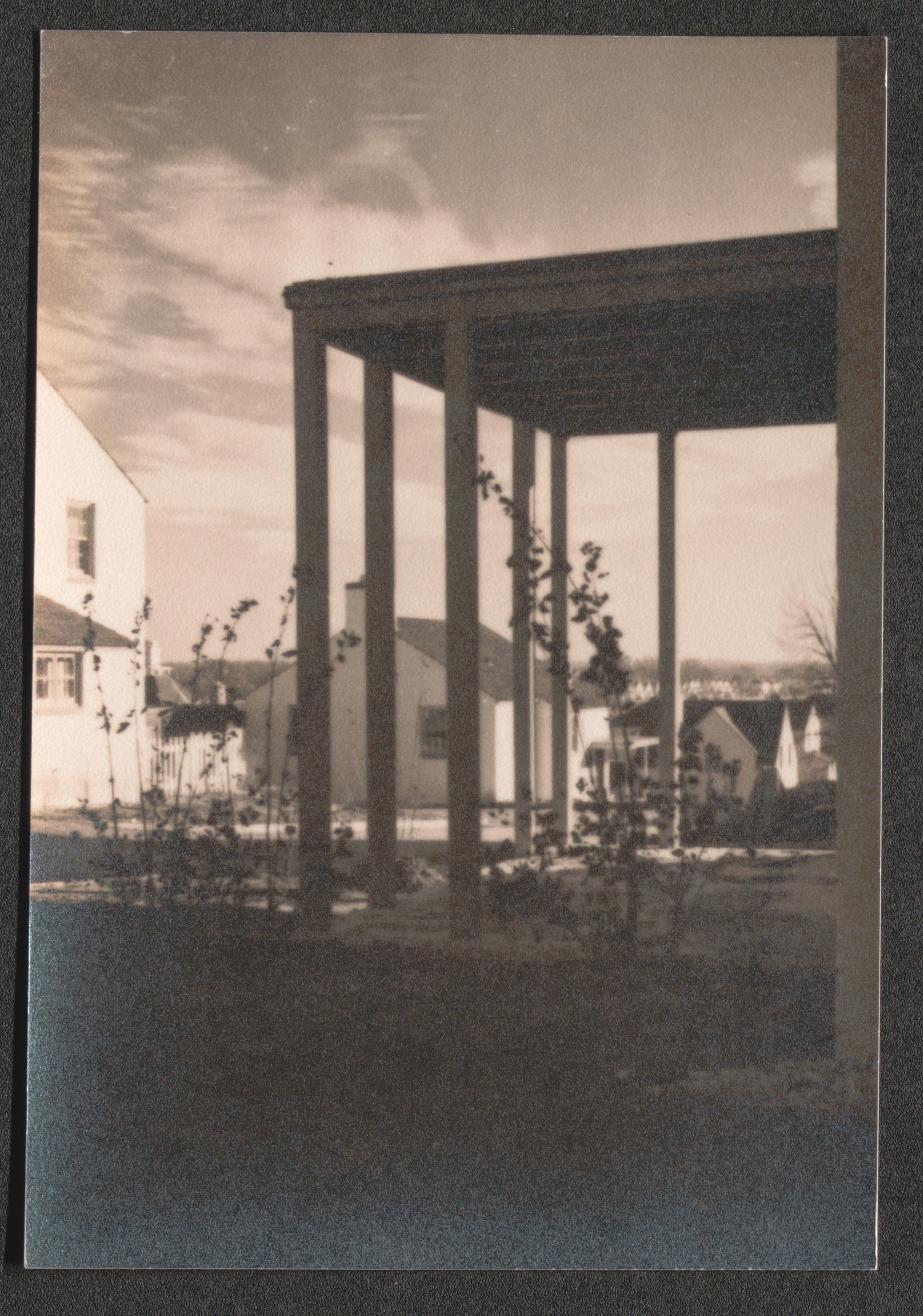
Close up; covered patio of housing unit, undated
Housing units under construction, hand written on back of image - "Milwaukee // Aug. 1936", 1936 August, 1936 August
Two men working on roof rafters, undated

Horse drawn wagon bringing supplies to construction site and several group homes under construction in background, undated

Group homes under construction, undated
Two rows of housing units nearing completion, undated
Side view of housing unit, undated
Housing units from adjacent open land, undated
Road, not yet paved, with housing units on both sides, undated

People viewing completed home exterior, undated
Housing unit painted white while others remain unpainted, undated

Housing unit painted white while others remain unpainted, undated
Section of kitchen with range, undated

Corner of furnished living room, undated

Group of adults and children watch as man sets dining table, undated

Old concrete building, undated
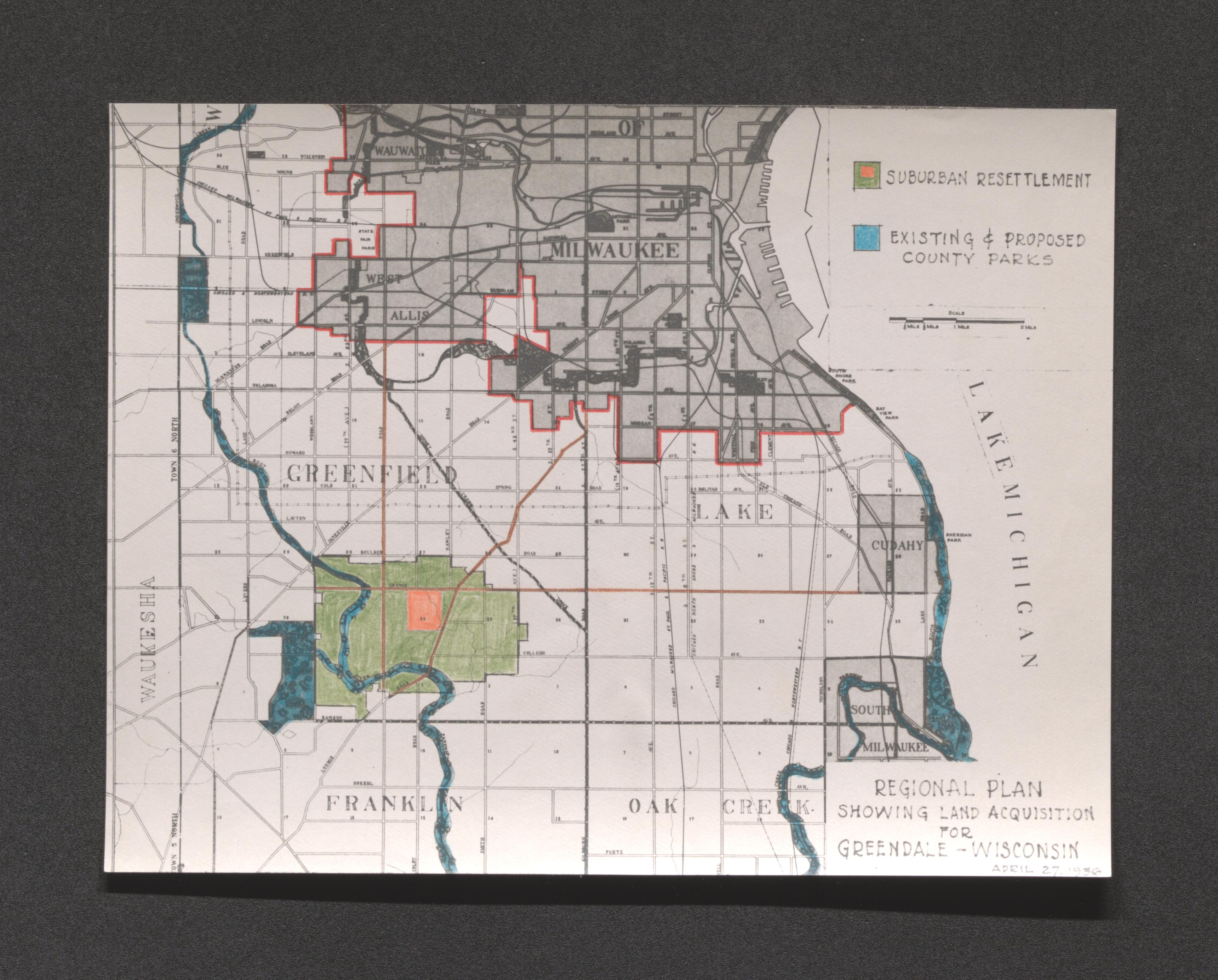
Regional plan map showing land acquisition and site location of Greendale (in green), 1936 April 27
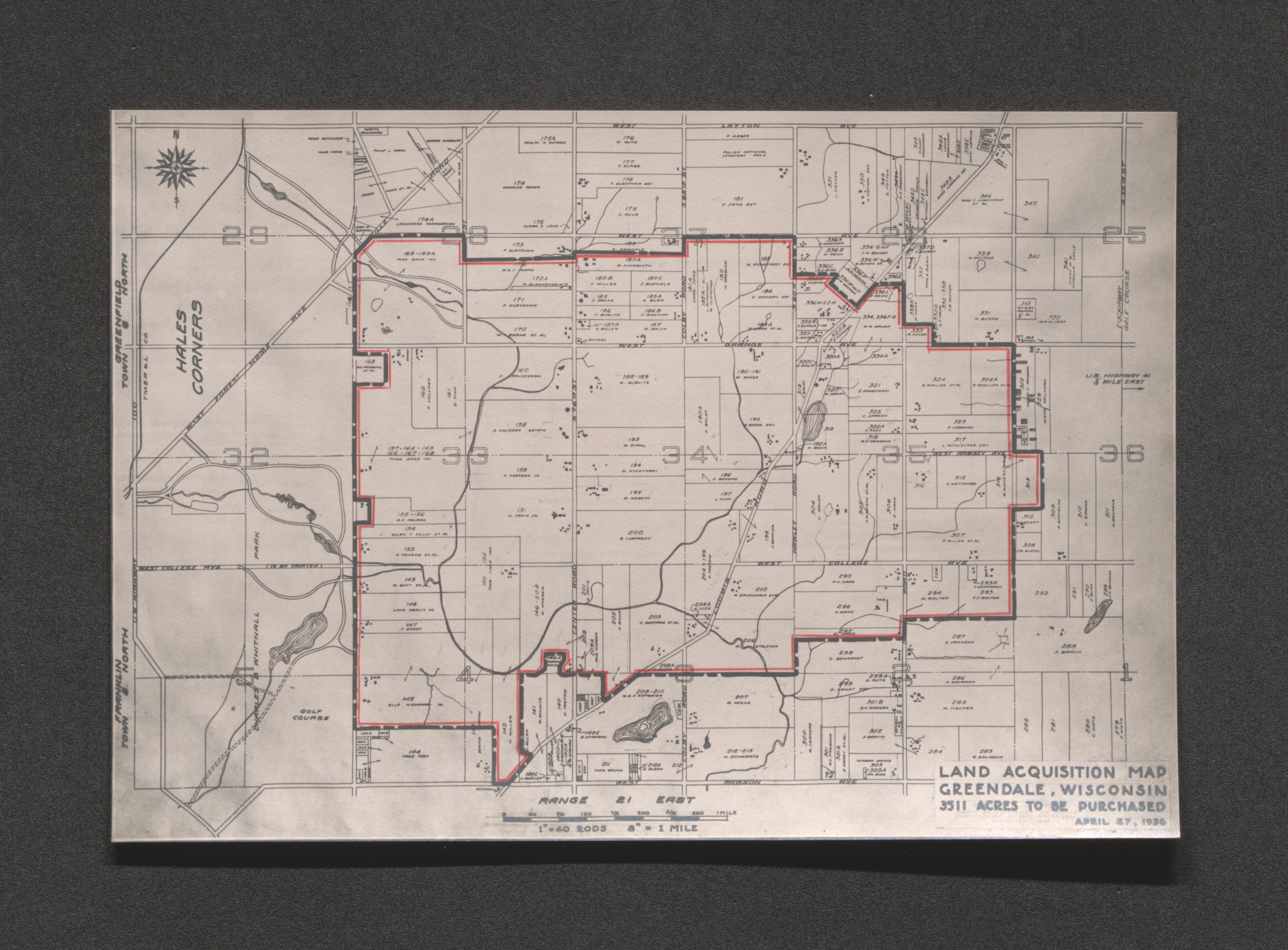
Land acquisition map of Greendale, 1936 April 27
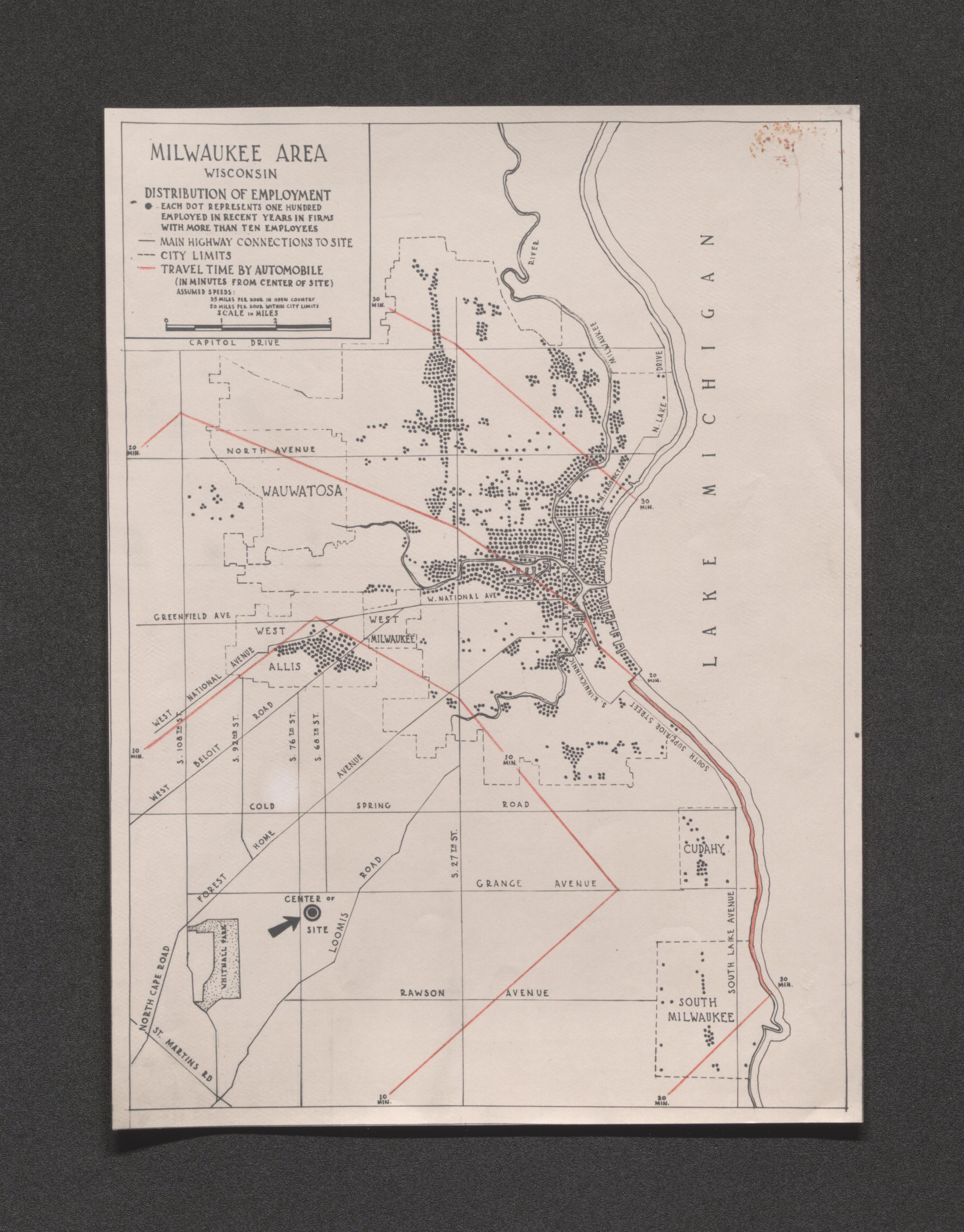
Map showing Milwaukee area distribution of employment, undated
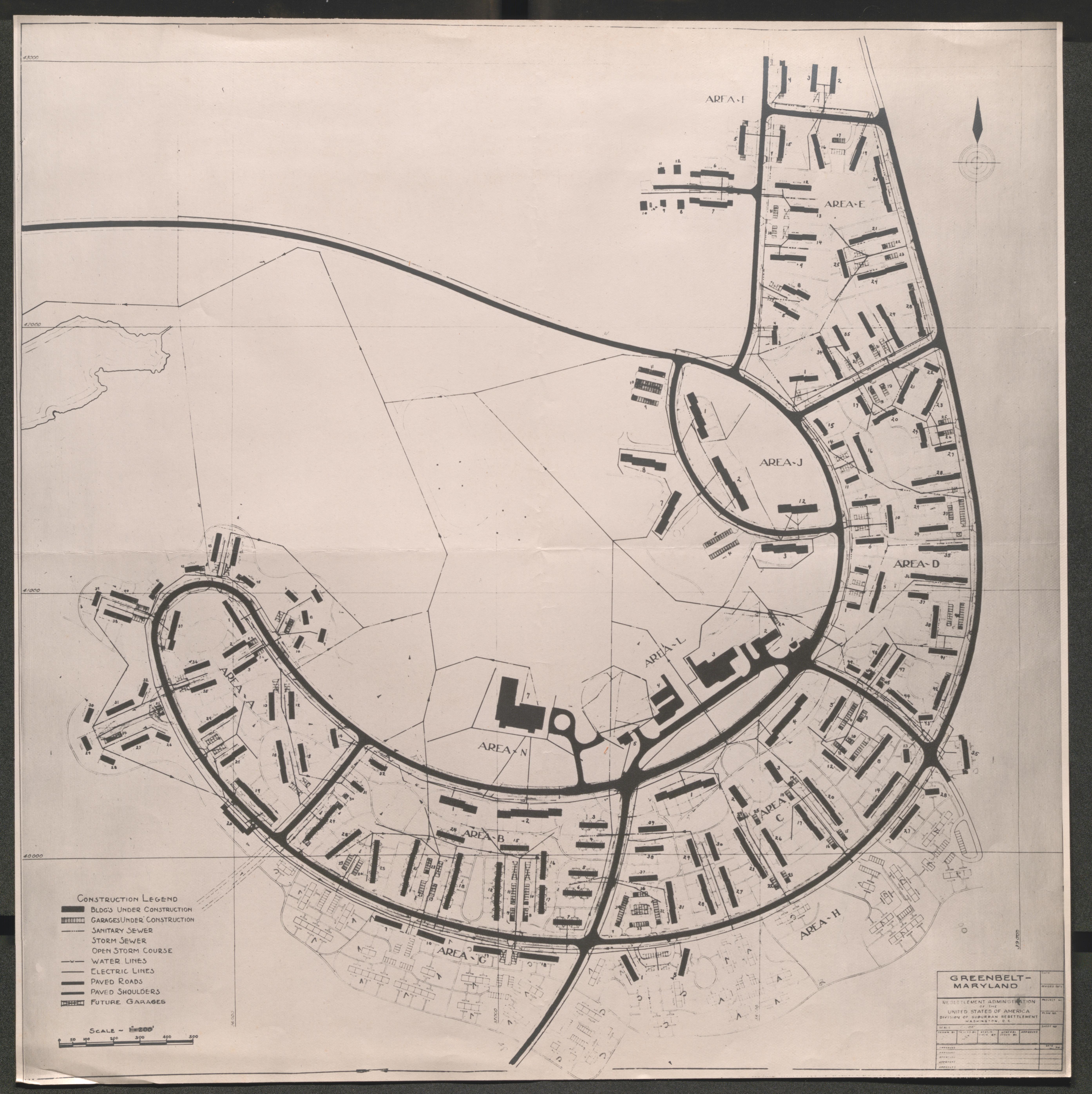
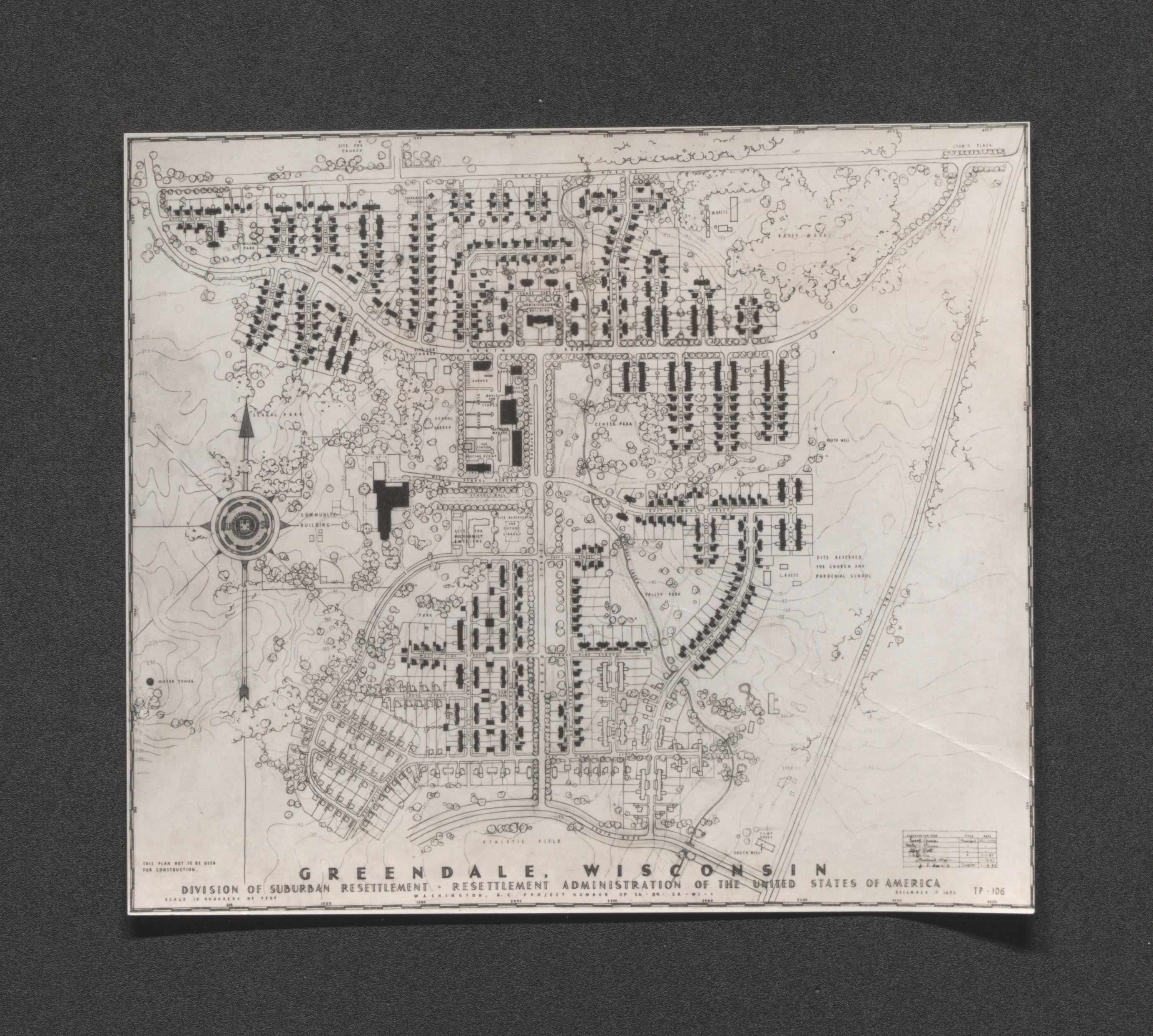
Map showing housing units throughout Greendale project, 1936 December 10
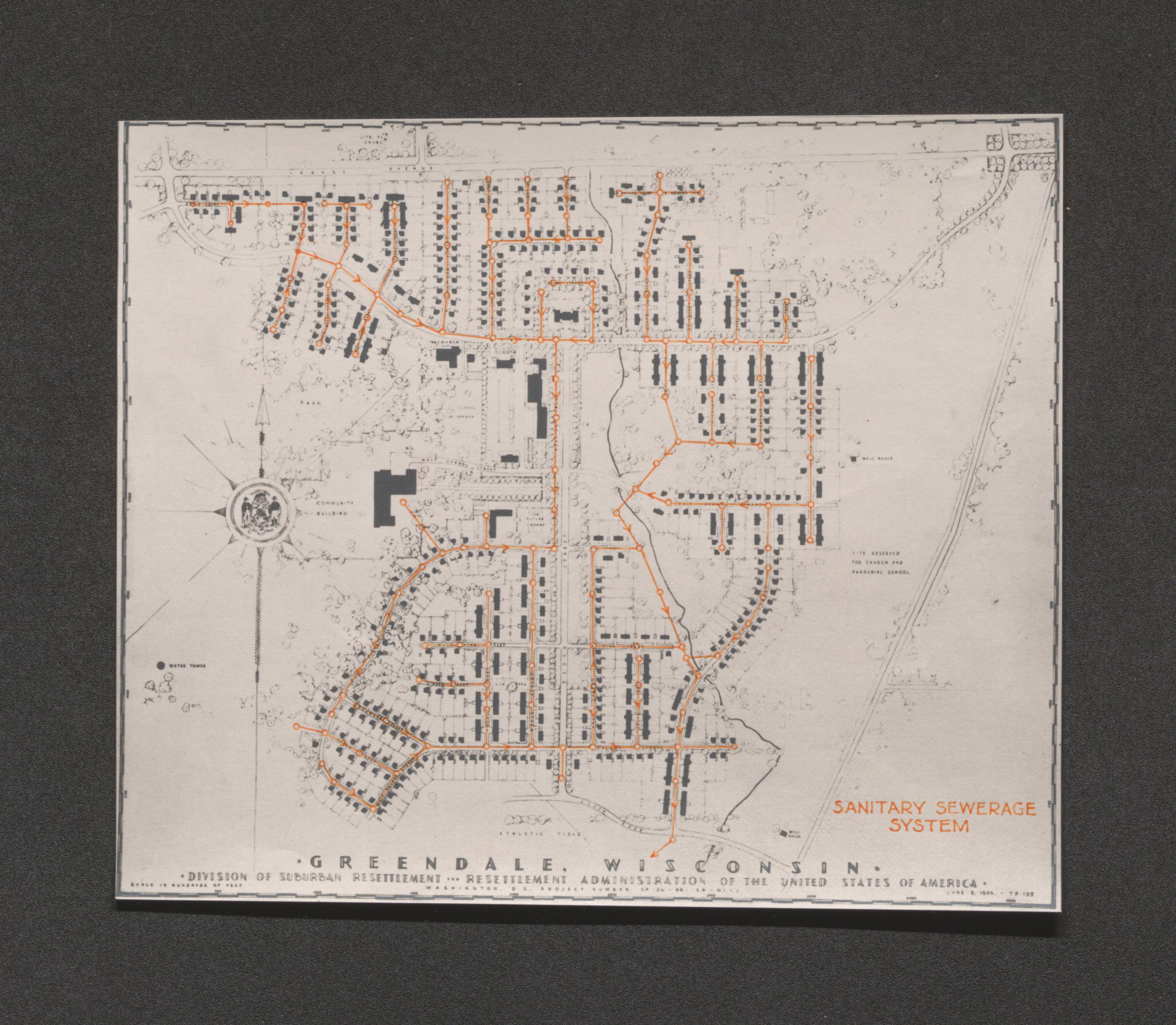
Map showing housing units and sanitary sewage system throughout Greendale project, 1936 June 9
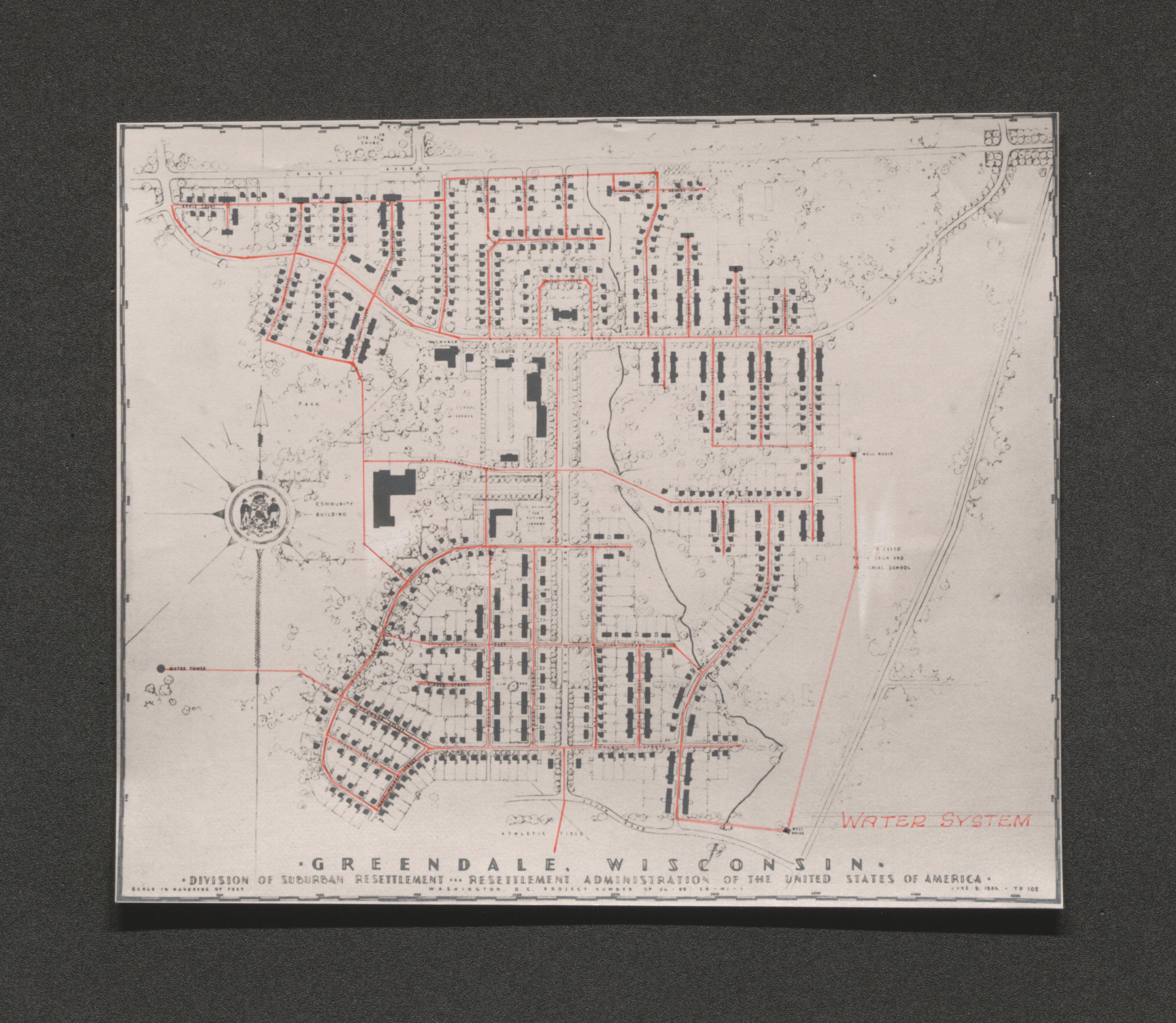
Map showing housing units and water system throughout Greendale project, 1936 June 9
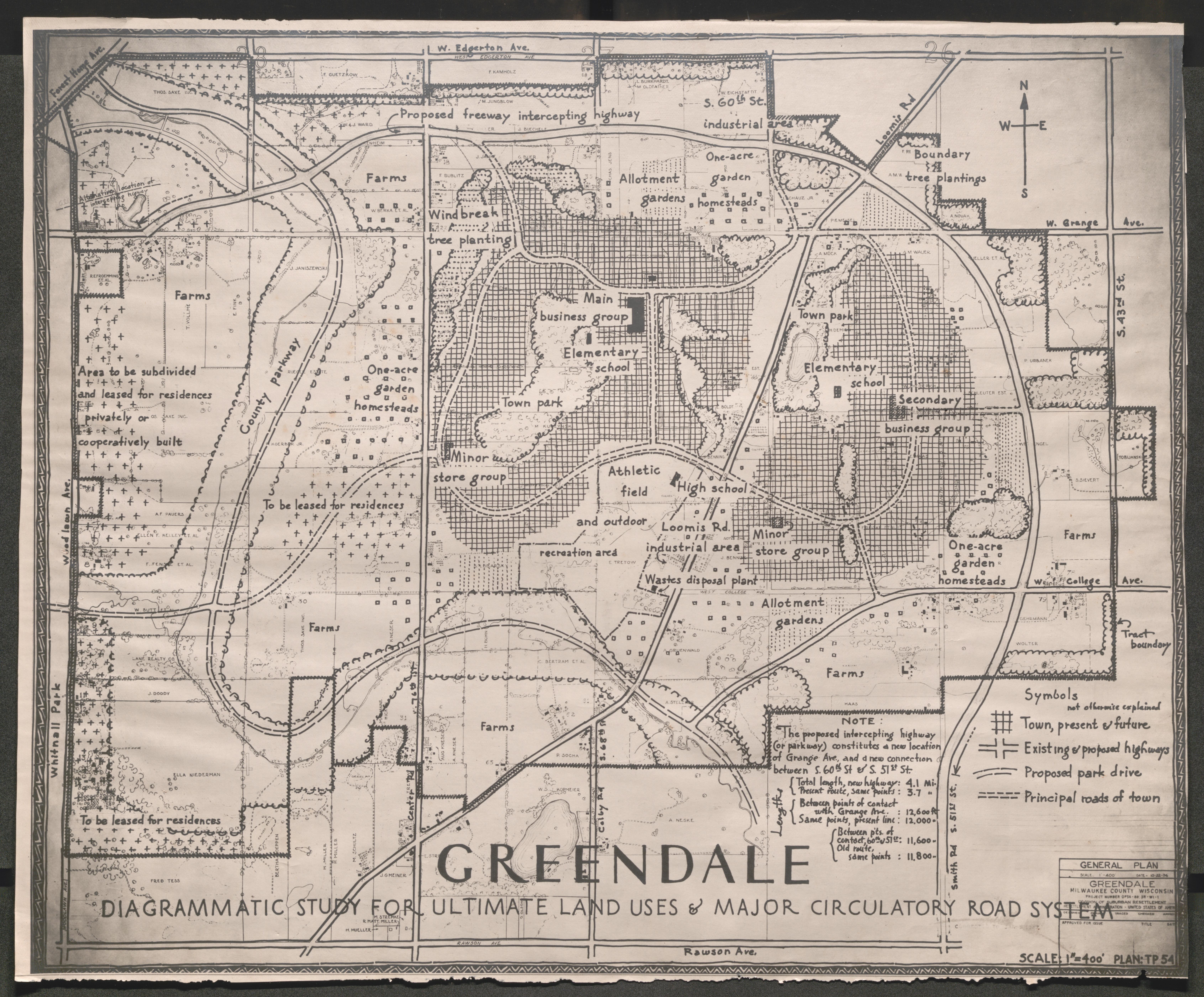
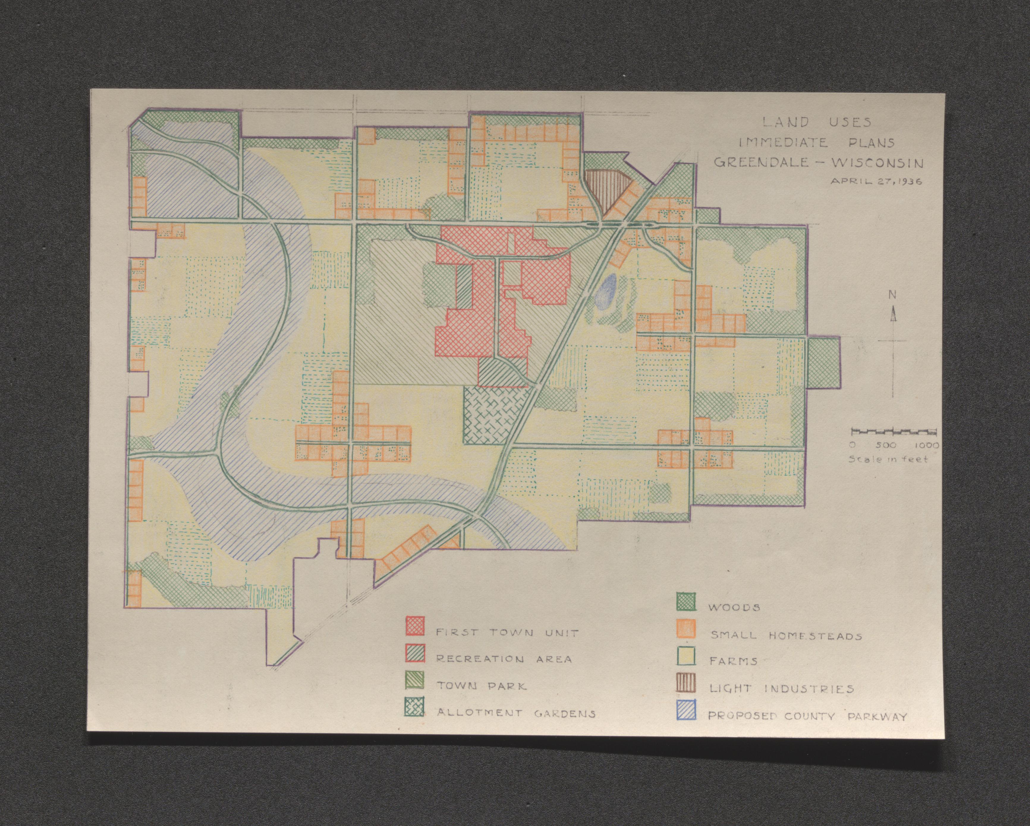
Map of land use plans for Greendale area with color key, 1936 April 27
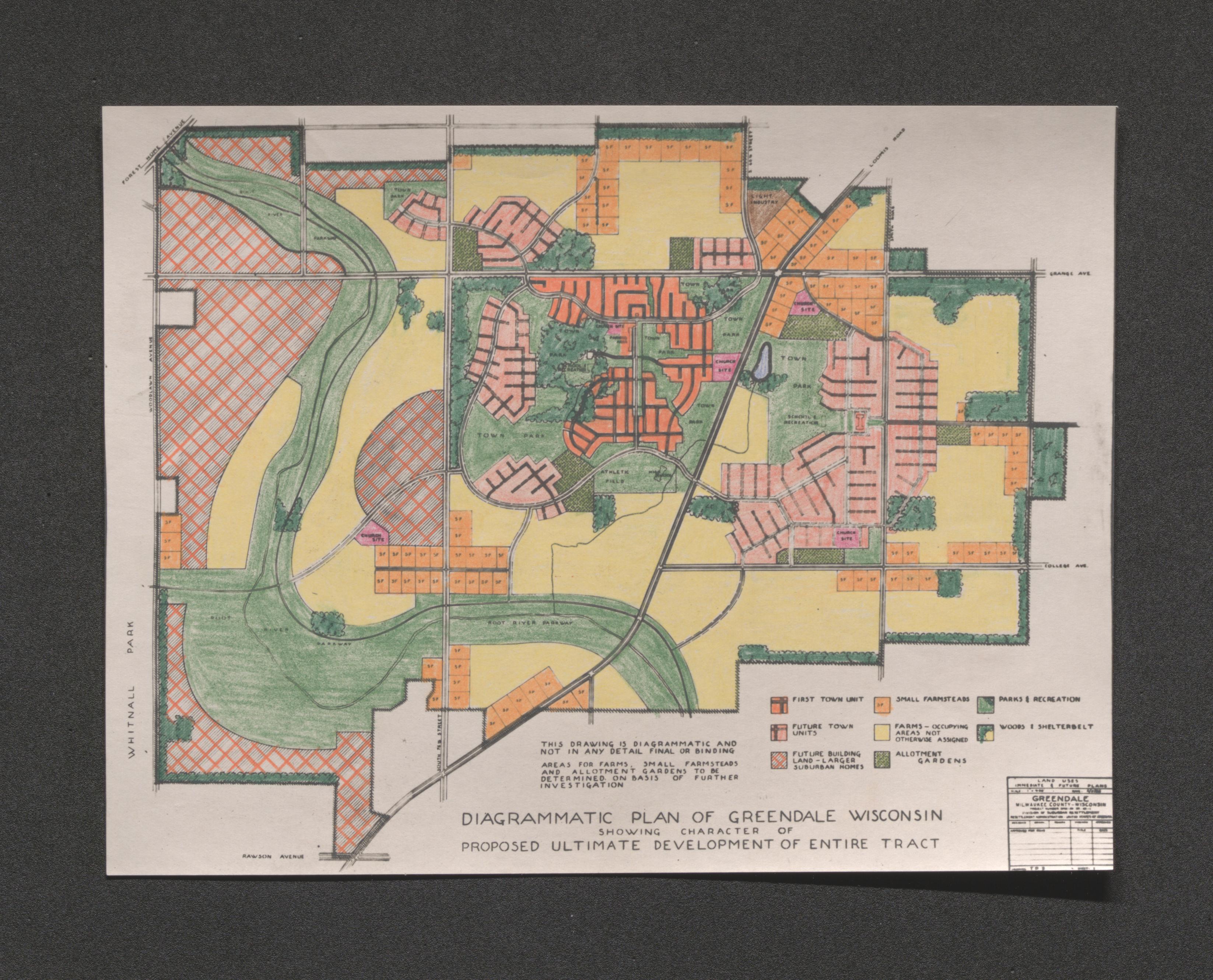
Diagrammatic map of Greendale area showing character of proposed ultimate development with color key, undated
Sketch of single houses and two story floor plan, undated
Sketch of group home and two story half floor plans, undated
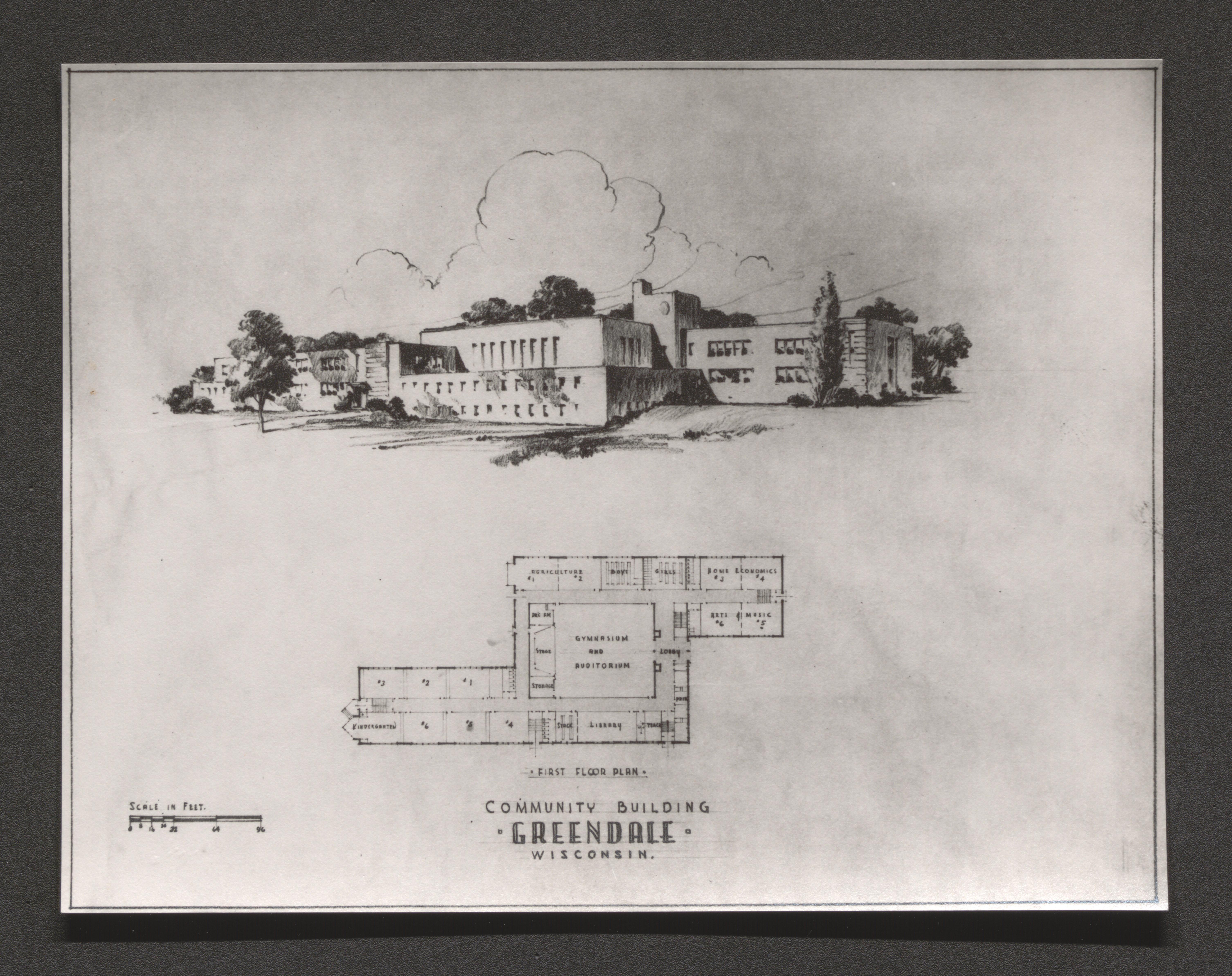
Sketch and floor plan of Greendale Community Building, undated
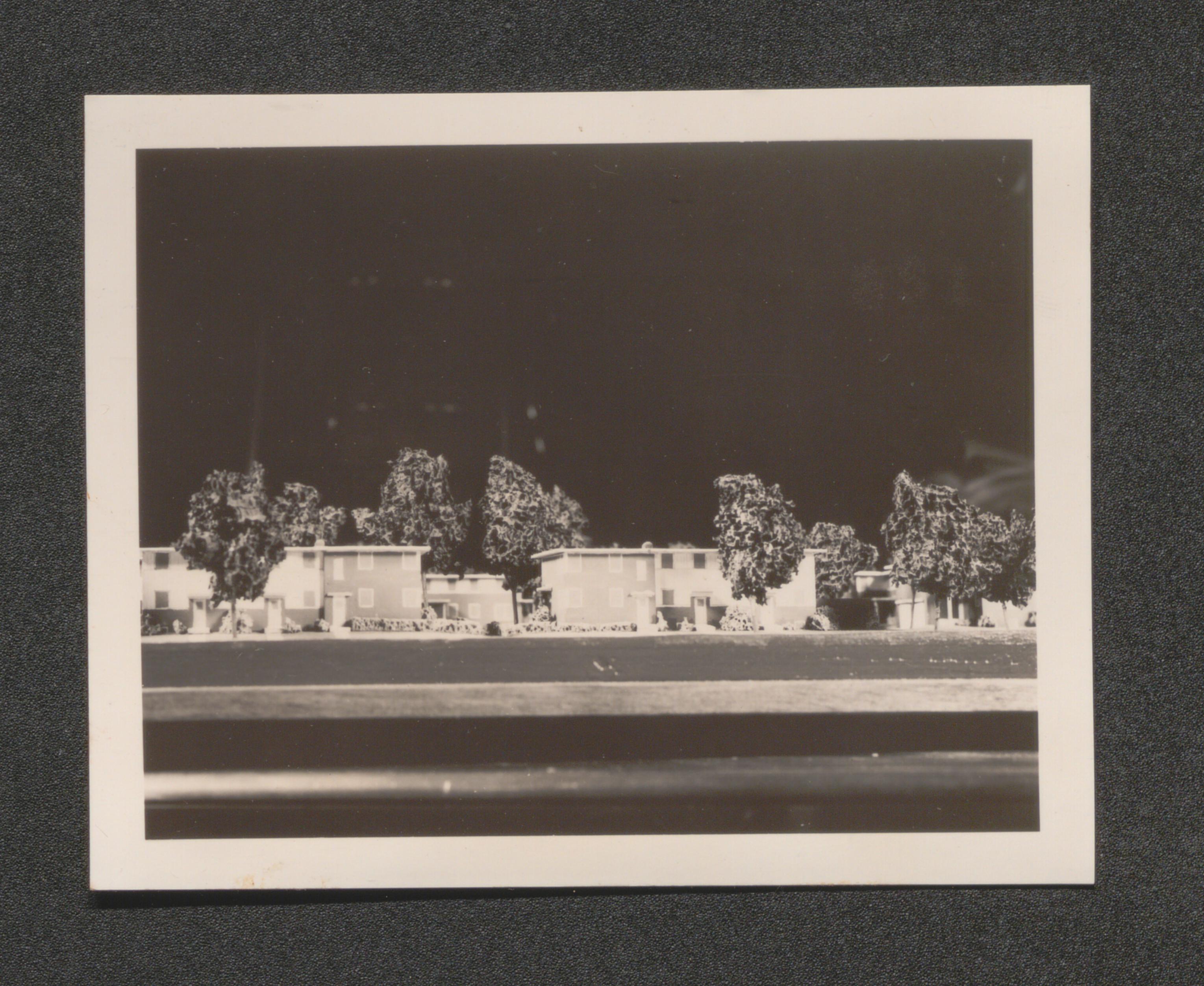
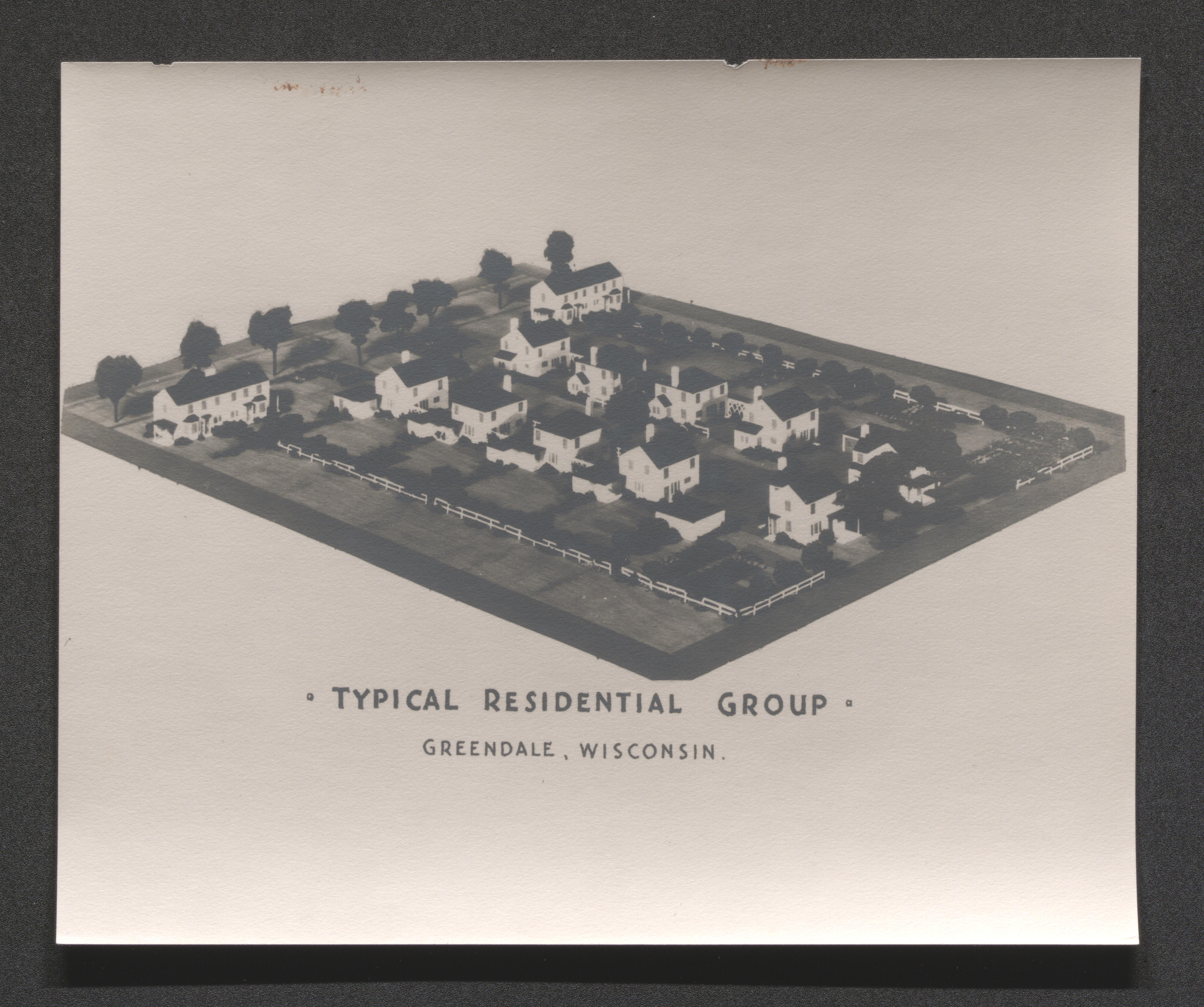
Scale model of Greendale residential group, undated
Scale model of single home housing unit, long hand written notes on back of image, undated
Artists drawing of Greendale plan superimposed over aerial photo, undated
Poster listing the community features that Milwaukee prospective tenants want, undated
Greenhills, Ohio, 1935-1937, undated
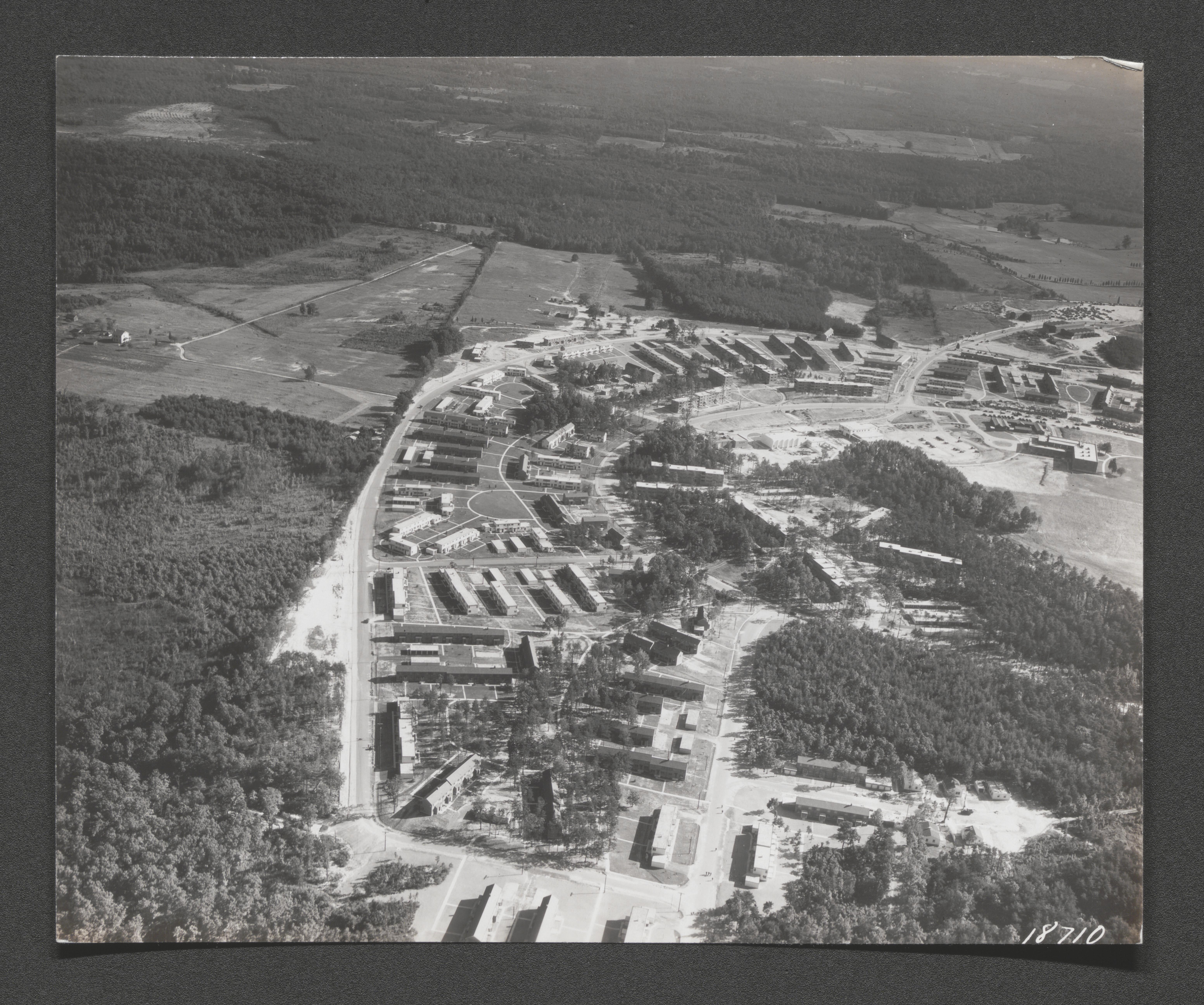
Southwest section of development, aerial view, 1936 December
Aerial view, undated
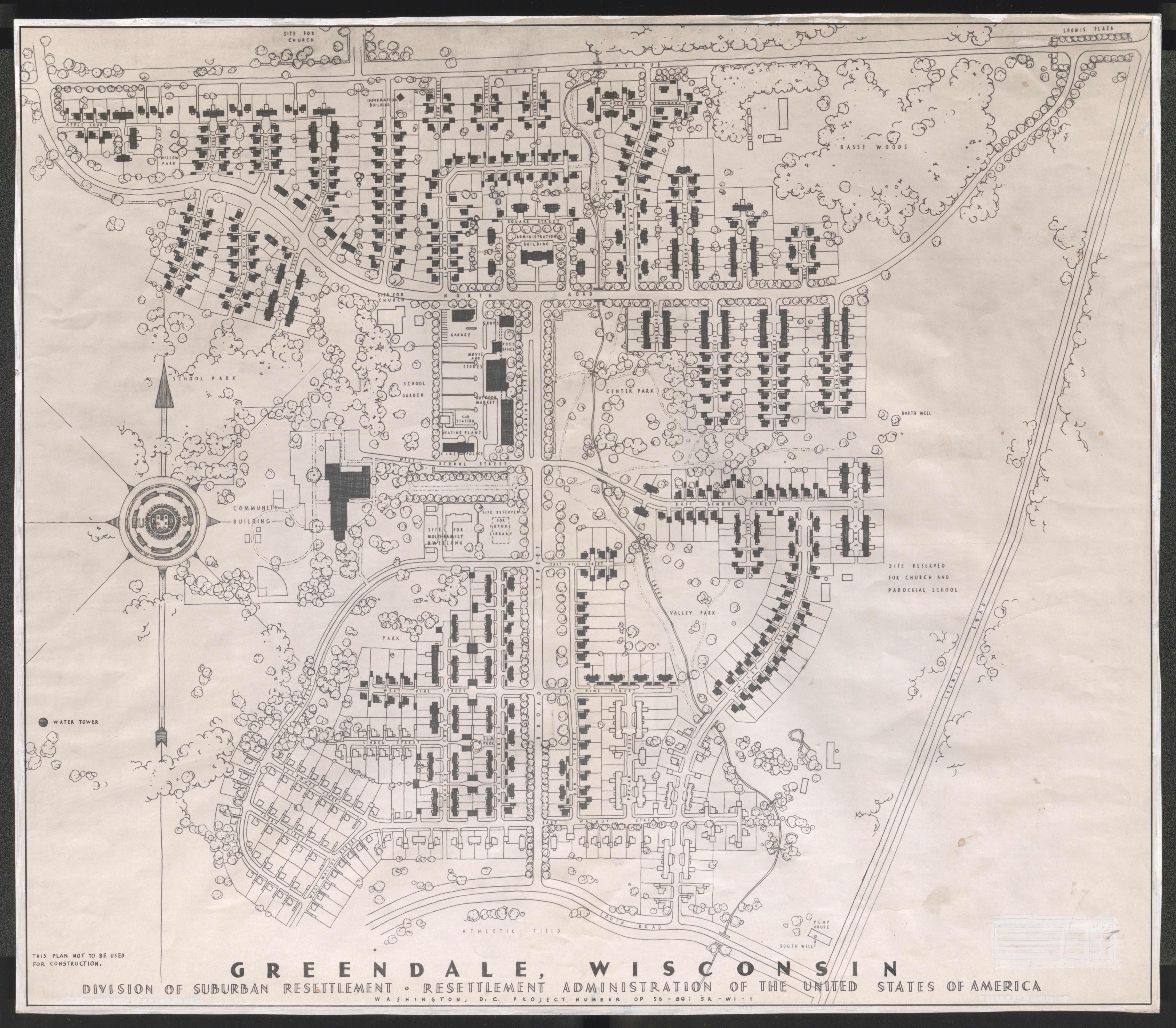
Preliminary plan map, undated
Aerial view, undated
Two dwellings with yard and outbuildings, printed on label on back of image "CINCINNATI // Steele Subdivision"
Dwelling with others in background, printed on label on back of image - "Cincinnati // House in Steele Subdivision", undated
Interior hallway, printed on label on back of image - "Cincinnati // Hall and stair in Mt. Adams section", undated
Two shotgun type houses and their front yards, printed on label on back of image "CINCINNATI // Steele Subdivision", undated
Interior hallway/stairwell, printed on label on back of image - "CINCINNATI // Hall in West End tenement", undated
Bedroom with person in bed, printed on label on back of image "Cincinnati // Bedroom of [African-American] dwelling // off Van Horn Street", undated
Trench along building with stone retainer on other side, printed on label on back of image - "CINCINNATI // Open sewer on hillside above Eastern Ave. Several privies drain into this sewer", undated
Homes surround vehicles in parking area, printed on label on back of image - "CINCINNATI // Eastern Avenue homes", undated
Connected tenement structures on hillside, printed on label on back of image - "CINCINNATI // Eastern Avenue tenement"
Street with homes at its edge, printed on label on back of image " CINCINNATI // Homes off Eastern Ave. // on Gladstone Street", undated
Two story apartment house, printed on label on back of image - "CINCINNATI // Apartment on Eastern Ave", undated
House near street with adjacent billboard, printed on label on back of image - "CINCINNATI // Eastern Ave home", undated
Double outhouse entrances at attachment to building, printed on label on back of image "CINCINNATI // Privies off Eastern Ave", undated
Frontal view; two adjacent homes, printed on label on back of image - "CINCINNATI // Gladstone Street - homes of // General Grant period. // Outside privies", undated
Toilet, printed on label on back of image - "Cincinnati // Outside toilet in S.E. part of town", undated
Sink, printed on label on back of image - "Cincinnati // One of the sinks which form only water // supply in schoolhouse in Southeast // Cincinnati. School condemned 37 years ago. // Since then it has housed 12 to 15 white // families. Outside privies", undated
Set of four outhouses; one with open door, against building, printed on label on back of image - "CINCINNATI // Privies in rear of condemned school, // now housing 12 to 15 white families", undated
Family of five (three children) in bedroom, printed on label on back of image - "Cincinnati // Two room home - 10 Faulkner Court - Denkins family. // Bedroom. Until family got mattress from // city dump, three children slept on floor. // They still have no sheets or blankets", undated
Semicircular stone pavilion, printed on label on back of image - "CINCINNATI // Mariemont pavilion", undated
Looking down parallel roads with residential areas on each side and railroad track and utility lines running in-between, printed on label on back of image "CINCINNATI // Car line separating Mariemont from cheaper subdivision", undated
Cluttered walls and furnishings of one room home, printed on label on back of image - "Cincinnati // One room home of three adults in West End", undated
Room with bed, cooking stove and fireplace stove, printed on label on back of image - "CINCINNATI // Interior in Basin District", undated
Kitchen, printed on label on back of image - "CINCINNATI // Kitchen in West End home", undated
Bedroom with icebox, printed on label on back of image - "CINCINNATI // Two room home in West End", undated
Woman in room next to fireplace stove, printed on label on back of image "CINCINNATI // Living room in West End", undated

Woman with child in room next to fireplace stove, printed on label on back of image - "Cincinnati // Interior of two room apartment in // Basin District, near Union // Station", undated
Woman tending stove, printed on label on back of image - "Cincinnati // Kitchen of two room house, // home of family of five", undated
Two small children sit on bed holding infant, printed on label on back of image - "CINCINNATI // Interior in Basin District", undated
House at edge of body of water, printed on label on back of image - "CINCINNATI // Mariemont boat house"
Body of water shoreline with large drain through stone wall, printed on label on back of image - "CINCINNATI // Mariemont community lake", undated
Three story tenement balconies, printed on label on back of image - "CINCINNATI // Tenement on Eastern Ave"
Woman and children at back edge of house with outhouse on hillside behind, printed on label on back of image - "Cincinnati // Back yard near Eastern Avenue. // Many houses are built like // this one, with privy above // kitchen on slope of hill", undated
Homes on neighborhood street, printed on label on back of image - "CINCINNATI // Houses on Laconia Street in a // suburb of Cincinnati, Ohio, // showing some of the finer type // and newer homes. (Dec. 1935)", 1935 December
Homes on end of street loop, printed on label on back of image - "CINCINNATI // Mariemont (Dec. 1935)", 1935 December
Two large homes near road, hand written on back of image - "Greenhills 1937 Sept. // Houses in F Block", 1937 September
Apartment house, hand written on back of image - "Greenhills 1937 Sept. // Four two bed room S houses", undated, Sep-37
House near street, printed on label on back of image - "CINCINNATI // Mariemont, Dec. 1935", 1935 December
Tenement buildings, printed on label on back of image - "CINCINNATI // Model Housing Co.// Dec. 1935", 1935 December
Tenement building, printed on label on back of image - "CINCINNATI // Model Housing Co.// Dec. 1935", 1935 December
Broken concrete steps, printed on label on back of image - "CINCINNATI // Model Housing Co.// Dec. 1935", 1935 December
Row of houses on inclined street, printed on label on back of image - "CINCINNATI // Middle class housing // section", undated
Row of houses on street, printed on label on back of image - "CINCINNATI // Middle class housing // section", undated
House or apartment house with signs indicative of dry cleaning business, printed on label on back of image - "CINCINNATI // Blight", undated
Tenement buildings with courtyard, printed on label on back of image - "CINCINNATI // Model Housing Co.", undated
Large home with sign on tree about rooms and meals, printed on label on back of image - "CINCINNATI // Blight in good residential section", undated

Cracked sidewalk, printed on label on back of image - "CINCINNATI // Model Housing Co.", undated
Sidewalk through apartment courtyard and play area, printed on label on back of image - "CINCINNATI // Model Housing Co.", undated
Man and child on sidewalk of tenement back alley, printed on label on back of image - "CINCINNATI // Model Housing Co.", undated
Road between rows of tenements, printed on label on back of image - "CINCINNATI // Model Housing Co.", undated
Crack through brick wall and foundation of building exterior, printed on label on back of image - "CINCINNATI // Model Housing Co.", undated
Printed on label on back of image - "CINCINNATI // Memorial Bust of // J.G. Schmidlapp // 1849-1919 - // Founder Model // Homes", undated
Damaged low brick wall, printed on label on back of image - "CINCINNATI // Model Housing Co.", undated
Artists drawing of Greenhills plan superimposed over aerial photo, undated
Artists drawing of Greenhills plan superimposed over aerial photo, hand written on back of image - "Plan of Greenhills, Ohio", undated
Aerial view of Greenhills, Ohio, hand written on back of image - "Air view of // Greenhills, Ohio // December, 1936", 1936 December
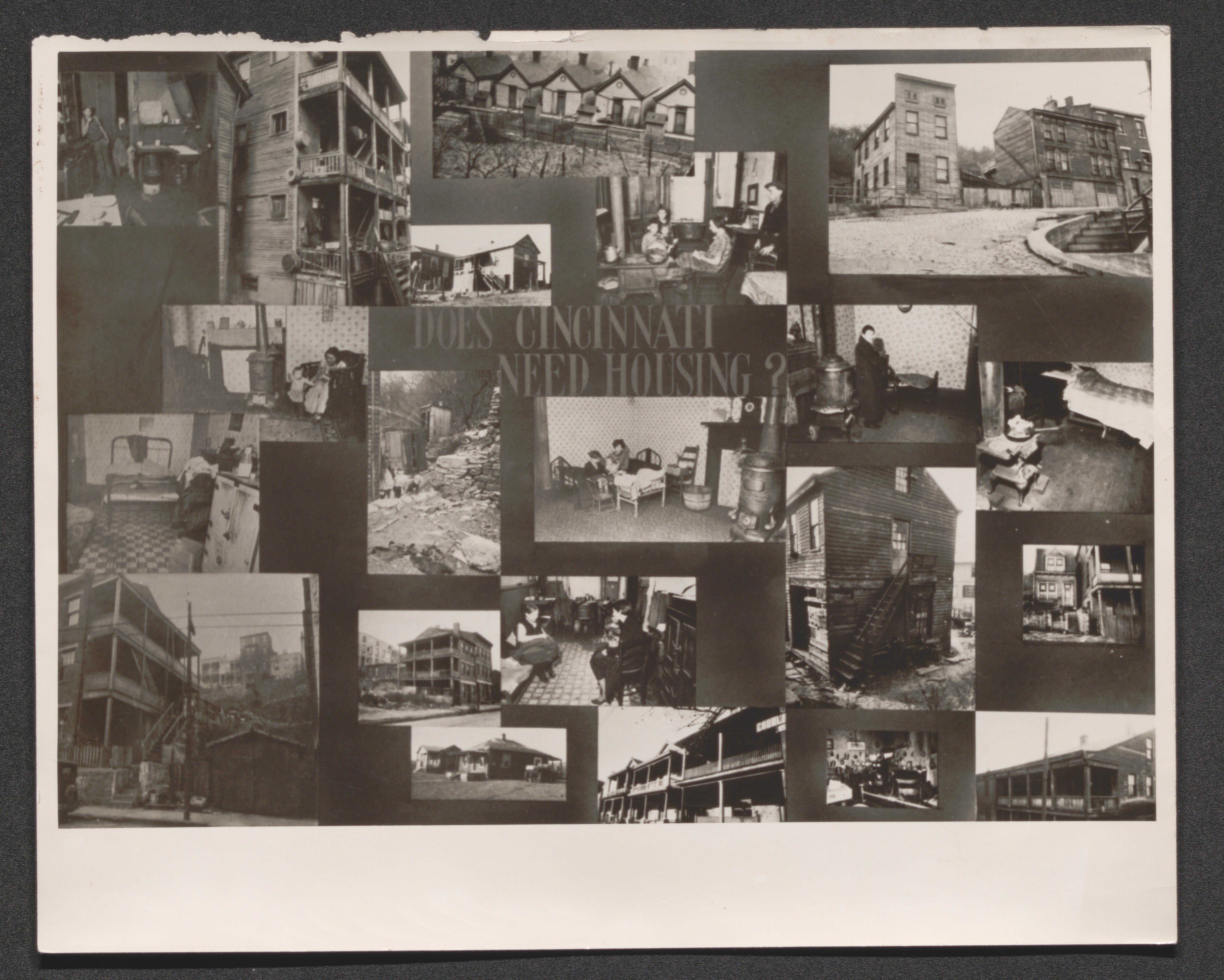
Photo collage of slum tenement conditions, with message in center "DOES CINCINNATI NEED HOUSING?", undated
Indian Demonstration Project, undated
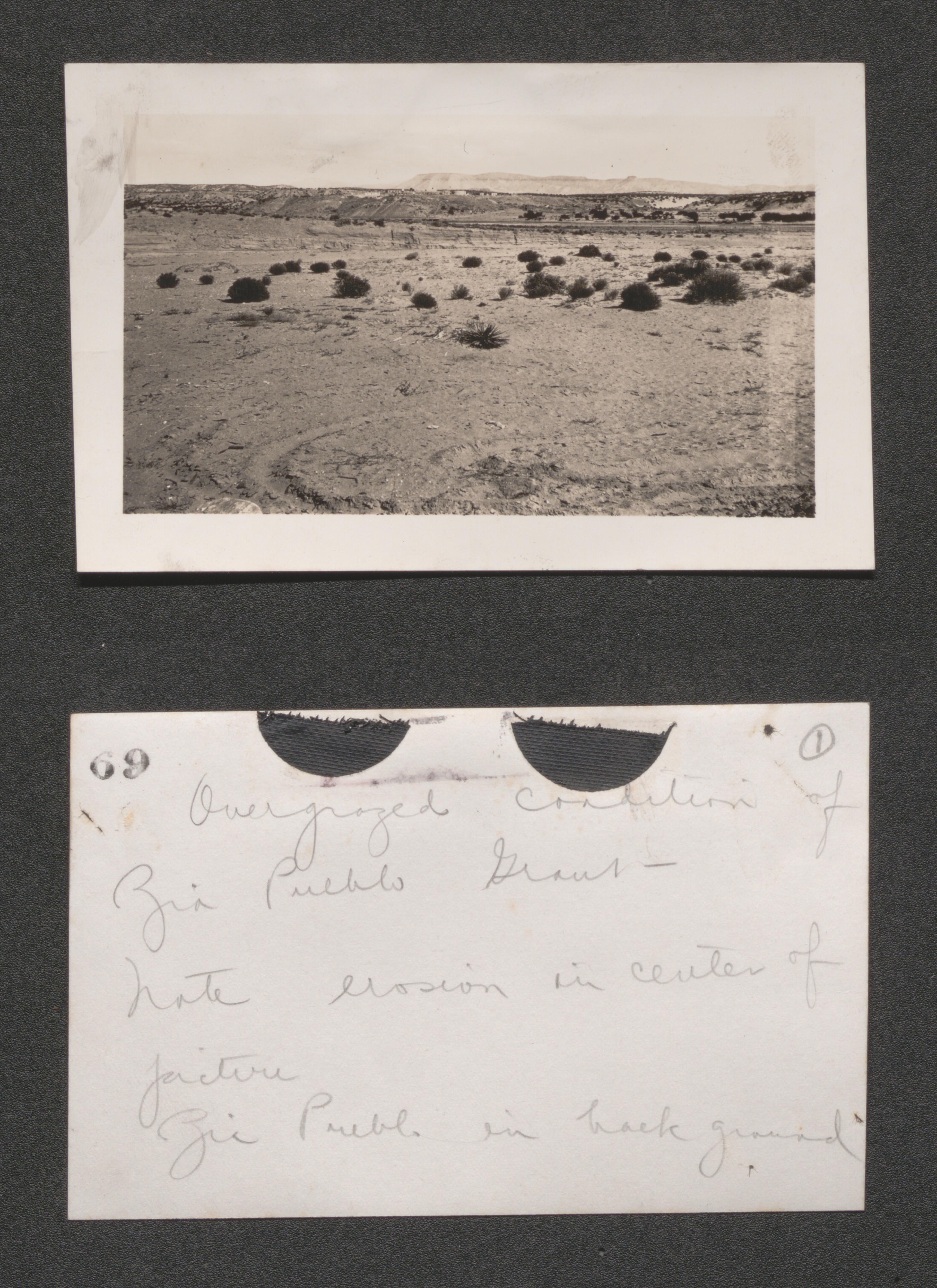
Page 4 overgrazed range Zia Pueblo, undated
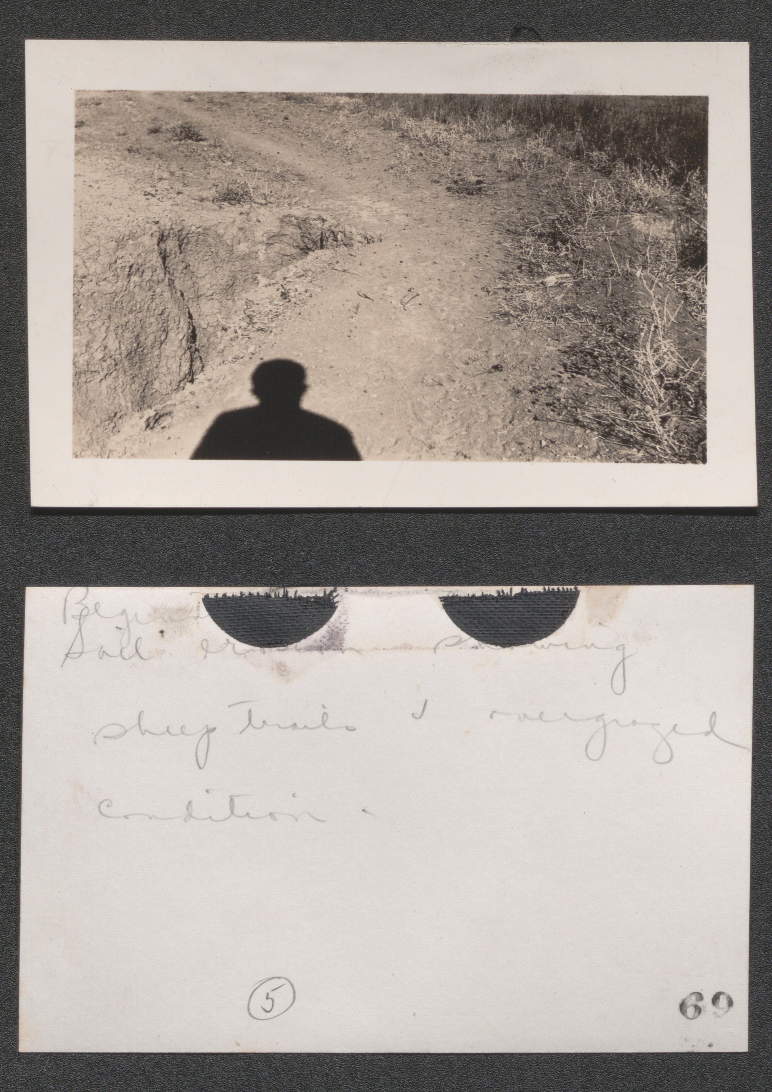
Page 4 incipient soil erosion on sheep trail at Zia Santana Pueblos, undated
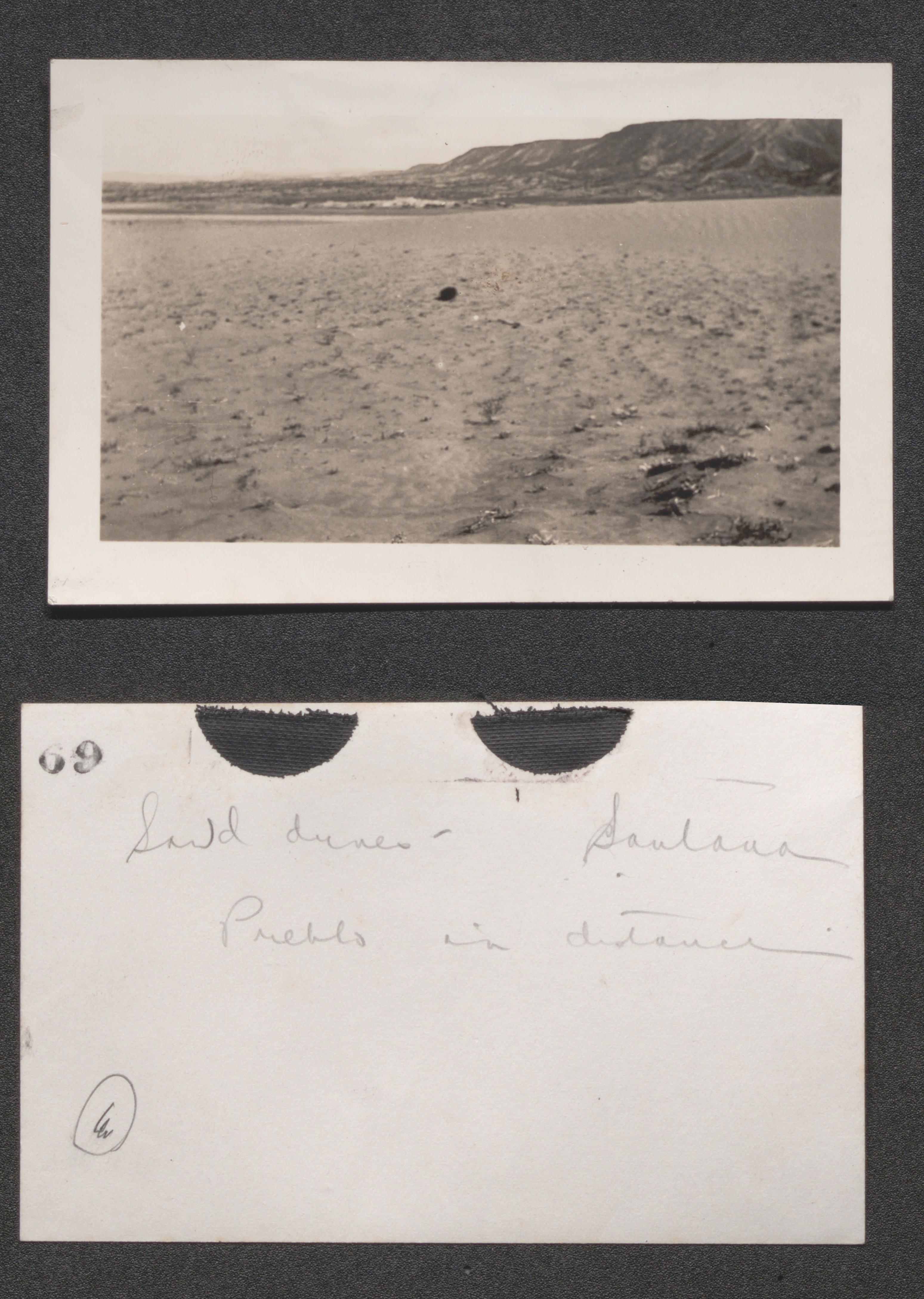
Page 4 sand dunes caused by overgrazing Santana Pueblo in distance, undated
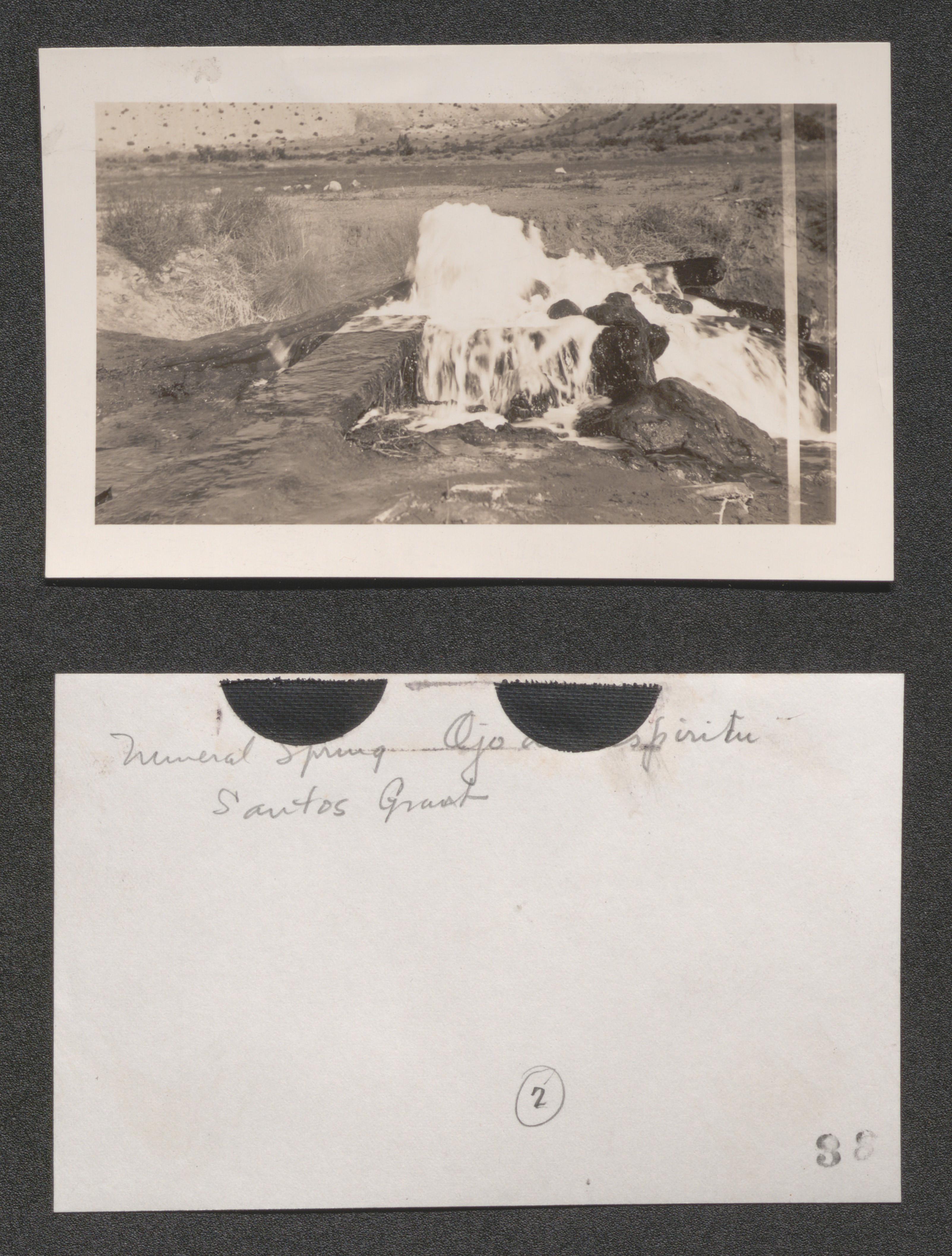
Page 4 mineral spring (Ojo del Espiritu) Santos Grant, Jemez Project, undated
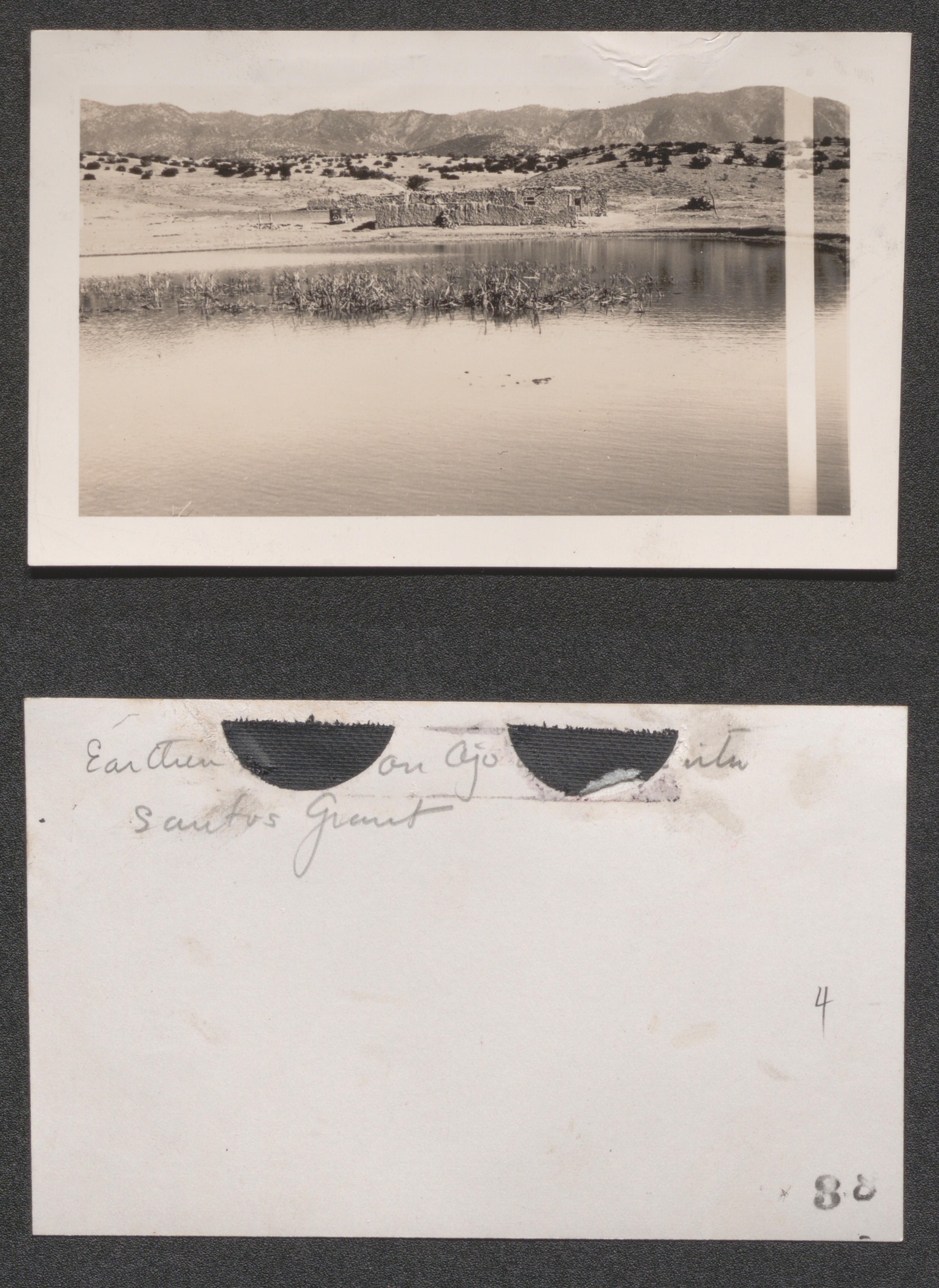
Page 4 earthen tank on Ojo del Espiritu, Jemez Project, undated
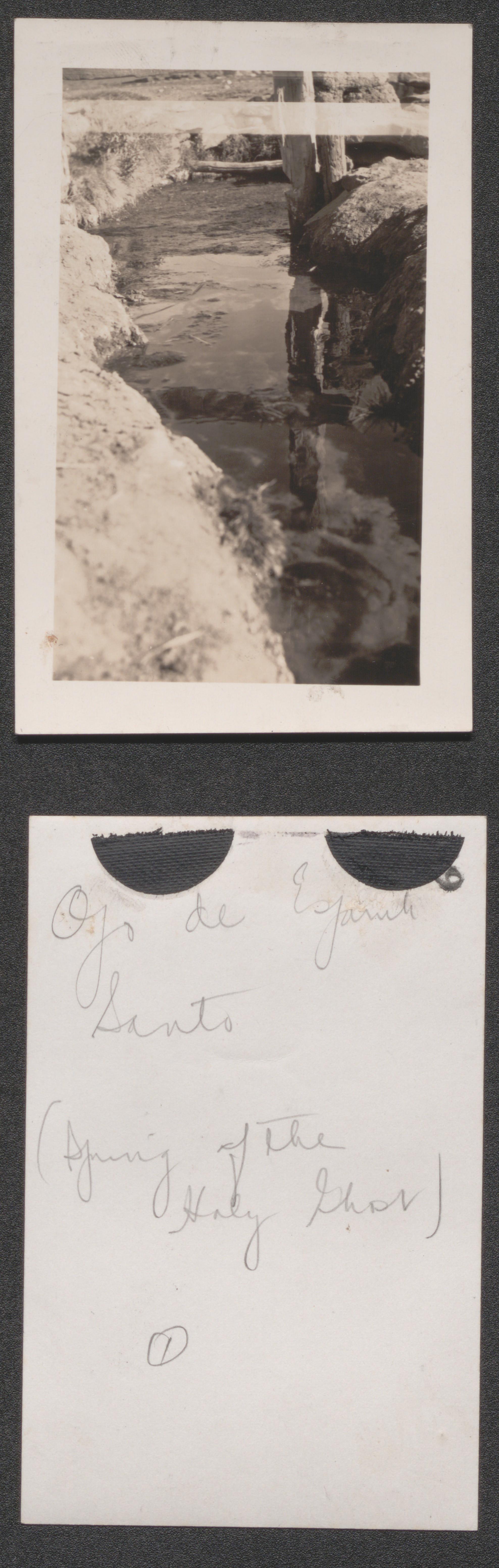
Page 4 a mineral spring on the Santos Grant, Jemez, undated
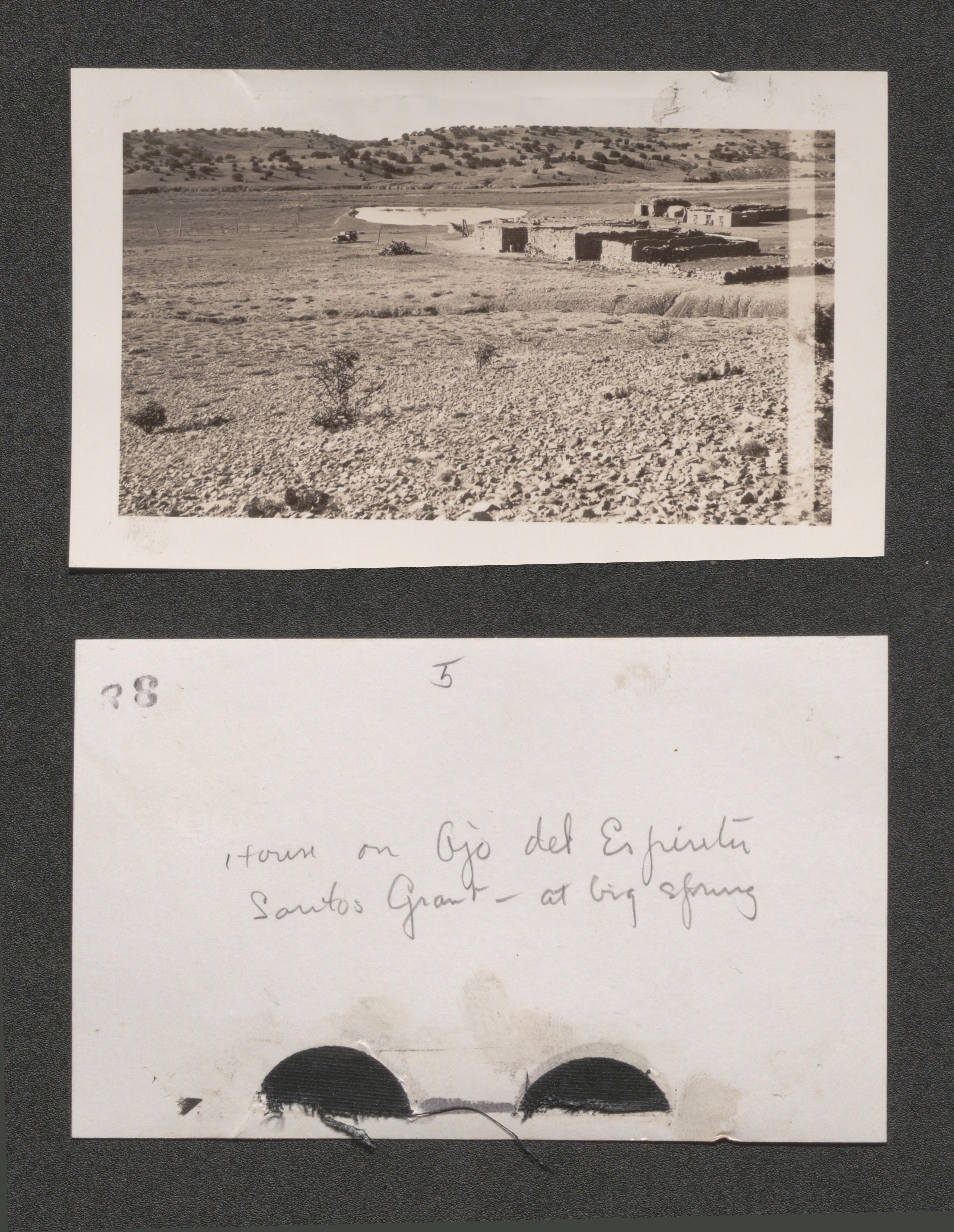
Page 4 house on big spring on the Santos Grant, undated
Page 6 Fort Peck, Montana, undated
Page 1 advanced stage of gully erosion. Middle Rio Puerco drainage (Caberon Peak in the background), undated
Page 1 Rio Puerco head gulley at right destroying farm lands, undated

Page 1 typical foothill country - Lobato Grant range control is chief, undated
Page 1 badlands - North of Santa Fe, near Rio Grande, range control will not help, but there us no practicable cure for this condition, undated
Page 2 the land moves with every rain - Rio Pojoaque, North of Santa Fe, condition approaching total destruction of land values, following range depletion, undated
Page 2 near Abiquiu, New Mexico native village hemmed by destructive forces of erosion, undated
Page 2 gullies eating back into a fertile valley - Acoma, undated
Page 2 a once fertile valley is now a flood menace, Gallisteo Creek, near its mouth, threatening Pueblo Indian farms irrigated from Rio Grande, undated
Page 3 two distinct types of gully erosion laguna, stock trails radiating from watering place in venter of photograph, undated
Page 3 the aftermath of overgrazing laguna, undated
Page 3 headward erosion affecting highway - San Felipe irrigation canal and farm land, undated
Page 3 devastated Indian Country Pojoaque Valley, undated
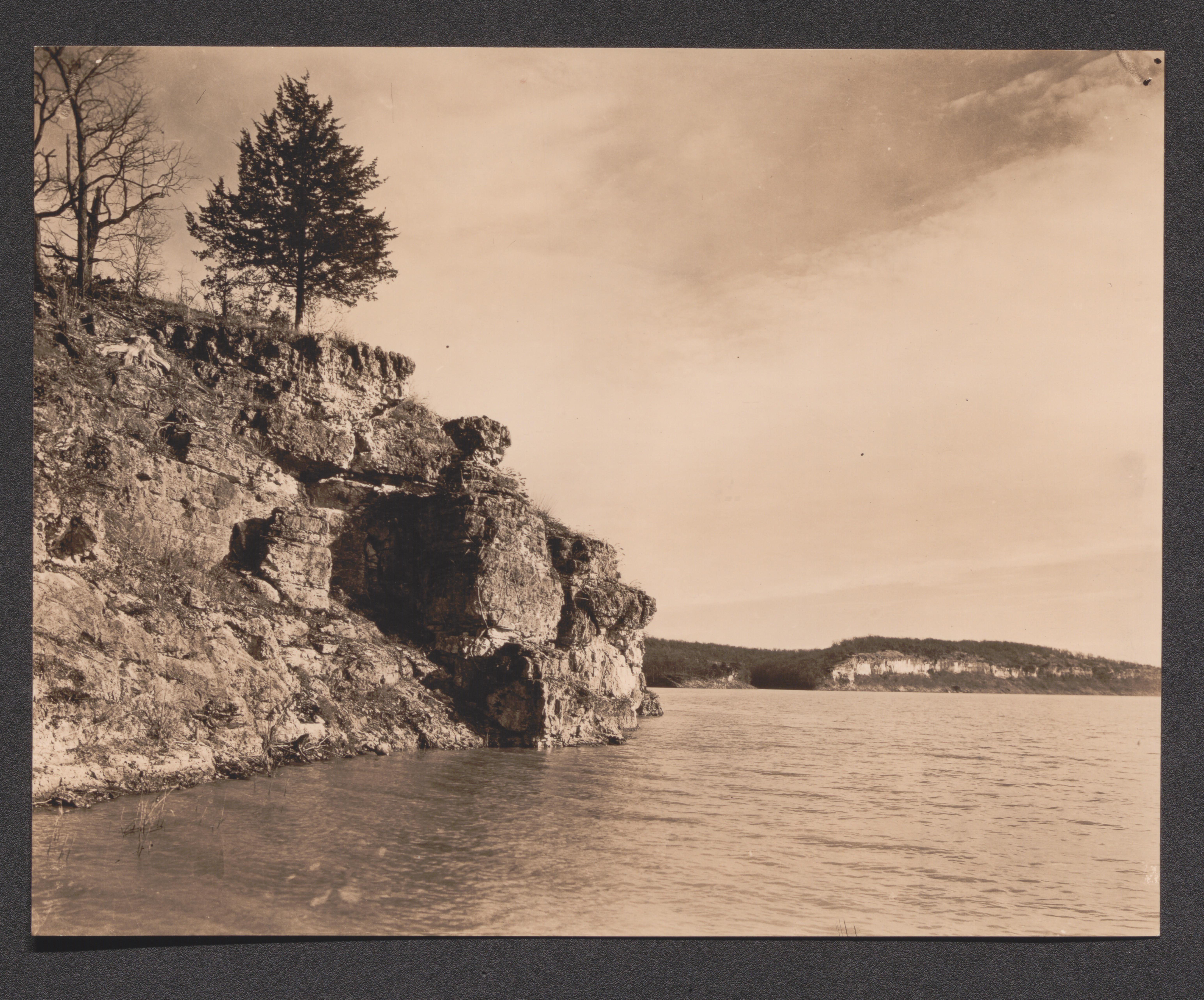
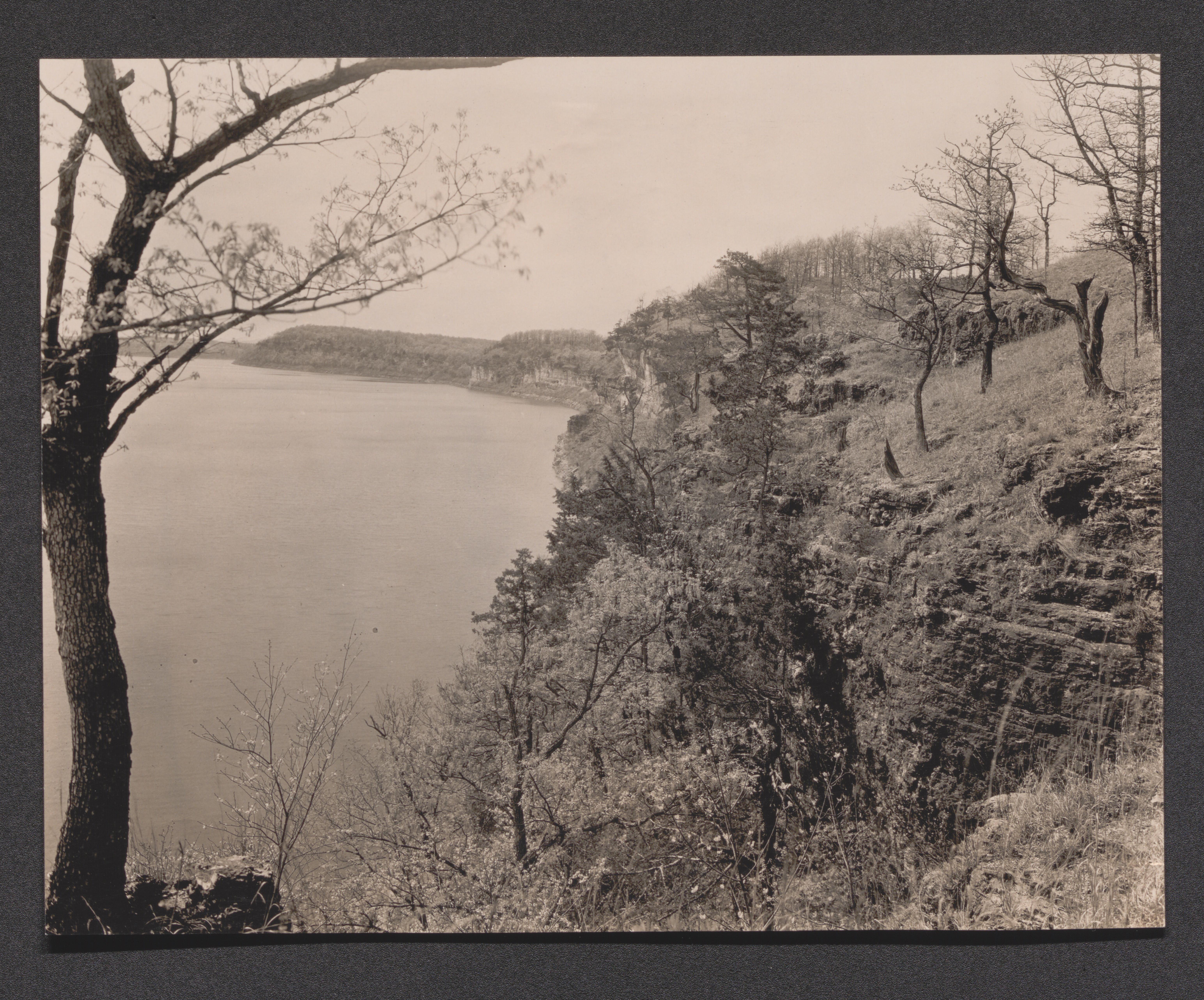
Lake of the Ozarks Regional Recreational Area, undated
Exhibit 4A cabin 1, undated
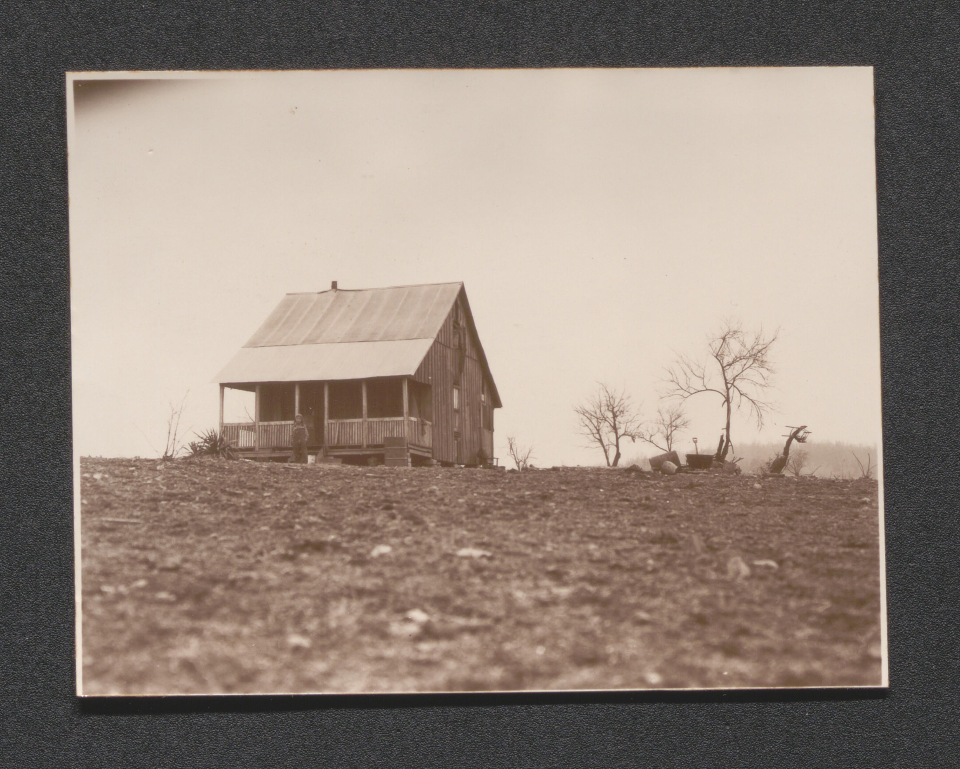
Exhibit 4A cabin 2, undated
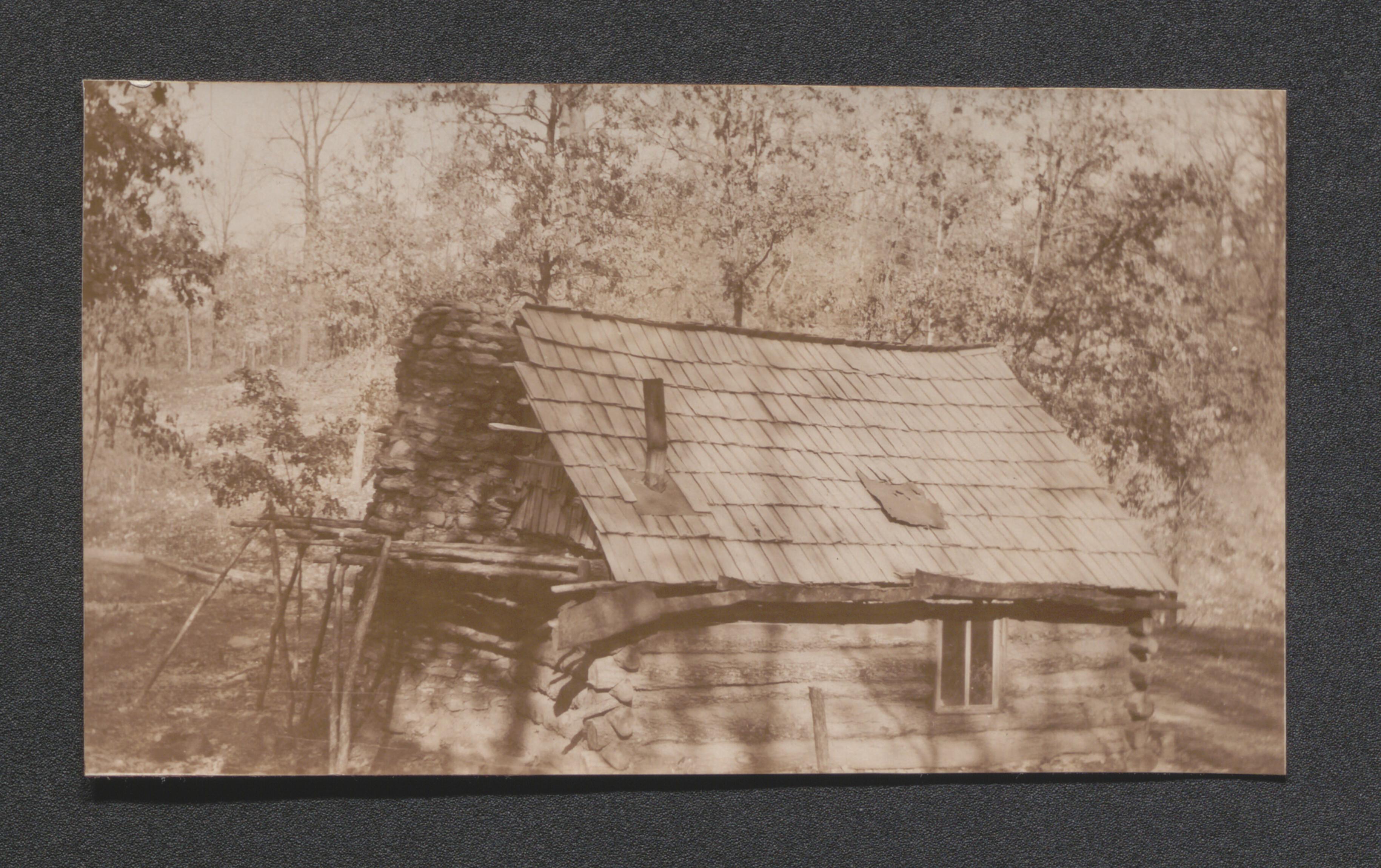
Exhibit 4A cabin 3, undated
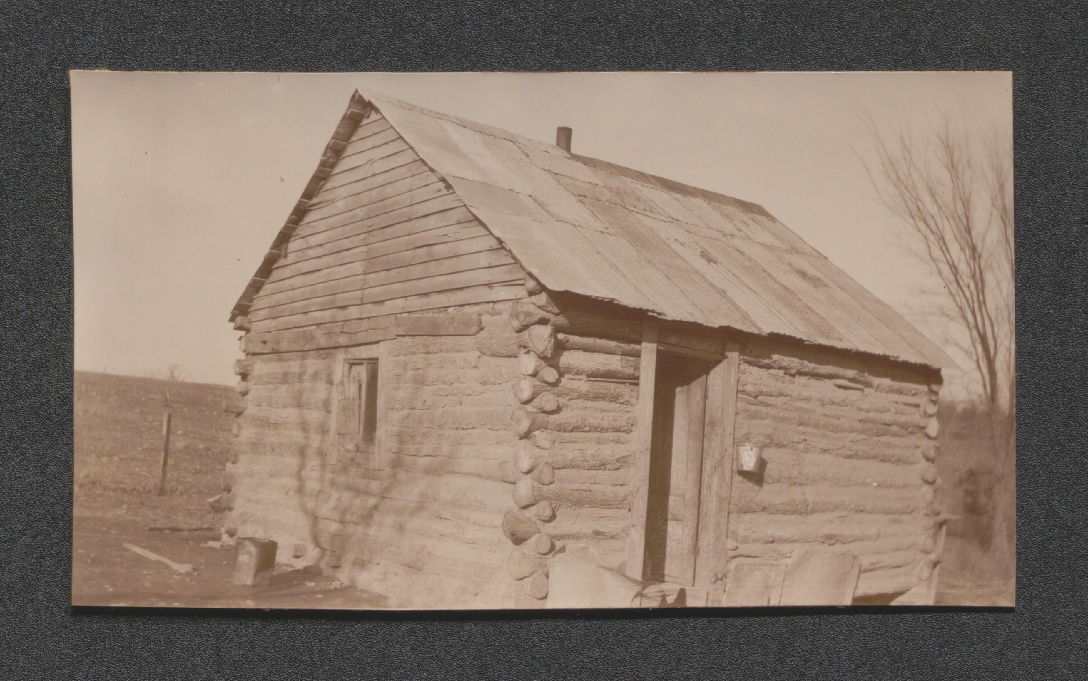
Exhibit 4A cabin 4, undated
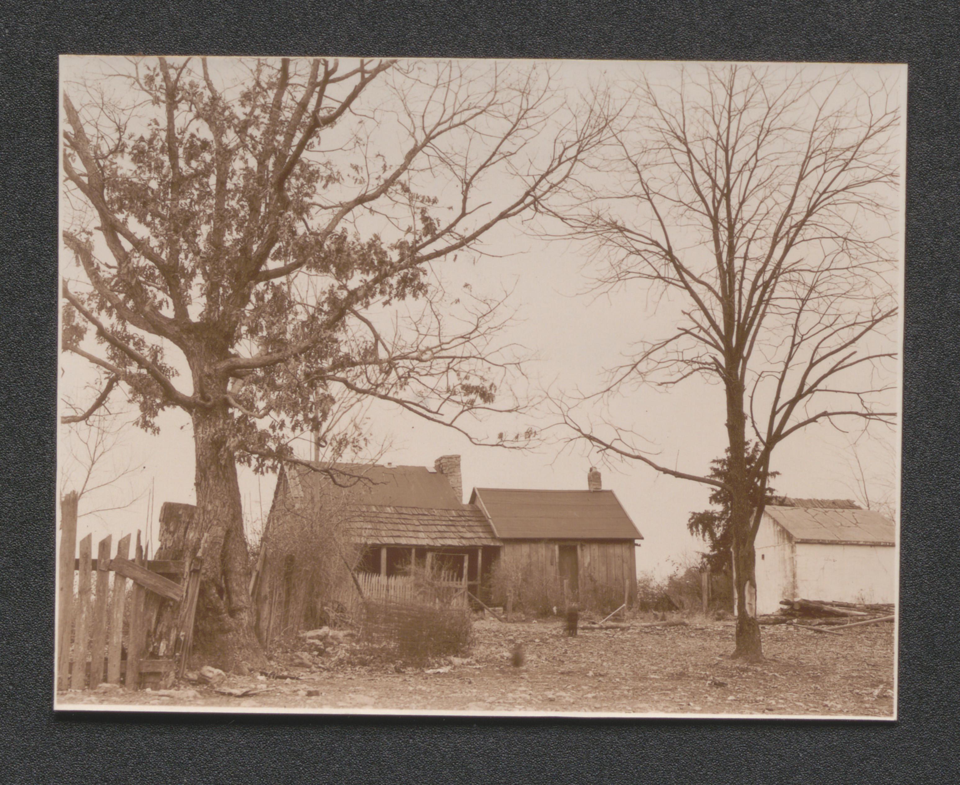
Exhibit 4A cabin 5, undated
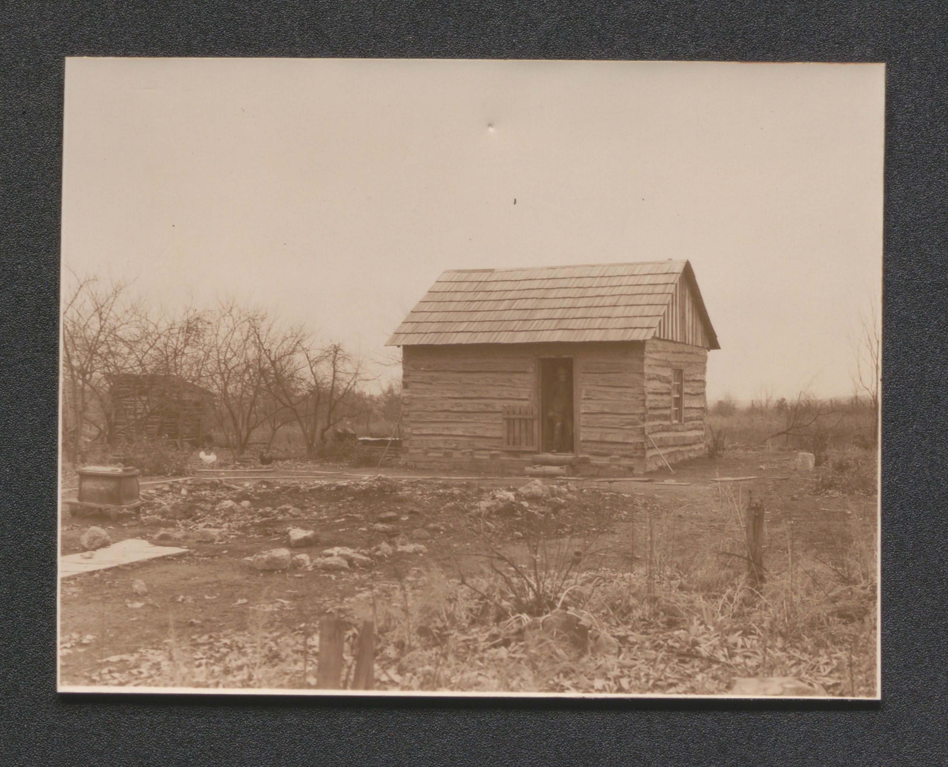
Exhibit 4A cabin 6, undated
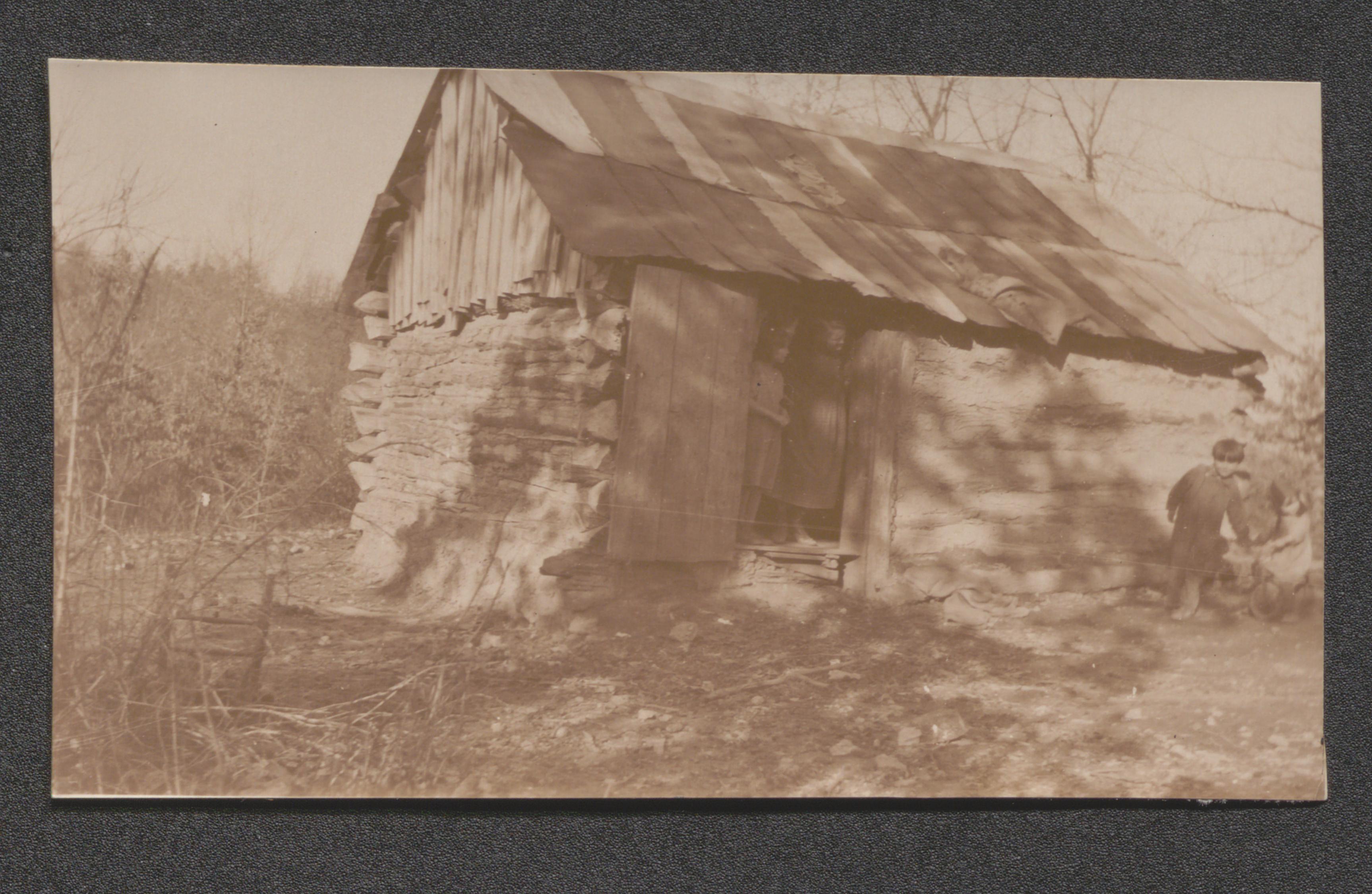
Exhibit 4A cabin 7, undated
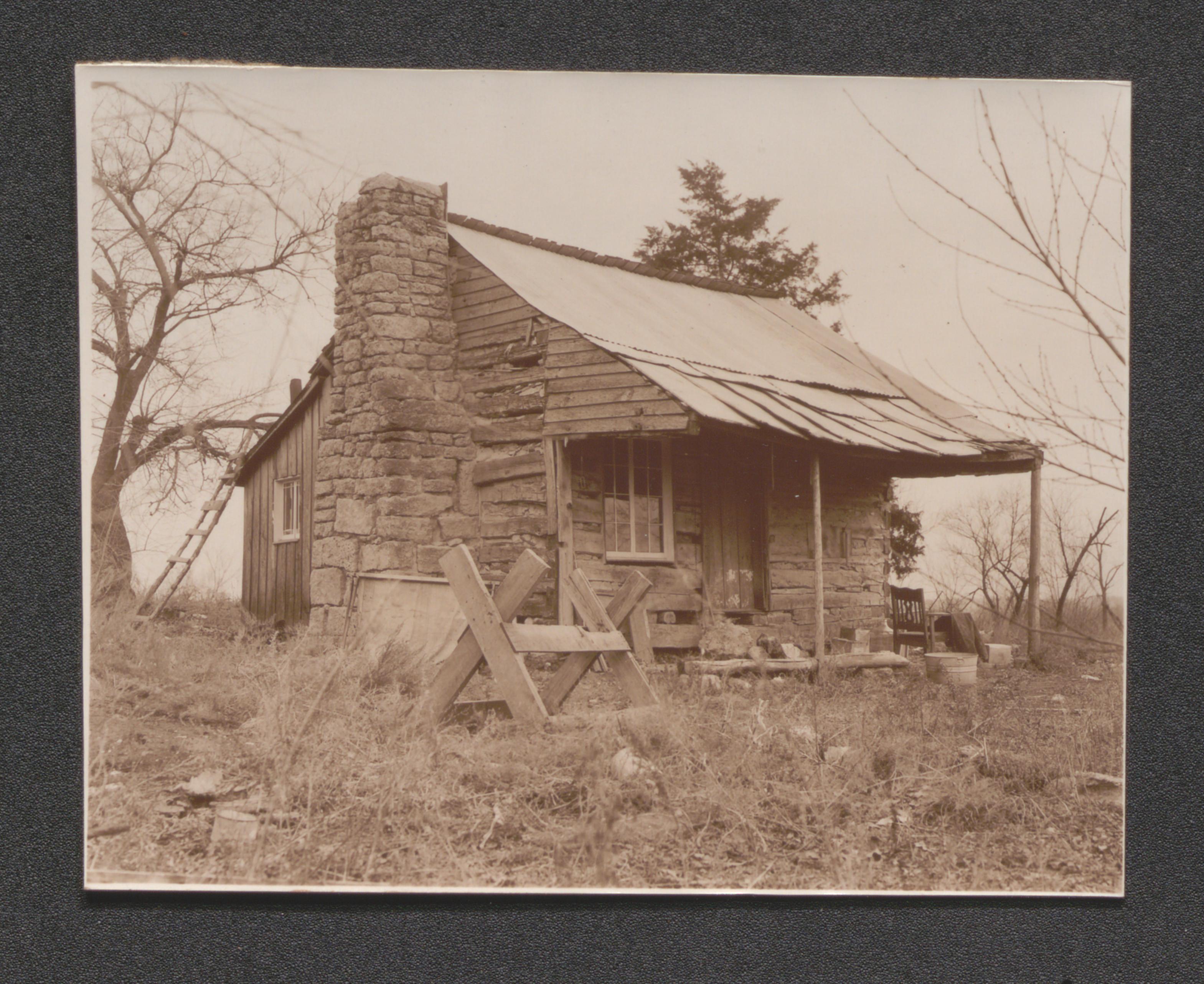
Exhibit 4A cabin 8, undated

Exhibit 4A cabin 9, undated
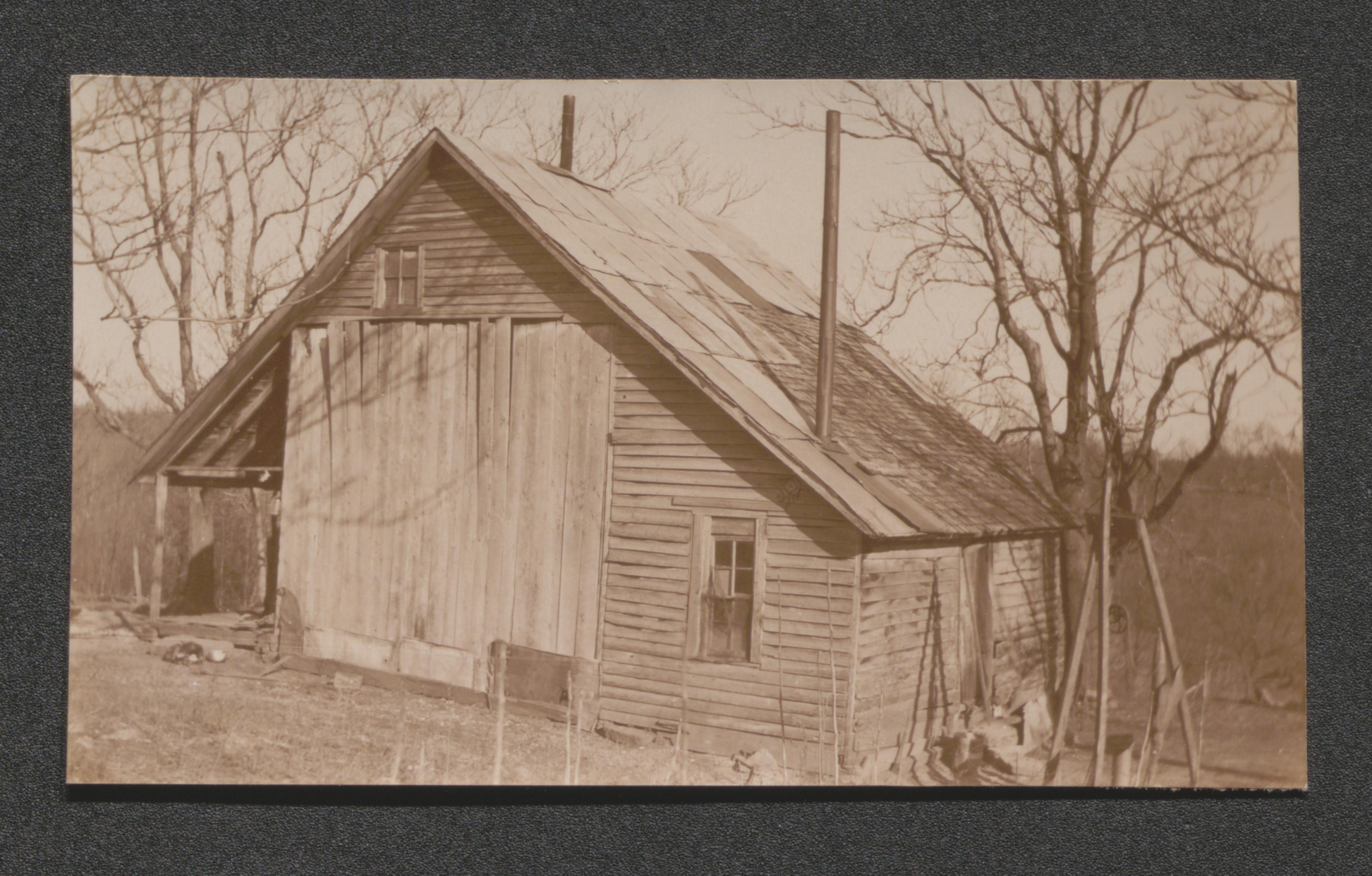
Exhibit 4B cabin 1, undated
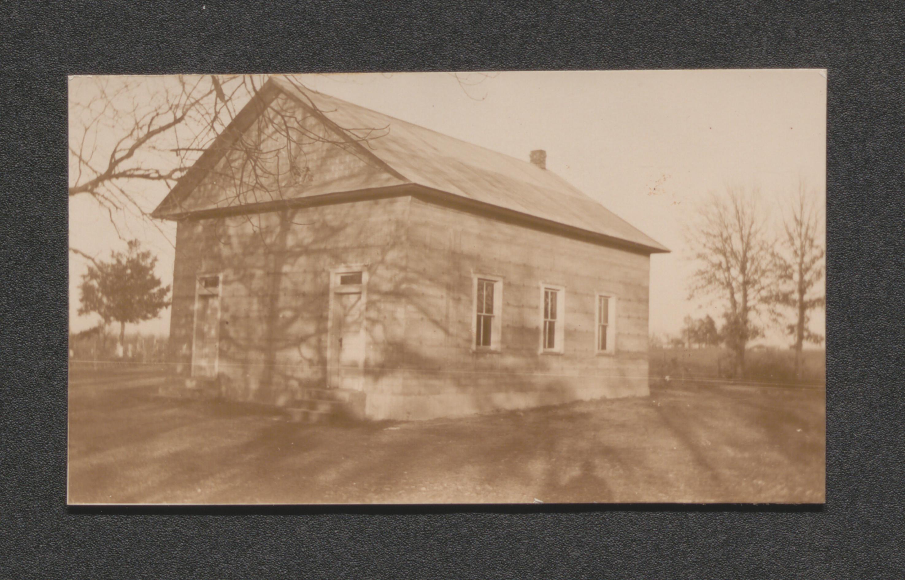
Exhibit 4B New Hope Baptist Church and adjoining cemetery tract no. 32, undated
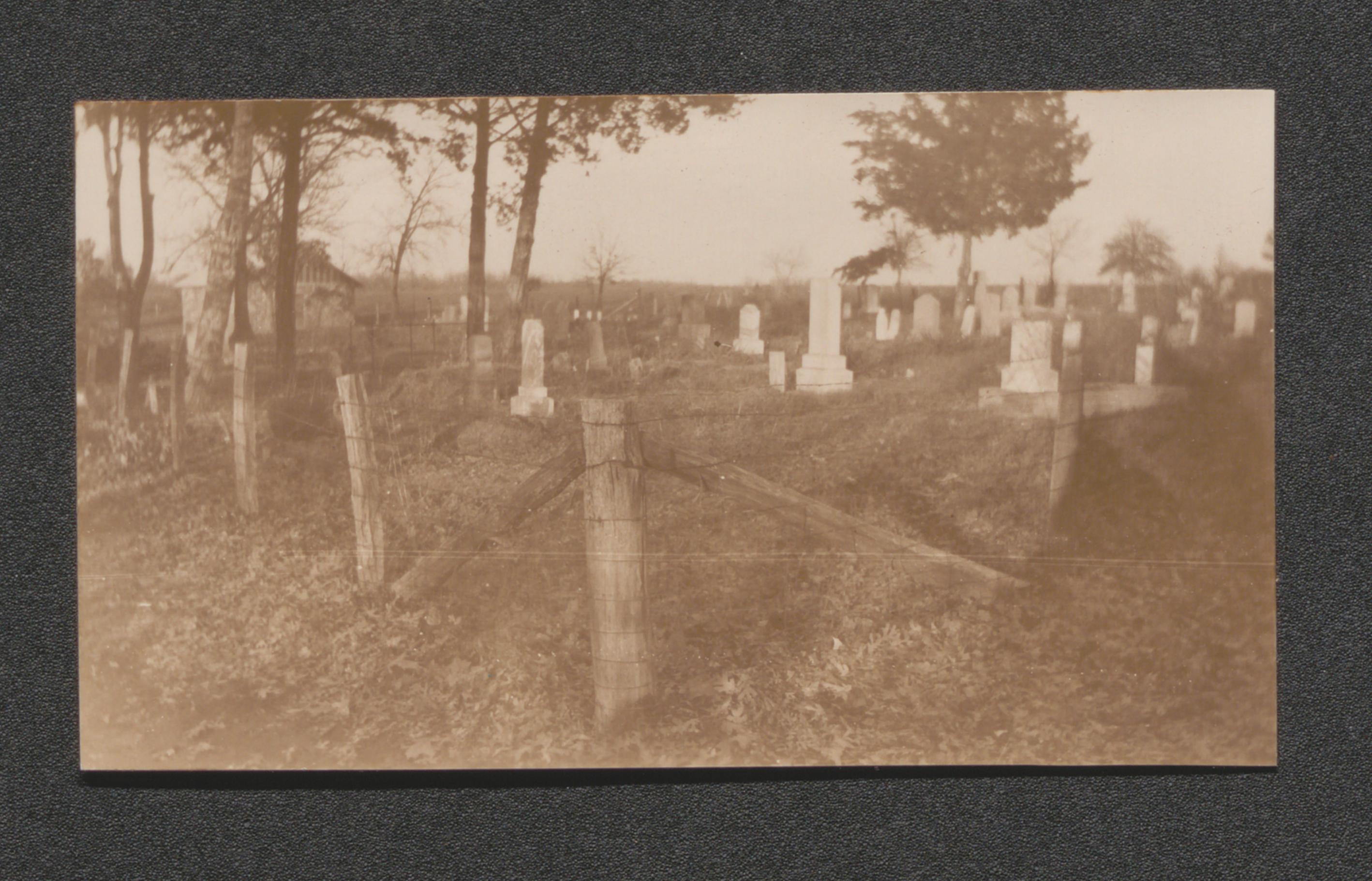
Exhibit 4B Church built of native rocks tract no. 32, undated
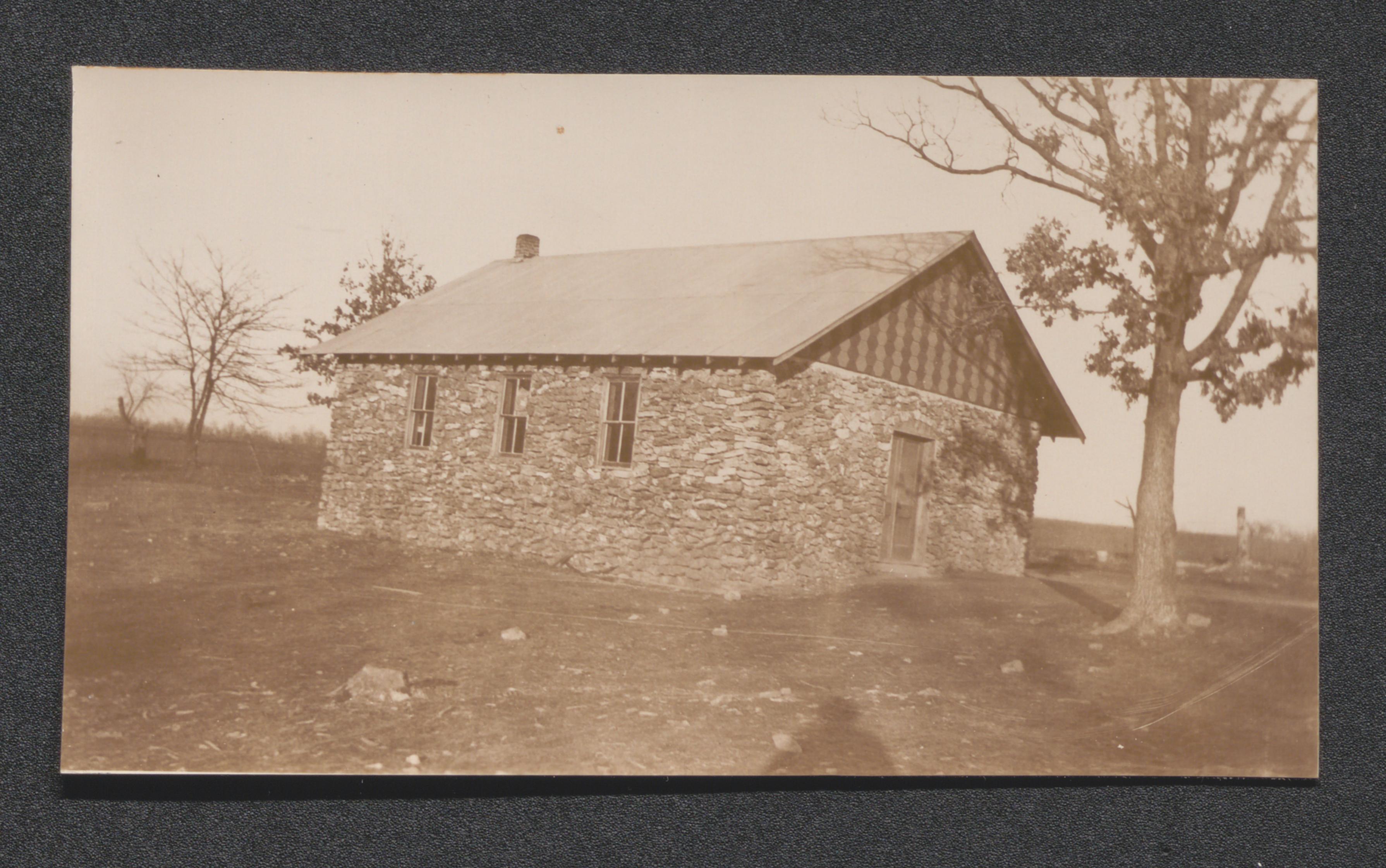
Exhibit 4B cabin and well, undated
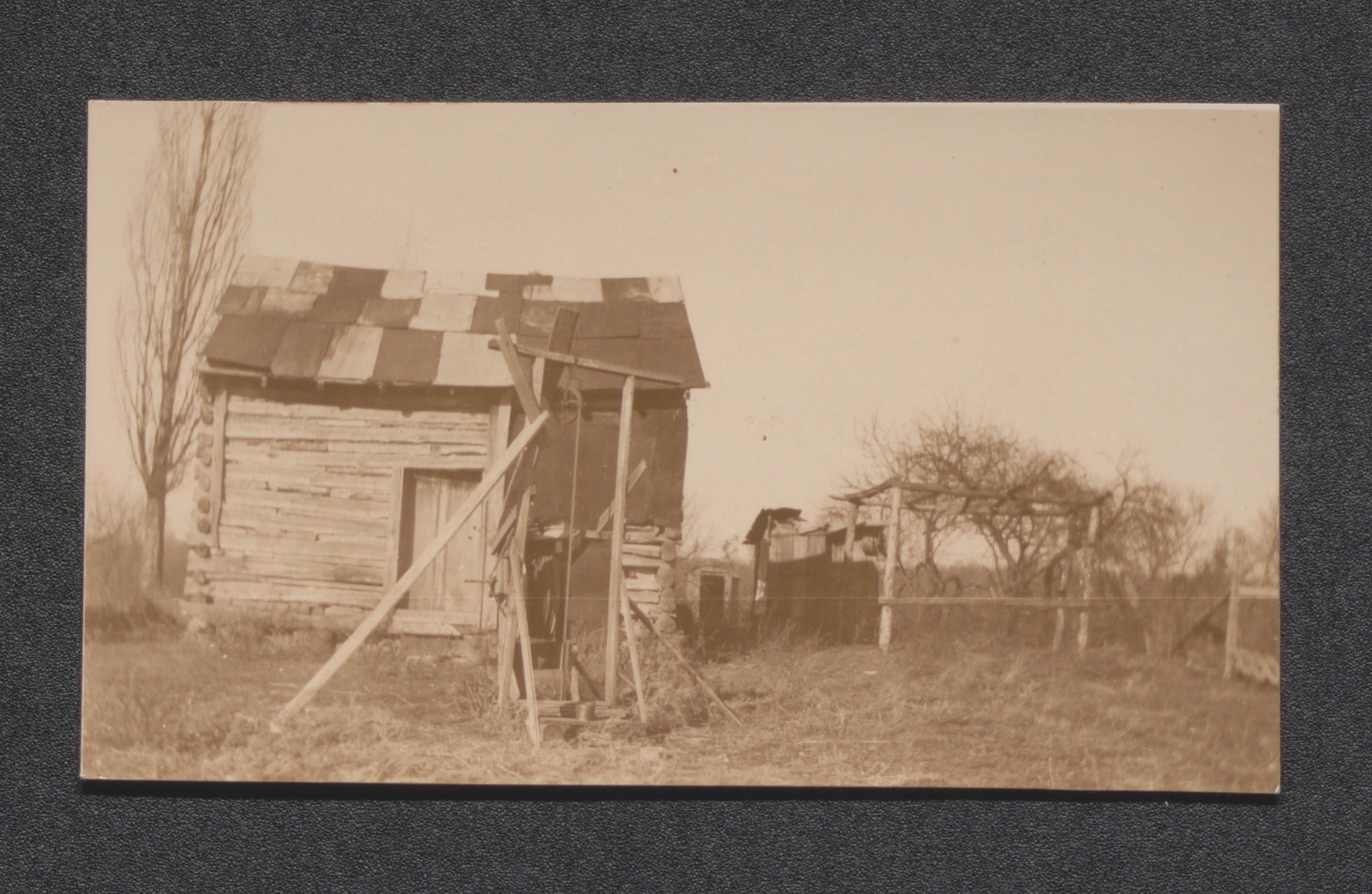
Exhibit 4B abandoned homes tract no. 14, undated
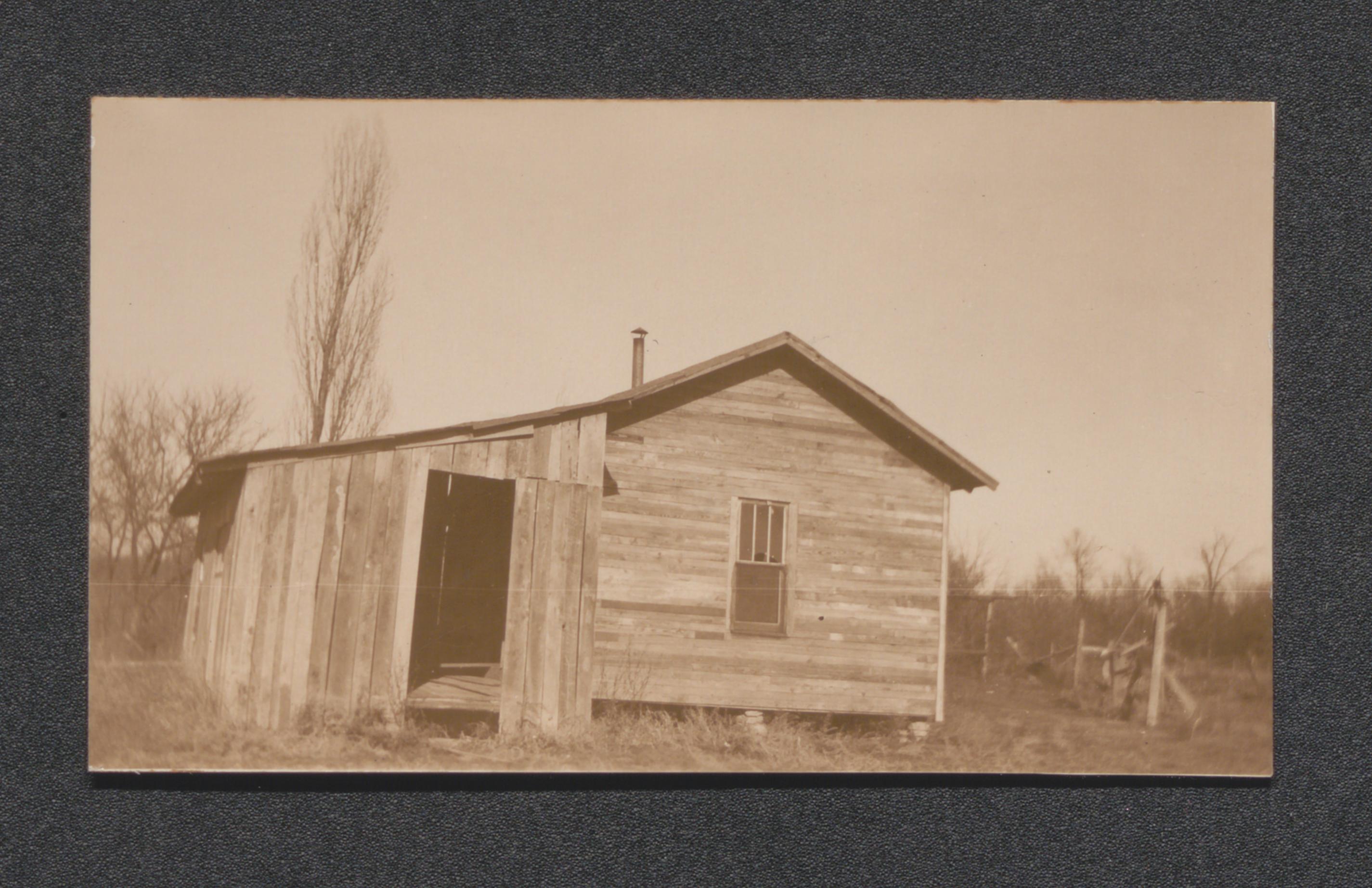
Exhibit 4B the Dinwiddie home tract no. 32, undated
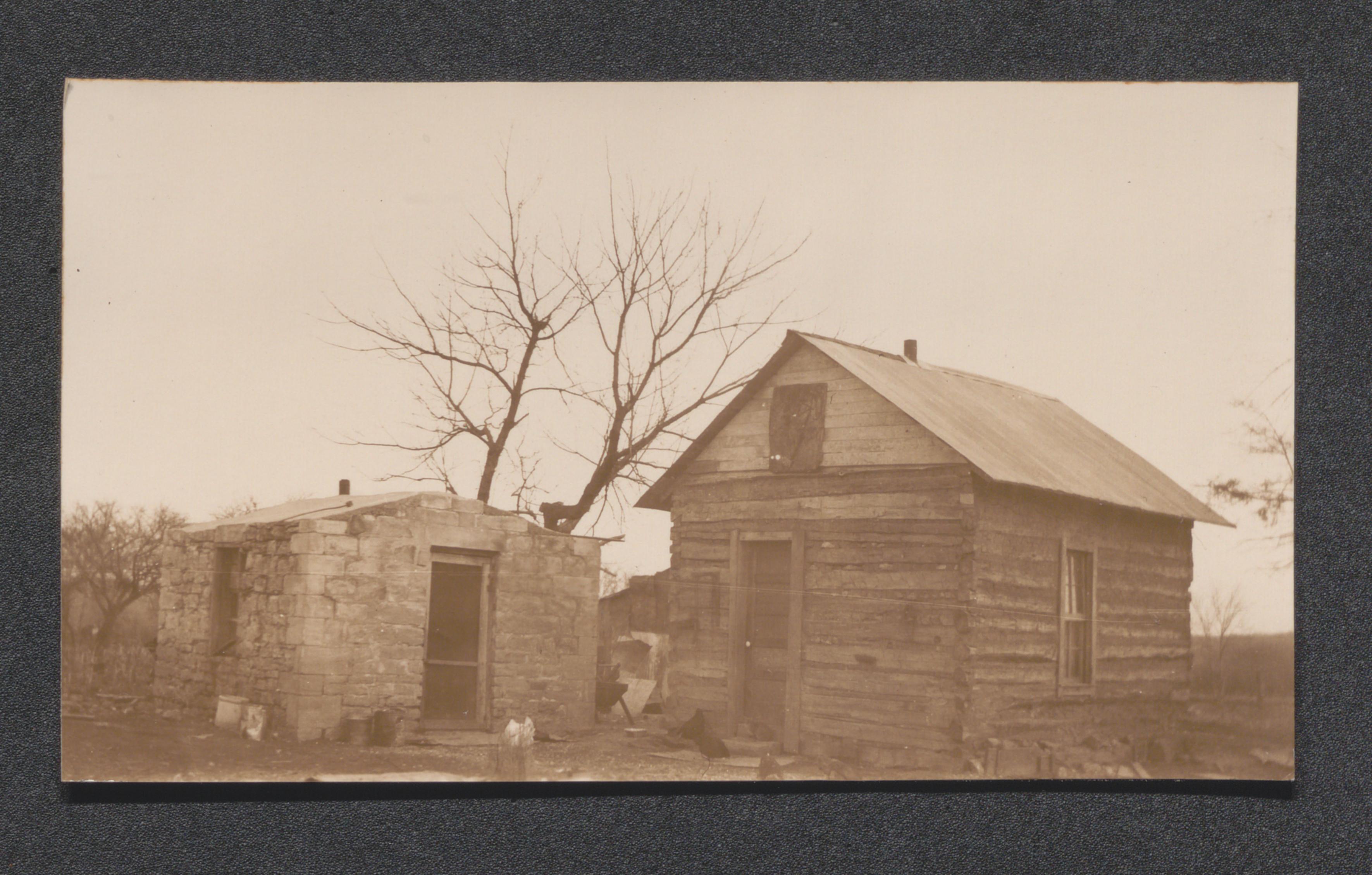
Exhibit 4B livestock shed, undated
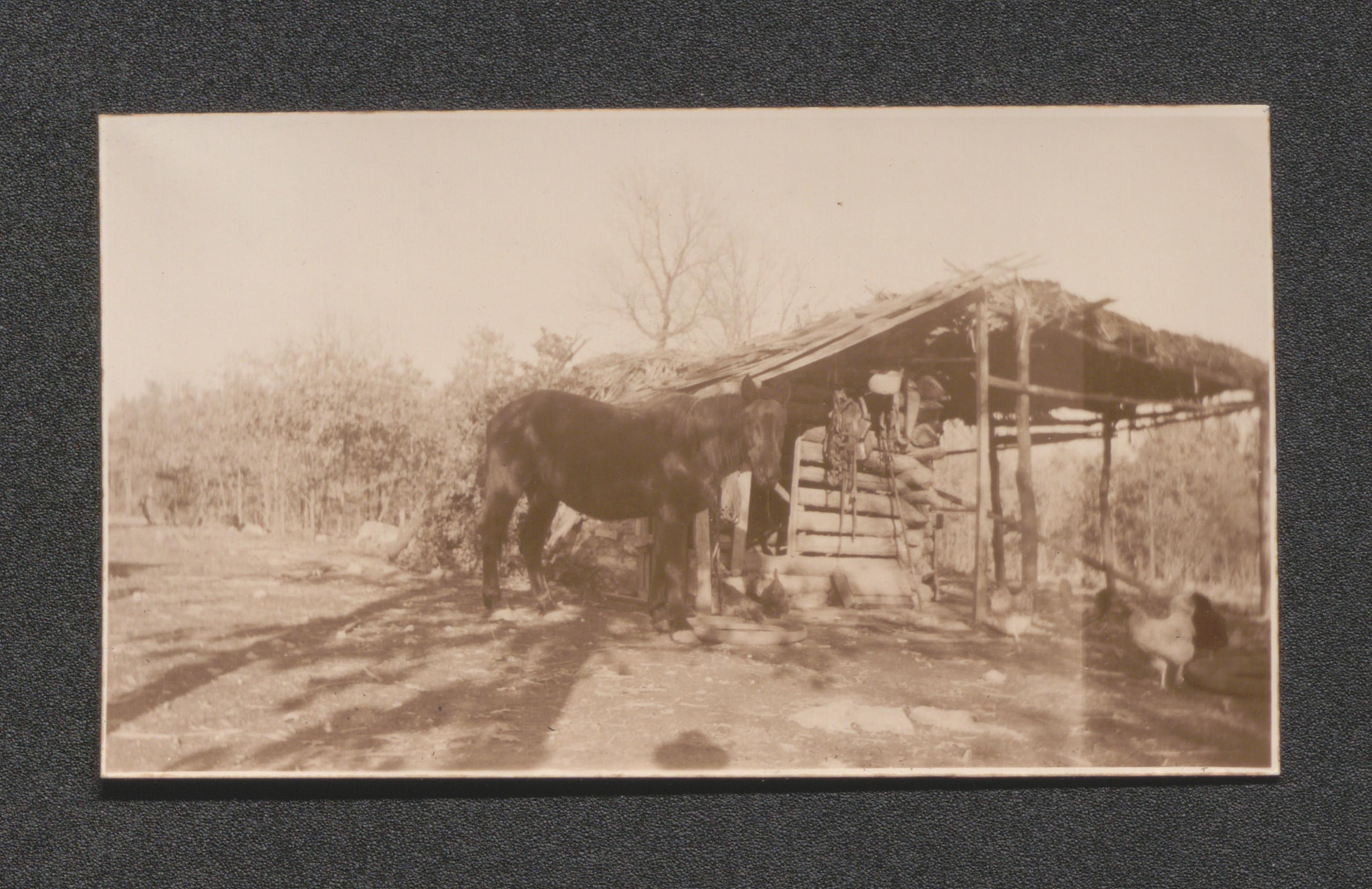
Exhibit 4B livestock facilities, undated
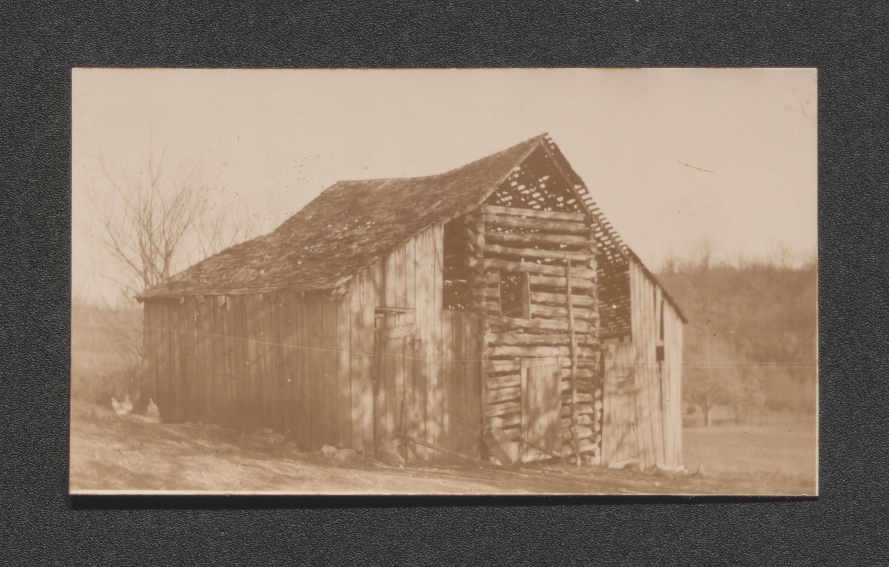
Exhibit 4B run down improvements adjoining Dinwiddie home, undated
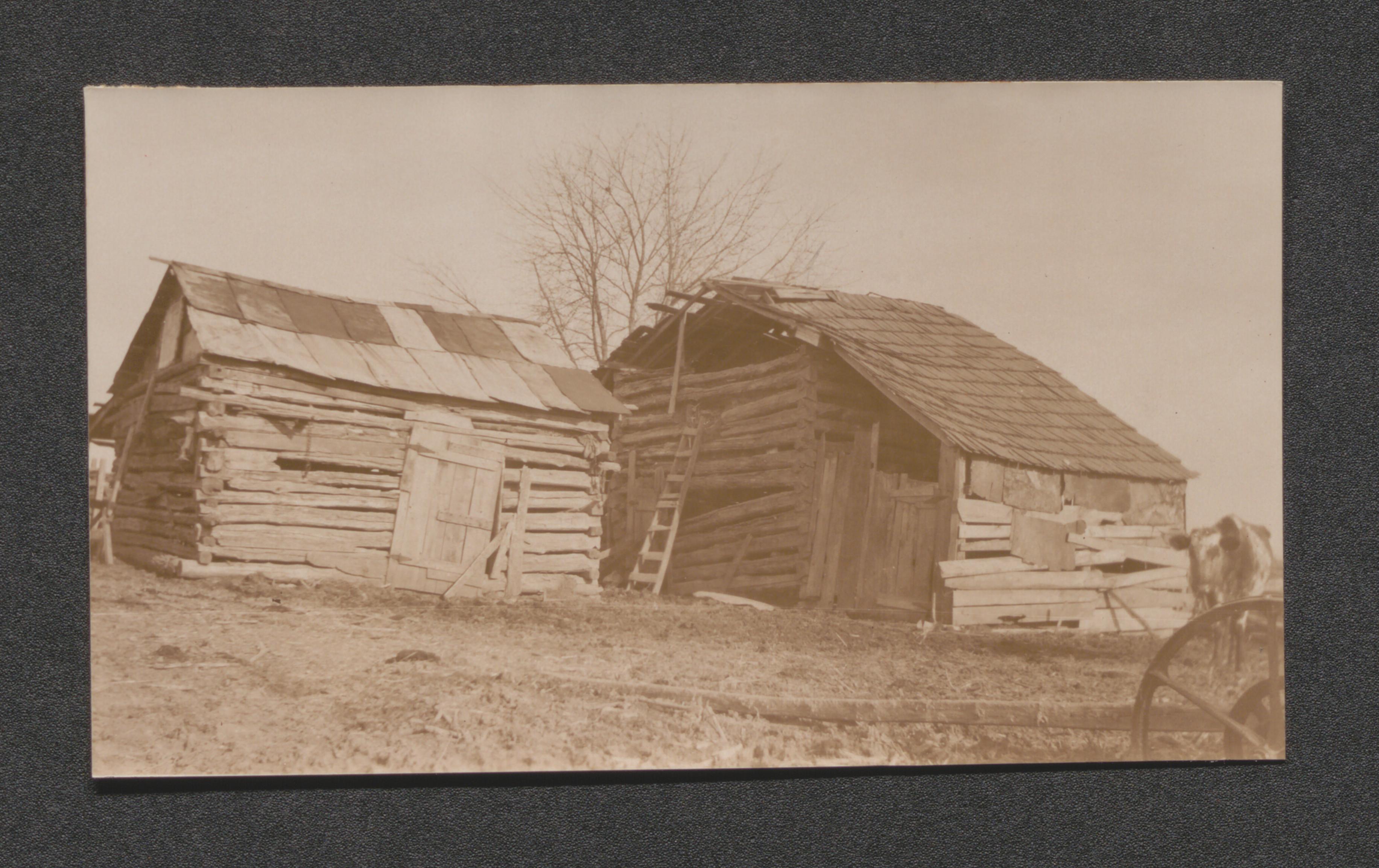
Exhibit 4C highest type of improvements in the area, undated
Tinsley house and barn tract no. 73, undated
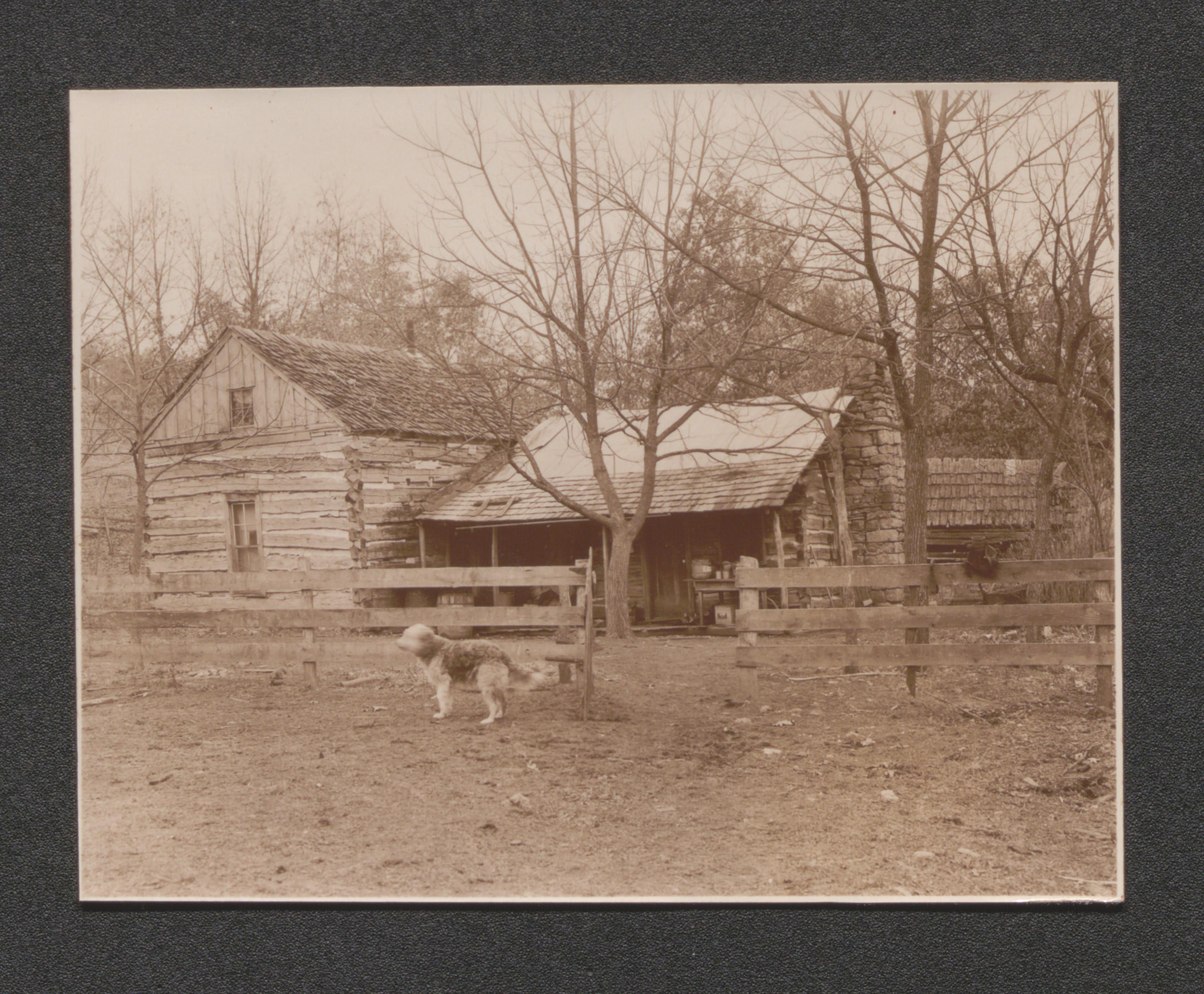
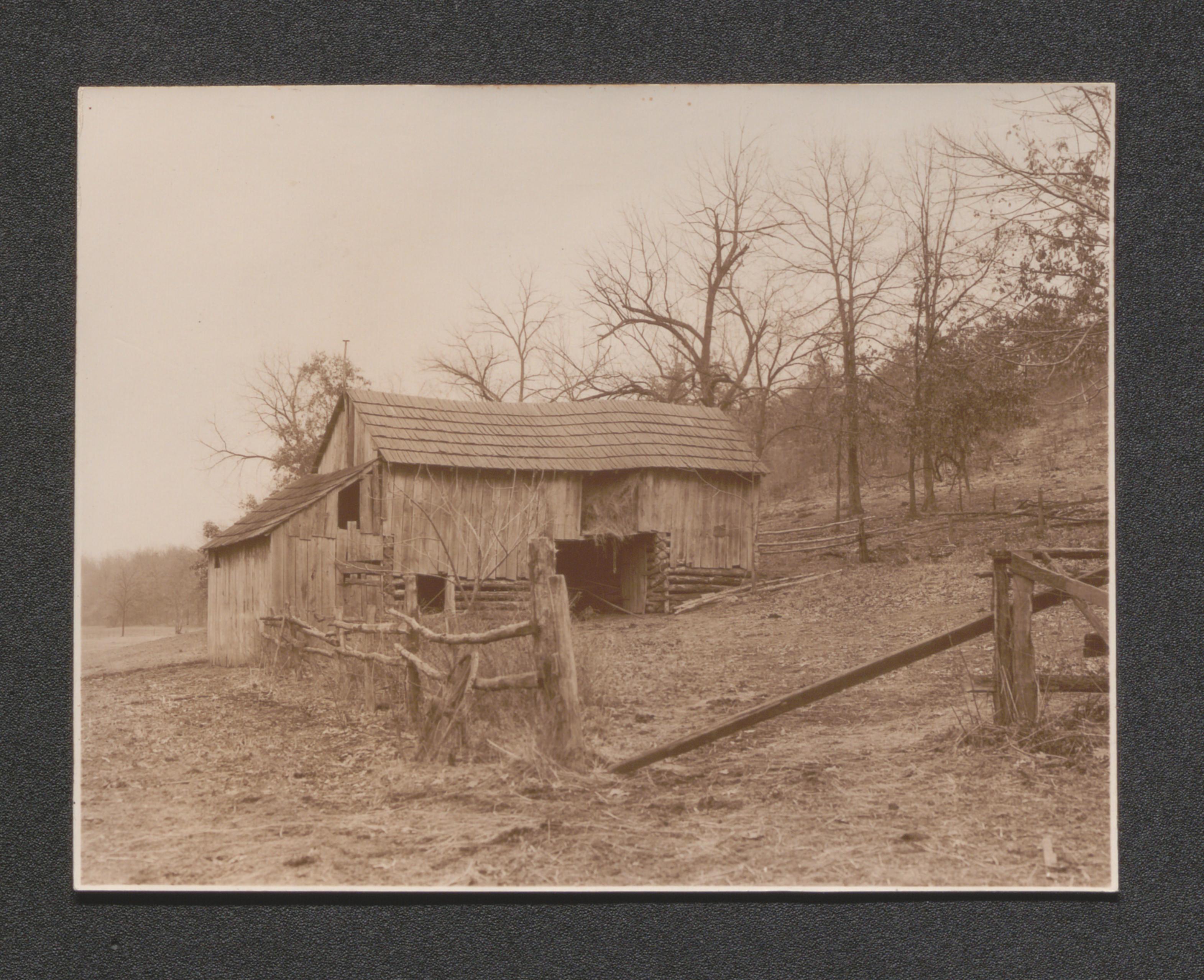
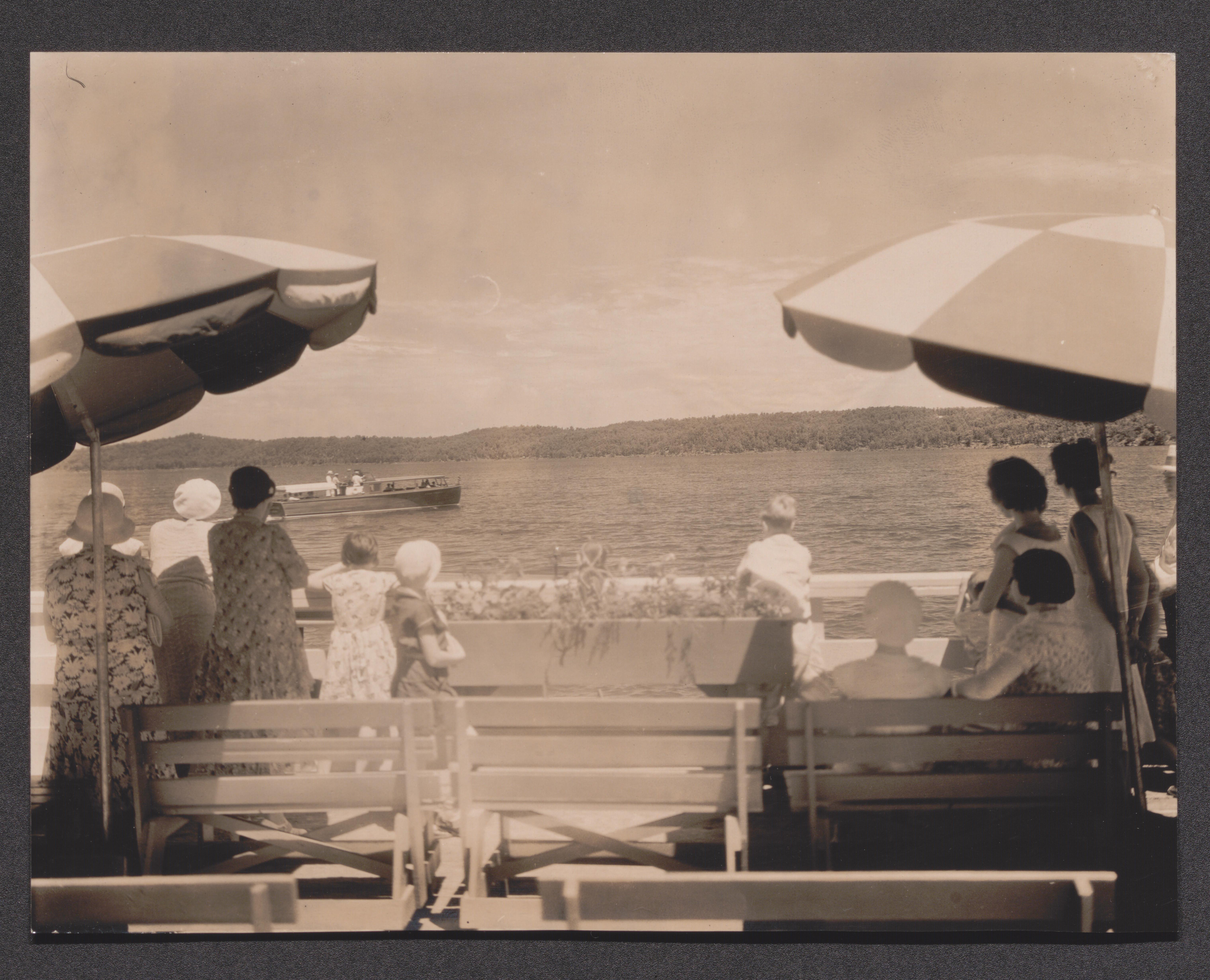
Exhibit 5G people swimming in a lake, undated
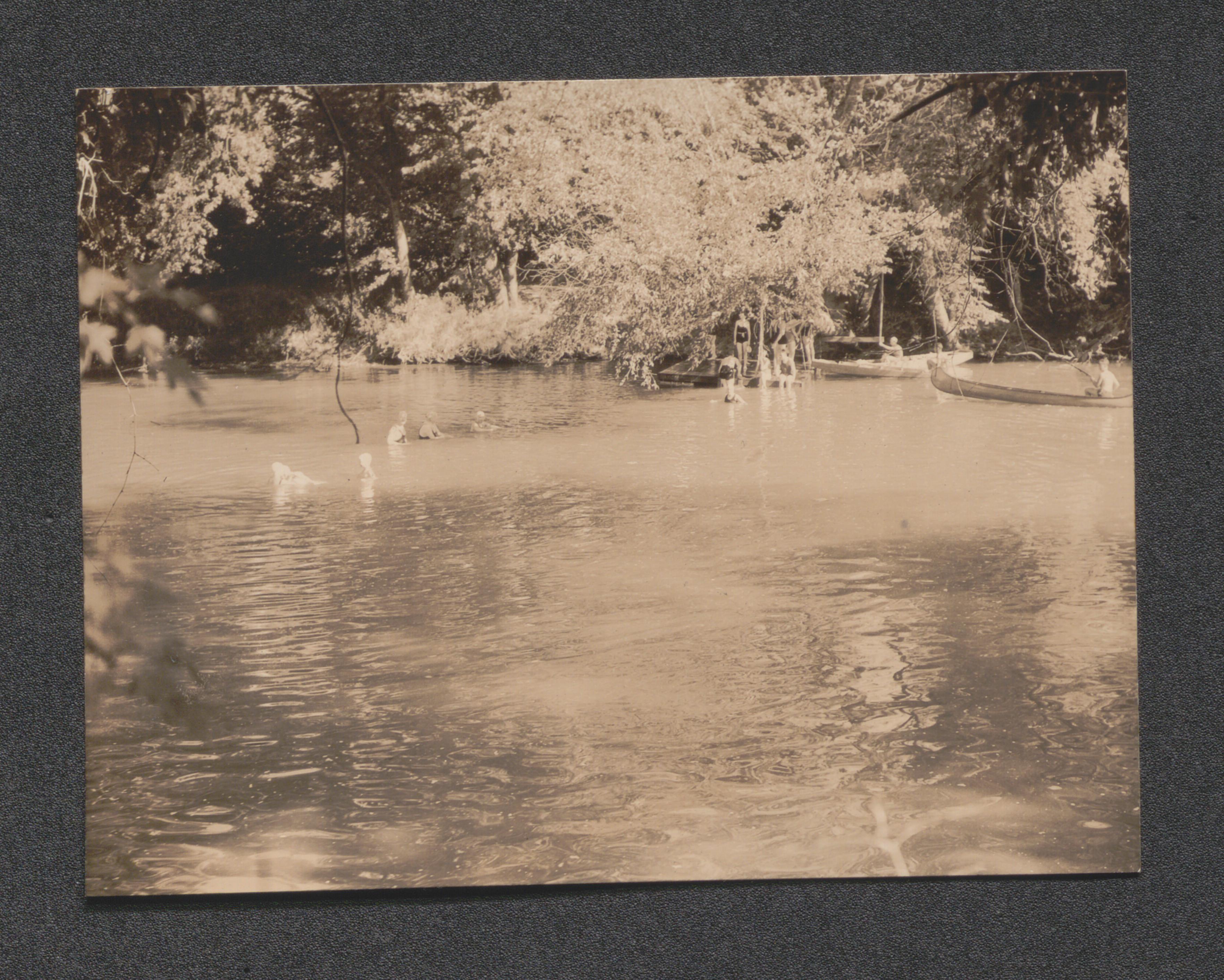
Exhibit 5G diving board into lake, undated
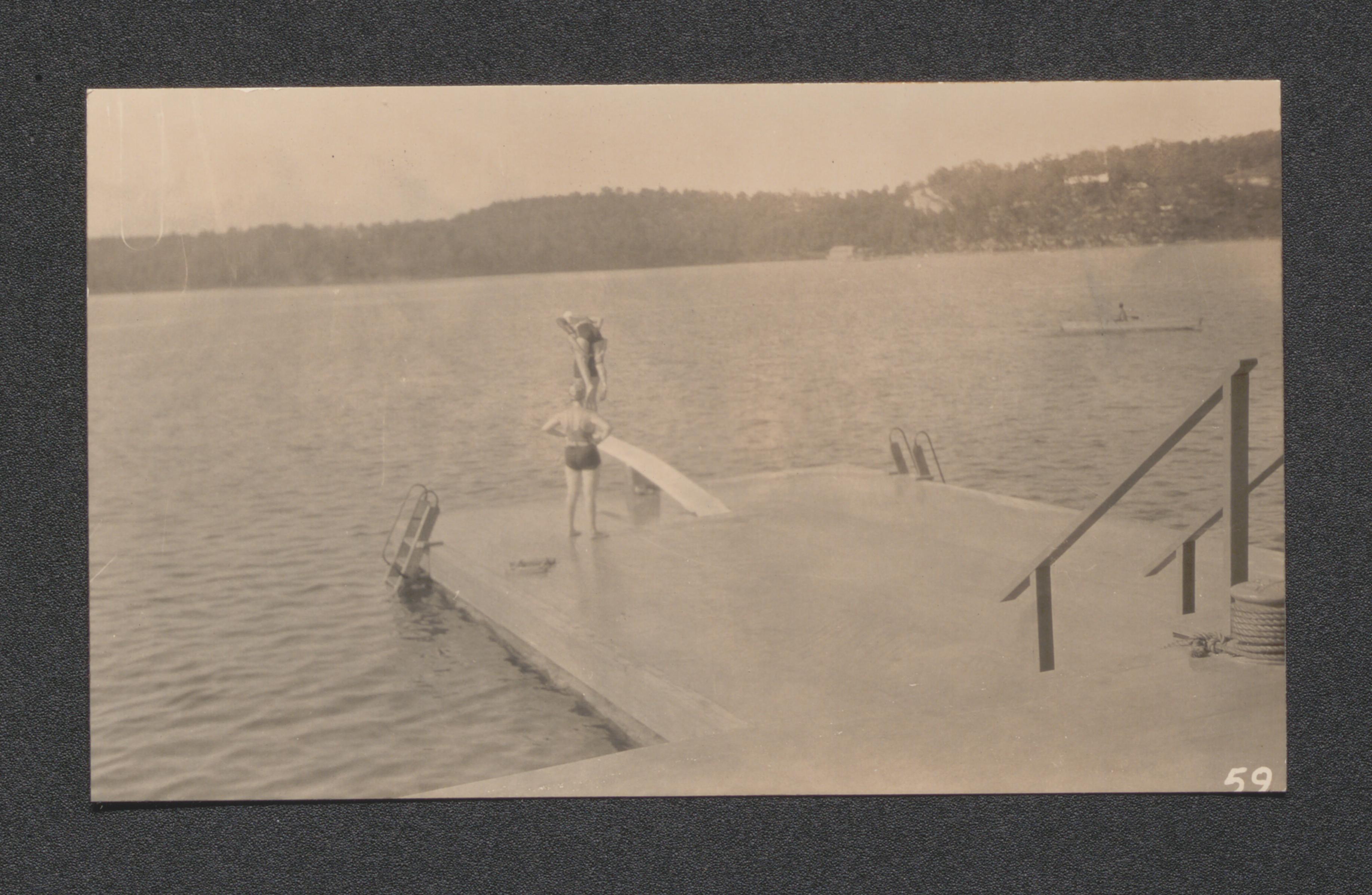
Exhibit 5G swimmers at the beach, undated
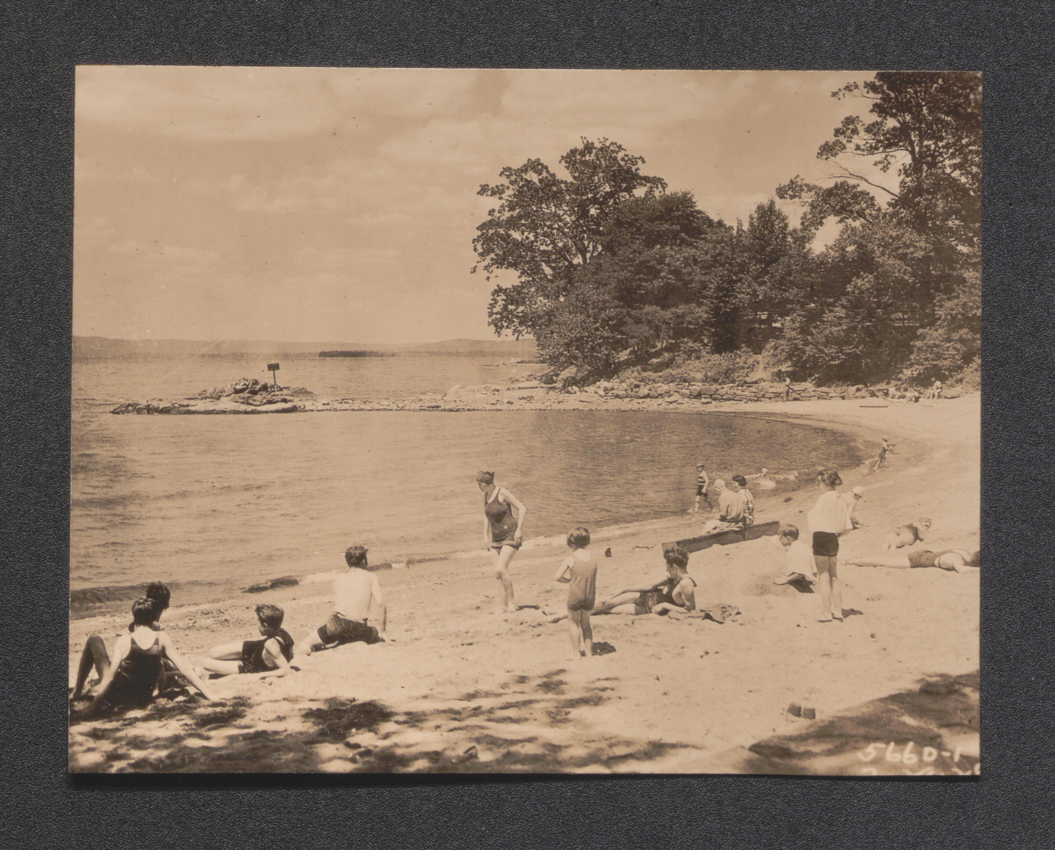
Exhibit 5G boat in lake, undated
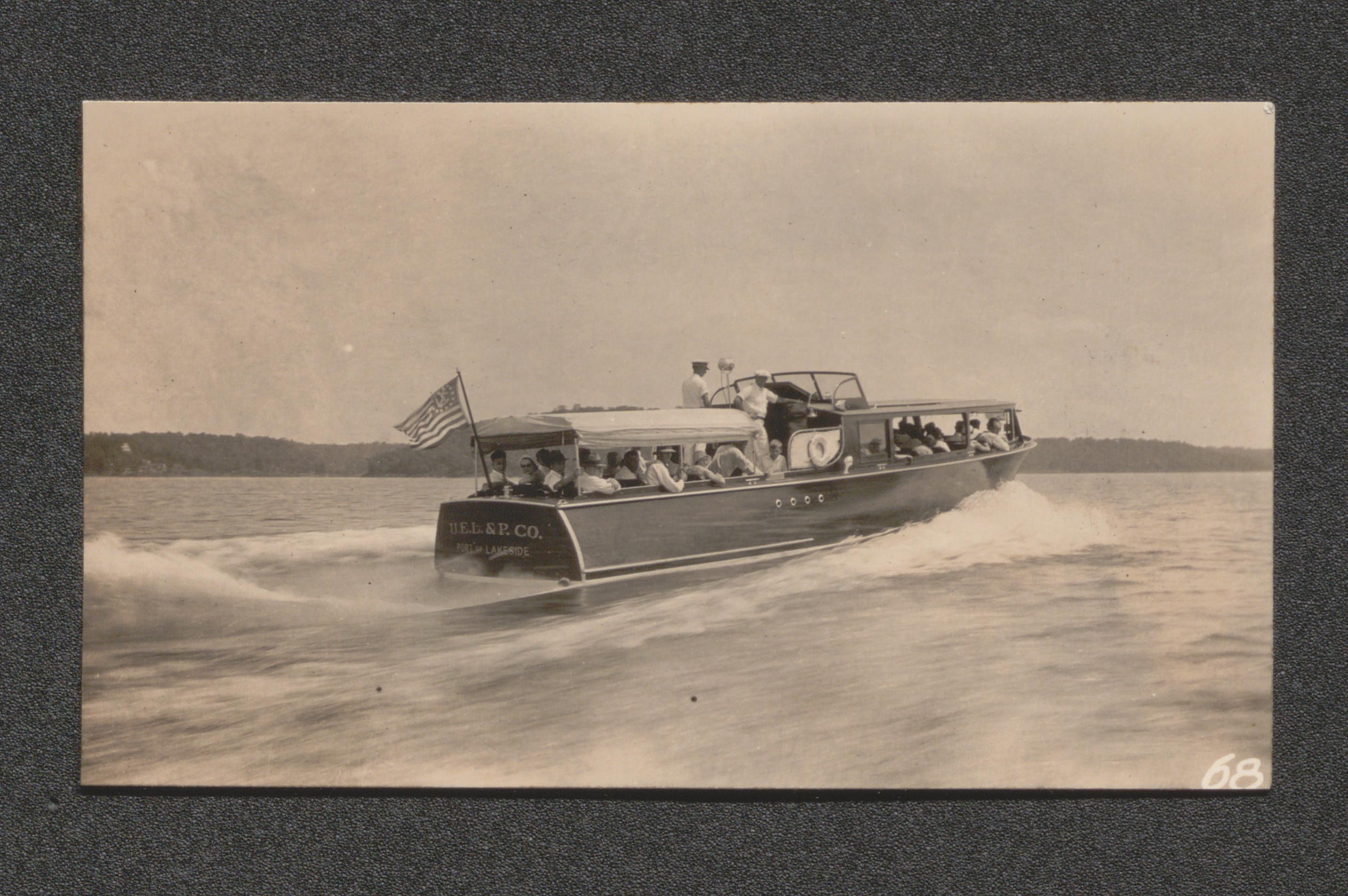
Exhibit 5G boat at dock, undated
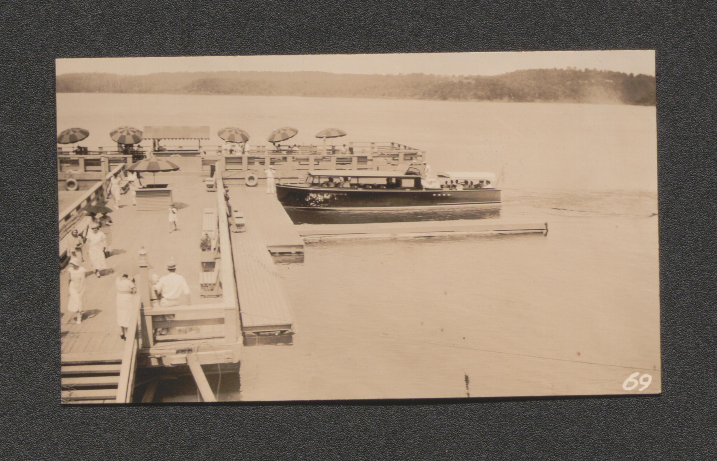
Exhibit 5A broad ridge top cultivated in small grain, undated
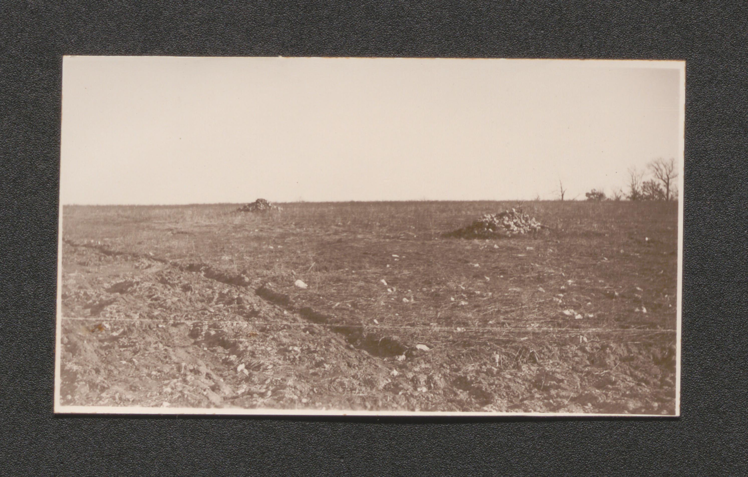
Exhibit 5A Clarksville gravelly loam on cleared hill slope, undated
Exhibit 5A narrow branch bottom for cereal grains, undated
Exhibit 5A land returned to pasture in 1918 gulley erosion still active, undated
Exhibit 5A Huntington silt loam bottom used chiefly for corn, undated
Exhibit 5A side slope spring on Clarksville stony loam, undated
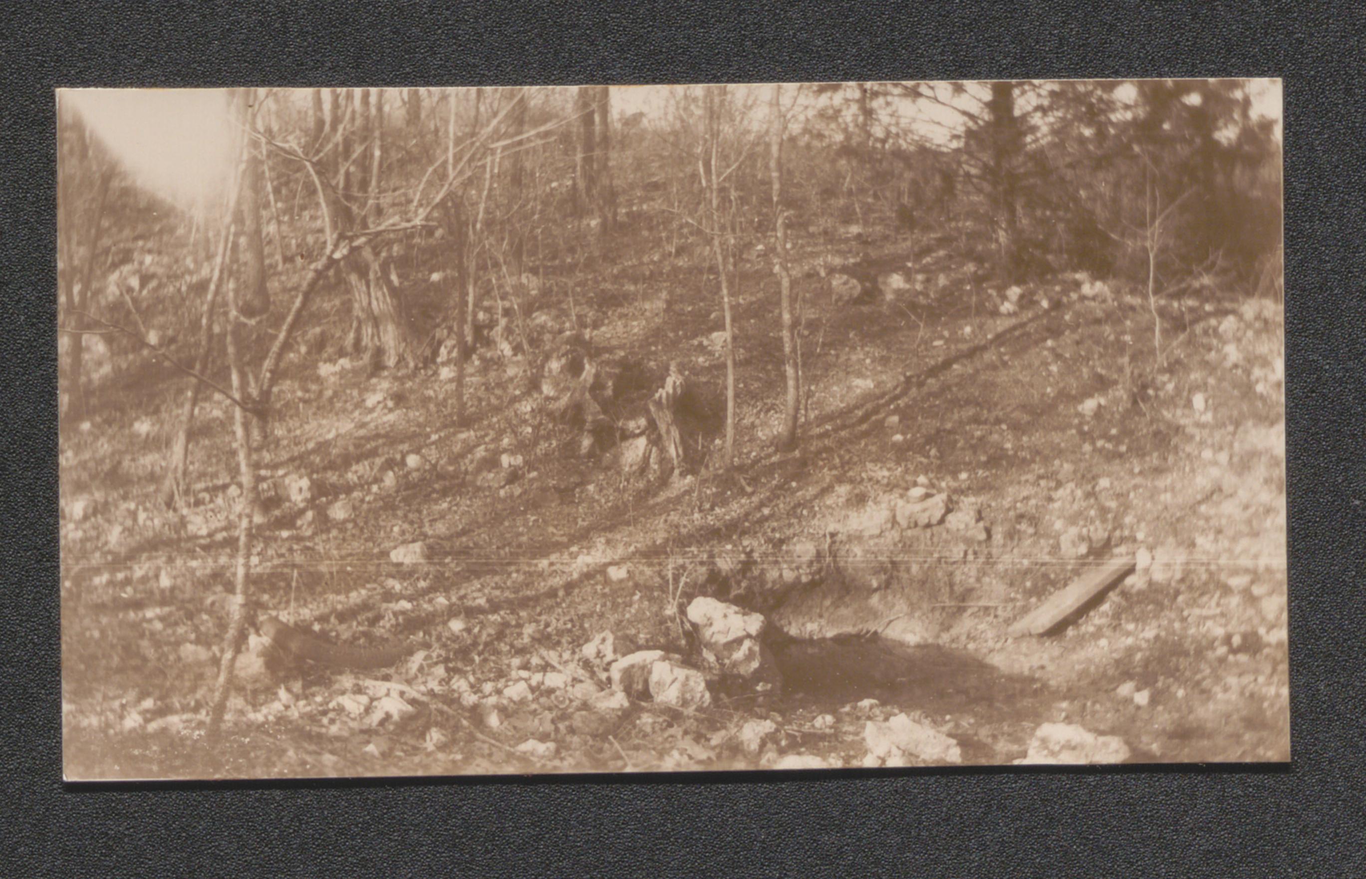
Exhibit 10A Watson School Camden County to be abandoned, undated
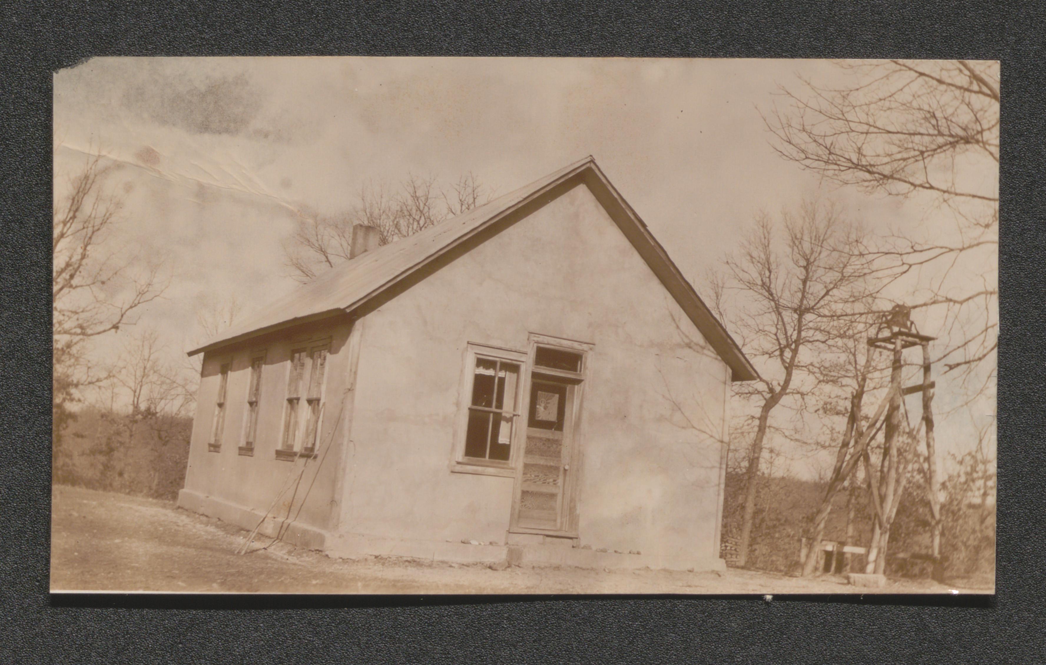
Exhibit 5B men in queue area, undated
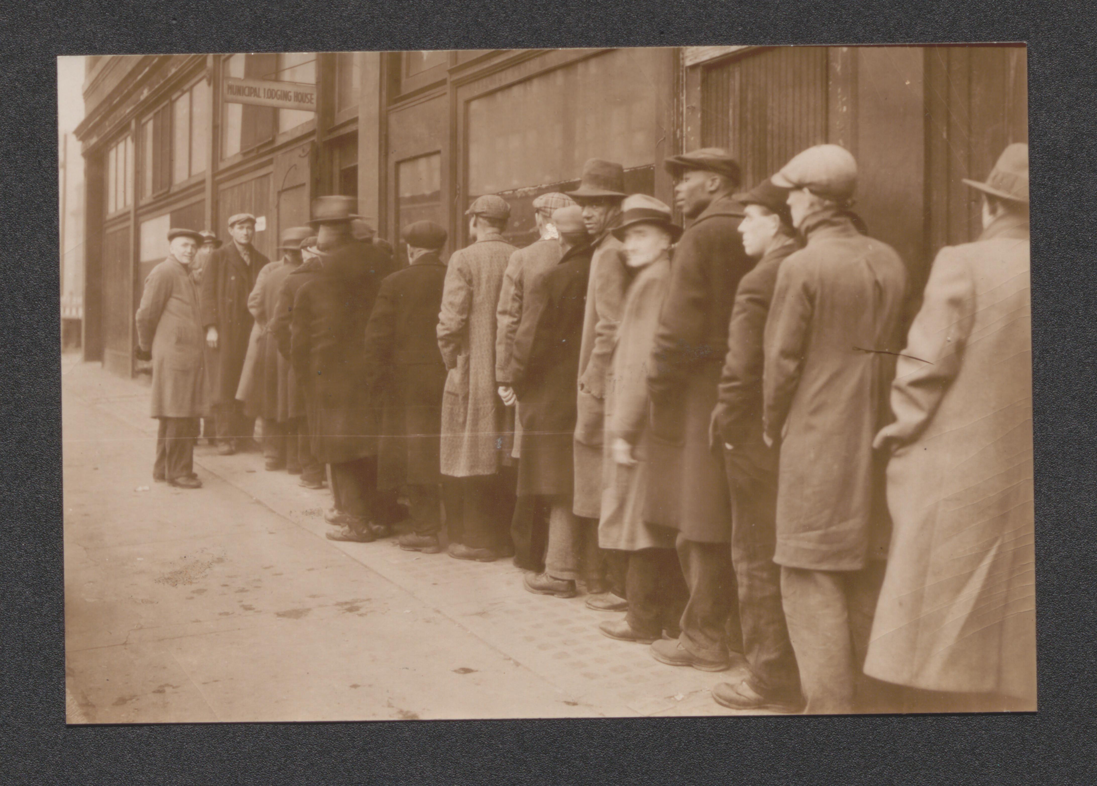
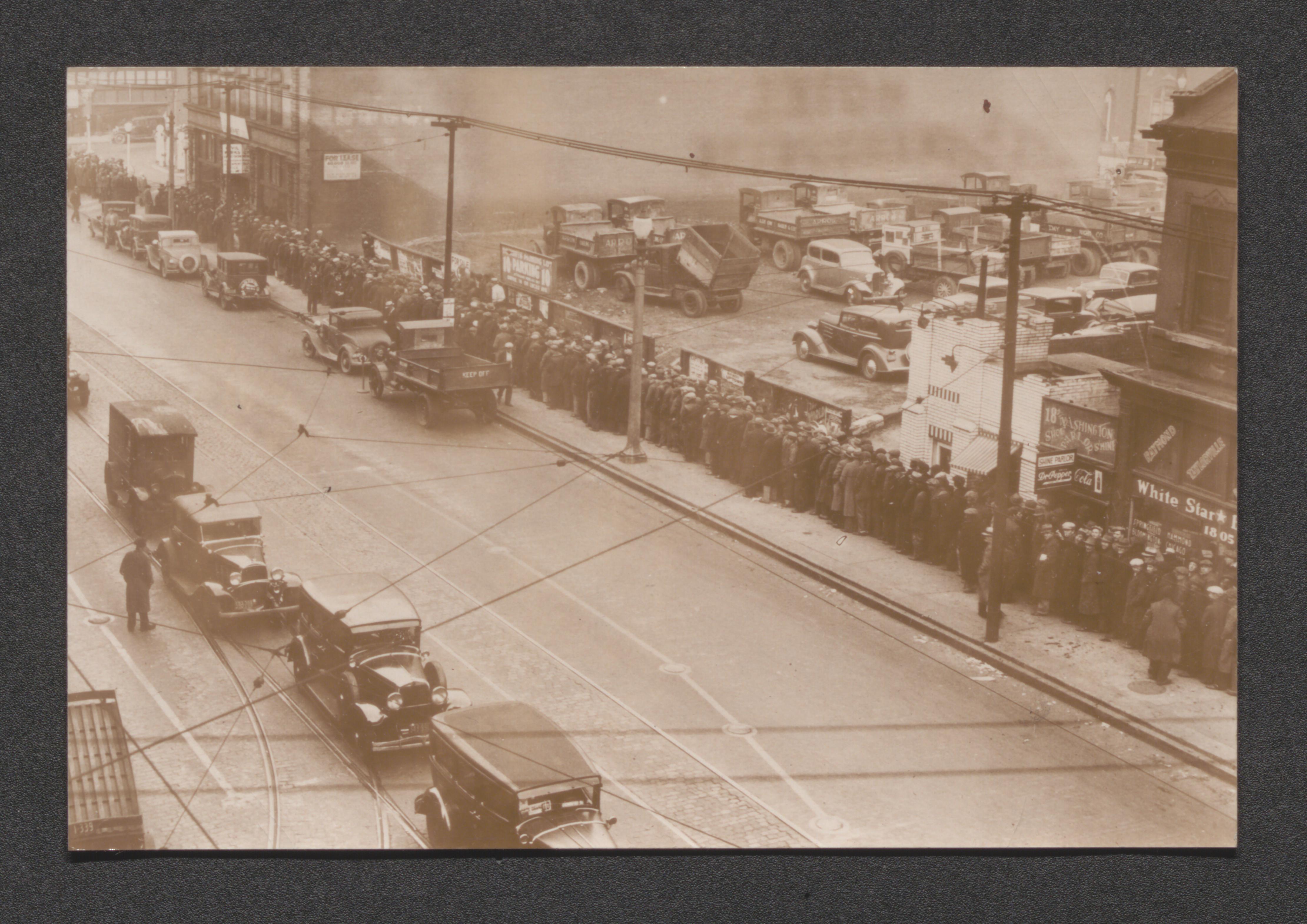
Exhibit 5C children at street corner, undated
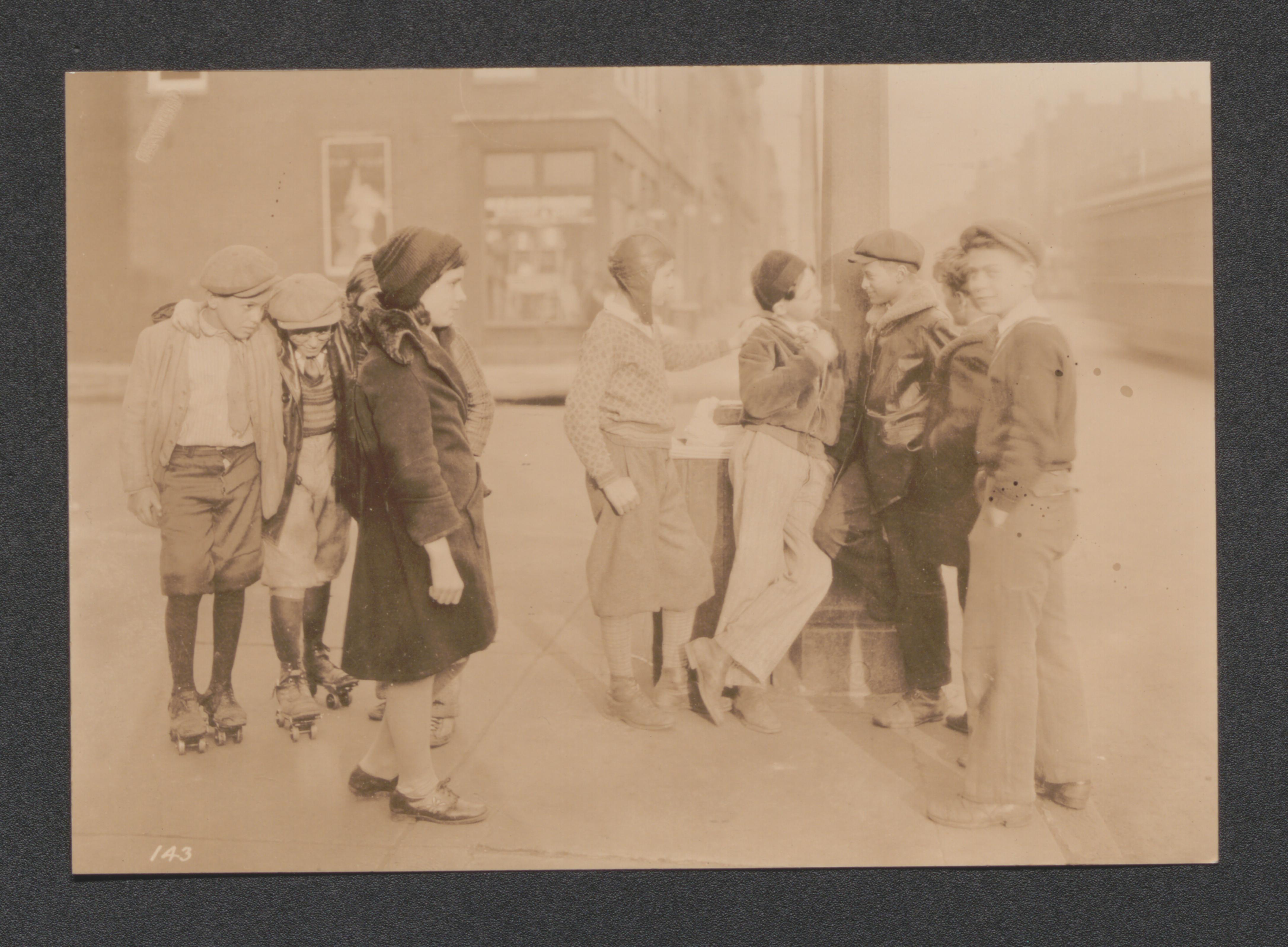
Exhibit 5C African American children gathering water, undated
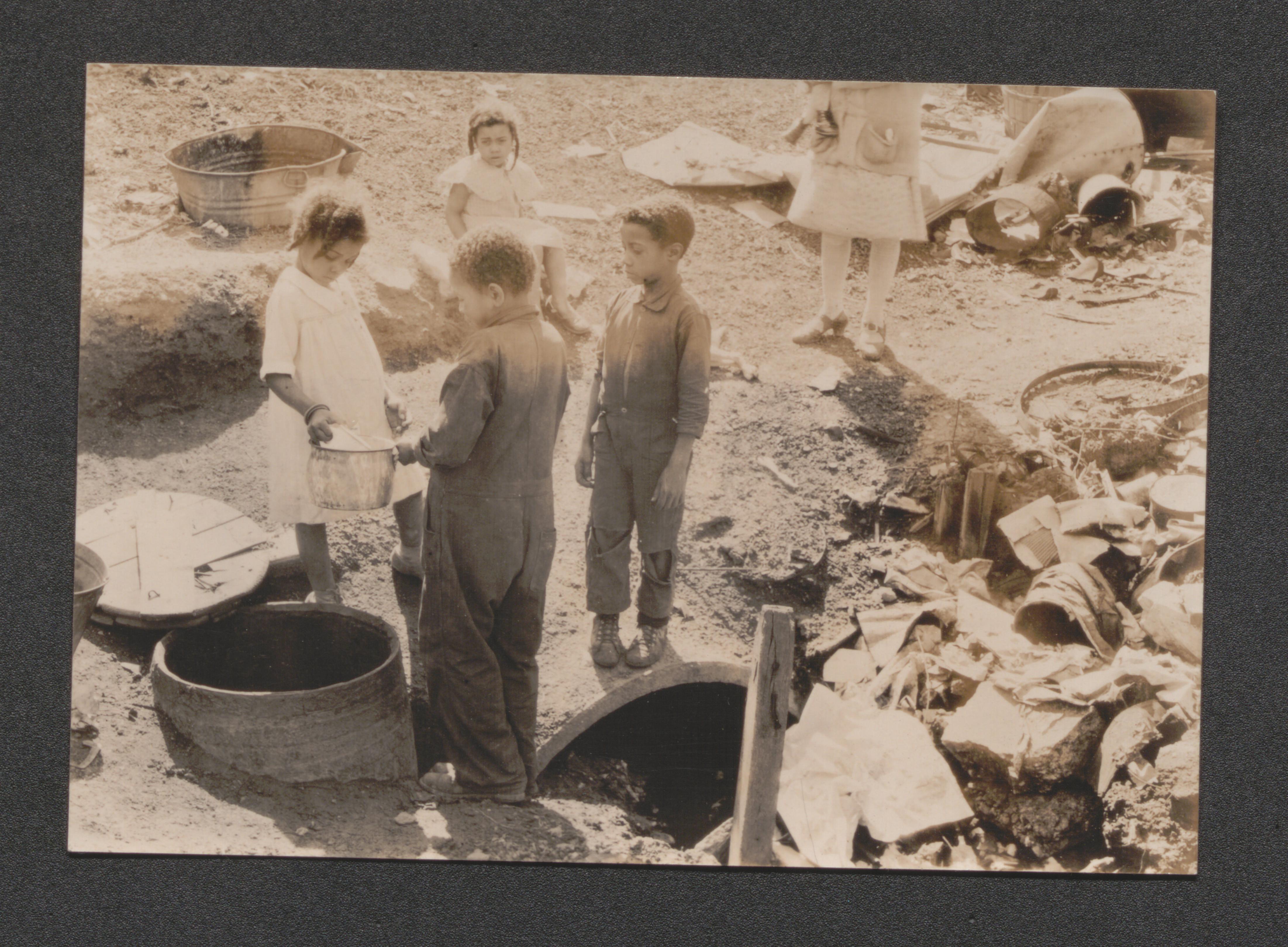
Exhibit 5C shanty town on river, undated
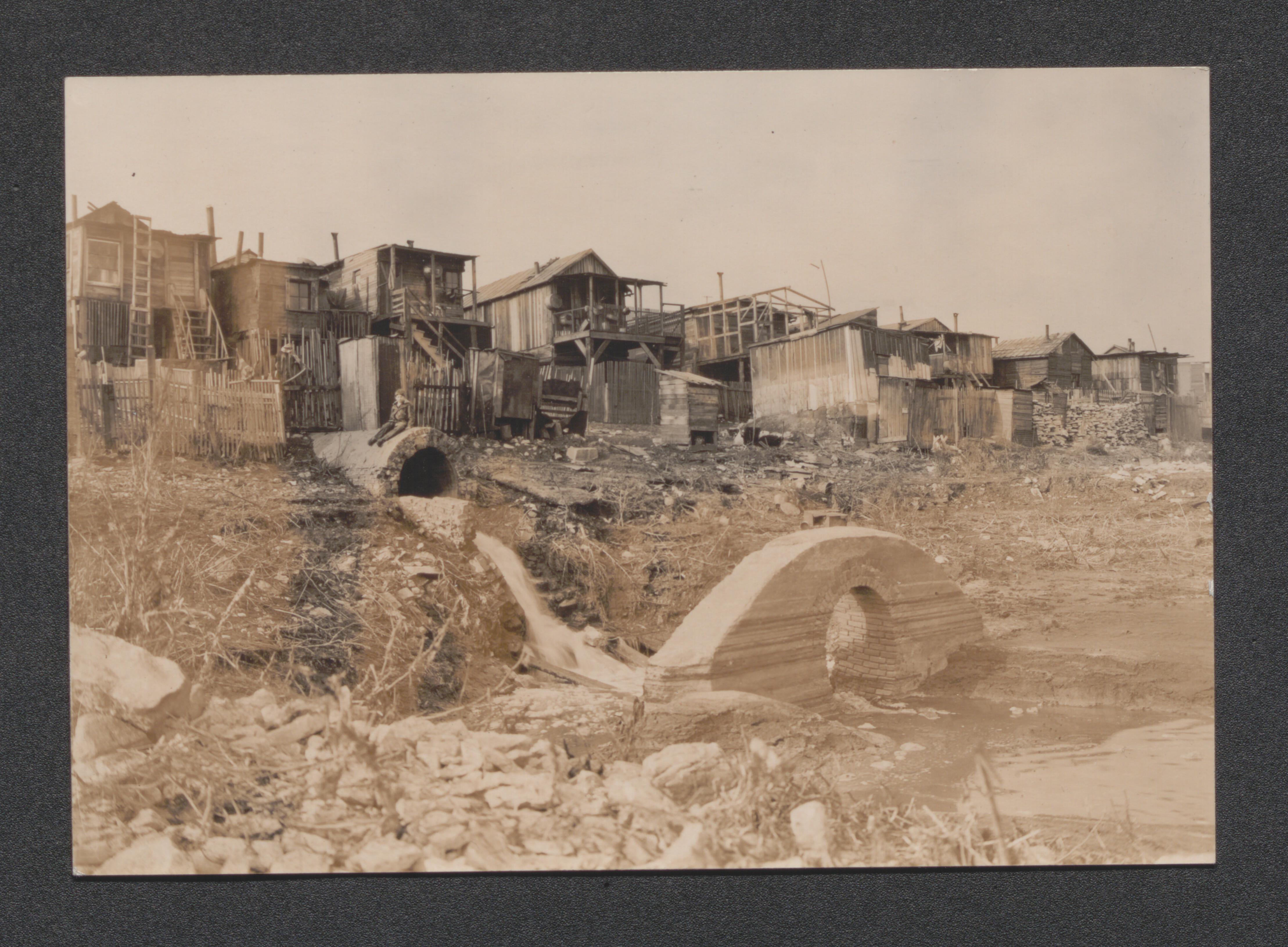
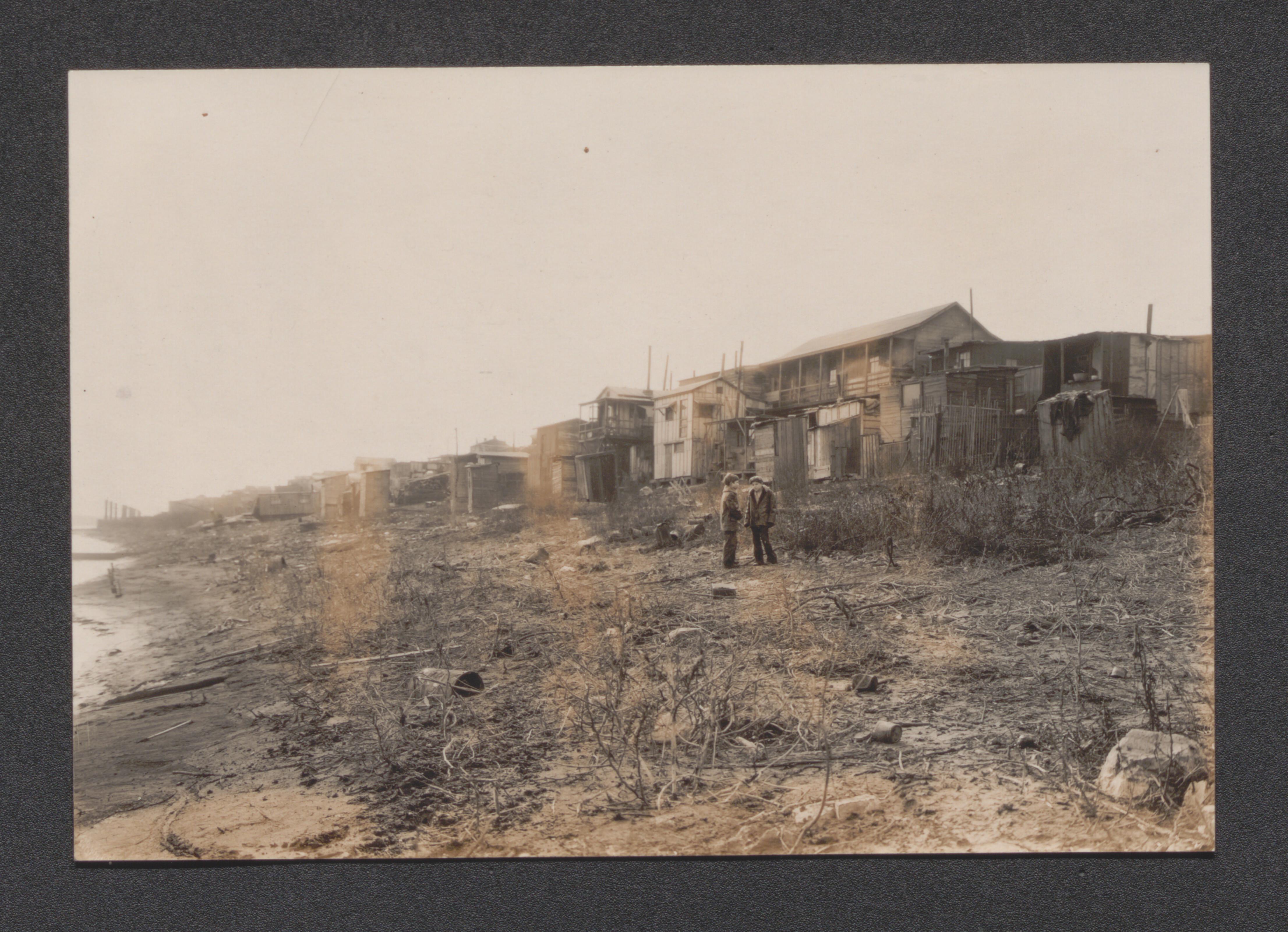
Exhibit 5D African American mother with children and female aid worker, undated
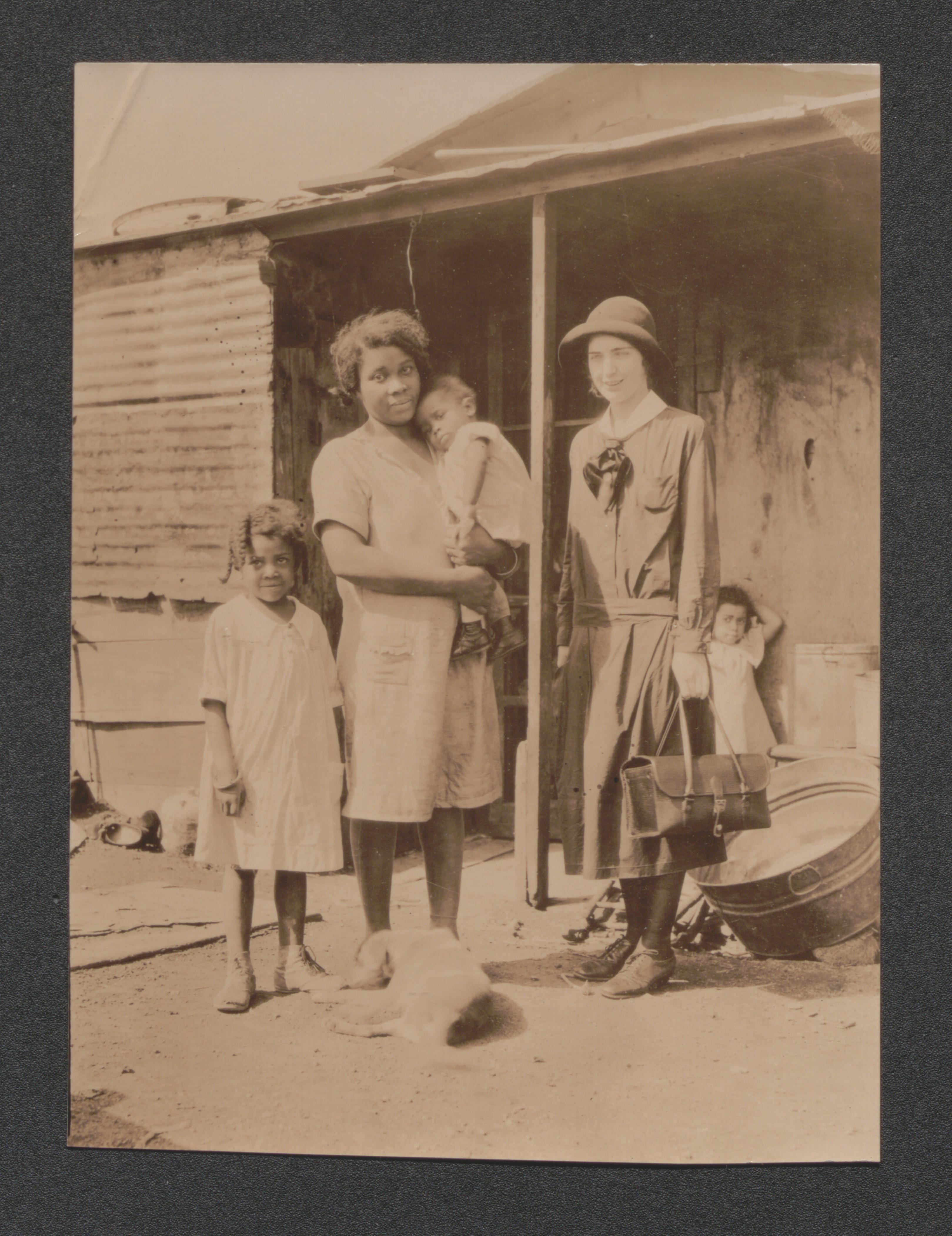
Exhibit 5D children boxing, undated
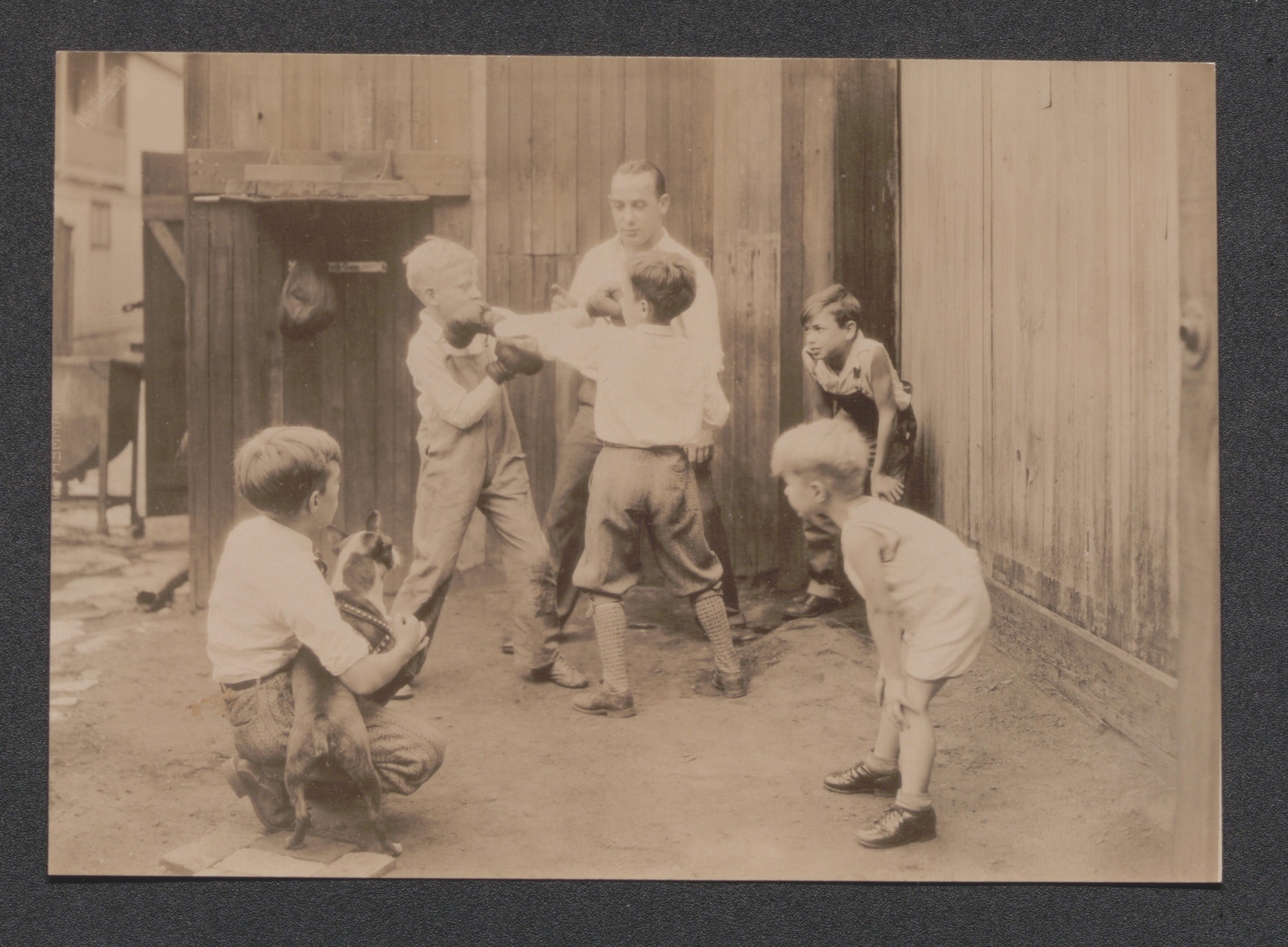
Exhibit 5D children playing on monkey bars, undated
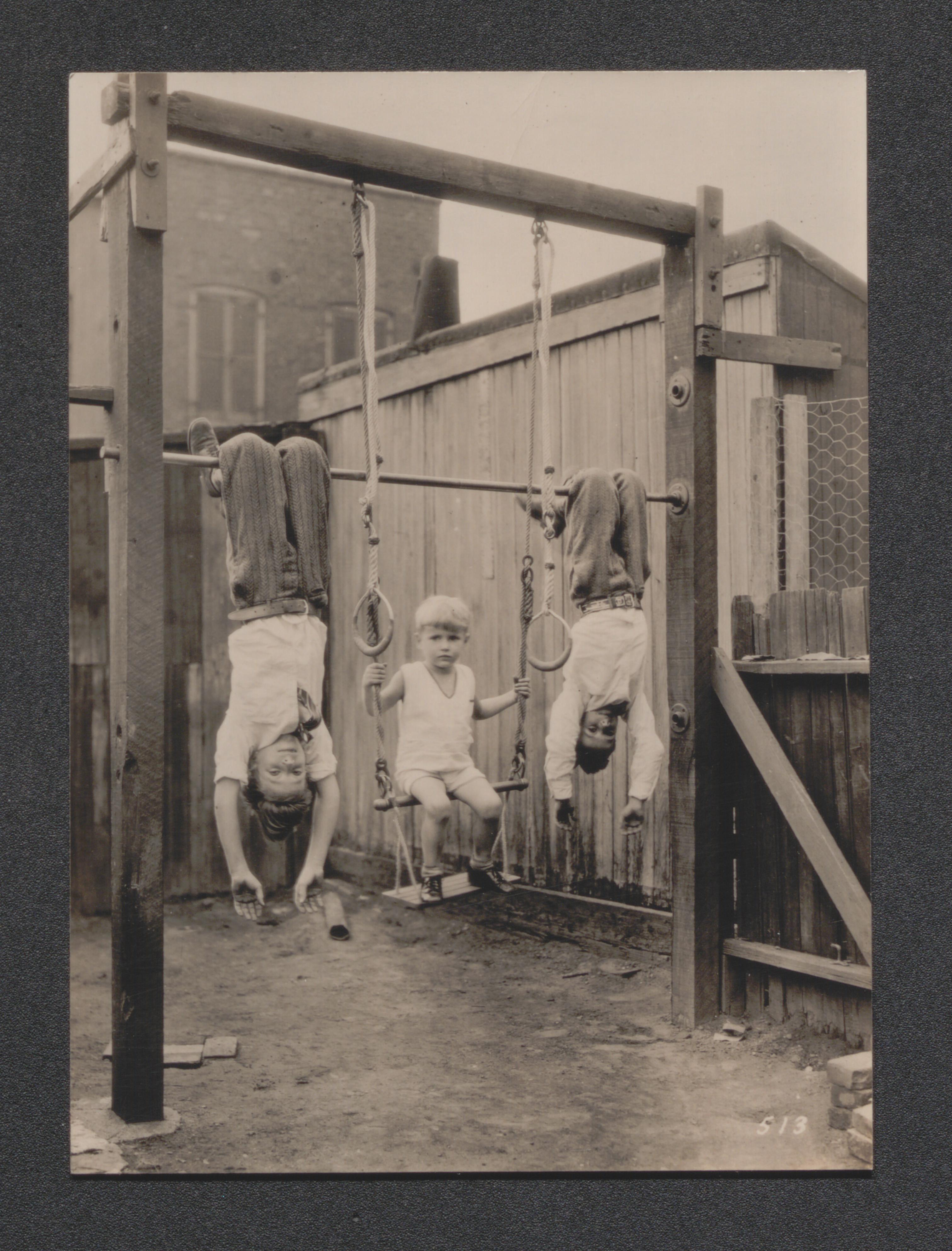
Exhibit 5D shanty town on river, undated
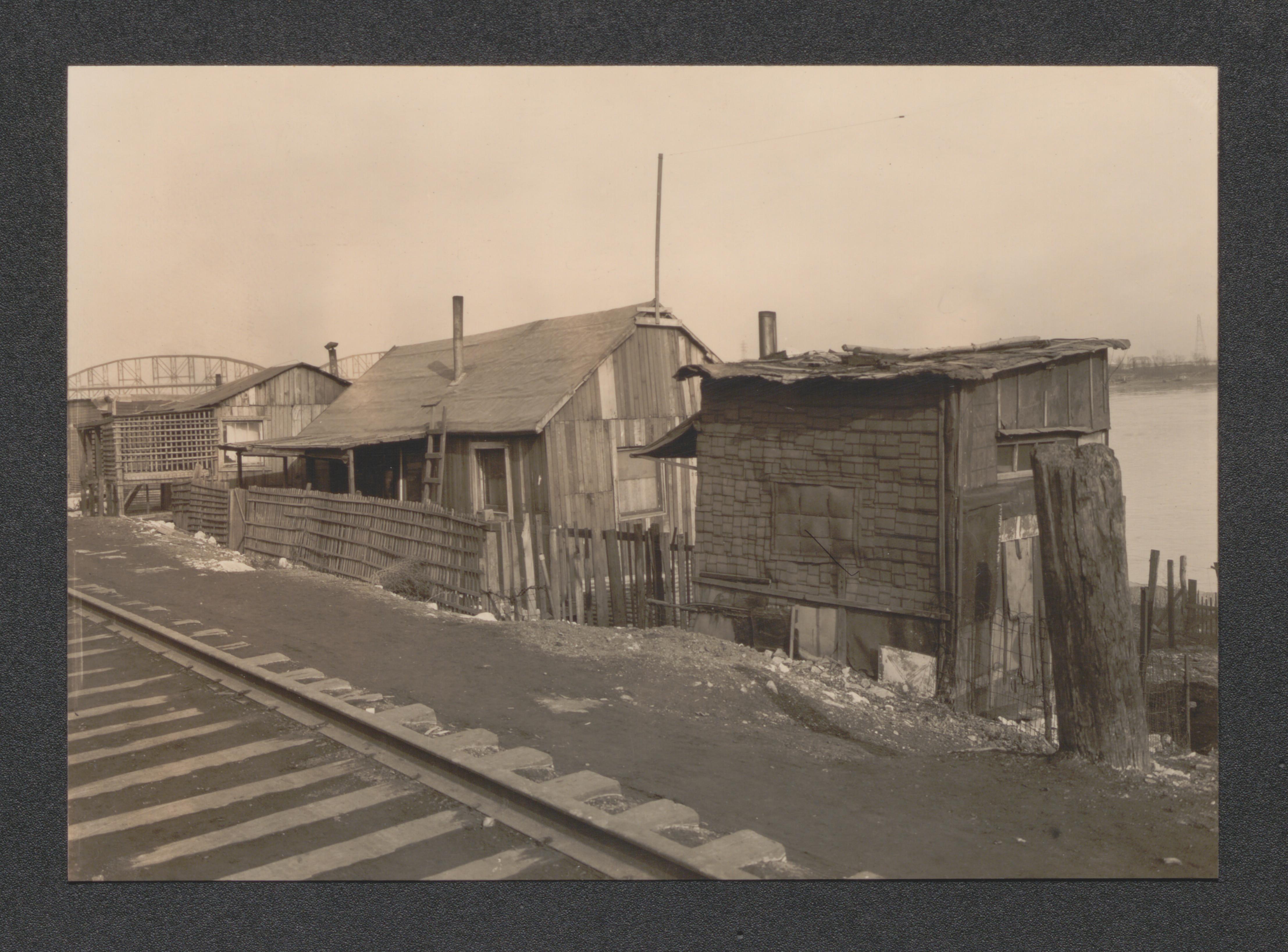
Exhibit 5D disconsolate mother with son and daughter, undated
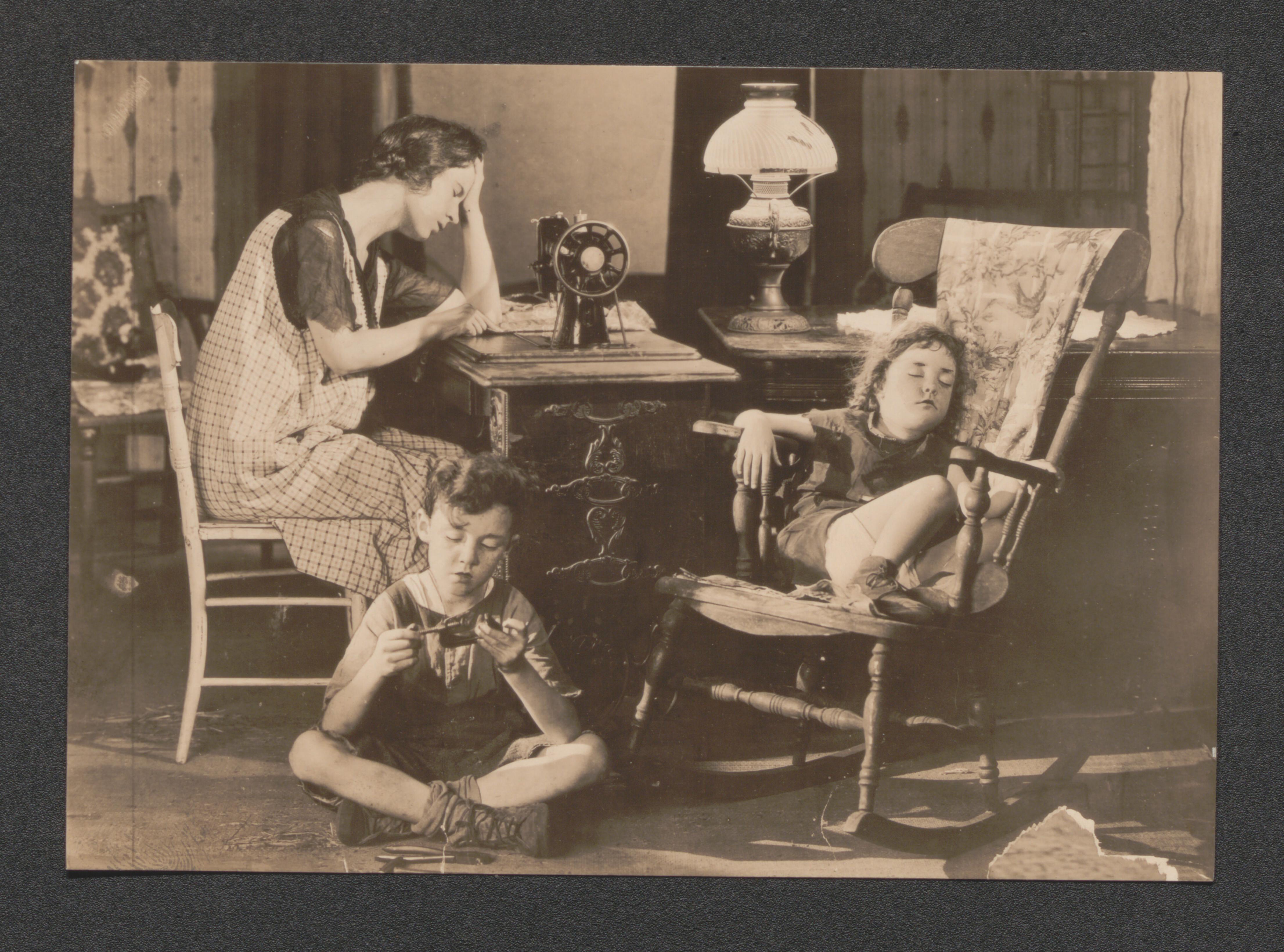
Exhibit 5D dirt road in slum, undated
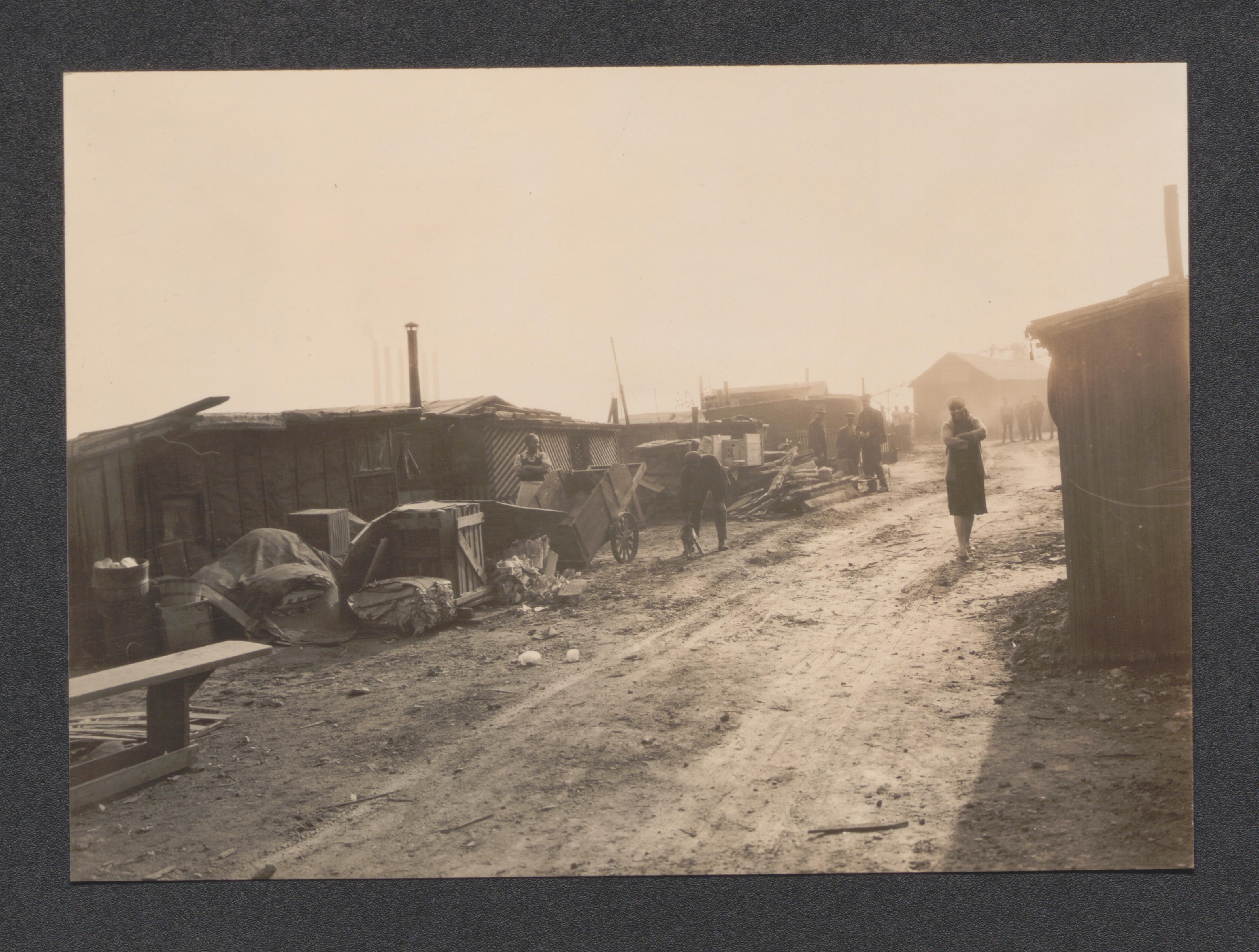
Exhibit 5D industry and slum on river, undated
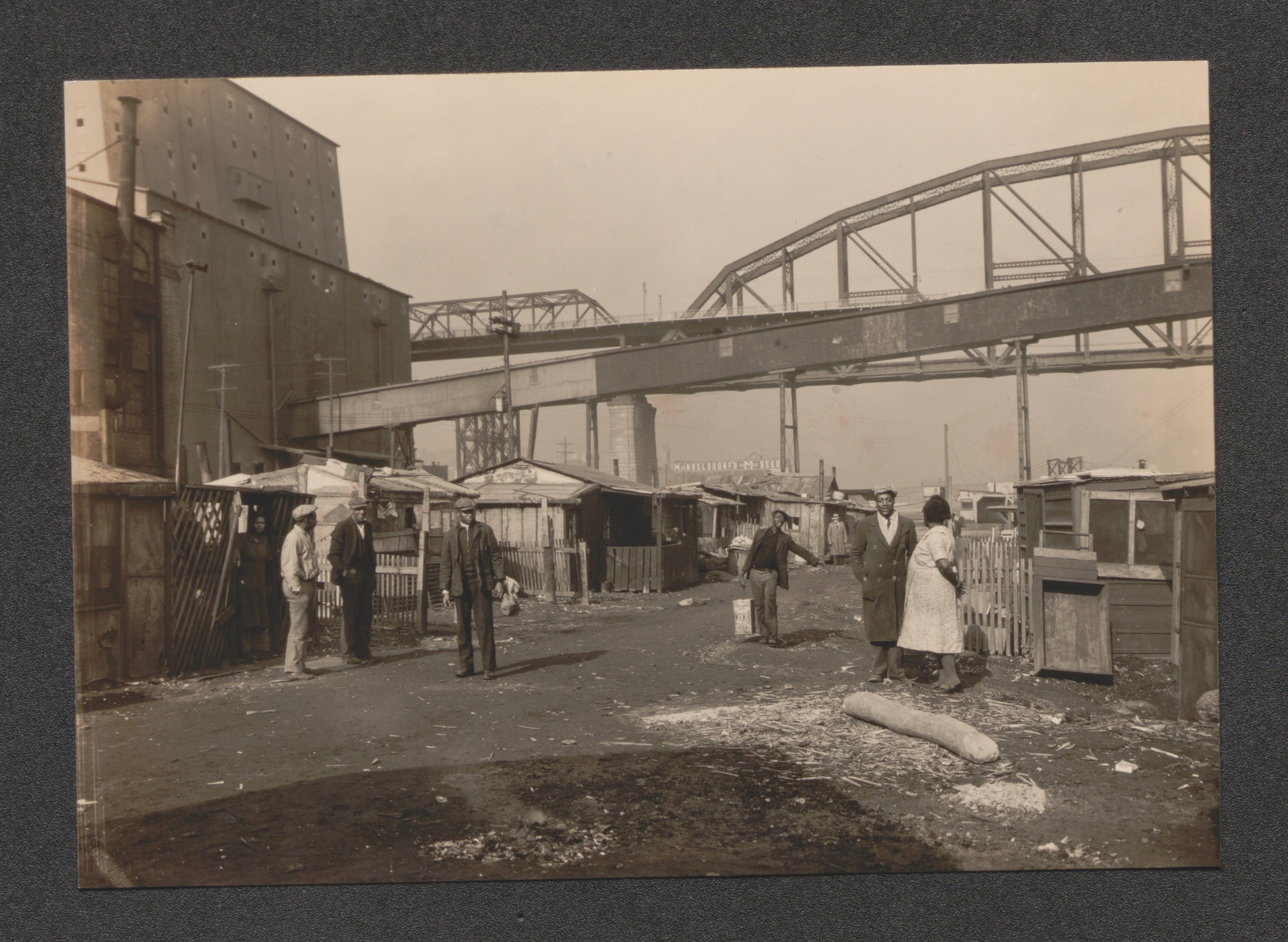
Exhibit 5D girls at playground, undated
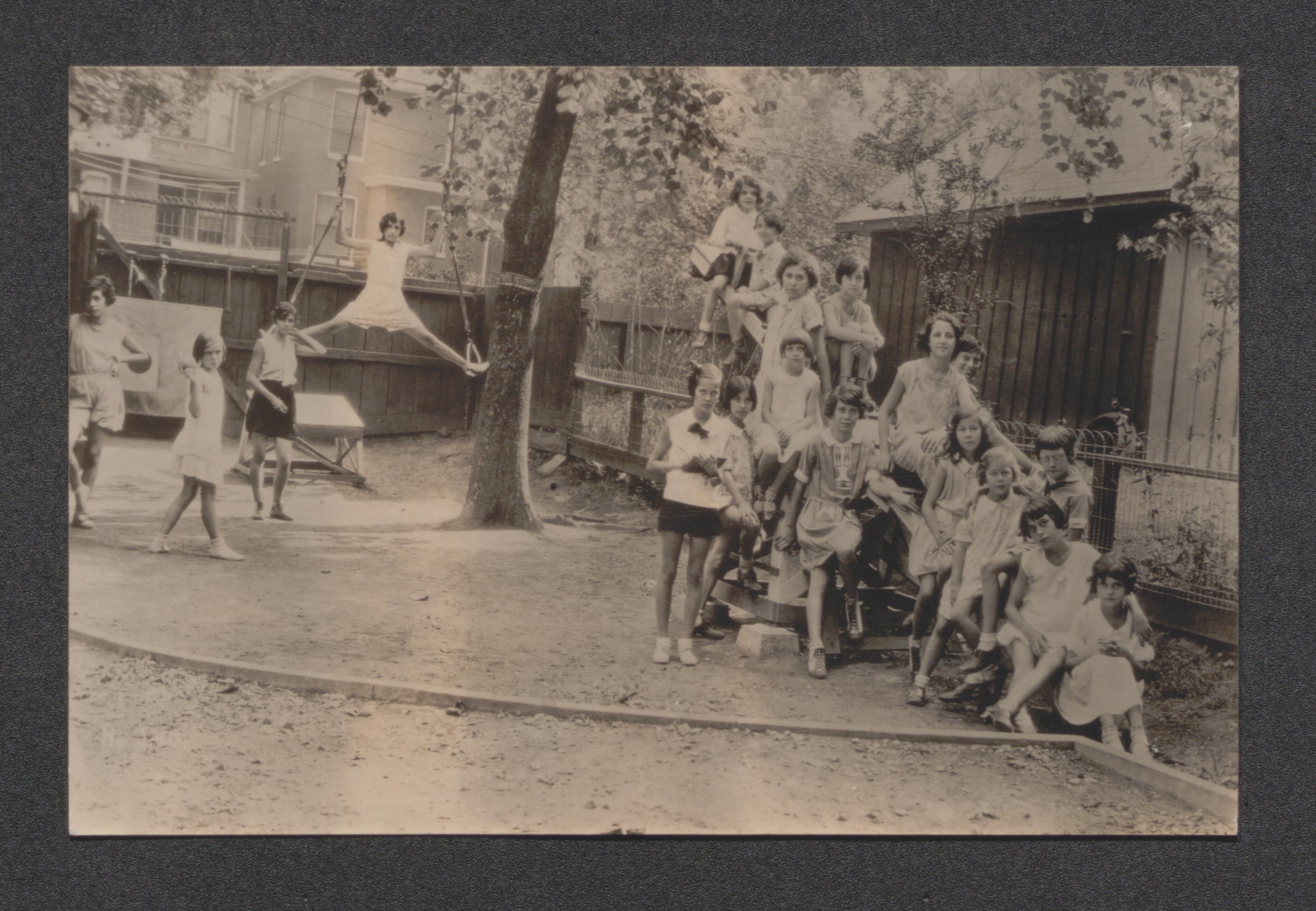
Exhibit 5D shanty town, undated
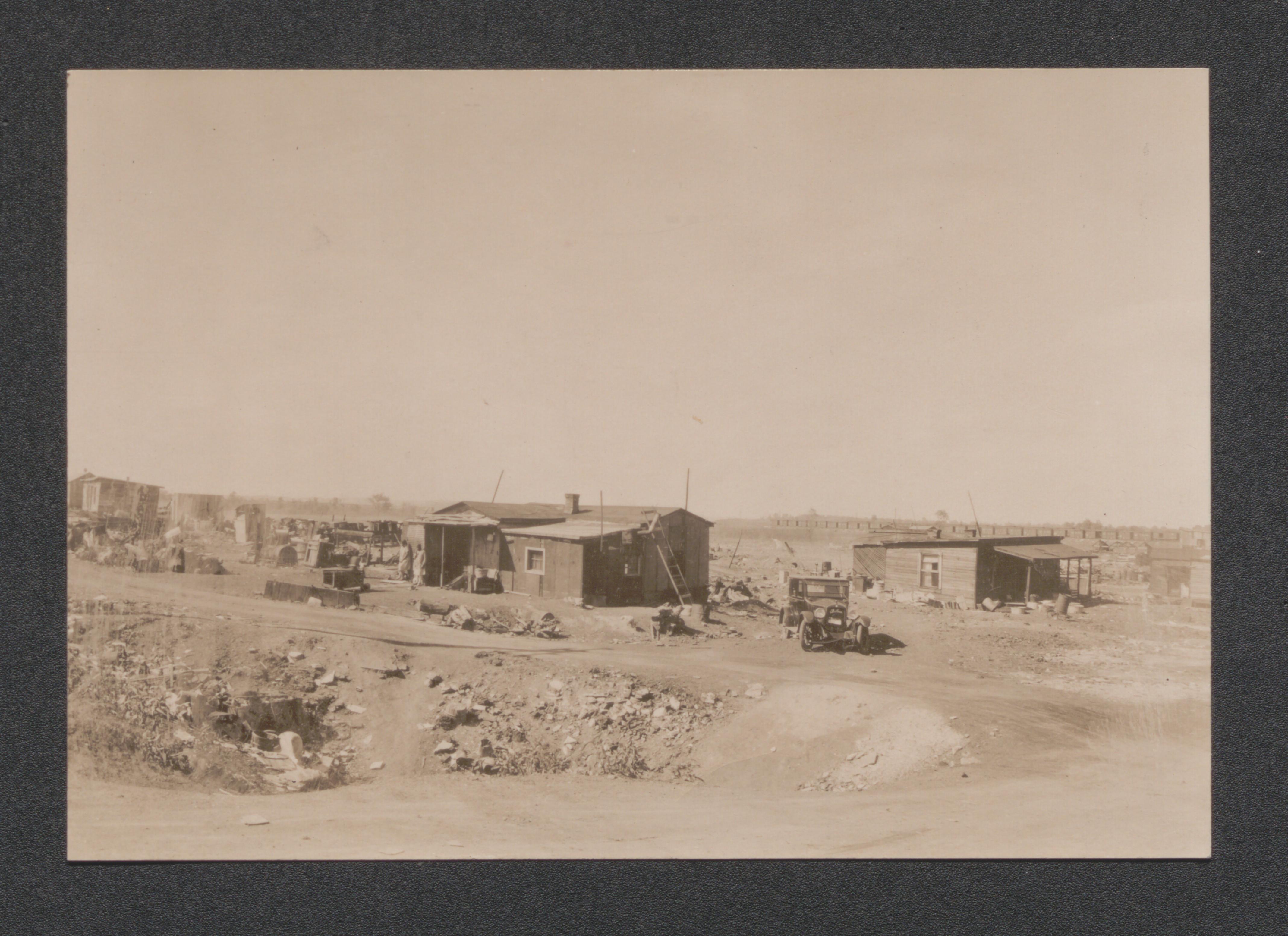
Exhibit 5F shoreline view, undated
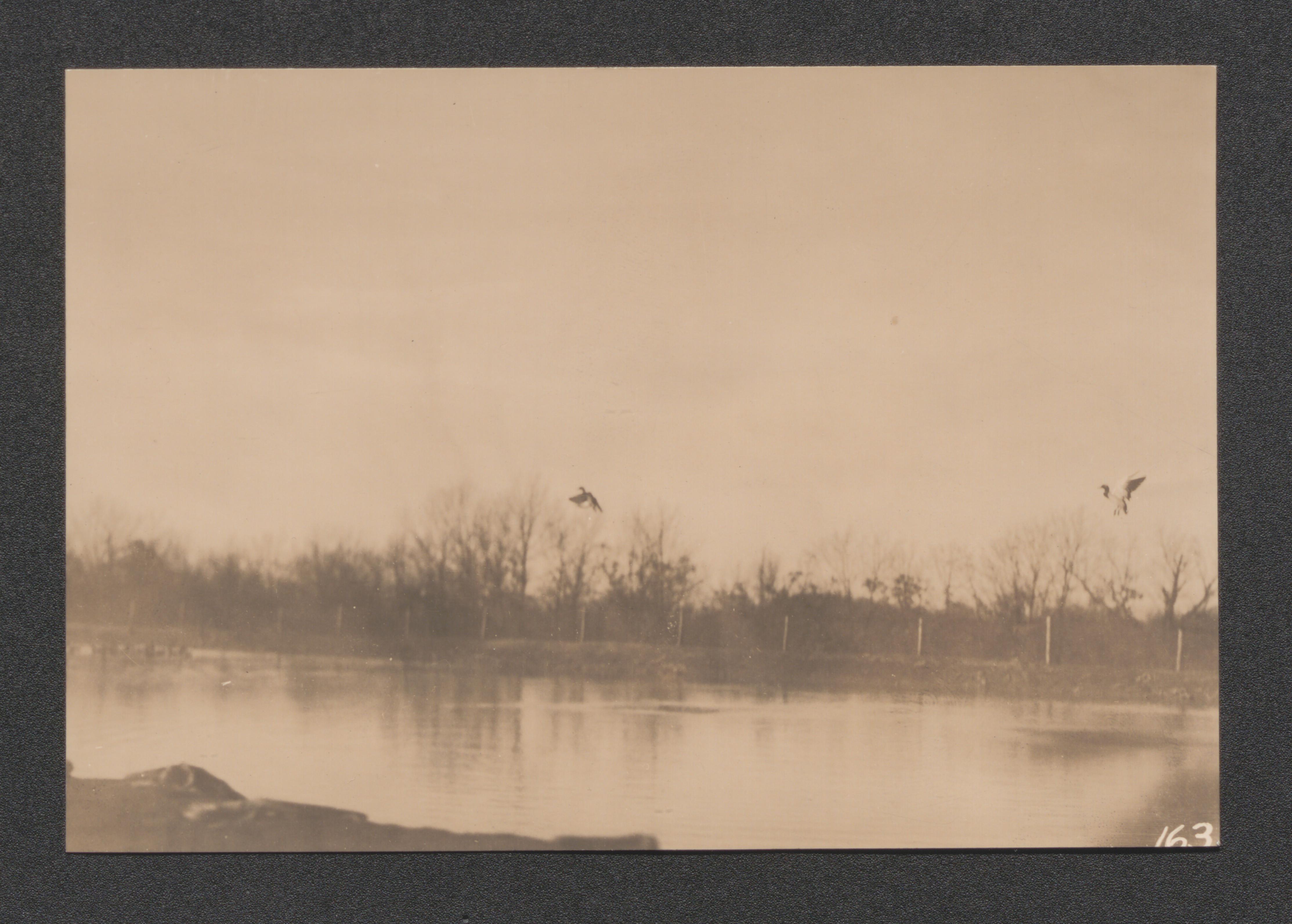
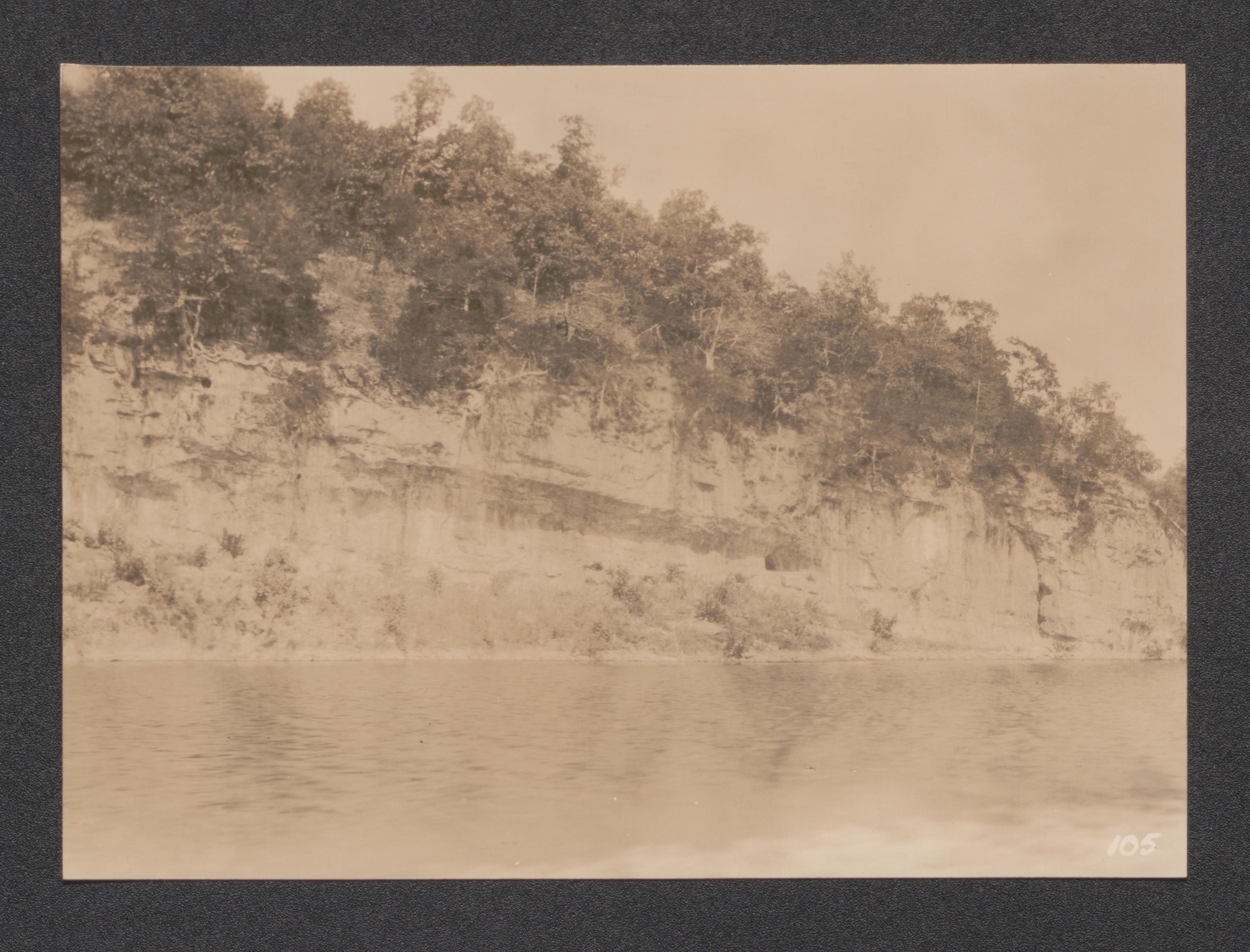
Exhibit 5G boat entering dock, undated

Exhibit 5G boat in the lake, undated
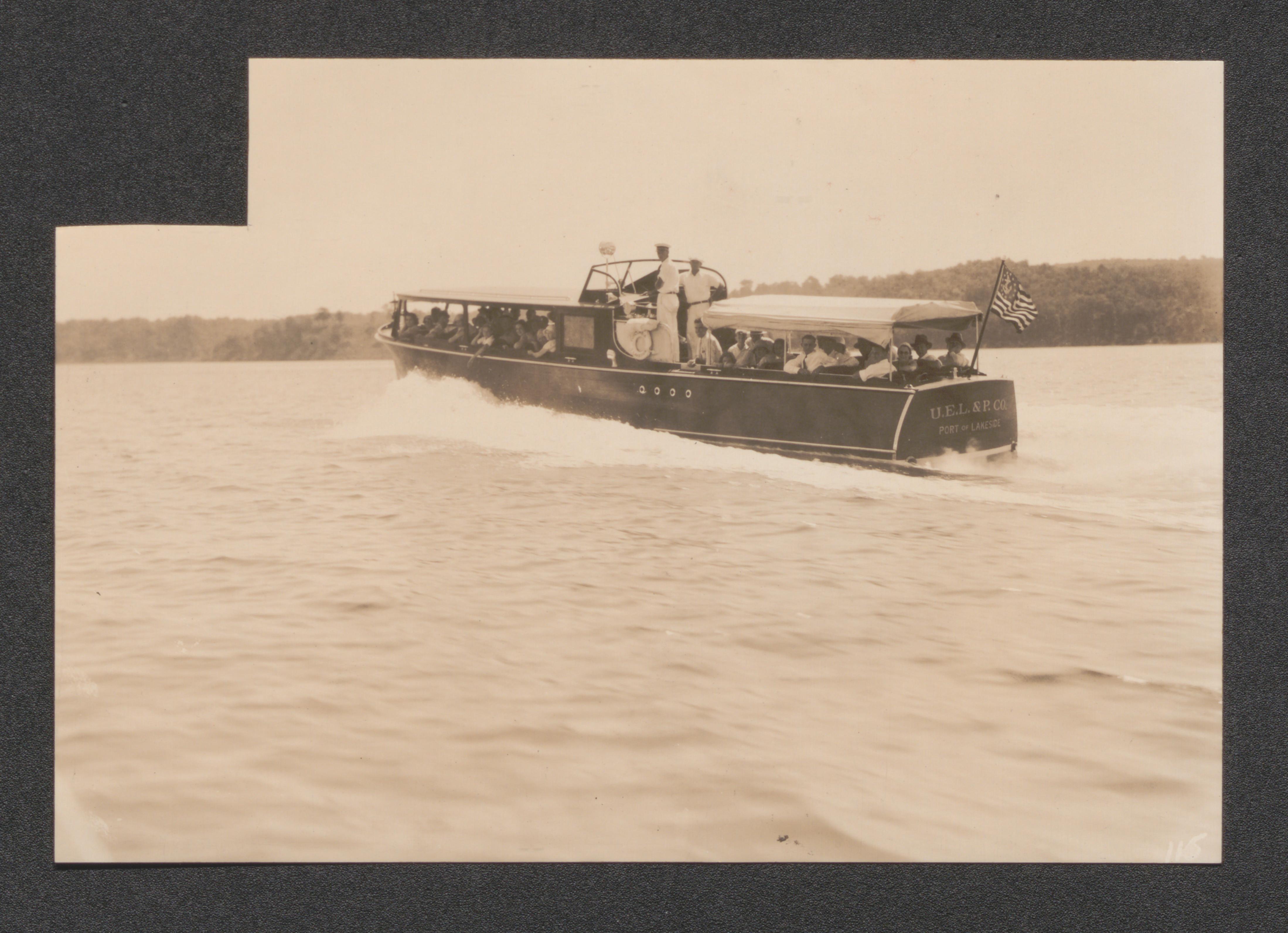
Exhibit 5A Tract No.31 showing land to the South and the East in purchase area, undated
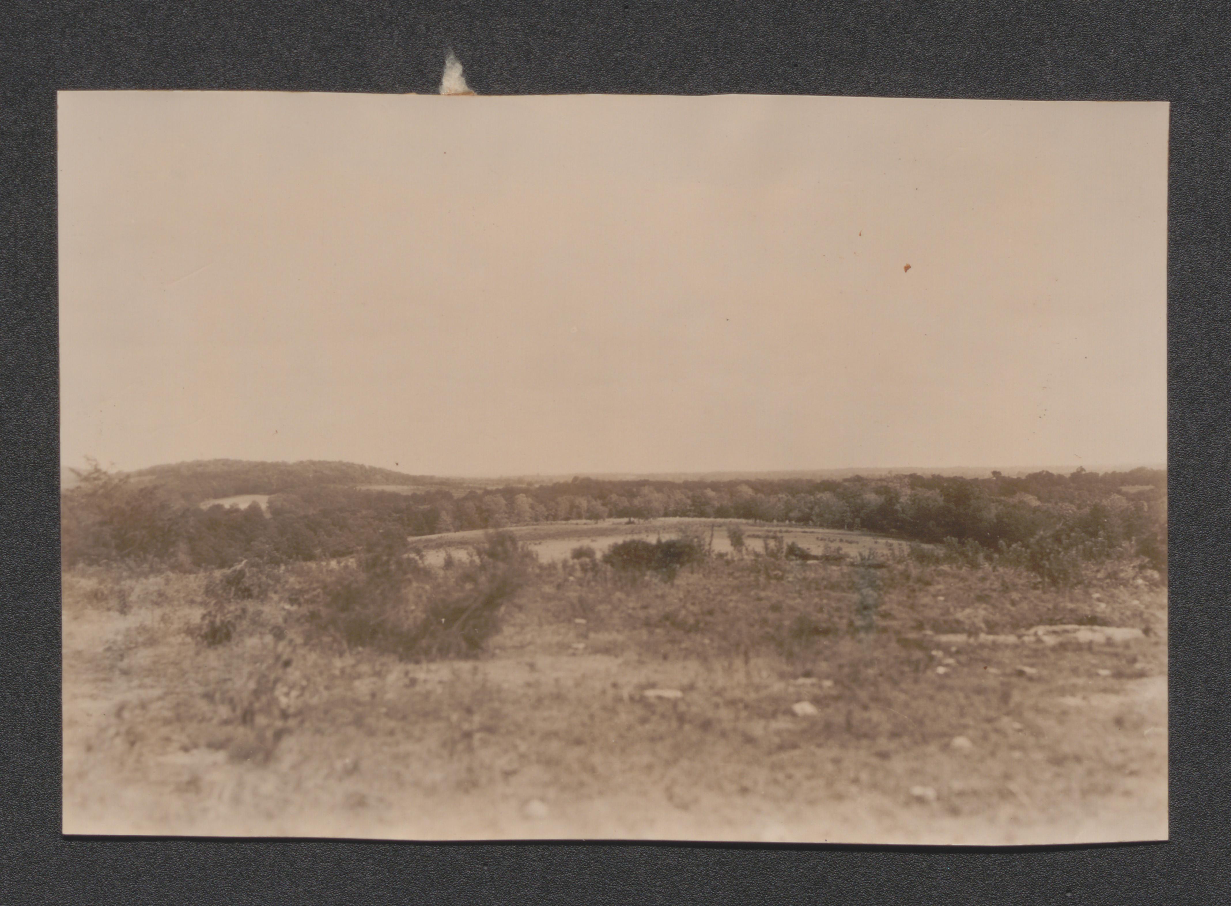
Exhibit 5A tract no. 68 typical branch bottom farming showing tract no. 67 to the North and East, undated
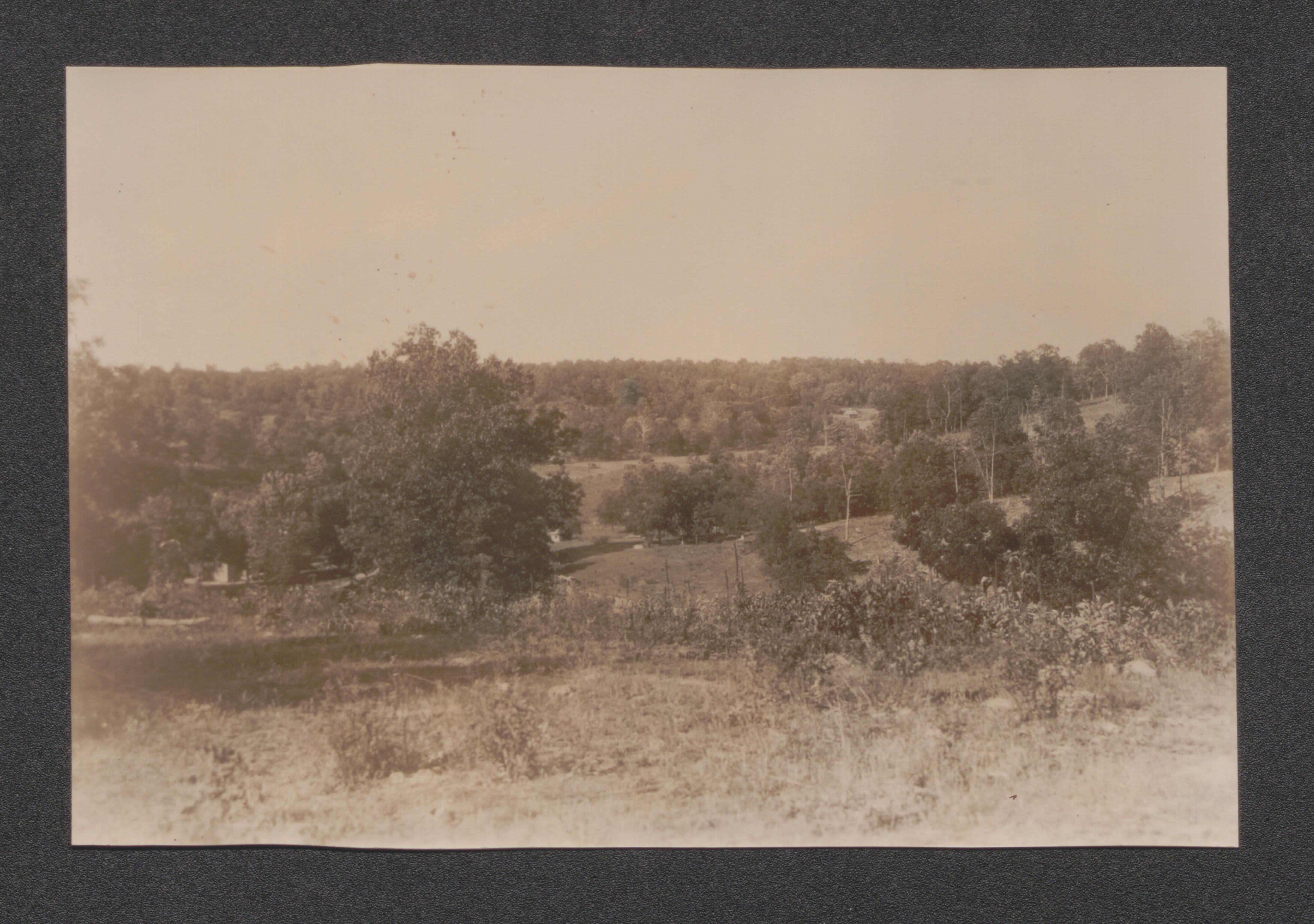
Exhibit 2B view showing North and West part of purchase area, undated
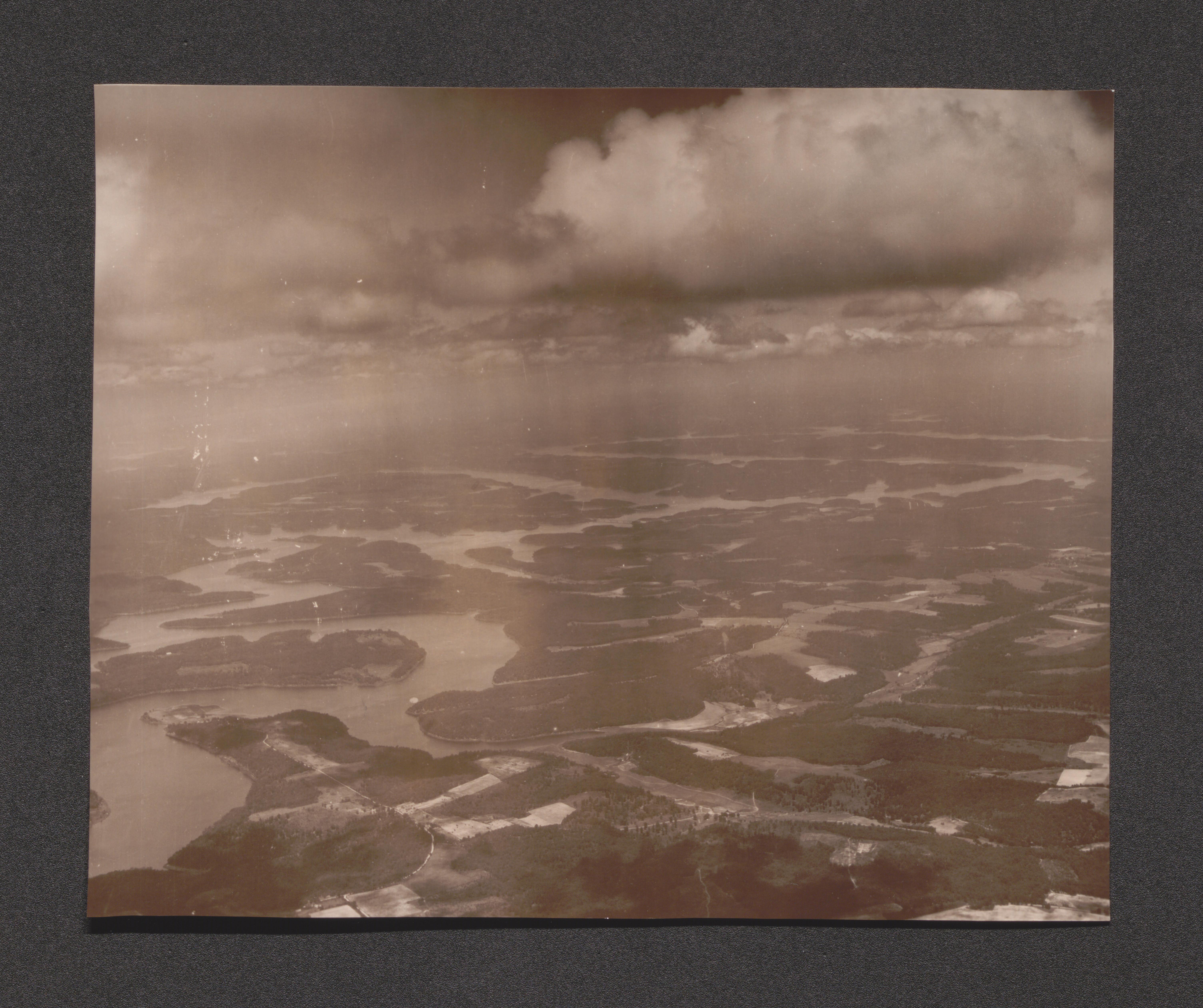
Exhibit 2B view showing South and East of purchase area, undated
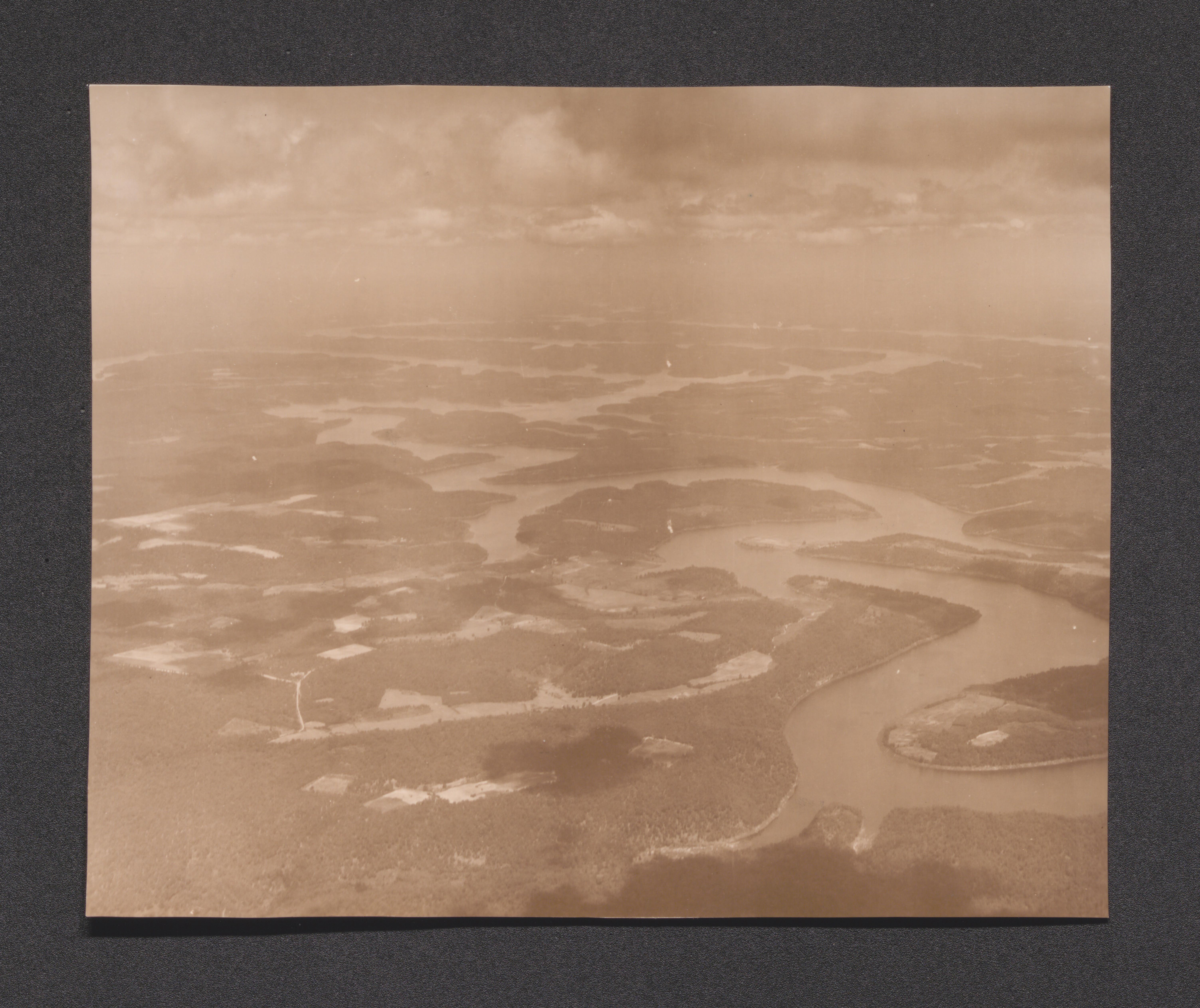
Exhibit 5B men eating at food kitchen, undated
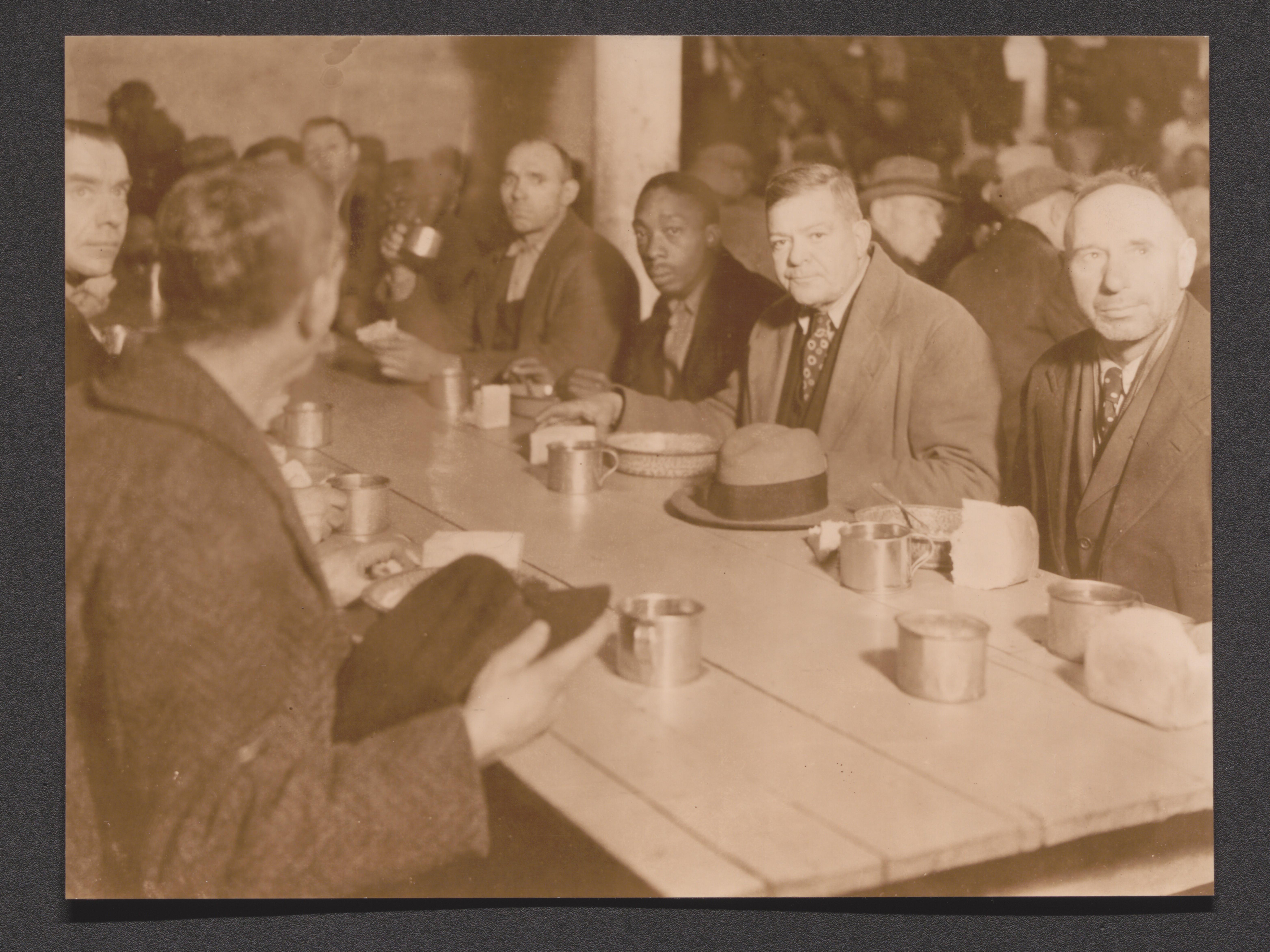
Exhibit 5B queue of men on Market Street, St. Louis, undated
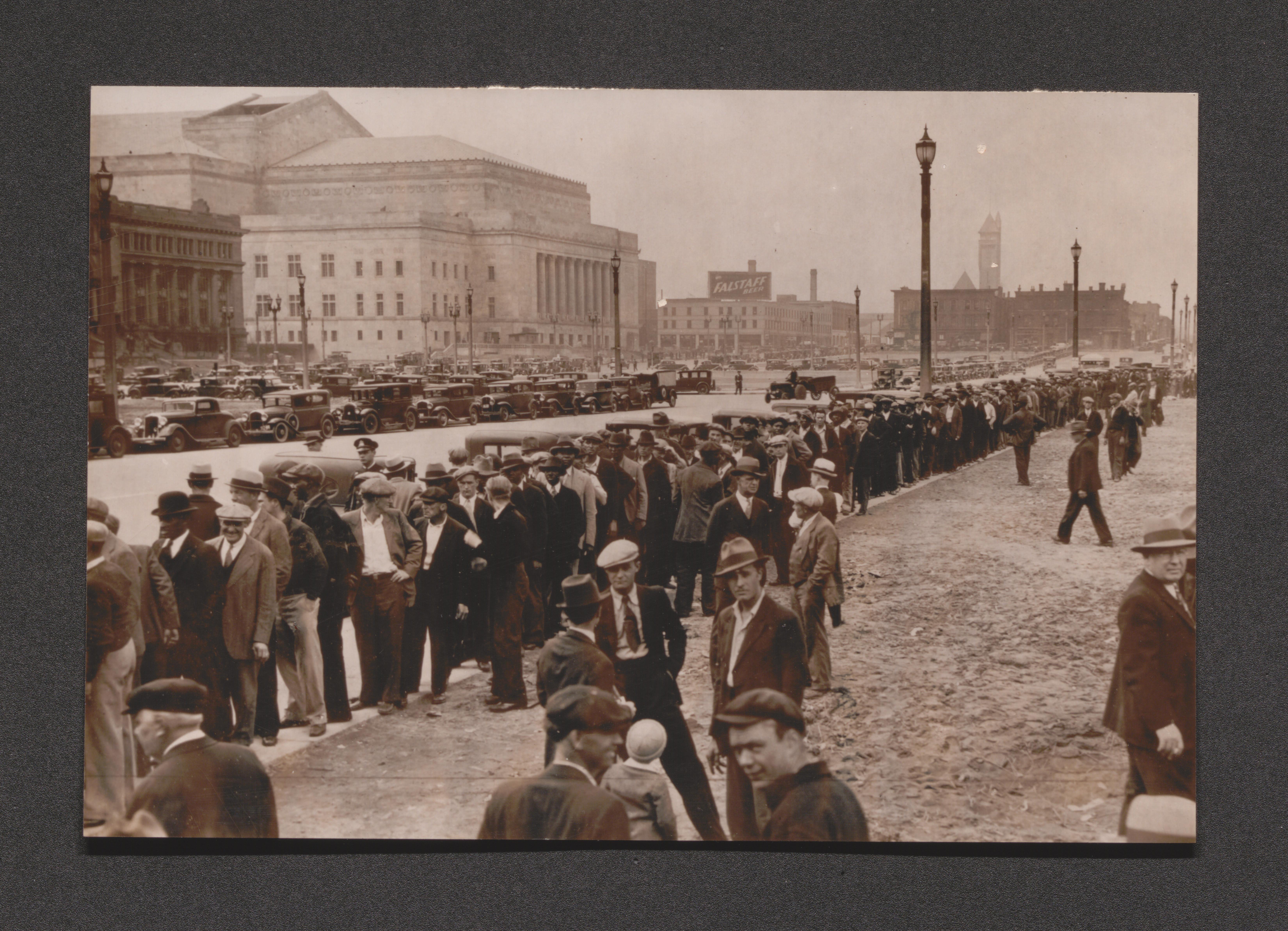
Exhibit 5C playground with children, undated
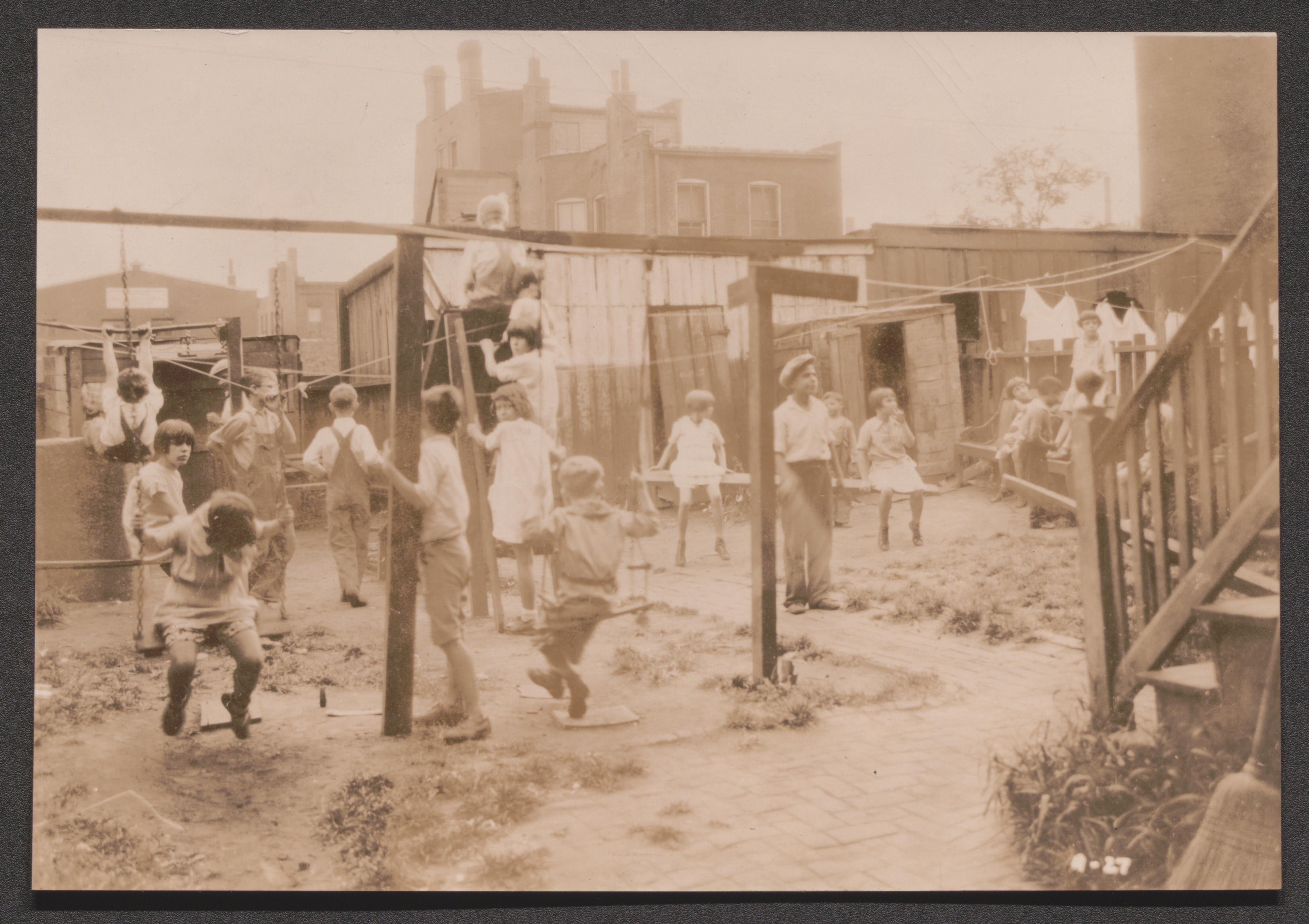
Exhibit 5E scenic photographs of Kaiser, Missouri, undated
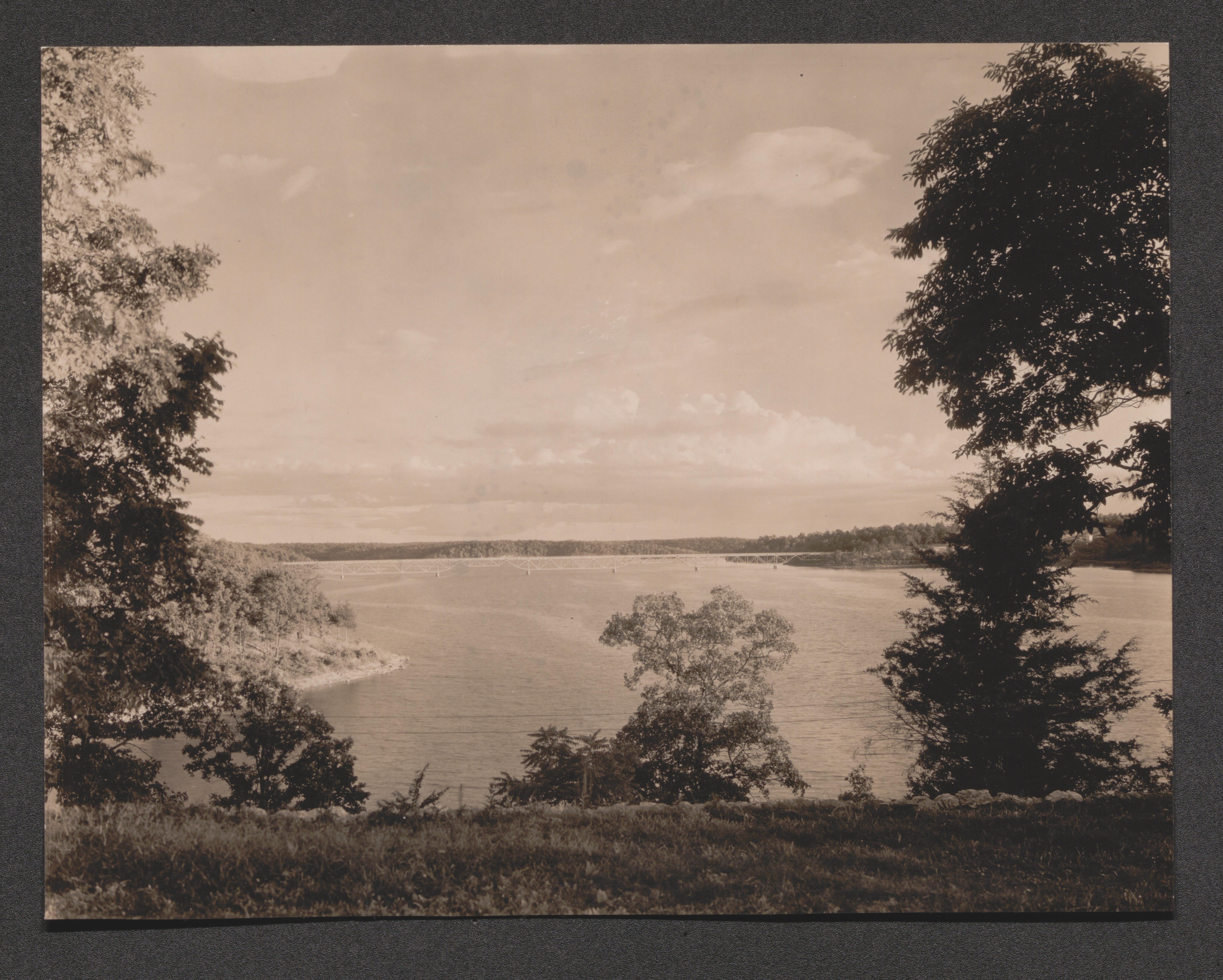
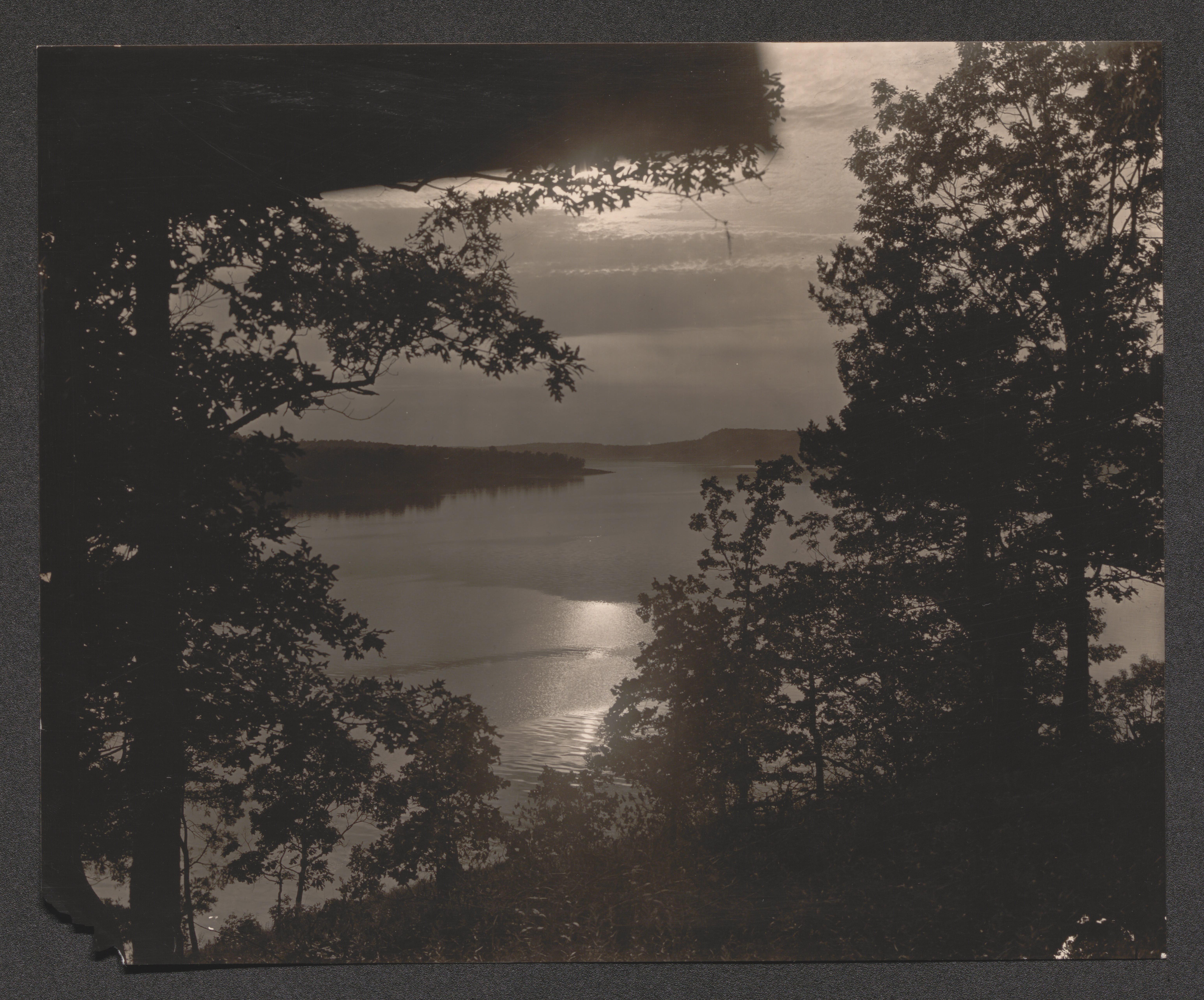
Exhibit 5F shoreline view, undated
Women and children watching boat from dock, undated
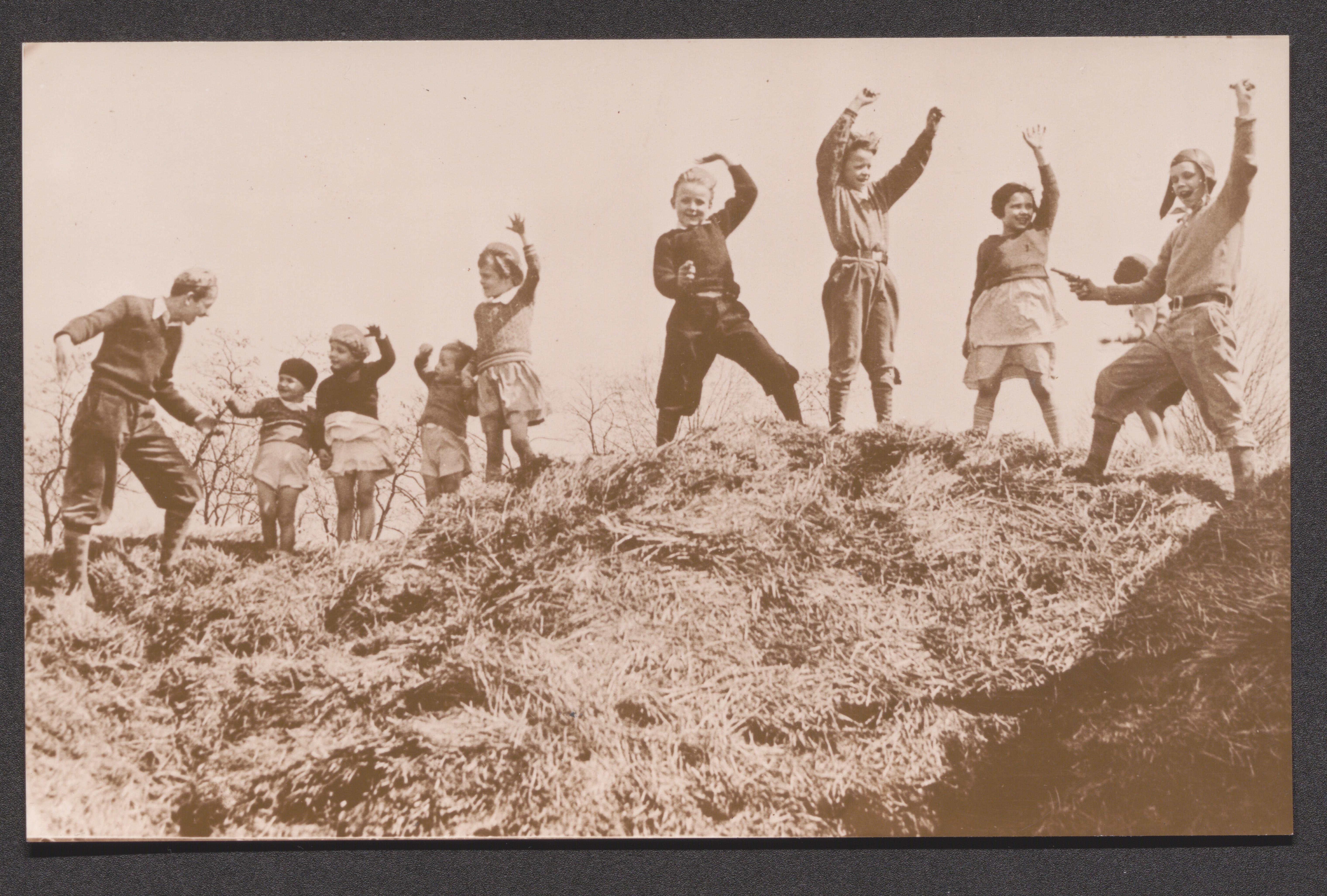
Children playing hold up on hillside, undated
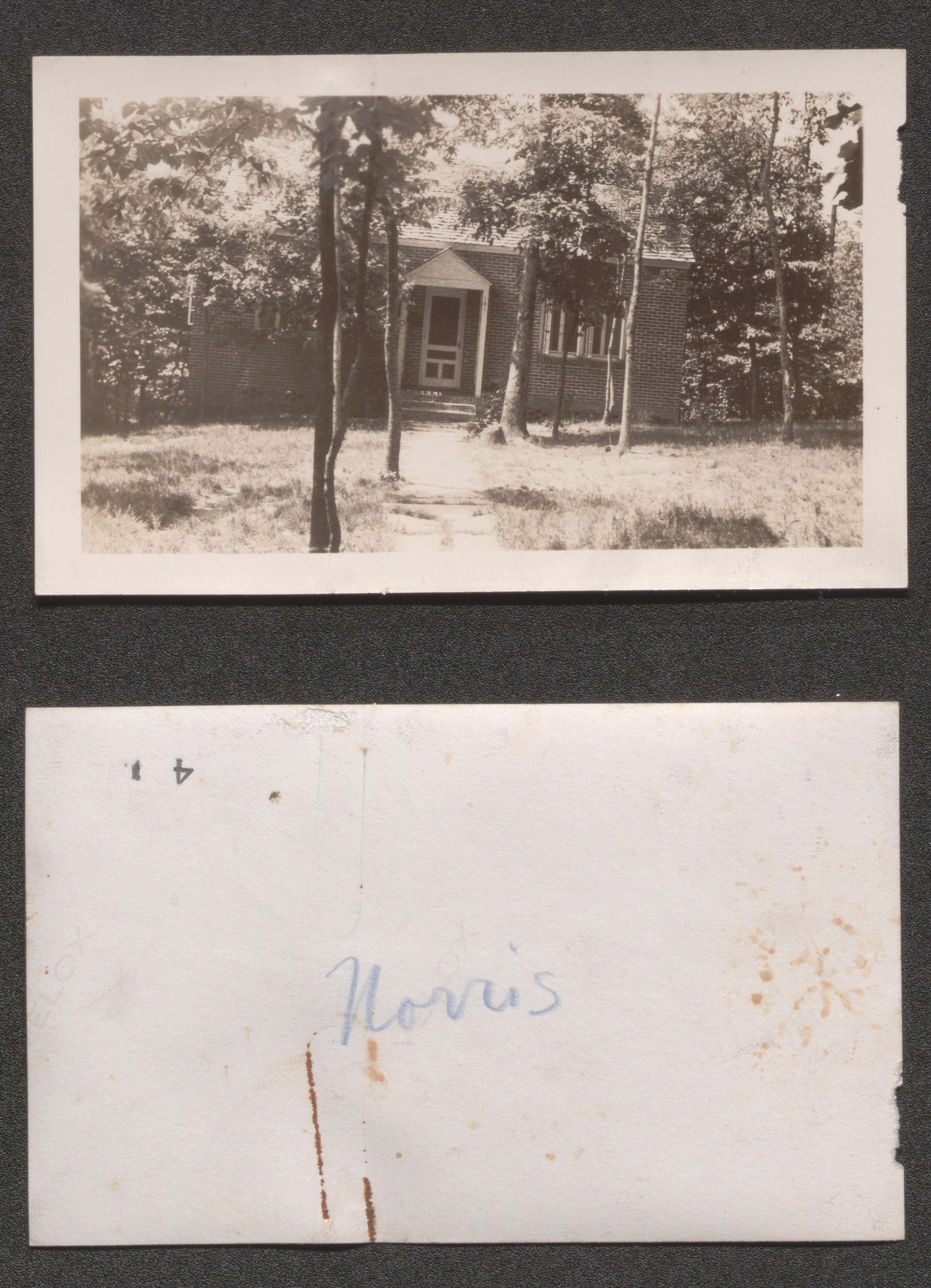
Norris, Tennessee, 1937, undated
Scope and Contents
All of the photos in the Norris, Tennessee subseries were originally found in the Norris, Tennessee Map, Pamphlets and Report folder.
Front of house, 1937 September
Back of house, 1937 September
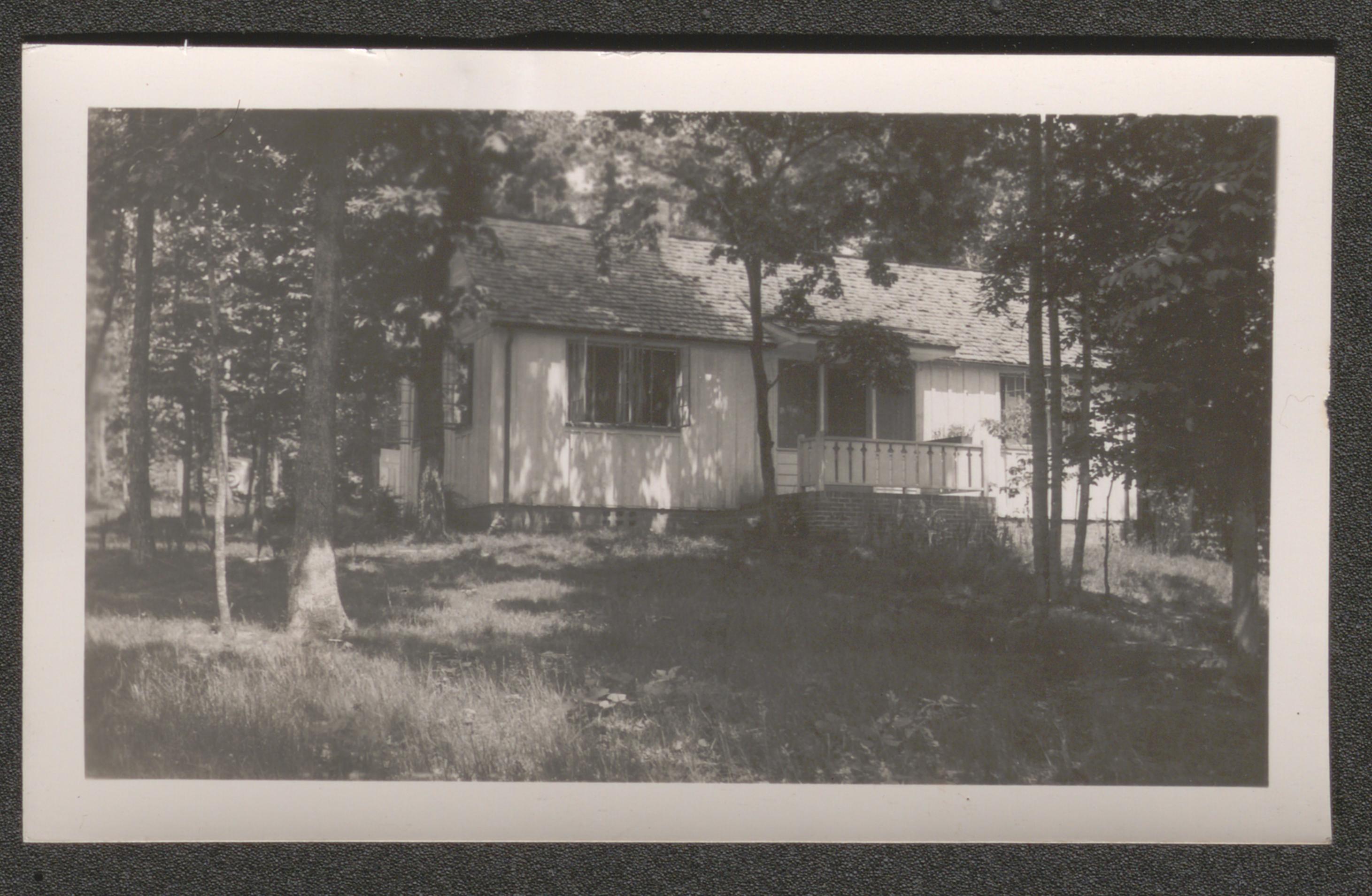
Side view of house, undated
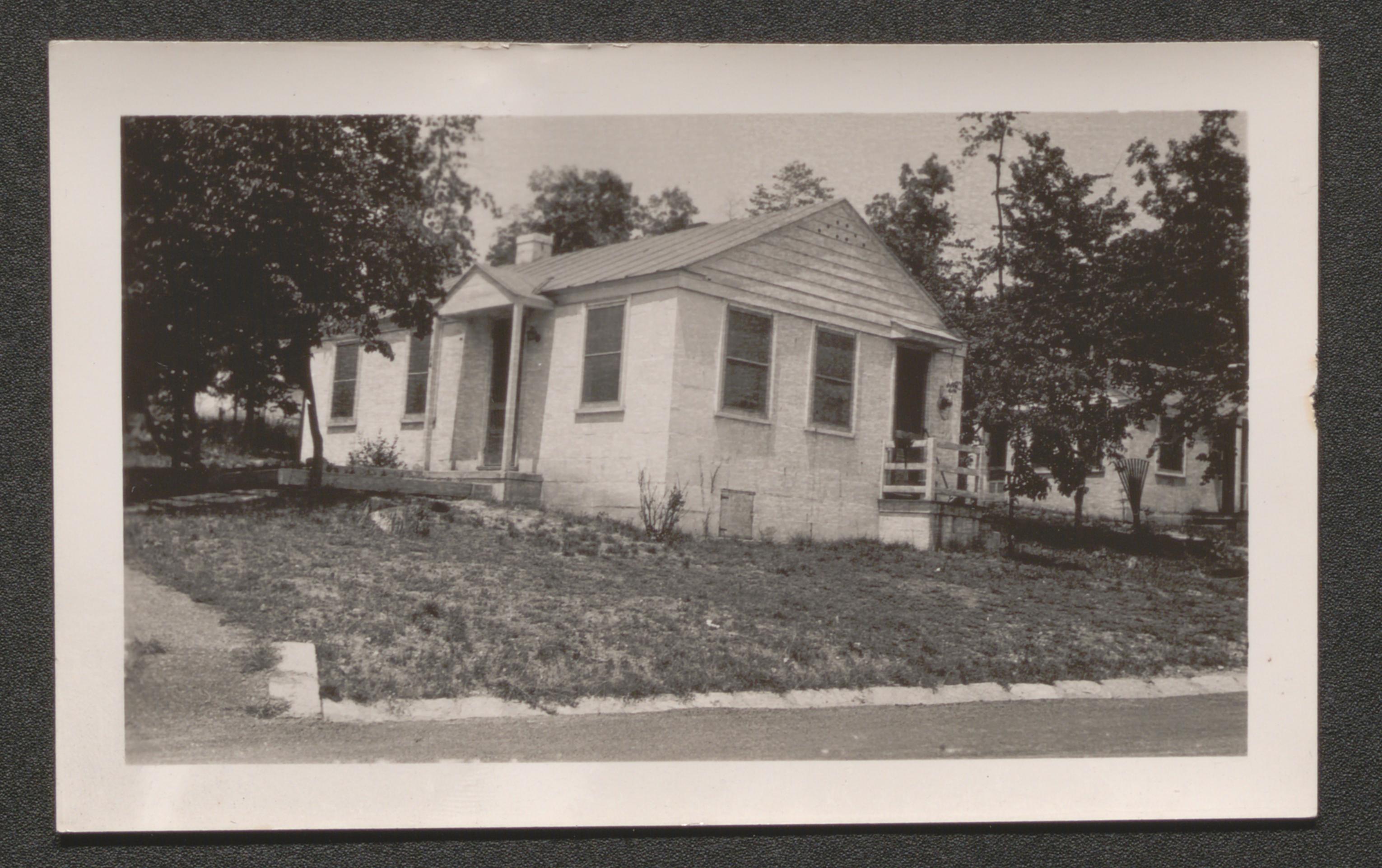
Front of house, undated
School, undated
Three houses, undated

Long ranch styled building, undated
Apartments, undated
View of road and large house, undated
Apartments exterior, undated
Bridge over dam, undated
View of the dam, 1937
Construction near dam, undated
Scenic view of water source, undated
Scenic view of water and dam, undated
Bridge over the dam, 1937
Project plan and research, undated
Washington, D.C., undated
Interior living quarters, printed on label on back of image "WASHINGTON // [African American] home in S.E. section", undated
Outhouse, printed on label on back of image - "WASHINGTON // Sanitary system near // Government Printing // office", undated
Three houses with children in front of one, printed on label on back of image - "WASHINGTON // [Afircan American] homes near Capital", undated
Children in card game in front of buildings, printed on label on back of image - "WASHINGTON // Street Scene near Union Station", undated
Alley tenement housing, beginning of brief essay attached to back of image - "IN THE SHADOW OF THE CAPITAL. // Alley dwellings where families with small incomes seek the only // shelter they can afford", undated
Child stepping into debris strewn hallway from outside, printed on label on back of image - "Washington // Georgetown hallway", undated

Tenement rooftops and backyard, printed on label on back of image "WASHINGTON // Backyards near Capital", undated
Long row of tenement housing, printed on label on back of image - "WASHINGTON // Street near Capital", undated
Woman dips bucket into half barrow of water outside tenement, printed on label on back of image - "WASHINGTON // The only water supply for a family of six", undated
Woman pumps water into bucket outside tenement, printed on label on back of image - "WASHINGTON // [African American] home in S.E. section", undated
Interior living quarters, printed on label on back of image - "WASHINGTON // [African American] home in N.E. section", undated
Tenement doorway, printed on label on back of image - "WASHINGTON // [African American] dwelling near House office building", undated
Tenement kitchen area, printed on label on back of image - "WASHINGTON // Rear and kitchen near House office building", undated
Bathroom facilities, printed on label on back of image - "WASHINGTON // Bath shared by four families, // each with at least four persons // at 25 K Street", undated
Shop window on building front, printed on label on back of image - "WASHINGTON // Blight - 435 M St. N.W.", undated
Two floors of building exterior at entrance, printed on label on back of image - "WASHINGTON // Blight - 1008 Mass. Ave", undated
Dwelling entrance with stairs along alley, printed on label on back of image - "WASHINGTON // 1901 Florida Ave. N.W.", undated
Printed on back of image - "House on 22nd Street in NW Washington, D.C., showing how this once old home has been converted into commercial purpose", undated
Three story dwelling structure on alley, printed on label on back of image - "WASHINGTON // Slums - alley dwellings // vicinity of L and First Streets", undated
Second story balconies on alley, printed on label on back of image - "WASHINGTON // Alley dwellings - slums // vicinity of First and L", undated
Large home or apartment house with partial conversion to automobile service station, printed on label on back of image - "WASHINGTON // Blight - 430 Rhode Island Ave, N.W.", undated
Elevated view; tenement area rooftops and church, printed on label on back of image - "WASHINGTON // Slums - vicinity of Pierce // and L Sts. and First St.", undated
First floor businesses on three story building, printed on label on back of image - "WASHINGTON // 20 - 21 on P St. N.W.", undated
Elevated view; street with long row of tenement housing, printed on label on back of image - "WASHINGTON // Slums - alley dwellings near First and L Sts. N.W.", undated
Elevated view; tenement neighborhood, printed on label on back of image - "WASHINGTON // Slums - alley dwellings near First and L Sts", undated
Elevated view; debris strewn back alley, printed on label on back of image - "WASHINGTON // Slums - alley dwellings near First and L Sts", undated
Fish business within crude structures of alleyway, printed on label on back of image - "WASHINGTON // Slums - alley dwellings // L and First Sts. N.W.", undated
Crude structure and debris looking down alley, printed on label on back of image - "WASHINGTON // Slums - alleys near First and L Sts. N.W.", undated
Aerial shot; suburban neighborhood, handwritten on back of image - "General air view of Washington, D.C.", undated
Photo montage; tenement alley shots on one side and Washington postcards on other side of tour vehicle caricature with message "Ladies N Gentlemen! On Yer Left", undated
Photo montage; alley tenements, children in tenement areas, brief essay on one photo, and city map, undated
Collage of images of tenement slums, undated
Four captioned housing images with overall title "Washington Housing: A National Example" and accompanying segmented essay, undated
Captioned housing images with continuation of accompanying segmented essay (began on 387), undated
Series of captioned slum tenement images, undated
Newspaper article, reprinted from The Washington Post, titled "Government Clerks Cant Have Homes with captioned images and cartoon drawings"
Photo montage; slum tenement views with Washington DC map section, undated
Wayside Areas of Virginia, undated
Page 5 Hanover County wayside W-2 no. 1 lake site from existing dam, undated
Page 5 Hanover County wayside W-2 no. 2 spring fed brook, undated
Page 5 Hanover County wayside W-2 no. 3 undergrowth of many varieties, undated
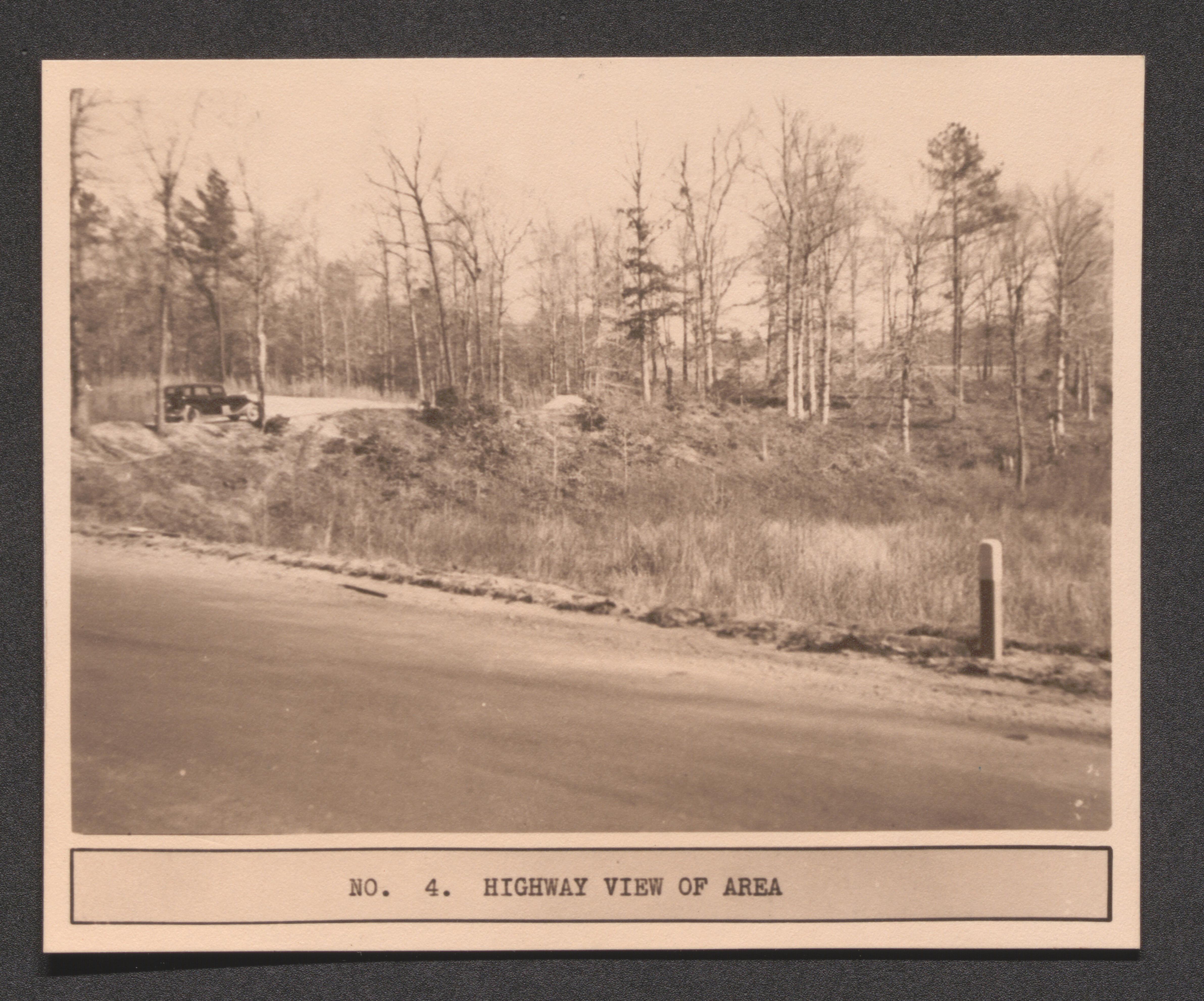
Page 5 no. 4 highway view of area, undated
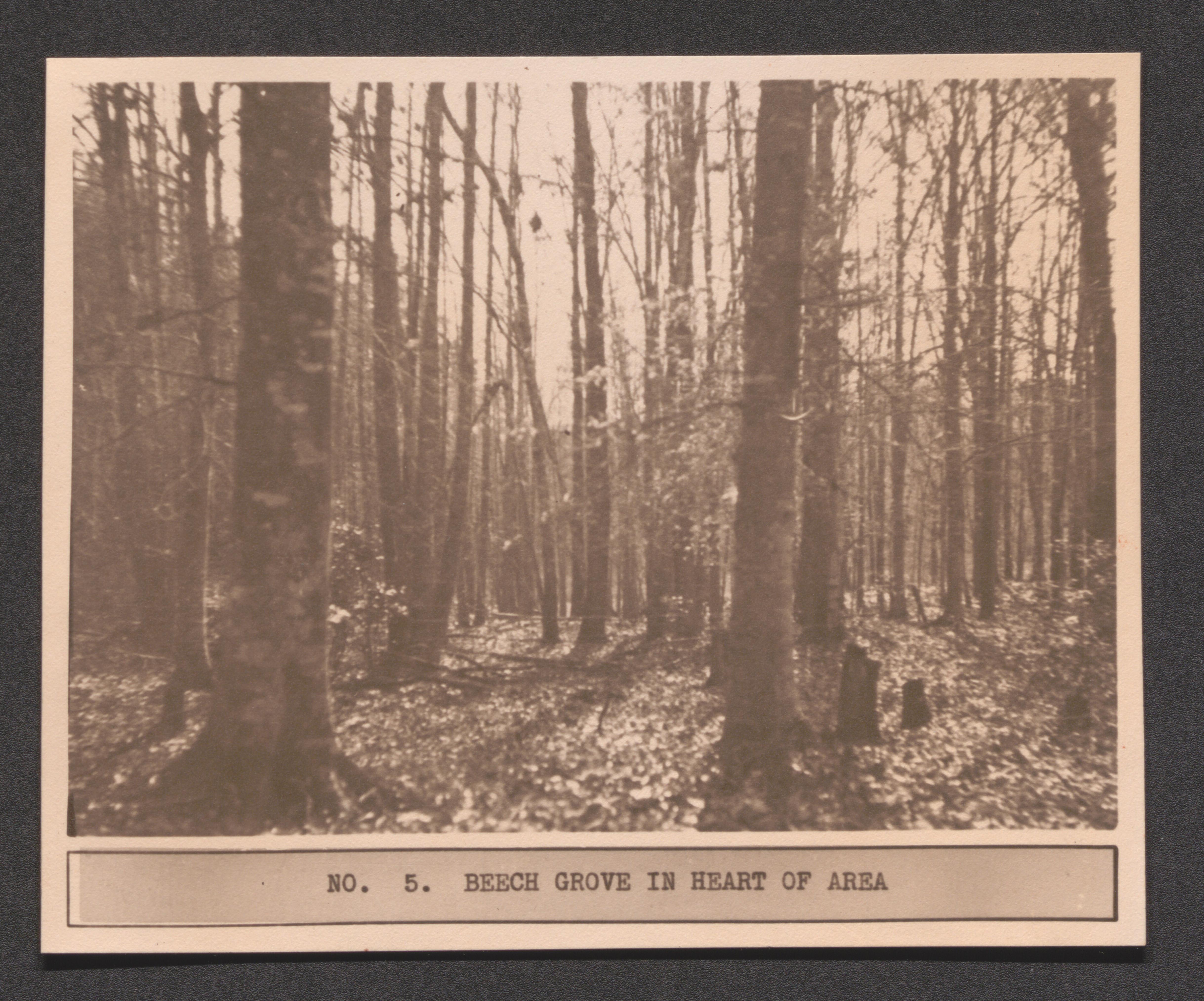
Page 5 Hanover County wayside W-2 no. 5 beech grove in heart of area, undated
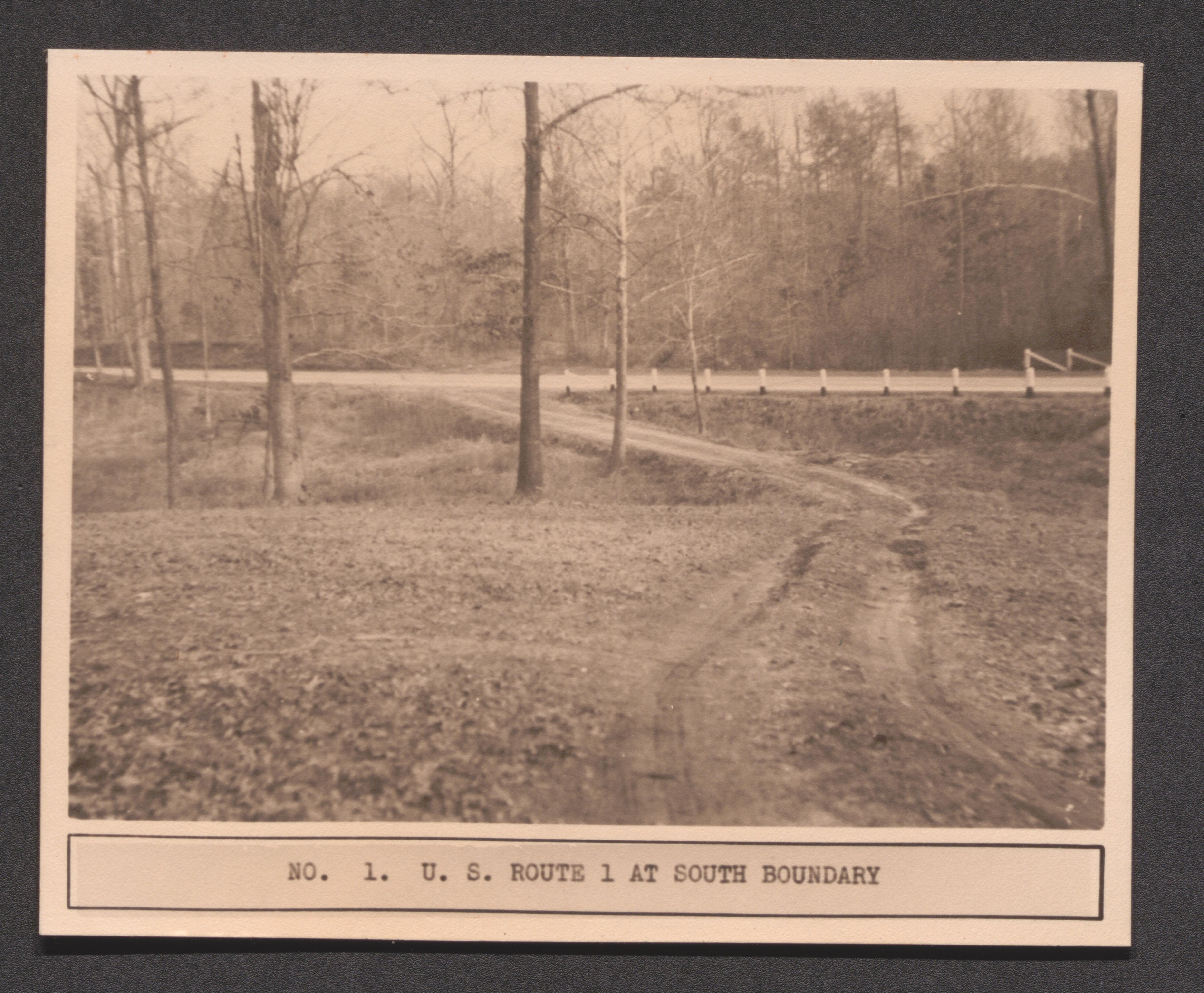
Page 9 Mecklenburg County wayside W-7 no. 1 US Route 1 at Southern boundary, undated
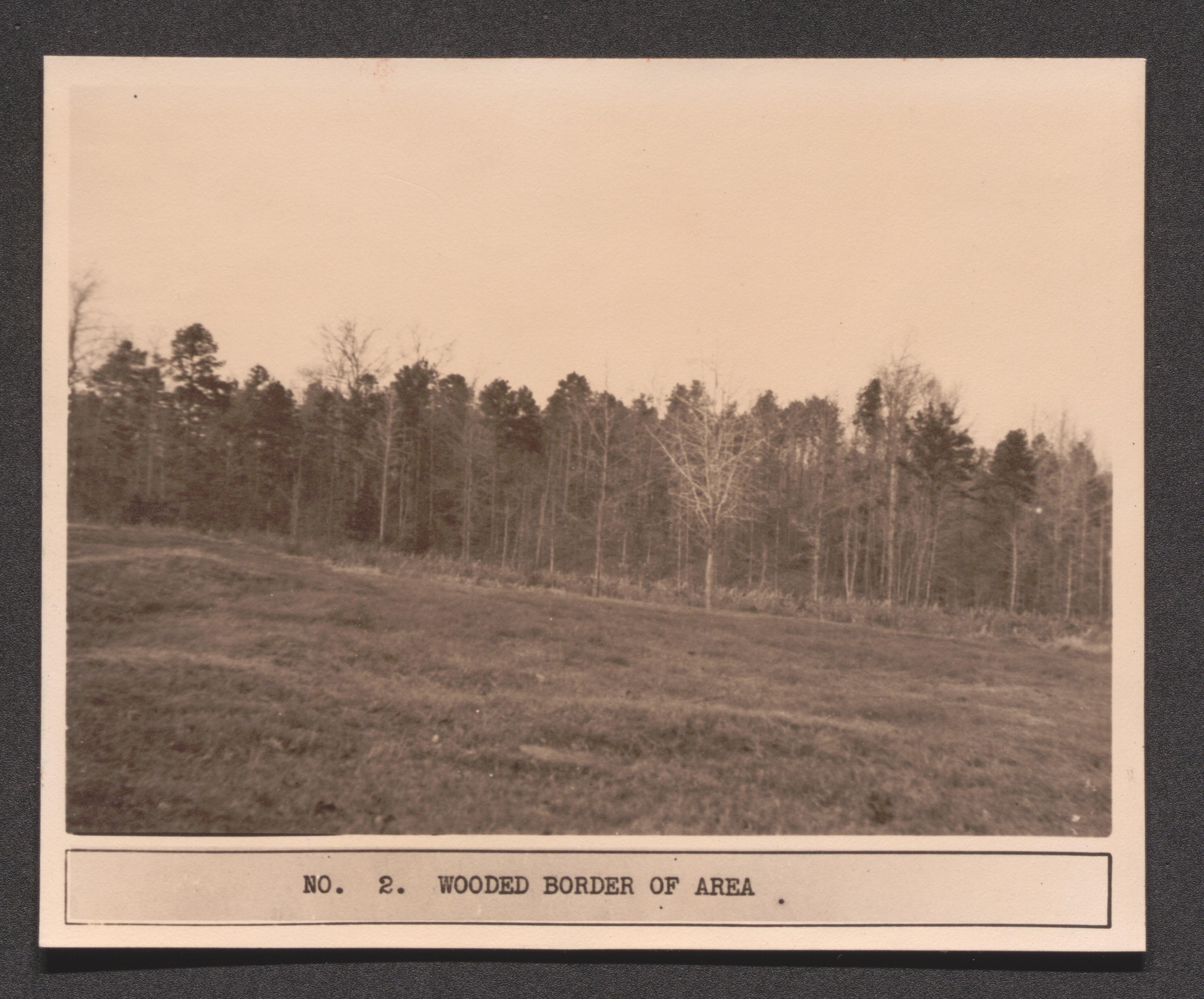
Page 9 Mecklenburg County wayside W-7 no. 2 wooded border of area, undated
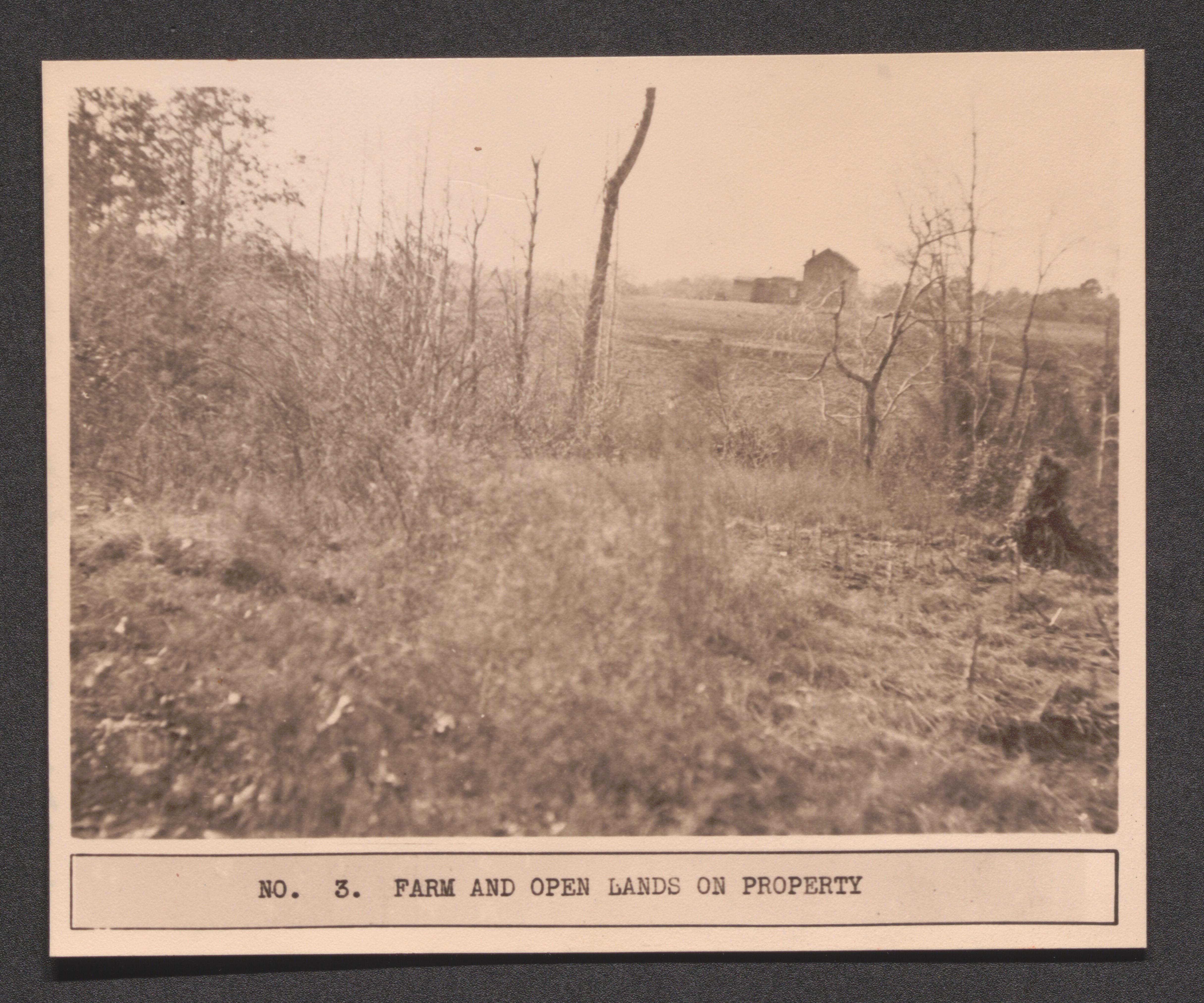
Page 9 Mecklenburg County wayside W-7 no. 3 farm and open lands on property, undated
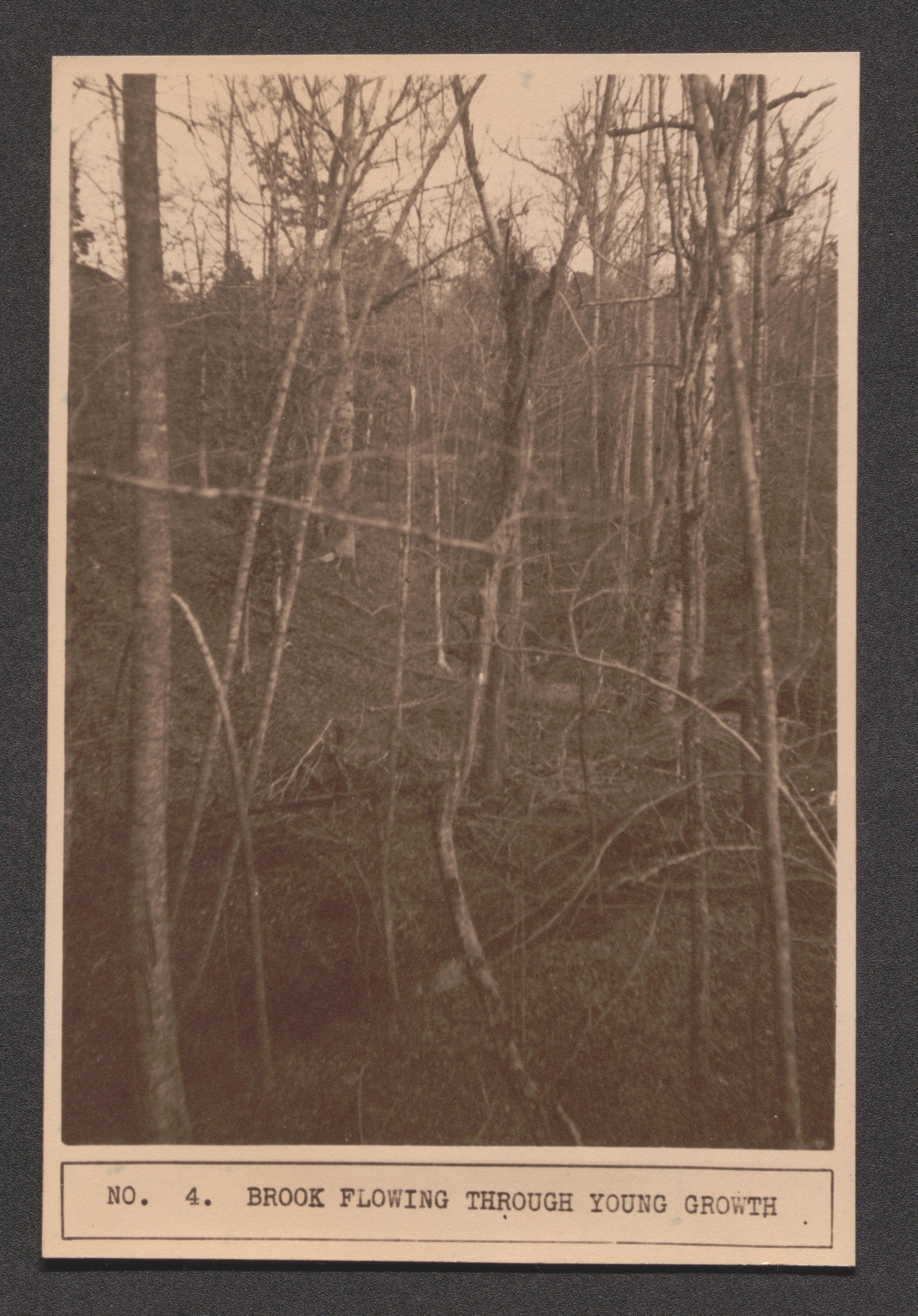
Page 9 Mecklenburg County wayside W-7 no. 4 brook flowing through young growth, undated
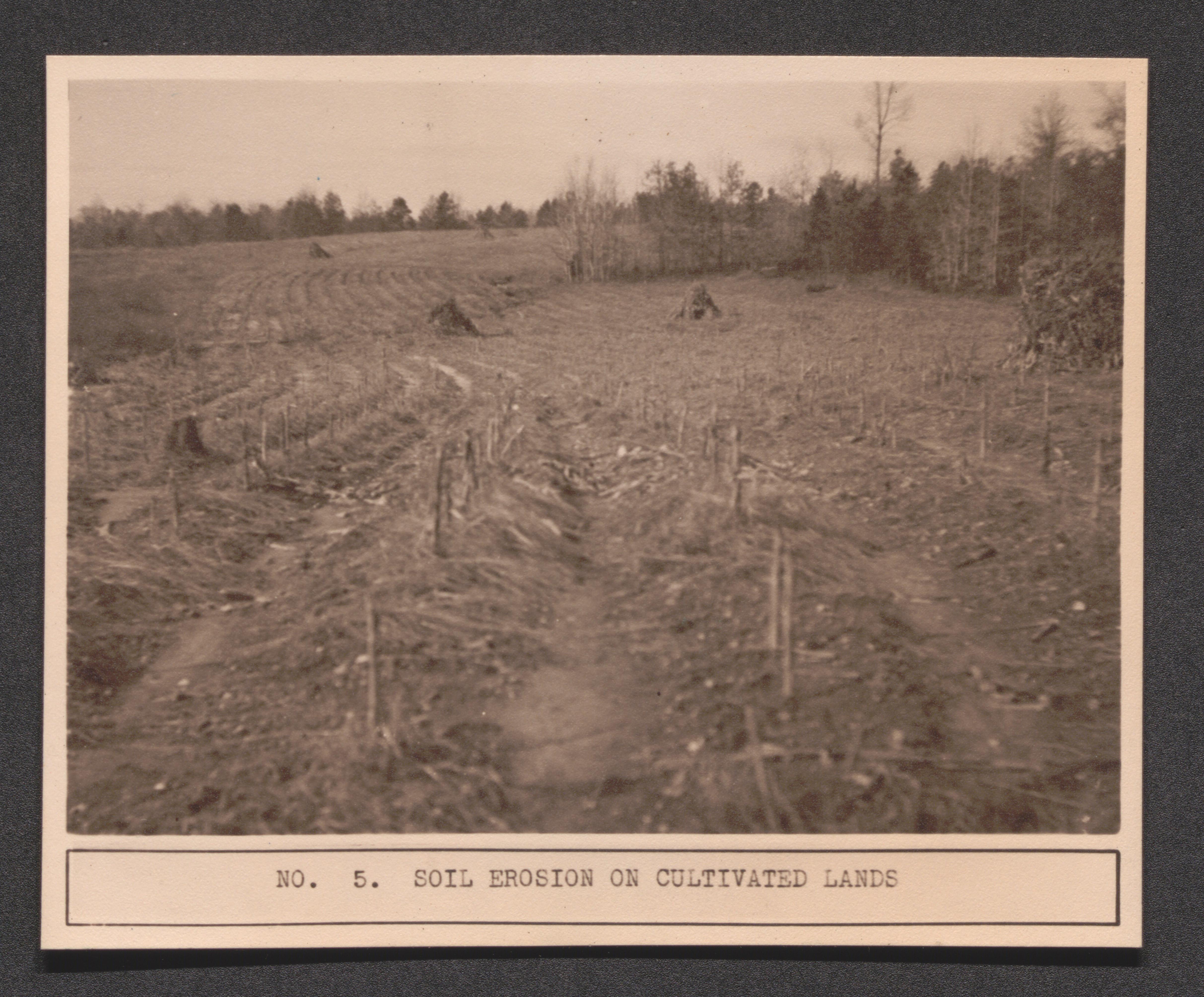
Page 9 Mecklenburg County wayside W-7 no. 5 soil erosion on cultivated land, undated
Page 13 Pulaski County wayside W-8 no. 1 Drapper family area, undated
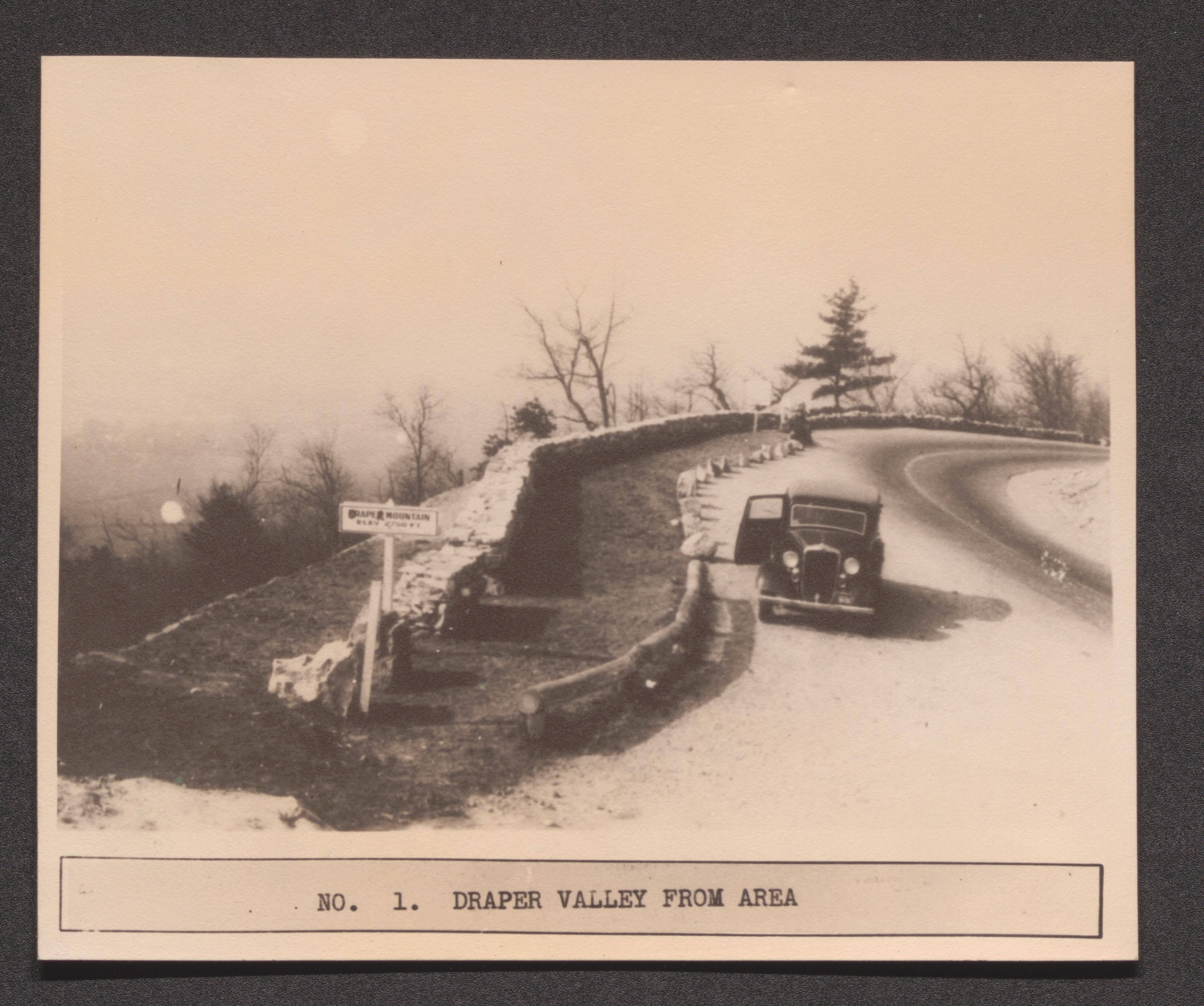
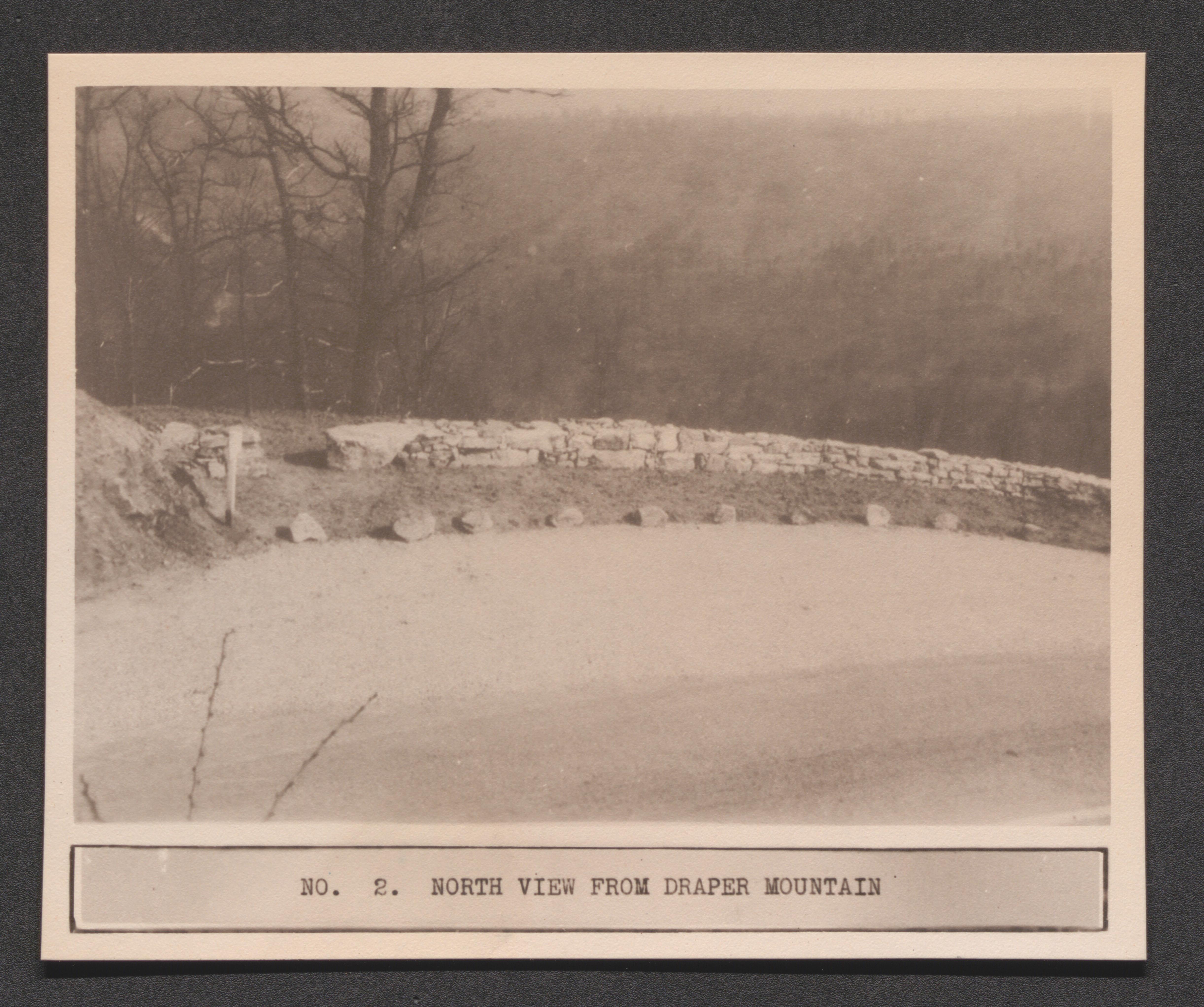
Page 13 Pulaski County wayside W-8 no. 2 North view from Draper Mountain, undated
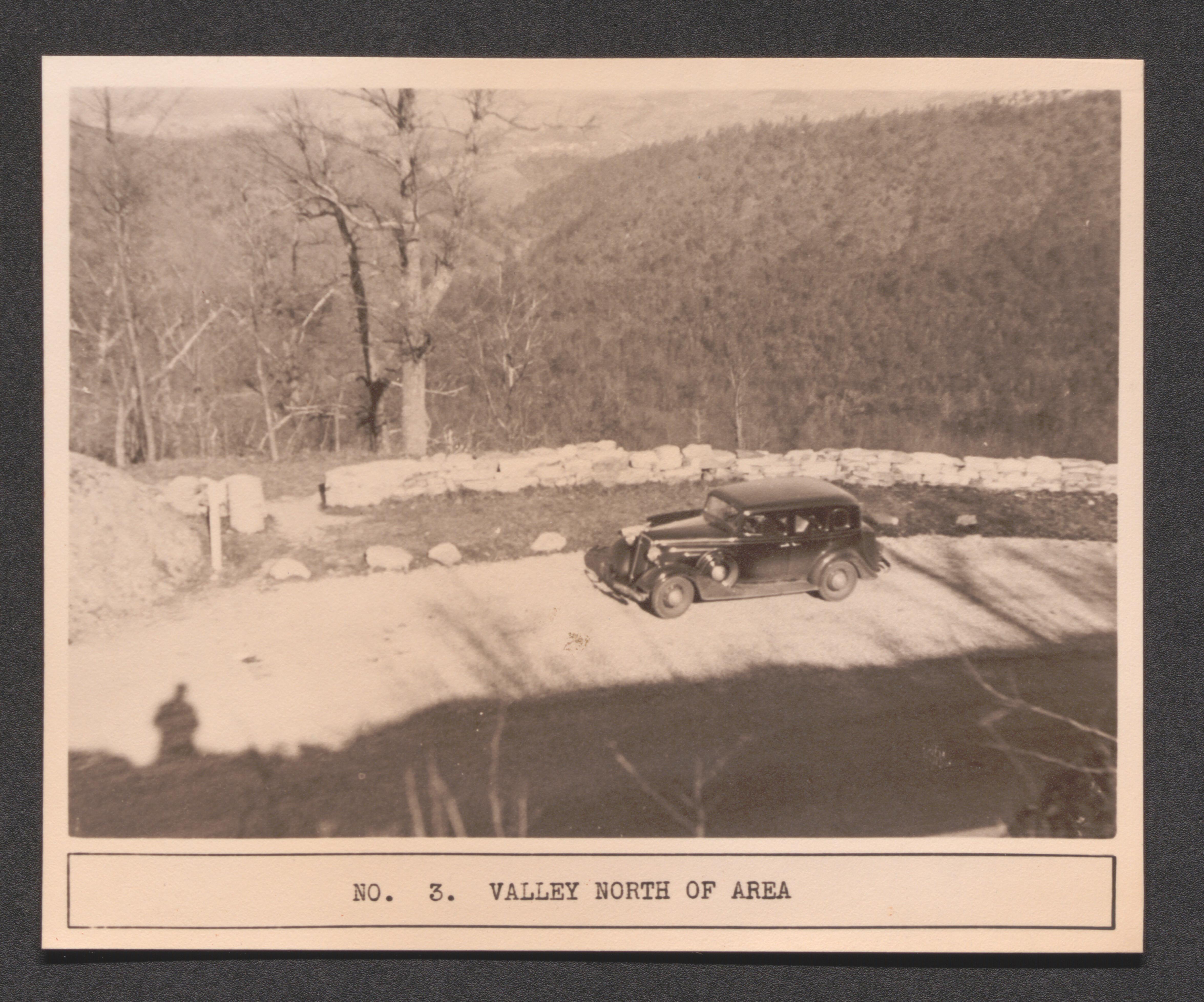
Page 13 Pulaski County wayside W-8 no. 3 valley North of area, undated
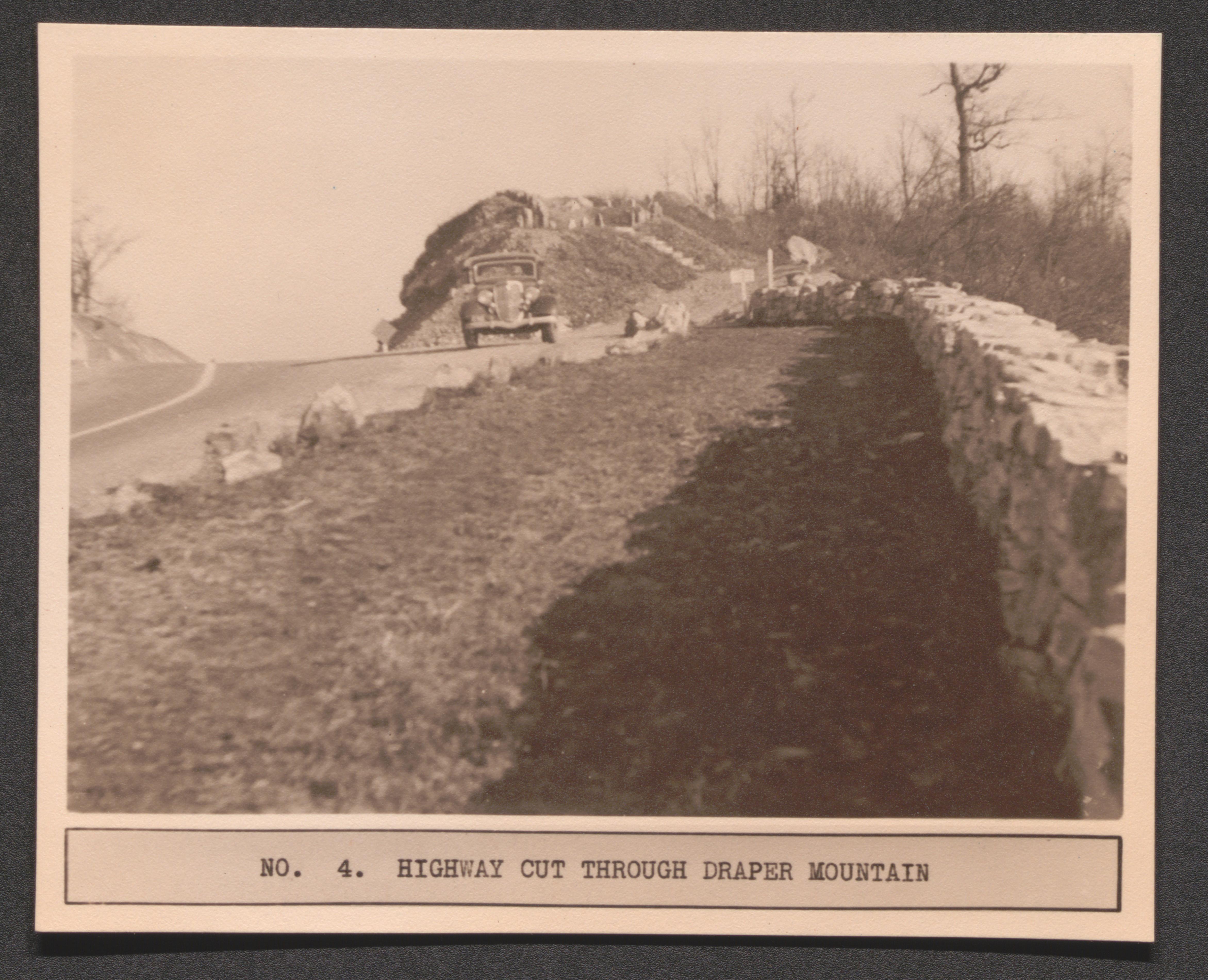
Page 13 Pulaski County wayside W-8 no. 4 highway cutting through Draper Mountain, undated
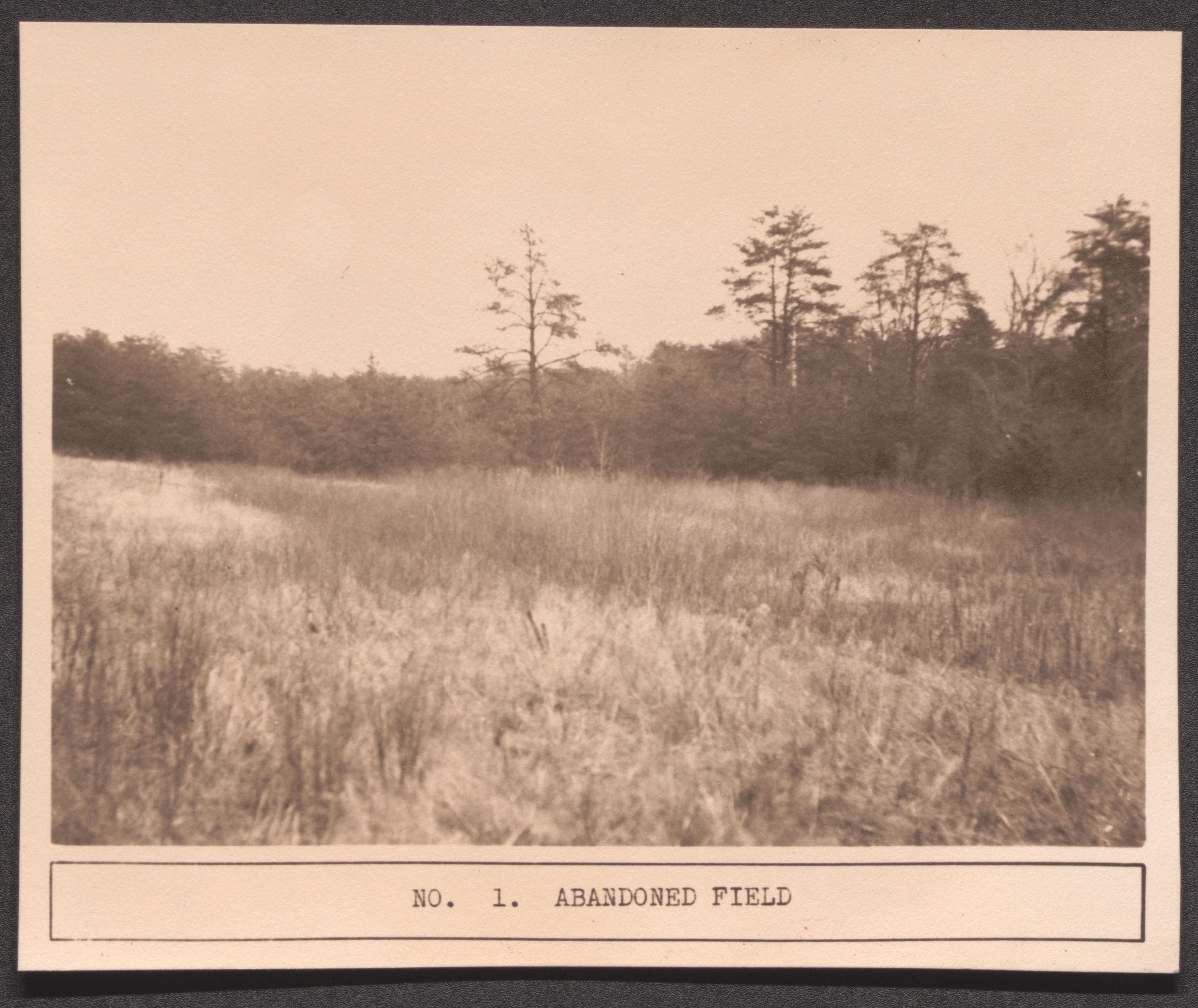
Page 17 Amherst County wayside W-3 no. 1 abandoned field, undated
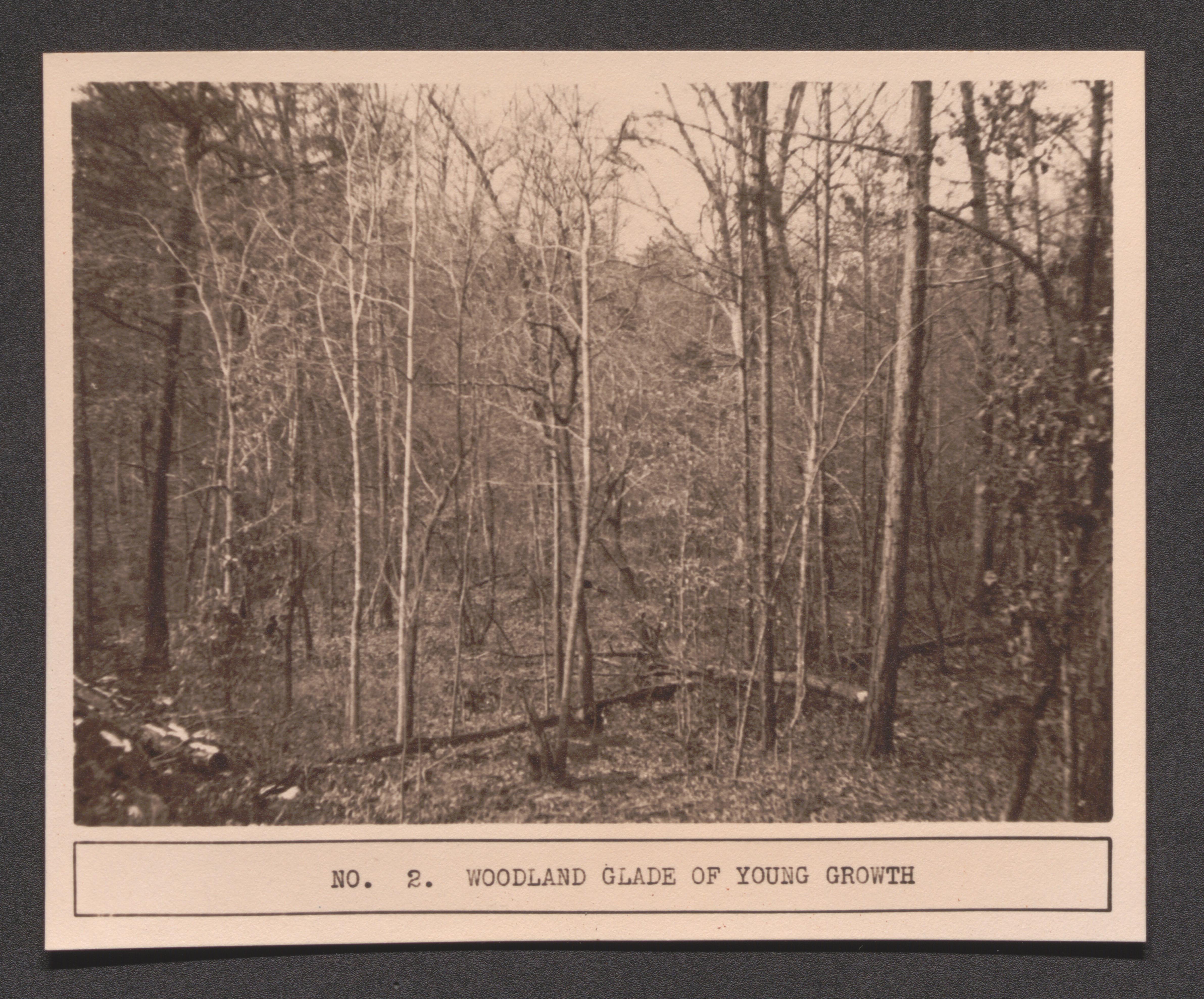
Page 17 Amherst County wayside W-3 no. 2 woodland glade of youth growth, undated
Page 17 Amherst County wayside W-3 no. 3 US Route 60 dividing area, undated

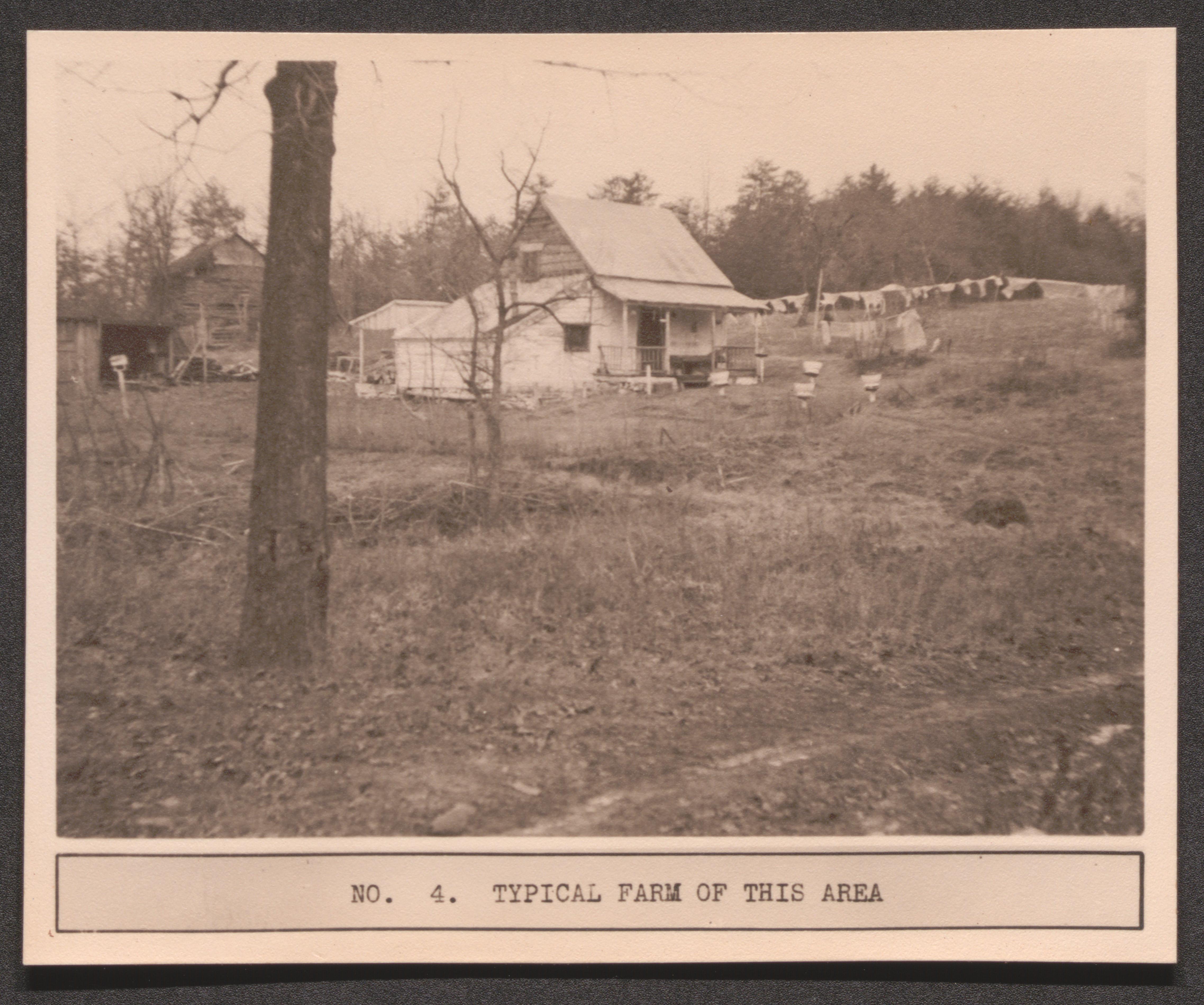
Page 17 Amherst County wayside W-3 no. 4 typical farm of this area, undated
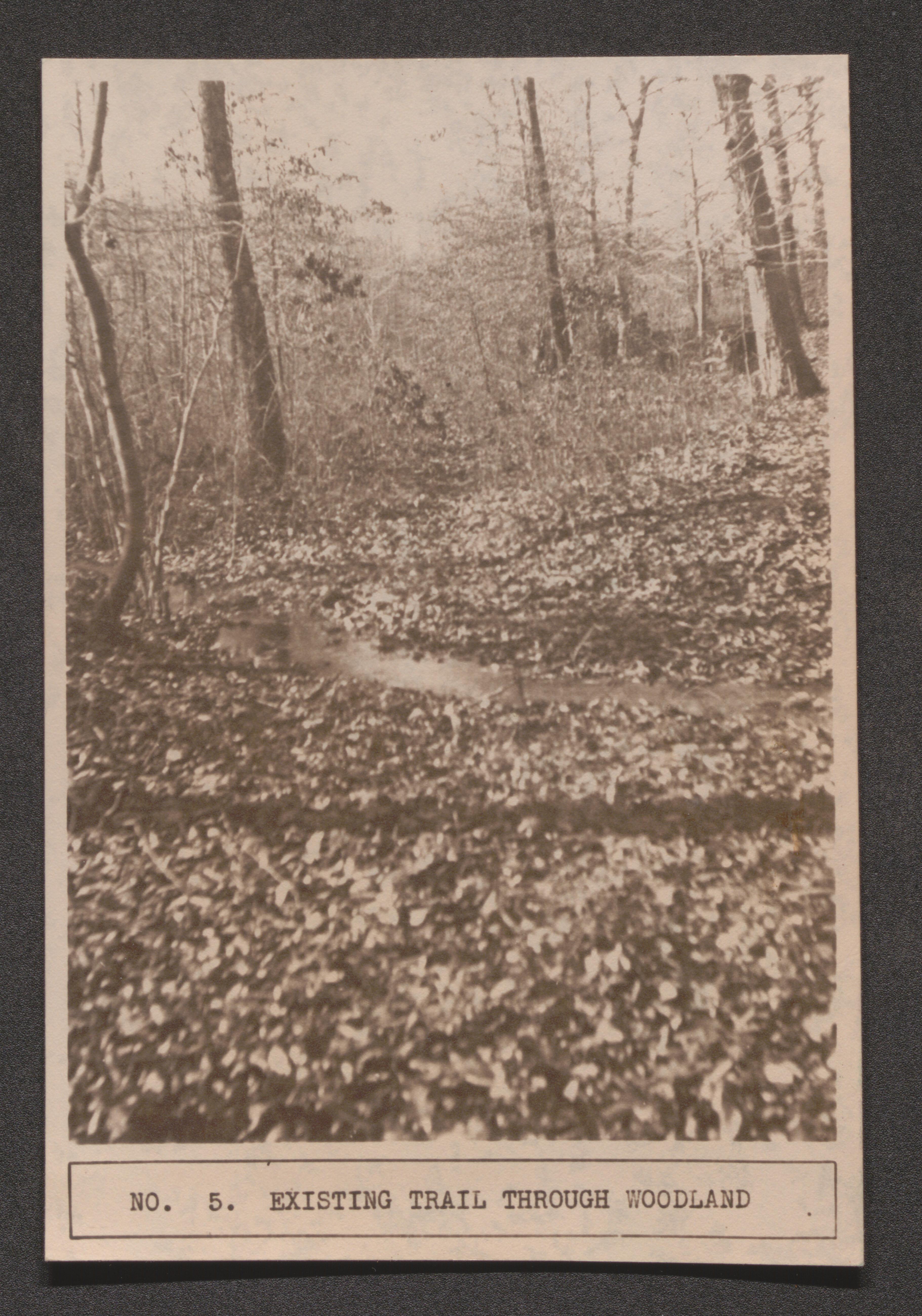
Page 17 Amherst County W-3 no. 5 existing trail through woodland, undated
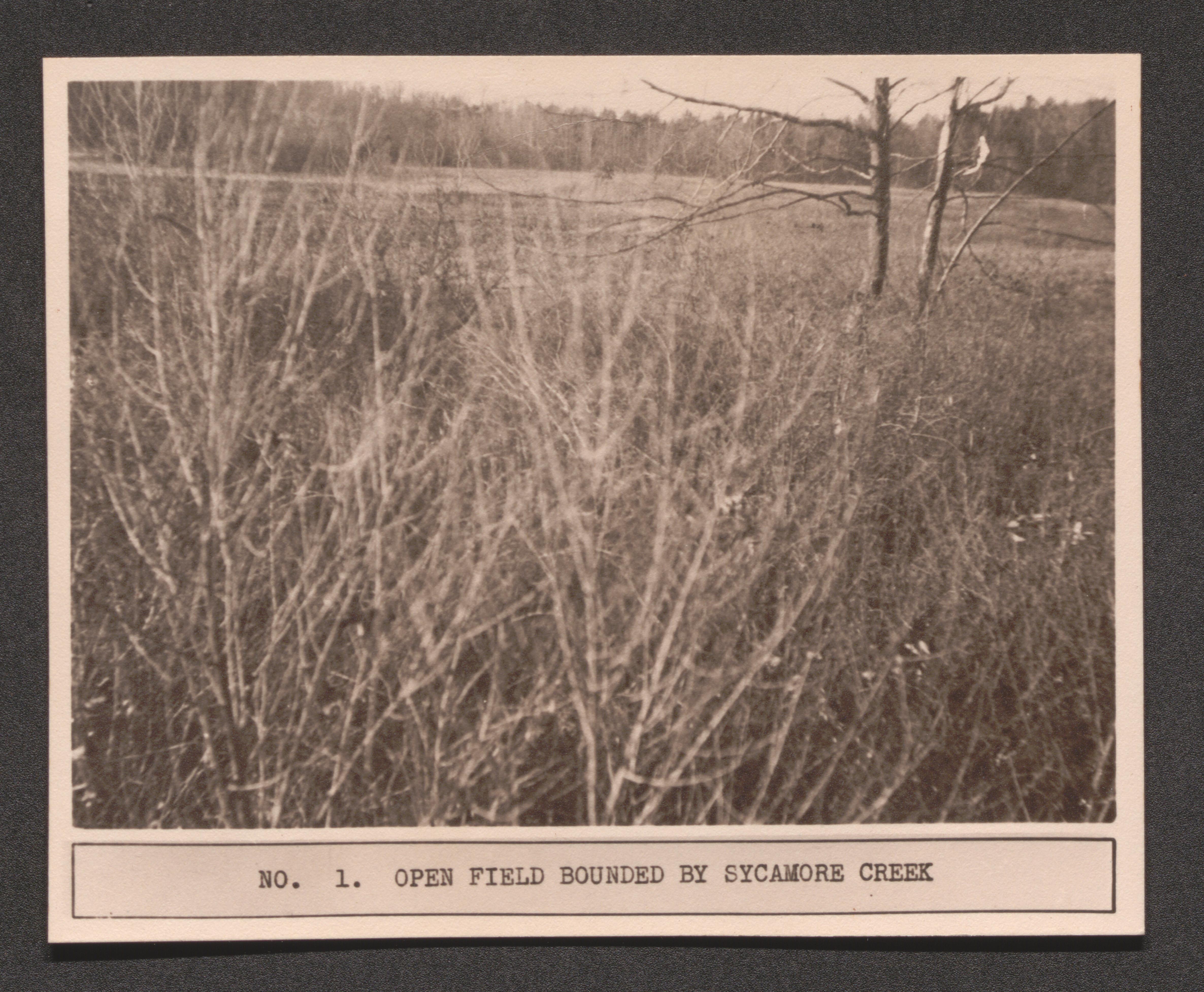
Page 21 no. 1 open field burned by Sycamore Creek, undated
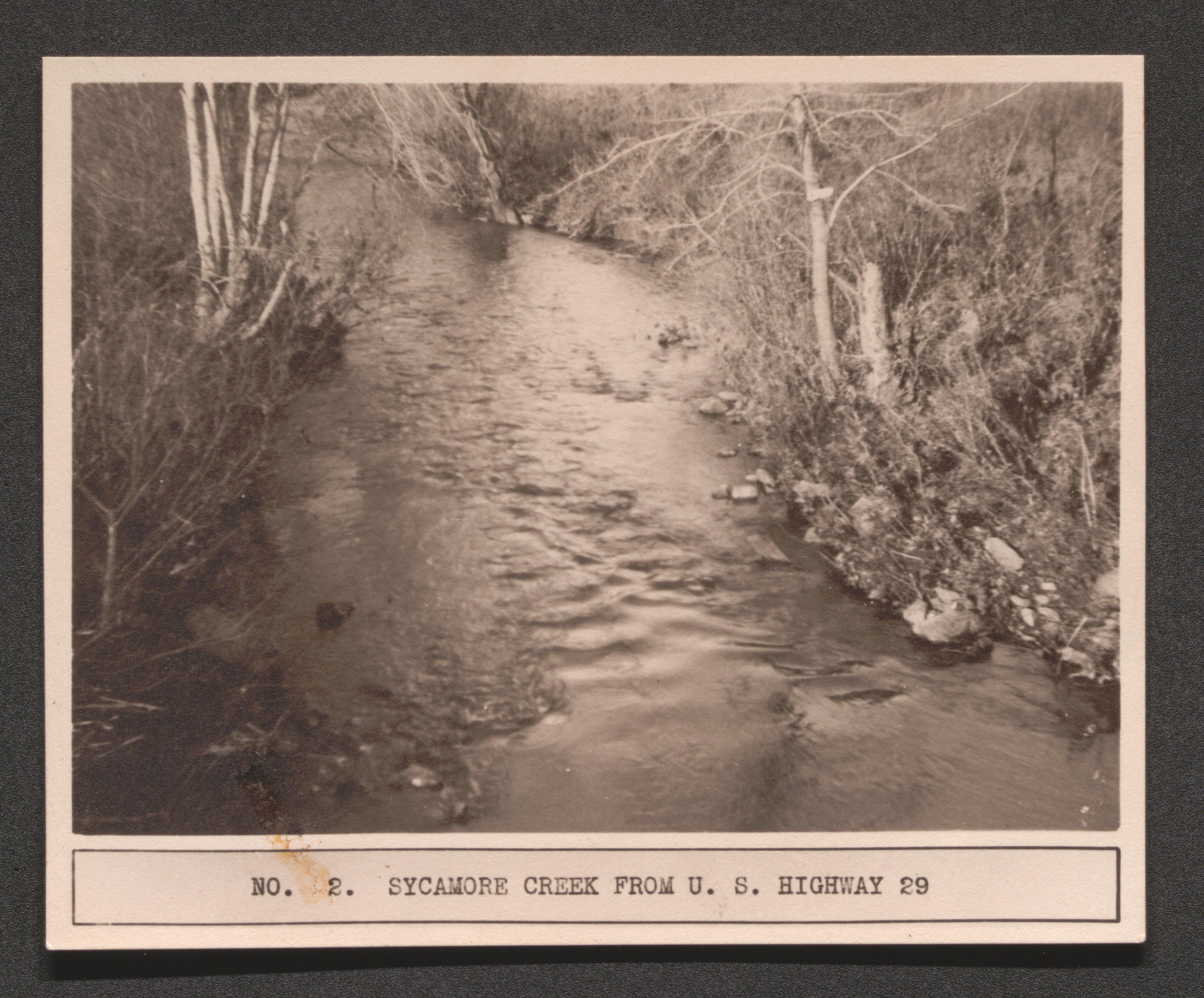
Page 21 no. 2 Sycamore Creek from US Highway 29, undated
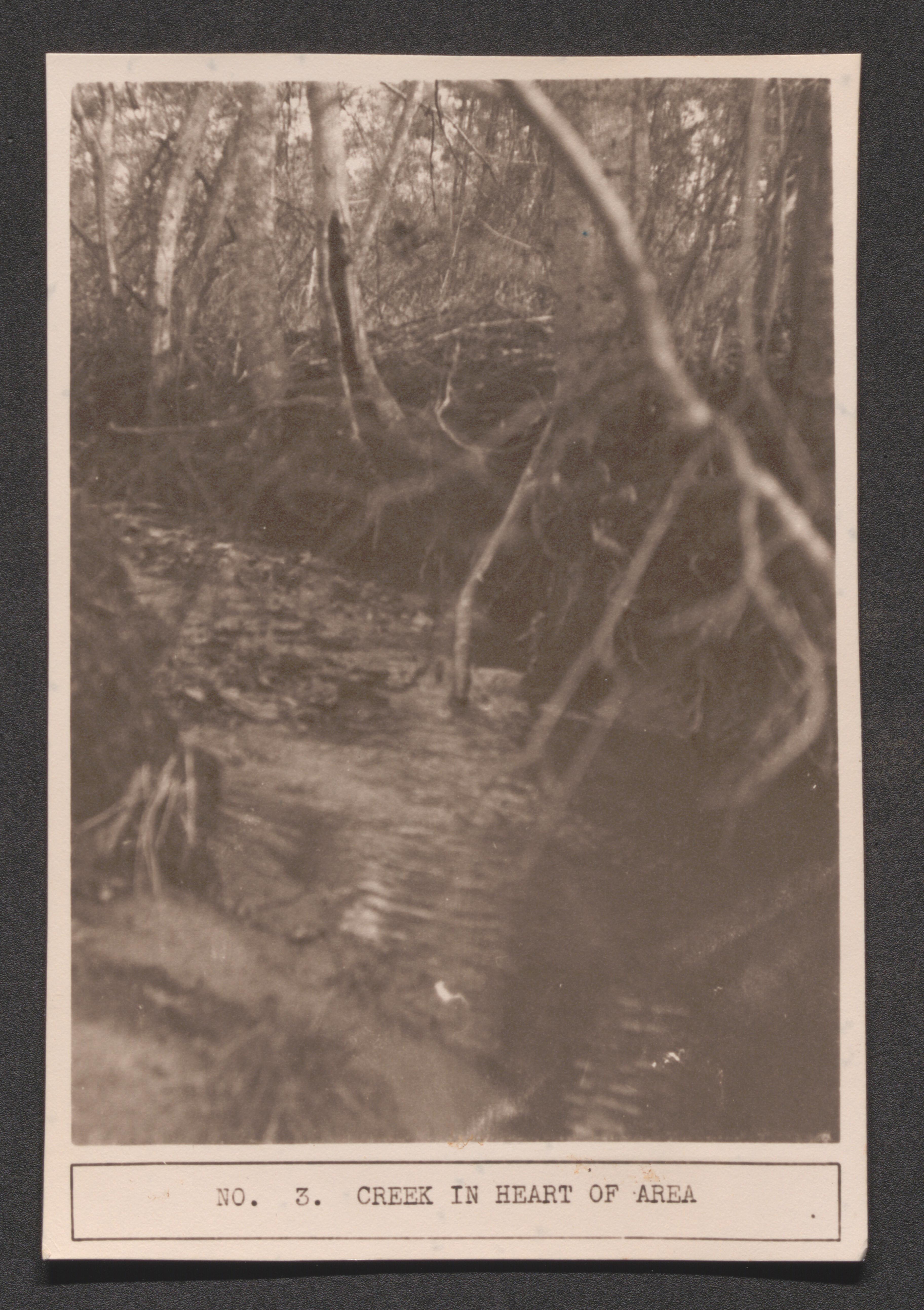
Page 21 no. 3 creek in heart of area, undated
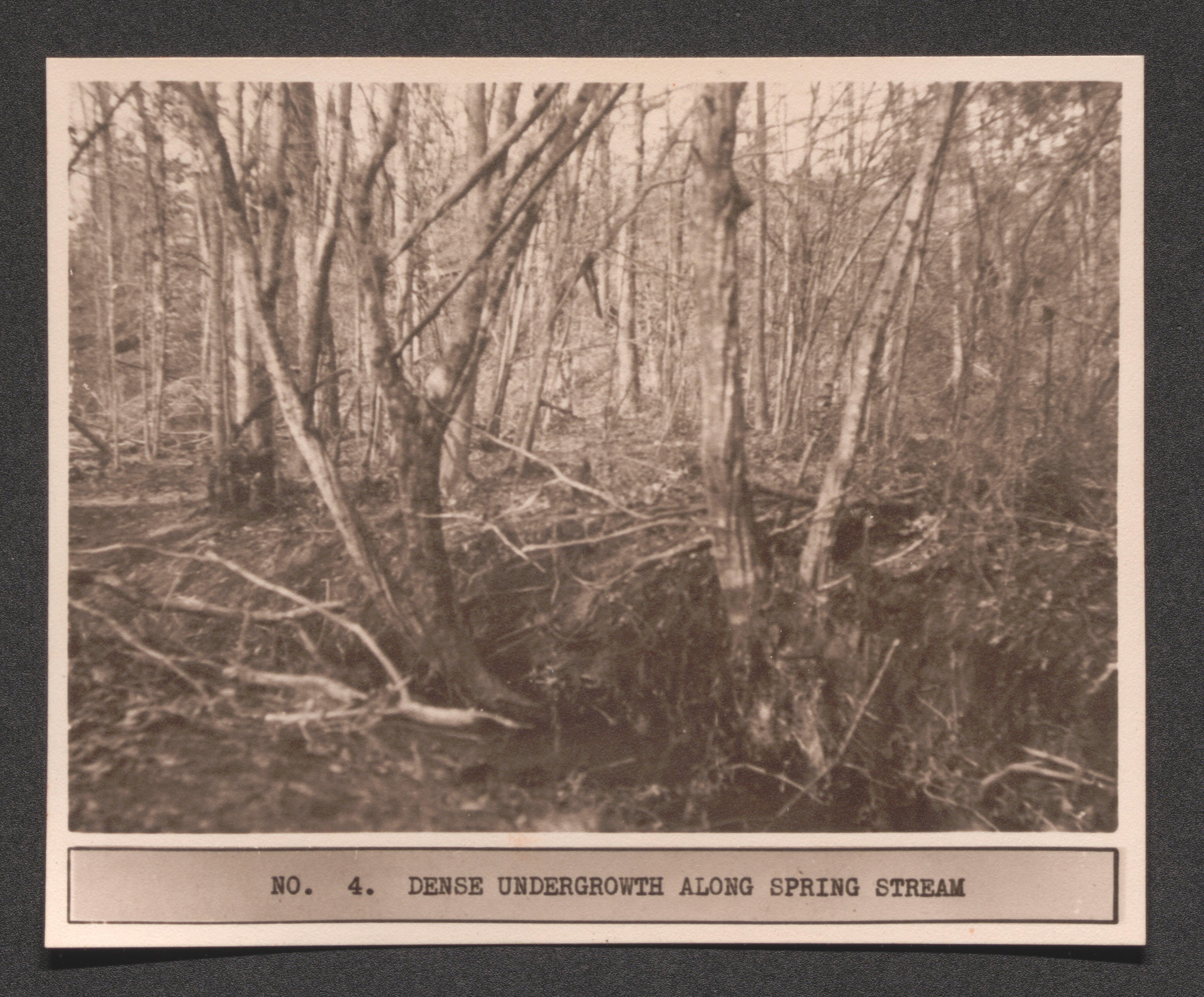
Page 21 no. 4 dense undergrowth along spring stream, undated
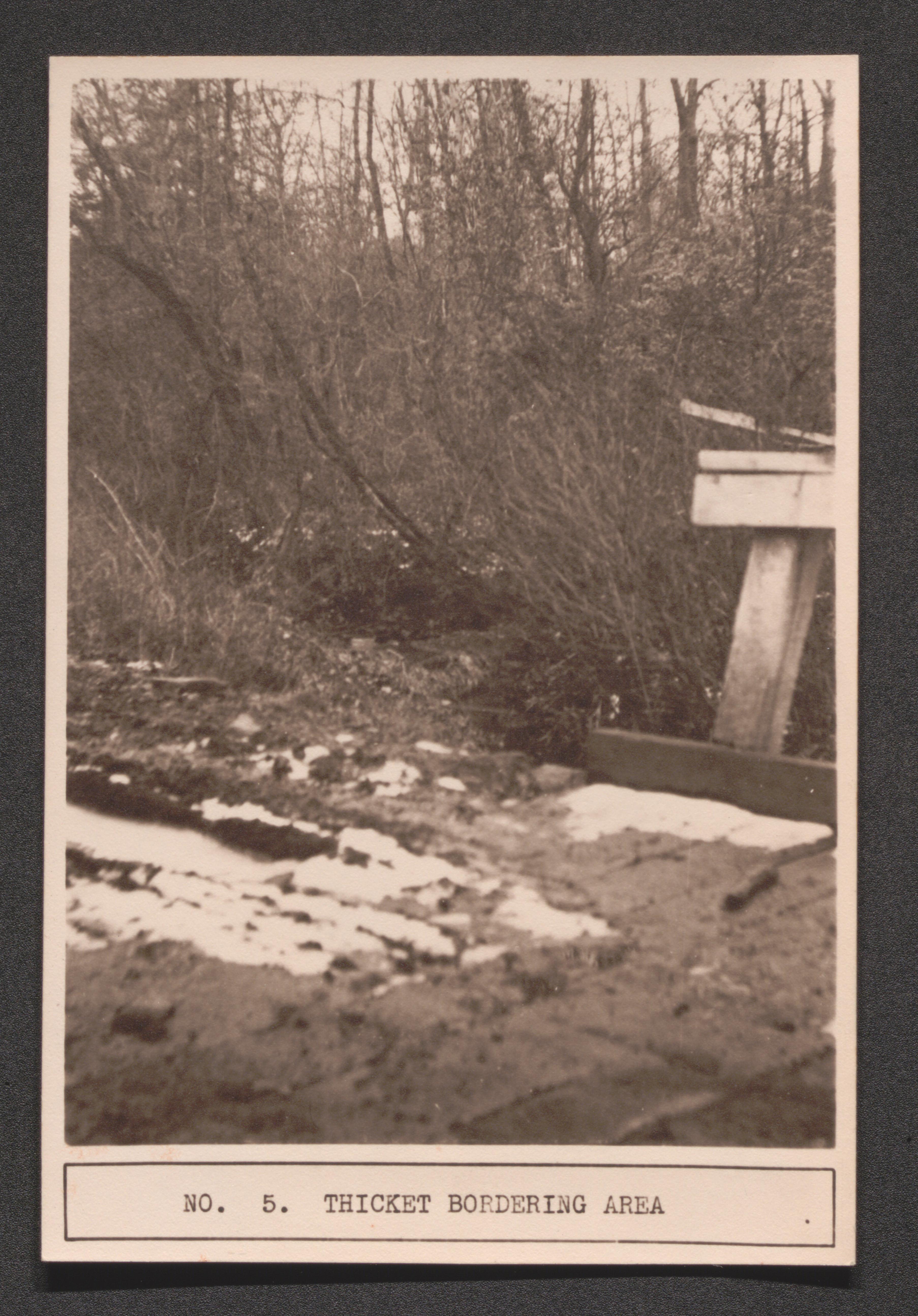
Page 21 no. 5 thickest border area, undated
Oversize duplicates
- Box 24, item 16-21
Scope and Contents
Oversize duplicates. Duplicate noted in scope and contents notes of original.
UK Libraries Special Collections Research Center is open Monday to Friday, 9:00am to 4:00pm. Appointments are encouraged but not required. Schedule an appointment here.
Researchers must have an SCRC Researcher Account to request materials. View account set-up and use instructions here.
Questions? Contact SCRC via our Contact Form.
Table of Contents
You may come across language in UK Libraries Special Collections Research Center collections and online resources that you find harmful or offensive. SCRC collects materials from different cultures and time periods to preserve and make available the historical record. These materials document the time period when they were created and the view of their creator. As a result, some may demonstrate racist and offensive views that do not reflect the values of UK Libraries.
If you find description with problematic language that you think SCRC should review, please contact us at SCRC@uky.edu.
UK Libraries Special Collections Research Center is open Monday to Friday, 9:00am to 4:00pm. Appointments are encouraged but not required. Schedule an appointment here.
Researchers must have an SCRC Researcher Account to request materials. View account set-up and use instructions here.
Questions? Contact SCRC via our Contact Form.
Requests
No items have been requested.
You may come across language in UK Libraries Special Collections Research Center collections and online resources that you find harmful or offensive. SCRC collects materials from different cultures and time periods to preserve and make available the historical record. These materials document the time period when they were created and the view of their creator. As a result, some may demonstrate racist and offensive views that do not reflect the values of UK Libraries.
If you find description with problematic language that you think SCRC should review, please contact us at SCRC@uky.edu.
